Stage 63 is an expedition through the northern realms of Scandinavia and Russia, a journey that will carry you through some of the most remote and captivating landscapes on Earth. The stage commences in Kiruna, Sweden, a place where the ethereal dance of the Northern Lights illuminates the Arctic skies, and heads northward, venturing into the heart of Norway, where the breathtaking Nordkapp awaits. Perched on the very edge of the continent, this iconic cliff is a sentinel overlooking the Arctic Ocean, a vast expanse of water that stretches to the North Pole. As you trace the northern coastline, the landscapes will shift, revealing a panorama of untamed beauty. The rugged shores, fjords, and tundra stretch out in all directions, creating a tapestry of nature’s grandeur. Along the way, you’ll encounter small coastal communities, each with its own unique culture and traditions, shaped by the relentless embrace of the Arctic. The journey then veers southeast towards the Kola Peninsula, where Russia’s frontier with the Arctic Ocean unfolds. This remote region is a land of extremes, with stark tundra, crystalline lakes, and a history that echoes through the ages. Here, the Sami and the Russian cultures intermingle, creating a rich tapestry of traditions that have withstood the test of time. Having traversed the Kola Peninsula, you continue southward, leaving the Arctic behind as you make your way towards the final destination, Arkhangelsk, where you’ll witness the transition from the Arctic wilderness to the more settled landscapes of the Russian heartland.
Total Legs: 23 Total Distance: 1051 Total Time(125kts): 8 hours 24 minutes
Leg 1
Flying from ESNQ
Leg Distance: 87.62 Approximate time at 125kts: 42 minutes.
ESNQ(ESNQ) to Jukkasjarvi(POI1)
Distance: 4.72NM Bearing: 54° 2 minutes
After takeoff, fly northeast to Jukkasjärvi – a long narrow lake running east. The town of Jukkasjärvi on the lake's north shore is known for its ice hotel
Jukkasjarvi(POI1) to Taavinunnanen(POI2)
Distance: 14.29NM Bearing: 37° 7 minutes
Continue northeast to the tallest peak in that direction, Taavinunnanen at 780 meters
Taavinunnanen(POI2) to Lainioalven(POI3)
Distance: 17.58NM Bearing: 74° 8 minutes
Fly east across the flat countryside until you reach the Lainio River, considered one of Europe's finest fishing rivers
Lainioalven(POI3) to Kuormakka(POI4)
Distance: 11.63NM Bearing: 6° 6 minutes
Turn northwards and head for the nearby mountain ridge, then continue north until you reach highway E45 running northeast
Kuormakka(POI4) to Idivuoma(POI5)
Distance: 7.3NM Bearing: 26° 4 minutes
Follow the highway northeast to the town of Idivuoma, near a group of lakes that line the road
Idivuoma(POI5) to Karesuando(POI6)
Distance: 10.62NM Bearing: 33° 5 minutes
Keep following the highway northeast to the town of Karesuando, on the Muonio River. The river forms part of the border between Sweden and Finland
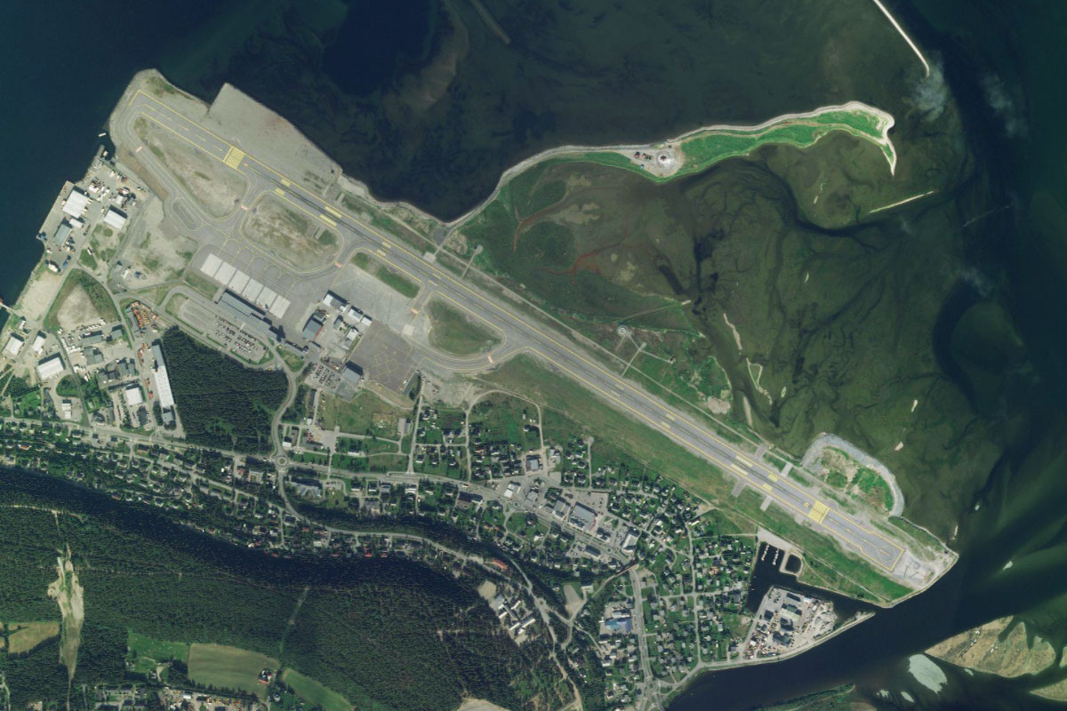
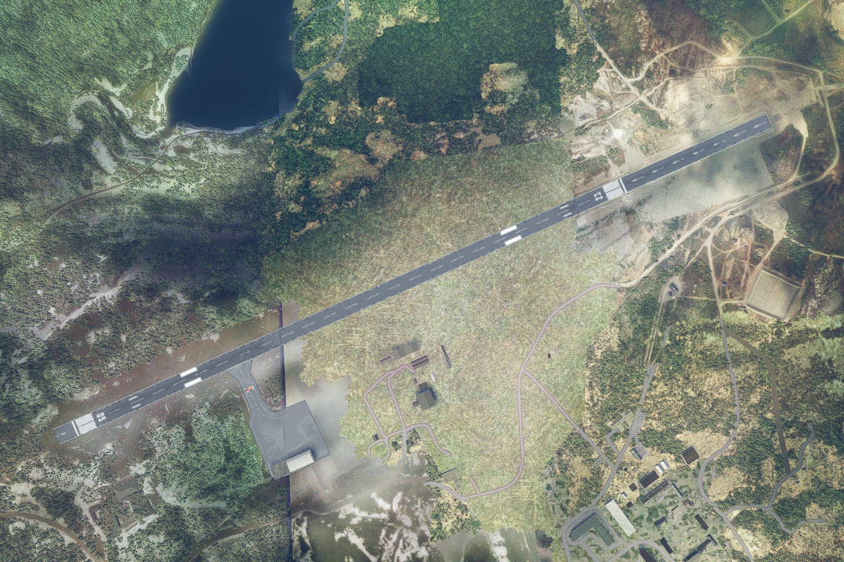
Karesuando(POI6) to EFET(EFET)
Distance: 21.48NM Bearing: 90° 10 minutes
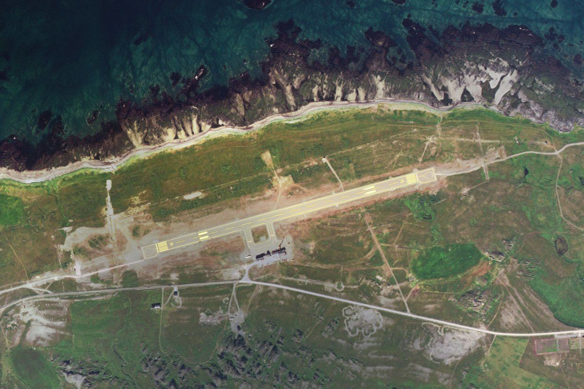
From the river, fly east across the countryside to Enontekio Airport, which lies next to a long narrow lake system
Leg 2
Flying from EFET
Leg Distance: 43.26 Approximate time at 125kts: 21 minutes.
EFET(EFET) to Road 93(POI7)
Distance: 4.8NM Bearing: 359° 2 minutes
After takeoff, fly north to meet a main road heading northwest
Road 93(POI7) to Leppajarvi(POI8)
Distance: 5.15NM Bearing: 303° 2 minutes
Follow the road northwest
Leppajarvi(POI8) to Geadgejavri(POI9)
Distance: 11.84NM Bearing: 349° 6 minutes
At the small village of Leppäjärvi the road will run north and cross back into Norway, and the region of Finnmark
Geadgejavri(POI9) to Bievjaveaijohka(POI10)
Distance: 8.1NM Bearing: 334° 4 minutes
Keep following the road, now European route 45, as it heads north, eventually running alongside a small river, Bievjaveaijohka
Bievjaveaijohka(POI10) to Kautokeino(POI11)
Distance: 11.5NM Bearing: 324° 6 minutes
The road will turn briefly west, before continuing northwest to the town of Kautokeino
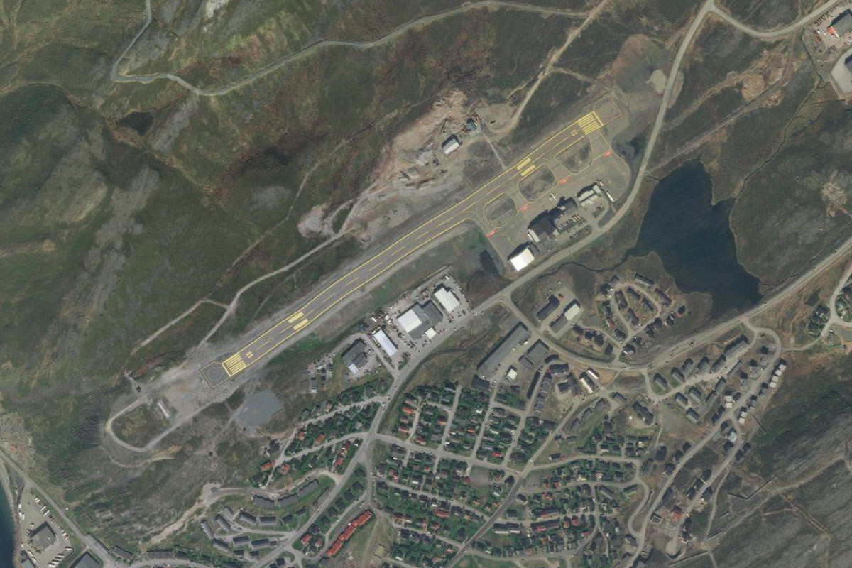
Kautokeino(POI11) to ENKA(ENKA)
Distance: 1.87NM Bearing: 341° 1 minutes
There is a small airstrip located just north of the town
Leg 3
Flying from ENKA
Leg Distance: 28.77 Approximate time at 125kts: 14 minutes.
ENKA(ENKA) to Vuolgamasjavri(POI12)
Distance: 14.59NM Bearing: 38° 7 minutes
After takeoff, follow E45 as it makes its way northeast alongside a chain of river like lakes which carve a shallow valley across the Finnmarksvidda plateau
Vuolgamasjavri(POI12) to Kautokeinoelva(POI13)
Distance: 4.06NM Bearing: 3° 2 minutes
Keep following the road and river system as they turn north
Kautokeinoelva(POI13) to Kautokeinoelva(POI14)
Distance: 2.95NM Bearing: 326° 1 minutes
The river will flow northwest between some low lying hills
Kautokeinoelva(POI14) to ENMZ(ENMZ)
Distance: 7.17NM Bearing: 356° 3 minutes
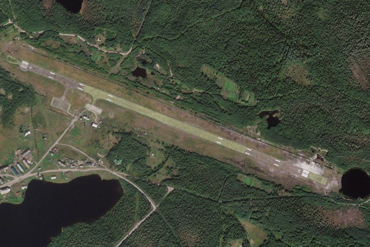
The river will continue north across the plateau. When you reach a narrow section heading northeast, look for a small grass airstrip on the river's left bank, a couple of miles south of the village of Masi. Beware of the power lines west of the runway
Leg 4
Flying from ENMZ
Leg Distance: 40.22 Approximate time at 125kts: 19 minutes.
ENMZ(ENMZ) to Masi(POI15)
Distance: 3.9NM Bearing: 15° 2 minutes
After takeoff, follow the river north past the village of Masi and into a valley
Masi(POI15) to Virdnejavri(POI16)
Distance: 13.84NM Bearing: 355° 7 minutes
Follow the river north, which will form into a long, narrow reservoir with the Alta Dam at its northern end
Virdnejavri(POI16) to Sautso(POI17)
Distance: 7.91NM Bearing: 316° 4 minutes
From the dam, follow the Alta river northwest along Sautso, the largest canyon in northern Europe
Sautso(POI17) to Altaelva(POI18)
Distance: 8.2NM Bearing: 282° 4 minutes
The canyon will become more shallow as it turns to the west, revealing more beautiful scenery
Altaelva(POI18) to ENAT(ENAT)
Distance: 6.37NM Bearing: 7° 3 minutes
The valley will meet another valley as the river turns north towards the town of Alta, at the end of Alta Fjord, with Komsa mountain overlooking the town. The area around the town contains thousands of rock carvings, making it a UNESCO World Heritage Site. Head for the airport on the north side of town.
Leg 5
Flying from ENAT
Leg Distance: 47.58 Approximate time at 125kts: 23 minutes.
ENAT(ENAT) to Altafjorden(POI19)
Distance: 8.35NM Bearing: 303° 4 minutes
Follow the fjord northwest
Altafjorden(POI19) to Seiland(POI20)
Distance: 10.08NM Bearing: 351° 5 minutes
Fly north along the center of the fjord towards Seiland, a large mountainous island which is mostly national park, and contains two glaciers
Seiland(POI20) to Seiland(POI21)
Distance: 19.24NM Bearing: 359° 9 minutes
Climb as you cross north over the island for a great view of its glaciers and fjord system that nearly cuts the island in half
Seiland(POI21) to ENHF(ENHF)
Distance: 9.91NM Bearing: 28° 5 minutes
As you reach the north of the main part of the island, turn northeast and fly across a narrow peninsula to Hammerfest, the northernmost town with over 10,000 people in the world, and one of the capitals of Sami culture. The town is on the island of Kvaløya and the airport is on the town's northern edge
Leg 6
Flying from ENHF
Leg Distance: 65.3 Approximate time at 125kts: 31 minutes.
ENHF(ENHF) to Kjerkegardsbukta(POI22)
Distance: 4.27NM Bearing: 40° 2 minutes
After takeoff, head northeast across the peninsula
Kjerkegardsbukta(POI22) to Porsanger Peninsula(POI23)
Distance: 11.55NM Bearing: 37° 6 minutes
Continue northeast across the water to the hilly headland, one of many on the larger Porsanger Peninsula
Porsanger Peninsula(POI23) to Porsanger Peninsula(POI24)
Distance: 7.79NM Bearing: 38° 4 minutes
Keep flying northeast to a small bay on the next peninsula
Porsanger Peninsula(POI24) to Havoysund(POI25)
Distance: 4.77NM Bearing: 3° 2 minutes
Follow the winding road as it cuts a path to the north of the peninsula, and the town of Havøysund
Havoysund(POI25) to Masoya(POI26)
Distance: 5.79NM Bearing: 59° 3 minutes
Fly northeast across to the island of Måsøya. The lone village on the island, Måsøy, has a population of about 40 people
Masoya(POI26) to Gjesvaer(POI27)
Distance: 7.38NM Bearing: 39° 4 minutes
Fly northeast across the water to another mountain headland west of the village of Gjesvær
Gjesvaer(POI27) to Gjesvaerstappan(POI28)
Distance: 2.89NM Bearing: 11° 1 minutes
From the peninsula, head north to Gjesværstappan, a group of islands and also a nature reserve which is home to large colonies of sea birds
Gjesvaerstappan(POI28) to Knivskjellodden(POI29)
Distance: 6.91NM Bearing: 50° 3 minutes
From the islands, fly northeast across to Knivskjellodden. This small peninsula is the northernmost point on the island of Magerøya in Northern Norway, and at 71 degrees north, is the northernmost point on this world tour
Knivskjellodden(POI29) to Nordkapp(POI30)
Distance: 2.52NM Bearing: 99° 1 minutes
Continue east to Nordkapp. This plateau is a popular tourist attraction as the northernmost point in Europe that can be accessed by car
Nordkapp(POI30) to Opnanvatnet(POI31)
Distance: 4.15NM Bearing: 106° 2 minutes
Fly east across the bay to another plateau-like peninsula. A small lagoon on the eastern side of the peninsula, Opnanvatnet, is surrounded by the coastal cliffs
Opnanvatnet(POI31) to ENHV(ENHV)
Distance: 7.28NM Bearing: 163° 3 minutes
Fly south from the headland along the bay to Valan Airport, which runs along the southern shore of the bay and serves the nearby towns of Storbukt, Honningsvåg and Nordvågen
Leg 7
Flying from ENHV
Leg Distance: 46.29 Approximate time at 125kts: 22 minutes.
ENHV(ENHV) to Svaerholt(POI32)
Distance: 13.9NM Bearing: 85° 7 minutes
After takeoff, fly east across the mouth of Porsanger fjord to the northern tip of the peninsula on the fjord's eastern shore
Svaerholt(POI32) to Nordkinnhalvoya(POI33)
Distance: 8.56NM Bearing: 86° 4 minutes
Continue east across the water to the sea cliffs of the western Nordkinn Peninsula
Nordkinnhalvoya(POI33) to Nordkinnhalvoya(POI34)
Distance: 2.87NM Bearing: 359° 1 minutes
Follow the rugged coastline north
Nordkinnhalvoya(POI34) to Nordkinnhalvoya(POI35)
Distance: 4.42NM Bearing: 17° 2 minutes
Continue north across the mouth of Kjollefjord to another plateau like headland with more impressive sea cliffs, and follow them north
Nordkinnhalvoya(POI35) to Kinnarodden(POI36)
Distance: 9.06NM Bearing: 38° 4 minutes
Fly northeast across the mouth of another fjord, Oskefjord, then follow the coast to the peninsula's northern tip at Kinnarodden
Kinnarodden(POI36) to Magkellhetta(POI37)
Distance: 2.38NM Bearing: 105° 1 minutes
Follow the coastline around to the east
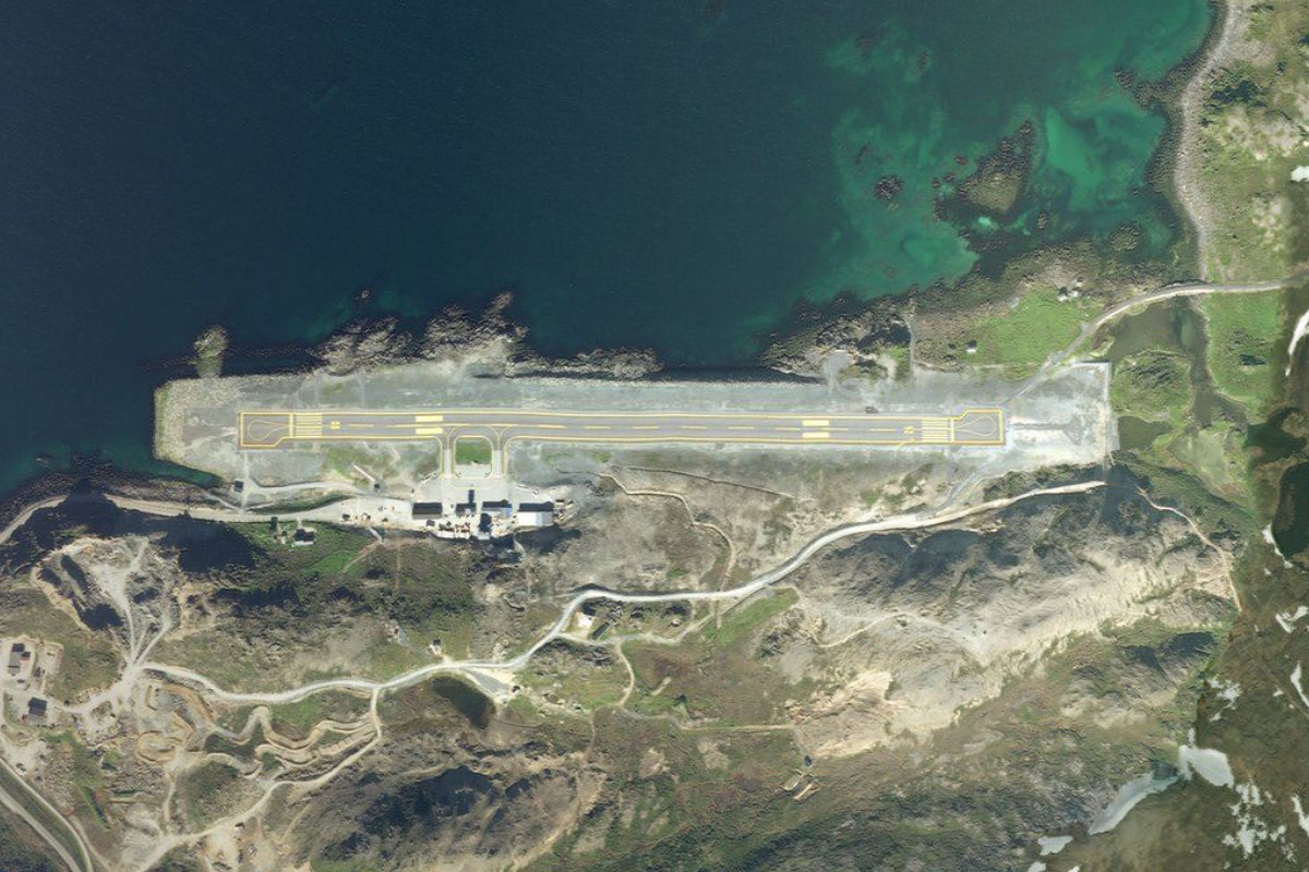
Magkellhetta(POI37) to ENMH(ENMH)
Distance: 5.1NM Bearing: 147° 2 minutes
Fly southeast over a narrow peninsula, then continue to Mehamn Airport, a mile southwest from the town
Leg 8
Flying from ENMH
Leg Distance: 25.68 Approximate time at 125kts: 12 minutes.
ENMH(ENMH) to Koifjorden(POI38)
Distance: 7.91NM Bearing: 89° 4 minutes
Fly east across the lake filled tundra to Koifjorden, a small fjord leading south
Koifjorden(POI38) to Nordkinnhalvoya(POI39)
Distance: 6.45NM Bearing: 89° 3 minutes
Continue east across the fjord and the land beyond to reach the eastern coast of the peninsula
Nordkinnhalvoya(POI39) to Varangerhalvoya(POI40)
Distance: 9.9NM Bearing: 103° 5 minutes
Fly east across the Tana fjord to the northern tip of the Varanger Peninsula. Most of this 2000 square kilometer peninsula is protected by the Varangerhalvøya National Park
Varangerhalvoya(POI40) to ENBV(ENBV)
Distance: 1.42NM Bearing: 100° 1 minutes
Continue east to Berlevag airport on the peninsula's north coast
Leg 9
Flying from ENBV
Leg Distance: 26.47 Approximate time at 125kts: 13 minutes.
ENBV(ENBV) to Berlevag(POI41)
Distance: 4.15NM Bearing: 88° 2 minutes
Head east to the nearby town of Berlevåg, one of the larger fishing villages in the area, then continue east along the coast, where the Kjølnes lighthouse keeps watch over the Barents Sea
Berlevag(POI41) to Sandfjordstranden(POI42)
Distance: 5.03NM Bearing: 129° 2 minutes
Follow the coast around to the southeast, passing Sandfjord beach on the way
Sandfjordstranden(POI42) to Batsfjorden(POI43)
Distance: 9.41NM Bearing: 95° 5 minutes
From the small rocky outcrop, head east across the bay to the flat peninsula on the other side, then continue east to the entrance of Batsfjord
Batsfjorden(POI43) to ENBS(ENBS)
Distance: 7.88NM Bearing: 181° 4 minutes
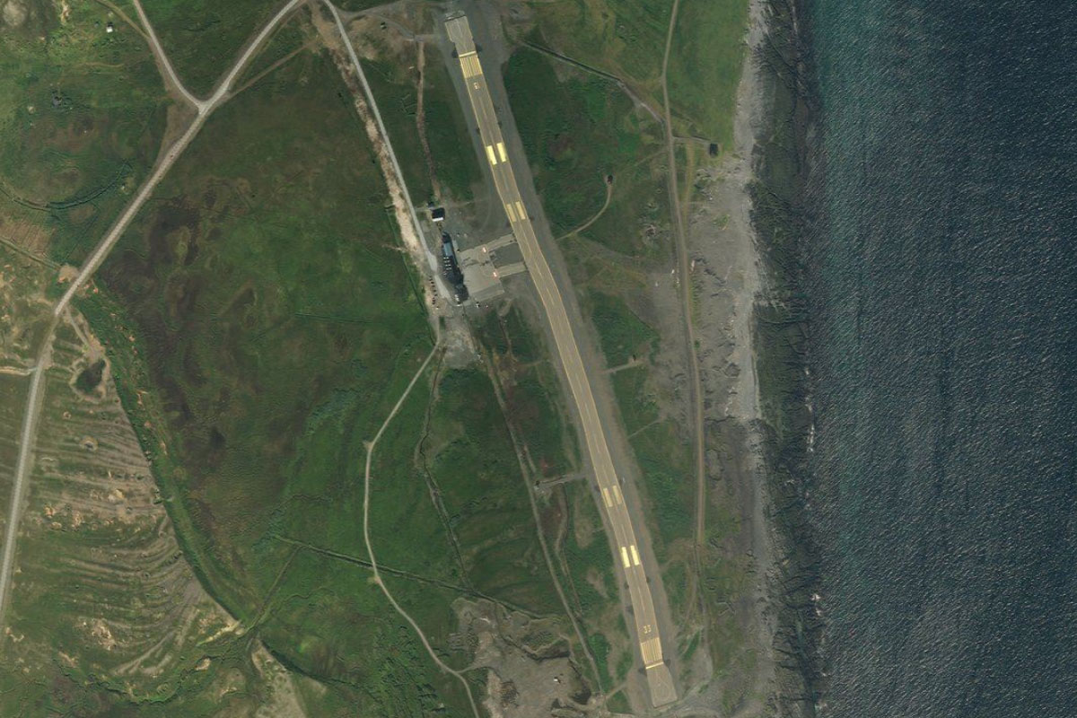
Fly to the southern end of the fjord, where Batsfjord airport lies on higher ground a couple of miles south from the town
Leg 10
Flying from ENBS
Leg Distance: 33.01 Approximate time at 125kts: 16 minutes.
ENBS(ENBS) to Syltefjorden(POI44)
Distance: 10.19NM Bearing: 89° 5 minutes
After takeoff, fly east across the peninsula to reach another inlet, Syltefjorden
Syltefjorden(POI44) to Syltevik(POI45)
Distance: 3.29NM Bearing: 79° 2 minutes
Cross the fjord to a valley entrance carved into the cliffs on the eastern side
Syltevik(POI45) to Syltevikvatnet(POI46)
Distance: 2.97NM Bearing: 122° 1 minutes
Follow the valley southeast, passing over a lake, Syltevikvatnet, before reaching a valley junction
Syltevikvatnet(POI46) to Sandfjordelva(POI47)
Distance: 2.97NM Bearing: 74° 1 minutes
At the valley junction, follow the Sandfjord river east to the coast
Sandfjordelva(POI47) to Blodskytodden naturreservat(POI48)
Distance: 7.75NM Bearing: 101° 4 minutes
Follow the coast east, then continue across the bay. The headland on the other side is part of a nature reserve
Blodskytodden naturreservat(POI48) to ENSS(ENSS)
Distance: 5.84NM Bearing: 138° 3 minutes
Follow the coastline around to the southeast, and on to Vardo Airport, which lies at the southern end of a large breakwater protected harbor
Leg 11
Flying from ENSS
Leg Distance: 33.58 Approximate time at 125kts: 16 minutes.
ENSS(ENSS) to Kiberg(POI49)
Distance: 4.06NM Bearing: 159° 2 minutes
Fly south along the coast, where it will soon turn to the southwest
Kiberg(POI49) to Komagvaer(POI50)
Distance: 12.14NM Bearing: 234° 6 minutes
Follow the coast southwest along a number of bays and beaches
Komagvaer(POI50) to Ekkeroy(POI51)
Distance: 11.65NM Bearing: 202° 6 minutes
Continue southwest along the coast as it turns more towards the south to the small island of Ekkerøy, which is now joined to the mainland by a small sandy isthmus
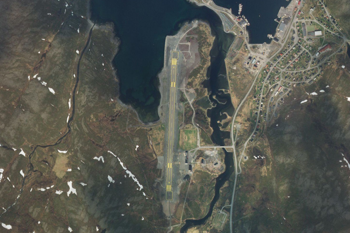
Ekkeroy(POI51) to ENVD(ENVD)
Distance: 5.73NM Bearing: 248° 3 minutes
Follow the coast west to Vadso airport, which is east from the town
Leg 12
Flying from ENVD
Leg Distance: 24.08 Approximate time at 125kts: 12 minutes.
ENVD(ENVD) to Vadso(POI52)
Distance: 2.06NM Bearing: 272° 1 minutes
Fly west to the nearby town of Vadsø
Vadso(POI52) to Bugoya(POI53)
Distance: 6.54NM Bearing: 177° 3 minutes
From Vadsø, fly south across Varangerfjord to the small island of Bugøya which lies at the end of a peninsula
Bugoya(POI53) to Kjofjorden(POI54)
Distance: 3.82NM Bearing: 140° 2 minutes
Continue southeast across the bay to the entrance of Kjøfjorden, which leads south
Kjofjorden(POI54) to Kjofjorden(POI55)
Distance: 5.73NM Bearing: 153° 3 minutes
Follow the fjord south. The fjord separates the uninhabited island of Skogerøya from the mainland
Kjofjorden(POI55) to ENKR(ENKR)
Distance: 5.93NM Bearing: 143° 3 minutes
Halfway along the fjord, where it turns south, continue southeast across the island, then across Korsfjorden to Kirkenes Airport
Leg 13
Flying from ENKR
Leg Distance: 46.13 Approximate time at 125kts: 22 minutes.
ENKR(ENKR) to Kirkenes(POI56)
Distance: 3.74NM Bearing: 70° 2 minutes
After takeoff, head east to the nearby town of Kirkenes
Kirkenes(POI56) to Elvenes(POI57)
Distance: 3.05NM Bearing: 144° 1 minutes
As you pass Kirkenes, turn southeast and follow Bøkfjorden to the small town of Elvenes, where a new bridge crossing was opened in 2017
Elvenes(POI57) to Fossevatn(POI58)
Distance: 2.24NM Bearing: 152° 1 minutes
Keep flying southeast along what is now part of the Pasvik River. This will take you briefly into Russian territory until you reach a small dam at the northern end of Fossevatn, which is itself the northern end of a large lake system
Fossevatn(POI58) to Klistervatnet(POI59)
Distance: 8.19NM Bearing: 157° 4 minutes
Keep following the waterway along its eastern side. This is also part of the border between Norway and Russia. You will be met by a highway running alongside the eastern shore
Klistervatnet(POI59) to P-21(POI60)
Distance: 6.07NM Bearing: 70° 3 minutes
At the southern tip of the lake, the highway will turn to the northeast, leading you further into Russia
P-21(POI60) to Zapolyarny(POI61)
Distance: 11.34NM Bearing: 103° 5 minutes
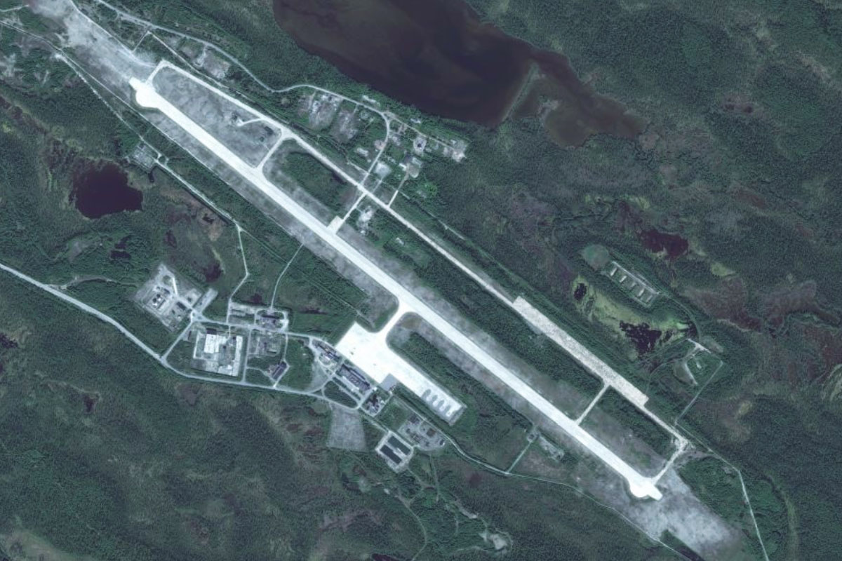
Follow the highway as its turns east across the river and heads to the town of Zapolyarny. A few miles west of the town is the Kola Superdeep Borehole, which at 12262 meters is the deepest human made hole on Earth
Zapolyarny(POI61) to UPEC(UPEC)
Distance: 11.5NM Bearing: 133° 6 minutes
After passing the town, fly southeast past the disused Luostari Air Base to the also disused Koshka Yavr naval air station 10 miles further south
Leg 14
Flying from UPEC
Leg Distance: 59.03 Approximate time at 125kts: 28 minutes.
UPEC(UPEC) to Lake Koshkayavr(POI62)
Distance: 3.62NM Bearing: 140° 2 minutes
After takeoff, fly southeast to nearby Lake Koshkayavr
Lake Koshkayavr(POI62) to Nyalyavr(POI63)
Distance: 19.7NM Bearing: 89° 9 minutes
Fly east across the tundra until you reach a long narrow lake, Nyalyavr
Nyalyavr(POI63) to Kilpyavr(POI64)
Distance: 5.85NM Bearing: 74° 3 minutes
From the lake, fly east over another disused air base, Kilpyavr
Kilpyavr(POI64) to Murmansk(POI65)
Distance: 15.89NM Bearing: 99° 8 minutes
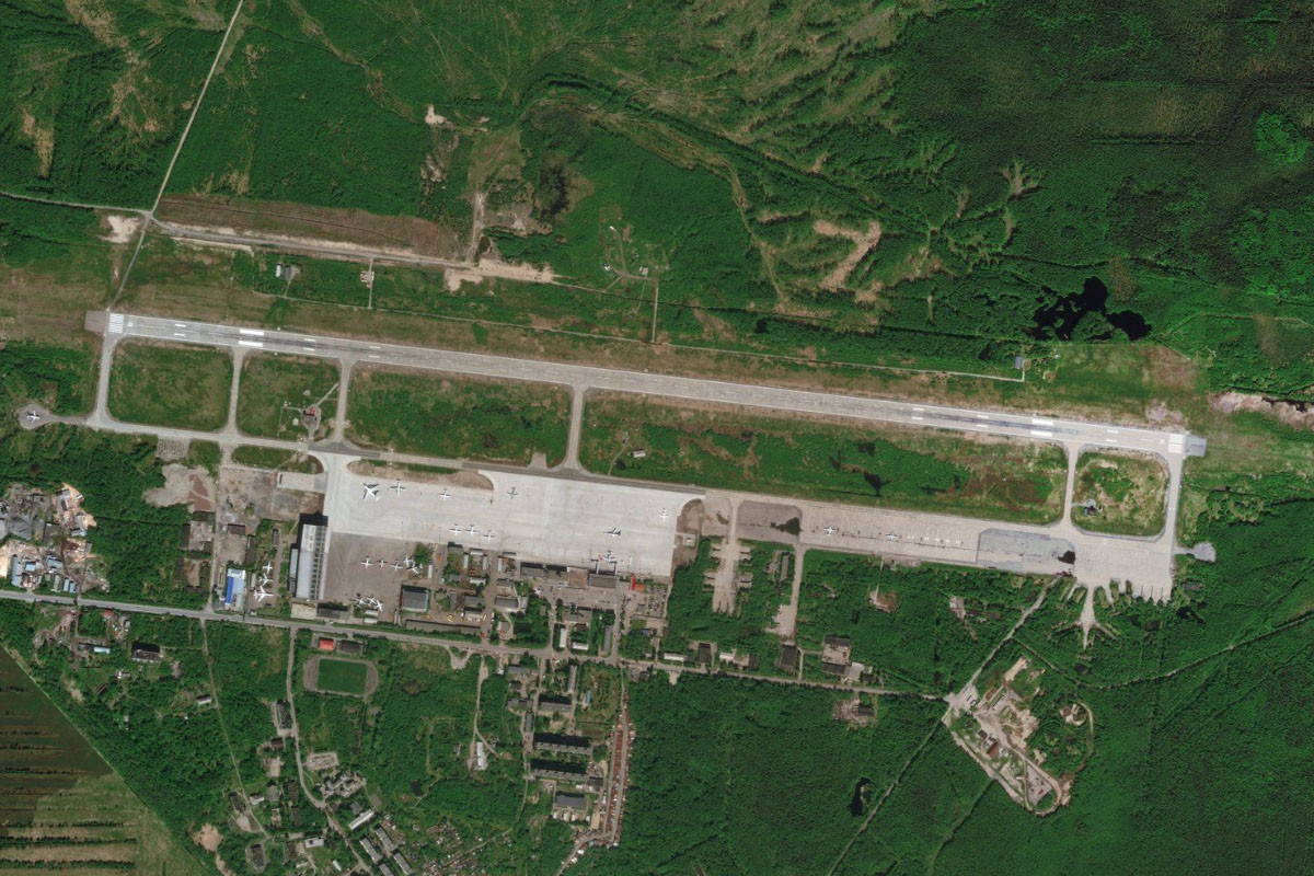
Continue east to the city of Murmansk, on the eastern shore of Kola Bay, a long inlet running south from the Barents Sea. It is the world's largest city north of the Arctic Circle, and is a major port
Murmansk(POI65) to Kola(POI66)
Distance: 5.36NM Bearing: 174° 3 minutes
Head south along Kola Bay, which becomes the Tuloma River
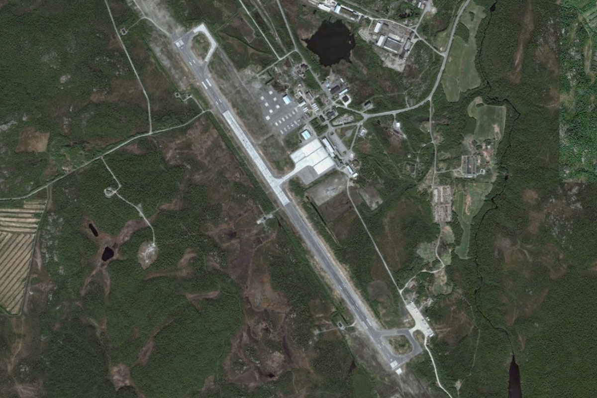
Kola(POI66) to ULMM(ULMM)
Distance: 8.61NM Bearing: 205° 4 minutes
Follow the river southwest, where you will soon see an island in the middle of the river where the Murmashi hydroelectric dam is located just before reaching Murmansk Airport a few miles further south and a mile east of the river
Leg 15
Flying from ULMM
Leg Distance: 52.53 Approximate time at 125kts: 25 minutes.
ULMM(ULMM) to Household Lake(POI67)
Distance: 6.26NM Bearing: 139° 3 minutes
After takeoff, fly southeast to one of the larger lakes in the area
Household Lake(POI67) to Kola River(POI68)
Distance: 9.05NM Bearing: 109° 4 minutes
Continue southeast towards a group of low hills, then on to the Kola River a few miles beyond
Kola River(POI68) to Kola River(POI69)
Distance: 8.7NM Bearing: 159° 4 minutes
Follow the river south as it widens and weaves between the mountains
Kola River(POI69) to Lake Kolozero(POI70)
Distance: 8.7NM Bearing: 166° 4 minutes
When the river narrow and turns east, continue south over the hills to a large lake on the other side
Lake Kolozero(POI70) to Olenegorsk(POI71)
Distance: 9.4NM Bearing: 162° 5 minutes
Keep flying south to the large iron ore mine past the southern end of the lake
Olenegorsk(POI71) to UMOE(UMOE)
Distance: 10.42NM Bearing: 185° 5 minutes
10 miles south from the mine is Monchegorsk Air Base, just north of the town of Monchegorsk. This also marks the halfway point across the 40000 square mile Kola Peninsula
Leg 16
Flying from UMOE
Leg Distance: 42.22 Approximate time at 125kts: 20 minutes.
UMOE(UMOE) to Khibiny Mountains(POI72)
Distance: 13.71NM Bearing: 91° 7 minutes
After takeoff, fly east across Lake Imandra towards the northern end of the mountain range east of the lake
Khibiny Mountains(POI72) to Gol’tsovoye(POI73)
Distance: 4.63NM Bearing: 140° 2 minutes
As you get closer to the mountain range, head for a large valley leading south into the mountains, with lake Gol'tsovoye at its entrance
Gol’tsovoye(POI73) to Kuna River(POI74)
Distance: 3.95NM Bearing: 193° 2 minutes
From the lake, follow the Kuna River valley south
Kuna River(POI74) to Bolshoy Vudyavr(POI75)
Distance: 9.27NM Bearing: 149° 4 minutes
When you reach a fork in the valley, take the left fork and fly southeast through the mountains, where you will eventually meet lake Bolshoy Vudyavr on the south side of the mountains
Bolshoy Vudyavr(POI75) to ULMK(ULMK)
Distance: 10.66NM Bearing: 174° 5 minutes
Exit the mountains heading south over the town of Kirovsk, then onto Khibiny Airport 10 miles further south
Leg 17
Flying from ULMK
Leg Distance: 50.4 Approximate time at 125kts: 24 minutes.
ULMK(ULMK) to Lake Kanozero(POI76)
Distance: 21.75NM Bearing: 135° 10 minutes
From Khibiny airport, fly southeast across the flat taiga landscape until you reach the northern tip of Lake Kanozero, which is part of the Umba River
Lake Kanozero(POI76) to Umba River(POI77)
Distance: 13.59NM Bearing: 143° 7 minutes
Fly southeast to the southern end of the lake
Umba River(POI77) to Lake Ponchozero(POI78)
Distance: 4.71NM Bearing: 122° 2 minutes
Follow a river channel southeast to a nearby lake, Ponchozero
Lake Ponchozero(POI78) to ULMA(ULMA)
Distance: 10.35NM Bearing: 157° 5 minutes
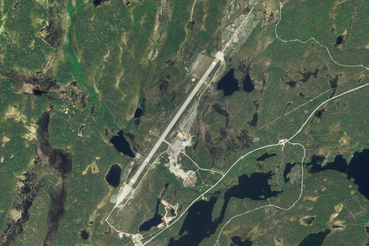
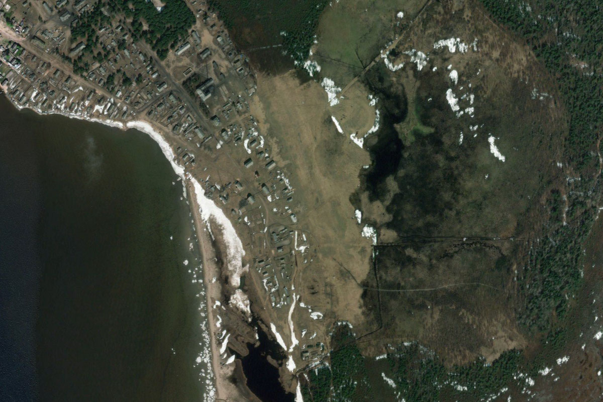
From the lake, a series of connected waterways lead south to towards the town of Umba, which lies on a small peninsula. There is a small airfield east of the town, across a small bay
Leg 18
Flying from ULMA
Leg Distance: 59.62 Approximate time at 125kts: 29 minutes.
ULMA(ULMA) to Volostrov(POI79)
Distance: 4.82NM Bearing: 174° 2 minutes
Fly south to the small island of Volostrov near the coast
Volostrov(POI79) to Kandalaksha(POI80)
Distance: 16.72NM Bearing: 210° 8 minutes
Fly southwest across Kandalaksha Bay to a group of flat islands, which are part of the Kandalaksha Nature Reserve. You will also cross over the Arctic Circle on the way
Kandalaksha(POI80) to Karelia(POI81)
Distance: 9.24NM Bearing: 179° 4 minutes
Head south over another group of islands to reach the mainland
Karelia(POI81) to Ambarnyi(POI82)
Distance: 22.8NM Bearing: 165° 11 minutes
From the coast, fly south across the lake filled taiga until you reach the town of Ambarnyi, where the railway passes through on its journey through the Karelia region
Ambarnyi(POI82) to XLPZ(XLPZ)
Distance: 6.04NM Bearing: 91° 3 minutes
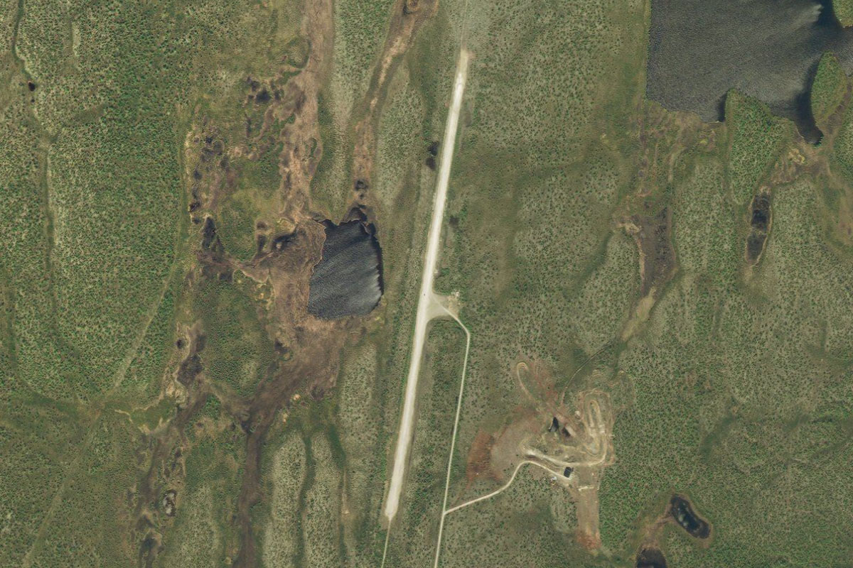
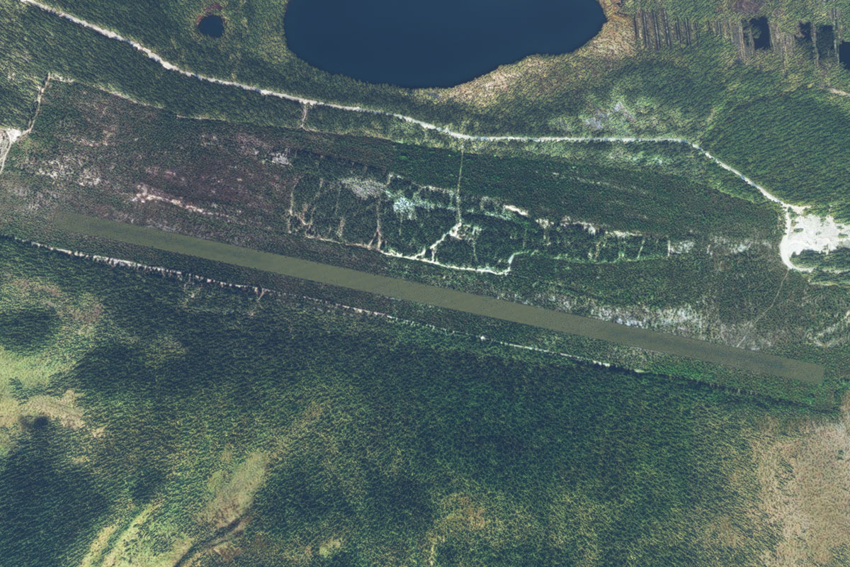
From the town, fly east to the disused Engozero Air Base, the land long since cleared of all facilities
Leg 19
Flying from XLPZ
Leg Distance: 62.23 Approximate time at 125kts: 30 minutes.
XLPZ(XLPZ) to Engozero(POI83)
Distance: 5.04NM Bearing: 163° 2 minutes
After takeoff, head south to the nearby town of Engozero
Engozero(POI83) to Unduksa(POI84)
Distance: 11.87NM Bearing: 133° 6 minutes
From Engozero, you'll once again meet the railway line heading southeast across the flat landscape
Unduksa(POI84) to Kuzema(POI85)
Distance: 15.6NM Bearing: 157° 7 minutes
Keep following the railway as it turns further south towards the small town of Kuzema, near the western tip of a coastal inlet from the White Sea
Kuzema(POI85) to Letnyaya River(POI86)
Distance: 13.63NM Bearing: 133° 7 minutes
The railway line will continue southeast running parallel with the coast, where you will cross two large rivers – the Pongoma and the Letnyaya
Letnyaya River(POI86) to UKEA(UKEA)
Distance: 16.09NM Bearing: 189° 8 minutes
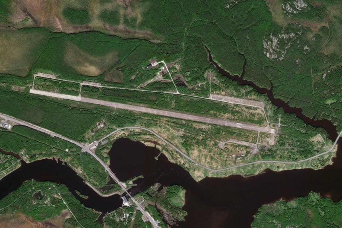
From the second river, fly south to the Kem River, where you arrive at Kem Airport on the river's north bank
Leg 20
Flying from UKEA
Leg Distance: 37.87 Approximate time at 125kts: 18 minutes.
UKEA(UKEA) to Kem(POI87)
Distance: 8.71NM Bearing: 61° 4 minutes
After takeoff, follow the river northeast as it passes the town of Kem
Kem(POI87) to White Sea(POI88)
Distance: 24.39NM Bearing: 64° 12 minutes
Continue northeast past the river mouth and across the White Sea towards the Solovetsky Islands
White Sea(POI88) to ULAS(ULAS)
Distance: 4.77NM Bearing: 61° 2 minutes
As you near the island, head for Solovki Aerodrome near the narrow middle section of the island. Near the airport is the area's most famous landmark, Solovetsky Monastery. Established in 1436, the monastery was converted into a Soviet prison and labor camp in 1926 to 1939, and served as a prototype for the camps of the Gulag system
Leg 21
Flying from ULAS
Leg Distance: 51.68 Approximate time at 125kts: 25 minutes.
ULAS(ULAS) to Bolshaya Muksalma(POI89)
Distance: 7.34NM Bearing: 70° 4 minutes
Fly to the eastern point of the nearby island of Bolshaya Muksalma
Bolshaya Muksalma(POI89) to Onega Peninsula(POI90)
Distance: 18.86NM Bearing: 90° 9 minutes
Fly east across the White Sea to the Onega Peninsula
Onega Peninsula(POI90) to Lopshenga(POI91)
Distance: 24.51NM Bearing: 69° 12 minutes
Fly east across the northern part of the peninsula to the small town of Lopshenga on the other side. Much of the peninsula is part of the Onezhskoye Pomorye National Park
Lopshenga(POI91) to ULBL(ULBL)
Distance: 0.97NM Bearing: 347° 0 minutes
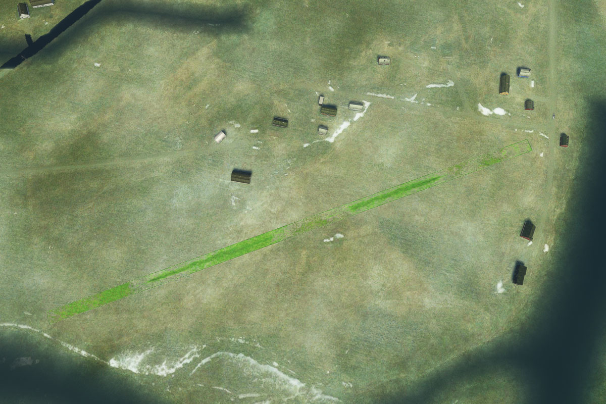
Lopshenga airfield is a mile north from the town
Leg 22
Flying from ULBL
Leg Distance: 23.75 Approximate time at 125kts: 11 minutes.
ULBL(ULBL) to Dvina Bay(POI92)
Distance: 3.41NM Bearing: 132° 2 minutes
After takeoff, fly southeast along the coast of Dvina Bay – one of the main offshoots of the White Sea
Dvina Bay(POI92) to Ozero Murakanskoye(POI93)
Distance: 10.3NM Bearing: 103° 5 minutes
Keep following the coastline east
Ozero Murakanskoye(POI93) to Yarengski-Rog Point(POI94)
Distance: 6.48NM Bearing: 73° 3 minutes
The sandy coastline will lead you east to Yarengski-Rog Point, at the mouth of a large inlet leading south from Dvina Bay
Yarengski-Rog Point(POI94) to ULAT(ULAT)
Distance: 3.56NM Bearing: 137° 2 minutes
Cross the inlet southeast to the small town of Pertominsk, with the grass airstrip in a field on the town's eastern edge
Leg 23
Flying from ULAT
Leg Distance: 64.03 Approximate time at 125kts: 31 minutes.
ULAT(ULAT) to Dvina Bay(POI95)
Distance: 11.8NM Bearing: 87° 6 minutes
From Pertminsk, fly east and continue along the coastline of Dvina Bay
Dvina Bay(POI95) to Solza(POI96)
Distance: 20.9NM Bearing: 105° 10 minutes
Keep following the coast as turns slightly southeast
Solza(POI96) to Severodvinsk(POI97)
Distance: 7.47NM Bearing: 66° 4 minutes
The coast will turn back to the east and lead you to the city of Severodvinsk. This city of about 180,000 people lies on the Northern Dvina River delta, and its main industry remains defense related — the construction and repair of submarines
Severodvinsk(POI97) to Arkhangelsk(POI98)
Distance: 18.05NM Bearing: 75° 9 minutes
From the city, fly east to meet the Northern Dvina River and follow it to the city of Arkhangelsk. This city of 350,000 people was the chief seaport of medieval and early modern Russia until 1703, when it was replaced by the newly-founded Saint Petersburg
Arkhangelsk(POI98) to ULAA(ULAA)
Distance: 5.81NM Bearing: 35° 3 minutes
Talagi Airport is a few miles northeast from the city and is the destination for this stage