The second part of our journey takes us south through Denali National Park, featuring North Americas tallest mountain. We’ll then explore the area around the western Kenai Peninsula and the waters of Cook Inlet, before heading over to the spectacular Katmai National Park. We’ll head back north to Anchorage via the beautiful Kodiak Island, followed by the valleys and glaciers of the eastern Kenai Peninsula.
Total Legs: 25 Total Distance: 1199 Total Time(125kts): 9 hours 35 minutes
Leg 1
Flying from PAFA
Leg Distance: 35.49 Approximate time at 125kts: 17 minutes.
PAFA(PAFA) to Tanana River(POI1)
Distance: 9.11NM Bearing: 218° 4 minutes
After takeoff, head south to the river and then follow it to the southwest
Tanana River(POI1) to Tanana River(POI2)
Distance: 14.82NM Bearing: 227° 7 minutes
Continue along the river southwest
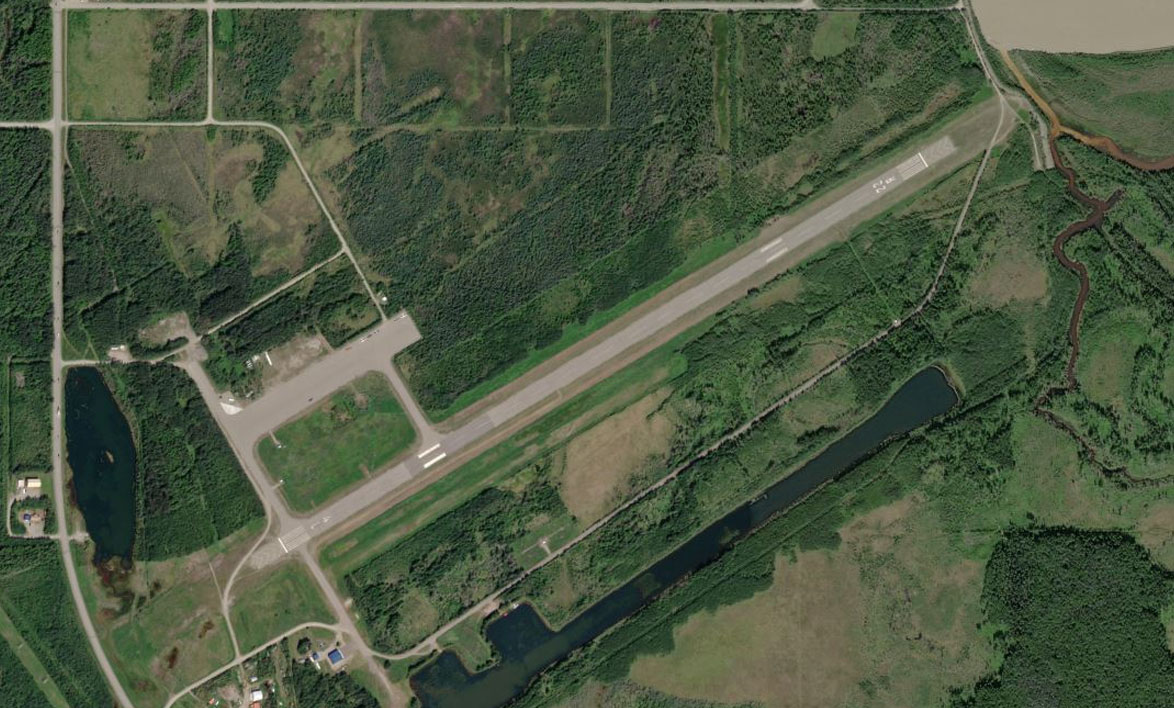
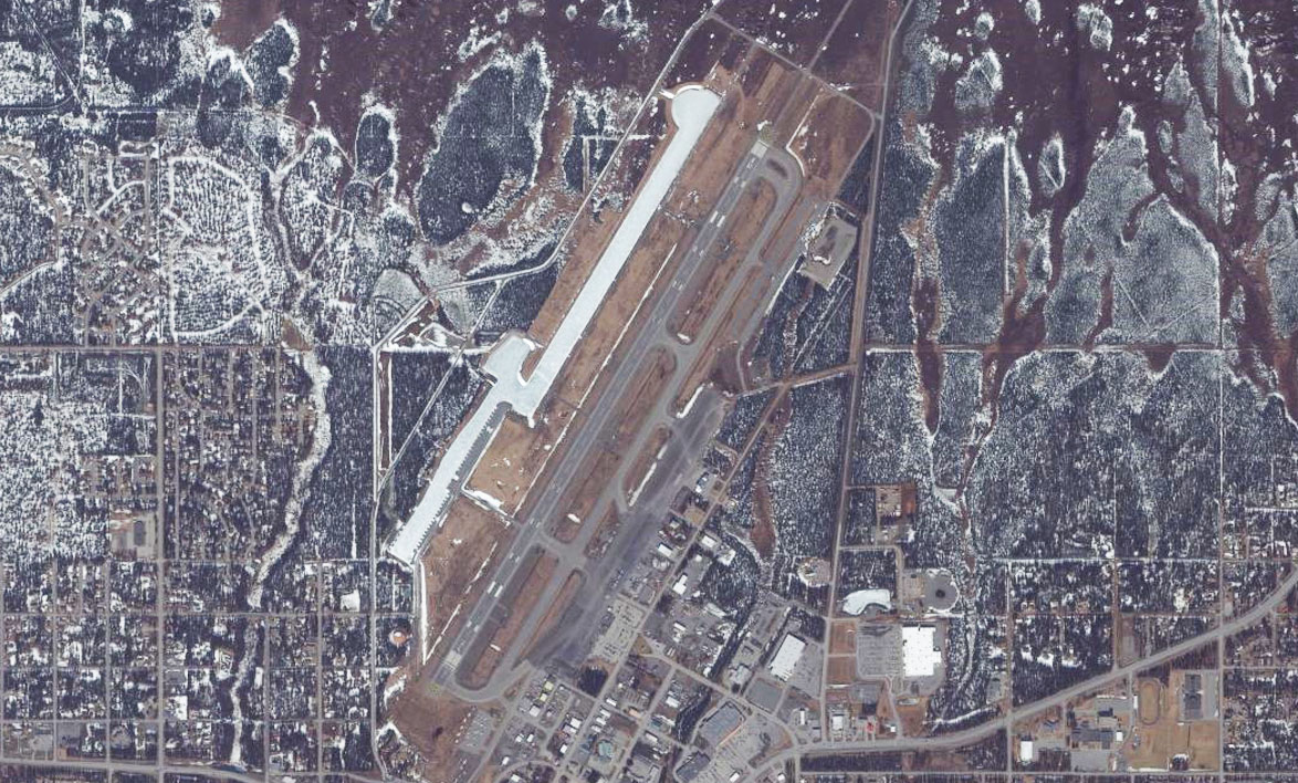
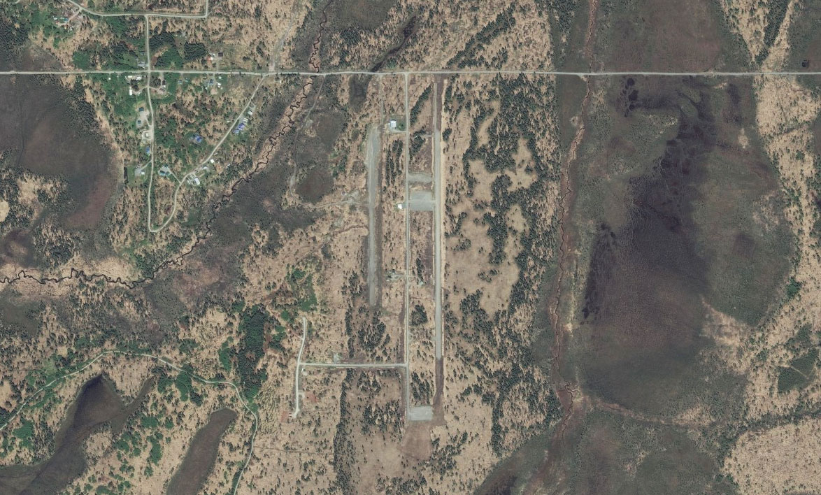
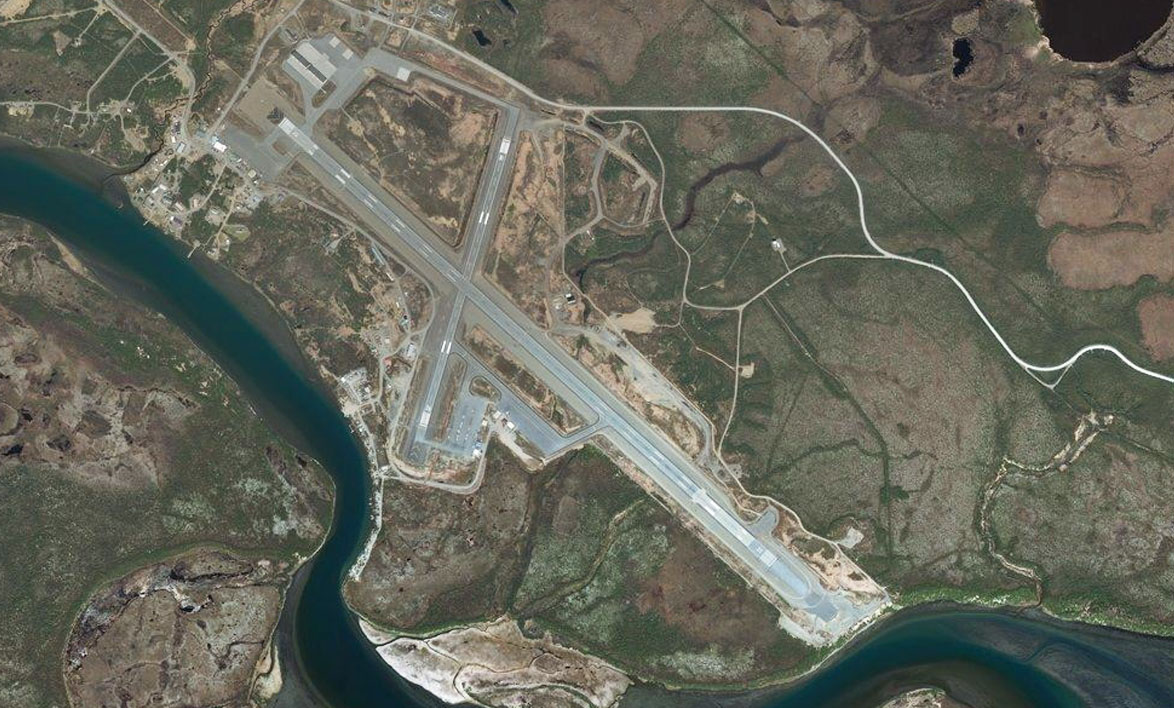
Tanana River(POI2) to PANN(PANN)
Distance: 11.56NM Bearing: 237° 6 minutes
The river will meet the Nenana river at the town of Nenana. Just to the south of the town is the airport
Leg 2
Flying from PANN
Leg Distance: 51.69 Approximate time at 125kts: 25 minutes.
PANN(PANN) to Clear Station(POI3)
Distance: 15.63NM Bearing: 185° 8 minutes
Follow the Nenana river south
Clear Station(POI3) to Nenana River(POI4)
Distance: 8NM Bearing: 163° 4 minutes
Continue along the Nenana River as it heads south
Nenana River(POI4) to Healy(POI5)
Distance: 20.91NM Bearing: 142° 10 minutes
The river will meet the Healy river from the east at the town of Healy. Continue following the Nenana river south
Healy(POI5) to Denali National Park(POI6)
Distance: 4.66NM Bearing: 153° 2 minutes
From the town of Healy, head south into the valley as you enter Denali National Park
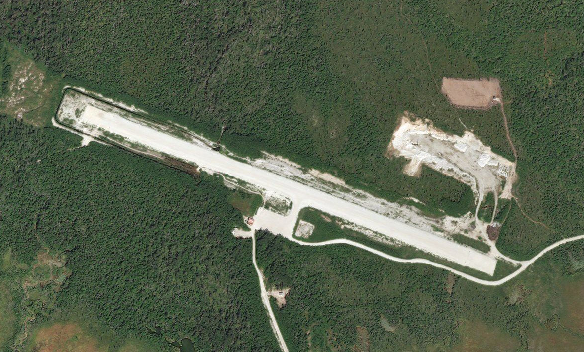
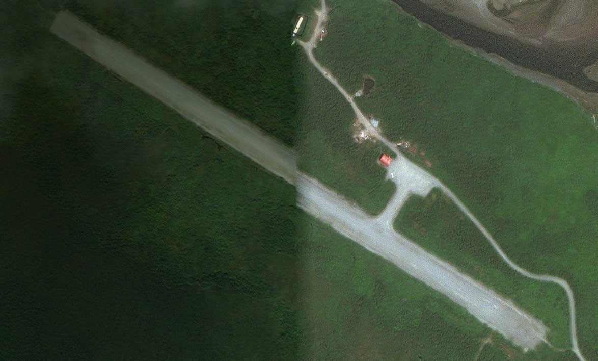
Denali National Park(POI6) to PAIN(PAIN)
Distance: 2.49NM Bearing: 164° 1 minutes
Just as the valley widens, you'll see the airport ahead
Leg 3
Flying from PAIN
Leg Distance: 28.58 Approximate time at 125kts: 14 minutes.
PAIN(PAIN) to Denali(POI7)
Distance: 7.3NM Bearing: 137° 4 minutes
After takeoff, continue southeast along the valley. The river and accompanying roads lead the way
Denali(POI7) to Chavey Lakes(POI8)
Distance: 10.47NM Bearing: 172° 5 minutes
Continue following the river along the valley
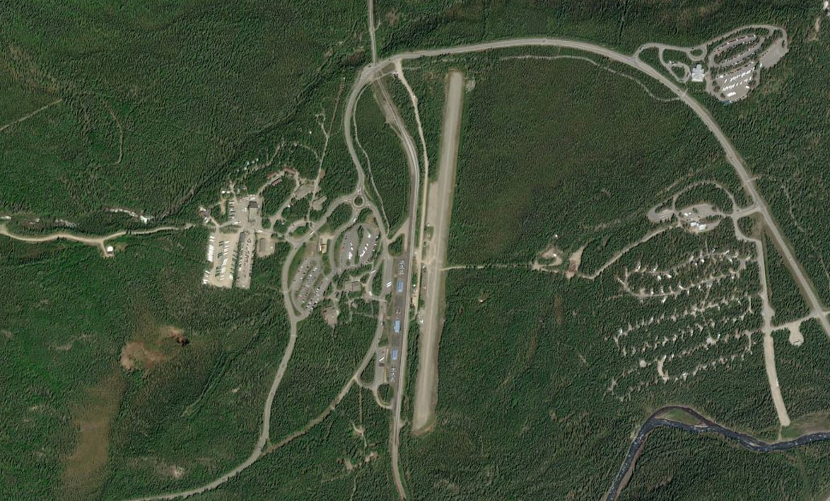
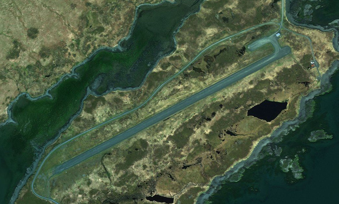
Chavey Lakes(POI8) to PAST(PAST)
Distance: 10.81NM Bearing: 213° 5 minutes
As the valley opens up, turn right and follow the highway along the valley to the southwest. The airport sits alongside the right edge of the highway
Leg 4
Flying from PAST
Leg Distance: 69.72 Approximate time at 125kts: 33 minutes.
PAST(PAST) to Chulitna River(POI9)
Distance: 21.21NM Bearing: 203° 10 minutes
Continue following the river southwest along the valley As the river starts to widen, you'll come to an opening on your left that leads into the next valley. As you head through the gap, a quick look to the right should give you a great view of Denali, the tallest mountain in North America. Leading down from the mountain is the Eldridge Glacier
Chulitna River(POI9) to Indian River(POI10)
Distance: 10.65NM Bearing: 160° 5 minutes
Once you're into the next valley, turn to the right and follow the river southwest
Indian River(POI10) to Susitna River(POI11)
Distance: 23.73NM Bearing: 202° 11 minutes
The valley will open out onto a plain and the river will turn to the south
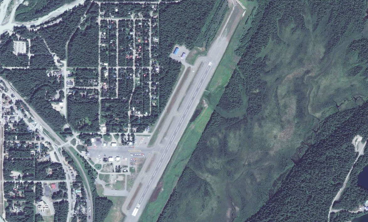
Susitna River(POI11) to PATK(PATK)
Distance: 14.13NM Bearing: 166° 7 minutes
Follow the river south until it meets up with the Chulitna River at the town of Talkeetna. The airport is just next to the town
Leg 5
Flying from PATK
Leg Distance: 47.58 Approximate time at 125kts: 23 minutes.
PATK(PATK) to Trapper Ck(POI12)
Distance: 6.84NM Bearing: 253° 3 minutes
Head west straight after takeoff and follow the road heading directly west from the other side of the river. It will shortly pass a lake with a small town to the south of the road. From here turn to the southwest
Trapper Ck(POI12) to Yentna River(POI13)
Distance: 29.7NM Bearing: 214° 14 minutes
Heading across the landscape towards the large mountain range in the distance, you'll soon pass the smaller Kahiltna river and then eventually meet the larger Yentna river where it joins the Skwentna river
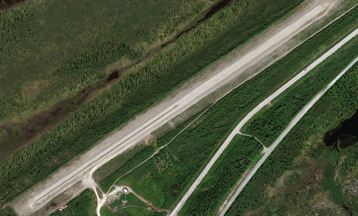
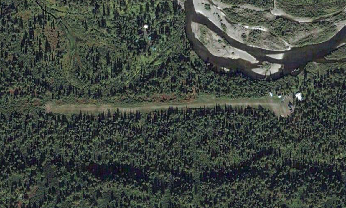
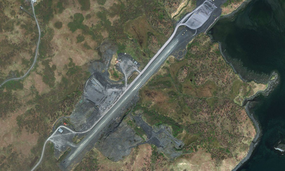
Yentna River(POI13) to 1AK6(1AK6)
Distance: 11.04NM Bearing: 210° 5 minutes
Continue southwest, following the inland delta of the river where it will join up as a single flow. Just south of here you will see the airfield lying on the south side of the smaller Talachulitna River
Leg 6
Flying from 1AK6
Leg Distance: 42.86 Approximate time at 125kts: 21 minutes.
1AK6(1AK6) to Beluga Peak(POI14)
Distance: 10.04NM Bearing: 148° 5 minutes
Fly southeast and along the right side of the mountain range which runs southeast
Beluga Peak(POI14) to Mt Susitna(POI15)
Distance: 17.44NM Bearing: 143° 8 minutes
As you pass the mountain range, turn slightly left and continue southwest across to the southern end of the next mountain range which lies to the southeast
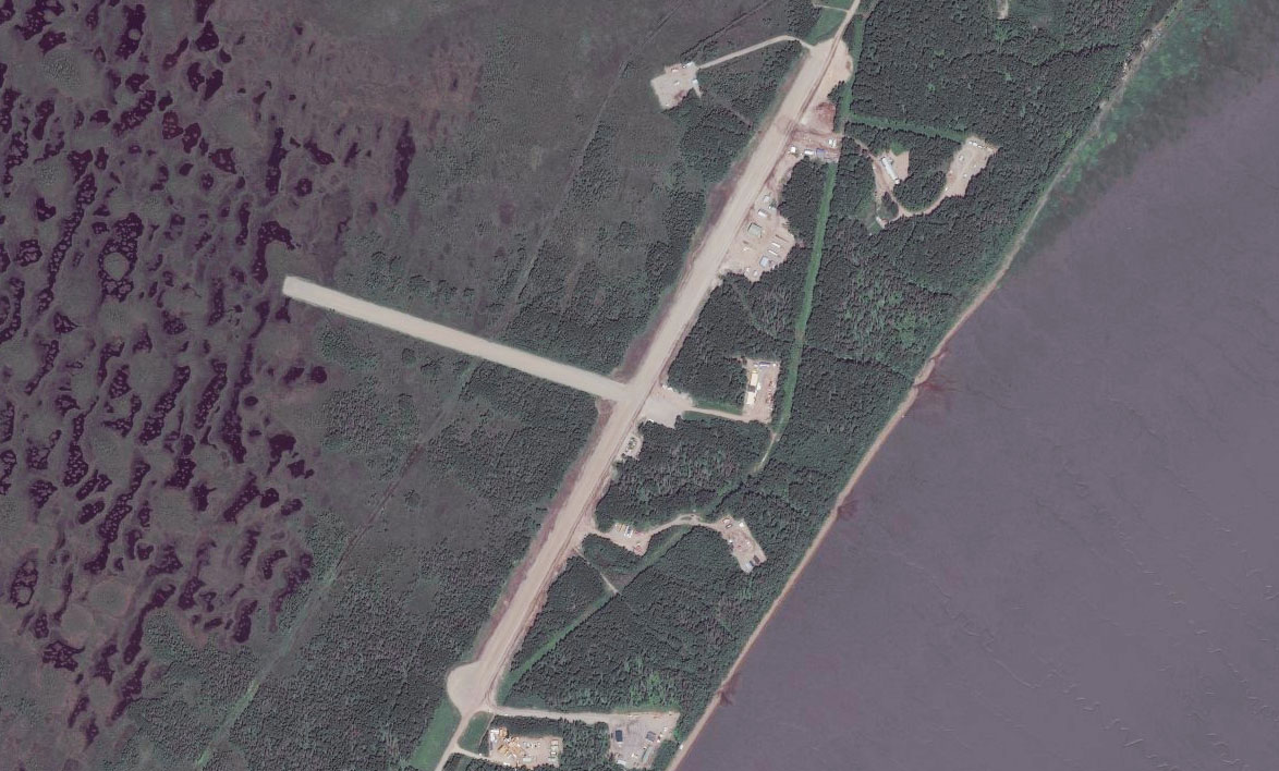
Mt Susitna(POI15) to PABG(PABG)
Distance: 15.38NM Bearing: 165° 7 minutes
As you near the southern end of the range, continue southeast to the coast, then follow the coast southwest. This should bring you to the small town of Beluga, and the airfield which runs parallel to the highway
Leg 7
Flying from PABG
Leg Distance: 38.76 Approximate time at 125kts: 19 minutes.
PABG(PABG) to Tyonek(POI16)
Distance: 8.65NM Bearing: 192° 4 minutes
Head south from Beluga along the shoreline until you reach the town of Tyonek, where the coast will turn to the west. Once you pass the town, turn southeast and head over the Cook Inlet
Tyonek(POI16) to Konovalof Lake(POI17)
Distance: 15.43NM Bearing: 150° 7 minutes
After heading southeast across Cook Inlet, turn south once you cross the coast of Kenai Peninsula
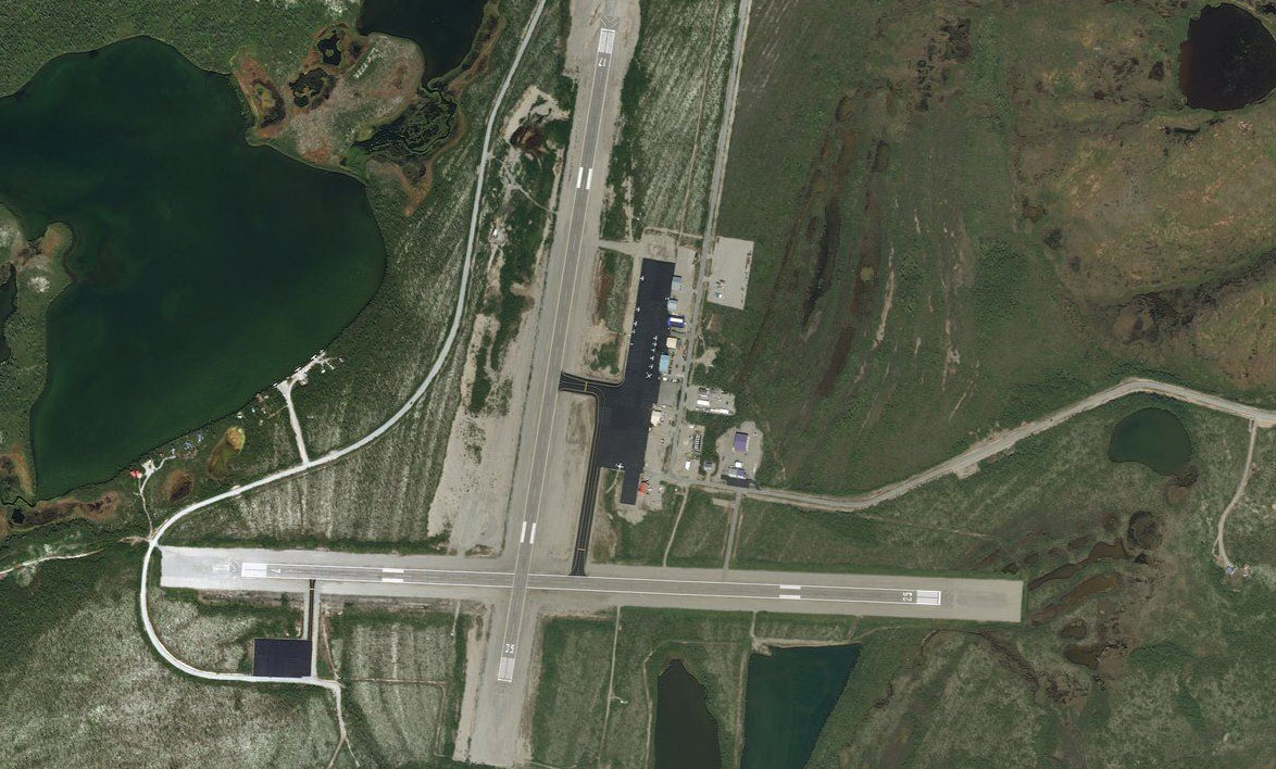
Konovalof Lake(POI17) to PAEN(PAEN)
Distance: 14.68NM Bearing: 191° 7 minutes
Head south across the Kenai Peninsula to Kenai airport on the far side
Leg 8
Flying from PAEN
Leg Distance: 40.19 Approximate time at 125kts: 19 minutes.
PAEN(PAEN) to Cape Kasilof(POI18)
Distance: 13.38NM Bearing: 185° 6 minutes
After takeoff, head south along the coast. It will turn to the east and then south again at Cape Kasilof
Cape Kasilof(POI18) to Ninilchik(POI19)
Distance: 20.57NM Bearing: 190° 10 minutes
Continue south along the coast which will curve gradually to the southwest before turning south again near the town of Ninilchik
Ninilchik(POI19) to 00AK(00AK)
Distance: 6.24NM Bearing: 173° 3 minutes
Fly south from the town and you will soon see the runway of Lowell Field, about a mile inland
Leg 9
Flying from 00AK
Leg Distance: 84.76 Approximate time at 125kts: 41 minutes.
00AK(00AK) to Mount Iliamna(POI20)
Distance: 28.85NM Bearing: 262° 14 minutes
Head west back across Cook Inlet, in the direction of Mount Iliamna which dominates the skyline ahead
Mount Iliamna(POI20) to Chinitna Bay(POI21)
Distance: 9.97NM Bearing: 203° 5 minutes
When you reach the coast, turn to the southwest and follow the coast around into the large bay
Chinitna Bay(POI21) to Chinitna Bay(POI22)
Distance: 12.93NM Bearing: 250° 6 minutes
Head to the western end of the bay where there will be river valleys heading off to the north, west and south. Turn and head through the valley to the south
Chinitna Bay(POI22) to Portage Creek(POI23)
Distance: 6.79NM Bearing: 192° 3 minutes
Head south through the valley where you'll shortly reach Iniskin Bay
Portage Creek(POI23) to Sugarloaf Mountain(POI24)
Distance: 3.7NM Bearing: 295° 2 minutes
Turn right and head northwest across the bay. As the bay narrows into the Iniskin River and heads north, turn northwest into the valley to the left
Sugarloaf Mountain(POI24) to Chigmit Mountains(POI25)
Distance: 3.33NM Bearing: 290° 2 minutes
Continue following the valley northwest through the Chigmit Mountains
Chigmit Mountains(POI25) to Iliamna River(POI26)
Distance: 3.15NM Bearing: 286° 2 minutes
The valley will open out to the east where it meets the Iliamna River
Iliamna River(POI26) to Pile River(POI27)
Distance: 7.32NM Bearing: 259° 4 minutes
Head west over Long Lake to the foot of the mountains ahead
Pile River(POI27) to Lonesome Bay(POI28)
Distance: 4.77NM Bearing: 217° 2 minutes
Follow the base of the mountains southwest, turning around to the west towards Pedro Bay
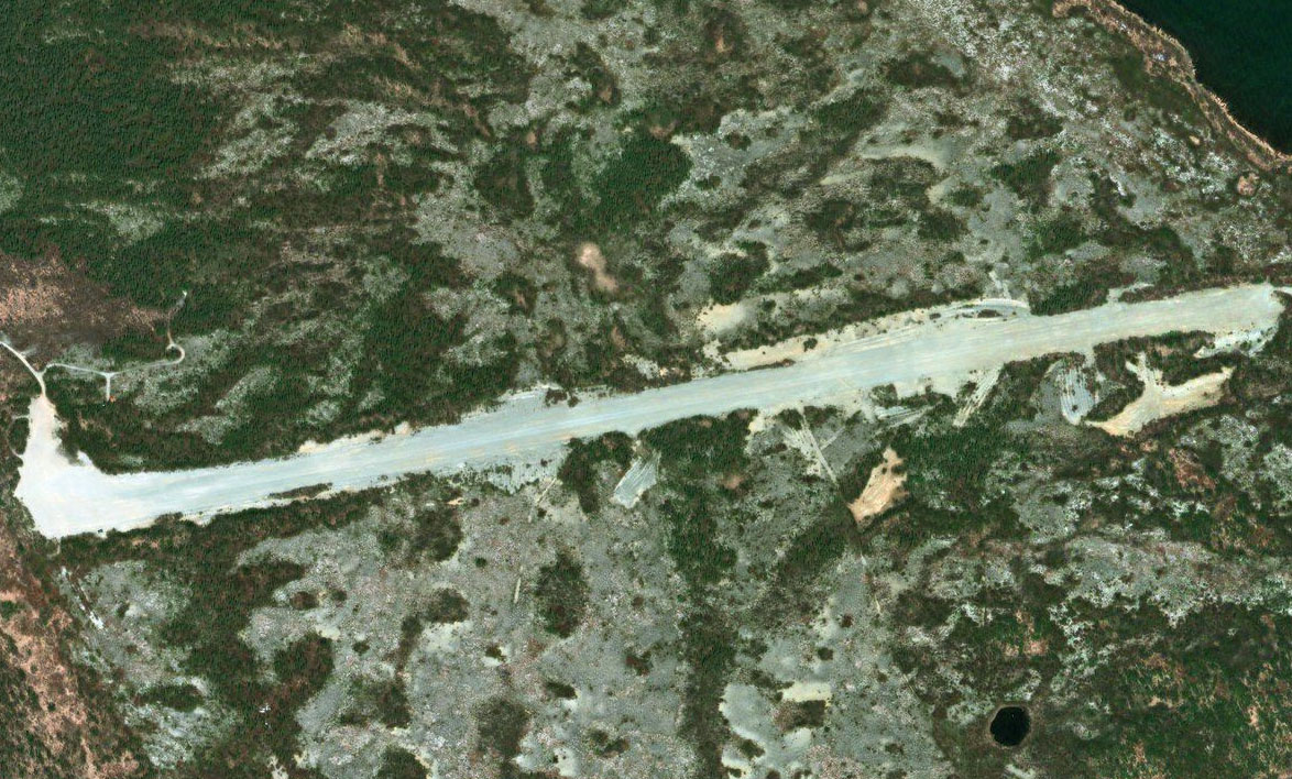
Lonesome Bay(POI28) to 4K0(4K0)
Distance: 3.95NM Bearing: 278° 2 minutes
Once you turn west around the base of the hills, Pedro Bay landing strip will be ahead
Leg 10
Flying from 4K0
Leg Distance: 23.77 Approximate time at 125kts: 11 minutes.
4K0(4K0) to Iliamna Lake(POI29)
Distance: 6.08NM Bearing: 256° 3 minutes
After takeoff, head west along the north shore of Iliamna Lake
Iliamna Lake(POI29) to Iliamna Lake(POI30)
Distance: 6.89NM Bearing: 249° 3 minutes
Continue along the shore to the west. You may catch sight of some bears on the way to the next waypoint
Iliamna Lake(POI30) to Iliamna(POI31)
Distance: 8.06NM Bearing: 250° 4 minutes
Keep following the shore southwest to the town of Iliamna
Iliamna(POI31) to PAIL(PAIL)
Distance: 2.74NM Bearing: 251° 1 minutes
West of the town, a couple of miles from the shore, is Iliamna airport
Leg 11
Flying from PAIL
Leg Distance: 48.07 Approximate time at 125kts: 23 minutes.
PAIL(PAIL) to Tenmile Island(POI32)
Distance: 6.84NM Bearing: 191° 3 minutes
Fly south to the small island off shore, then head south across the lake, aiming to the left of the mountain on the far shore
Tenmile Island(POI32) to Dennis Creek(POI33)
Distance: 16.29NM Bearing: 168° 8 minutes
After crossing Iliamna lake, Alaska's largest lake, you should hit land just to the left of a small mountain.
Dennis Creek(POI33) to Kukaklek Lake(POI34)
Distance: 14.26NM Bearing: 174° 7 minutes
Keep heading south past the mountain, and cross over the eastern edge of another large lake, Kukaklek Lake
Kukaklek Lake(POI34) to PAKL(PAKL)
Distance: 10.68NM Bearing: 175° 5 minutes
Continue south from here over a hilly area and you'll arrive at the twin lakes of Kulik Lake and Nonvianuk Lake. Look for a small bridge of land dividing these two lakes and you will find Kulik Lake airport
Leg 12
Flying from PAKL
Leg Distance: 55.09 Approximate time at 125kts: 26 minutes.
PAKL(PAKL) to Nonvianuk Lake(POI35)
Distance: 14.94NM Bearing: 266° 7 minutes
After takeoff, head west along the length of Nonvianuk Lake.
Nonvianuk Lake(POI35) to Naknek Lake(POI36)
Distance: 30.27NM Bearing: 219° 15 minutes
Once you reach the end of the lake, turn to the southwest and cross another hilly area to reach another large lake, Naknek Lake. When you reach the main body of the lake, turn to the west
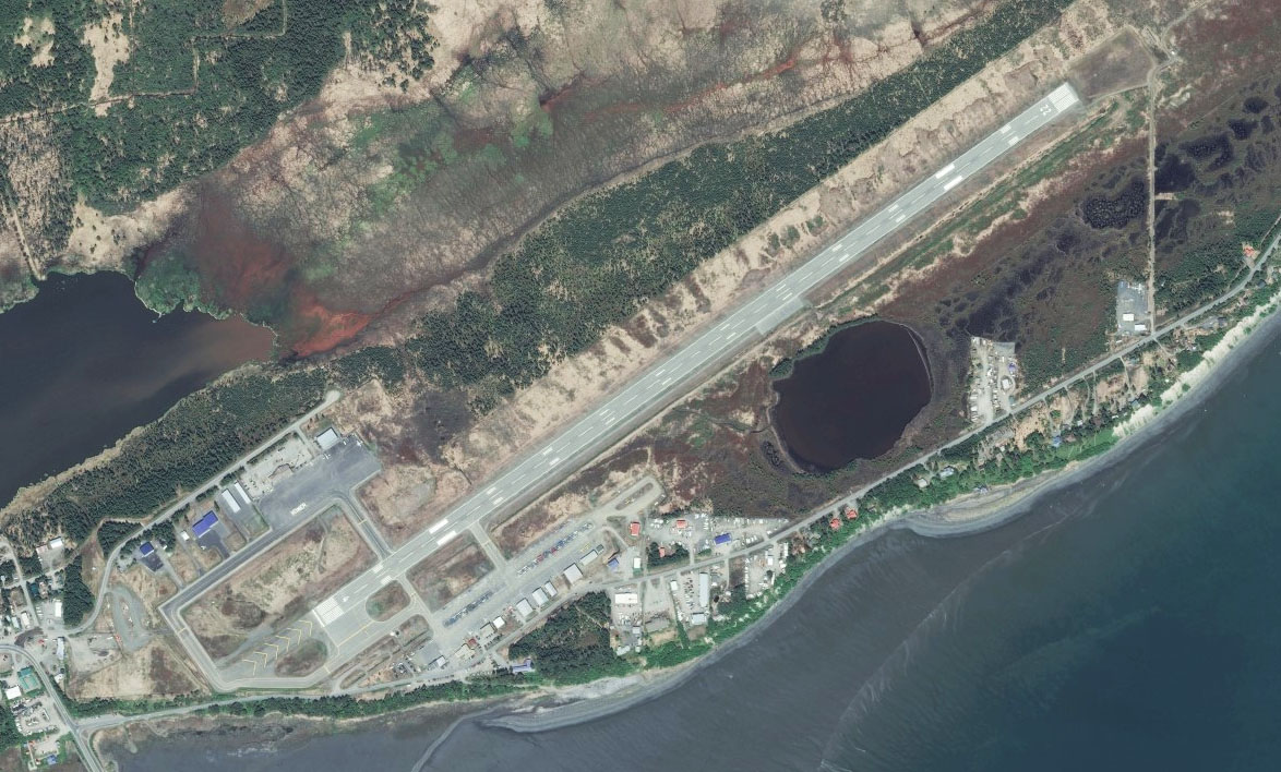
Naknek Lake(POI36) to PAKN(PAKN)
Distance: 9.88NM Bearing: 257° 5 minutes
The western point of the lake will lead you to the Naknek River, which in turn will lead you to King Salmon Airport
Leg 13
Flying from PAKN
Leg Distance: 111.59 Approximate time at 125kts: 54 minutes.
PAKN(PAKN) to Naknek Lake(POI37)
Distance: 11.9NM Bearing: 100° 6 minutes
From King Salmon, fly east back to Naknek lake and along its southern shore
Naknek Lake(POI37) to Dumpling Mountain(POI38)
Distance: 14.3NM Bearing: 77° 7 minutes
Following the lake's southern shore, you'll pass a mountain where a channel of the lake will lead to the southeast
Dumpling Mountain(POI38) to Iliuk Arm(POI39)
Distance: 6.96NM Bearing: 116° 3 minutes
Heading southeast towards the Iliuk Arm of Naknek Lake, you'll see a small river to the right linking lake Brooks. On this river is Brooks Falls, a popular salmon fishing spot for the local bears. Continue southeast
Iliuk Arm(POI39) to Mt Katolinat(POI40)
Distance: 10.68NM Bearing: 89° 5 minutes
Head east along the lake, passing to the north of Mt Katolinat at its south eastern shore
Mt Katolinat(POI40) to Ukak River(POI41)
Distance: 8.37NM Bearing: 172° 4 minutes
Follow the base of the mountain around to the south, where you'll be following the Ukak river through a short valley
Ukak River(POI41) to Mount Katmai(POI42)
Distance: 13.13NM Bearing: 105° 6 minutes
When you enter the open area ahead, turn to the east and start gaining some altitude, passing to the south of Mount Griggs. Keep climbing towards Mt Katmai and its water filled crater
Mount Katmai(POI42) to Katmai Bay(POI43)
Distance: 15.76NM Bearing: 164° 8 minutes
Head south from the peak of Mt Katmai towards the large sandy beach on the shore of Katmai Bay
Katmai Bay(POI43) to Shelikof Strait(POI44)
Distance: 27.31NM Bearing: 137° 13 minutes
Head southeast from the beach across Shelikof Strait. As you approach land on the other side, you'll notice a large rocky outcrop with a small inlet to its north. Head towards the inlet
Shelikof Strait(POI44) to PAKY(PAKY)
Distance: 3.18NM Bearing: 132° 2 minutes
On the south side of the inlet, at the base of a hill, is Karluk airstrip
Leg 14
Flying from PAKY
Leg Distance: 53.26 Approximate time at 125kts: 26 minutes.
PAKY(PAKY) to Cape Karluk(POI45)
Distance: 2.05NM Bearing: 284° 1 minutes
Head west back towards the open water then turn left to circle around the rocky outcrop of Cape Karluk, then follow the coast around to the southwest
Cape Karluk(POI45) to Grant Lagoon(POI46)
Distance: 7.86NM Bearing: 207° 4 minutes
As you follow the coast you'll see a lagoon followed by an area of steep rocky coast. You'll then come to another lagoon which will lead you into a large shallow valley heading to the southeast
Grant Lagoon(POI46) to Ayakulik River Valley(POI47)
Distance: 9.45NM Bearing: 140° 5 minutes
Cross the lagoon, then follow the valley south east
Ayakulik River Valley(POI47) to Ayakulik River Valley(POI48)
Distance: 5.65NM Bearing: 125° 3 minutes
Keep following the valley as it turns slightly to the left and then to an intersection of several valleys
Ayakulik River Valley(POI48) to Red Lake(POI49)
Distance: 3.32NM Bearing: 88° 2 minutes
Turn to the east towards the valley housing Red Lake
Red Lake(POI49) to Akalura Lake(POI50)
Distance: 5.04NM Bearing: 135° 2 minutes
Follow the lake as it runs along the valley, which will lead you to a second lake, Akalura Lake
Akalura Lake(POI50) to Olga Bay(POI51)
Distance: 3.2NM Bearing: 162° 2 minutes
Fly south over Akalura Lake and continue to its southern shore, where a small land bridge between two mountains will lead you south into Olga Bay
Olga Bay(POI51) to Olga Bay(POI52)
Distance: 5.12NM Bearing: 87° 2 minutes
Once out into the bay, turn to the east and fly along the bay where it narrows between two mountains, into its eastern section
Olga Bay(POI52) to Moser Bay(POI53)
Distance: 8.39NM Bearing: 186° 4 minutes
Turn to the south and head along the bay as it narrows into a channel before opening out again to Maser Bay. Continue south to the flat land ahead, and the town of Akhiok
Moser Bay(POI53) to PAKH(PAKH)
Distance: 3.18NM Bearing: 186° 2 minutes
Just south of the town is Akhiok Airport
Leg 15
Flying from PAKH
Leg Distance: 36.56 Approximate time at 125kts: 18 minutes.
PAKH(PAKH) to Portage Bay(POI54)
Distance: 9.96NM Bearing: 75° 5 minutes
After takeoff, head east across Portage Bay
Portage Bay(POI54) to Portage Bay(POI55)
Distance: 5.15NM Bearing: 37° 2 minutes
Follow the eastern shore of portage bay as it heads around to the northeast
Portage Bay(POI55) to Kiavak Bay(POI56)
Distance: 6.18NM Bearing: 64° 3 minutes
As the bay ends, head east over a couple of hills into Kiavak Bay
Kiavak Bay(POI56) to Sitkalidak Strait(POI57)
Distance: 9.71NM Bearing: 29° 5 minutes
When you enter the large bay, turn northeast and fly along Sitkalidak Strait
Sitkalidak Strait(POI57) to 6R7(6R7)
Distance: 5.56NM Bearing: 25° 3 minutes
Old Harbor airport is at the narrow northeast end of the strait
Leg 16
Flying from 6R7
Leg Distance: 51.83 Approximate time at 125kts: 25 minutes.
6R7(6R7) to Sitkalidak Strait(POI58)
Distance: 6.96NM Bearing: 81° 3 minutes
Heading east from Old Harbor, follow the north shore of Sitkalidak Strait east
Sitkalidak Strait(POI58) to Left Cape(POI59)
Distance: 5.03NM Bearing: 43° 2 minutes
Stay with the shore as it turns to the northeast
Left Cape(POI59) to Shearwater Bay(POI60)
Distance: 5.57NM Bearing: 2° 3 minutes
Head north across Kiliuda Bay and into Shearwater Bay
Shearwater Bay(POI60) to Ugak Bay(POI61)
Distance: 11.18NM Bearing: 35° 5 minutes
Fly northeast across the lower land then across Ugak Bay
Ugak Bay(POI61) to Kalsin Bay(POI62)
Distance: 9.71NM Bearing: 23° 5 minutes
Continue northeast across some more low lying land dotted with a couple of lakes, to Kalsin bay
Kalsin Bay(POI62) to Kodiak(POI63)
Distance: 11.1NM Bearing: 349° 5 minutes
Once you enter the bay, cross the small peninsula to your left. Then head north to the town of Kodiak. Aim for the light patch on the side of Pillar Mountain which was the site of a landslide in 2013
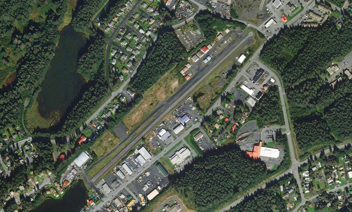
Kodiak(POI63) to PAKD(PAKD)
Distance: 2.28NM Bearing: 40° 1 minutes
Fly northeast along the length of the town and the airfield is just at the other end of a lake near the center of town
Leg 17
Flying from PAKD
Leg Distance: 20.78 Approximate time at 125kts: 10 minutes.
PAKD(PAKD) to Mt Herman(POI64)
Distance: 6.65NM Bearing: 355° 3 minutes
After taking off from Kodiak, turn to the north and in the direction of the mountain headland a few miles across the bay
Mt Herman(POI64) to The Triplets(POI65)
Distance: 6.01NM Bearing: 305° 3 minutes
After passing the headland, turn to the northwest and fly over the next peninsula towards the small group of islands, called The Triplets
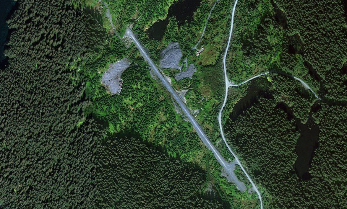
The Triplets(POI65) to PDGB(PDGB)
Distance: 8.12NM Bearing: 327° 4 minutes
From the Triplets, head northwest towards the nearest peninsula. As you reach land you should see the small airstrip near the left shore
Leg 18
Flying from PDGB
Leg Distance: 77.22 Approximate time at 125kts: 37 minutes.
PDGB(PDGB) to Shuyak Island(POI66)
Distance: 30.52NM Bearing: 356° 15 minutes
After takeoff, head north and over the hills ahead, then over flatter land of Shuyak Island. Adjust your course for the northern most point of the island
Shuyak Island(POI66) to Ushagat Island(POI67)
Distance: 19.82NM Bearing: 0° 10 minutes
Still heading in a northerly direction, there will be another group of islands ahead. Aim for the largest one on the left, Ushagat Island
Ushagat Island(POI67) to Mt Bede(POI68)
Distance: 23.77NM Bearing: 6° 11 minutes
Continue north towards the mountains of the Kenai Peninsula across the bay. Head for the left side, which is dominated by Mt Bede near the coast
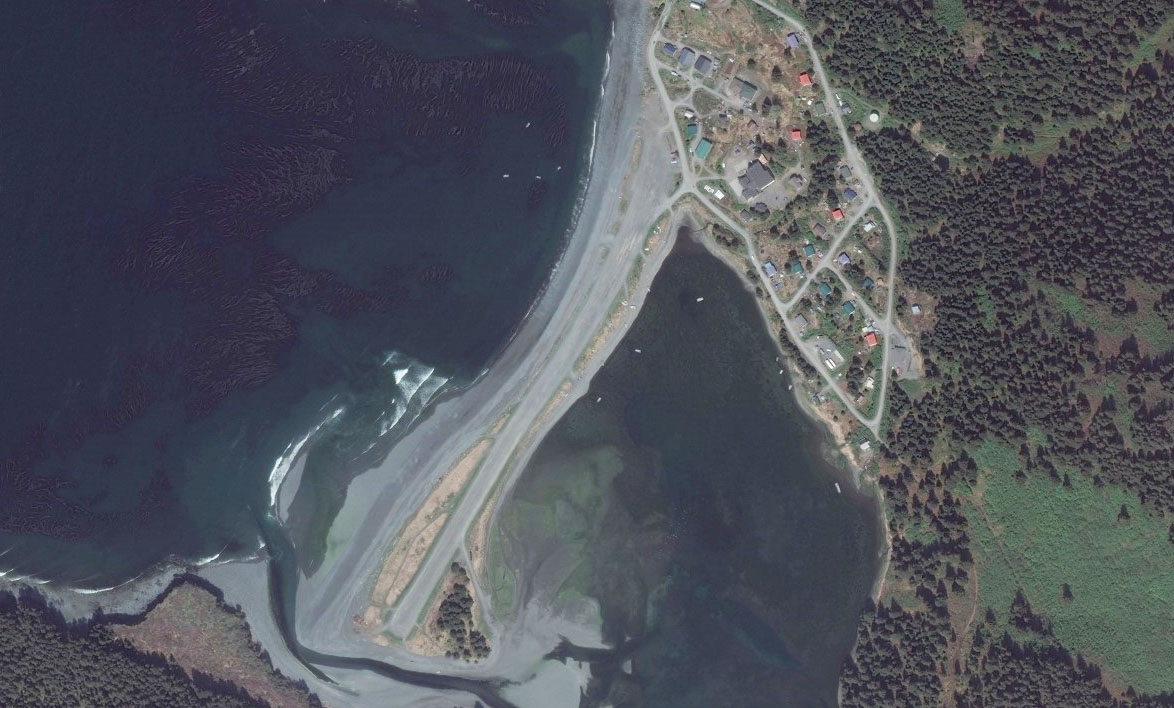
Mt Bede(POI68) to KEB(KEB)
Distance: 3.11NM Bearing: 29° 1 minutes
Stick to coast after as you pass by Mt Bede and you'll see the small town of Nanwalek and its airfield sitting at the edge of a river inlet
Leg 19
Flying from KEB
Leg Distance: 24.9 Approximate time at 125kts: 12 minutes.
KEB(KEB) to Pt Pogibshi(POI69)
Distance: 4.81NM Bearing: 1° 2 minutes
After takeoff, head north to the next outcrop of land on the coast
Pt Pogibshi(POI69) to Yukon Island(POI70)
Distance: 12.21NM Bearing: 51° 6 minutes
Follow the coast around to the northeast until you come to a bay with a group of islands. Head for the largest island then turn north
Yukon Island(POI70) to PAHO(PAHO)
Distance: 7.88NM Bearing: 356° 4 minutes
A straight shot north across Kachemak Bay will take you to the town of Homer. The airport is just to the east of the town, where the long spit meets the shore
Leg 20
Flying from PAHO
Leg Distance: 30.1 Approximate time at 125kts: 14 minutes.
PAHO(PAHO) to Deep Creek(POI71)
Distance: 21.01NM Bearing: 1° 10 minutes
Head north from Homer. After approx 20nm you will reach a shallow river canyon, then turn west
Deep Creek(POI71) to NIN(NIN)
Distance: 9.09NM Bearing: 270° 4 minutes
Heading west, look for the road heading in the same direction that will lead you straight past Ninilchik airfield
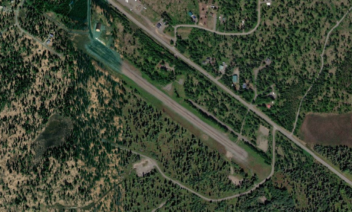
Leg 21
Flying from NIN
Leg Distance: 33.06 Approximate time at 125kts: 16 minutes.
NIN(NIN) to AK1(POI72)
Distance: 4.91NM Bearing: 351° 2 minutes
Head north after takeoff towards the coast then follow the highway as it runs north along the coast
AK1(POI72) to Sterling Highway(POI73)
Distance: 14.35NM Bearing: 24° 7 minutes
Follow the highway north as it heads further inland
Sterling Highway(POI73) to Soldotna(POI74)
Distance: 12.39NM Bearing: 13° 6 minutes
Continue following the highway until it crosses the Kenai river at the town of Soldotna
Soldotna(POI74) to PASX(PASX)
Distance: 1.41NM Bearing: 71° 1 minutes
The airport is just south of town beside the river
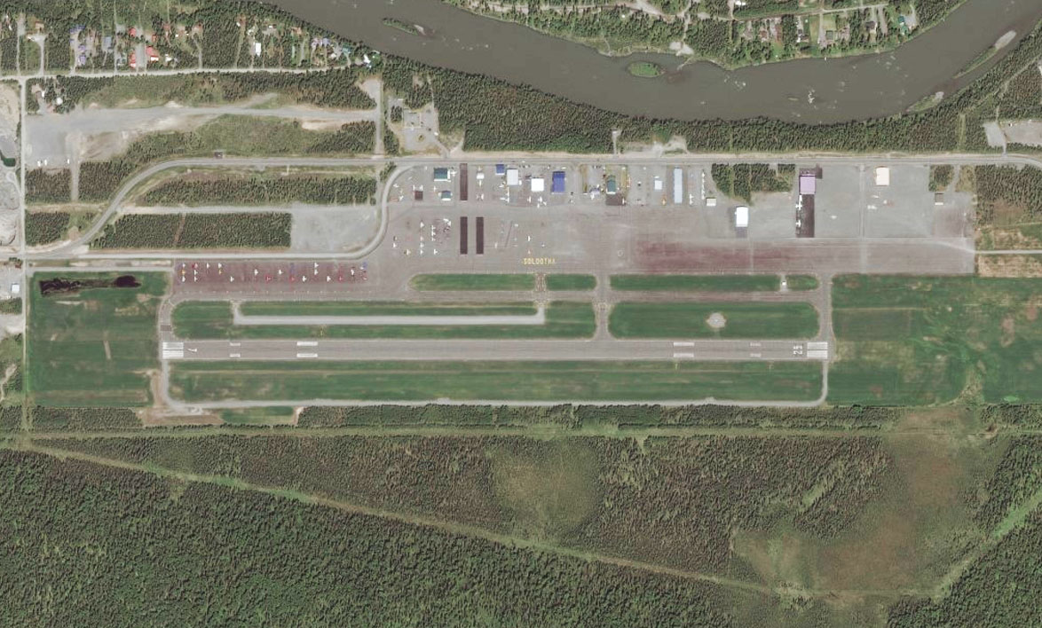
Leg 22
Flying from PASX
Leg Distance: 81.72 Approximate time at 125kts: 39 minutes.
PASX(PASX) to Skilak Lake(POI75)
Distance: 15.28NM Bearing: 81° 7 minutes
Head east to where the river meets Skilak Lake
Skilak Lake(POI75) to Skilak Lake(POI76)
Distance: 12.11NM Bearing: 90° 6 minutes
Fly to the far end of the lake, then turn to the southeast
Skilak Lake(POI76) to Skilak Glacier(POI77)
Distance: 6.58NM Bearing: 142° 3 minutes
Follow the Skilak River as it curves around to the right and becomes Skilak Glacier
Skilak Glacier(POI77) to Skilak Glacier(POI78)
Distance: 9.87NM Bearing: 166° 5 minutes
Fly south, climbing up the glacier valley as you go. After you clear the valley and enter the ice field, turn to the southeast
Skilak Glacier(POI78) to Harding Ice Field(POI79)
Distance: 13.11NM Bearing: 101° 6 minutes
Head southeast across the ice field and you will see a small triangle shaped peak across the other side. Pass to the left side of the peak which marks the entry to Bear Glacier
Harding Ice Field(POI79) to Bear Glacier(POI80)
Distance: 9.51NM Bearing: 138° 5 minutes
Descend down Bear Glacier as it turns to the southeast and out into a small bay, which will then lead out into open water
Bear Glacier(POI80) to Resurrection Bay(POI81)
Distance: 6.51NM Bearing: 25° 3 minutes
As soon as you are over the open waters of the large bay, turn left and around into the next bay, called Resurrection Bay, then follow it north
Resurrection Bay(POI81) to PAWD(PAWD)
Distance: 8.75NM Bearing: 336° 4 minutes
Head north to the far end of the bay, and Seward Airport sitting to the left of the river
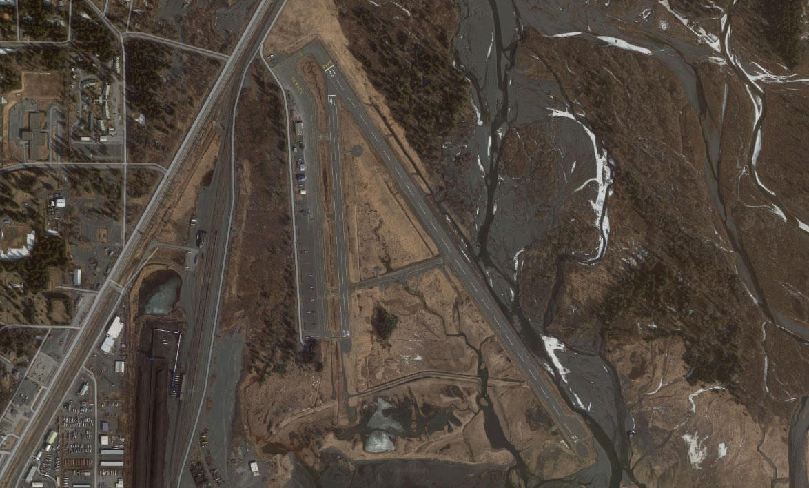
Leg 23
Flying from PAWD
Leg Distance: 30.77 Approximate time at 125kts: 15 minutes.
PAWD(PAWD) to Bear Lake(POI82)
Distance: 5NM Bearing: 6° 2 minutes
Head northeast from Seward, then follow the valley north
Bear Lake(POI82) to Kenai Lake(POI83)
Distance: 11.73NM Bearing: 343° 6 minutes
Head north along the valley which will lead you to the start of Kenai Lake. Follow the lake as it turns west
Kenai Lake(POI83) to Kenai Lake(POI84)
Distance: 8.17NM Bearing: 251° 4 minutes
Keep following the lake as it makes a turn to the northwest
Kenai Lake(POI84) to JLA(JLA)
Distance: 5.87NM Bearing: 324° 3 minutes
At the end of this stretch of lake you will see Quartz Creek airport on the right side, at the end of an adjoining valley
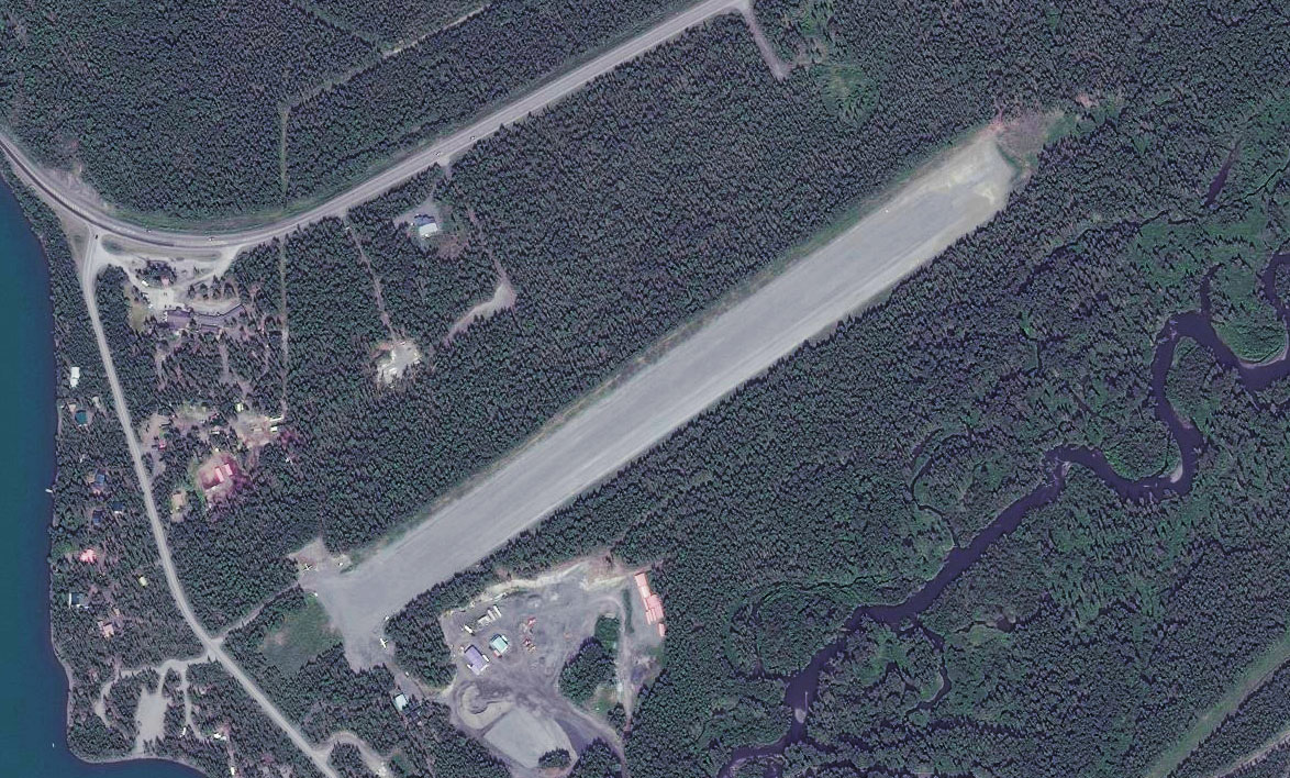
Leg 24
Flying from JLA
Leg Distance: 48.03 Approximate time at 125kts: 23 minutes.
JLA(JLA) to Quartz Creek(POI85)
Distance: 4.63NM Bearing: 30° 2 minutes
After takeoff, head northeast along the valley for a few miles before another large valley splits off to the right. Turn to the east and head down this valley
Quartz Creek(POI85) to Upper Trail Lake(POI86)
Distance: 6.85NM Bearing: 93° 3 minutes
You will come to a lake in the next valley, turn to the northeast and follow it
Upper Trail Lake(POI86) to Trail Creek(POI87)
Distance: 3.39NM Bearing: 31° 2 minutes
Trail Lake will reduce to a creek and continue turning to the northeast. Follow it northeast
Trail Creek(POI87) to Trail Creek(POI88)
Distance: 5.33NM Bearing: 62° 3 minutes
Keep following the creek northeast
Trail Creek(POI88) to Trail Creek(POI89)
Distance: 3.09NM Bearing: 25° 1 minutes
The valley will turn to the north to another junction where the creek will then turn east. Leave the creek here and follow the railway north
Trail Creek(POI89) to Spencer Lake(POI90)
Distance: 5.08NM Bearing: 355° 2 minutes
You will come to another valley junction at Spencer Lake. Follow the river north through the valley
Spencer Lake(POI90) to Portage(POI91)
Distance: 8.06NM Bearing: 358° 4 minutes
The valley will open up to another junction where four valleys meet at the own of Portage. Turn left into the eastern reaches of Cook Inlet, called Turnagain Arm.
Portage(POI91) to Turnagain Arm(POI92)
Distance: 8.82NM Bearing: 305° 4 minutes
Follow the valley northwest. An opening to the north will lead you to the town of Girdwood
Turnagain Arm(POI92) to AQY(AQY)
Distance: 2.78NM Bearing: 17° 1 minutes
A few miles from the shore, just to the left of the town is the airport
Leg 25
Flying from AQY
Leg Distance: 32.77 Approximate time at 125kts: 16 minutes.
AQY(AQY) to Turnagain Arm(POI93)
Distance: 7.46NM Bearing: 231° 4 minutes
After takeoff, head back to the water and turn right, heading west along Turnagain Arm
Turnagain Arm(POI93) to Turnagain Arm(POI94)
Distance: 14.11NM Bearing: 280° 7 minutes
Follow the north shore as it turns to the northwest and heads towards Anchorage
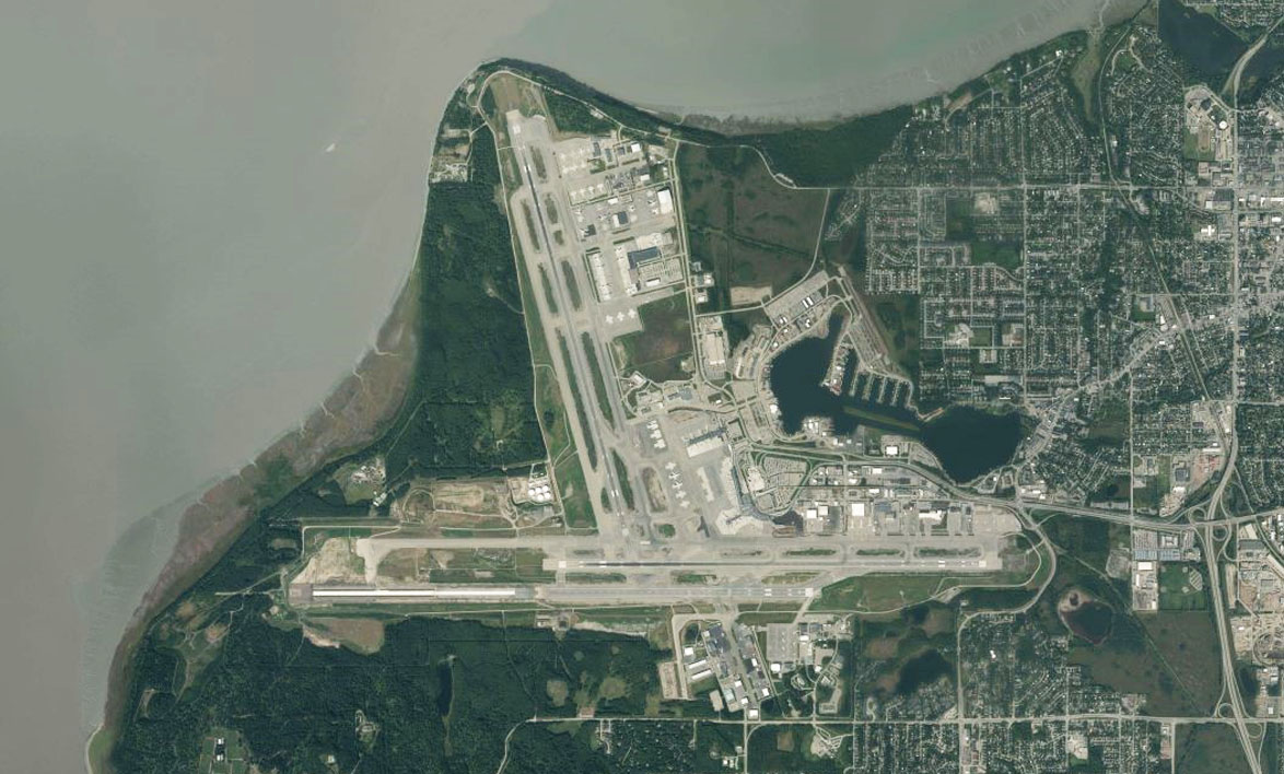
Turnagain Arm(POI94) to Ted Stevens Anchorage Intl(PANC)
Distance: 11.2NM Bearing: 313° 5 minutes
Stay with the shore and you will see Anchorage Airport to the right