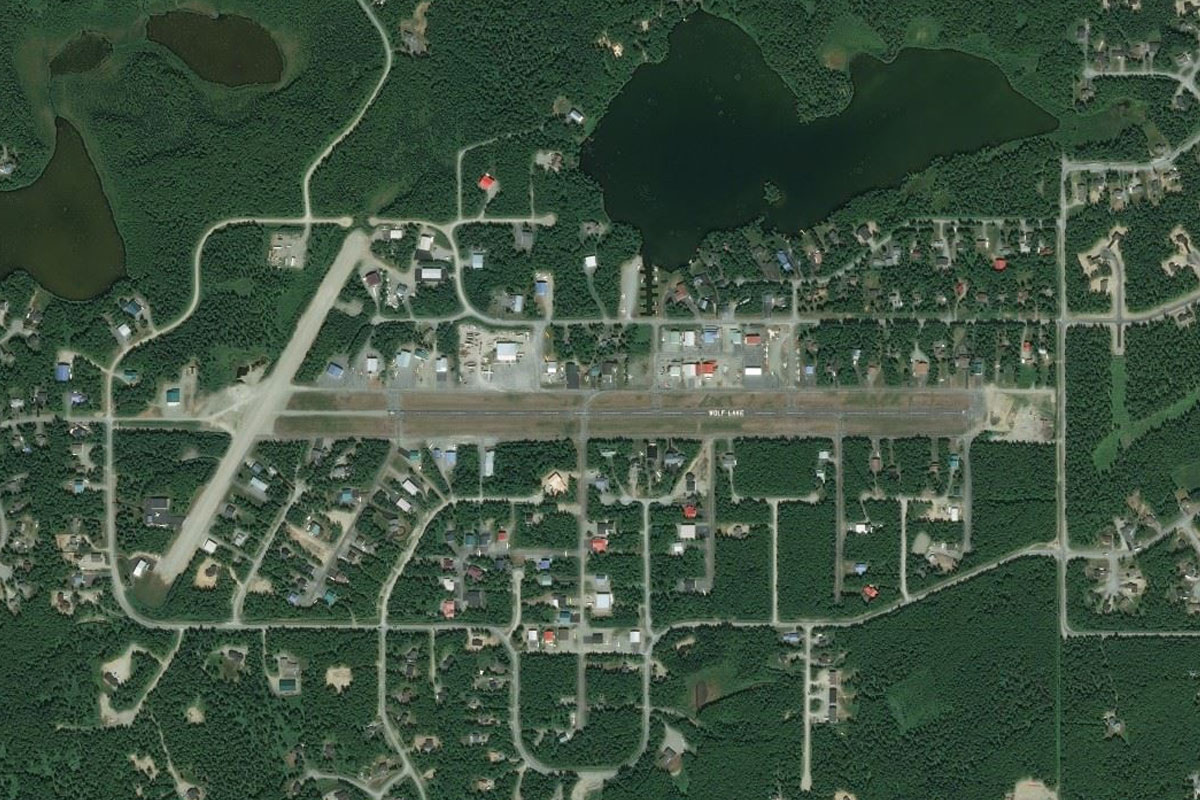
Welcome to stage 3 of our trip, and the journey into the Yukon. Starting from Anchorage, you’ll head northeast into Canada and cross the mighty Yukon River and territory. You’ll then venture through the Mackenzie Mountains to the South Nahanni and Liard Rivers, before making your way west, back to Alaska and the city of Juneau.
Total Legs: 24 Total Distance: 1518 Total Time(125kts): 12 hours 8 minutes
Leg 1
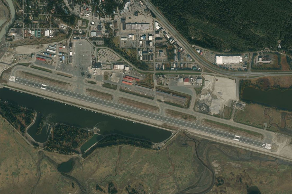
Flying from PANC
Leg Distance: 35.3 Approximate time at 125kts: 17 minutes.
PANC(PANC) to Anchorage(POI1)
Distance: 9.39NM Bearing: 24° 5 minutes
Head northeast after takeoff for a closer look at the downtown area. From there, fly to the shoreline and follow it northeast
Anchorage(POI1) to Birchwood(POI2)
Distance: 11.91NM Bearing: 34° 6 minutes
Once you pass Birchwood Airport, which sits near the shoreline not far before it meets the mountains, turn north
Birchwood(POI2) to Lakes(POI3)
Distance: 10.66NM Bearing: 5° 5 minutes
Heading across the water, aim for the V-shaped valley in the distance, which should be just to the east of north. Once over the opposite shore, you should fly over a shopping center and then a row of lakes
Lakes(POI3) to 4AK6(4AK6)
Distance: 3.34NM Bearing: 21° 2 minutes
Once you pass the first group of lakes you should start to see the airfield ahead and slightly to the right, with another group of lakes nearby
Leg 2
Flying from 4AK6
Leg Distance: 52.34 Approximate time at 125kts: 25 minutes.
4AK6(4AK6) to Matanuska River(POI4)
Distance: 16.68NM Bearing: 57° 8 minutes
After takeoff, head northeast and follow the Matanuska River into the valley
Matanuska River(POI4) to Matanuska River(POI5)
Distance: 9.52NM Bearing: 51° 5 minutes
Continue northeast along the main valley with the river
Matanuska River(POI5) to Matanuska Glacier(POI6)
Distance: 17.74NM Bearing: 74° 9 minutes
Continue east along the river, passing the Matanuska Glacier on your right
Matanuska Glacier(POI6) to PASP(PASP)
Distance: 8.4NM Bearing: 66° 4 minutes
Just after the glacier, start following the highway as it follows the river northeast. Just ahead, to the left of the highway, is the airstrip
Leg 3
Flying from PASP
Leg Distance: 63.33 Approximate time at 125kts: 30 minutes.
PASP(PASP) to Glenn Highway(POI7)
Distance: 15.84NM Bearing: 38° 8 minutes
After takeoff, follow Alaska Route 1 as it heads northeast
Glenn Highway(POI7) to Mendeltna Creek(POI8)
Distance: 15.67NM Bearing: 56° 8 minutes
Continue along the highway as it heads northeast.
Mendeltna Creek(POI8) to Glennallen(POI9)
Distance: 28.26NM Bearing: 66° 14 minutes
Continue following the highway northeast. The Tazlina River will soon be running along the south side of the highway
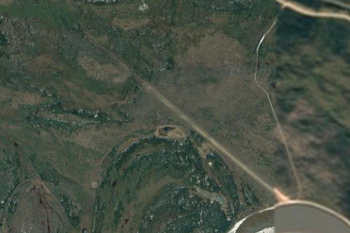
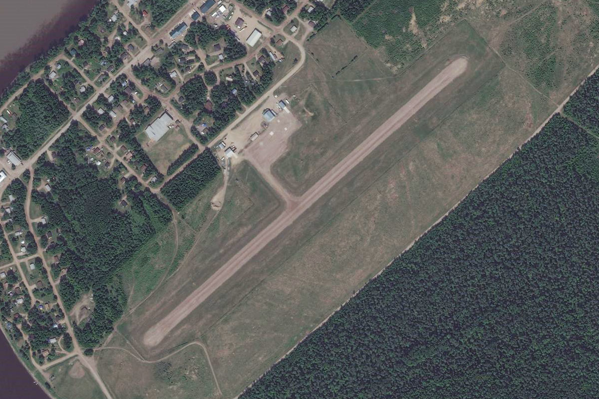
Glennallen(POI9) to PAGK(PAGK)
Distance: 3.56NM Bearing: 21° 2 minutes
Just after the town of Glennallen the highway will turn north at a t-intersection. Turn north here and the airport will be just ahead
Leg 4
Flying from PAGK
Leg Distance: 33.42 Approximate time at 125kts: 16 minutes.
PAGK(PAGK) to Gakona(POI10)
Distance: 9.04NM Bearing: 11° 4 minutes
Head north along the Cooper River after takeoff and follow it as it turns to the northeast
Gakona(POI10) to Copper River(POI11)
Distance: 16.3NM Bearing: 37° 8 minutes
Continue northeast, following the river and the highway. Along the way you will pass the Sanford River branching off to the south towards Mount Sanford.
Copper River(POI11) to CZO(CZO)
Distance: 8.08NM Bearing: 18° 4 minutes
The river will turn north, then northeast again just before the small town of Christochina. Running right alongside the road is the airstrip
Leg 5
Flying from CZO
Leg Distance: 73.95 Approximate time at 125kts: 35 minutes.
CZO(CZO) to AK-1(POI12)
Distance: 26.03NM Bearing: 49° 12 minutes
Head northeast and follow the highway after takeoff. It will run east along the base of the mountains then turn to the north along with the Slana River
AK-1(POI12) to AK-1(POI13)
Distance: 12.09NM Bearing: 7° 6 minutes
Follow the highway as it heads north, before leaving the river through a gap in the mountains
AK-1(POI13) to AK-1(POI14)
Distance: 8.09NM Bearing: 66° 4 minutes
Follow the highway as it heads northeast through the valley before turning northwest
AK-1(POI14) to Little Tok River(POI15)
Distance: 6.93NM Bearing: 335° 3 minutes
The highway will head northwest along with the Little Tok River, before turning northeast to meet the Tok River
Little Tok River(POI15) to AK-1(POI16)
Distance: 13.29NM Bearing: 28° 6 minutes
Stay with the highway as it heads northeast through the valley
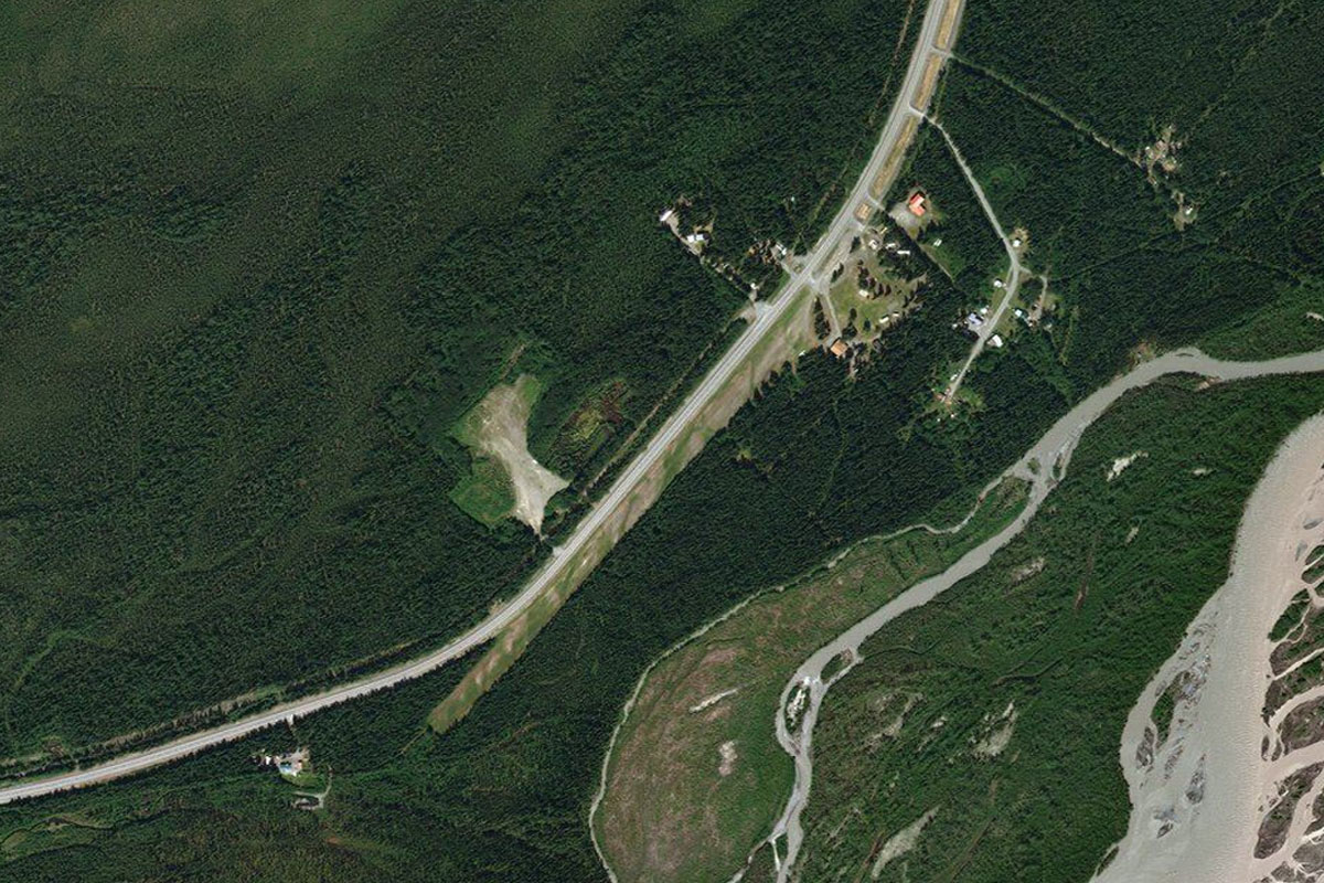
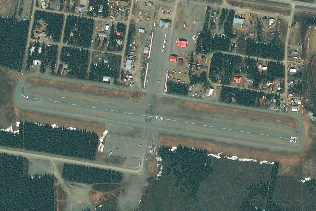
AK-1(POI16) to PFTO(PFTO)
Distance: 7.52NM Bearing: 0° 4 minutes
After the road leaves the valley, it will head north to the town of Tok. The airport is near the center of town, running alongside the highway just to the east
Leg 6
Flying from PFTO
Leg Distance: 54.68 Approximate time at 125kts: 26 minutes.
PFTO(PFTO) to AK-5(POI17)
Distance: 16.66NM Bearing: 39° 8 minutes
Fly northeast over the river and hills beyond until you see Highway 5 heading north, then follow it
AK-5(POI17) to AK-5(POI18)
Distance: 30.1NM Bearing: 357° 14 minutes
Stay with Highway 5 as it journeys north
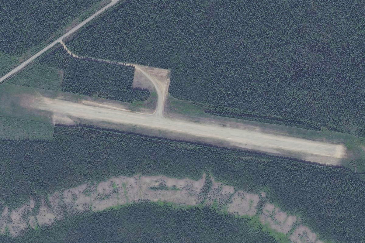
AK-5(POI18) to CKX(CKX)
Distance: 7.92NM Bearing: 27° 4 minutes
The road will turn northeast towards the town of Chicken. The airport is just before the town
Leg 7
Flying from CKX
Leg Distance: 78.64 Approximate time at 125kts: 38 minutes.
CKX(CKX) to AK-5(POI19)
Distance: 8.65NM Bearing: 71° 4 minutes
Follow the highway northeast after takeoff
AK-5(POI19) to Boundary(POI20)
Distance: 13.9NM Bearing: 72° 7 minutes
The highway will turn north but keep heading north to meet up with it further ahead when it turns back towards you
Boundary(POI20) to AK-5(POI21)
Distance: 23.5NM Bearing: 49° 11 minutes
Stay with the road as it winds its way northeast
AK-5(POI21) to Dawson City(POI22)
Distance: 23.92NM Bearing: 98° 11 minutes
The highway will gradually turn east and meet the mighty Yukon River at the town of Dawson City
Dawson City(POI22) to Klondike Highway(POI23)
Distance: 7.22NM Bearing: 81° 3 minutes
Fly over the river and head east, following the Klondike Hwy through the valley
Klondike Highway(POI23) to CYDA(CYDA)
Distance: 1.45NM Bearing: 48° 1 minutes
The highway and river will both turn northeast, pointing you in the direction of Yukon Dawson Airport
Leg 8
Flying from CYDA
Leg Distance: 53.53 Approximate time at 125kts: 26 minutes.
CYDA(CYDA) to Klondike Hwy(POI24)
Distance: 2.13NM Bearing: 33° 1 minutes
Head northeast after takeoff, following the Klondike Highway (and river)
Klondike Hwy(POI24) to Klondike Hwy(POI25)
Distance: 6.01NM Bearing: 85° 3 minutes
Both the road and river will turn to the east
Klondike Hwy(POI25) to North Klondike River(POI26)
Distance: 6.15NM Bearing: 122° 3 minutes
Continue following the road as it turns southeast along with the river
North Klondike River(POI26) to Klondike Hwy(POI27)
Distance: 9.28NM Bearing: 90° 4 minutes
Continue following the road as it heads east. It will kink left and right around some hills on the way
Klondike Hwy(POI27) to Klondike Hwy(POI28)
Distance: 8.07NM Bearing: 96° 4 minutes
Keep following the road east
Klondike Hwy(POI28) to Barlow Lake(POI29)
Distance: 12.05NM Bearing: 104° 6 minutes
The road will turn southeast around a small lake
Barlow Lake(POI29) to Klondike Hwy(POI30)
Distance: 7.06NM Bearing: 150° 3 minutes
Continue following the road southeast
Klondike Hwy(POI30) to CFP4(CFP4)
Distance: 2.78NM Bearing: 114° 1 minutes
As the road turns to the east, it will point you in the direction of the airfield
Leg 9
Flying from CFP4
Leg Distance: 55.89 Approximate time at 125kts: 27 minutes.
CFP4(CFP4) to Stewart River(POI31)
Distance: 8.95NM Bearing: 112° 4 minutes
Continue along the river east after takeoff. Keep an eye out for a group of lakes off to the right, and head for the largest one
Stewart River(POI31) to Reid Lakes(POI32)
Distance: 7.13NM Bearing: 125° 3 minutes
Head southeast across the lake and continue in that direction
Reid Lakes(POI32) to Klondike Hwy(POI33)
Distance: 31.94NM Bearing: 128° 15 minutes
Continue southeast until you meet up with the highway heading south
Klondike Hwy(POI33) to CFQ6(CFQ6)
Distance: 7.87NM Bearing: 165° 4 minutes
Follow the road south to the small town of Pelly Crossing. The airport is just to the left side of the road
Leg 10
Flying from CFQ6
Leg Distance: 48.37 Approximate time at 125kts: 23 minutes.
CFQ6(CFQ6) to Yukon River(POI34)
Distance: 26.89NM Bearing: 162° 13 minutes
Head south after takeoff until you meet up with the Klondike Highway running southeast with the Yukon River
Yukon River(POI34) to Yukon River(POI35)
Distance: 8.59NM Bearing: 122° 4 minutes
Follow the river and highway southeast
Yukon River(POI35) to Yukon River(POI36)
Distance: 8.33NM Bearing: 159° 4 minutes
Both the road and river will turn more to the south before the river turns east just before the town of Carmacks
Yukon River(POI36) to CEX4(CEX4)
Distance: 4.56NM Bearing: 95° 2 minutes
Following the river east, you will see the airport between the road and one of the river's turns
Leg 11
Flying from CEX4
Leg Distance: 82.38 Approximate time at 125kts: 40 minutes.
CEX4(CEX4) to Yukon River(POI37)
Distance: 11.5NM Bearing: 102° 6 minutes
Continue along the river east and also as it turns northeast
Yukon River(POI37) to Robert Campbell Highway(POI38)
Distance: 7.51NM Bearing: 41° 4 minutes
Follow the river northeast for a few miles. As it turns away to the east, stay northeast, now following the highway
Robert Campbell Highway(POI38) to Robert Campbell Highway(POI39)
Distance: 17.57NM Bearing: 53° 8 minutes
Keep following the road as it heads northeast, where it will soon reach Little Salmon Lake
Robert Campbell Highway(POI39) to Little Salmon Lake(POI40)
Distance: 18.24NM Bearing: 66° 9 minutes
Continue northeast along the length of the lake
Little Salmon Lake(POI40) to Robert Campbell Highway(POI41)
Distance: 23.31NM Bearing: 70° 11 minutes
After the lake, keep following the highway as it heads northeast
Robert Campbell Highway(POI41) to CZFA(CZFA)
Distance: 4.25NM Bearing: 67° 2 minutes
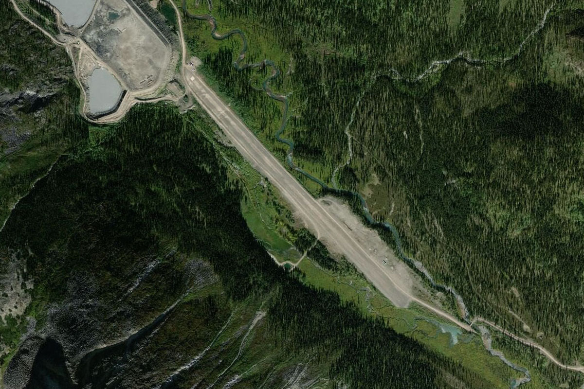
The road will make its way into a large, shallow valley where the Pelly River lies. A smaller road will branch off and head for the town of Faro across the river, passing the airport along the way
Leg 12
Flying from CZFA
Leg Distance: 82.29 Approximate time at 125kts: 39 minutes.
CZFA(CZFA) to Ross River(POI42)
Distance: 32.08NM Bearing: 102° 15 minutes
Head east, following the river. The highway will also run along to the right
Ross River(POI42) to Pelly River(POI43)
Distance: 29.69NM Bearing: 96° 14 minutes
Continue following the Pelly river east
Pelly River(POI43) to Robert Campbell Highway(POI44)
Distance: 13.3NM Bearing: 61° 6 minutes
The river and highway will soon turn to the northeast, where the river will start to move northward away from the highway. Start following the highway from here
Robert Campbell Highway(POI44) to CFT3(CFT3)
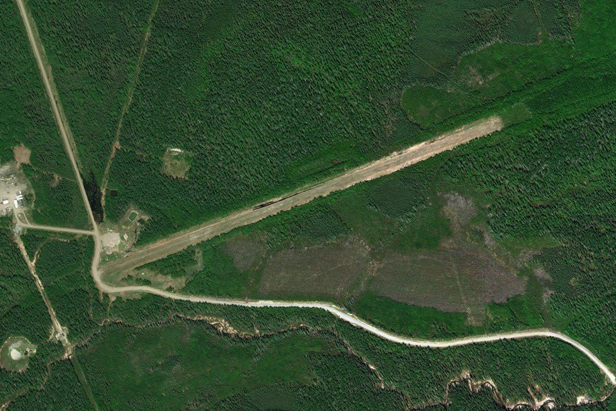
Distance: 7.22NM Bearing: 102° 3 minutes
Follow the road as it turns east towards Finlayson Lake. The airport is at the side of the road a few miles west of the lake
Leg 13
Flying from CFT3
Leg Distance: 87.61 Approximate time at 125kts: 42 minutes.
CFT3(CFT3) to McEvoy Lake(POI45)
Distance: 24.52NM Bearing: 47° 12 minutes
Fly northeast over the lake after takeoff and head for the large gap in the mountains ahead. You'll pass over another large lake on the way, McEvoy Lake
McEvoy Lake(POI45) to Narchilla Brook(POI46)
Distance: 10.52NM Bearing: 62° 5 minutes
After passing McEvoy lake and the smaller lakes after it, you'll be in an open area with a choice of valleys ahead. Ignore the valley directly ahead and turn slightly more to the east to head into the next valley to its right
Narchilla Brook(POI46) to McPherson Lake(POI47)
Distance: 11.59NM Bearing: 21° 6 minutes
A thin lake will lead the way north into the valley
McPherson Lake(POI47) to Yusezyu River(POI48)
Distance: 6.96NM Bearing: 66° 3 minutes
When the valley reaches a fork, turn right and head northeast along the next valley
Yusezyu River(POI48) to Yusezyu River(POI49)
Distance: 6.3NM Bearing: 47° 3 minutes
Keep following the valley as it turns slightly to the left
Yusezyu River(POI49) to Little Nahanni River(POI50)
Distance: 9.33NM Bearing: 31° 4 minutes
The valley will head northeast and into a large open area. Half way across the open area you should cross paths with the Little Nahanni River. Turn to the right and follow this river east
Little Nahanni River(POI50) to Little Nahanni River(POI51)
Distance: 5.36NM Bearing: 109° 3 minutes
Again there will be a choice of valleys. Follow the Little Nahanni River as it heads southeast into the right valley
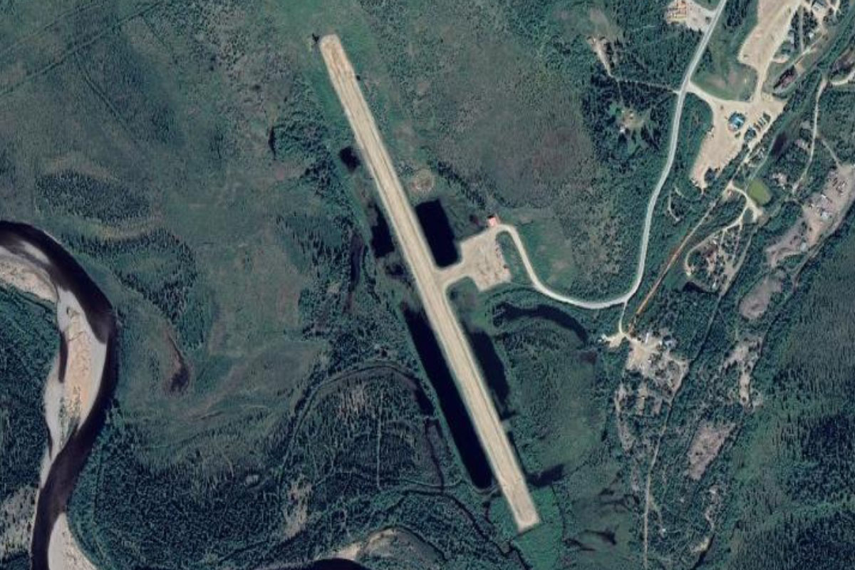
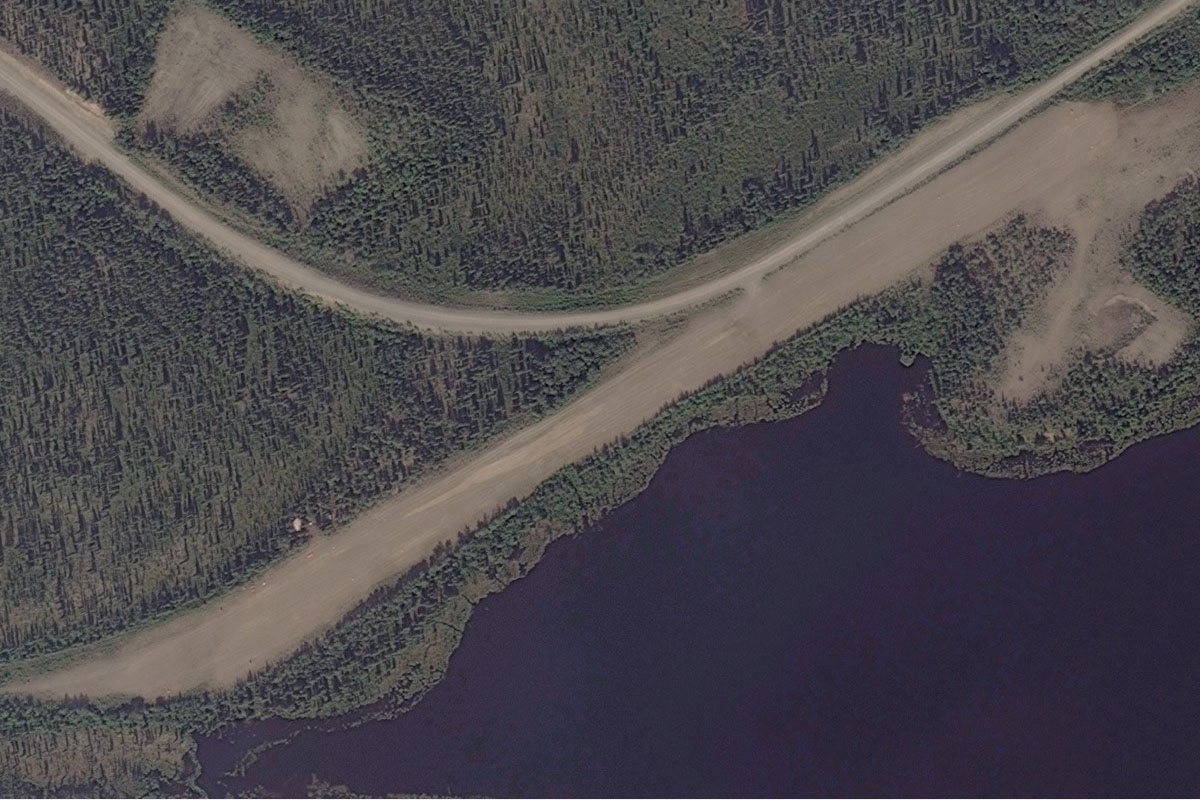
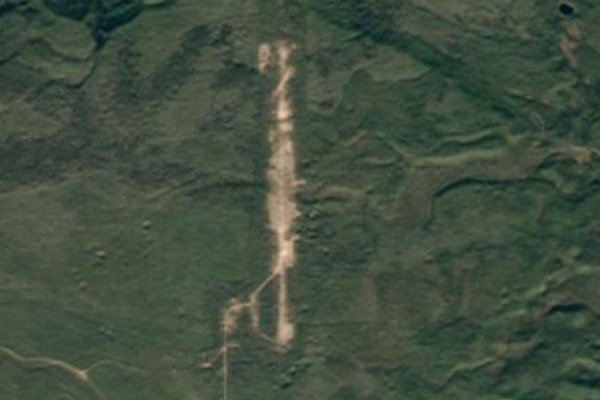
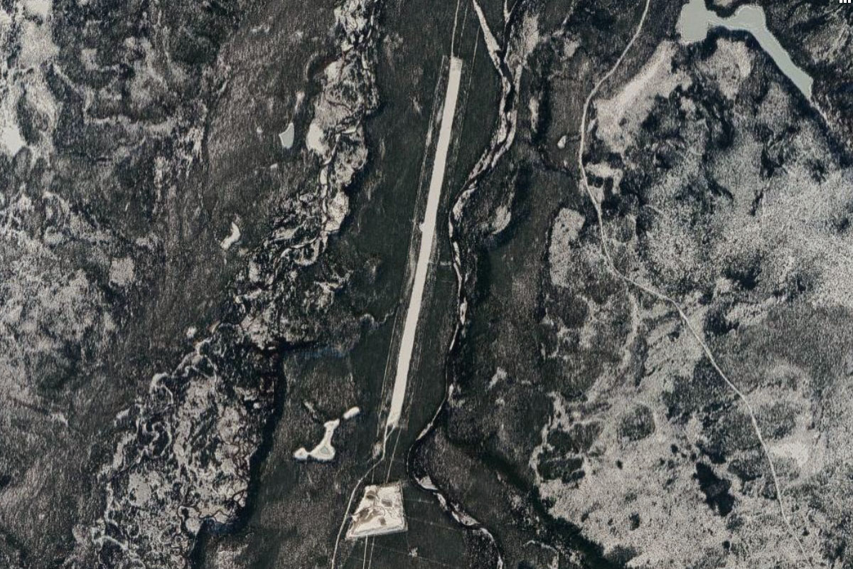
Little Nahanni River(POI51) to CBX5(CBX5)
Distance: 13.03NM Bearing: 122° 6 minutes
Along the valley you will come across a mining settlement followed by an airstrip at the other end
Leg 14
Flying from CBX5
Leg Distance: 100.76 Approximate time at 125kts: 48 minutes.
CBX5(CBX5) to Flat River(POI52)
Distance: 11NM Bearing: 114° 5 minutes
Fly east along the valley, following what is now the Flat River
Flat River(POI52) to Flat River(POI53)
Distance: 14.45NM Bearing: 112° 7 minutes
Keep following the river valley east
Flat River(POI53) to Seaplane Lake(POI54)
Distance: 26.78NM Bearing: 107° 13 minutes
The valley will soon open out and the river will turn north. Turn left and follow the river
Seaplane Lake(POI54) to Flat River(POI55)
Distance: 12.48NM Bearing: 19° 6 minutes
Follow the river on its short journey north before it turns back to the east
Flat River(POI55) to Flat River(POI56)
Distance: 22.63NM Bearing: 91° 11 minutes
Stay with the river as it heads east into another valley
Flat River(POI56) to South Nahanni River(CB1X)
Distance: 13.42NM Bearing: 44° 6 minutes
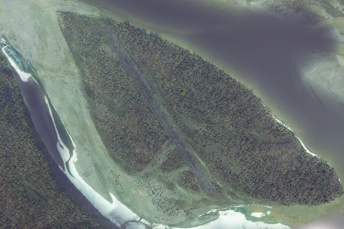
The Flat river will meet with another river and start winding its way northeast, where it will eventually run into the South Nahanni River. At this point the island in the river provides a landing strip for the next stop
Leg 15
Flying from CB1X
Leg Distance: 68.22 Approximate time at 125kts: 33 minutes.
South Nahanni River(CB1X) to Third Canyon(POI57)
Distance: 16.59NM Bearing: 108° 8 minutes
Follow the river as it cuts its way east through the mountains, and through the first of three canyon runs
Third Canyon(POI57) to Second Canyon(POI58)
Distance: 10.12NM Bearing: 99° 5 minutes
Keep following the river through the second canyon
Second Canyon(POI58) to South Nahanni River(POI59)
Distance: 6.3NM Bearing: 101° 3 minutes
The river will exit the canyon and continue east over an open area before meeting the last canyon
South Nahanni River(POI59) to First Canyon(POI60)
Distance: 9.8NM Bearing: 67° 5 minutes
The river will turn northeast and head into the last of the 3 canyons (called First Canyon)
First Canyon(POI60) to South Nahanni River(POI61)
Distance: 10.28NM Bearing: 80° 5 minutes
The river will emerge from the canyon and head east over some more gentle territory
South Nahanni River(POI61) to CBD6(CBD6)
Distance: 15.13NM Bearing: 124° 7 minutes
Follow the river as it turns southeast, then turns east around the peak of Nahanni Butte. The airport and town of the same name are just to the south the peak and the river
Leg 16
Flying from CBD6
Leg Distance: 48.15 Approximate time at 125kts: 23 minutes.
CBD6(CBD6) to Liard River(POI62)
Distance: 23.74NM Bearing: 172° 11 minutes
Head south from the airport and start following the Liard River which is winding its way south
Liard River(POI62) to CYJF(CYJF)
Distance: 24.41NM Bearing: 157° 12 minutes
The river will be joined by another highway also heading southeast. Keep following the river, where it will soon turn to the south and meet the town of Fort Liard. The airport is right next to the town
Leg 17
Flying from CYJF
Leg Distance: 34.58 Approximate time at 125kts: 17 minutes.
CYJF(CYJF) to Liard River(POI63)
Distance: 11.63NM Bearing: 217° 6 minutes
Continue following the river southwest, it will gradually turn south
Liard River(POI63) to La Biche River(POI64)
Distance: 11.82NM Bearing: 169° 6 minutes
Follow the river as it turns south. It will soon come to the junction of the smaller La Biche River heading west. Turn west and follow this river
La Biche River(POI64) to CF41(CF41)
Distance: 11.13NM Bearing: 264° 5 minutes
As the river turns to the northwest, keep an eye out for the road leading straight past the airstrip a couple of miles from the river
Leg 18
Flying from CF41
Leg Distance: 67.24 Approximate time at 125kts: 32 minutes.
CF41(CF41) to Beavercrow Mountain(POI65)
Distance: 24.88NM Bearing: 251° 12 minutes
Head west after takeoff. In the distance you should see a small mountain range with about 4 or 5 peaks. Aim for the left side of the tallest peak and continue west over its extended ridge
Beavercrow Mountain(POI65) to Caribou Range(POI66)
Distance: 16.15NM Bearing: 251° 8 minutes
Up ahead, you should see some less covered highlands extending away to the south. Continue west over the northern tip of this range
Caribou Range(POI66) to C345(C345)
Distance: 26.21NM Bearing: 242° 13 minutes
Continue west until the land flattens out where the Smith River lies. When you see the river, which is running north-south, turn left to the southwest and you should see the airfield just to the south of a small lake
Leg 19
Flying from C345
Leg Distance: 77.75 Approximate time at 125kts: 37 minutes.
C345(C345) to Shaw Creek(POI67)
Distance: 19.04NM Bearing: 246° 9 minutes
After takeoff, head southwest and follow the small valley created by Shaw Creek
Shaw Creek(POI67) to Liard River(POI68)
Distance: 20.99NM Bearing: 274° 10 minutes
At the end of the valley the creek will run into the Coal River. Beyond here you will see a couple of points of higher land. Turn slightly to the right and past the first peak which will take you back to the Liard River, and following it west
Liard River(POI68) to Alaska Hwy(POI69)
Distance: 25.68NM Bearing: 248° 12 minutes
Once you see the highway running alongside the river, follow it southwest
Alaska Hwy(POI69) to CYQH(CYQH)
Distance: 12.04NM Bearing: 300° 6 minutes
The road will turn northwest and head for the town of Watson Lake, with the main lake to the northwest of town. The airport sits on the northern edge of the lake
Leg 20
Flying from CYQH
Leg Distance: 66.98 Approximate time at 125kts: 32 minutes.
CYQH(CYQH) to Alaska Hwy(POI70)
Distance: 21.57NM Bearing: 253° 10 minutes
Head southwest after takeoff, crossing the river and eventually meeting up with the highway as it journeys west
Alaska Hwy(POI70) to Alaska Hwy(POI71)
Distance: 17.17NM Bearing: 266° 8 minutes
Continue following the highway as it turns to the west
Alaska Hwy(POI71) to Rancheria River(POI72)
Distance: 14.14NM Bearing: 217° 7 minutes
The highway will meet up with the Rancheria River and turn southwest
Rancheria River(POI72) to Rancheria River(POI73)
Distance: 11.53NM Bearing: 253° 6 minutes
Continue along the river/highway as they curve west through a valley
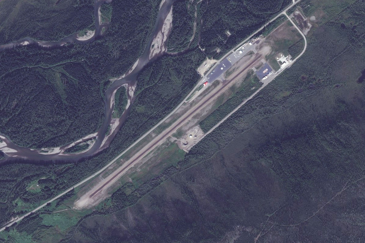
Rancheria River(POI73) to CFY5(CFY5)
Distance: 2.57NM Bearing: 297° 1 minutes
After exiting the valley, follow the river north to Pine Lake Airport, just a couple of miles from the highway
Leg 21
Flying from CFY5
Leg Distance: 55.62 Approximate time at 125kts: 27 minutes.
CFY5(CFY5) to Cassiar Mountains(POI74)
Distance: 14.55NM Bearing: 250° 7 minutes
Head southwest after takeoff and gain some altitude to cross the mountains ahead
Cassiar Mountains(POI74) to Dorsey Lake(POI75)
Distance: 5.62NM Bearing: 292° 3 minutes
After crossing a few sets of ridges and valleys you should come to a valley heading west towards a lake. Head towards the lake
Dorsey Lake(POI75) to Teslin Lake(POI76)
Distance: 28.15NM Bearing: 251° 14 minutes
Head southwest along the lake and over the hilly terrain beyond. You will eventually come to the 75 mile long Teslin Lake, with the Alaska Highway heading northwest along the lake
Teslin Lake(POI76) to CYZW(CYZW)
Distance: 7.3NM Bearing: 261° 4 minutes
The highway runs along the north shore of the lake, leading to the town and airport
Leg 22
Flying from CYZW
Leg Distance: 61.97 Approximate time at 125kts: 30 minutes.
CYZW(CYZW) to Little Atlin Lake(POI77)
Distance: 33.14NM Bearing: 251° 16 minutes
Head southwest after takeoff, crossing the hills on the other side of the lake, and towards the mountains in the distance
Little Atlin Lake(POI77) to Jubilee Mountain(POI78)
Distance: 8.89NM Bearing: 282° 4 minutes
Just before you reach the mountains, you should see a road heading northwest past a large lake. From here, turn west to go around the mountains
Jubilee Mountain(POI78) to Tagish Lake(POI79)
Distance: 13.96NM Bearing: 223° 7 minutes
Turning left around the mountain to face southeast, head across the large Tagish Lake and along the narrow channel towards the island
Tagish Lake(POI79) to CFA4(CFA4)
Distance: 5.98NM Bearing: 279° 3 minutes
Turn west from the island and along the channel you will see the town of Carcross with the airport at its northern edge
Leg 23
Flying from CFA4
Leg Distance: 49.29 Approximate time at 125kts: 24 minutes.
CFA4(CFA4) to Bennett Lake(POI80)
Distance: 2.88NM Bearing: 227° 1 minutes
Head southwest over Bennett Lake
Bennett Lake(POI80) to Bennett Lake(POI81)
Distance: 11.37NM Bearing: 183° 5 minutes
Fly south along the length of Bennet Lake. You'll also be following the route of the White Pass and Yukon Railway
Bennett Lake(POI81) to Yukon Railway(POI82)
Distance: 8.19NM Bearing: 181° 4 minutes
At the end of the lake, turn to the southeast and follow the railway as it heads towards another valley
Yukon Railway(POI82) to Klondike Highway(POI83)
Distance: 6.12NM Bearing: 148° 3 minutes
The rail line will meet up with the highway and head south along the valley, past the town of Fraser
Klondike Highway(POI83) to Klondike Highway(POI84)
Distance: 9.44NM Bearing: 202° 5 minutes
Continue following the highway southwest
Klondike Highway(POI84) to Skagway River(POI85)
Distance: 4.59NM Bearing: 176° 2 minutes
The highway will pass the Klondike Goldrush National Historic Park, while the railway will deviate along the Skagway River to deal with the elevation change
Skagway River(POI85) to Skagway River(POI86)
Distance: 3.14NM Bearing: 190° 2 minutes
Continue along the valley towards the town of Skagway
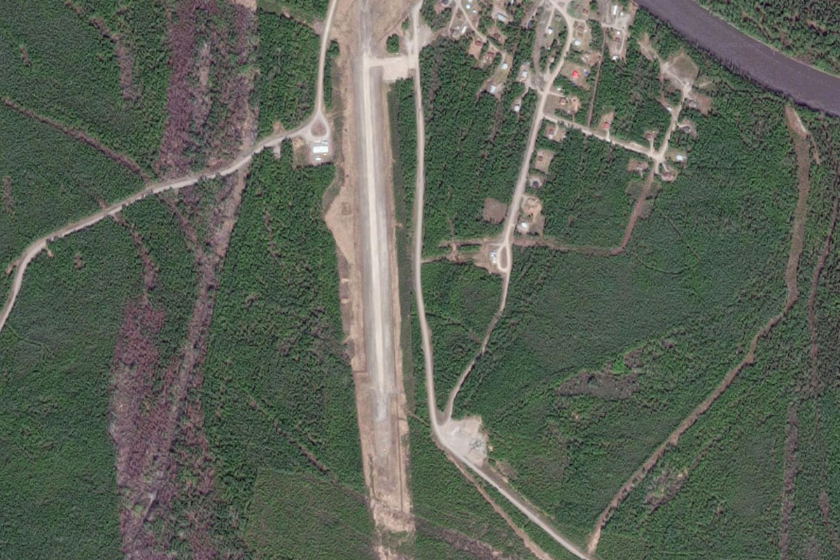
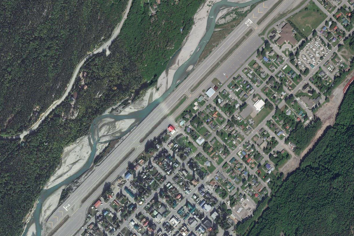
Skagway River(POI86) to PAGY(PAGY)
Distance: 3.56NM Bearing: 197° 2 minutes
The airport sits on the right edge of town as you approach from the north
Leg 24
Flying from PAGY
Leg Distance: 86.18 Approximate time at 125kts: 41 minutes.
PAGY(PAGY) to Taiya Inlet(POI87)
Distance: 11.41NM Bearing: 174° 5 minutes
Fly south from Skagway along the Taya Inlet
Taiya Inlet(POI87) to Chilkoot Inlet(POI88)
Distance: 26.77NM Bearing: 146° 13 minutes
From Taiya Inlet, turn left and follow the larger Chilkoot Inlet southeast, sticking to the left shore
Chilkoot Inlet(POI88) to Lions Head Mountain(POI89)
Distance: 2.43NM Bearing: 118° 1 minutes
After passing a large mountain peak to your left, the land will lower in elevation before ending at a bay. Turn northeast across the lower part of the land towards two rivers heading into valleys.
Lions Head Mountain(POI89) to Gilkey River(POI90)
Distance: 8.13NM Bearing: 70° 4 minutes
Ignore the river and lakes to the north and head east into the Gilkey River valley
Gilkey River(POI90) to Gilkey River(POI91)
Distance: 4.51NM Bearing: 115° 2 minutes
Follow the river as it turns southeast
Gilkey River(POI91) to Gilkey Glacier(POI92)
Distance: 5.4NM Bearing: 73° 3 minutes
Stay with the river as it turns east until it becomes the Gilkey Glacier. You'll need to gain some elevation as you head into glacier territory
Gilkey Glacier(POI92) to Battle Glacier(POI93)
Distance: 1.24NM Bearing: 164° 1 minutes
Turn south into the Battle Glacier, before continuing the U turn southwest into the Thiel Glacier
Battle Glacier(POI93) to Thiel Glacier(POI94)
Distance: 4.35NM Bearing: 215° 2 minutes
Head southwest up Thiel Glacier towards the fork near the top
Thiel Glacier(POI94) to Eagle Glacier(POI95)
Distance: 3.14NM Bearing: 159° 2 minutes
At the fork, head southeast through the gap in the mountain peaks and over the icefield
Eagle Glacier(POI95) to Herbert Glacier(POI96)
Distance: 5.19NM Bearing: 137° 2 minutes
Now on the snowfields, turn slightly left and head across them. You'll immediately see the Eagle Glacier heading off to the right, then the Herbert Glacier doing the same
Herbert Glacier(POI96) to Mendenhall Glacier(POI97)
Distance: 6.85NM Bearing: 141° 3 minutes
From the Herbert Glacier, you'll fly southeast over another set of peaks before coming to the Mendenhall Glacier
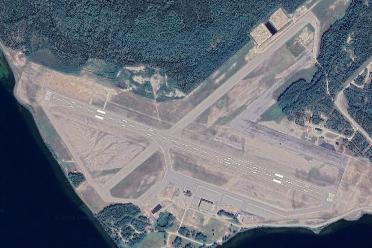
Mendenhall Glacier(POI97) to PAJN(PAJN)
Distance: 6.76NM Bearing: 174° 3 minutes
Follow the Mendenhall Glacier as it curves south towards Juneau. The airport is at the far end of the city