Stage 4 of our trip takes us through parts of Alaska’s Alexander Archipelago and Inside Passage, before heading into British Columbia and the stunning beauty of western Canada
Total Legs: 25 Total Distance: 1425 Total Time(125kts): 11 hours 24 minutes
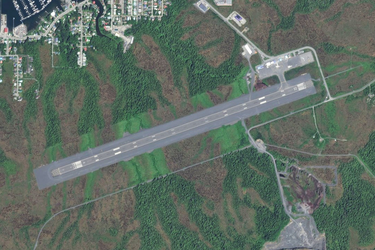
Leg 1
Flying from PAJN
Leg Distance: 30.8 Approximate time at 125kts: 15 minutes.
PAJN(PAJN) to Admiralty Island(POI1)
Distance: 11.82NM Bearing: 219° 6 minutes
Fly southwest after takeoff and head across the channel and across Admiralty Island beyond it. Fly between the two peaks and you will be over a bay at the opposite side of the island
Admiralty Island(POI1) to Icy Strait(POI2)
Distance: 15.05NM Bearing: 219° 7 minutes
Continue southwest across the waters of Lynn Canal and Icy Strait. Aim to overfly the tip of Point Couverden which juts out into the water ahead, and then towards the flat area of land to the left of the headland across the strait
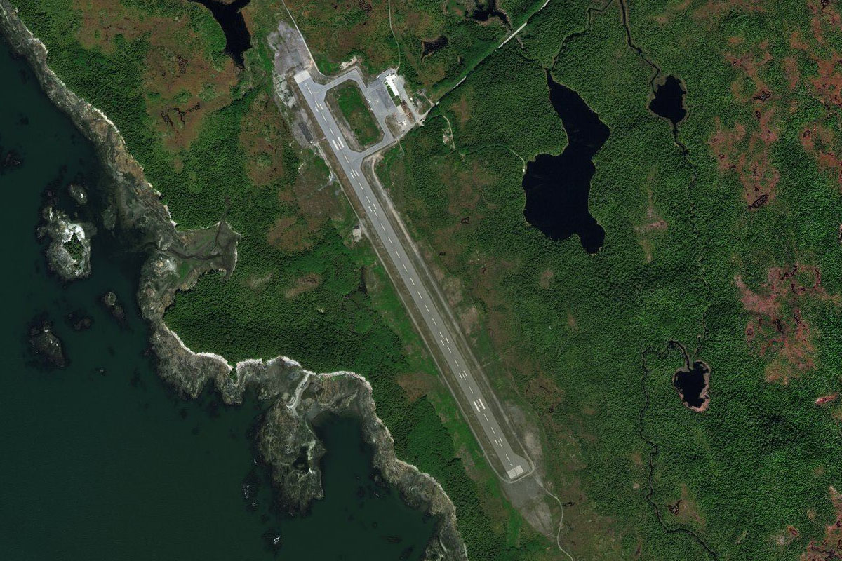
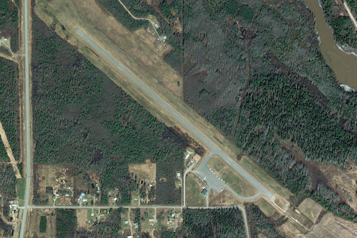
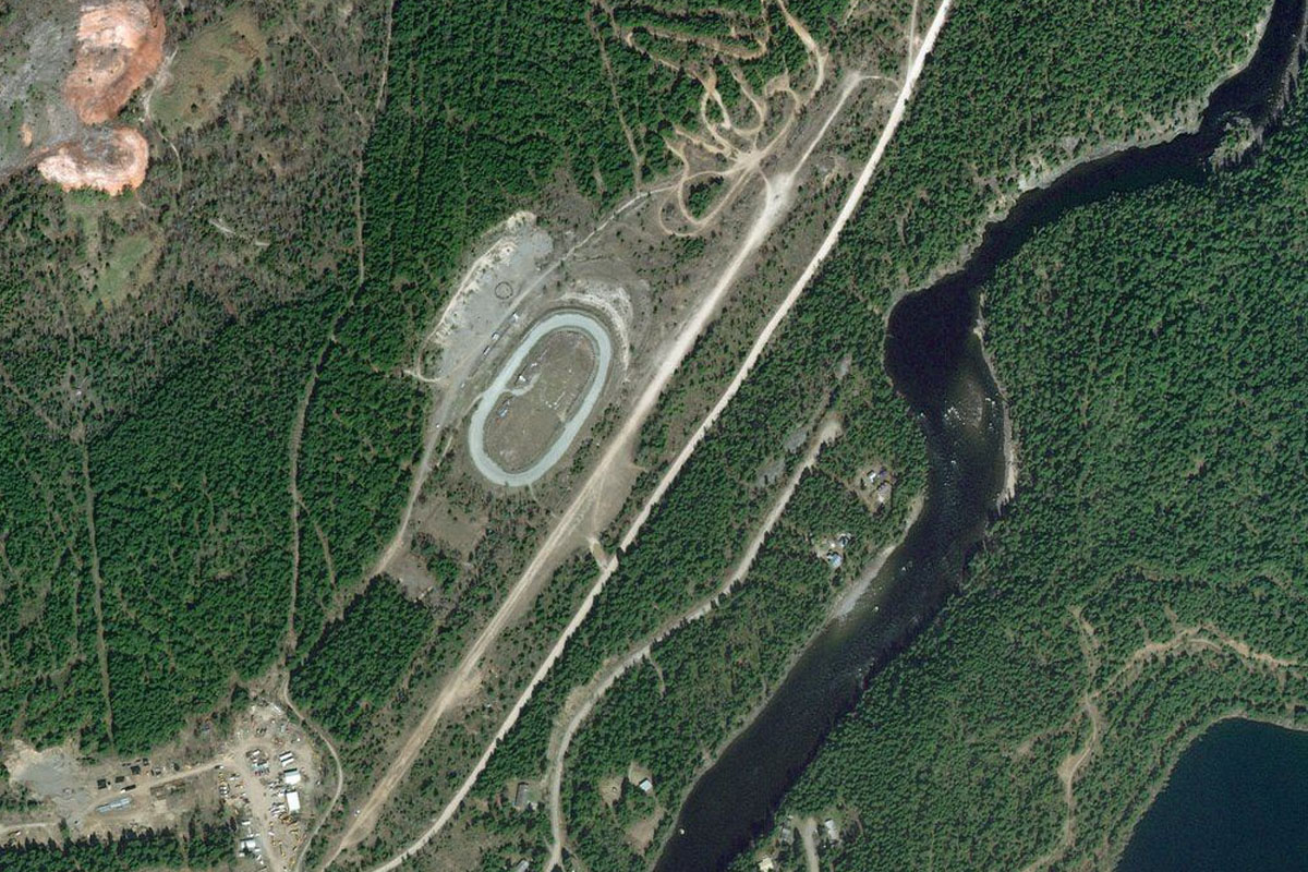
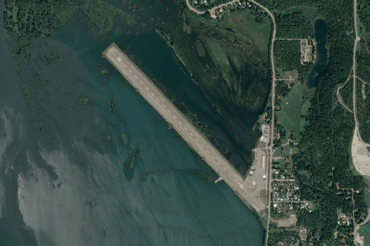
Icy Strait(POI2) to PAOH(PAOH)
Distance: 3.93NM Bearing: 239° 2 minutes
Turning slightly to the right as you approach the land you should see Hoonah airport ahead at the base of the mountain
Leg 2
Flying from PAOH
Leg Distance: 73.23 Approximate time at 125kts: 35 minutes.
PAOH(PAOH) to Port Frederick(POI3)
Distance: 4.33NM Bearing: 233° 2 minutes
Head southwest into the channel of Port Frederick, then turn left and follow it to the south
Port Frederick(POI3) to The Narrows(POI4)
Distance: 6.48NM Bearing: 196° 3 minutes
Just after the point where the channel narrows, turn left to the southeast and along the land valley ahead
The Narrows(POI4) to Tenakee Inlet(POI5)
Distance: 5.59NM Bearing: 133° 3 minutes
Fly southeast along the valley until it reaches the waters of Tenakee Inlet at the other end
Tenakee Inlet(POI5) to Moore Mountains(POI6)
Distance: 14.61NM Bearing: 163° 7 minutes
Once over water, head directly south and gain enough altitude to pass over the Moore Mountains ahead
Moore Mountains(POI6) to Peril Strait(POI7)
Distance: 11.99NM Bearing: 157° 6 minutes
Once over the mountains, you will be flying over Hoonah Sound. Continue ahead to the south, there should be a large bay which narrows into a channel at its south end
Peril Strait(POI7) to Kakul Narrows(POI8)
Distance: 7.76NM Bearing: 202° 4 minutes
Keep following the channel as it widens out to the southwest. We will continue past a large inlet to the left before the channel narrows again. As the channel opens out into the open waters of Salisbury Sound, there will be another channel to the left. Fly southeast along this channel
Kakul Narrows(POI8) to Neva Strait(POI9)
Distance: 4.34NM Bearing: 126° 2 minutes
Continue southeast along Neva Strait as it passes to the left of the large island in the center, Partofshikof Island
Neva Strait(POI9) to Neva Point(POI10)
Distance: 4.68NM Bearing: 132° 2 minutes
Keep following Neva Strait as it curves slightly to the right around the island before entering open waters at the other end
Neva Point(POI10) to Olga Strait(POI11)
Distance: 4.94NM Bearing: 117° 2 minutes
Ahead and slightly to the left you will see another channel cutting through the mountains. Fly southeast along this channel
Olga Strait(POI11) to Kasiana Islands(POI12)
Distance: 6.4NM Bearing: 152° 3 minutes
Once you pass through the channel, turn south over the open waters of Sitka Sound. Fly over the low lying islands, keeping the larger, hillier Middle Island to your right
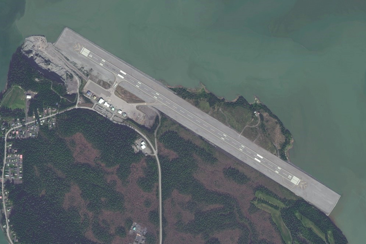
Kasiana Islands(POI12) to PASI(PASI)
Distance: 2.11NM Bearing: 117° 1 minutes
Once you pass most of the smaller islands, you should see Sitka Airport sitting on a flat island to your left
Leg 3
Flying from PASI
Leg Distance: 50.19 Approximate time at 125kts: 24 minutes.
PASI(PASI) to Sugarloaf Mountain(POI13)
Distance: 4.09NM Bearing: 97° 2 minutes
After clearing the islands to the south of Sitka Airport, turn east you should see the volcano shaped Sugarloaf Mountain poking out of the water ahead. Pass to the right (south) side of the mountain
Sugarloaf Mountain(POI13) to Bear Cove(POI14)
Distance: 3.15NM Bearing: 77° 2 minutes
Continuing east, you'll enter another small channel with some imposing mountains on the other side. Start climbing as you head for the gap in the mountains and then turn northeast into the narrow valley
Bear Cove(POI14) to Mount Bassie(POI15)
Distance: 3.15NM Bearing: 48° 2 minutes
Continue climbing as you fly towards the mountain pass ahead, and between the two peaks
Mount Bassie(POI15) to Baranof Lake(POI16)
Distance: 8.49NM Bearing: 50° 4 minutes
After the mountain pass, descend as you fly northeast along the valley towards the large lake at its end, Baranof Lake
Baranof Lake(POI16) to Chatham Strait(POI17)
Distance: 11.03NM Bearing: 91° 5 minutes
Once you pass Baranof Lake and emerge from the valley into open water, turn to the right and across to the thin slivers of land that form the southern end of Admiralty Island
Chatham Strait(POI17) to Frederick Sound(POI18)
Distance: 17.18NM Bearing: 79° 8 minutes
Once you pass the series of inlets and islands, continue east across the waters of Frederick Sound towards the western shore of Kupreanof Island
Frederick Sound(POI18) to PAFE(PAFE)
Distance: 3.1NM Bearing: 113° 1 minutes
Turn right upon reaching the shore and the town of Kake with its airport should be ahead, just near the shore
Leg 4
Flying from PAFE
Leg Distance: 35.28 Approximate time at 125kts: 17 minutes.
PAFE(PAFE) to Hamilton Bay(POI19)
Distance: 5.76NM Bearing: 117° 3 minutes
Head southeast along the coast from Kake and you will shortly come to a bay narrowing to a river at its east end
Hamilton Bay(POI19) to Duncan Canal(POI20)
Distance: 13.13NM Bearing: 83° 6 minutes
Following the bay and the river to the east, fly across the lowlands between the hills towards the small lake. From here, turn to the southeast and head for the bay which leads to Duncan Canal
Duncan Canal(POI20) to Duncan Creek(POI21)
Distance: 6.86NM Bearing: 112° 3 minutes
Once you start along the bay, a valley on its left shore will quickly open up to the east. Head down the valley
Duncan Creek(POI21) to PAPG(PAPG)
Distance: 9.53NM Bearing: 64° 5 minutes
Once you pass through the valley, the town of Petersburg and the airport should be visible straight ahead
Leg 5
Flying from PAPG
Leg Distance: 31.44 Approximate time at 125kts: 15 minutes.
PAPG(PAPG) to Horn Cliffs(POI22)
Distance: 8.37NM Bearing: 74° 4 minutes
After takeoff, head east across Frederick Sound to the opposite shore
Horn Cliffs(POI22) to Mallard Slough(POI23)
Distance: 7NM Bearing: 113° 3 minutes
Turn to the southeast and follow the shore. Continue over the small island and then over the marshlands of Mallard Slough
Mallard Slough(POI23) to Dry Island(POI24)
Distance: 4.84NM Bearing: 131° 2 minutes
Turn slightly more south and continue on over the river entrance and then some more river wetlands between the two mountain islands of Dry Island and Farm Island
Dry Island(POI24) to Kadin Island(POI25)
Distance: 8.67NM Bearing: 157° 4 minutes
After you pass between the mountains, turn south and head for the left side of the island that sits in the middle of the bay ahead
Kadin Island(POI25) to PAWG(PAWG)
Distance: 2.56NM Bearing: 104° 1 minutes
As you pass the island, the town of Wrangell will be just to your left, with the airport running along the shoreline
Leg 6
Flying from PAWG
Leg Distance: 68.77 Approximate time at 125kts: 33 minutes.
PAWG(PAWG) to Woronkofski Island(POI26)
Distance: 7.76NM Bearing: 221° 4 minutes
Head southwest from Wrangell across the bay and past the northern end of the large island ahead
Woronkofski Island(POI26) to Stikine Strait(POI27)
Distance: 9.54NM Bearing: 174° 5 minutes
Head south as you round the island and follow Stikine Strait to its southern coast. You should be heading towards a large "W" shaped valley entrance due to the hill at its center. Continue south into the valley
Stikine Strait(POI27) to Mosman Inlet(POI28)
Distance: 10.8NM Bearing: 148° 5 minutes
As the mountains steepen on the sides of the valley, the waters of Mosman Inlet will appear – continue following until the inlet opens out into the bay
Mosman Inlet(POI28) to Luck Lake(POI29)
Distance: 10.67NM Bearing: 203° 5 minutes
Once you enter the bay, turn southwest over the group of small islands and across the bay. You will see another valley ahead with a lake at its center
Luck Lake(POI29) to Luck Creek(POI30)
Distance: 4.38NM Bearing: 180° 2 minutes
Enter the valley and follow the lake as it makes a dog-leg turn to the left. At the end of the lake the valley will fork, take the right fork
Luck Creek(POI30) to Prince of Wales Island(POI31)
Distance: 8.13NM Bearing: 132° 4 minutes
After the fork, there will be another choice of valleys. Ignore the one heading west and fly southeast down the narrower valley
Prince of Wales Island(POI31) to Big Salt Lake(POI32)
Distance: 12.28NM Bearing: 214° 6 minutes
Once you clear the valley, turn to the southwest and across the lowlands to meet the small highway ahead which will lead you to another inlet called Big Salt Lake
Big Salt Lake(POI32) to PAKW(PAKW)
Distance: 5.21NM Bearing: 209° 3 minutes
Just ahead and to the left you should see the airport, just to the other side of a group of hills
Leg 7
Flying from PAKW
Leg Distance: 51.49 Approximate time at 125kts: 25 minutes.
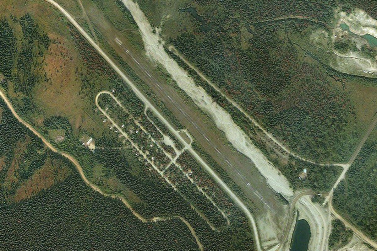
PAKW(PAKW) to Klawock Lake(POI33)
Distance: 11.25NM Bearing: 115° 5 minutes
Head southeast from the airport and fly along the length of Klawock Lake, then follow the road from the lake's end
Klawock Lake(POI33) to Harris River(POI34)
Distance: 6.29NM Bearing: 63° 3 minutes
Turn east where the road forks and follow it as it leads through the small valley alongside the Harris River
Harris River(POI34) to Grindall Island(POI35)
Distance: 17.26NM Bearing: 76° 8 minutes
Where the river empties into the waters of Twelvemile Arm, continue east over the mountain and the lower terrain beyond. Once you're over the water again, head for the outcrop of land ahead, and the small island at its south end
Grindall Island(POI35) to Tongass Narrows(POI36)
Distance: 10.16NM Bearing: 78° 5 minutes
Keep heading east across Clarence Strait, then once you get closer to the coast on the other side you will see the waters of Tongass Narrows to the right. Turn southeast and fly along the right edge of the water
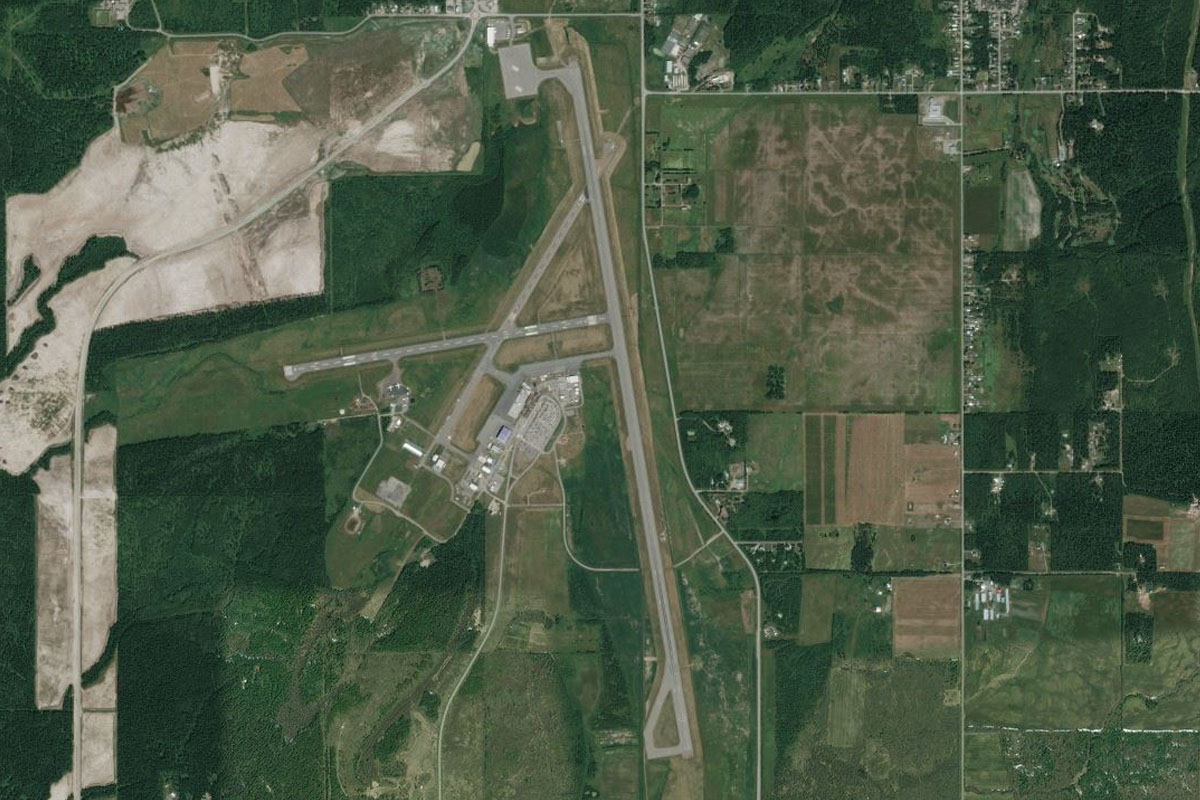
Tongass Narrows(POI36) to PAKT(PAKT)
Distance: 6.53NM Bearing: 118° 3 minutes
Ketchikan Airport is ahead on the right side of the bay, with the town across the water on the left
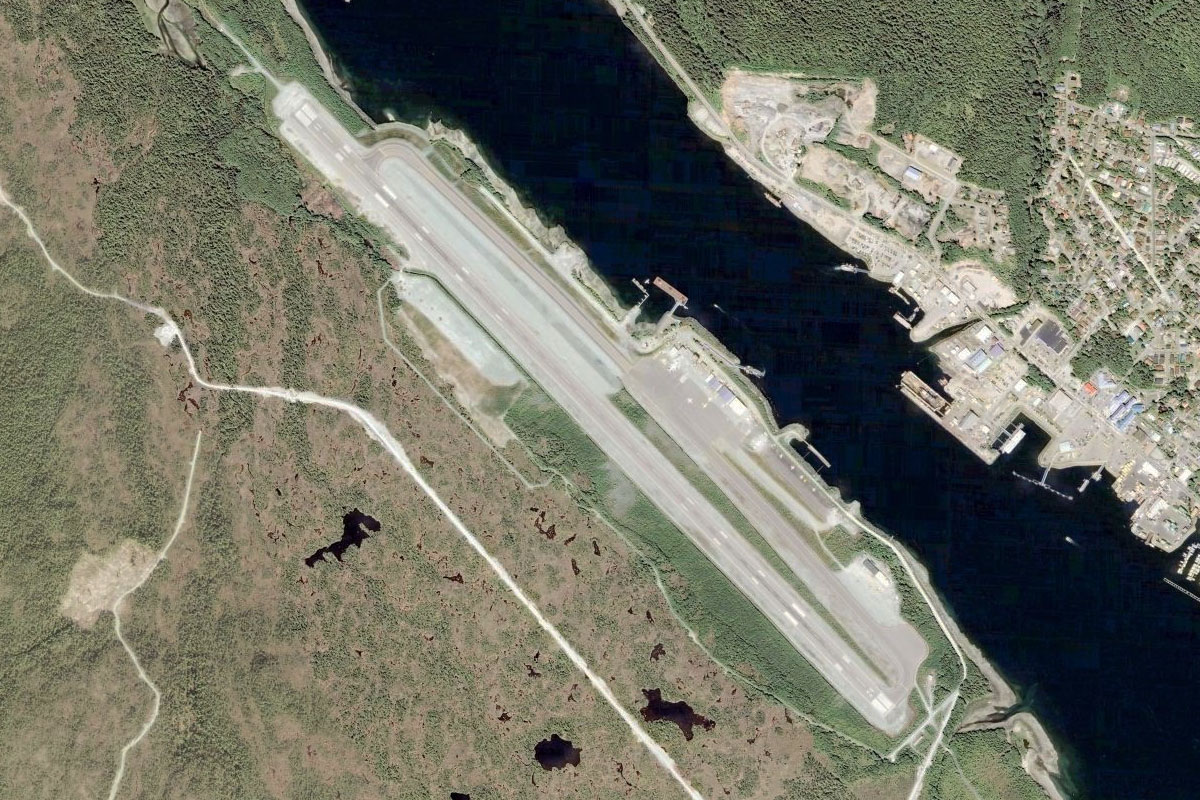
Leg 8
Flying from PAKT
Leg Distance: 80.87 Approximate time at 125kts: 39 minutes.
PAKT(PAKT) to Mountain Point(POI37)
Distance: 6.81NM Bearing: 108° 3 minutes
After Takeoff, head southeast along the island at the centre of the narrows.
Mountain Point(POI37) to Bold Island(POI38)
Distance: 13.35NM Bearing: 100° 6 minutes
Continue southeast, past the small town of Mountain Point to your left and over the lake filled island of Bold Island. Then continue southeast towards the outcrop of flat land ahead and slightly to the left
Bold Island(POI38) to Revillagigedo Channel(POI39)
Distance: 8.99NM Bearing: 122° 4 minutes
Continue southeast across the water to towards the coastline ahead
Revillagigedo Channel(POI39) to Cape Fox(POI40)
Distance: 19.09NM Bearing: 146° 9 minutes
Follow the flat coastal area south to its southern most point of Cape Fox
Cape Fox(POI40) to Dundas Island(POI41)
Distance: 9.89NM Bearing: 138° 5 minutes
From Cape Fox, turn slight south and head across the water to the tip of Dundas Island, the large island to the south
Dundas Island(POI41) to CYPR(CYPR)
Distance: 22.74NM Bearing: 133° 11 minutes
After reaching Dundas Island, turn slightly back to the left and head across the bay where you should soon make out the town of Prince Rupert ahead, with the airport sitting on the outer edge of the large island to it's west
Leg 9
Flying from CYPR
Leg Distance: 74.97 Approximate time at 125kts: 36 minutes.
CYPR(CYPR) to Lelu Island(POI42)
Distance: 7.76NM Bearing: 117° 4 minutes
Head southeast from Prince Rupert and you will shortly pass the industrial area and shipping terminal of Port Edward. Just after there, still continuing southeast, you will see the Inverness Passage cutting its way between the mountains
Lelu Island(POI42) to Skeena River(POI43)
Distance: 8.34NM Bearing: 101° 4 minutes
Once you pass through Inverness Passage you will enter a larger bay which is the head of the Skeena River. Turn left and follow it northeast
Skeena River(POI43) to Skeena River(POI44)
Distance: 10.08NM Bearing: 37° 5 minutes
Follow the wide river valley northeast
Skeena River(POI44) to Skeena River(POI45)
Distance: 8.37NM Bearing: 91° 4 minutes
Continue along the river as it turns to the east
Skeena River(POI45) to Skeena River(POI46)
Distance: 14.95NM Bearing: 38° 7 minutes
The river will turn to the northeast as it narrows
Skeena River(POI46) to CYXT(CYXT)
Distance: 25.47NM Bearing: 53° 12 minutes
The river will continue winding its way through the valley northeast, eventually opening out before the town of Terrace. The airport is just to the south of the town
Leg 10
Flying from CYXT
Leg Distance: 64.02 Approximate time at 125kts: 31 minutes.
CYXT(CYXT) to Zymoetz River(POI47)
Distance: 5.64NM Bearing: 19° 3 minutes
After takeoff, meet up with the river north of the airport and follow it northeast where it will head back into a valley. As you pass the first mountain to your right, a smaller river valley will lead to the east. Turn right into this valley and follow the smaller Zymoetz River
Zymoetz River(POI47) to Zymoetz River(POI48)
Distance: 16.16NM Bearing: 91° 8 minutes
Keep following the river as it twists southeast through the valley. There should also be a power line clearing following the valley
Zymoetz River(POI48) to Zymoetz River(POI49)
Distance: 4.06NM Bearing: 54° 2 minutes
Continue along the river as it turns to the northeast and heads towards the larger mountains
Zymoetz River(POI49) to Limonite Creek(POI50)
Distance: 3.49NM Bearing: 10° 2 minutes
The river will turn sharply north. Follow it briefly until you see a smaller creek (and the powerlines) heading through a steep valley to the east. Turn right through the valley
Limonite Creek(POI50) to Telkwa River(POI51)
Distance: 14.31NM Bearing: 52° 7 minutes
Follow the creek through the valley where it will pass through a couple of lakes before the valley opens out and follows the Telkwa River, heading northeast
Telkwa River(POI51) to Telkwa River(POI52)
Distance: 6.92NM Bearing: 67° 3 minutes
Keep following the river (or the powerlines) until they cross paths where the land flattens out more
Telkwa River(POI52) to Smithers(POI53)
Distance: 10.46NM Bearing: 10° 5 minutes
From the intersection of the river and the powerlines, you can now turn northeast directly towards the town of Smithers, as the land between has lowered in elevation
Smithers(POI53) to CYYD(CYYD)
Distance: 2.98NM Bearing: 333° 1 minutes
Head north from the town and the airport is just a couple of miles ahead
Leg 11
Flying from CYYD
Leg Distance: 59.14 Approximate time at 125kts: 28 minutes.
CYYD(CYYD) to Babine Mountains(POI54)
Distance: 13.74NM Bearing: 73° 7 minutes
Heading east from Smithers Airport, you will be heading towards the southern peaks of the Babine Mountains. Gain enough altitude to negotiate your way through these, after which you can descend to meet and then follow the highway heading northeast
Babine Mountains(POI54) to Babine Lake(POI55)
Distance: 21.61NM Bearing: 41° 10 minutes
The highway will take you past the south edge of Chapman lake before heading towards some hills in the distance. As the road turns away, continue over the hills and towards the large quarry at the other side of the much larger Babine Lake.
Babine Lake(POI55) to Takla Lake(POI56)
Distance: 19.34NM Bearing: 47° 9 minutes
From the quarry you should see a smaller L-shaped lake ahead. Follow the lake as it points the way east to the larger Takla Lake
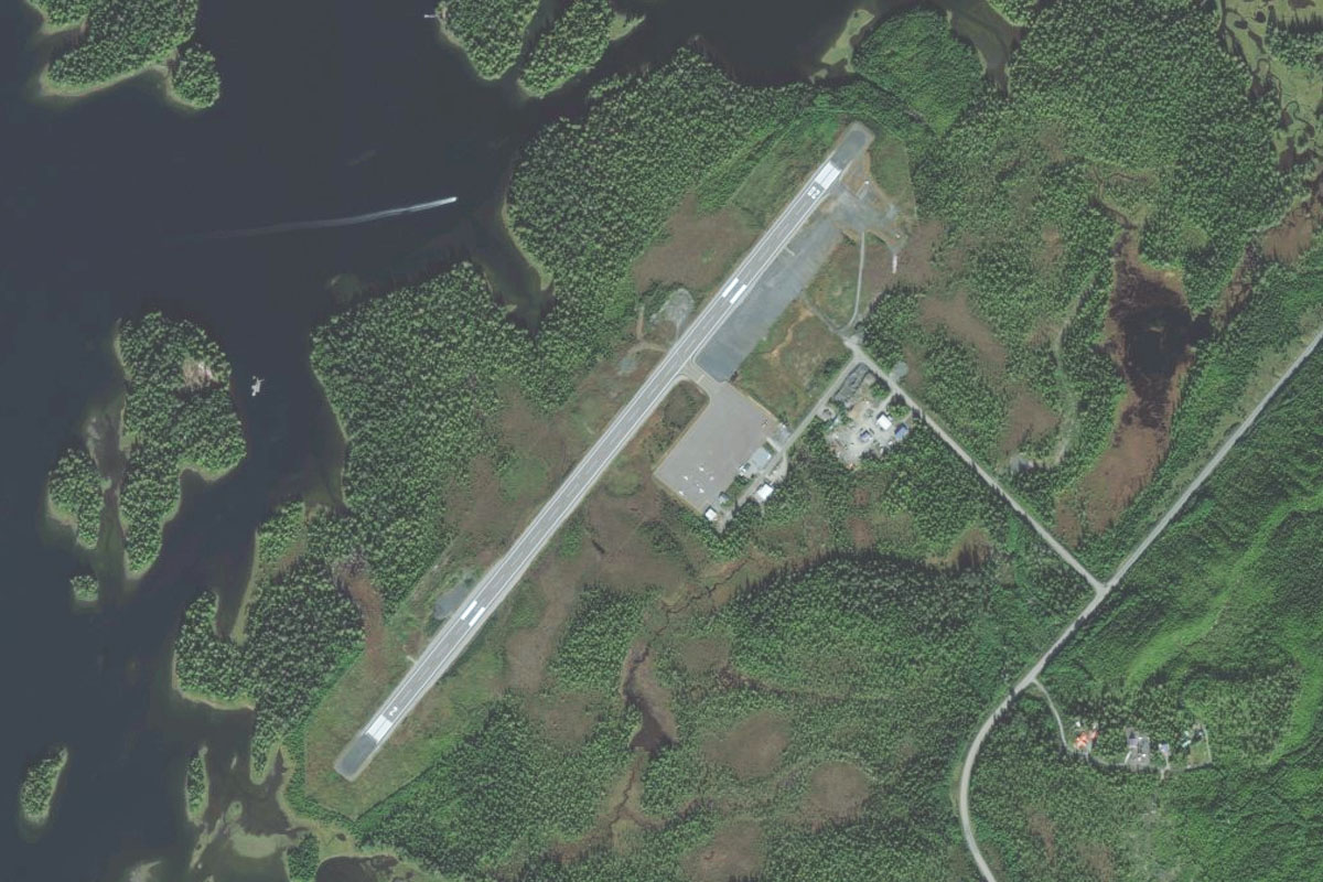
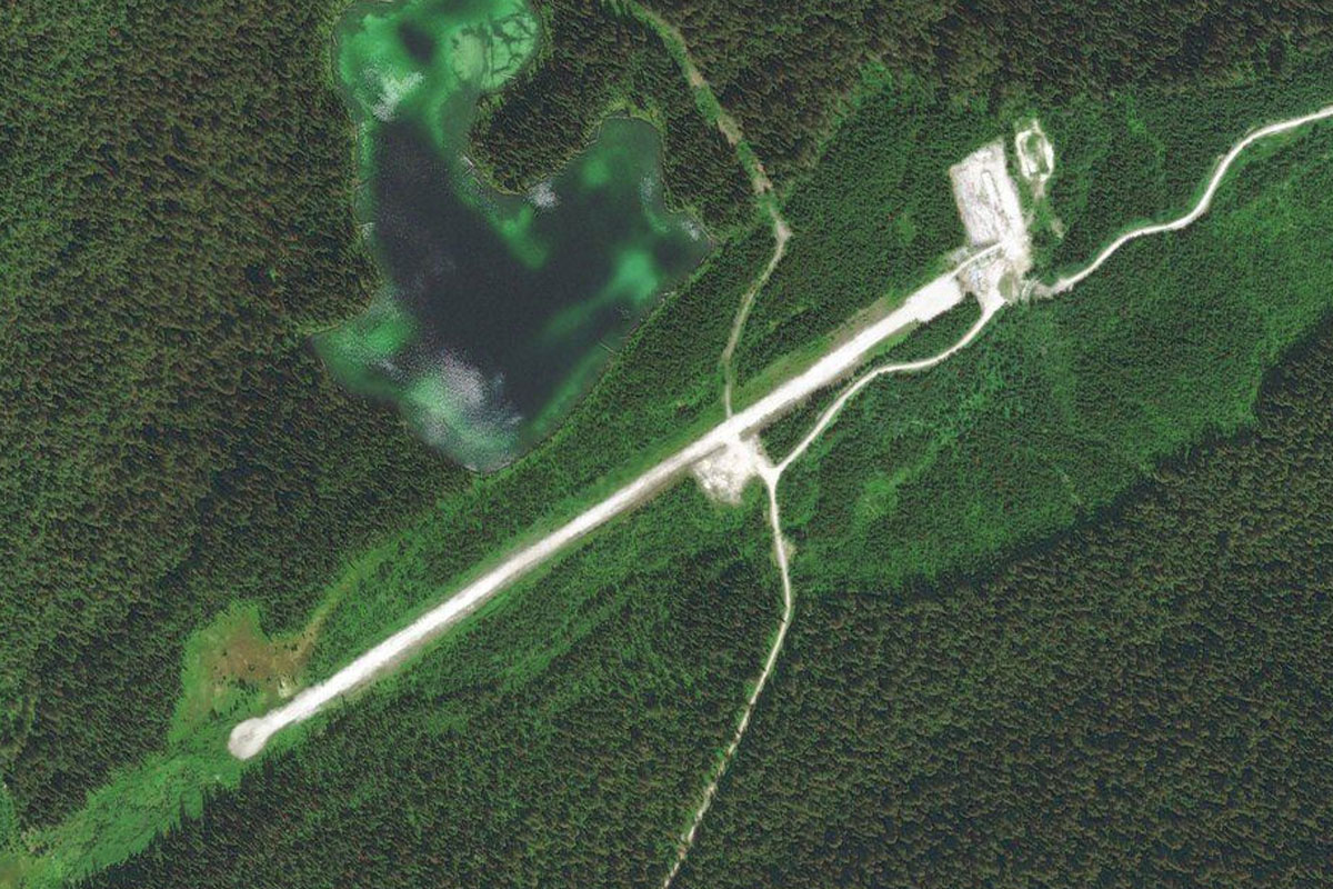
Takla Lake(POI56) to CAH5(CAH5)
Distance: 4.45NM Bearing: 91° 2 minutes
Once you reach the Y-shaped Takla lake, you may see a small airstrip ahead at the join in the Y, but turn southeast and head across to the lake's far shore where it will shortly lead us to the larger Leo Creek airstrip
Leg 12
Flying from CAH5
Leg Distance: 63.87 Approximate time at 125kts: 31 minutes.
CAH5(CAH5) to Trembleur Lake(POI57)
Distance: 24.34NM Bearing: 114° 12 minutes
Head southeast along the length of the lake, where it will soon narrow into a river. Follow the river southeast until it reaches the large Trembleur Lake
Trembleur Lake(POI57) to Stuart Lake(POI58)
Distance: 18.17NM Bearing: 119° 9 minutes
Looking southeast across the lake's opposite shore, you will see another river continuing the journey in the same direction towards the next large lake, Stuart Lake
Stuart Lake(POI58) to CYJM(CYJM)
Distance: 21.36NM Bearing: 114° 10 minutes
Continue southeast along the length of Stuart Lake where it will end at the town of Fort St James. Another river will lead south from the town and towards the airport, a couple of miles from the lake's southern shore
Leg 13
Flying from CYJM
Leg Distance: 65.66 Approximate time at 125kts: 32 minutes.
CYJM(CYJM) to Stuart River(POI59)
Distance: 29.81NM Bearing: 102° 14 minutes
After takeoff, follow the river south, then southeast as it meanders through the countryside
Stuart River(POI59) to Isle Pierre(POI60)
Distance: 15.03NM Bearing: 121° 7 minutes
At the point where the river turns sharply and disappears south, cut southeast and you should pass the medium sized Saxton lake, before meeting up with the Nechako river as it continues southeast
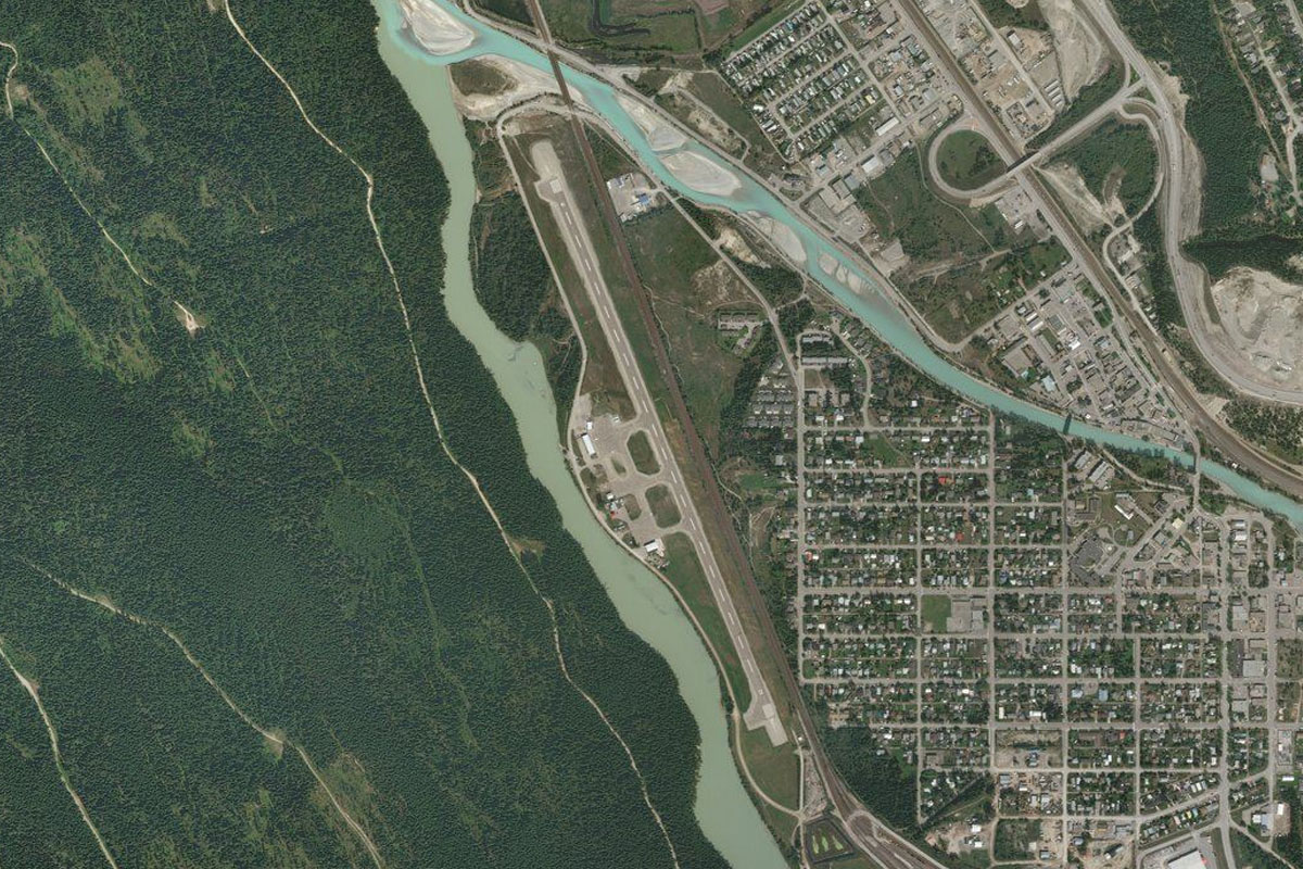
Isle Pierre(POI60) to Prince George(POI61)
Distance: 16.53NM Bearing: 82° 8 minutes
Continue following the river as it twists and turns its way east towards the town of Prince George
Prince George(POI61) to CYXS(CYXS)
Distance: 4.29NM Bearing: 106° 2 minutes
From the town, the airport sits just to the southeast on the other side of the river
Leg 14
Flying from CYXS
Leg Distance: 64.38 Approximate time at 125kts: 31 minutes.
CYXS(CYXS) to Willow River(POI62)
Distance: 17.63NM Bearing: 107° 8 minutes
Fly southeast from Prince George and you will meet a road and river heading into a shallow, wide valley
Willow River(POI62) to Stoney Lake(POI63)
Distance: 20.63NM Bearing: 128° 10 minutes
Keeps following the river as it winds its way to the southeast, where eventually it will lead you to a long lake, called Stony Lake
Stoney Lake(POI63) to Two Sisters Mountain(POI64)
Distance: 18.28NM Bearing: 124° 9 minutes
Fly along to the other end of the lake and its two smaller companions, then turning slightly to the right, head for the tall twin peaked Two Sisters Mountain roughly 15 miles ahead. As you get closer to the mountain, aim for the valley to it's right side
Two Sisters Mountain(POI64) to CAS3(CAS3)
Distance: 7.84NM Bearing: 139° 4 minutes
Flying along the valley for a few miles, you should see a small quarry area ahead. From there, Barkerville airstrip is directly south, hiding between the hills
Leg 15
Flying from CAS3
Leg Distance: 37.77 Approximate time at 125kts: 18 minutes.
CAS3(CAS3) to Matthew Valley Road(POI65)
Distance: 9.72NM Bearing: 121° 5 minutes
Fly southeast from Barkerville and follow the road which winds its way along the valleys southeast
Matthew Valley Road(POI65) to Ishpa Mountain(POI66)
Distance: 10.73NM Bearing: 71° 5 minutes
The road will soon take a tight turn to the east. When it does, turn east towards the tall peaks ahead
Ishpa Mountain(POI66) to Matthew River(POI67)
Distance: 5.37NM Bearing: 122° 3 minutes
Before you reach the mountain, you will see a lake valley to its left (northeast), and a valley with a river and road to the right, heading southeast. Turn southeast and follow the river valley
Matthew River(POI67) to Quesnel Lake(POI68)
Distance: 7.58NM Bearing: 126° 4 minutes
Follow the river and road southeast, keeping the taller mountains to your left. The river will eventually turn south and meet Quesnel Lake
Quesnel Lake(POI68) to Quesnel Lake(POI69)
Distance: 2.55NM Bearing: 156° 1 minutes
Fly to the point where the river meet the lake then start a left turn for the airfield
Quesnel Lake(POI69) to CYWB(CYWB)
Distance: 1.82NM Bearing: 75° 1 minutes
The airfield sits about half way up the mountain slope, tucked in behind a hill
Leg 16
Flying from CYWB
Leg Distance: 60.41 Approximate time at 125kts: 29 minutes.
CYWB(CYWB) to Quesnel Lake(POI70)
Distance: 15.83NM Bearing: 207° 8 minutes
After takeoff, head back to the southwest and follow the lake
Quesnel Lake(POI70) to Horsefly Lake(POI71)
Distance: 11.02NM Bearing: 165° 5 minutes
When you reach Quesnel Lake's T intersection, head south directly across the lake. You'll pass a small airstrip on the south shore before flying over land for another few miles where you will reach another long lake, Horsefly Lake
Horsefly Lake(POI71) to Horsefly Lake(POI72)
Distance: 9.81NM Bearing: 249° 5 minutes
Turn right and follow Horsefly lake west along its length. When you near the end of the lake, turn back to the south
Horsefly Lake(POI72) to Murphy Lake(POI73)
Distance: 18.03NM Bearing: 165° 9 minutes
Heading south you will soon come to the end of another long lake which leads off to the left. Turn to the southeast and follow the lake
Murphy Lake(POI73) to CDC5(CDC5)
Distance: 5.72NM Bearing: 117° 3 minutes
You should soon be able to make out the airstrip, sitting at the southern shore of the lake

Leg 17
Flying from CDC5
Leg Distance: 59.48 Approximate time at 125kts: 29 minutes.
CDC5(CDC5) to Lang Lake(POI74)
Distance: 8.8NM Bearing: 100° 4 minutes
Just southeast of the airport is a smaller elongated lake called Lang Lake. Head to its eastern end
Lang Lake(POI74) to Canim Lake(POI75)
Distance: 8.49NM Bearing: 110° 4 minutes
Head southeast to the next large lake, Canim Lake
Canim Lake(POI75) to Mahood Lake(POI76)
Distance: 11.11NM Bearing: 68° 5 minutes
Fly east along the length of Canim Lake, then to the next lake, Mahood Lake
Mahood Lake(POI76) to Mahood River(POI77)
Distance: 10.26NM Bearing: 56° 5 minutes
Fly along the length of the lake as it heads east. At it's end it will meet up with the river flowing to the southeast. Turn to the left and follow the river
Mahood River(POI77) to Clearwater River(POI78)
Distance: 9.88NM Bearing: 114° 5 minutes
The river will meet with the Clearwater River and curve its way around to the south
Clearwater River(POI78) to Clearwater River(POI79)
Distance: 8.63NM Bearing: 162° 4 minutes
Continue following the river as it heads south towards the town of Clearwater
Clearwater River(POI79) to CCW1(CCW1)
Distance: 2.31NM Bearing: 203° 1 minutes
As the town appears at the valley junction, the river will lead you southwest straight to the airfield
Leg 18
Flying from CCW1
Leg Distance: 56.67 Approximate time at 125kts: 27 minutes.
CCW1(CCW1) to Vavenby(POI80)
Distance: 13.63NM Bearing: 94° 7 minutes
Head east over the town and into the large valley beyond, where the river, highway and railway will all lead the way
Vavenby(POI80) to North Thompson River(POI81)
Distance: 6.2NM Bearing: 15° 3 minutes
Continue along the valley as it turns northeast
North Thompson River(POI81) to North Thompson River(POI82)
Distance: 7.93NM Bearing: 73° 4 minutes
They valley will continue east
North Thompson River(POI82) to Avola(POI83)
Distance: 10.52NM Bearing: 13° 5 minutes
Stay with the valley as it turns to the north and past the town of Avola
Avola(POI83) to North Thompson River(POI84)
Distance: 9.06NM Bearing: 331° 4 minutes
Continue north along the valley
North Thompson River(POI84) to CYCP(CYCP)
Distance: 9.33NM Bearing: 357° 4 minutes
The valley will open out at the town of Blue River. The airport is just at the other side of town, running alongside the highway
Leg 19
Flying from CYCP
Leg Distance: 48.25 Approximate time at 125kts: 23 minutes.
CYCP(CYCP) to North Thompson River(POI85)
Distance: 9.97NM Bearing: 10° 5 minutes
Head northwest, then continue along the valley as it curls around to the north
North Thompson River(POI85) to CA-5(POI86)
Distance: 18.95NM Bearing: 353° 9 minutes
Continue north along the valley. The North Thompson River will disappear west in to another valley, continue following the highway north
CA-5(POI86) to CA-5(POI87)
Distance: 10.64NM Bearing: 306° 5 minutes
Keep following the highway through the valley as it turns to the northwest
CA-5(POI87) to Valemount(POI88)
Distance: 4.17NM Bearing: 352° 2 minutes
The highway will turn north again towards the town of Valemount, which sits in a wider valley
Valemount(POI88) to CAH4(CAH4)
Distance: 4.52NM Bearing: 305° 2 minutes
Once you see the town, turn to the left and you should see the airfield at the edge of the valley
Leg 20
Flying from CAH4
Leg Distance: 75.41 Approximate time at 125kts: 36 minutes.
CAH4(CAH4) to Kinbasket Lake(POI89)
Distance: 7.95NM Bearing: 110° 4 minutes
After takeoff, head southeast over the town towards the lake
Kinbasket Lake(POI89) to Kinbasket Lake(POI90)
Distance: 14.73NM Bearing: 122° 7 minutes
Head southeast along Kinbasket Lake, which is a reservoir created by the Mica Dam and runs over 100 miles in length
Kinbasket Lake(POI90) to Kinbasket Lake(POI91)
Distance: 26.76NM Bearing: 130° 13 minutes
Continue along the lake as it heads southeast
Kinbasket Lake(POI91) to Kinbasket Lake(POI92)
Distance: 5.81NM Bearing: 160° 3 minutes
You eventually come to an open area of the lake where all of the arms of the lake meet
Kinbasket Lake(POI92) to Mica Dam(POI93)
Distance: 6.83NM Bearing: 210° 3 minutes
Turn right and head southwest over Mica Dam. The river will continue south from there
Mica Dam(POI93) to Columbia River(POI94)
Distance: 9.13NM Bearing: 159° 4 minutes
Follow the river south through the valley
Columbia River(POI94) to CA28(CA28)
Distance: 4.2NM Bearing: 195° 2 minutes
The river will turn to the southwest just before it narrows at a wedge shaped point of land which houses the airstrip
Leg 21
Flying from CA28
Leg Distance: 58.98 Approximate time at 125kts: 28 minutes.
CA28(CA28) to Columbia River(POI95)
Distance: 4.59NM Bearing: 190° 2 minutes
After takeoff, follow the Columbia River south through the valley
Columbia River(POI95) to Columbia River(POI96)
Distance: 10.91NM Bearing: 149° 5 minutes
Continue south along the river
Columbia River(POI96) to Lake Revelstoke(POI97)
Distance: 9.95NM Bearing: 132° 5 minutes
Stay along the river as it widens out at Lake Revelstoke and continues south
Lake Revelstoke(POI97) to Lake Revelstoke(POI98)
Distance: 5.58NM Bearing: 149° 3 minutes
Follow the lake as it turns to the southeast
Lake Revelstoke(POI98) to Lake Revelstoke(POI99)
Distance: 8.05NM Bearing: 115° 4 minutes
Continue along the lake as it turns back to the south
Lake Revelstoke(POI99) to Lake Revelstoke(POIA0)
Distance: 12.64NM Bearing: 152° 6 minutes
Keep following the lake
Lake Revelstoke(POIA0) to Revelstoke(POIA1)
Distance: 2.87NM Bearing: 197° 1 minutes
The lake will eventually turn southwest and narrow back into the Columbia river just north of the town of Revelstoke
Revelstoke(POIA1) to CYRV(CYRV)
Distance: 4.39NM Bearing: 147° 2 minutes
The river will lead you past the town and to the airport at its south
Leg 22
Flying from CYRV
Leg Distance: 74.66 Approximate time at 125kts: 36 minutes.
CYRV(CYRV) to Illecillewaet River(POIA2)
Distance: 2.07NM Bearing: 20° 1 minutes
Just north of the airport, before the main part of town, you'll see a small river heading east into a valley along with the railway and highway. Head east into the valley
Illecillewaet River(POIA2) to Trans Canada Highway(POIA3)
Distance: 9.11NM Bearing: 50° 4 minutes
Continue along the valley as it turns northeast
Trans Canada Highway(POIA3) to Albert Canyon(POIA4)
Distance: 5.5NM Bearing: 9° 3 minutes
The valley will turn more to the east as it opens up at the town of Albert Canyon, then continue northeast
Albert Canyon(POIA4) to Trans Canada Highway(POIA5)
Distance: 9.92NM Bearing: 38° 5 minutes
Keep following the highway northeast through the valley
Trans Canada Highway(POIA5) to Glacier(POIA6)
Distance: 6.13NM Bearing: 55° 3 minutes
Keep following the highway all the way to the end of the valley, where the railway will disappear into the Connaught Tunnel, and turn north along with the highway
Glacier(POIA6) to Rogers Pass(POIA7)
Distance: 2.34NM Bearing: 331° 1 minutes
The highway will briefly head north before turning east near Rogers Pass
Rogers Pass(POIA7) to Trans Canada Highway(POIA8)
Distance: 4.17NM Bearing: 45° 2 minutes
The highway will head east before turning north into another valley
Trans Canada Highway(POIA8) to Heather Mountain(POIA9)
Distance: 8.79NM Bearing: 329° 4 minutes
Keep following the road as it heads north, with the summit of Heather Mountain to the right
Heather Mountain(POIA9) to Kinbasket Lake(POIAA)
Distance: 3.22NM Bearing: 28° 2 minutes
Stay with the highway as it turns right and curves around the base of Heather Mountain
Kinbasket Lake(POIAA) to Columbia River(POIAB)
Distance: 11.54NM Bearing: 91° 6 minutes
The highway will head southeast where it will soon be met by the Columbia River and turn further to the south
Columbia River(POIAB) to CYGE(CYGE)
Distance: 11.87NM Bearing: 136° 6 minutes
Follow the river down to the town of Golden. The airport is wedged in between the river and the town
Leg 23
Flying from CYGE
Leg Distance: 74.24 Approximate time at 125kts: 36 minutes.
CYGE(CYGE) to Kicking Horse River(POIAC)
Distance: 4.1NM Bearing: 73° 2 minutes
From Golden, head east and follow the small river into the valley, which will then turn to the southeast
Kicking Horse River(POIAC) to Trans Canada Highway(POIAD)
Distance: 12.69NM Bearing: 105° 6 minutes
Follow the river and the Trans Canada Highway as they head southeast along the valley. It will soon open out into a larger valley where the highway will take a sharp turn to the north. Turn north with the highway
Trans Canada Highway(POIAD) to Trans Canada Highway(POIAE)
Distance: 8.16NM Bearing: 346° 4 minutes
Head north with the highway and follow it as it turns northeast where the valley widens
Trans Canada Highway(POIAE) to Field(POIAF)
Distance: 5.42NM Bearing: 28° 3 minutes
The highway will cut northeast across the open valley before entering another valley along with the railway and river
Field(POIAF) to Trans Canada Highway(POIAG)
Distance: 8.84NM Bearing: 51° 4 minutes
The highway will pass the town of Field, and be dwarfed by the peaks of Mount Burgess, Mount Field and Mount Stephen as it travels northeast
Trans Canada Highway(POIAG) to Lake Louise(POIAH)
Distance: 4NM Bearing: 109° 2 minutes
Turn to the southeast with the highway, It will be joined by the Icefields Parkway coming from the north and pass the famous hamlet of Lake Louise, with the world famous lake just to the west
Lake Louise(POIAH) to Bow River Valley(POIAI)
Distance: 24.19NM Bearing: 116° 12 minutes
Continue along the highway as it heads southeast along the Bow River valley, until the river and highway will turn east towards the town of Banff
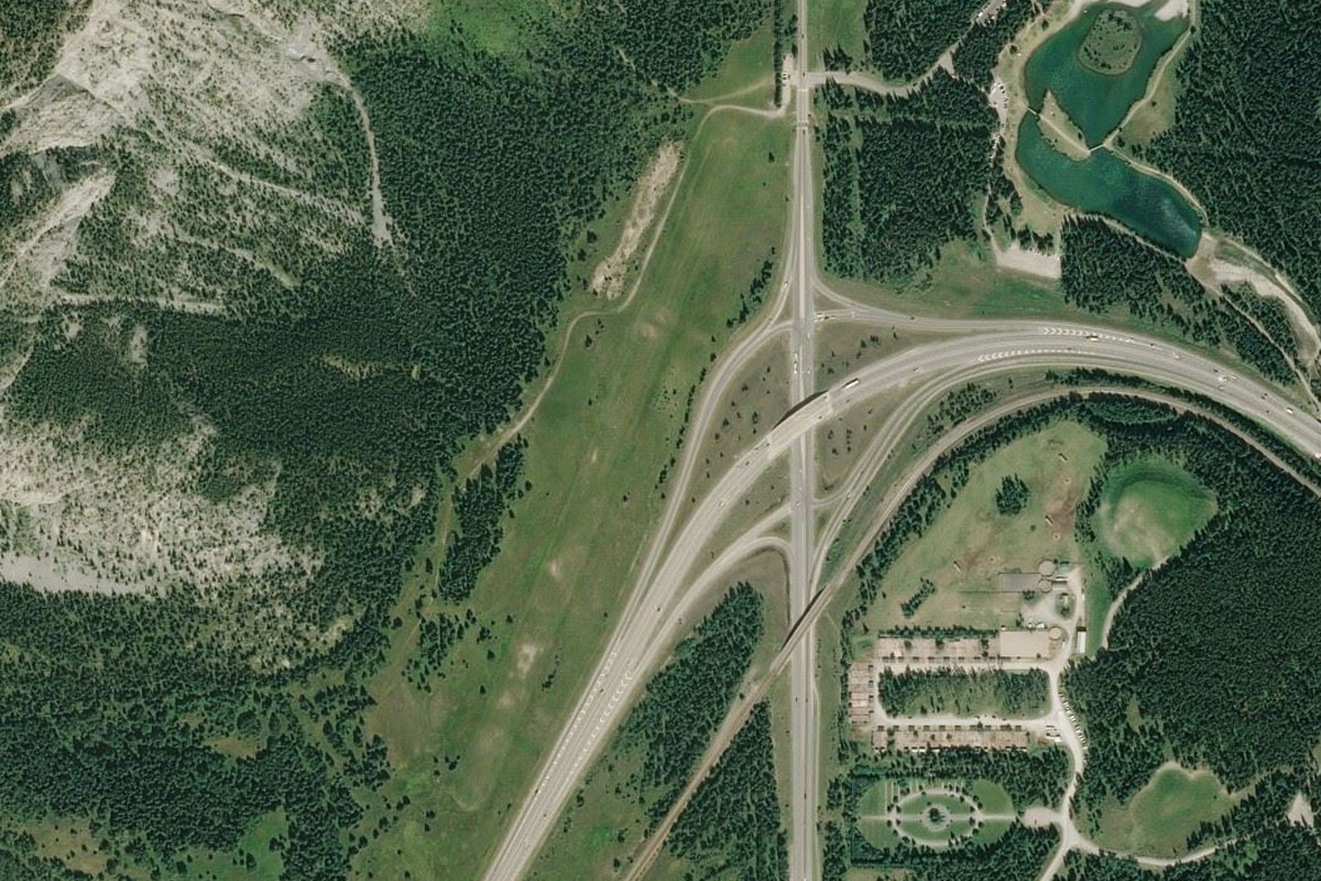
Bow River Valley(POIAI) to Banff(POIAJ)
Distance: 4.68NM Bearing: 62° 2 minutes
Head towards the town of Banff and the small mountain behind it. To the south of the town you might see the grand Banff Springs Hotel
Banff(POIAJ) to CYBA(CYBA)
Distance: 2.16NM Bearing: 17° 1 minutes
Turn to the northeast from the town and back towards the Trans Canada Highway as it also turns northeast. The airstrip is just to the left of the highway
Leg 24
Flying from CYBA
Leg Distance: 35.15 Approximate time at 125kts: 17 minutes.
CYBA(CYBA) to Canmore(POIAK)
Distance: 14.82NM Bearing: 118° 7 minutes
From Banff, head southeast along the highway as it heads through the town of Canmore before turning east
Canmore(POIAK) to Morley(POIAL)
Distance: 11.93NM Bearing: 48° 6 minutes
Stay with the highway as it heads east, then northeast where you will emerge from the mountains and onto the great plains of Alberta
Morley(POIAL) to CKY8(CKY8)
Distance: 8.4NM Bearing: 46° 4 minutes
As the road straightens out, start following the river to its left. The river will lead to waters of Ghost Lake, which has an airfield half way along on its north side
Leg 25
Flying from CKY8
Leg Distance: 29.53 Approximate time at 125kts: 14 minutes.
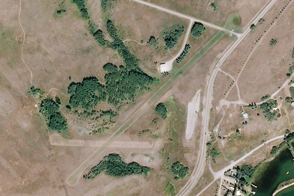
CKY8(CKY8) to Cochrane(POIAM)
Distance: 10.39NM Bearing: 78° 5 minutes
After takeoff, head east and follow the Bow River as it heads towards the built up area of Cochrane
Cochrane(POIAM) to Crowchild Trail NW(POIAN)
Distance: 10.98NM Bearing: 98° 5 minutes
Leave the river at Cochrane and follow the highway running east. It will turn gradually to the southeast and become a dual carriageway. Just after it enters the outer suburbs of Calgary it will meet a large freeway interchange
Crowchild Trail NW(POIAN) to CYYC(CYYC)
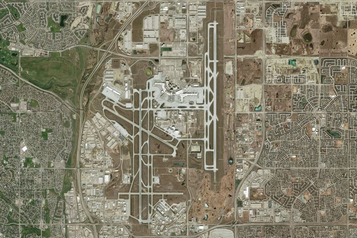
Distance: 8.16NM Bearing: 82° 4 minutes
Head directly east from the interchange and you will pass over the northern suburbs of Calgary before the destination airport