Welcome to stage 7 of our around the world sightseeing adventure. In this trip you’ll depart Albuquerque and head west to Las Vegas, checking out the Arizona Meteor Crater, the beautiful area of Sedona, the majesty of the Grand Canyon and the world famous Hoover Dam along the way.
Total Legs: 11 Total Distance: 585 Total Time(125kts): 4 hours 40 minutes
Leg 1
Flying from KABQ
Leg Distance: 66.58 Approximate time at 125kts: 32 minutes.
KABQ(KABQ) to Interstate 40(POI1)
Distance: 15.62NM Bearing: 261° 7 minutes
After takeoff, head directly west until you meet up with Interstate 40
Interstate 40(POI1) to I-40(POI2)
Distance: 10.67NM Bearing: 244° 5 minutes
Keep following the highway as it heads south west
I-40(POI2) to Laguna(POI3)
Distance: 11.86NM Bearing: 277° 6 minutes
The highway will pass through the town of Laguna
Laguna(POI3) to Flower Mountain(POI4)
Distance: 8.61NM Bearing: 273° 4 minutes
Keep following the highway towards the small mountain called Flower Mountain. You can either stick with the highway as it bends around the mountain or follow the railway on the left side
Flower Mountain(POI4) to I-40(POI5)
Distance: 8.5NM Bearing: 264° 4 minutes
Keep heading west. You'll see some ancient lava flows up ahead
I-40(POI5) to KGNT(KGNT)
Distance: 11.32NM Bearing: 296° 5 minutes
The town of Grants is on the north side of the highway and the airport is on the west side as it curves to the north, just past the larger lava field
Leg 2
Flying from KGNT
Leg Distance: 50.98 Approximate time at 125kts: 24 minutes.
KGNT(KGNT) to I-40(POI6)
Distance: 7.24NM Bearing: 320° 3 minutes
After takeoff, keep following the highway as it heads northwest. It will eventually start to turn towards the west
I-40(POI6) to Thoreau(POI7)
Distance: 16.9NM Bearing: 292° 8 minutes
The highway and railway will pass through the small town of Thoreau
Thoreau(POI7) to Church Rock(POI8)
Distance: 17.67NM Bearing: 288° 8 minutes
The road will turn west towards the town of Gallup. To the left you'll see a disused ammunitions depot
Church Rock(POI8) to KGUP(KGUP)
Distance: 9.17NM Bearing: 250° 4 minutes
Just past the town, on the south side of the highway, is Gallup Municipal Airport
Leg 3
Flying from KGUP
Leg Distance: 75.57 Approximate time at 125kts: 36 minutes.
KGUP(KGUP) to I-40(POI9)
Distance: 5.18NM Bearing: 249° 2 minutes
Follow the highway to the west
I-40(POI9) to Lupton(POI10)
Distance: 13.63NM Bearing: 215° 7 minutes
The highway will head south west and curve its way between the hills. Up ahead at the truck stop and roadside attractions is where you'll cross over into Arizona
Lupton(POI10) to Painted Desert(POI11)
Distance: 37.52NM Bearing: 236° 18 minutes
This long leg will have us following the highway south west, where it will eventually pass the Petrified Forest National Park. You'll get a good look at the Painted Desert Rim to the north of the highway
Painted Desert(POI11) to Sun Valley(POI12)
Distance: 11.61NM Bearing: 239° 6 minutes
The road will continue to the southwest, passing over the dry bed of Lithodendron Wash, before passing through the small settlement of Sun Valley
Sun Valley(POI12) to P14(P14)
Distance: 7.63NM Bearing: 236° 4 minutes
Holbrook airport is just before the town, on the north side of the highway
Leg 4
Flying from P14
Leg Distance: 42.43 Approximate time at 125kts: 20 minutes.
P14(P14) to Cholla Power Plant(POI13)
Distance: 7.07NM Bearing: 264° 3 minutes
Heading west from Holbrook Airport, you'll come to Cholla Power Plant and it's artificial lakes
Cholla Power Plant(POI13) to Joseph City(POI14)
Distance: 11.59NM Bearing: 270° 6 minutes
Keep following the highway past Joseph City
Joseph City(POI14) to Winslow(POI15)
Distance: 9.59NM Bearing: 282° 5 minutes
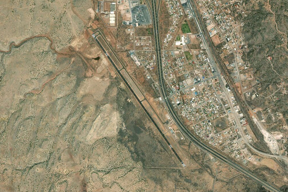
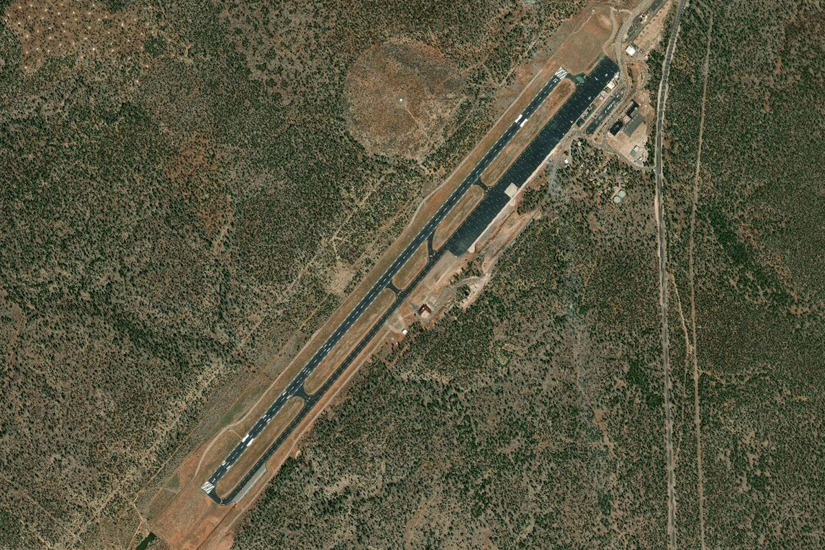
Once you get to Winslow, turn west and start diverging from the highway. You'll recognize Winslow from it's T-shaped airport layout at the south of the town, and the large shopping center to the north
Winslow(POI15) to KLEF(KLEF)
Distance: 14.18NM Bearing: 259° 7 minutes
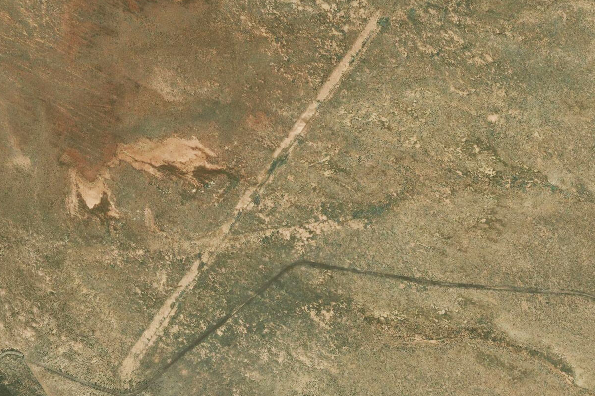
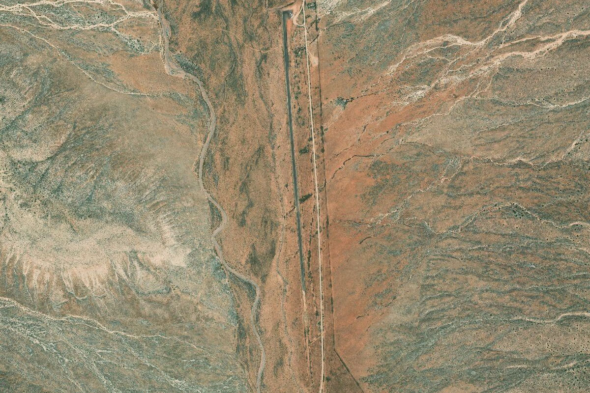
You should start to see the large meteor crater come into view, You'll be landing at the small airstrip 2 miles before, on the eastern side
Leg 5
Flying from KLEF
Leg Distance: 47.66 Approximate time at 125kts: 23 minutes.
KLEF(KLEF) to Meteor Crater(POI16)
Distance: 1.89NM Bearing: 258° 1 minutes
After takeoff, head to the Meteor Crater for a closer look
Meteor Crater(POI16) to Mormon Lake(POI17)
Distance: 21.76NM Bearing: 247° 10 minutes
From the crater, head south west towards the low lying ridge and beyond to the dry lake
Mormon Lake(POI17) to Munds Wilderness(POI18)
Distance: 11.98NM Bearing: 233° 6 minutes
In the distance you'll see the mountains around Sedona. Head towards the southern end of this area which is where the airport lies
Munds Wilderness(POI18) to Woods Canyon(POI19)
Distance: 3.68NM Bearing: 201° 2 minutes
Head southwest over the canyon towards the eastern reaches of the residential area
Woods Canyon(POI19) to Village at Oak Creek(POI20)
Distance: 3NM Bearing: 240° 1 minutes
As you head into the valley you'll see a large residential area dotted with golf courses. From there you'll start turning towards the airport
Village at Oak Creek(POI20) to Red Rock(POI21)
Distance: 3.72NM Bearing: 311° 2 minutes
Head northwest past Cathedral Rock before turning on final
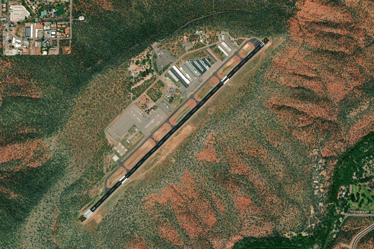
Red Rock(POI21) to KSEZ(KSEZ)
Distance: 1.63NM Bearing: 36° 1 minutes
Sedona airport sits on top of a mesa which lies just south of the main town.
Leg 6
Flying from KSEZ
Leg Distance: 20.06 Approximate time at 125kts: 10 minutes.
KSEZ(KSEZ) to Oak Creek(POI22)
Distance: 4.32NM Bearing: 33° 2 minutes
Head north from the airport and follow the creek through the mountains.
Oak Creek(POI22) to Oak Creek(POI23)
Distance: 3.55NM Bearing: 329° 2 minutes
Keep following the creek as it cuts through the hills
Oak Creek(POI23) to Oak Creek(POI24)
Distance: 4.22NM Bearing: 3° 2 minutes
Keep following the creek and the road north where it will eventually climb out of the valley
Oak Creek(POI24) to AZ 89A(POI25)
Distance: 3.9NM Bearing: 359° 2 minutes
Follow the road north and you'll soon see the airport come into view off the right nose
AZ 89A(POI25) to KFLG(KFLG)
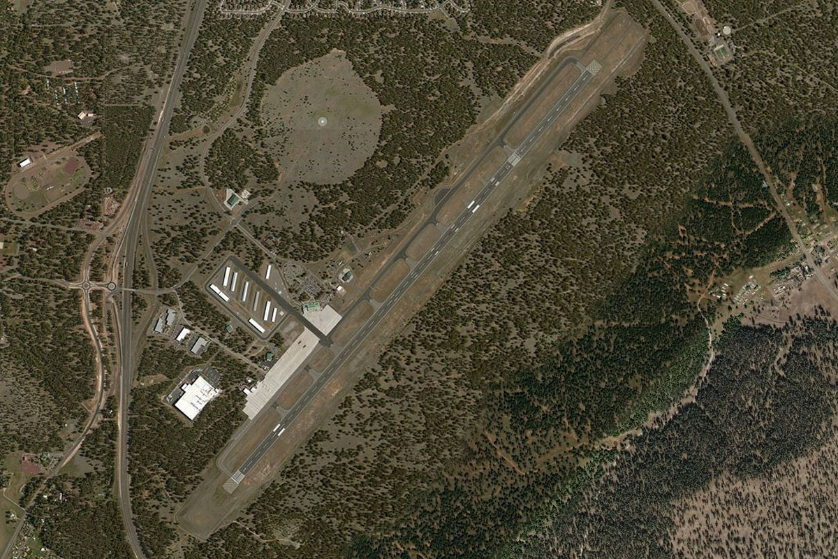
Distance: 4.07NM Bearing: 31° 2 minutes
You should easily spot Flagstaff airport, with more golf courses at each end of the runway
Leg 7
Flying from KFLG
Leg Distance: 67.5 Approximate time at 125kts: 32 minutes.
KFLG(KFLG) to Enden Mountain(POI26)
Distance: 10.12NM Bearing: 28° 5 minutes
Head northeast past the town and around to the eastern side of the mountain.
Enden Mountain(POI26) to Sunset Crater Volcano National Monument(POI27)
Distance: 11.43NM Bearing: 50° 5 minutes
Fly northwest towards the main group of volcanic craters
Sunset Crater Volcano National Monument(POI27) to S P Crater(POI28)
Distance: 20.03NM Bearing: 306° 10 minutes
Once you pass the craters, make a left turn to the northwest. In the distance you should see a dark patch on the ground, which is the ancient lava flow from S P Crater. Head northwest towards this crater, the northernmost of another crater group
S P Crater(POI28) to Valle(POI29)
Distance: 19.44NM Bearing: 260° 9 minutes
Head west from the lava flow and you will eventually meet up with the highway just before it reaches the town of Valle
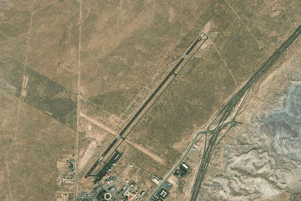
Valle(POI29) to 40G(40G)
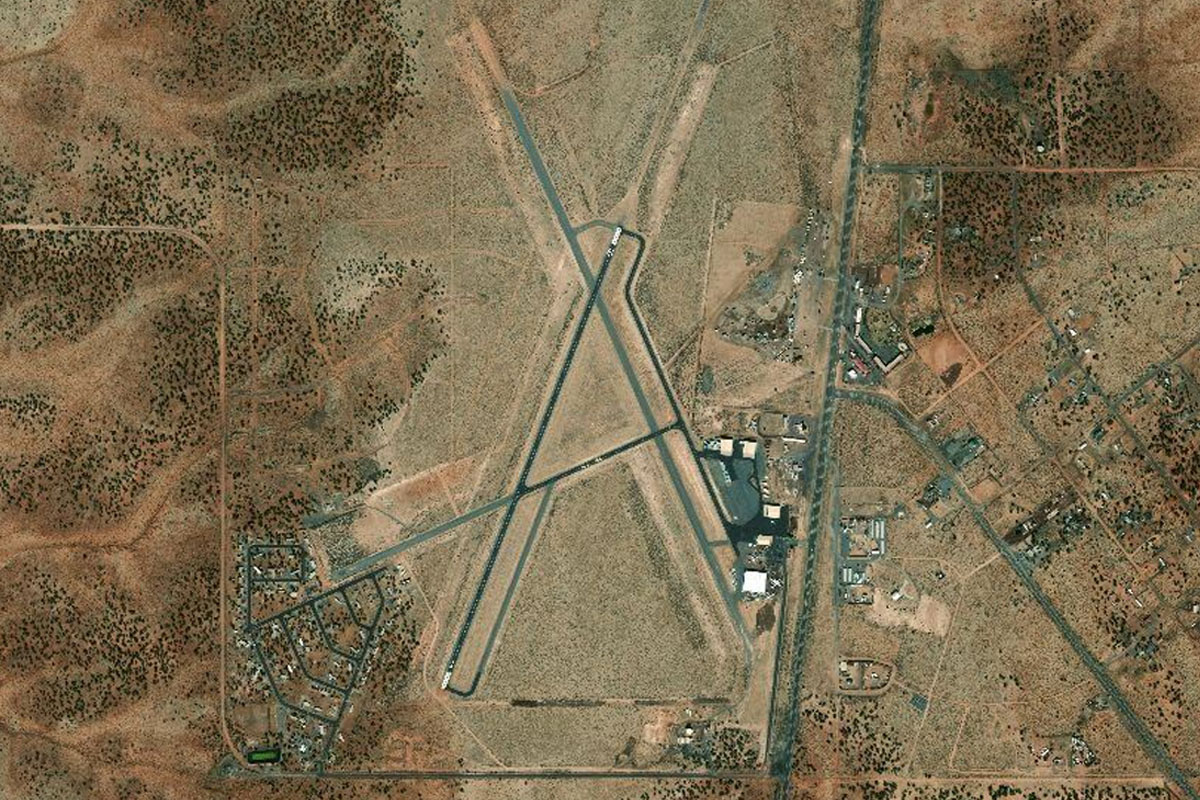
Distance: 6.48NM Bearing: 287° 3 minutes
The airport is easy to spot, at the intersection of the 2 main roads
Leg 8
Flying from 40G
Leg Distance: 18.46 Approximate time at 125kts: 9 minutes.
40G(40G) to US 180(POI30)
Distance: 5.97NM Bearing: 1° 3 minutes
After takeoff, follow highway 160 north
US 180(POI30) to Tusayan(POI31)
Distance: 10.8NM Bearing: 349° 5 minutes
Continue heading north. Once you pass the mountain to the right (Red Butte), you should just about see Grand Canyon airport to the left of the road ahead
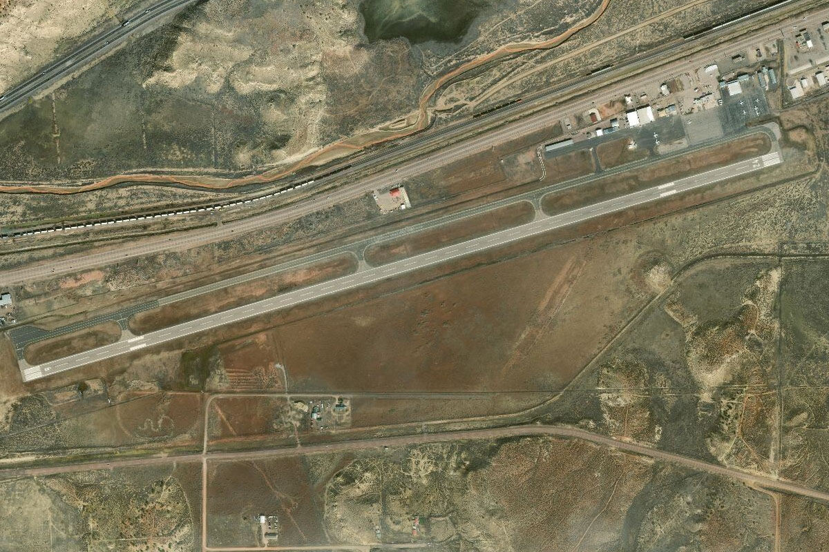
Tusayan(POI31) to KGCN(KGCN)
Distance: 1.69NM Bearing: 315° 1 minutes
Check your fuel here – this will be the last chance to fill up before we get to Las Vegas
Leg 9
Flying from KGCN
Leg Distance: 93.89 Approximate time at 125kts: 45 minutes.
KGCN(KGCN) to Grand Canyon(POI32)
Distance: 9.53NM Bearing: 26° 5 minutes
Head northeast after takeoff and head straight into the canyon. Then turn to the left for some adventure along the Colorado River
Grand Canyon(POI32) to Grand Canyon(POI33)
Distance: 3.05NM Bearing: 286° 1 minutes
Continue west along the canyon
Grand Canyon(POI33) to Grand Canyon(POI34)
Distance: 5.8NM Bearing: 257° 3 minutes
Follow the Colorado River west inside the canyon
Grand Canyon(POI34) to Grand Canyon(POI35)
Distance: 6.09NM Bearing: 297° 3 minutes
Continue along the river as it turns northwest
Grand Canyon(POI35) to Grand Canyon(POI36)
Distance: 5.03NM Bearing: 329° 2 minutes
Follow the canyon as it heads north
Grand Canyon(POI36) to Grand Canyon(POI37)
Distance: 2.25NM Bearing: 274° 1 minutes
Follow the canyon west
Grand Canyon(POI37) to Grand Canyon(POI38)
Distance: 3.24NM Bearing: 205° 2 minutes
Follow the canyon as it turns south
Grand Canyon(POI38) to Explorers Monument(POI39)
Distance: 1.46NM Bearing: 249° 1 minutes
Follow the canyon as it turns west, then north around Explorers Monument
Explorers Monument(POI39) to Grand Canyon(POI40)
Distance: 2.49NM Bearing: 343° 1 minutes
Keep following the river north
Grand Canyon(POI40) to Grand Canyon(POI41)
Distance: 3.05NM Bearing: 270° 1 minutes
Keep following the river west
Grand Canyon(POI41) to Grand Canyon(POI42)
Distance: 7.97NM Bearing: 11° 4 minutes
The river will slowly curve around to the north, then back to the west
Grand Canyon(POI42) to Grand Canyon(POI43)
Distance: 4.44NM Bearing: 282° 2 minutes
Keep following the river
Grand Canyon(POI43) to Grand Canyon(POI44)
Distance: 4.26NM Bearing: 253° 2 minutes
Keep following the river
Grand Canyon(POI44) to Grand Canyon(POI45)
Distance: 16.71NM Bearing: 228° 8 minutes
Stay along the river as it heads southwest
Grand Canyon(POI45) to Lava Falls(POI46)
Distance: 8.58NM Bearing: 238° 4 minutes
Keep following the river as it cuts through the lava flows of the Uinkaret volcanic field. Start gaining enough altitude to get level with the canyon rim
Lava Falls(POI46) to Uinkaret Volcanic Field(POI47)
Distance: 6.09NM Bearing: 261° 3 minutes
Fly directly west over the ancient lava field into a small valley with a dry creek bed at its center, then turn north along the valley
Uinkaret Volcanic Field(POI47) to 1Z1(1Z1)
Distance: 3.85NM Bearing: 343° 2 minutes
The airstrip is up ahead to the right of the creek bed
Leg 10
Flying from 1Z1
Leg Distance: 41.42 Approximate time at 125kts: 20 minutes.
1Z1(1Z1) to Grassy Mountain(POI48)
Distance: 10.97NM Bearing: 258° 5 minutes
Turn to the left after takeoff and head west over a deep valley. Up ahead you'll see a dark hilly area which is Grassy Mountain, keep this to your right.
Grassy Mountain(POI48) to Snap Point(POI49)
Distance: 16.53NM Bearing: 248° 8 minutes
Ahead and slightly to the left you will see another dark hilly area. Head towards that, and then directly west from there after a few miles you will see a horseshoe shaped hill jutting out into the valley. Head for the northern edge of this hill
Snap Point(POI49) to Colorado River(POI50)
Distance: 7.58NM Bearing: 235° 4 minutes
Turning more to the southwest, you should just start to see the Colorado river and beyond that, the eastern arm of Lake Mead
Colorado River(POI50) to L25(L25)
Distance: 6.34NM Bearing: 228° 3 minutes
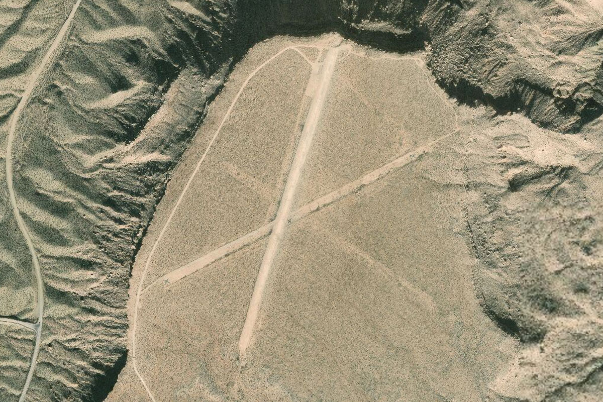
From above the river you should see the star shaped layout Pearce Ferry airstrip a few miles ahead, which sits on top of a flat bluff overlooking the lake
Leg 11
Flying from L25
Leg Distance: 60.44 Approximate time at 125kts: 29 minutes.
L25(L25) to Lake Mead(POI51)
Distance: 11.34NM Bearing: 257° 5 minutes
After takeoff, head west between the two mountains towards the main body of Lake Mead
Lake Mead(POI51) to Guardian Peak(POI52)
Distance: 14.02NM Bearing: 276° 7 minutes
Turn slightly northwest and fly to the far side of the lake to where it narrows and cuts through the mountains
Guardian Peak(POI52) to Lake Mead(POI53)
Distance: 6.13NM Bearing: 242° 3 minutes
Fly through the narrow part of the lake, then keeping left, follow the bank around to the southwest
Lake Mead(POI53) to Lake Mead(POI54)
Distance: 6.11NM Bearing: 191° 3 minutes
You'll see another area where the lake narrows ahead. Fly though here and follow the valley
Lake Mead(POI54) to Hoover Dam(POI55)
Distance: 1.31NM Bearing: 213° 1 minutes
Fly over Hoover Dam and continue following the Colorado River below. Don't fly under the bridge
Hoover Dam(POI55) to Henderson(POI56)
Distance: 9.71NM Bearing: 260° 5 minutes
Once you pass the bridge, turn to the west and fly over the mountains. The first population center you will arrive at is Henderson. From here you'll see a long straight highway heading northwest
Henderson(POI56) to Boulder Highway(POI57)
Distance: 5.31NM Bearing: 305° 3 minutes
Following the straight line of the Boulder Highway north west towards Las Vegas. Keep looking left and you'll soon be lined up for an approach into Las Vegas airport
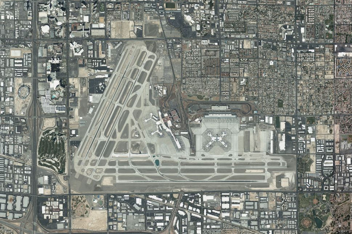
Boulder Highway(POI57) to KLAS(KLAS)
Distance: 6.51NM Bearing: 262° 3 minutes
Head west to the airport