Welcome to stage 17 of the tour, this time through the heart of Central America, as you explore the countries of Belize, Guatemala, Honduras, El Salvador and Nicaragua. Ancient ruins from the Maya civilization featured on this journey include Xunantunich, Yaxha, Tikal, and Copán, along with the modern capital cities of Belmopan, Guatemala City, Tegucigalpa, San Salvador and Managua. The natural world is not to be outdone here. In a land dominated by volcanoes, lake filled craters and mountain forests, there’s no shortage of beautiful sights on offer.
Total Legs: 24 Total Distance: 1101 Total Time(125kts): 8 hours 48 minutes
Leg 1
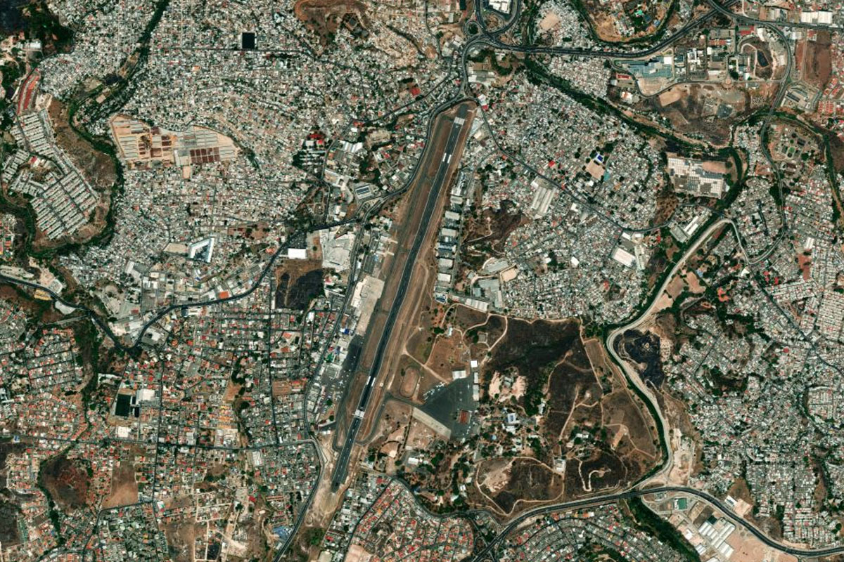
Flying from MZBE
Leg Distance: 37.91 Approximate time at 125kts: 18 minutes.
MZBE(MZBE) to George Price Highway(POI1)
Distance: 6.39NM Bearing: 245° 3 minutes
After takeoff, head southwest over the city and meet up with the George Price Highway heading west
George Price Highway(POI1) to Hattieville(POI2)
Distance: 5.56NM Bearing: 266° 3 minutes
Follow the highway west
Hattieville(POI2) to George Price Highway(POI3)
Distance: 17.26NM Bearing: 232° 8 minutes
Stay with the highway as it heads southwest towards Belmopan
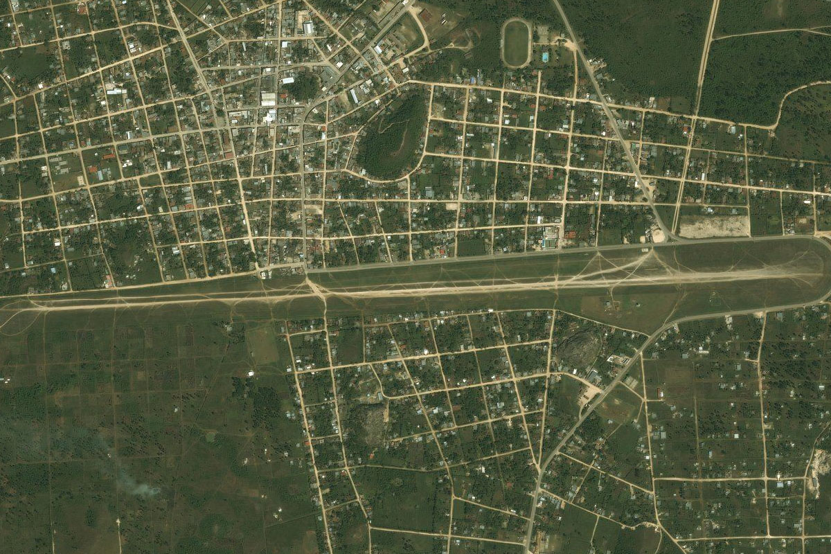
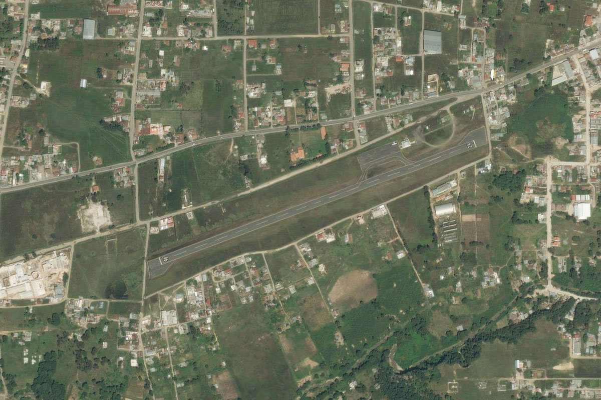
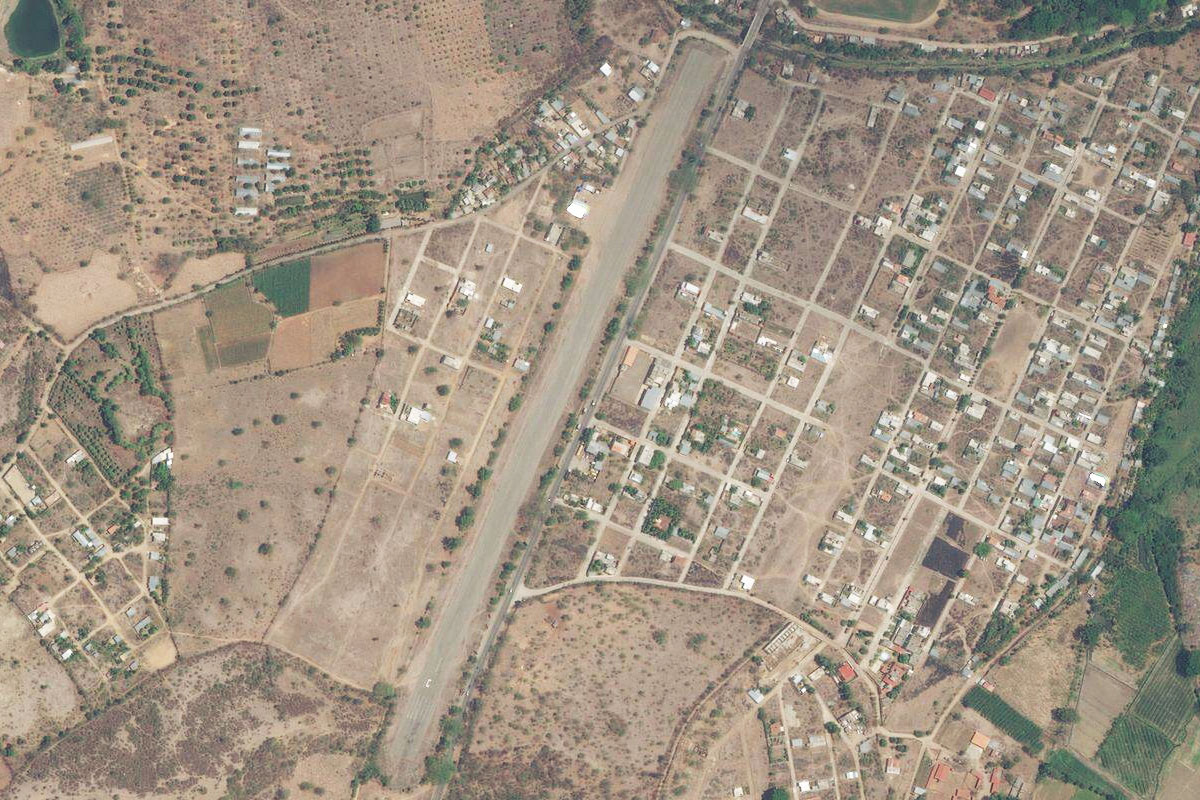
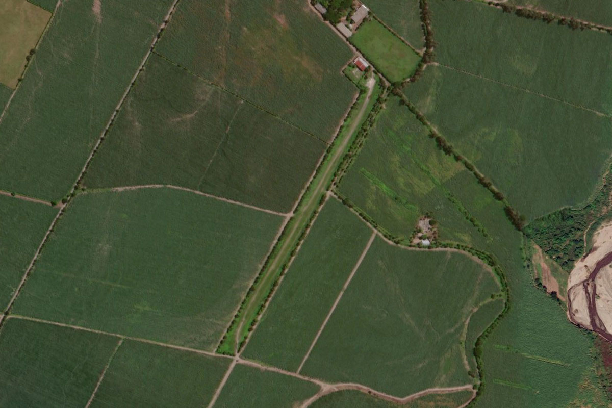
George Price Highway(POI3) to MBCV(MBCV)
Distance: 8.7NM Bearing: 268° 4 minutes
Hector Silva Airstrip lies in between the highway and the northern edge of the town
Leg 2
Flying from MBCV
Leg Distance: 31.61 Approximate time at 125kts: 15 minutes.
MBCV(MBCV) to Thousand Foot Falls(POI4)
Distance: 12.25NM Bearing: 183° 6 minutes
Head south towards the mountains after takeoff, gaining enough altitude to fly over. When you reach the first large valley, turn east and head towards the airstrip cut into the forest
Thousand Foot Falls(POI4) to Pine Ridge Forest(POI5)
Distance: 4.78NM Bearing: 268° 2 minutes
As you head east to fly over the dirt airstrip, you will pass the popular tourist attraction of 1000 foot falls, Central America's largest waterfall
Pine Ridge Forest(POI5) to Macal River(POI6)
Distance: 12.02NM Bearing: 273° 6 minutes
Head west until you reach the Macal River running north out of the mountains
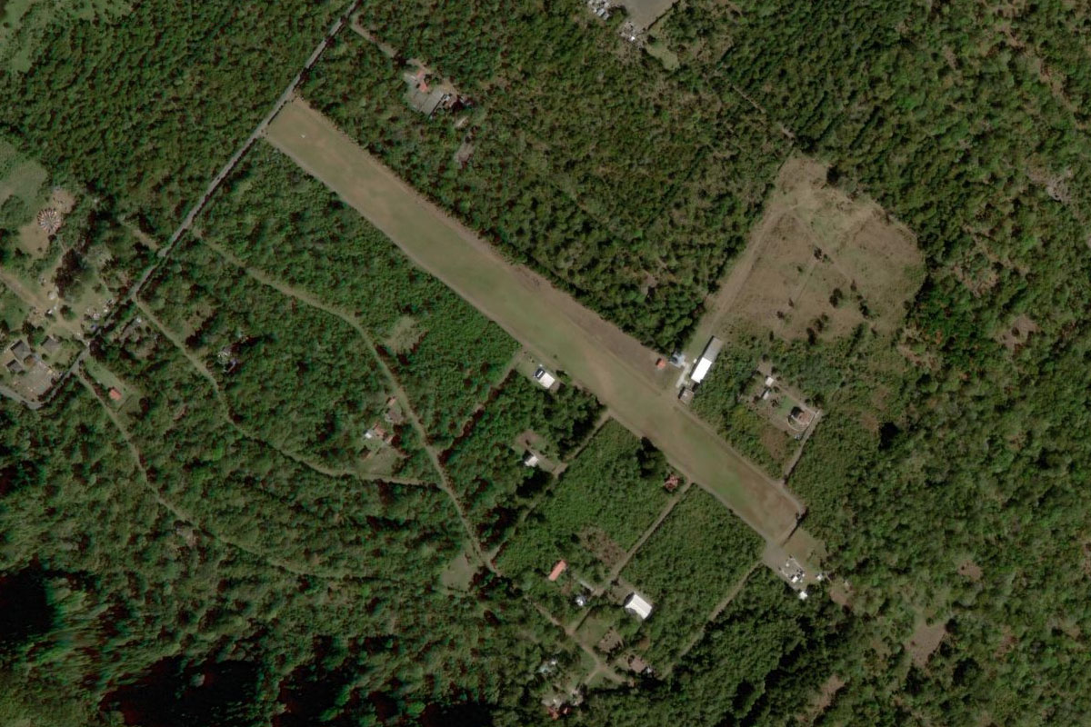
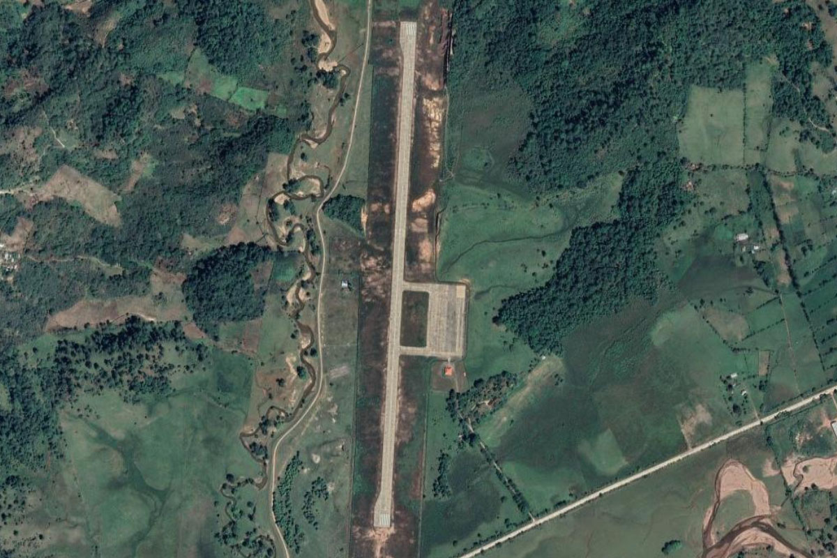
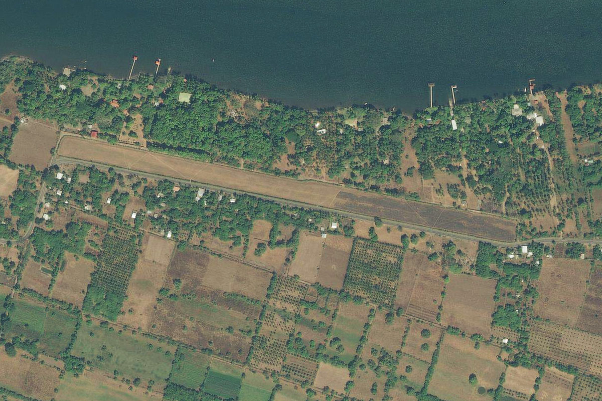
Macal River(POI6) to MZMF(MZMF)
Distance: 2.56NM Bearing: 328° 1 minutes
Turn northwest at the river and head to the small paved airstrip at Maya Flats
Leg 3
Flying from MZMF
Leg Distance: 59 Approximate time at 125kts: 28 minutes.
MZMF(MZMF) to Xunantunich(POI7)
Distance: 2.49NM Bearing: 256° 1 minutes
Head west (runway heading) after takeoff will take you to the Xunantunich Mayan Ruins a couple of miles away next to the Guatemalan border
Xunantunich(POI7) to Laguna Sacnab(POI8)
Distance: 11.76NM Bearing: 263° 6 minutes
Head west until you reach a chain of lakes
Laguna Sacnab(POI8) to Yaxha(POI9)
Distance: 3.26NM Bearing: 285° 2 minutes
Head along the northern edge of the largest lake, to the ancient Mayan city of Yaxha
Yaxha(POI9) to Laguna de Yaxha(POI10)
Distance: 2.65NM Bearing: 255° 1 minutes
Head to the western end of the largest lake, Laguna de Yaxha, then turn to the northwest
Laguna de Yaxha(POI10) to Tikal(POI11)
Distance: 13.34NM Bearing: 316° 6 minutes
Head northwest over the Guatemalan forest to the famous ancient Mayan city of Tikal
Tikal(POI11) to Tikal(POI12)
Distance: 1.22NM Bearing: 268° 1 minutes
Just west of the commercial area are the ancient ruins, which was also a filming location for Star Wars (1977)
Tikal(POI12) to Lago Peten Itza(POI13)
Distance: 18.44NM Bearing: 226° 9 minutes
From Tikal, head southwest back over the forest to the third largest lake in Guatemala, Lago Petén Itzá
Lago Peten Itza(POI13) to MGMM(MGMM)
Distance: 5.84NM Bearing: 185° 3 minutes
Head south over the lake to Mundo Maya Intl, which serves the large town of Flores
Leg 4
Flying from MGMM
Leg Distance: 48.29 Approximate time at 125kts: 23 minutes.
MGMM(MGMM) to Santa Ana(POI14)
Distance: 7.21NM Bearing: 159° 3 minutes
After takeoff, head southeast to the nearby town of Santa Ana
Santa Ana(POI14) to El Chal(POI15)
Distance: 13.42NM Bearing: 136° 6 minutes
Follow the main highway southeast from Santa Ana to the town of El Chal
El Chal(POI15) to Dolores(POI16)
Distance: 13.9NM Bearing: 114° 7 minutes
The highway will turn towards the east and continue through the hills towards the town of Dolores
Dolores(POI16) to Poptun(POI17)
Distance: 10.86NM Bearing: 182° 5 minutes
Follow the highway as it turns south towards the large town of Poptún
Poptun(POI17) to MGPP(MGPP)
Distance: 2.9NM Bearing: 155° 1 minutes
Poptún airport cuts through the center of town
Leg 5
Flying from MGPP
Leg Distance: 44.15 Approximate time at 125kts: 21 minutes.
MGPP(MGPP) to San Luis(POI18)
Distance: 7.72NM Bearing: 189° 4 minutes
Follow the road heading south from the town, across the hills to the town of San Luis
San Luis(POI18) to Actela(POI19)
Distance: 9.83NM Bearing: 194° 5 minutes
Follow the road south from San Luis to Actela, where it will turn to the west
Actela(POI19) to Rio Santa Isabel o Cancuen(POI20)
Distance: 10.68NM Bearing: 254° 5 minutes
Follow the base of the hills west along with the Río Santa Isabel o Cancuén
Rio Santa Isabel o Cancuen(POI20) to MG13(MG13)
Distance: 15.92NM Bearing: 227° 8 minutes
When you reach the western end of the hills, turn southwest to the town of Fray Bartolomé de las Casas, and the airport at its southern edge
Leg 6
Flying from MG13
Leg Distance: 38.25 Approximate time at 125kts: 18 minutes.
MG13(MG13) to Cojaj(POI21)
Distance: 21.56NM Bearing: 237° 10 minutes
After takeoff, continue southwest over the mountains, aiming for the tallest of the nearby hills
Cojaj(POI21) to Coban(POI22)
Distance: 13.83NM Bearing: 235° 7 minutes
Continue southwest to the town of Coban
Coban(POI22) to MGCB(MGCB)
Distance: 2.86NM Bearing: 264° 1 minutes
Coban airport is on the western side of town
Leg 7
Flying from MGCB
Leg Distance: 51.11 Approximate time at 125kts: 25 minutes.
MGCB(MGCB) to Rio Chixoy(POI23)
Distance: 9.45NM Bearing: 213° 5 minutes
Head southwest (runway heading) after takeoff, until you reach the valley of the Chixoy River
Rio Chixoy(POI23) to Rio Chixoy(POI24)
Distance: 12NM Bearing: 279° 6 minutes
Follow the river valley west
Rio Chixoy(POI24) to Cunen(POI25)
Distance: 17.93NM Bearing: 263° 9 minutes
When the river turns north, continue west along the valley as it climbs. You will pass a couple of towns along the way before reaching the town of Cunén which sits in a lower hollow
Cunen(POI25) to Nebaj(POI26)
Distance: 7.11NM Bearing: 296° 3 minutes
From Cunén, turn northwest and around the tallest part of the mountain into the next valley
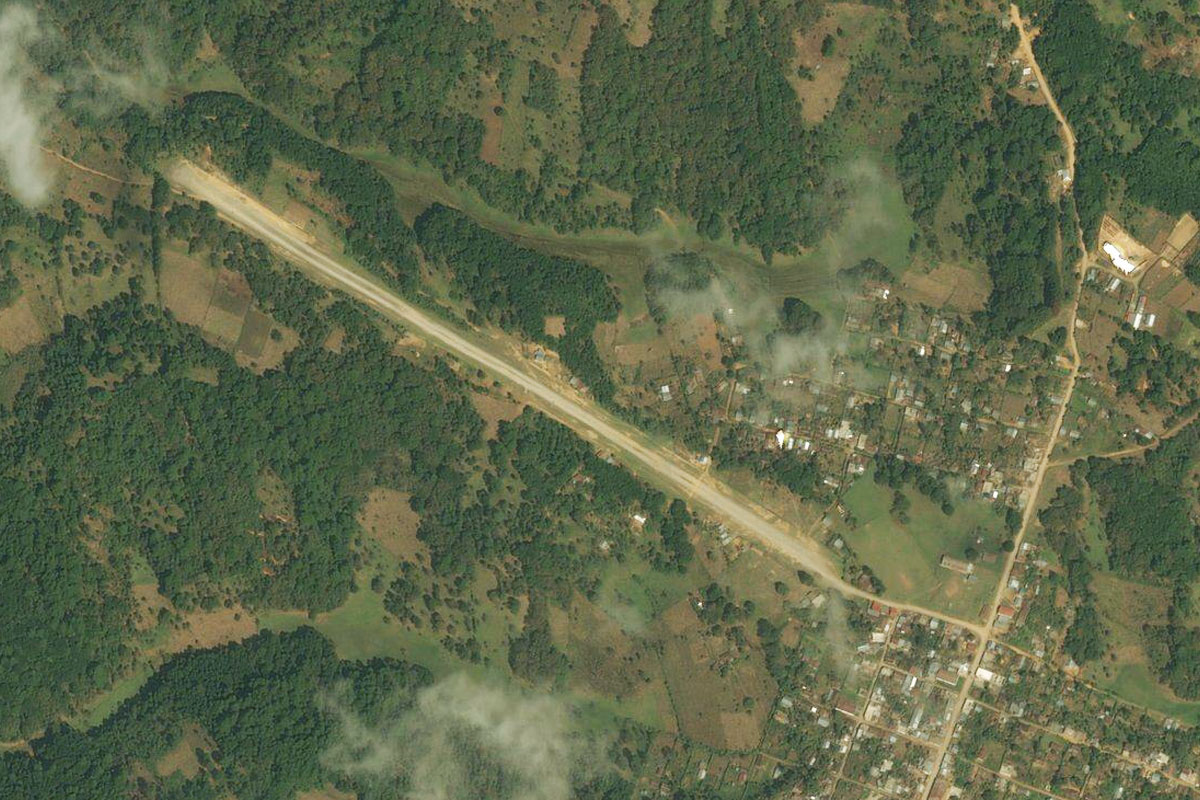
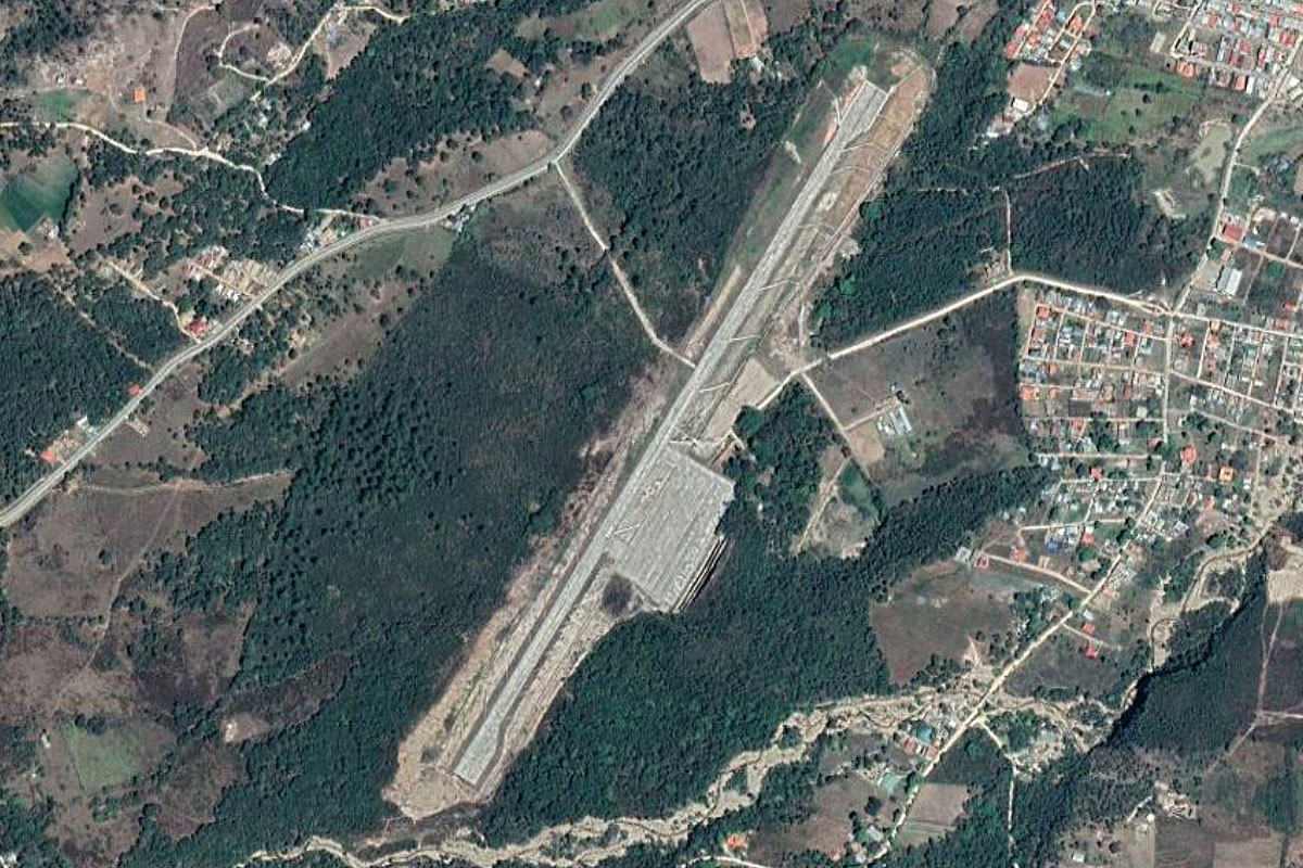
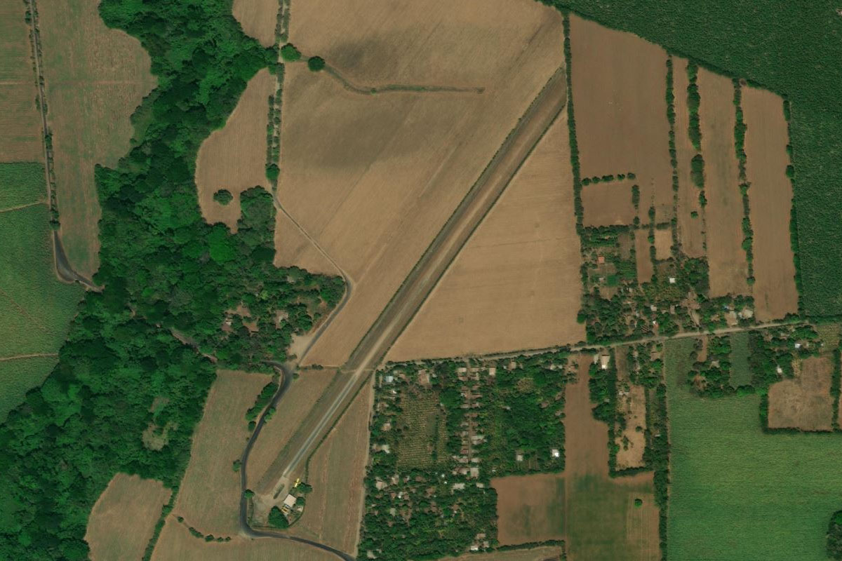
Nebaj(POI26) to MGNE(MGNE)
Distance: 4.62NM Bearing: 325° 2 minutes
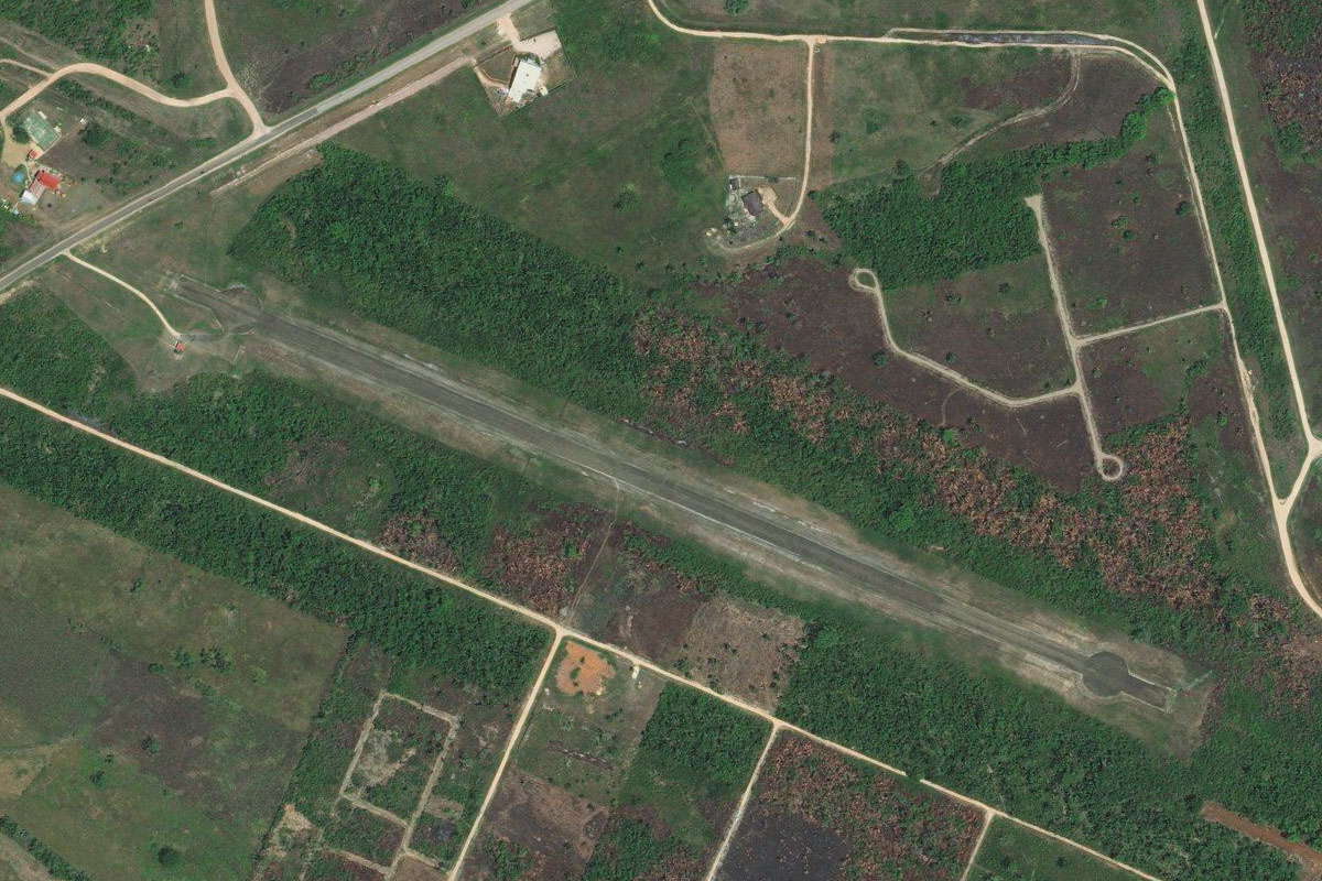
A couple of miles north of the town of Nebaj, is the challenging airstrip which sits next to a cliff
Leg 8
Flying from MGNE
Leg Distance: 26.3 Approximate time at 125kts: 13 minutes.
MGNE(MGNE) to Parraxtut(POI27)
Distance: 6.61NM Bearing: 184° 3 minutes
After takeoff, head south and clear the mountains before turning west
Parraxtut(POI27) to Huehuetenango(POI28)
Distance: 14.41NM Bearing: 271° 7 minutes
Fly west along the side of the mountains, then head to the city of Huehuetenango
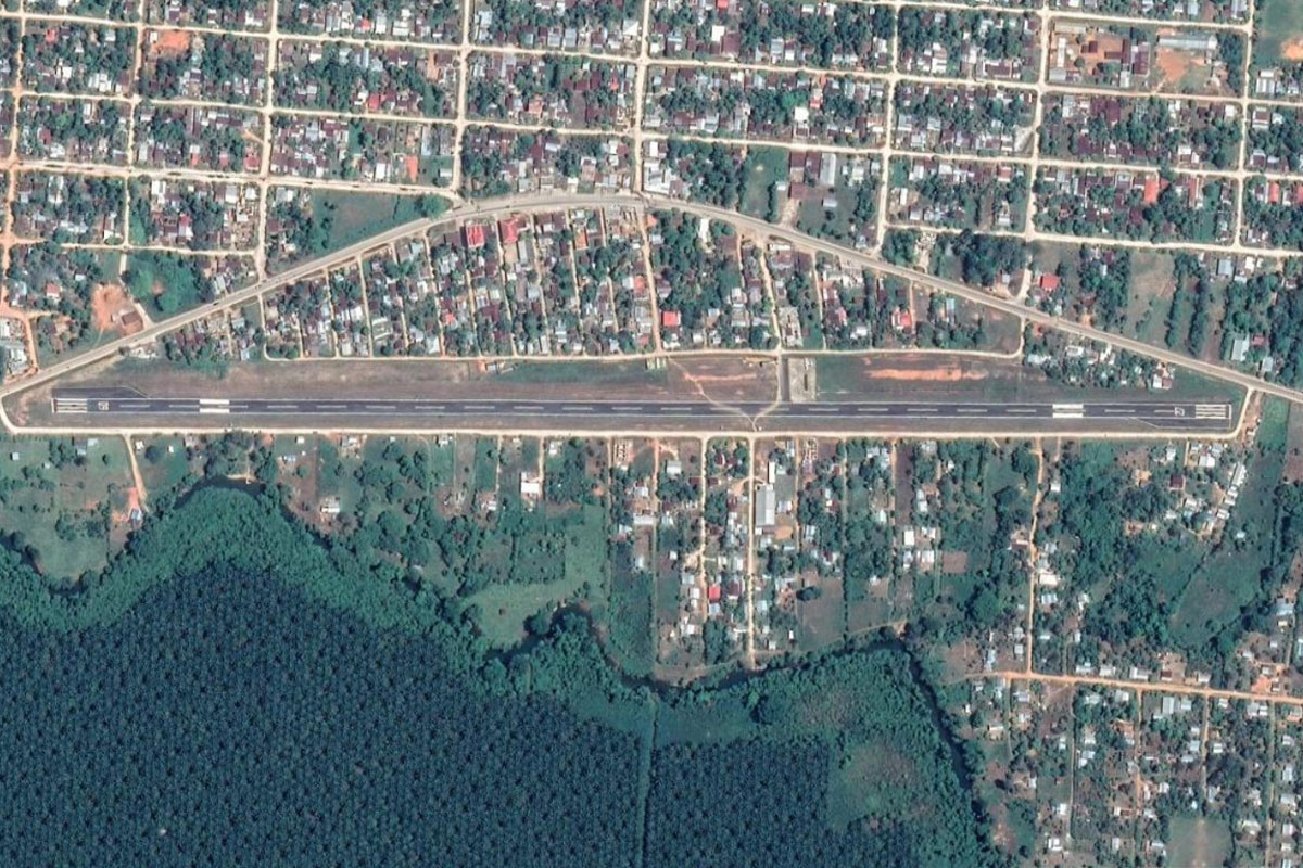
Huehuetenango(POI28) to MGHT(MGHT)
Distance: 5.28NM Bearing: 251° 3 minutes
The airport is on the western side of the town
Leg 9
Flying from MGHT
Leg Distance: 27.1 Approximate time at 125kts: 13 minutes.
MGHT(MGHT) to Quetzaltenango(POI29)
Distance: 25.83NM Bearing: 180° 12 minutes
Head south towards the perfect cone shaped Santa Maria Volcano in the distance. Just north of the volcano you will reach the city of Quetzaltenango
Quetzaltenango(POI29) to MGQZ(MGQZ)
Distance: 1.27NM Bearing: 163° 1 minutes
You should see the airport to your left as you approach the northern edge of the city
Leg 10
Flying from MGQZ
Leg Distance: 33.63 Approximate time at 125kts: 16 minutes.
MGQZ(MGQZ) to Santa Maria Volcano(POI30)
Distance: 10.82NM Bearing: 191° 5 minutes
Head south between the Santa Maria and Santo Tomas Volcanoes. On the southern side of Santa Maria Volcano is Santiaguito, which is still active
Santa Maria Volcano(POI30) to Volcan Santo Tomas(POI31)
Distance: 7.54NM Bearing: 100° 4 minutes
Head east past the Volcán Santo Tomás. Maintain your altitude as you will be heading to Lago Aitilan
Volcan Santo Tomas(POI31) to Lago Atitlan(POI32)
Distance: 8.23NM Bearing: 73° 4 minutes
Turn northeast and head to Lake Atitlan
Lago Atitlan(POI32) to Volcan San Pedro(POI33)
Distance: 3.62NM Bearing: 131° 2 minutes
Turn right and follow the base of Volcan San Pedro to the southeast
Volcan San Pedro(POI33) to MGST(MGST)
Distance: 3.42NM Bearing: 194° 2 minutes
Continue turning around to the south and into the narrow bay. At the southeastern edge of the bay is a small grass airfield
Leg 11
Flying from MGST
Leg Distance: 54.64 Approximate time at 125kts: 26 minutes.
MGST(MGST) to Volcan Atitlan(POI34)
Distance: 4.82NM Bearing: 152° 2 minutes
After takeoff, head southeast to the south side of Volcan Atitlan
Volcan Atitlan(POI34) to Volcan de Fuego(POI35)
Distance: 19.39NM Bearing: 107° 9 minutes
Head east towards the southern side of the next large volcano, Volcan de Fuego, which is still active with the most recent large eruption in 2018
Volcan de Fuego(POI35) to Volcan de Agua(POI36)
Distance: 8.48NM Bearing: 90° 4 minutes
A few miles east of Fuego, is another perfect cone shaped stratovolcano, Volcan de Agua
Volcan de Agua(POI36) to Pacaya(POI37)
Distance: 8.91NM Bearing: 114° 4 minutes
A slight turn to the southeast will take you towards Pacaya Volcano, another active volcano and a popular tourist attraction
Pacaya(POI37) to Guatemala City(POI38)
Distance: 9.28NM Bearing: 17° 4 minutes
Turn to the north around the volcano and head for Guatemala City, the capital and largest city in Guatemala
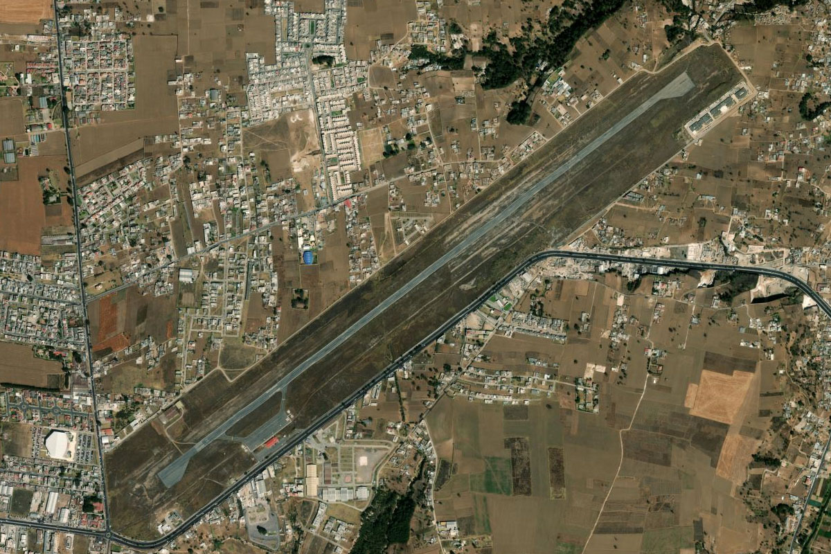
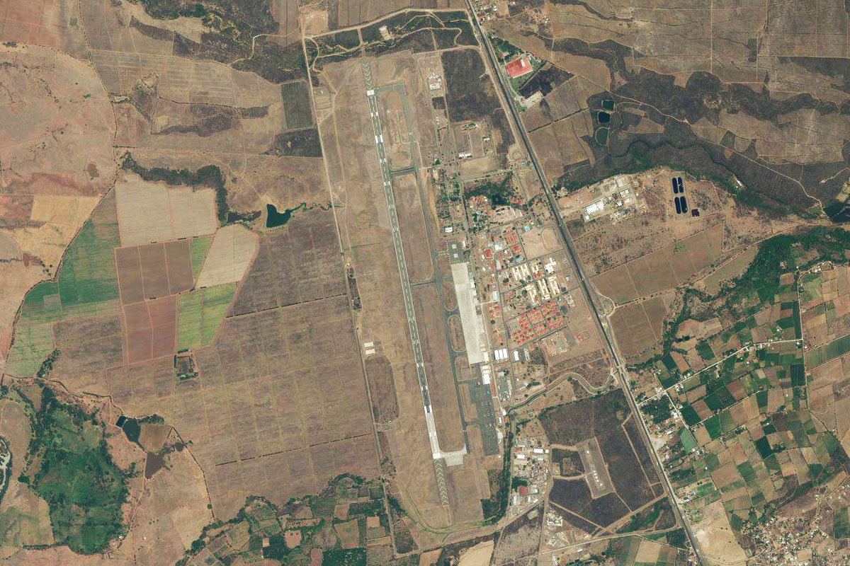
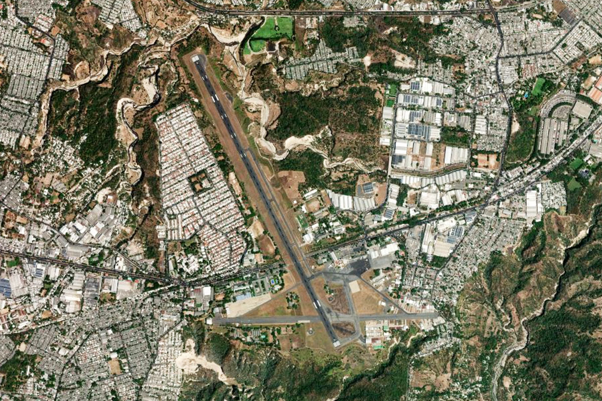
Guatemala City(POI38) to MGGT(MGGT)
Distance: 3.76NM Bearing: 23° 2 minutes
The international airport lies just south of the downtown area
Leg 12
Flying from MGGT
Leg Distance: 85.16 Approximate time at 125kts: 41 minutes.
MGGT(MGGT) to Guatemala City(POI39)
Distance: 4.03NM Bearing: 16° 2 minutes
After takeoff, head north for a closer look at the downtown area
Guatemala City(POI39) to Contreras(POI40)
Distance: 7.73NM Bearing: 92° 4 minutes
From the city, head east towards the nearby mountain range
Contreras(POI40) to Concepcion Pinula(POI41)
Distance: 7.55NM Bearing: 178° 4 minutes
Fly south along the western side of the mountains
Concepcion Pinula(POI41) to Laguna de Ayarza(POI42)
Distance: 15.55NM Bearing: 112° 7 minutes
When you come to the southern end of the mountain range near some golf courses, turn east and head to the crater lake of Laguna de Ayarza
Laguna de Ayarza(POI42) to Volcan Suchitan(POI43)
Distance: 20.2NM Bearing: 93° 10 minutes
From the lake, head east to Volcan Suchitan
Volcan Suchitan(POI43) to Volcan Ipala(POI44)
Distance: 12.26NM Bearing: 41° 6 minutes
Turn northeast and head for the smaller Volcan Ipala, which has a crater lake at its summit
Volcan Ipala(POI44) to MGCH(MGCH)
Distance: 17.84NM Bearing: 23° 9 minutes
Head north along the river valley to the town of Chiquimula. The airstrip is a couple of miles north of the town
Leg 13
Flying from MGCH
Leg Distance: 33.34 Approximate time at 125kts: 16 minutes.
MGCH(MGCH) to Rio Grande(POI45)
Distance: 4.37NM Bearing: 60° 2 minutes
After takeoff, head northwest into the valley of the Rio Grande
Rio Grande(POI45) to Jocotan(POI46)
Distance: 5.3NM Bearing: 125° 3 minutes
Follow the river southeast through the valley to the town of Jocotán
Jocotan(POI46) to Rio Grande(POI47)
Distance: 7.42NM Bearing: 67° 4 minutes
The river will turn northeast, then head east past a mountain
Rio Grande(POI47) to Copan(POI48)
Distance: 6.48NM Bearing: 106° 3 minutes
When the river turns away to the south, follow the highway into Honduras, which is winding its way east to Copán, another ancient Maya city
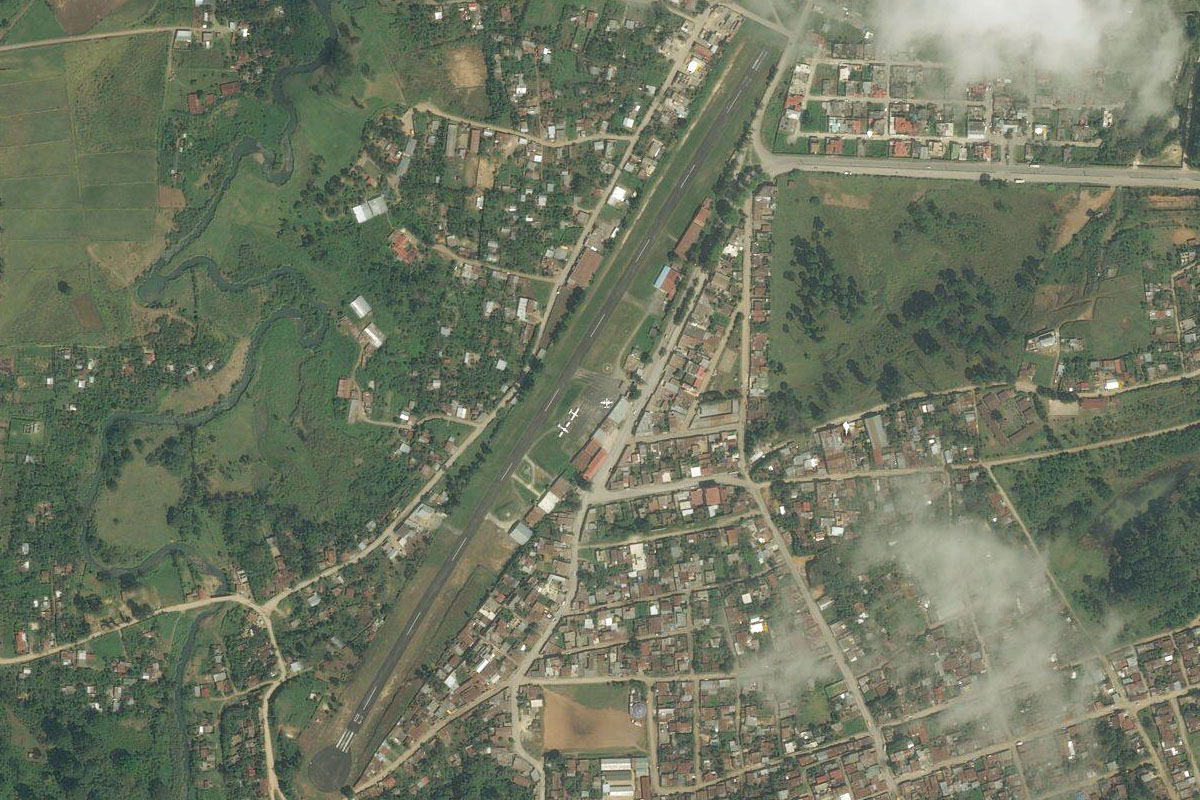
Copan(POI48) to MHRU(MHRU)
Distance: 9.77NM Bearing: 62° 5 minutes
Follow the highway northeast through the hills. You will soon come to the airport which sits on the north side of the road
Leg 14
Flying from MHRU
Leg Distance: 33.17 Approximate time at 125kts: 16 minutes.
MHRU(MHRU) to Santa Rosa(POI49)
Distance: 15.94NM Bearing: 124° 8 minutes
After takeoff, head southeast to the town of Santa Rosa, which overlooks the Rio Higuito valley below
Santa Rosa(POI49) to Gracias(POI50)
Distance: 13.95NM Bearing: 129° 7 minutes
Continue southeast, following the highway and Rio Arcagual to the town of Gracias
Gracias(POI50) to MHGS(MHGS)
Distance: 3.28NM Bearing: 189° 2 minutes
The airport is just southwest of the town
Leg 15
Flying from MHGS
Leg Distance: 62.47 Approximate time at 125kts: 30 minutes.
MHGS(MHGS) to Opalaca Biological Reserve(POI51)
Distance: 12.26NM Bearing: 96° 6 minutes
Fly east between the two mountain ranges which lie in the Opalaca Biological Reserve
Opalaca Biological Reserve(POI51) to Jesus de Otoro(POI52)
Distance: 20.38NM Bearing: 91° 10 minutes
Continue east across the mountains towards the northern end of a wide valley near the town of Jesús de Otoro
Jesus de Otoro(POI52) to Siguatepeque(POI53)
Distance: 10.54NM Bearing: 80° 5 minutes
Turning slightly north, head over to the next valley and the larger city of Siguatepeque
Siguatepeque(POI53) to Comayagua(POI54)
Distance: 15.45NM Bearing: 126° 7 minutes
Follow the highway southeast to the city of Comayagua
Comayagua(POI54) to MHSC(MHSC)
Distance: 3.84NM Bearing: 166° 2 minutes
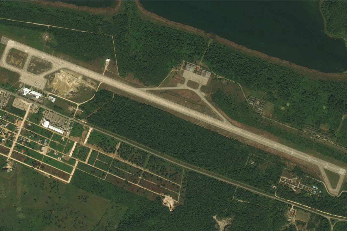
Soto Cano Air Base is a few miles south of Comayagua, and is now Palmerola International Airport which is intended to eventually replace Toncontín Airport
Leg 16
Flying from MHSC
Leg Distance: 38.57 Approximate time at 125kts: 19 minutes.
MHSC(MHSC) to CA-5(POI55)
Distance: 7.19NM Bearing: 153° 3 minutes
After takeoff, follow the highway southeast towards the mountains
CA-5(POI55) to Zambrano(POI56)
Distance: 9.16NM Bearing: 91° 4 minutes
Follow the highway east across the mountains
Zambrano(POI56) to Tegucigalpa(POI57)
Distance: 14.62NM Bearing: 138° 7 minutes
Follow the highway as it turns southeast towards Tegucigalpa
Tegucigalpa(POI57) to Suyapa(POI58)
Distance: 4.01NM Bearing: 101° 2 minutes
Head east for a closer look at the city. Just southeast of the city at the foot of the mountains, is the beautiful Basilica de Nuestra Señora De Suyapa
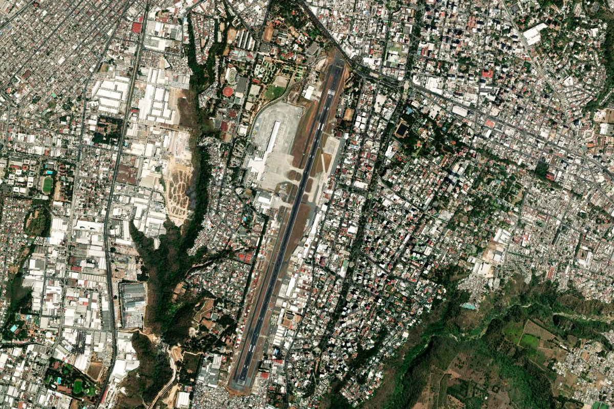
Suyapa(POI58) to MHTG(MHTG)
Distance: 3.59NM Bearing: 243° 2 minutes
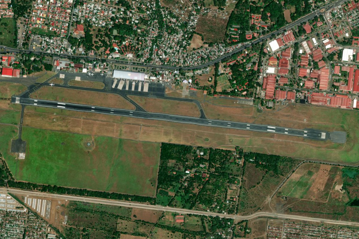
Toncontin International Airport is at the southern end of the city, and considered one of the most dangerous airport approaches in the world for larger aircraft
Leg 17
Flying from MHTG
Leg Distance: 41.29 Approximate time at 125kts: 20 minutes.
MHTG(MHTG) to Cerro de Hula Wind Farm(POI59)
Distance: 6.17NM Bearing: 179° 3 minutes
After takeoff, head south until you reach the Cerro de Hula Wind Farm, Central America's largest wind farm
Cerro de Hula Wind Farm(POI59) to Rio Sonta(POI60)
Distance: 17.86NM Bearing: 215° 9 minutes
Turn to the southwest and follow the Sonta River through the mountains to Lago Jose Cecilio del Valle, which has a hydroelectric power plant at its southern end
Rio Sonta(POI60) to Pespire(POI61)
Distance: 8.03NM Bearing: 182° 4 minutes
Follow the river and highway south
Pespire(POI61) to MHSL(MHSL)
Distance: 9.23NM Bearing: 210° 4 minutes
As the road and river turn southwest, continue to the port town of San Lorenzo, with the dirt airstrip on the western side of town
Leg 18
Flying from MHSL
Leg Distance: 61.71 Approximate time at 125kts: 30 minutes.
MHSL(MHSL) to Tiger Island(POI62)
Distance: 13.03NM Bearing: 232° 6 minutes
After takeoff, head southwest to the lagoon, and between the volcanic island peaks of Cerro Tigre and Zacate Grande
Tiger Island(POI62) to Conchagua(POI63)
Distance: 12.21NM Bearing: 277° 6 minutes
Head west along the lagoon into El Salvador, and past the Volcan de Conchagua
Conchagua(POI63) to San Miguel Volcano(POI64)
Distance: 26.01NM Bearing: 286° 12 minutes
Head west to the prominent San Miguel Volcano
San Miguel Volcano(POI64) to Volcan Chinameca(POI65)
Distance: 3.84NM Bearing: 316° 2 minutes
Northwest of Volcan San Miguel is the smaller, tree covered Volcan Chinameca
Volcan Chinameca(POI65) to MSPT(MSPT)
Distance: 6.62NM Bearing: 11° 3 minutes
Head north to the small town of El Platanar, and the airfield at its northwestern edge
Leg 19
Flying from MSPT
Leg Distance: 51.88 Approximate time at 125kts: 25 minutes.
MSPT(MSPT) to El Tigre(POI66)
Distance: 8.88NM Bearing: 233° 4 minutes
After takeoff, head southwest towards another volcanic mountain, El Tigre
El Tigre(POI66) to Tecapa(POI67)
Distance: 4.28NM Bearing: 272° 2 minutes
Head west to the nearby Tecapa Volcano, with the picturesque Laguna de Alegria near the summit
Tecapa(POI67) to Volcan San Vicente(POI68)
Distance: 20.83NM Bearing: 291° 10 minutes
A slight turn to the northwest will point you to the twin peaked Volcan San Vicente, El Salvador's second highest volcano. Pass by its north side
Volcan San Vicente(POI68) to Lago de Ilopango(POI69)
Distance: 13.29NM Bearing: 285° 6 minutes
Continue west to Lake Ilopango
Lago de Ilopango(POI69) to MSSS(MSSS)
Distance: 4.6NM Bearing: 289° 2 minutes
Continue west over the lake to Ilopango Airport
Leg 20
Flying from MSSS
Leg Distance: 32.72 Approximate time at 125kts: 16 minutes.
MSSS(MSSS) to Volcan San Salvador(POI70)
Distance: 9.91NM Bearing: 283° 5 minutes
After takeoff, head west over the country's capital city, San Salvador, before a flyover of the large crater of Volcan San Salvador
Volcan San Salvador(POI70) to Puerto de la Libertad(POI71)
Distance: 15.04NM Bearing: 183° 7 minutes
From the volcano, head south to the coast
Puerto de la Libertad(POI71) to Rio Tihuapa(POI72)
Distance: 6.02NM Bearing: 116° 3 minutes
Head east along the coast to the mouths of two rivers, El Chichiguiste and Tihuapa
Rio Tihuapa(POI72) to MSRO(MSRO)
Distance: 1.75NM Bearing: 30° 1 minutes
When you pass the first river mouth, turn northeast to the small grass airstrip a couple of miles from the shore
Leg 21
Flying from MSRO
Leg Distance: 41.39 Approximate time at 125kts: 20 minutes.
MSRO(MSRO) to La Zunganera(POI73)
Distance: 5.71NM Bearing: 134° 3 minutes
After takeoff, head southeast back to the coast
La Zunganera(POI73) to Jaltepeque Estuary(POI74)
Distance: 15.49NM Bearing: 116° 7 minutes
Follow the coast southeast to Jaltepeque estuary, near the popular beach area of Costa del Sol
Jaltepeque Estuary(POI74) to MSCM(MSCM)
Distance: 20.19NM Bearing: 105° 10 minutes
Continue along the coast past the mouth of the Lempa River. You'll soon be flying along a narrow peninsula, with the small grass airstrip on the inland (north) side next to Jiquilisco Bay
Leg 22
Flying from MSCM
Leg Distance: 37.72 Approximate time at 125kts: 18 minutes.
MSCM(MSCM) to El Salamar(POI75)
Distance: 18.05NM Bearing: 98° 9 minutes
After takeoff, continue east along the coast
El Salamar(POI75) to MS1A(MS1A)
Distance: 19.67NM Bearing: 91° 9 minutes
Keep following the coast all the way to Punta Amapala, where Tamarindo Airport is situated
Leg 23
Flying from MS1A
Leg Distance: 55.67 Approximate time at 125kts: 27 minutes.
MS1A(MS1A) to Cosiguina(POI76)
Distance: 22.58NM Bearing: 120° 11 minutes
Head southeast across the mouth of the bay into Nicaragua, and to Volcan Cosigüina, which features a large crater lake in its caldera
Cosiguina(POI76) to Estero Padre Ramos(POI77)
Distance: 13.94NM Bearing: 159° 7 minutes
From the volcano, head southeast back towards the coast
Estero Padre Ramos(POI77) to Rio Atoya(POI78)
Distance: 13.92NM Bearing: 137° 7 minutes
Follow the coast to the mouth of the Atoya River
Rio Atoya(POI78) to MNX1(MNX1)
Distance: 5.23NM Bearing: 74° 3 minutes
Turn northeast to face the large volcano in the distance, Cristobal. The small airstrip will be about 5 miles inland, next to the tree lined Rio Susana
Leg 24
Flying from MNX1
Leg Distance: 74.26 Approximate time at 125kts: 36 minutes.
MNX1(MNX1) to Volcan San Cristobal(POI79)
Distance: 12.65NM Bearing: 76° 6 minutes
After takeoff, continue northeast towards the San Cristobal Volcano
Volcan San Cristobal(POI79) to Momotombo Volcano(POI80)
Distance: 29.48NM Bearing: 126° 14 minutes
When you reach the south side of San Cristobal Volcano, turn southeast and follow the line of volcanoes to the western shore of Lake Xolotlan. The ruins of León Viejo, one of the oldest Spanish colonial settlements in the Americas, lie just south of Puerto Momotombo
Momotombo Volcano(POI80) to Laguna de Xiloa(POI81)
Distance: 19.92NM Bearing: 124° 10 minutes
Continue southeast past the small volcanic island of Volcan Momotombito, and the crater lake of Apoyeque
Laguna de Xiloa(POI81) to Ciudad Sandino(POI82)
Distance: 3.59NM Bearing: 176° 2 minutes
Head south across the bay to the western edge of Managua, Nicaragua's capital city
Ciudad Sandino(POI82) to MNMG(MNMG)
Distance: 8.62NM Bearing: 101° 4 minutes
Follow the main thoroughfare of Kennedy Boulevard (Carretera Norte) across the northern side of Managua to the international airport, which is the final stop of this stage