Stage 36 of the tour is the last in South America before you head into the Caribbean. In an epic tour of over 1600 nautical miles, you’ll leave the mouth of the Amazon River and head along the coast to explore the countries of French Guiana and Suriname. After crossing into Guyana, you’ll head south through gold mining territory to the spectacular Canaima National Park, featuring the ‘Lost World’ of Mount Roraima and the nearby table-top mountains known as tepui. The last part of this stage will take you north along Venezuela’s hydroelectric powerhouse, the Caroni River, on your way to the Caribbean coast where you’ll finish the stage on the island of Trinidad
Total Legs: 31 Total Distance: 1666 Total Time(125kts): 13 hours 19 minutes
Leg 1
Flying from SBMQ
Leg Distance: 80.9 Approximate time at 125kts: 39 minutes.
SBMQ(SBMQ) to Rio Amazonas(POI1)
Distance: 19.88NM Bearing: 83° 10 minutes
After takeoff, head east and follow the northern bank of the Amazon River
Rio Amazonas(POI1) to Ilha Curua(POI2)
Distance: 43.72NM Bearing: 60° 21 minutes
Follow the shore northeast to Curuá Island
Ilha Curua(POI2) to Rio Amazonas(POI3)
Distance: 10.09NM Bearing: 50° 5 minutes
Continue northeast around to the north side of the island
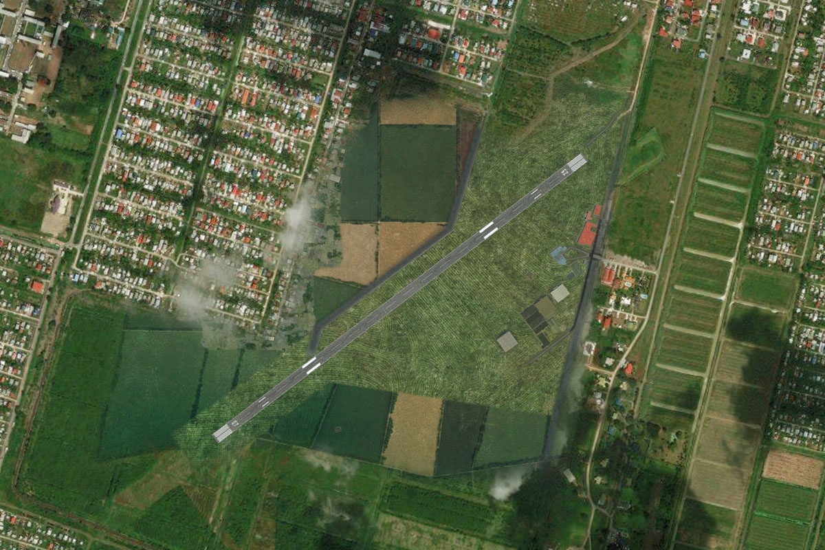
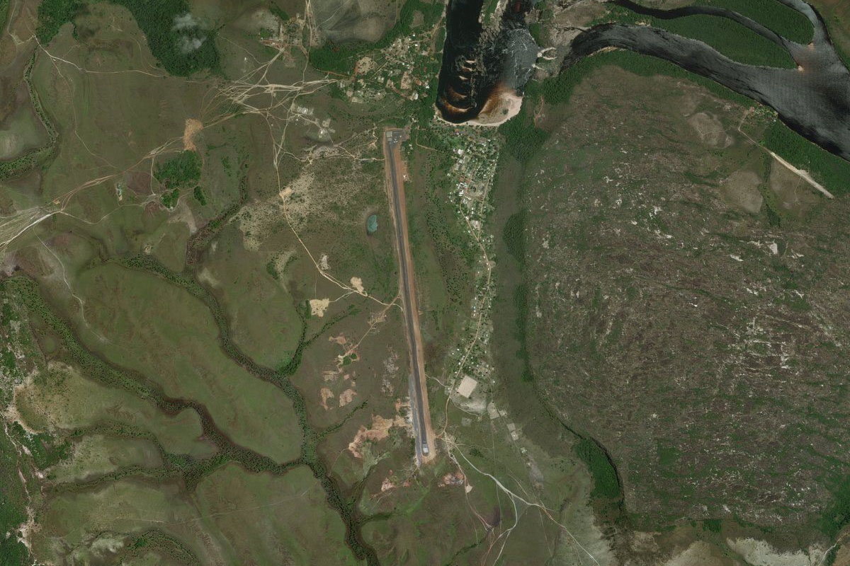
Rio Amazonas(POI3) to SJOR(SJOR)
Distance: 7.21NM Bearing: 23° 3 minutes
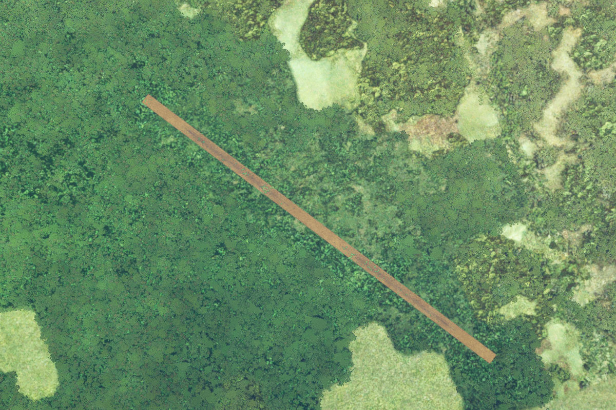
After passing a couple of islands, turn north into another smaller fork of the river, and head to the small airstrip on the eastern bank
Leg 2
Flying from SJOR
Leg Distance: 93.43 Approximate time at 125kts: 45 minutes.
SJOR(SJOR) to Rio Araguari(POI4)
Distance: 19.47NM Bearing: 34° 9 minutes
Fly northeast to the Araguari River, originally famed for its surfable tidal bore, or Pororoca, which no longer exists due to damming and erosion
Rio Araguari(POI4) to Reserva Biologica do Lago Piratuba(POI5)
Distance: 30.25NM Bearing: 1° 15 minutes
Fly north over the Lago Piratuba Biological Reserve, until you reach the Atlantic coast
Reserva Biologica do Lago Piratuba(POI5) to Ilha de Maraca(POI6)
Distance: 10.23NM Bearing: 299° 5 minutes
Follow the coast west as you pass south of Ilha de Maracá
Ilha de Maraca(POI6) to Rio Amapa Grande(POI7)
Distance: 20.89NM Bearing: 346° 10 minutes
Follow the coast north until you reach the mouth of the Amapa Grande River
Rio Amapa Grande(POI7) to SBAM(SBAM)
Distance: 12.59NM Bearing: 275° 6 minutes
Fly west to the long sealed runway of Amapá airport, passing to the north of the town of Amapá on the way
Leg 3
Flying from SBAM
Leg Distance: 26.41 Approximate time at 125kts: 13 minutes.
SBAM(SBAM) to BR-156(POI8)
Distance: 5.26NM Bearing: 353° 3 minutes
After takeoff, head north to meet highway 156
BR-156(POI8) to Calcoene(POI9)
Distance: 20.05NM Bearing: 6° 10 minutes
Follow the highway north to the small town of Calçoene on the right side of the road
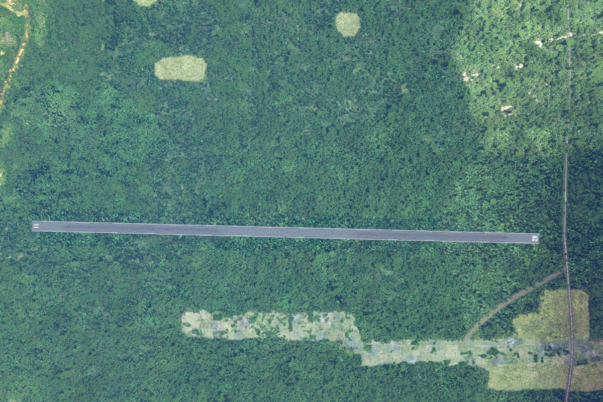
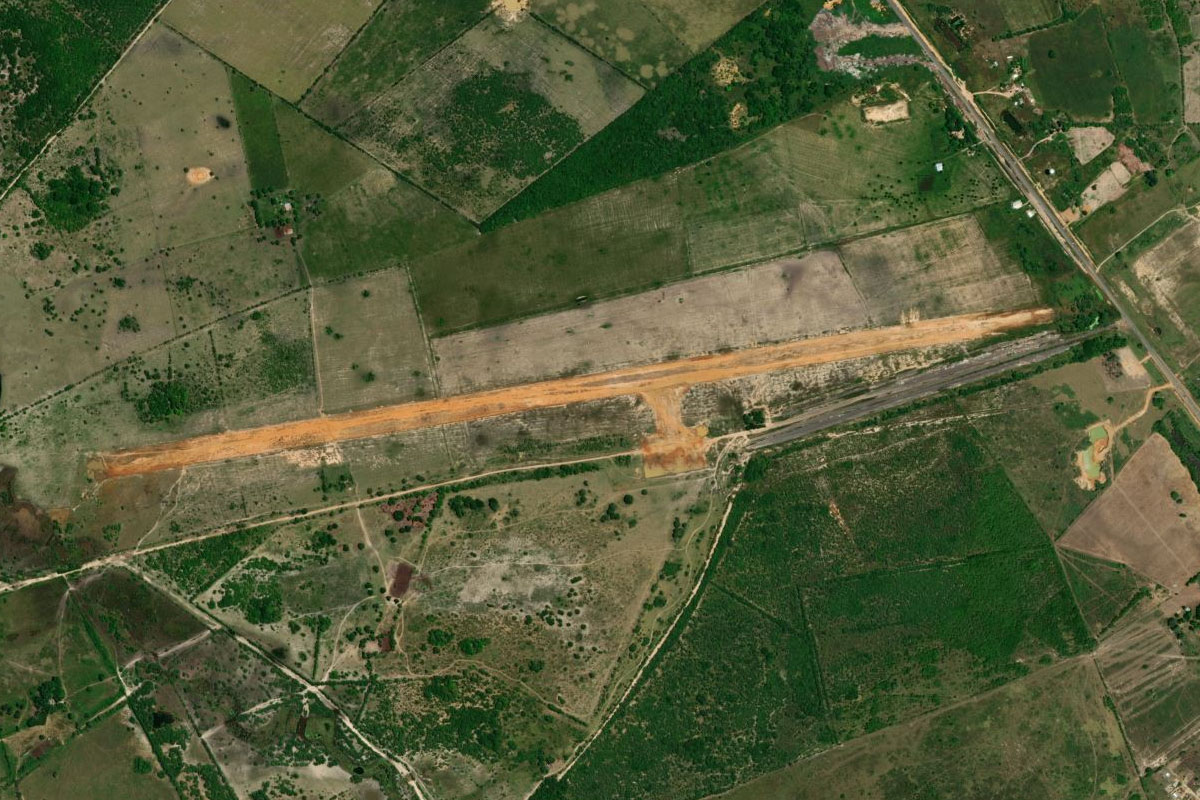
Calcoene(POI9) to SNCC(SNCC)
Distance: 1.1NM Bearing: 52° 1 minutes
Calçoene Airport runs along the northwestern edge of the town
Leg 4
Flying from SNCC
Leg Distance: 58.92 Approximate time at 125kts: 28 minutes.
SNCC(SNCC) to Cunani(POI10)
Distance: 23.34NM Bearing: 354° 11 minutes
After takeoff, head north in the direction of the lone mountain in the distance. You will soon meet the small settlement of Cunani, on the Cunani River. Cunani is recognized as a Quilombo settlement, founded by escaped slaves of African descent
Cunani(POI10) to Rio Uaca(POI11)
Distance: 26.03NM Bearing: 352° 12 minutes
Continue north towards the distant mountain, crossing the Cassiporé River before meeting the Uaçá River a few miles further ahead
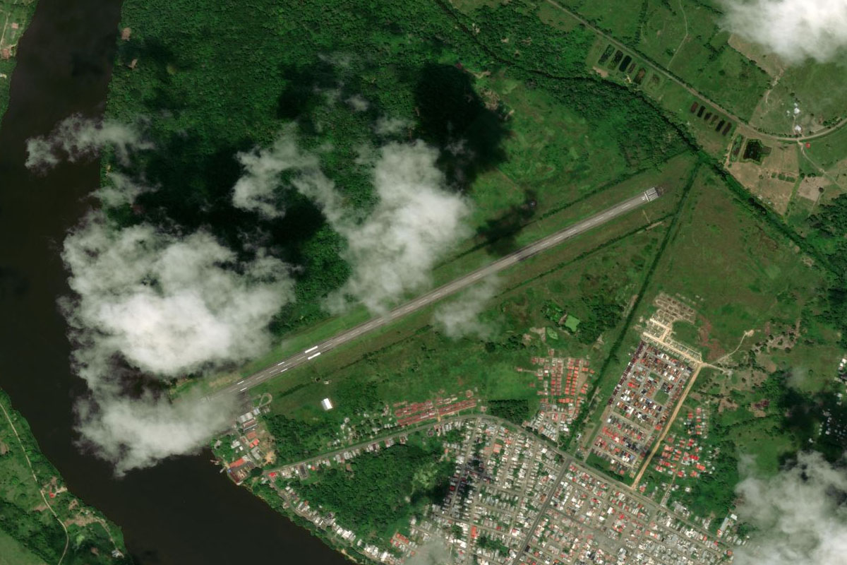
Rio Uaca(POI11) to SB6K(SB6K)
Distance: 9.55NM Bearing: 30° 5 minutes
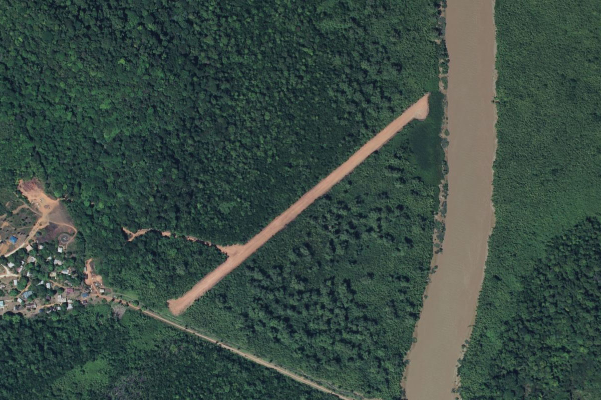
Follow the Uaçá River northeast to the small airstrip on the western side of the river, which serves the village of Kumarumã – home to the largest tribe of the Galibi people
Leg 5
Flying from SB6K
Leg Distance: 41.18 Approximate time at 125kts: 20 minutes.
SB6K(SB6K) to Monte Catari(POI12)
Distance: 20.17NM Bearing: 336° 10 minutes
Fly northwest to the rounded peak of Monte Catari
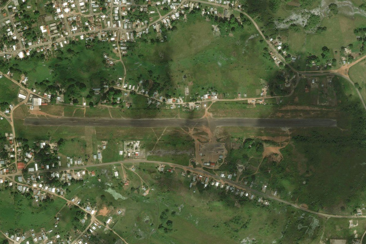
Monte Catari(POI12) to SBOI(SBOI)
Distance: 21.01NM Bearing: 329° 10 minutes
Continue northwest to the large town of Oiapoque, on the Oiapoque River which also serves as the border between Brazil and French Guiana. The airport is east of the town
Leg 6
Flying from SBOI
Leg Distance: 25.24 Approximate time at 125kts: 12 minutes.
SBOI(SBOI) to Fleuve Oyapock(POI13)
Distance: 6.36NM Bearing: 28° 3 minutes
After takeoff, follow the Oyapock River north
Fleuve Oyapock(POI13) to Fleuve Oyapock(POI14)
Distance: 9.2NM Bearing: 73° 4 minutes
Continue northeast along the river
Fleuve Oyapock(POI14) to Fleuve Oyapock(POI15)
Distance: 6.23NM Bearing: 24° 3 minutes
Follow the left shore of the river north towards its mouth
Fleuve Oyapock(POI15) to SOSA(SOSA)
Distance: 3.45NM Bearing: 356° 2 minutes
Turn north before the mouth of the river to gap between the coastal hills. There is an airstrip next to the town of Ouanary, which sits on the Ouanary River
Leg 7
Flying from SOSA
Leg Distance: 62.99 Approximate time at 125kts: 30 minutes.
SOSA(SOSA) to Montagne d’Argent(POI16)
Distance: 10.91NM Bearing: 9° 5 minutes
Follow the coast north after takeoff, to the outcrop of land, Mount Argent. To the east is the northern tip of Cape Orange, which marks the northernmost point of Brazil's coastline
Montagne d’Argent(POI16) to Pointe Behague(POI17)
Distance: 20.2NM Bearing: 345° 10 minutes
Continue north along the coast of the peninsula to Pointe Béhague
Pointe Behague(POI17) to Mahury(POI18)
Distance: 23.4NM Bearing: 318° 11 minutes
Cross the Approuague Estuary northwest, then along the mangrove coastline to the Mahury Estuary south of the capital city, Cayenne
Mahury(POI18) to SOCA(SOCA)
Distance: 8.48NM Bearing: 273° 4 minutes
Heading west along the river entrance will lead you to Félix Eboué Airport
Leg 8
Flying from SOCA
Leg Distance: 46.52 Approximate time at 125kts: 22 minutes.
SOCA(SOCA) to Cayenne(POI19)
Distance: 7.94NM Bearing: 35° 4 minutes
Fly northeast to the city of Cayenne, home to 150,000 people
Cayenne(POI19) to Ile du Diable(POI20)
Distance: 25.61NM Bearing: 343° 12 minutes
Fly northwest, running parallel with the coast, to Devil's Island, which is the northernmost of 3 islands that sit about 8 miles from the mainland. It is part of a former penal colony housing French political prisoners, notorious for its high death rate, and made famous by the book and movie 'Papillon'
Ile du Diable(POI20) to Kourou(POI21)
Distance: 8.65NM Bearing: 219° 4 minutes
After circling the islands, head south to the mouth of the Kourou River on the mainland, and the town of Kourou. Standing on Pointe des Roches at the river entrance is Dreyfus Tower, an icon of the town and former part of the prison complex
Kourou(POI21) to SOOK(SOOK)
Distance: 4.32NM Bearing: 302° 2 minutes
Head northwest to Kourou Airport, a couple of miles west of the town
Leg 9
Flying from SOOK
Leg Distance: 71.26 Approximate time at 125kts: 34 minutes.
SOOK(SOOK) to Centre Spatial Guyanais(POI22)
Distance: 5.73NM Bearing: 323° 3 minutes
After takeoff, follow the main road northwest to the Guiana Space Centre, part of the European Space Agency and launch site for the Ariane and Vega rockets
Centre Spatial Guyanais(POI22) to Ensemble de lancement Soyouz(POI23)
Distance: 5.7NM Bearing: 339° 3 minutes
Continue northwest to another launch area for the Soyuz rockets
Ensemble de lancement Soyouz(POI23) to Sinnamary(POI24)
Distance: 8.5NM Bearing: 319° 4 minutes
Keep flying northwest to the next town, Sinnamary
Sinnamary(POI24) to Organabo(POI25)
Distance: 32.43NM Bearing: 307° 16 minutes
From Sinnamary, follow the main highway (national highway 1) northwest
Organabo(POI25) to SOMA(SOMA)
Distance: 18.9NM Bearing: 309° 9 minutes
When the highway turns inland, stay with the coast and head northwest to the town of Mana, on the La Mana River. There is a small dirt airstrip on the eastern side of the river
Leg 10
Flying from SOMA
Leg Distance: 66.91 Approximate time at 125kts: 32 minutes.
SOMA(SOMA) to Plage des Hattes(POI26)
Distance: 11.95NM Bearing: 314° 6 minutes
Head northwest to the mouth of the Maroni River, which forms the border with Suriname. The beach at the town of Yalimapo on the eastern side of the river mouth is the world's largest nesting site for leatherback turtles
Plage des Hattes(POI26) to Albina(POI27)
Distance: 14.98NM Bearing: 218° 7 minutes
Head southwest along the river, passing the towns of Albina on the western side (Suriname), and Saint-Laurent-du-Maroni of the eastern side (French Guiana)
Albina(POI27) to Maroni River(POI28)
Distance: 22.72NM Bearing: 242° 11 minutes
Follow the river southwest
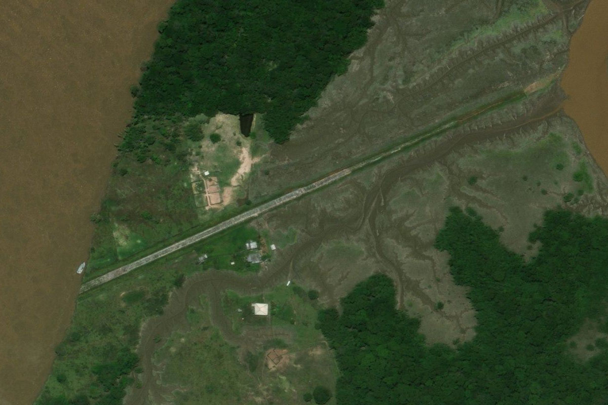
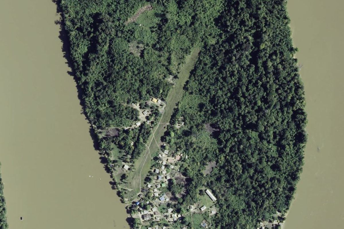
Maroni River(POI28) to SMLT(SMLT)
Distance: 17.26NM Bearing: 229° 8 minutes
Continue southwest along the river until you reach the small airstrip on the southern end of Langatabbetje Island
Leg 11
Flying from SMLT
Leg Distance: 45.71 Approximate time at 125kts: 22 minutes.
SMLT(SMLT) to Brokopondostuwmeer(POI29)
Distance: 20.81NM Bearing: 271° 10 minutes
Head west to Brokopondo Reservoir, one of the largest in the world, and covers nearly 1 percent of the country
Brokopondostuwmeer(POI29) to Brownsweg(POI30)
Distance: 23.41NM Bearing: 305° 11 minutes
Head to the town of Brownsweg on the northwestern edge of the reservoir
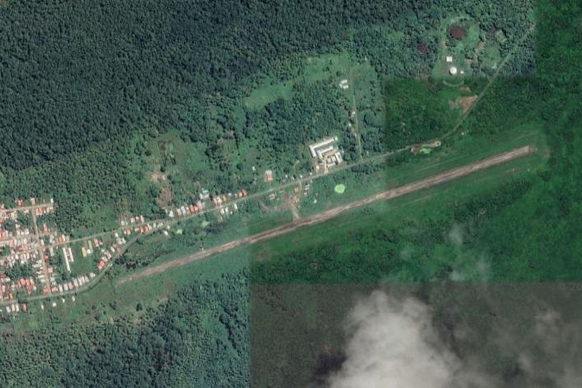
Brownsweg(POI30) to SMBS(SMBS)
Distance: 1.49NM Bearing: 337° 1 minutes
The dirt airstrip is on the north side of the town
Leg 12
Flying from SMBS
Leg Distance: 49.14 Approximate time at 125kts: 24 minutes.
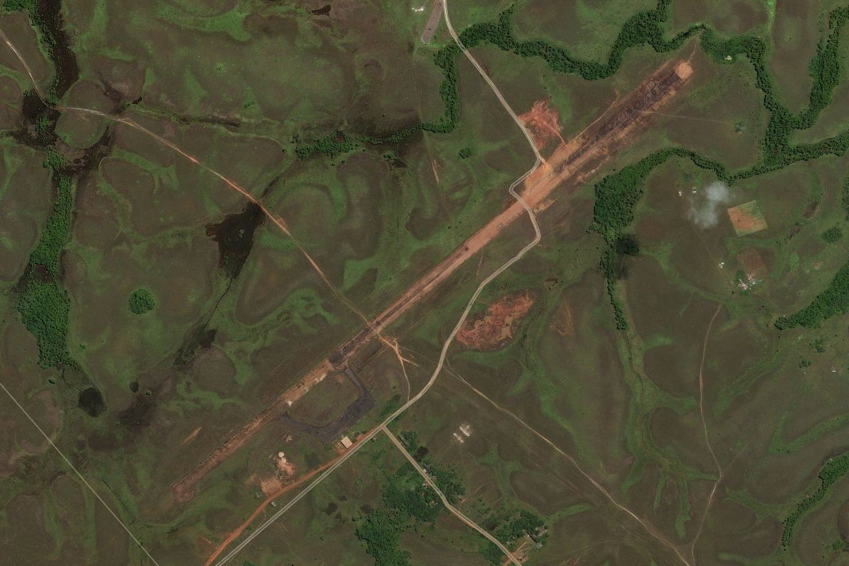
SMBS(SMBS) to Rosebel(POI31)
Distance: 6.51NM Bearing: 337° 3 minutes
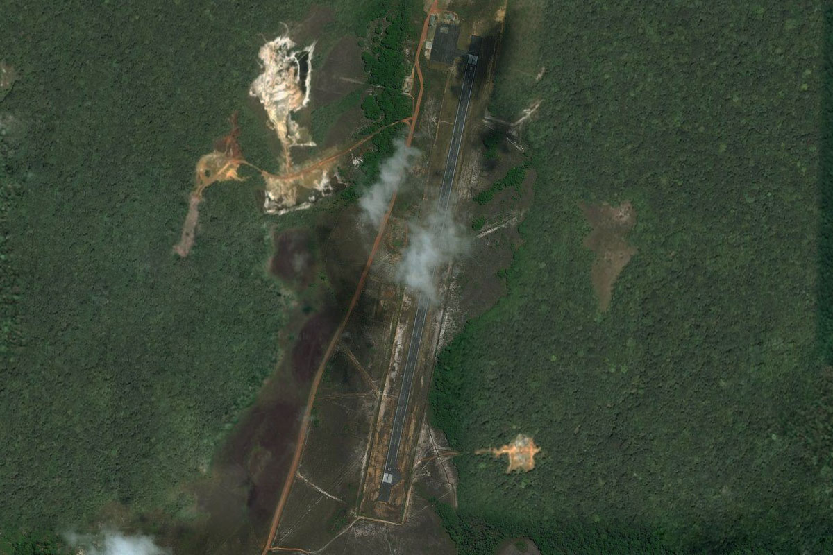
After takeoff, head northwest over the Rosebel Gold Mine
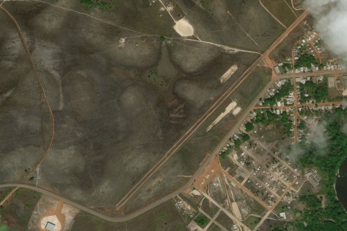
Rosebel(POI31) to Zanderij(POI32)
Distance: 21.46NM Bearing: 16° 10 minutes
Head north, passing the international airport along the way
Zanderij(POI32) to SMZO(SMZO)
Distance: 21.17NM Bearing: 27° 10 minutes
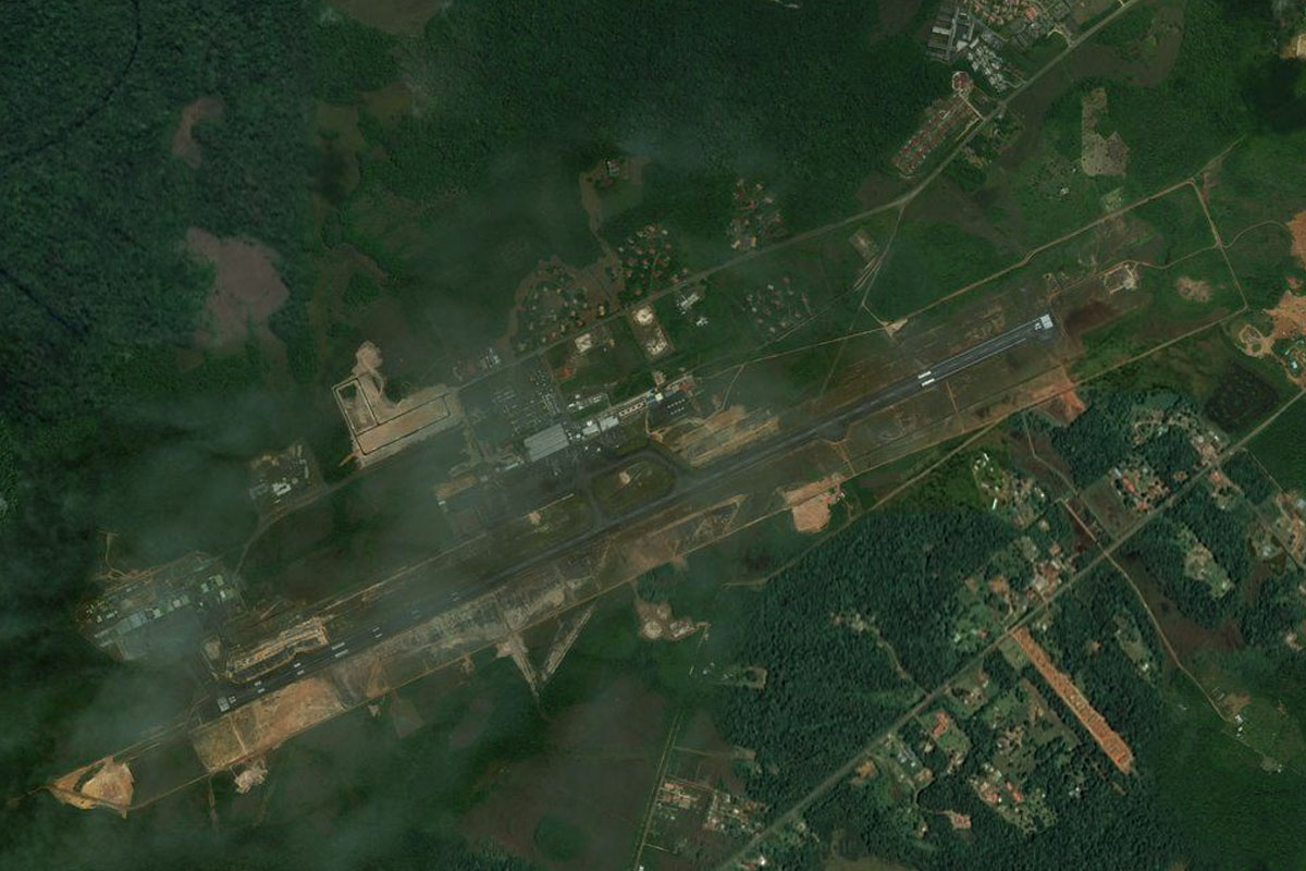
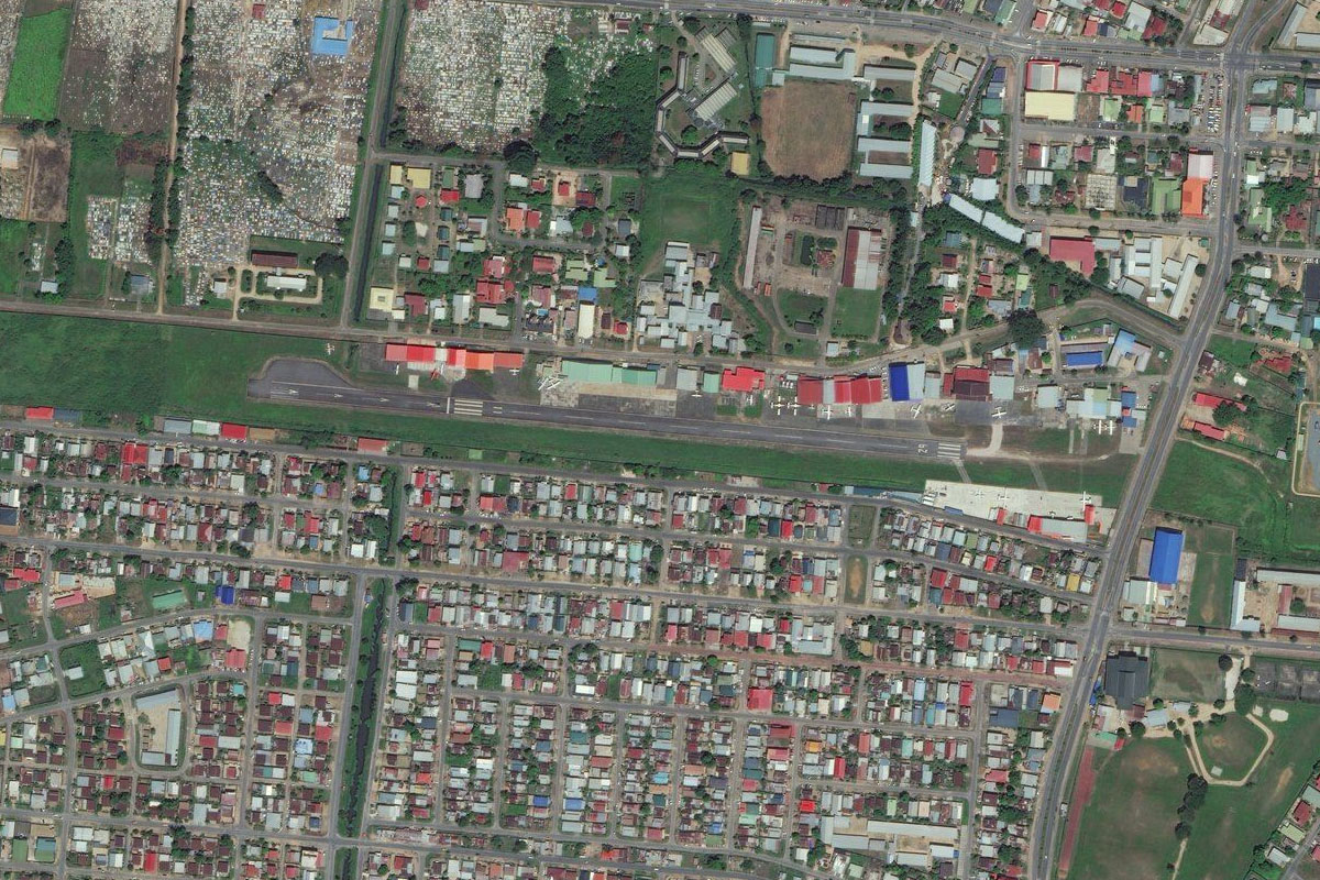
Continue north to the capital city of Paramaribo, home to nearly half of the country's population of nearly 600,000 people. the small general aviation airport is just southwest of the city center.
Leg 13
Flying from SMZO
Leg Distance: 68.19 Approximate time at 125kts: 33 minutes.
SMZO(SMZO) to Saramacca Rivier(POI33)
Distance: 15.87NM Bearing: 285° 8 minutes
After takeoff, fly west to meet the Saramacca River
Saramacca Rivier(POI33) to Saramacca Rivier(POI34)
Distance: 28.78NM Bearing: 293° 14 minutes
Follow the river west to its mouth
Saramacca Rivier(POI34) to Welgelegen(POI35)
Distance: 18.95NM Bearing: 296° 9 minutes
Follow the coastline until you reach a small peninsula
Welgelegen(POI35) to SMCO(SMCO)
Distance: 4.59NM Bearing: 273° 2 minutes
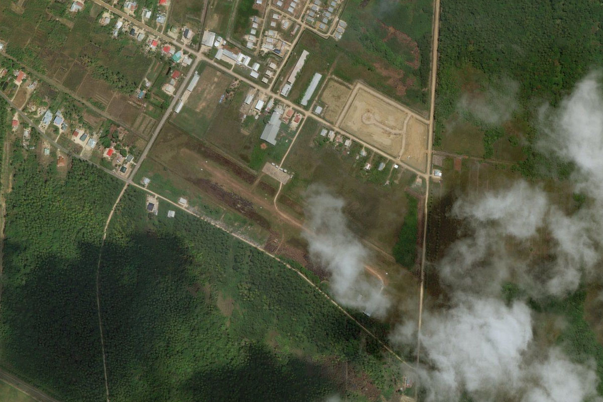
Turn inland and fly west to the small town of Totness, and the airstrip on its south edge
Leg 14
Flying from SMCO
Leg Distance: 44.69 Approximate time at 125kts: 21 minutes.
SMCO(SMCO) to Nieuw Nickerie(POI36)
Distance: 38.33NM Bearing: 301° 18 minutes
Head back to the coast and follow it northwest
Nieuw Nickerie(POI36) to SMNI(SMNI)
Distance: 6.36NM Bearing: 254° 3 minutes
Follow the coast southwest to the airport just after the mouth of the Nickerie River
Leg 15
Flying from SMNI
Leg Distance: 38.15 Approximate time at 125kts: 18 minutes.
SMNI(SMNI) to Guyana(POI37)
Distance: 6.14NM Bearing: 274° 3 minutes
Fly west across the mouth of the Courantyne River into the next country, Guyana, an English speaking, cricket-playing nation with a strong Caribbean culture
Guyana(POI37) to Brighton(POI38)
Distance: 13.72NM Bearing: 360° 7 minutes
Follow the coast north
Brighton(POI38) to Belvedere(POI39)
Distance: 12.3NM Bearing: 323° 6 minutes
Continue northwest along the coastal highway
Belvedere(POI39) to SYNA(SYNA)
Distance: 5.99NM Bearing: 272° 3 minutes
As you reach the last of the towns along this section of the highway, turn west and head to New Amsterdam Airport, which sits a couple of miles east of the river
Leg 16
Flying from SYNA
Leg Distance: 51.9 Approximate time at 125kts: 25 minutes.
SYNA(SYNA) to Fort Wellington(POI40)
Distance: 11.99NM Bearing: 339° 6 minutes
After takeoff, fly over the river and follow the coast northwest
Fort Wellington(POI40) to Triumph(POI41)
Distance: 35.51NM Bearing: 330° 17 minutes
Continue northwest along the coast
Triumph(POI41) to SYEC(SYEC)
Distance: 4.4NM Bearing: 288° 2 minutes
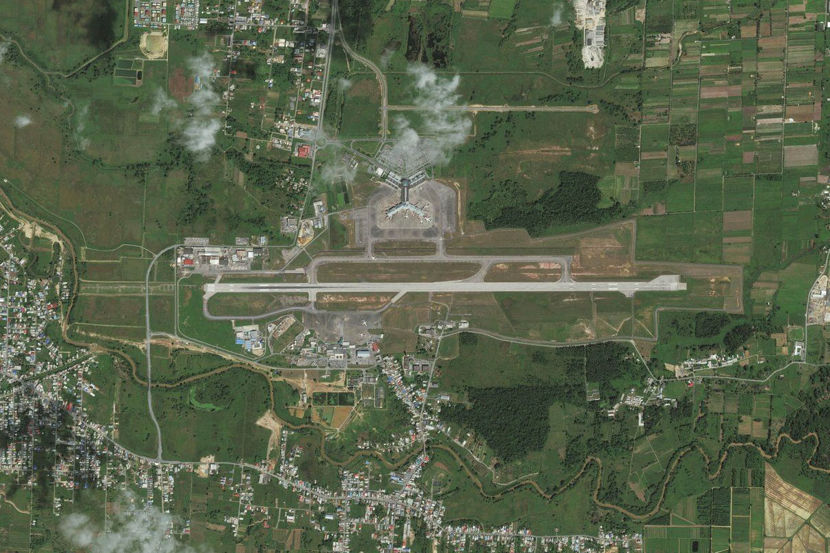
As the coast curves around to the west near the country's capital city, Georgetown, head to the international airport a mile inland
Leg 17
Flying from SYEC
Leg Distance: 56.8 Approximate time at 125kts: 27 minutes.
SYEC(SYEC) to Georgetown(POI42)
Distance: 3.67NM Bearing: 303° 2 minutes
After takeoff, head northwest for a closer look at the city
Georgetown(POI42) to Timehri(POI43)
Distance: 20.57NM Bearing: 217° 10 minutes
Follow the Demerara River south, passing the larger of the city's two international airports
Timehri(POI43) to Linden(POI44)
Distance: 28.97NM Bearing: 199° 14 minutes
Continue south along the river to the large bauxite mining town of Linden
Linden(POI44) to SYLD(SYLD)
Distance: 3.59NM Bearing: 168° 2 minutes
Head to Linden Airport, sitting outside a curve in the river between two mining areas
Leg 18
Flying from SYLD
Leg Distance: 44.99 Approximate time at 125kts: 22 minutes.
SYLD(SYLD) to Essequibo River(POI45)
Distance: 28.95NM Bearing: 241° 14 minutes
Head southwest to the Essequibo River
Essequibo River(POI45) to Essequibo River(POI46)
Distance: 12.07NM Bearing: 218° 6 minutes
Follow the river southwest
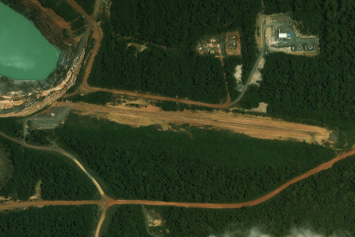
Essequibo River(POI46) to SY6O(SY6O)
Distance: 3.97NM Bearing: 289° 2 minutes
Turn west with the river and head to the dirt landing strip which services the Omai gold mine on the north bank of the river
Leg 19
Flying from SY6O
Leg Distance: 48.27 Approximate time at 125kts: 23 minutes.
SY6O(SY6O) to Essequibo River(POI47)
Distance: 8.96NM Bearing: 270° 4 minutes
Continue west along the river to its junction with the Potaro River as it turns south
Essequibo River(POI47) to Potaro River(POI48)
Distance: 18.15NM Bearing: 280° 9 minutes
Follow the Potaro River west as it heads in the direction of a deep valley cut into the mountains in the distance
Potaro River(POI48) to Potaro River(POI49)
Distance: 10.04NM Bearing: 267° 5 minutes
Stay with the river as it turns southwest towards the valley
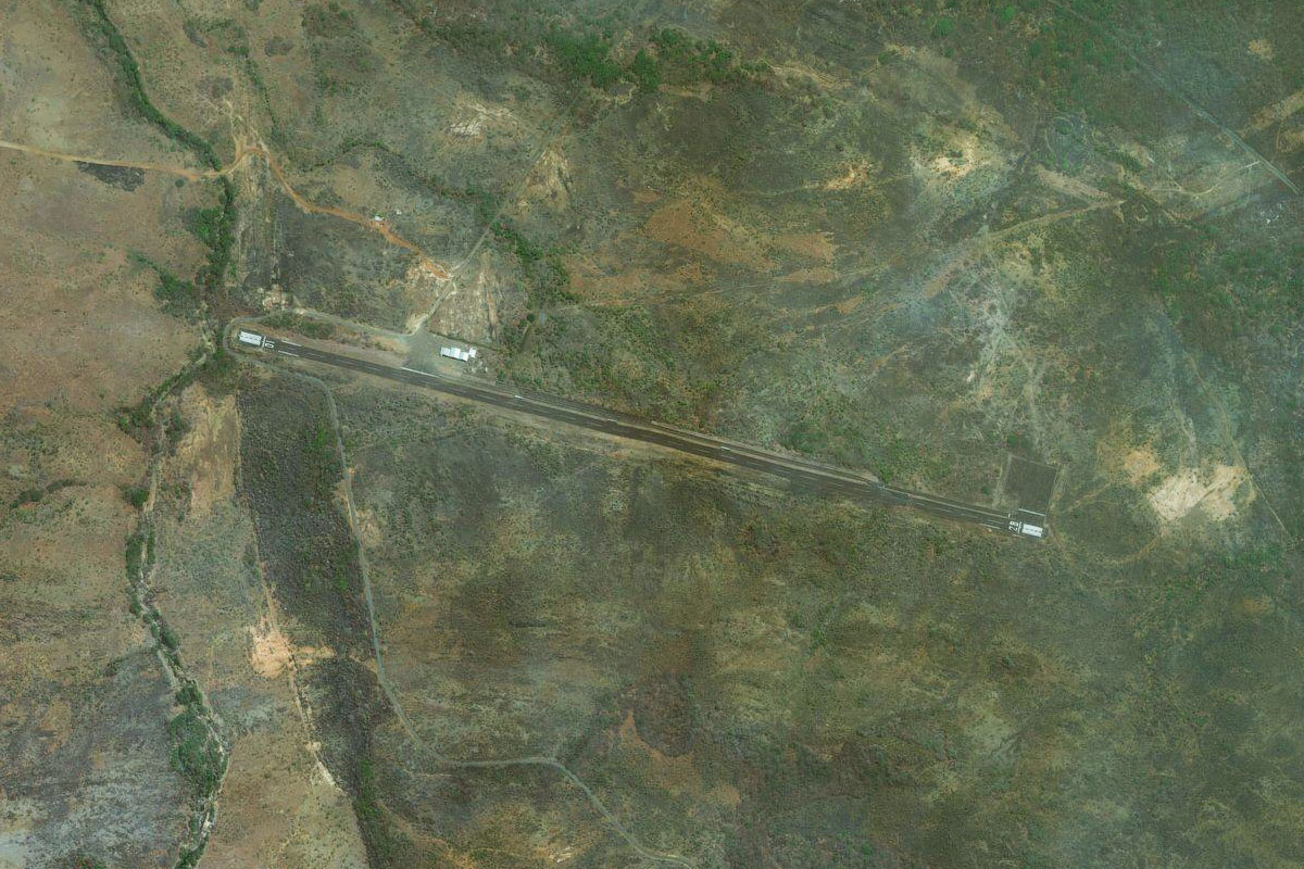
Potaro River(POI49) to PKSA(PKSA)
Distance: 11.12NM Bearing: 246° 5 minutes
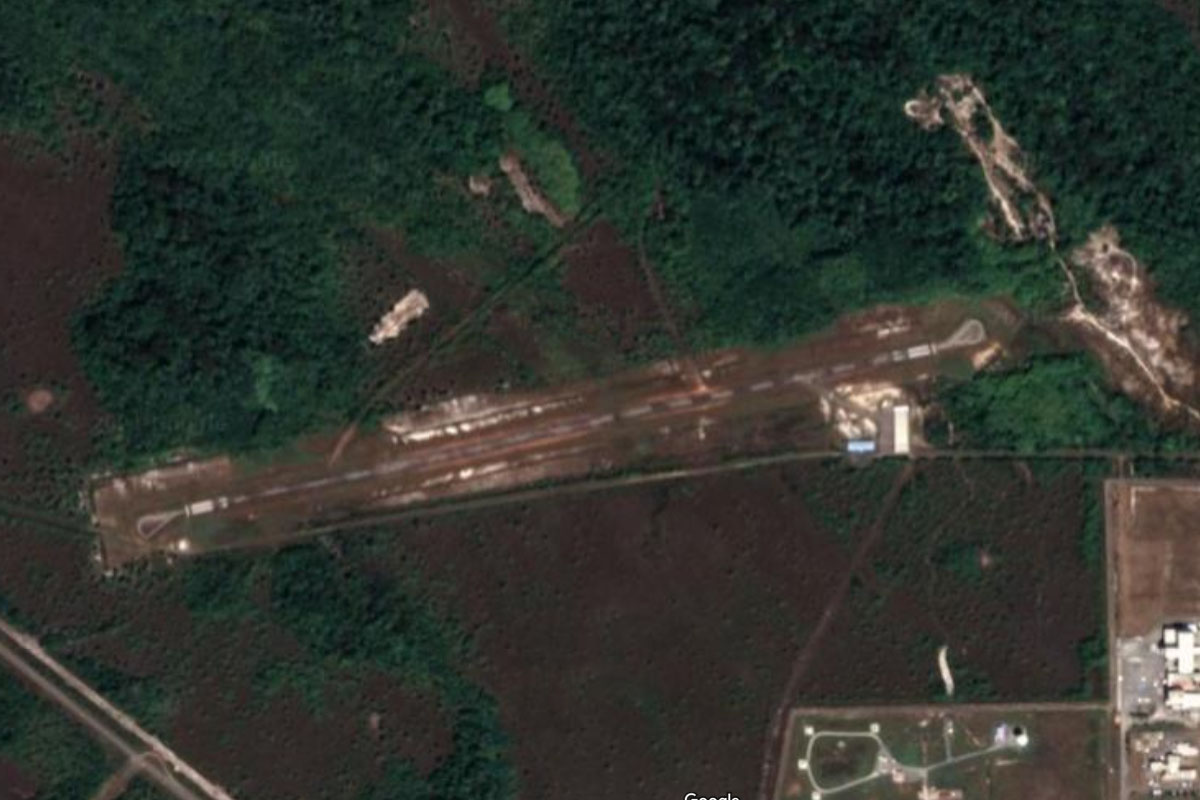
Follow the river through the valley and into Kaieteur National Park, home of Kaieteur Falls – the world's largest single drop waterfall by water volume. There is an airport at the top of the falls
Leg 20
Flying from PKSA
Leg Distance: 32.34 Approximate time at 125kts: 16 minutes.
PKSA(PKSA) to Chenapau(POI50)
Distance: 12.84NM Bearing: 219° 6 minutes
Follow the river southwest past the small village of Chenapau
Chenapau(POI50) to Kowatipu Mountain(POI51)
Distance: 10.71NM Bearing: 237° 5 minutes
Continue southwest past the table top formation of Kowapitu Mountain
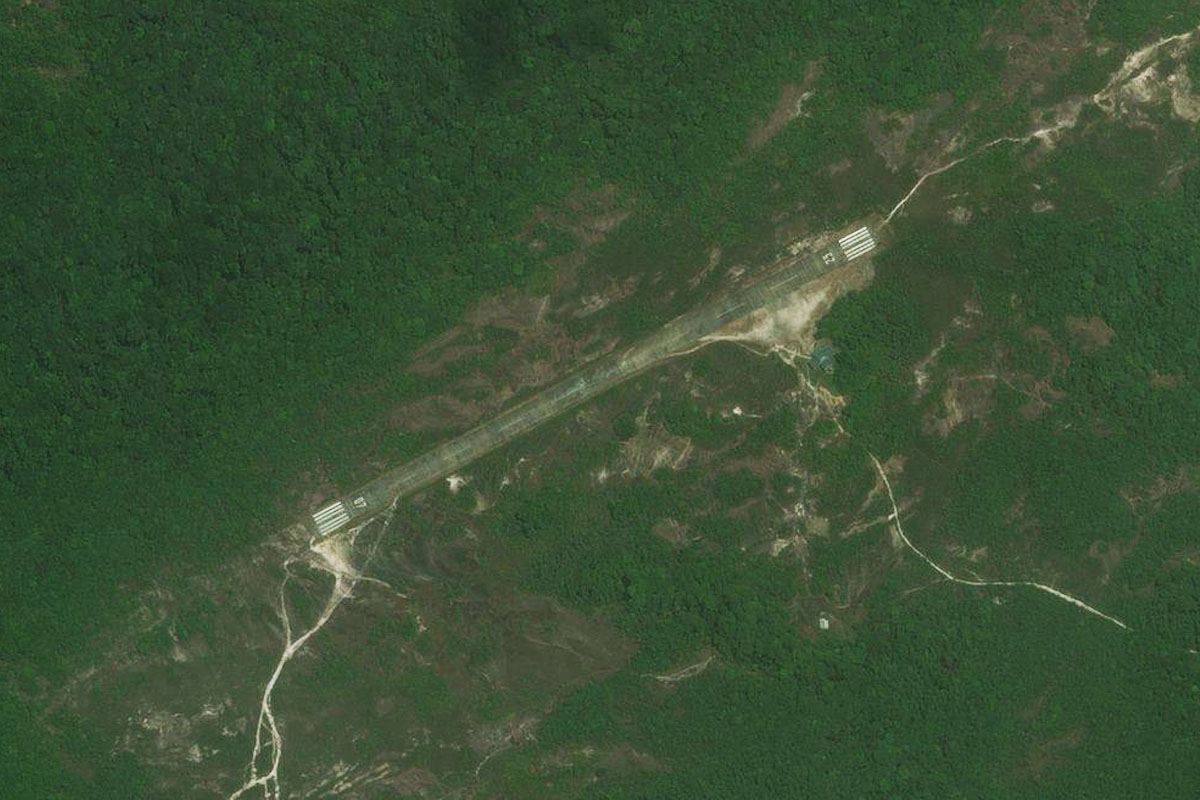
Kowatipu Mountain(POI51) to SYPM(SYPM)
Distance: 8.79NM Bearing: 207° 4 minutes
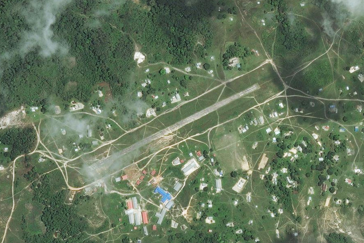
As you pass the mountain, turn south and head to the town of Paramakatoi, which sits above a valley. The airport is in the middle of the town
Leg 21
Flying from SYPM
Leg Distance: 46.87 Approximate time at 125kts: 22 minutes.
SYPM(SYPM) to Kamana(POI52)
Distance: 16.1NM Bearing: 317° 8 minutes
After takeoff, head northwest to an area clear of forest
Kamana(POI52) to Rio Uaila(POI53)
Distance: 17.73NM Bearing: 328° 9 minutes
Continue northwest over the border into northern Brazil and to another large area of bare land
Rio Uaila(POI53) to SJLO(SJLO)
Distance: 13.04NM Bearing: 300° 6 minutes
Head west across the highlands before descending to lower land, and the small airport at the base of the escarpment next to the Panari River
Leg 22
Flying from SJLO
Leg Distance: 87.27 Approximate time at 125kts: 42 minutes.
SJLO(SJLO) to Maringma Tepui(POI54)
Distance: 14.05NM Bearing: 318° 7 minutes
Fly northwest to the nearby mountain of Maringma Tepui
Maringma Tepui(POI54) to Monte Roraima(POI55)
Distance: 12.03NM Bearing: 262° 6 minutes
Head west into Venezuela, and the southern tip of Mount Roraima, the most well known of the group of tepui in this region, and inspiration for the settings of 'The Lost World' by Sir Arthur Conan Doyle and also the Pixar movie 'Up'
Monte Roraima(POI55) to Kukenan Tepui(POI56)
Distance: 13.58NM Bearing: 354° 7 minutes
Do a right hand circuit around Mount Roraima, then head north between it and Kukenan Tepui
Kukenan Tepui(POI56) to Ilu-Tramen Tepui(POI57)
Distance: 13.25NM Bearing: 310° 6 minutes
Follow the trail of peaks around to the northwest as you continue through Canaima National Park
Ilu-Tramen Tepui(POI57) to Venezuela Highway(POI58)
Distance: 14.94NM Bearing: 305° 7 minutes
Continue northwest and descend to around 6000ft to meet the Venezuela Highway heading north
Venezuela Highway(POI58) to SVPP(SVPP)
Distance: 19.42NM Bearing: 348° 9 minutes
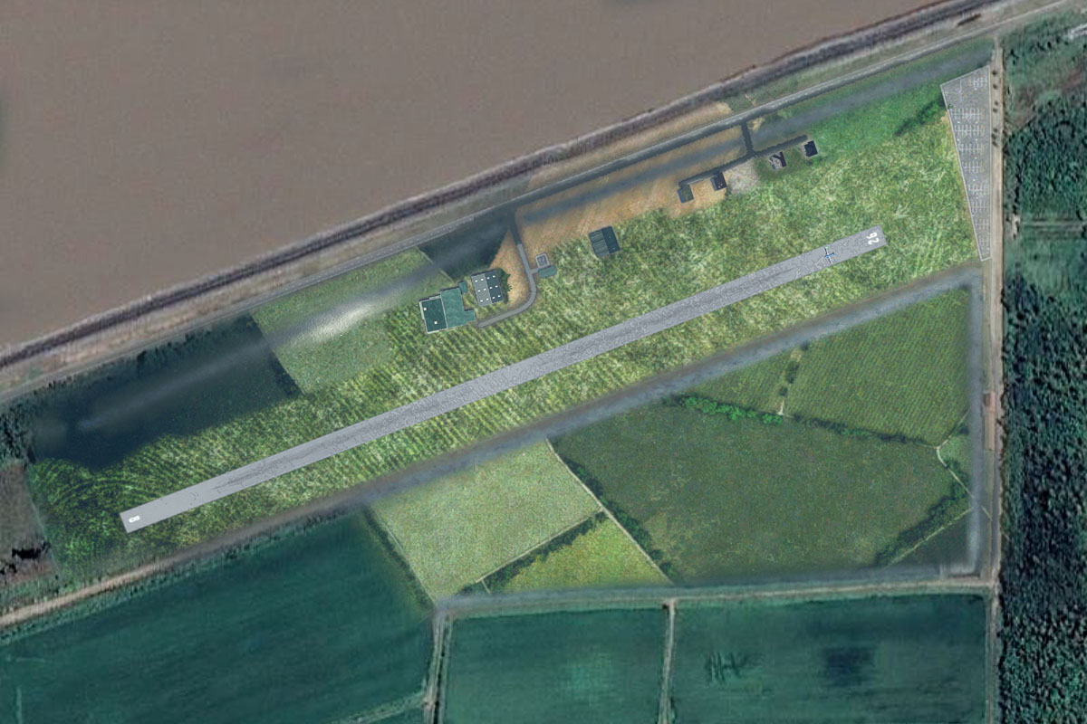
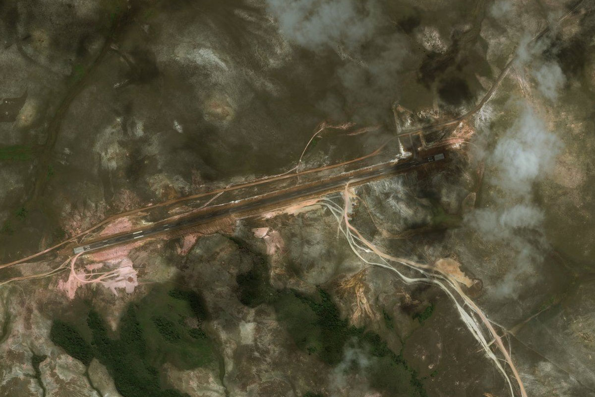
Follow the highway north and keep a lookout for Vuelpa Airport 2 miles west of the highway, just after it crosses the Yuruani River
Leg 23
Flying from SVPP
Leg Distance: 61.49 Approximate time at 125kts: 30 minutes.
SVPP(SVPP) to Sororopan(POI59)
Distance: 18.45NM Bearing: 271° 9 minutes
After takeoff, head west to the distinct mountain ridge of Sororopán
Sororopan(POI59) to Rio Uruyen(POI60)
Distance: 35.96NM Bearing: 283° 17 minutes
Continue west towards the large tepui (Auyan) in the distance. Once you reach the flat valley east of the mountain you will meet the Uruyen River also heading west
Rio Uruyen(POI60) to SVUY(SVUY)
Distance: 7.08NM Bearing: 284° 3 minutes
Follow the river to the south of the tepui, and the dirt airstrip at Uruyen Camp
Leg 24
Flying from SVUY
Leg Distance: 47.52 Approximate time at 125kts: 23 minutes.
SVUY(SVUY) to Auyan Tepui(POI61)
Distance: 9.68NM Bearing: 31° 5 minutes
After takeoff, head northeast along the eastern side of the mountain as you climb to fly over the top
Auyan Tepui(POI61) to Salto Angel(POI62)
Distance: 10.34NM Bearing: 336° 5 minutes
Fly northwest over the top of the tepui, then follow the river valley running north. On the left side of the valley is Angel Falls, the world's tallest uninterrupted waterfall
Salto Angel(POI62) to Rio Churun(POI63)
Distance: 4.79NM Bearing: 17° 2 minutes
Follow the Churun River north along the valley
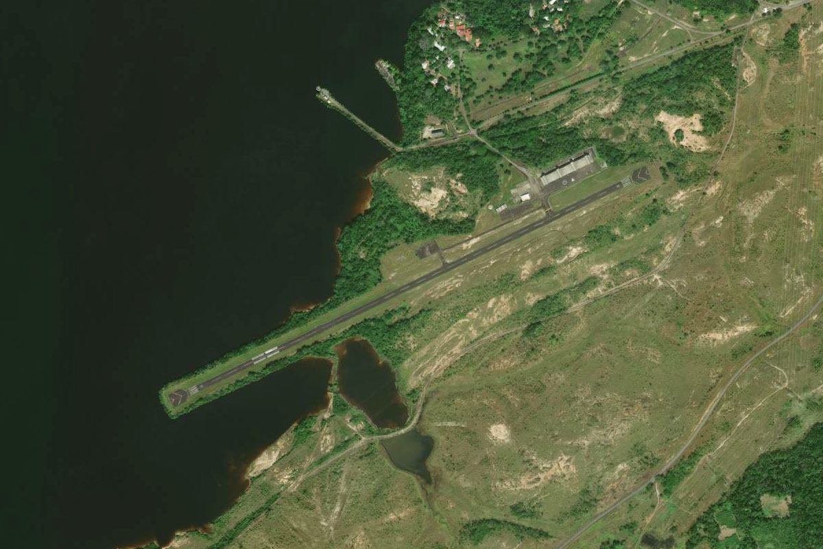
Rio Churun(POI63) to SVCN(SVCN)
Distance: 22.71NM Bearing: 314° 11 minutes
Follow the Churun River northwest until it meets the Carrao River,, then continue northwest along the Carrao River to Canaima Airport
Leg 25
Flying from SVCN
Leg Distance: 74.4 Approximate time at 125kts: 36 minutes.
SVCN(SVCN) to Embalse de Guri(POI64)
Distance: 38.67NM Bearing: 15° 19 minutes
After takeoff, head north and follow the Caroní River to the Guri Reservoir, one of the largest in the world
Embalse de Guri(POI64) to El Manteco(POI65)
Distance: 31.04NM Bearing: 43° 15 minutes
Head northeast to the only town on the eastern edge of the reservoir, Manteco
El Manteco(POI65) to SVET(SVET)
Distance: 4.69NM Bearing: 92° 2 minutes
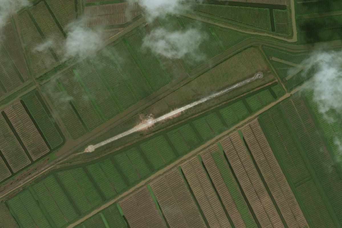
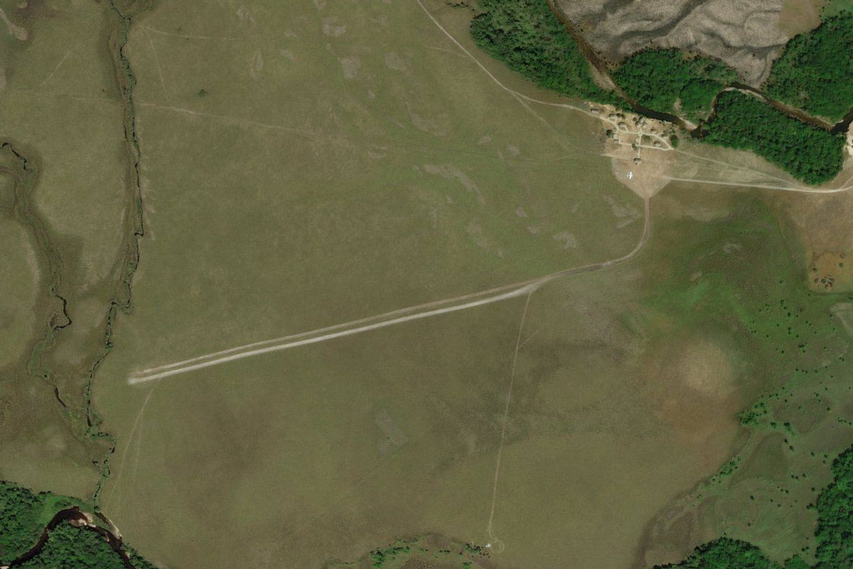
The airport is near the center of town
Leg 26
Flying from SVET
Leg Distance: 44.48 Approximate time at 125kts: 21 minutes.
SVET(SVET) to Embalse de Guri(POI66)
Distance: 32.95NM Bearing: 320° 16 minutes
Fly northwest to the hilly outcrop on the western side of the reservoir
Embalse de Guri(POI66) to Represa de Guri(POI67)
Distance: 6.55NM Bearing: 7° 3 minutes
Head north to Guri Dam, one of the largest hydroelectric power stations on earth
Represa de Guri(POI67) to SV76(SV76)
Distance: 4.98NM Bearing: 274° 2 minutes
Fly west to Tocomita Airport, which sits south of the group of hills
Leg 27
Flying from SV76
Leg Distance: 41.74 Approximate time at 125kts: 20 minutes.
SV76(SV76) to Tocoma Dam(POI68)
Distance: 9.55NM Bearing: 37° 5 minutes
After takeoff, head northwest along the reservoir to the unfinished Tocoma Dam
Tocoma Dam(POI68) to Rio Caroni(POI69)
Distance: 9.73NM Bearing: 34° 5 minutes
Continue northeast along the reservoir
Rio Caroni(POI69) to Caruachi(POI70)
Distance: 11.79NM Bearing: 74° 6 minutes
Follow the reservoir as it turns east towards the next large hydroelectric plant, Caruachi
Caruachi(POI70) to SVDN(SVDN)
Distance: 10.67NM Bearing: 63° 5 minutes
Head northeast to Macagua Airport on the eastern bank of Macagua Reservoir
Leg 28
Flying from SVDN
Leg Distance: 43.61 Approximate time at 125kts: 21 minutes.
SVDN(SVDN) to Ciudad Guayana(POI71)
Distance: 5.9NM Bearing: 2° 3 minutes
After takeoff, head north over Macagua Dam and Guayana City to the Orinoco River. Near the dam are the popular tourist parks near Llovizina Falls
Ciudad Guayana(POI71) to Rio Orinoco(POI72)
Distance: 30.71NM Bearing: 79° 15 minutes
Follow the Orinoco River east
Rio Orinoco(POI72) to SV13(SV13)
Distance: 7NM Bearing: 14° 3 minutes
As the river splits around a group of islands, head north to the airport next to the town of Barrancas
Leg 29
Flying from SV13
Leg Distance: 29.98 Approximate time at 125kts: 14 minutes.
SV13(SV13) to Cano Macareo(POI73)
Distance: 7.11NM Bearing: 101° 3 minutes
Fly east to the mouth of the Macareo Channel
Cano Macareo(POI73) to Cano Macareo(POI74)
Distance: 6.67NM Bearing: 46° 3 minutes
Follow the river northeast
Cano Macareo(POI74) to Cano Manamo(POI75)
Distance: 9.45NM Bearing: 1° 5 minutes
Cut across the land north to meet the Manamo Channel, then follow it north
Cano Manamo(POI75) to SVTC(SVTC)
Distance: 6.75NM Bearing: 14° 3 minutes
Continue north to the town of Tucupita. The airport is next to the river northwest of the town
Leg 30
Flying from SVTC
Leg Distance: 63.66 Approximate time at 125kts: 31 minutes.
SVTC(SVTC) to Cano Manamo(POI76)
Distance: 34.9NM Bearing: 339° 17 minutes
After takeoff, continue northwest along the river
Cano Manamo(POI76) to Isla Remediadora(POI77)
Distance: 25.92NM Bearing: 37° 12 minutes
Follow the river northeast as it splits as part of the Orinoco River delta on its journey to the coast
Isla Remediadora(POI77) to SVPE(SVPE)
Distance: 2.84NM Bearing: 81° 1 minutes
Stay to the right of the islands and head to the town and airport of Pedernales, the last stop on mainland South America
Leg 31
Flying from SVPE
Leg Distance: 70.66 Approximate time at 125kts: 34 minutes.
SVPE(SVPE) to Trinidad(POI78)
Distance: 43.65NM Bearing: 83° 21 minutes
Fly northeast across the Columbus Channel to the island of Trinidad
Trinidad(POI78) to Port of Spain(POI79)
Distance: 19.1NM Bearing: 30° 9 minutes
Head north along the western coast of the island towards Trinidad and Tobago's capital city, Port of Spain
Port of Spain(POI79) to TTPP(TTPP)
Distance: 7.91NM Bearing: 91° 4 minutes
Just before you reach the city and mountains, turn east and head to Piarco International Airport, the end of the South American part of the world tour, and the beginning of the Caribbean tour