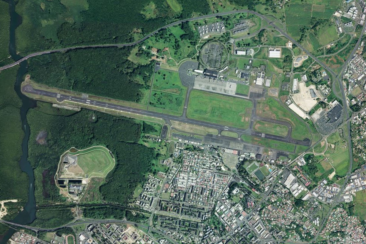
Welcome to the next region of the world tour, featuring the Caribbean and eastern half of North America. Starting in Trinidad, this stage will take you island hopping north through the Caribbean, then turning west with the islands to finish in the Dominican Republic. One the way you’ll experience beautiful island scenery, and some iconic airports on the islands of Saba, Saint Barts and Saint Maarten
Total Legs: 28 Total Distance: 1288 Total Time(125kts): 10 hours 18 minutes
Leg 1
Flying from TTPP
Leg Distance: 49.79 Approximate time at 125kts: 24 minutes.
TTPP(TTPP) to Matelot(POI1)
Distance: 19.17NM Bearing: 60° 9 minutes
After takeoff, fly northeast over the mountains to the northern coast of the island
Matelot(POI1) to Toco(POI2)
Distance: 11.1NM Bearing: 100° 5 minutes
Head to the eastern tip of the island at the town of Toco
Toco(POI2) to Tobago(POI3)
Distance: 18.83NM Bearing: 30° 9 minutes
Fly northeast across the Caribbean Sea to the southern tip of Tobago
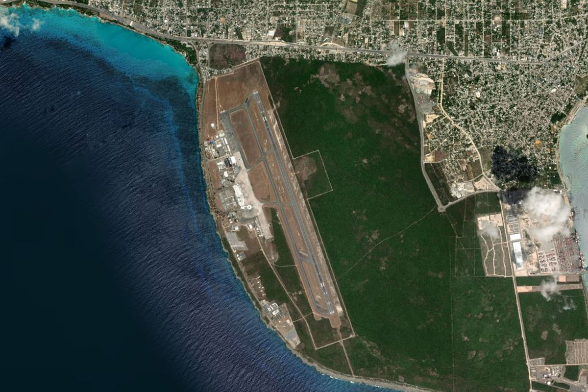
Tobago(POI3) to TTCP(TTCP)
Distance: 0.69NM Bearing: 71° 0 minutes
Crown Point airport is next to the coast
Leg 2
Flying from TTCP
Leg Distance: 85.97 Approximate time at 125kts: 41 minutes.
TTCP(TTCP) to Little Rocky Bay(POI4)
Distance: 3.49NM Bearing: 105° 2 minutes
Head east until you reach the coast
Little Rocky Bay(POI4) to Scarborough(POI5)
Distance: 2.72NM Bearing: 64° 1 minutes
Fly northeast along the coast to the town of Scarborough which houses the island's main port
Scarborough(POI5) to Western Tobago(POI6)
Distance: 3.63NM Bearing: 1° 2 minutes
Head north to the opposite coast
Western Tobago(POI6) to Grenada(POI7)
Distance: 74.34NM Bearing: 323° 36 minutes
Head northwest across the sea to the island of Grenada
Grenada(POI7) to TGPY(TGPY)
Distance: 1.79NM Bearing: 319° 1 minutes
The airport dominates the western tip of the island
Leg 3
Flying from TGPY
Leg Distance: 36.33 Approximate time at 125kts: 17 minutes.
TGPY(TGPY) to Mt. Hartman National Park(POI8)
Distance: 2.19NM Bearing: 105° 1 minutes
Head east after takeoff (runway heading) until you reach the forested Mt. Hartman National Park
Mt. Hartman National Park(POI8) to Grand Etang Lake(POI9)
Distance: 6.35NM Bearing: 45° 3 minutes
Turn northeast and head for the mountains. After passing by the capital of St. Georges, you will reach the small crater lake of Grand Etang, which is part of the volcano that formed the island
Grand Etang Lake(POI9) to Pearls(POI10)
Distance: 6.04NM Bearing: 73° 3 minutes
Turn northeast and head for the coast, passing by an area filled with waterfalls such as Seven Sisters, Adelphi and Mt. Carmel Waterfalls
Pearls(POI10) to Ronde Island(POI11)
Distance: 9.51NM Bearing: 23° 5 minutes
Fly to the north of the island, then over the sea to the private Ronde Island
Ronde Island(POI11) to Carriacou(POI12)
Distance: 9.82NM Bearing: 48° 5 minutes
Fly northeast to the second largest of Grenada's islands, Carriacou
Carriacou(POI12) to TGPZ(TGPZ)
Distance: 2.42NM Bearing: 53° 1 minutes
Continue northeast to Lauriston Airport which is on the northern side of the nearby hills
Leg 4
Flying from TGPZ
Leg Distance: 17.52 Approximate time at 125kts: 8 minutes.
TGPZ(TGPZ) to Petite Martinique(POI13)
Distance: 5.58NM Bearing: 79° 3 minutes
After takeoff, head northeast to the nearby island of Petite Martinique
Petite Martinique(POI13) to Mayreau(POI14)
Distance: 7.35NM Bearing: 13° 4 minutes
Head north past the reef and small island of Petite St Vincent, which is part of St Vincent and the Grenadines; before continuing north to the island of Mayreau
Mayreau(POI14) to TVSC(TVSC)
Distance: 4.59NM Bearing: 53° 2 minutes
Head northeast to the next island, Canouan, whose southern tip is dominated by the airport
Leg 5
Flying from TVSC
Leg Distance: 22.73 Approximate time at 125kts: 11 minutes.
TVSC(TVSC) to Petite Canouan(POI15)
Distance: 6.67NM Bearing: 51° 3 minutes
Fly to the north of the island, then northeast to the small island of Petite Canouan
Petite Canouan(POI15) to Mustique(POI16)
Distance: 7.8NM Bearing: 64° 4 minutes
Continue northeast to the island of Mustique
Mustique(POI16) to Isle a Quatre(POI17)
Distance: 6.43NM Bearing: 335° 3 minutes
Head northwest to the mostly uninhabited island of Quatre
Isle a Quatre(POI17) to TVSB(TVSB)
Distance: 1.83NM Bearing: 354° 1 minutes
Just north is the Island of Bequia, and J.F. Mitchell Airport
Leg 6
Flying from TVSB
Leg Distance: 104.54 Approximate time at 125kts: 50 minutes.
TVSB(TVSB) to Battowia(POI18)
Distance: 7.97NM Bearing: 116° 4 minutes
After takeoff, fly east (runway heading) to the nearby island of Battowia
Battowia(POI18) to Bridgetown(POI19)
Distance: 88.55NM Bearing: 100° 43 minutes
Fly east over the sea to the city of Bridgetown, capital of Barbados
Bridgetown(POI19) to Oistins(POI20)
Distance: 4.86NM Bearing: 131° 2 minutes
Follow the coast southeast
Oistins(POI20) to TBPB(TBPB)
Distance: 3.16NM Bearing: 94° 2 minutes
The airport is on the southeastern corner of the island
Leg 7
Flying from TBPB
Leg Distance: 103.39 Approximate time at 125kts: 50 minutes.
TBPB(TBPB) to Barbados(POI21)
Distance: 15.25NM Bearing: 340° 7 minutes
After takeoff, fly to the north of the island. Once a major producer of sugar cane driven by slavery for hundreds of years, the island nation is now famous for its beautiful beaches, it's national sport of Cricket, it's Rum, and pop singer Rihanna
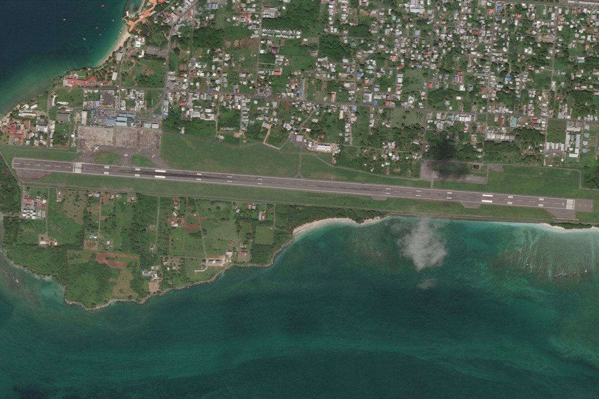
Barbados(POI21) to TVSA(TVSA)
Distance: 88.14NM Bearing: 281° 42 minutes
From Barbados, head west over the Caribbean Sea to the island of Saint Vincent. As you see the mountainous north of the island come into view, head to Argyle Airport on the southeast coast
Leg 8
Flying from TVSA
Leg Distance: 58.51 Approximate time at 125kts: 28 minutes.
TVSA(TVSA) to La Soufriere Volcano(POI22)
Distance: 13.23NM Bearing: 8° 6 minutes
After takeoff, head to the northern tip of the island, past La Soufriere Volcano whose latest period of eruptions began in April 2021
La Soufriere Volcano(POI22) to St. Lucia(POI23)
Distance: 23.86NM Bearing: 45° 11 minutes
Turn northeast and fly to the next island nation of St. Lucia
St. Lucia(POI23) to Gros Piton(POI24)
Distance: 7.53NM Bearing: 326° 4 minutes
Fly northwest along the coast to the pyramid shaped mountain of Gros Piton
Gros Piton(POI24) to Anse La Raye(POI25)
Distance: 8.26NM Bearing: 28° 4 minutes
Follow the coastline northeast past Petit Piton, the second of the two volcanic plugs. Near the town of Soufrière is another popular tourist attraction, the geothermal field of Sulphur Springs
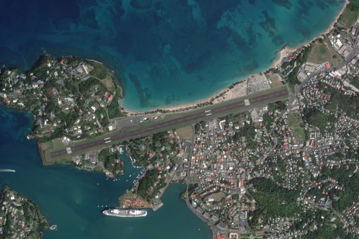
Anse La Raye(POI25) to TLPC(TLPC)
Distance: 5.63NM Bearing: 47° 3 minutes
Continue northeast to the nation's capital, Castries, and the airport just north of the port and cruise terminal area
Leg 9
Flying from TLPC
Leg Distance: 36.17 Approximate time at 125kts: 17 minutes.
TLPC(TLPC) to Gros Islet(POI26)
Distance: 6.19NM Bearing: 47° 3 minutes
Fly northeast to the northern tip of the island
Gros Islet(POI26) to Martinique(POI27)
Distance: 20.85NM Bearing: 1° 10 minutes
Head north over the sea to Martinique, an overseas region of France with a blend of French and West-Indian culture. Just south of the island is Diamond Rock, a small basalt island and battle site during the Napoleonic Wars
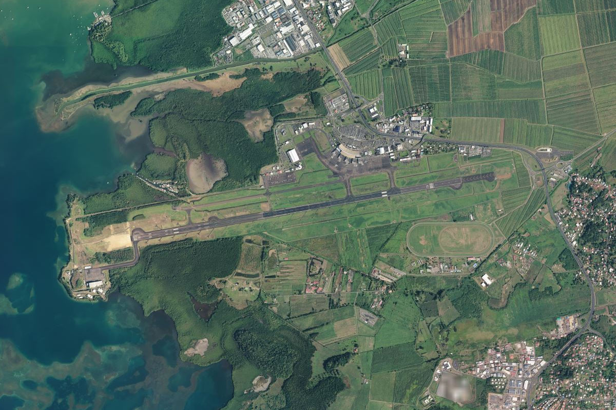
Martinique(POI27) to TFFF(TFFF)
Distance: 9.13NM Bearing: 28° 4 minutes
Head northeast to Le Lementin airport, near the capital city of Fort-de-France in the southwest of the island
Leg 10
Flying from TFFF
Leg Distance: 63.94 Approximate time at 125kts: 31 minutes.
TFFF(TFFF) to Montagne Pelee(POI28)
Distance: 16.22NM Bearing: 342° 8 minutes
After takeoff, head northwest to the large volcano on the northern end of the island, Mount Pelée, which last erupted in 1932 but is still considered active
Montagne Pelee(POI28) to Dominica(POI29)
Distance: 26.01NM Bearing: 356° 12 minutes
From the volcano, head north to the island of Dominica
Dominica(POI29) to Morne Trois Pitons National Park(POI30)
Distance: 9.49NM Bearing: 10° 5 minutes
Continue north past the eastern side of the large three-peak mountain that dominates the centre of the island
Morne Trois Pitons National Park(POI30) to Castle Bruce(POI31)
Distance: 4.66NM Bearing: 62° 2 minutes
Once you pass the mountain, turn northeast and descend to the coast
Castle Bruce(POI31) to Atkinson(POI32)
Distance: 5.08NM Bearing: 7° 2 minutes
Follow the coast north
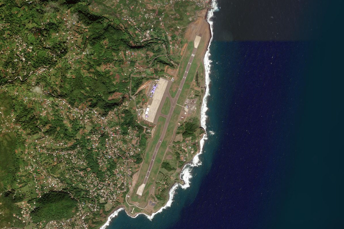
Atkinson(POI32) to TDPD(TDPD)
Distance: 2.48NM Bearing: 322° 1 minutes
The coast will turn to the northwest and lead you to Douglas-Charles Airport, the island's main airport
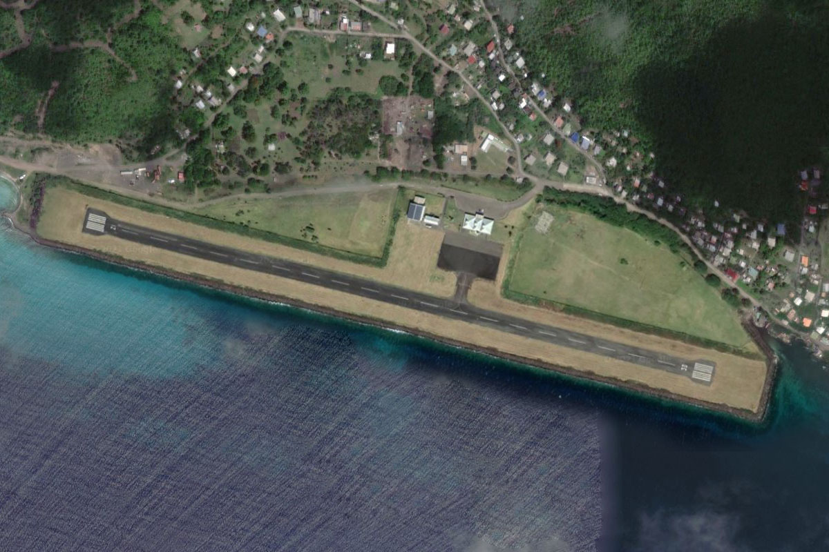
Leg 11
Flying from TDPD
Leg Distance: 26.73 Approximate time at 125kts: 13 minutes.
TDPD(TDPD) to Point Reposoir(POI33)
Distance: 10.14NM Bearing: 320° 5 minutes
After takeoff, head to the northern tip of the island
Point Reposoir(POI33) to Iles des Saintes(POI34)
Distance: 15.05NM Bearing: 339° 7 minutes
Fly northwest across the sea to Guadeloupe, a French overseas territory of six inhabited islands, plus many smaller ones. The small group of southern islands are the Îles des Saintes
Iles des Saintes(POI34) to TFFS(TFFS)
Distance: 1.54NM Bearing: 58° 1 minutes
Head to Le Saints airport, on the small island of Terre-de-Haut
Leg 12
Flying from TFFS
Leg Distance: 30.25 Approximate time at 125kts: 15 minutes.
TFFS(TFFS) to Basse-Terre(POI35)
Distance: 7.38NM Bearing: 360° 4 minutes
After takeoff, head north past the former prison of Fort Napoléon, before continuing north to the main island of Guadeloupe
Basse-Terre(POI35) to La Grande Soufriere(POI36)
Distance: 13.13NM Bearing: 359° 6 minutes
Continue north past the tallest mountain on the island, La Grande Soufrière, in an area also featuring the Carbet Waterfalls
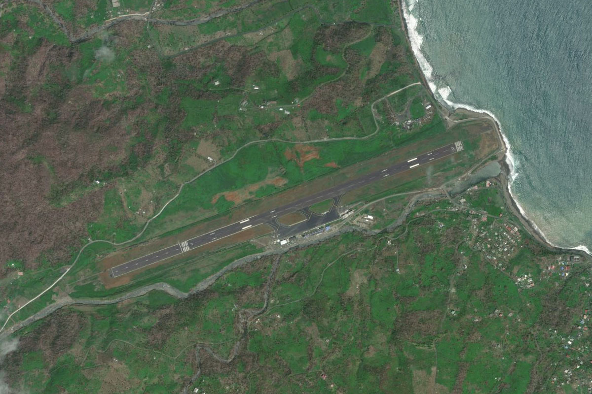
La Grande Soufriere(POI36) to TFFR(TFFR)
Distance: 9.74NM Bearing: 79° 5 minutes
As you enter the northern half of the island, head east for the largest city of Pointe-à-Pitre, with the airport just north of the city
Leg 13
Flying from TFFR
Leg Distance: 56.26 Approximate time at 125kts: 27 minutes.
TFFR(TFFR) to Pointe d’Antigues(POI37)
Distance: 10.58NM Bearing: 12° 5 minutes
Head north to the western most point of the low lying eastern half of the island, named Grande-Terre
Pointe d’Antigues(POI37) to Montserrat(POI38)
Distance: 38.2NM Bearing: 307° 18 minutes
Turn and head northwest to the island of Montserrat, which is a British overseas territory
Montserrat(POI38) to Soufriere Hills(POI39)
Distance: 4.07NM Bearing: 340° 2 minutes
Continue northwest past the Soufrière Hills volcano, which has caused significant damage to the southern part of the island since the 1990s
Soufriere Hills(POI39) to TRPG(TRPG)
Distance: 3.41NM Bearing: 15° 2 minutes
Head to Osborne Airport near the northern end of the island
Leg 14
Flying from TRPG
Leg Distance: 35.53 Approximate time at 125kts: 17 minutes.
TRPG(TRPG) to Antigua and Barbuda(POI40)
Distance: 23.69NM Bearing: 71° 11 minutes
After takeoff, head northeast across the water to the island of Antigua
Antigua and Barbuda(POI40) to English Harbour(POI41)
Distance: 4.32NM Bearing: 107° 2 minutes
Fly along the southern coast of the island to English Harbour, home to the historic port area of Nelson's Dockyard
English Harbour(POI41) to TAPA(TAPA)
Distance: 7.52NM Bearing: 8° 4 minutes
Fly north along the center of the island to V.C.Bird airport on the outskirts of the capital city of St. John's, named for the country's first prime minister
Leg 15
Flying from TAPA
Leg Distance: 56.82 Approximate time at 125kts: 27 minutes.
TAPA(TAPA) to Nevis(POI42)
Distance: 42.9NM Bearing: 286° 21 minutes
Head west across the sea to the island of Nevis, the southern of the two major islands that make up the nation of St. Kitts and Nevis
Nevis(POI42) to Hurricane Cove(POI43)
Distance: 4.91NM Bearing: 326° 2 minutes
Head northwest to the northern end of the island
Hurricane Cove(POI43) to TKPK(TKPK)
Distance: 9.01NM Bearing: 329° 4 minutes
Continue northwest to the island of St. Kitts, and along the southeast peninsula to the airport in the capital city of Basseterre, the smallest of the host cities for the 2007 Cricket World Cup
Leg 16
Flying from TKPK
Leg Distance: 35.15 Approximate time at 125kts: 17 minutes.
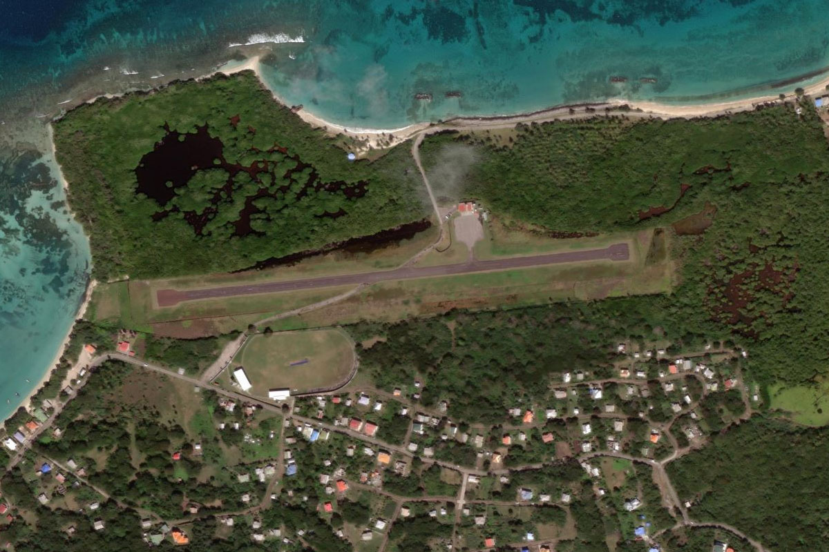
TKPK(TKPK) to Saint Paul’s(POI44)
Distance: 8.95NM Bearing: 327° 4 minutes
Head to the north end of the island, passing by Mount Liamuiga, the highest point on the island
Saint Paul’s(POI44) to Statia(POI45)
Distance: 9.32NM Bearing: 316° 4 minutes
Fly northwest to the next island of Statia, which is an overseas territory of The Netherlands. The volcano in the south of the island is the second highest mountain in the Netherlands
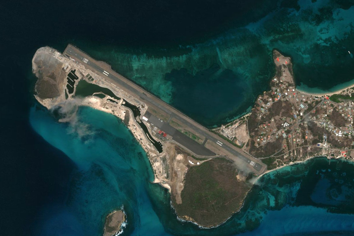
Statia(POI45) to TNCS(TNCS)
Distance: 16.88NM Bearing: 318° 8 minutes
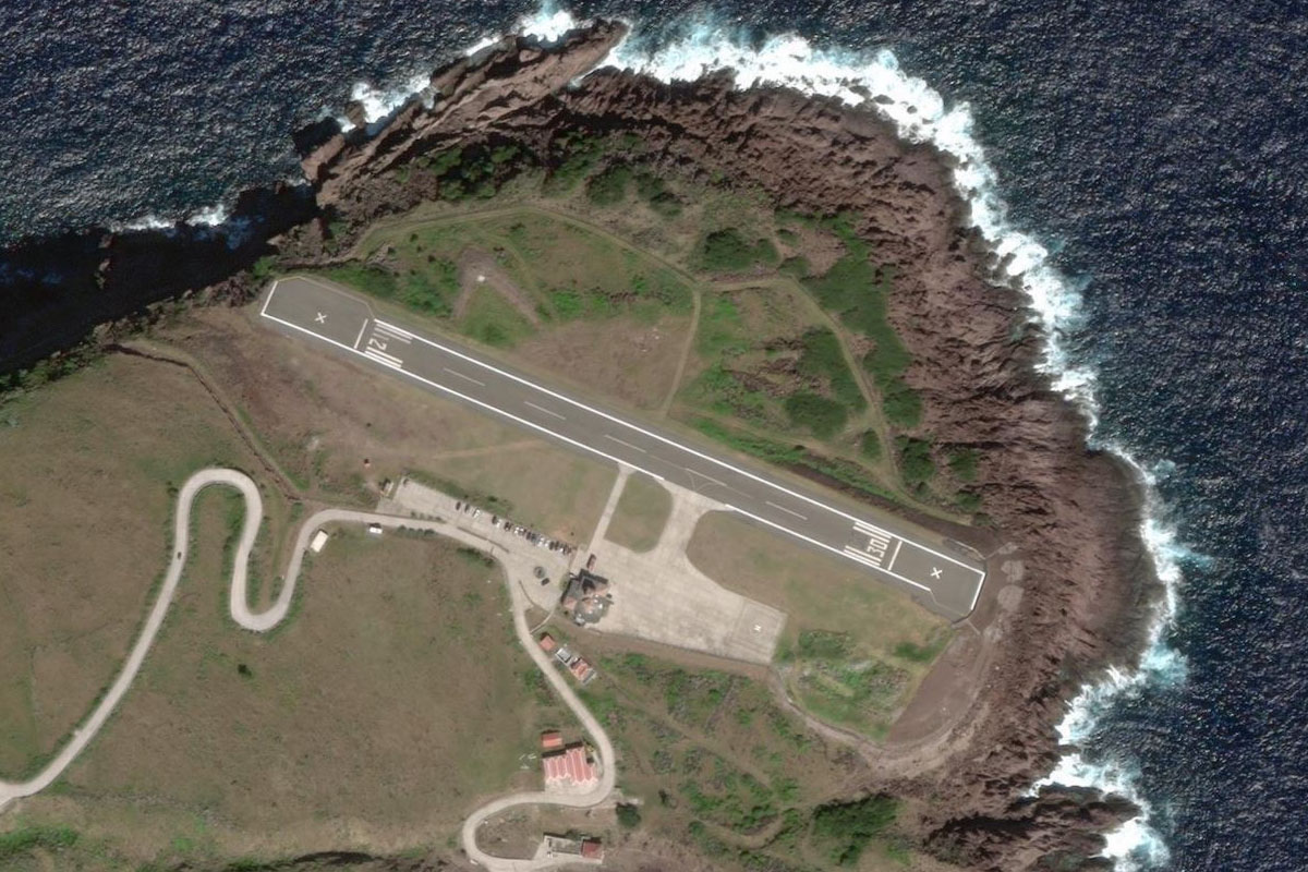
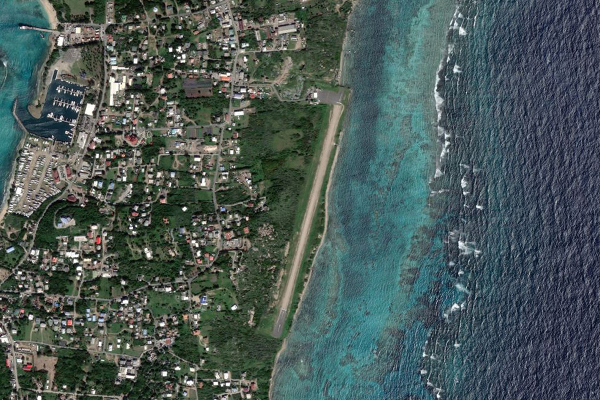
Continue northwest to the island of Saba, with it's iconic airport on the northeastern tip of the island. The main peak on the island, Mount Scenery, is the highest point in The Netherlands
Leg 17
Flying from TNCS
Leg Distance: 26.59 Approximate time at 125kts: 13 minutes.
TNCS(TNCS) to Saint Barthelemy(POI46)
Distance: 26.01NM Bearing: 68° 12 minutes
Fly northeast to the island of Saint Barthélemy, another overseas French region
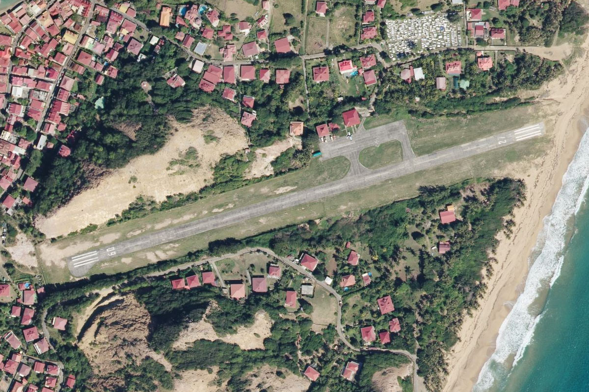
Saint Barthelemy(POI46) to TFFJ(TFFJ)
Distance: 0.58NM Bearing: 98° 0 minutes
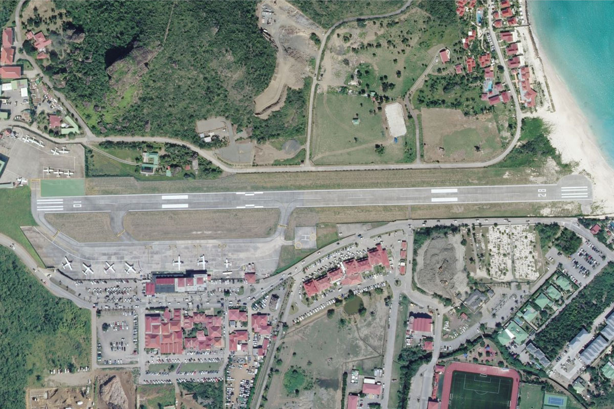
Head to the north of the terminal and port area to line up for the famous downhill approach east into Gustav III Airport
Leg 18
Flying from TFFJ
Leg Distance: 21.7 Approximate time at 125kts: 10 minutes.
TFFJ(TFFJ) to Pointe Milou(POI47)
Distance: 1.75NM Bearing: 77° 1 minutes
After takeoff, head east along the coast
Pointe Milou(POI47) to Ile Fourchue(POI48)
Distance: 5.42NM Bearing: 311° 3 minutes
Turn and head northwest, passing over the islands of the Saint Barthelemy Natural Reserve
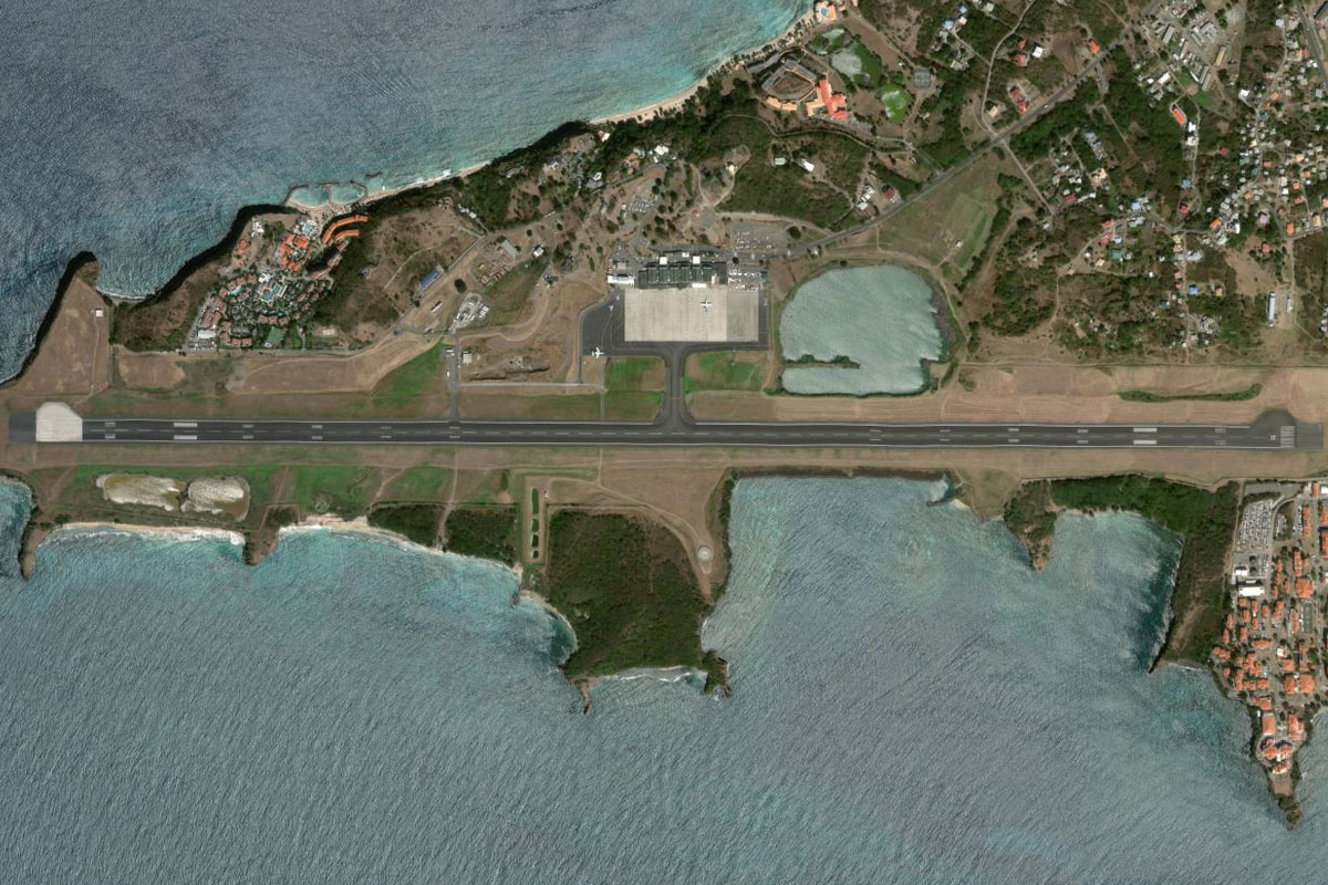
Ile Fourchue(POI48) to St. Maarten(POI49)
Distance: 8.49NM Bearing: 306° 4 minutes
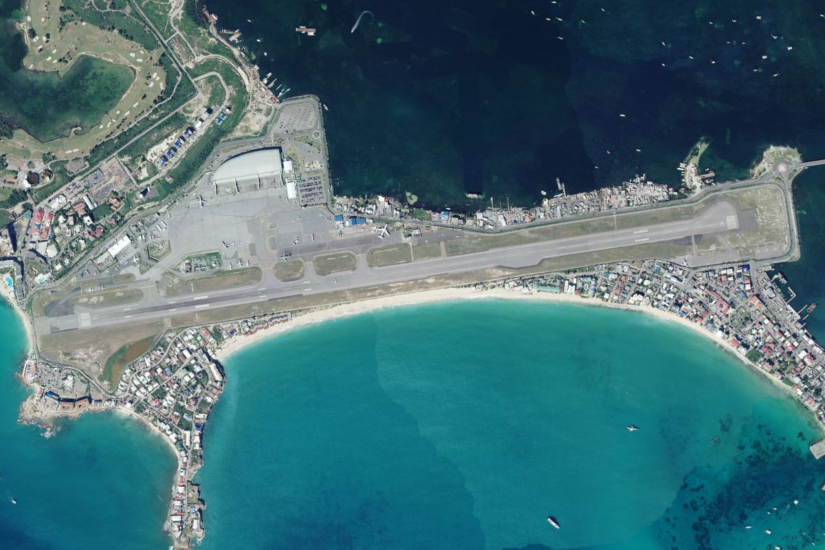
Continue northwest to the island of St. Maarten. The cruise terminal is on the southeastern tip of the island
St. Maarten(POI49) to Maho Bay(POI50)
Distance: 5.14NM Bearing: 306° 2 minutes
Follow the south coast of the island to Maho Bay, where you can line up for landing
Maho Bay(POI50) to TNCM(TNCM)
Distance: 0.9NM Bearing: 96° 0 minutes
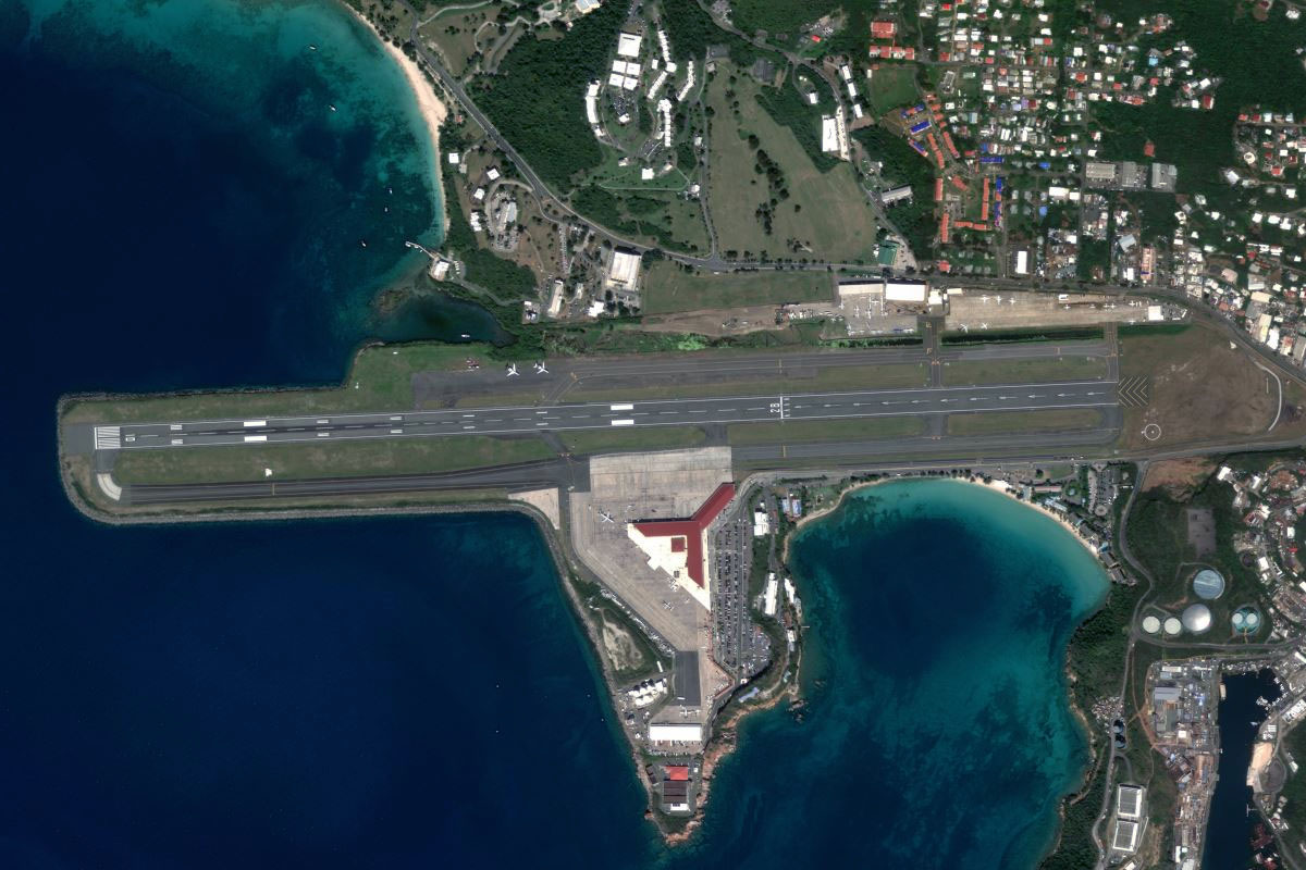
The easterly approach into Princess Juliana is one of the world's most famous, with aircraft of all sizes passing low over Maho Beach to the joy of plane spotters from all over the world
Leg 19
Flying from TNCM
Leg Distance: 13.54 Approximate time at 125kts: 6 minutes.
TNCM(TNCM) to Belvedere(POI51)
Distance: 4.44NM Bearing: 92° 2 minutes
After takeoff, head to the eastern side of the island
Belvedere(POI51) to Petites Cayes(POI52)
Distance: 4.03NM Bearing: 19° 2 minutes
Fly to the north of the island
Petites Cayes(POI52) to TQPF(TQPF)
Distance: 5.07NM Bearing: 358° 2 minutes
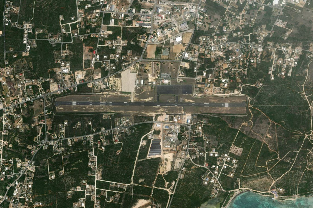
Continue north to the flat island of Anguilla, only five miles north of St. Maarten. The airport is in the center of the island along with the capital, The Valley
Leg 20
Flying from TQPF
Leg Distance: 80.85 Approximate time at 125kts: 39 minutes.
TQPF(TQPF) to Dog Island(POI53)
Distance: 12.33NM Bearing: 305° 6 minutes
After takeoff, head northwest to the outermost of the nearby islands, Dog Island
Dog Island(POI53) to Virgin Gorda(POI54)
Distance: 64.17NM Bearing: 296° 31 minutes
Head northwest across the sea to the distant mountains of Virgin Gorda, one of the four main islands of the British Virgin Islands
Virgin Gorda(POI54) to TUPW(TUPW)
Distance: 4.35NM Bearing: 255° 2 minutes
Fly to the southern end of the island, home to its main settlement of Spanish Town and the airport on the east coast. This area is also home to a popular tourist attraction known as 'The Baths'
Leg 21
Flying from TUPW
Leg Distance: 33.29 Approximate time at 125kts: 16 minutes.
TUPW(TUPW) to Tortola(POI55)
Distance: 10.66NM Bearing: 278° 5 minutes
Fly east to the island of Tortola, and its capital of Road Town near the center of the island
Tortola(POI55) to Saint John(POI56)
Distance: 8.64NM Bearing: 248° 4 minutes
Continue southwest into the US Virgin Islands, and the island of Saint John, much of which is part of the Virgin Islands National Park
Saint John(POI56) to Saint Thomas(POI57)
Distance: 10.86NM Bearing: 275° 5 minutes
Head west to the island of Saint Thomas, home of the territory's capital, Charlotte Amalie
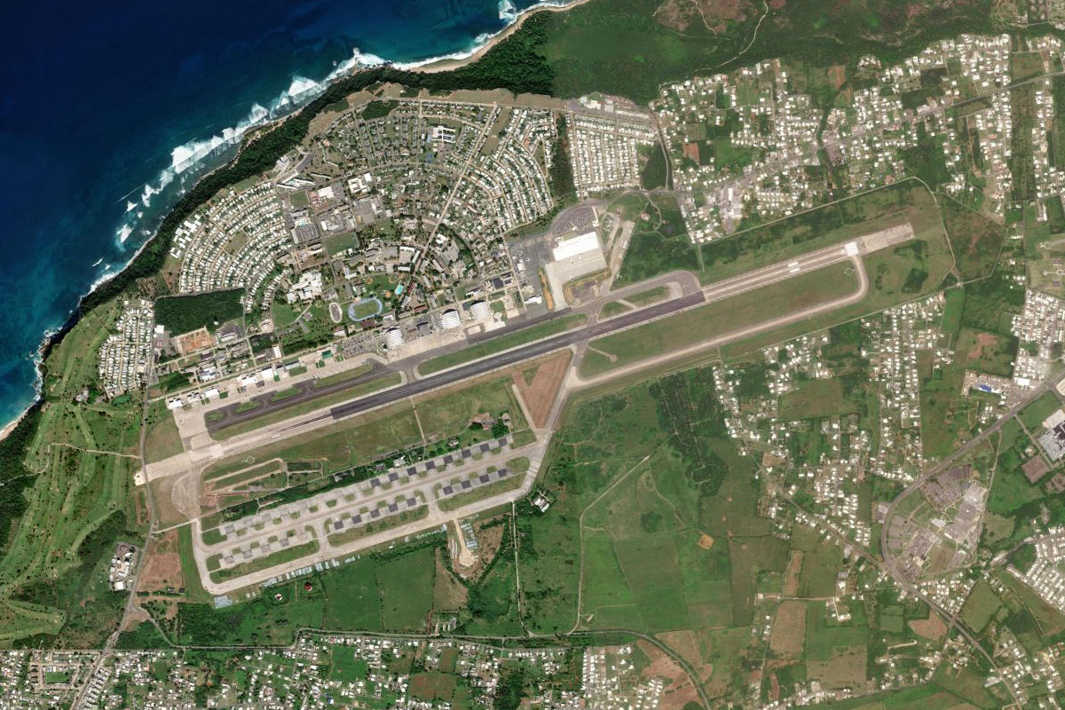
Saint Thomas(POI57) to TIST(TIST)
Distance: 3.13NM Bearing: 312° 2 minutes
Follow the south coast of the island to Cyril E King Airport, west of the capital
Leg 22
Flying from TIST
Leg Distance: 25 Approximate time at 125kts: 12 minutes.
TIST(TIST) to Peterborg(POI58)
Distance: 3.33NM Bearing: 62° 2 minutes
Fly northeast to the thin peninsula of Peterborg, an area of luxury villas and holiday rentals
Peterborg(POI58) to Savana(POI59)
Distance: 8.73NM Bearing: 271° 4 minutes
Turn and fly west to the small uninhabited Savana Island
Savana(POI59) to TJCP(TJCP)
Distance: 12.94NM Bearing: 277° 6 minutes
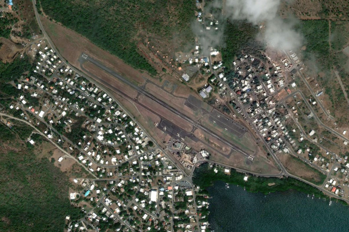
Continue west to the Puerto Rican island of Culebra. The airport is in the west of the island. Winds permitting – try the challenging approach from the north
Leg 23
Flying from TJCP
Leg Distance: 41.24 Approximate time at 125kts: 20 minutes.
TJCP(TJCP) to Puerto Rico(POI60)
Distance: 18.14NM Bearing: 283° 9 minutes
After takeoff, head west to the main island of Puerto Rico
Puerto Rico(POI60) to Rio Grande(POI61)
Distance: 12.57NM Bearing: 304° 6 minutes
Fly northwest between the coast and the Sierra de Luquillo mountains, which are home to the El Yunque National Forest, the only tropical rainforest in the US National Forest system
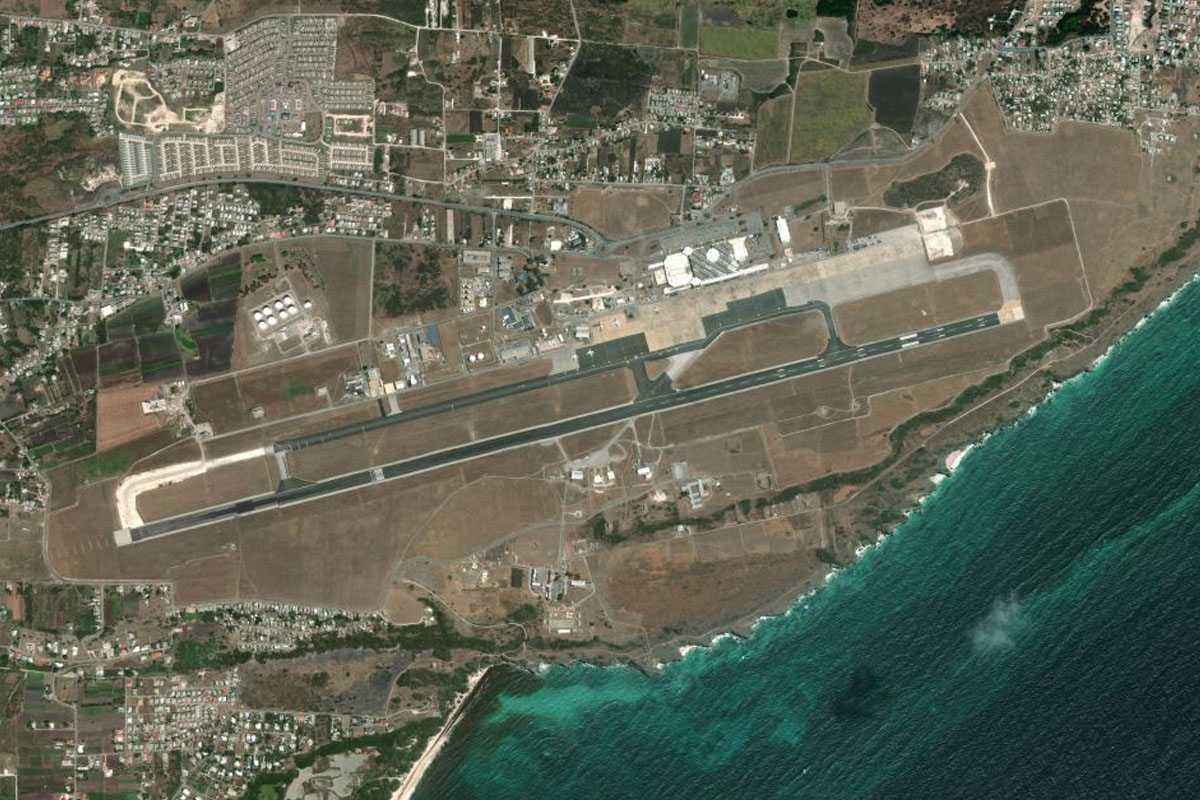
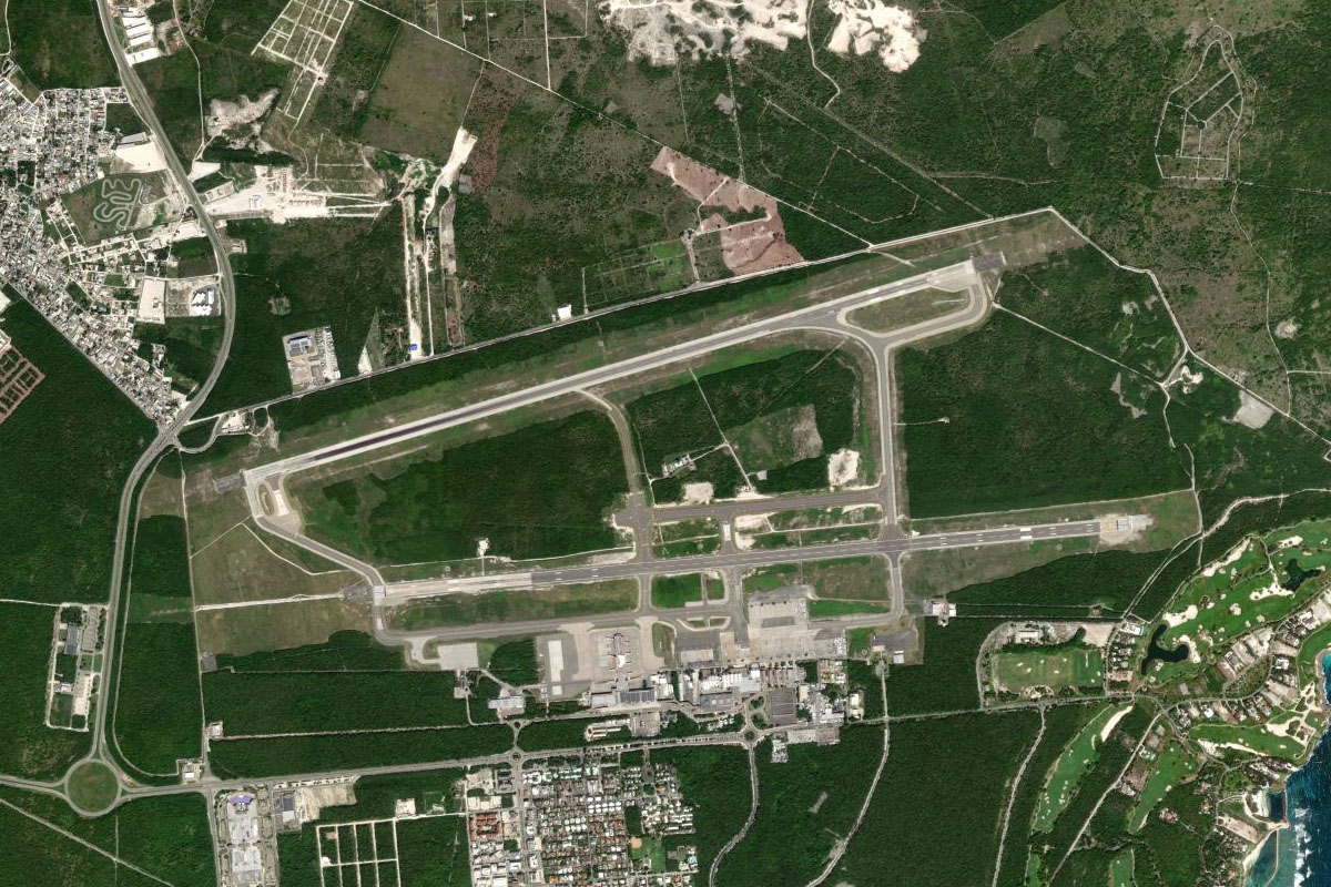
Rio Grande(POI61) to TJSJ(TJSJ)
Distance: 10.53NM Bearing: 304° 5 minutes
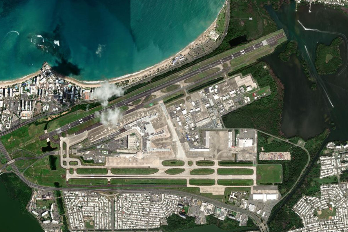
Continue northwest towards the capital city of San Juan, and Luis Muñoz Marín International Airport near the coast, east of the city
Leg 24
Flying from TJSJ
Leg Distance: 39.05 Approximate time at 125kts: 19 minutes.
TJSJ(TJSJ) to Viejo San Juan(POI62)
Distance: 7.29NM Bearing: 299° 3 minutes
After takeoff, fly along the coast to the historic area of San Juan. The small island is home to several historical city walls, citadel fortresses and churches
Viejo San Juan(POI62) to Arecibo(POI63)
Distance: 26.62NM Bearing: 286° 13 minutes
Follow the coast west until you near the large town of Arecibo
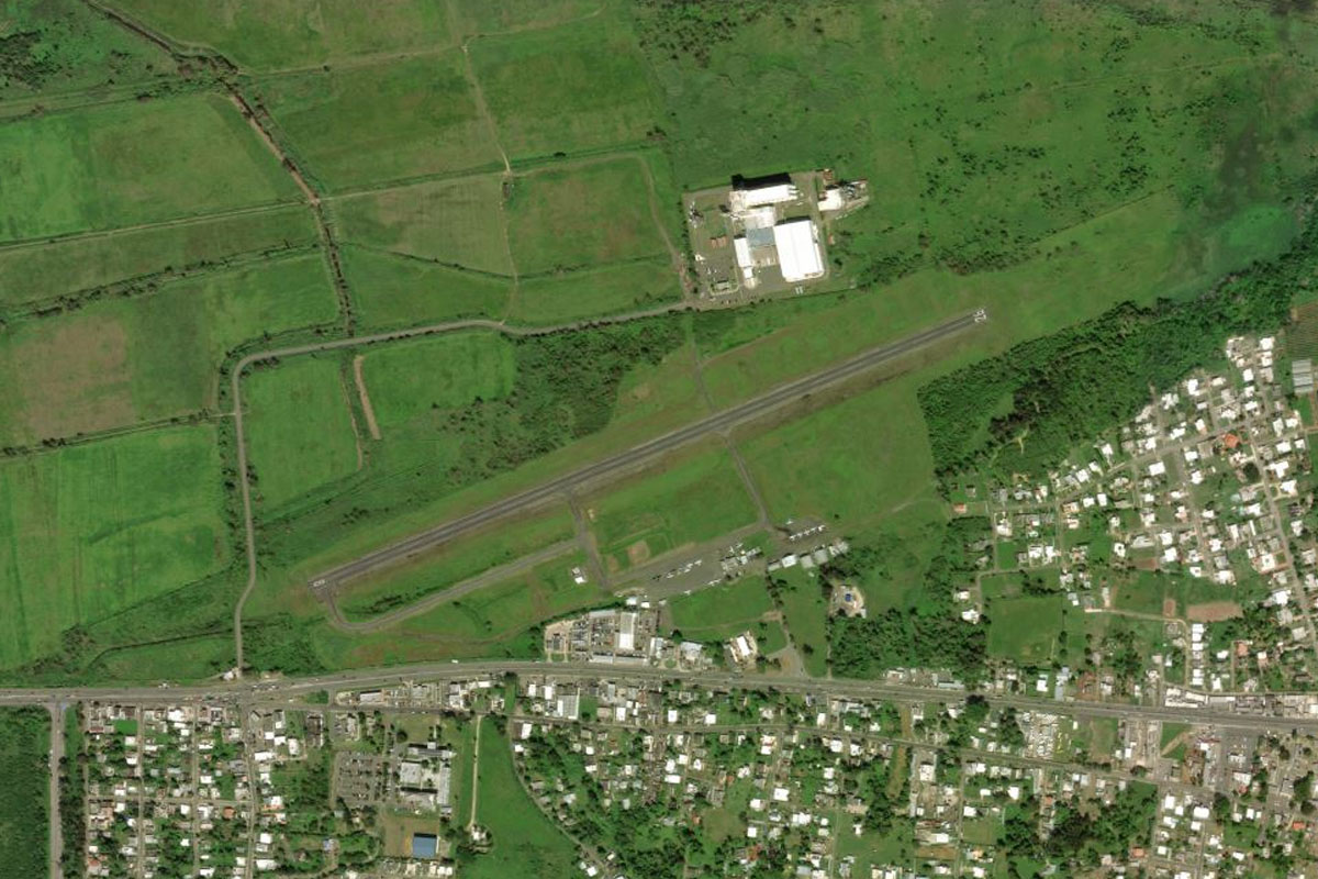
Arecibo(POI63) to TJAB(TJAB)
Distance: 5.14NM Bearing: 260° 2 minutes
Arecibo Airport is a couple of miles southeast from the town
Leg 25
Flying from TJAB
Leg Distance: 33.49 Approximate time at 125kts: 16 minutes.
TJAB(TJAB) to Rio Grande de Arecibo(POI64)
Distance: 5.51NM Bearing: 196° 3 minutes
After takeoff, follow the highway leading south from Arecibo towards the Rio Grande de Arecibo valley
Rio Grande de Arecibo(POI64) to Arecibo Observatory(POI65)
Distance: 4.27NM Bearing: 271° 2 minutes
As the valley starts to narrow, turn west and head for the Arecibo Observatory a few miles away. The 300 metre wide dish was part of the now destroyed Arecibo Telescope
Arecibo Observatory(POI65) to Lago Guajataca(POI66)
Distance: 8.81NM Bearing: 292° 4 minutes
Head west from the observatory to Guajataca Lake. The dam at the north end of the lake was damaged by hurricane Maria in 2017
Lago Guajataca(POI66) to TJBQ(TJBQ)
Distance: 14.9NM Bearing: 314° 7 minutes
Fly northwest to Rafael Hernandez Airport on the northwestern corner of the island
Leg 26
Flying from TJBQ
Leg Distance: 78.39 Approximate time at 125kts: 38 minutes.
TJBQ(TJBQ) to Canal de la Mona(POI67)
Distance: 71.02NM Bearing: 281° 34 minutes
After takeoff, fly west across the Mona Strait, which connects the Atlantic Ocean to the Caribbean Sea
Canal de la Mona(POI67) to MDPC(MDPC)
Distance: 7.37NM Bearing: 17° 4 minutes
As you reach the eastern coast of Dominican Republic. head north to the large airport at Punta Cana, a major Caribbean resort destination
Leg 27
Flying from MDPC
Leg Distance: 31.78 Approximate time at 125kts: 15 minutes.
MDPC(MDPC) to Autopista del Coral(POI68)
Distance: 26.16NM Bearing: 275° 13 minutes
After takeoff, follow the highway leading west from the airport
Autopista del Coral(POI68) to MDBC(MDBC)
Distance: 5.62NM Bearing: 263° 3 minutes
As the highway turns south, fly west to the grass airstrip of Batey Cacata airport, a couple of miles north of the much larger La Romana airport
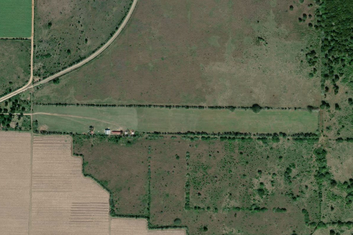
Leg 28
Flying from MDBC
Leg Distance: 43.36 Approximate time at 125kts: 21 minutes.
MDBC(MDBC) to Playa Nueva Romana(POI69)
Distance: 16.72NM Bearing: 274° 8 minutes
Head west until you reach the coast
Playa Nueva Romana(POI69) to Boca Chica(POI70)
Distance: 22.84NM Bearing: 284° 11 minutes
Follow the coast west to the town of Boca Chica, with its main beach a popular place for the residents of the capital Santo Domingo, 20 miles to the west
Boca Chica(POI70) to MDSD(MDSD)
Distance: 3.8NM Bearing: 264° 2 minutes
Las Américas International Airport is a few miles west of Boca Chica, and is the destination for this stage