Welcome to stage 42 of the tour, this time visiting the southeastern US states of Virginia, North Carolina and Georgia. From the small farmland towns of North Carolina to the major city of Charlotte, you’ll visit some spectacular airfields in the beautiful Blue Ridge Mountains before heading down into Georgia to its largest city, and one of America’s great cities, Atlanta. The second part of the stage will take you through the southern states of Alabama, Mississippi and Louisiana along the Gulf of Mexico coast to finish in the city known as ‘The Big Easy’ – New Orleans
Total Legs: 26 Total Distance: 1149 Total Time(125kts): 9 hours 11 minutes
Leg 1
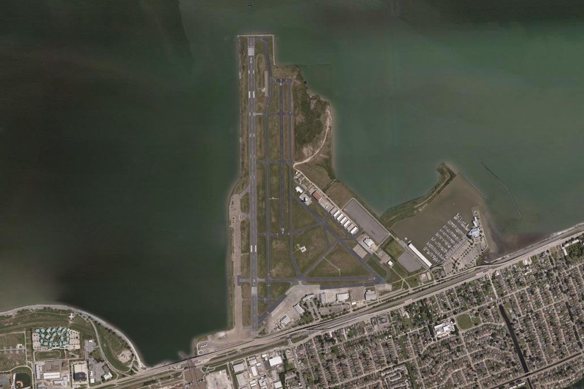
Flying from KORF
Leg Distance: 42.89 Approximate time at 125kts: 21 minutes.
KORF(KORF) to Willoughby Bay(POI1)
Distance: 7.53NM Bearing: 318° 4 minutes
After takeoff, head northwest towards Willoughby Bay, which sits to the north of Norfolk Naval Station
Willoughby Bay(POI1) to Hampton Roads(POI2)
Distance: 7.69NM Bearing: 247° 4 minutes
Once you pass the naval base and enter the main bay, turn to the southwest towards the long causeway crossing the bay. Just past the causeway, on the left shore, is a large warehouse which sits at the head of a wide river channel. Follow this river southwest
Hampton Roads(POI2) to Nansemond River(POI3)
Distance: 6.26NM Bearing: 239° 3 minutes
Follow the river as it turns to the south towards the town of Suffolk
Nansemond River(POI3) to Suffolk(POI4)
Distance: 6.08NM Bearing: 204° 3 minutes
As you approach the centre of town, turn right and follow the railway out of town to the west
Suffolk(POI4) to Carrsville(POI5)
Distance: 10.3NM Bearing: 277° 5 minutes
Follow the railway line west
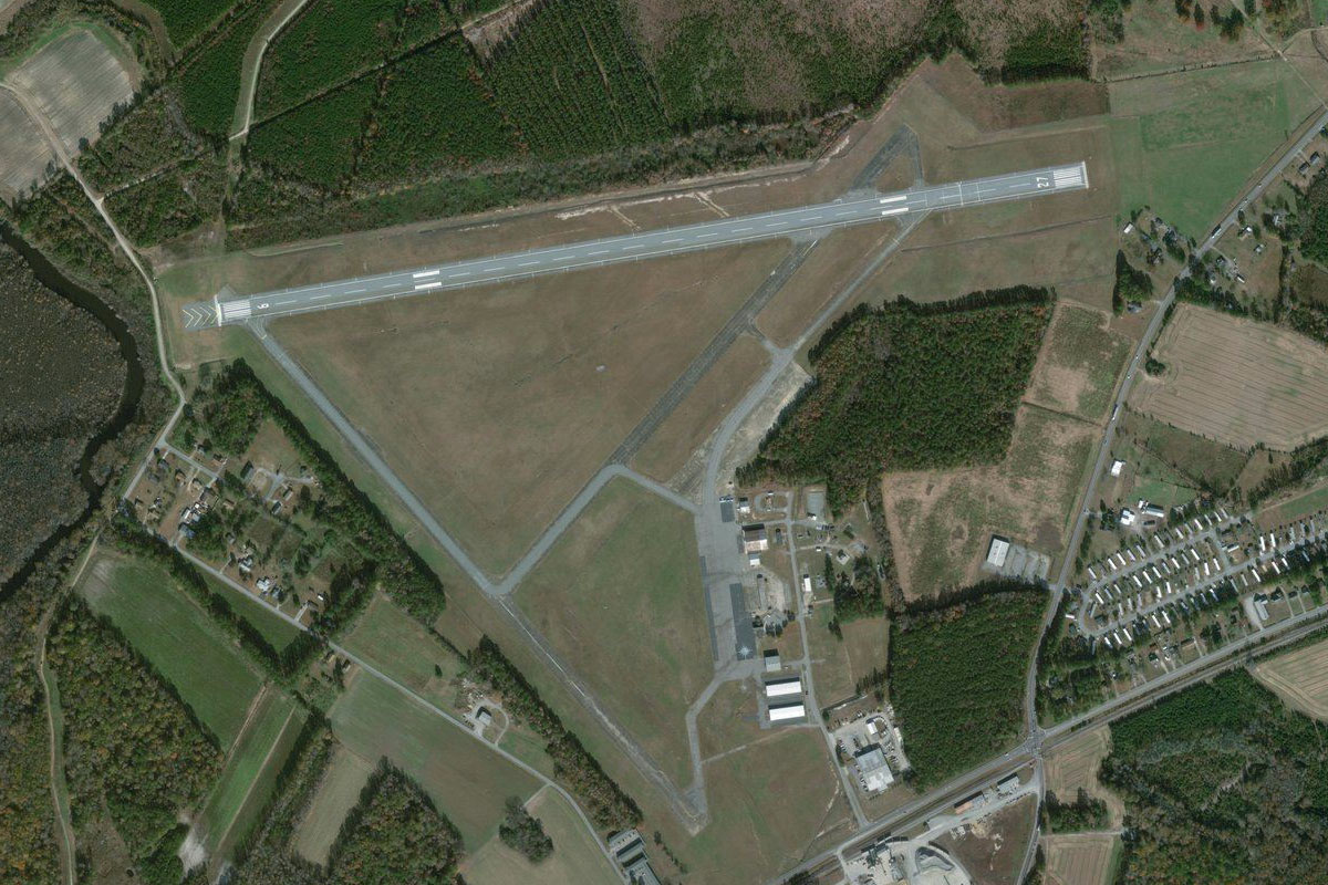
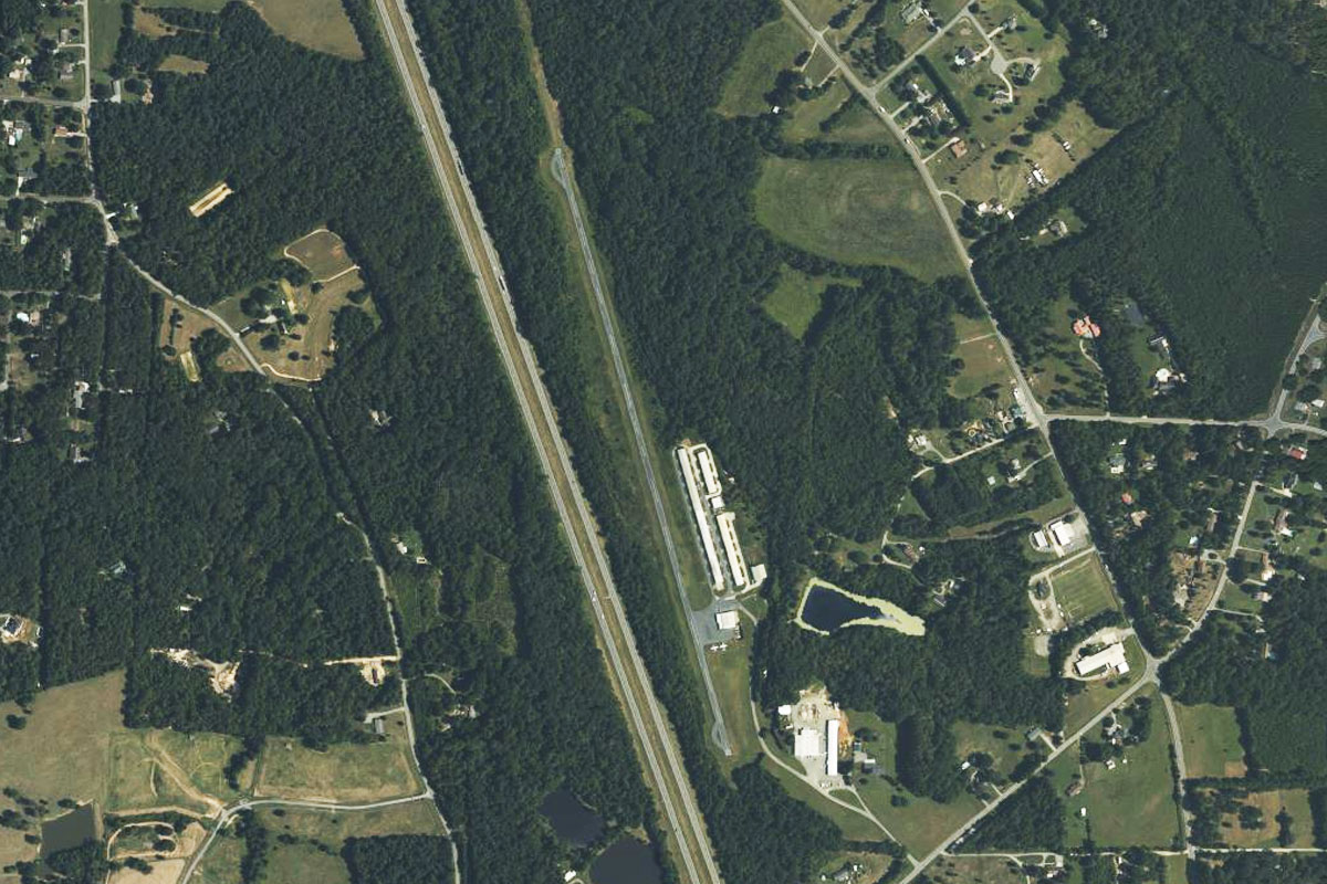
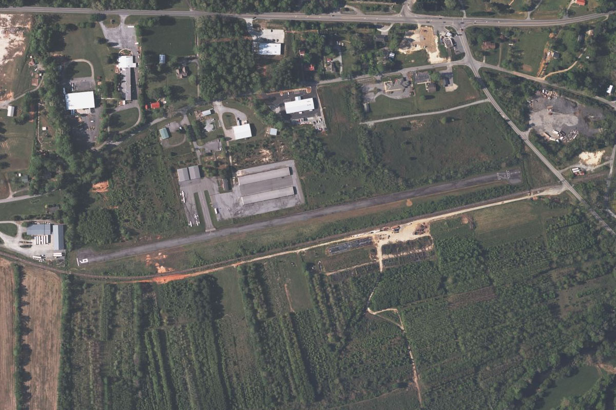
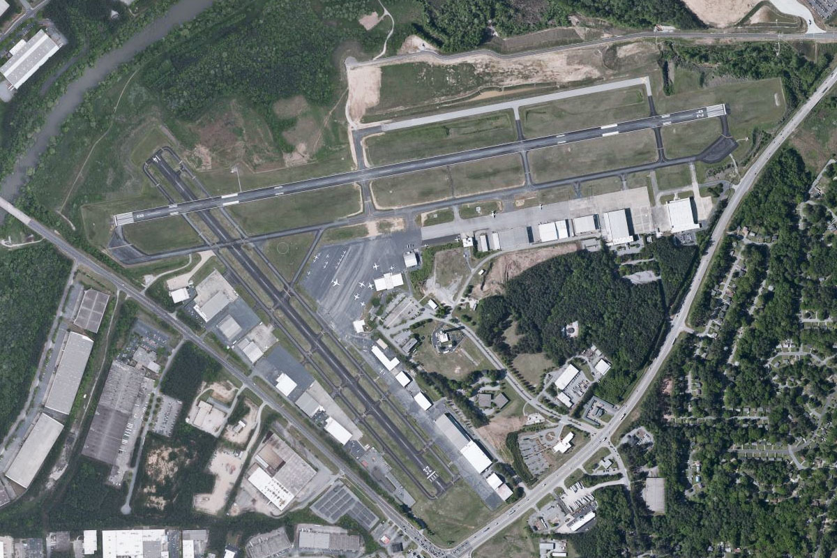
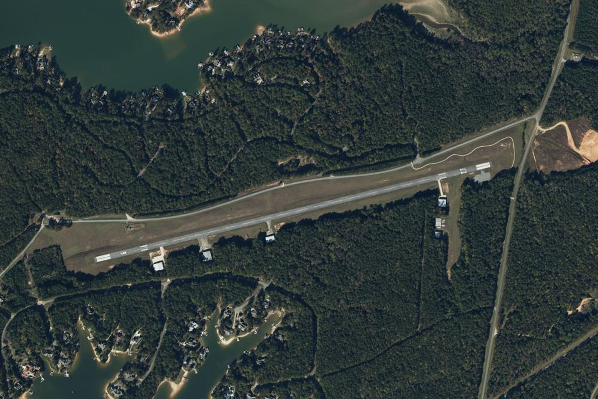
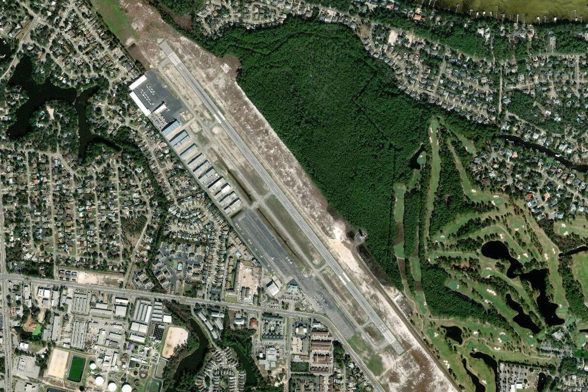
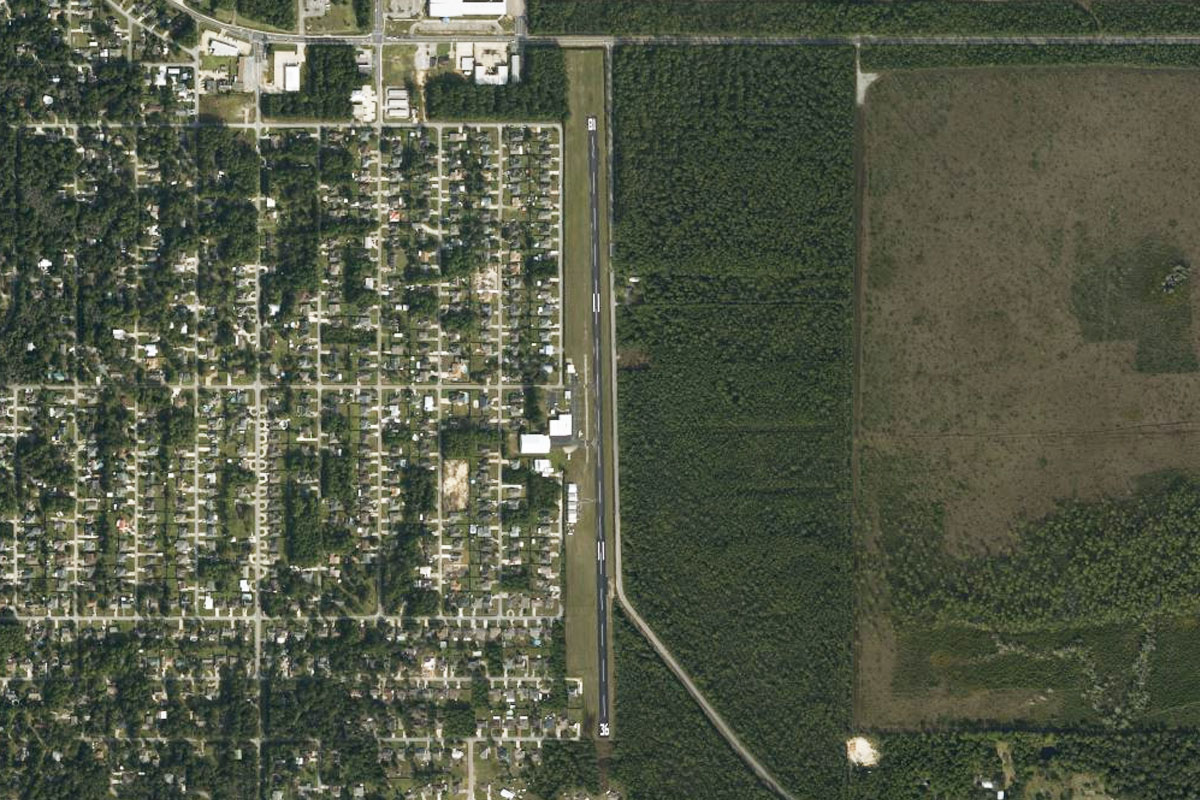
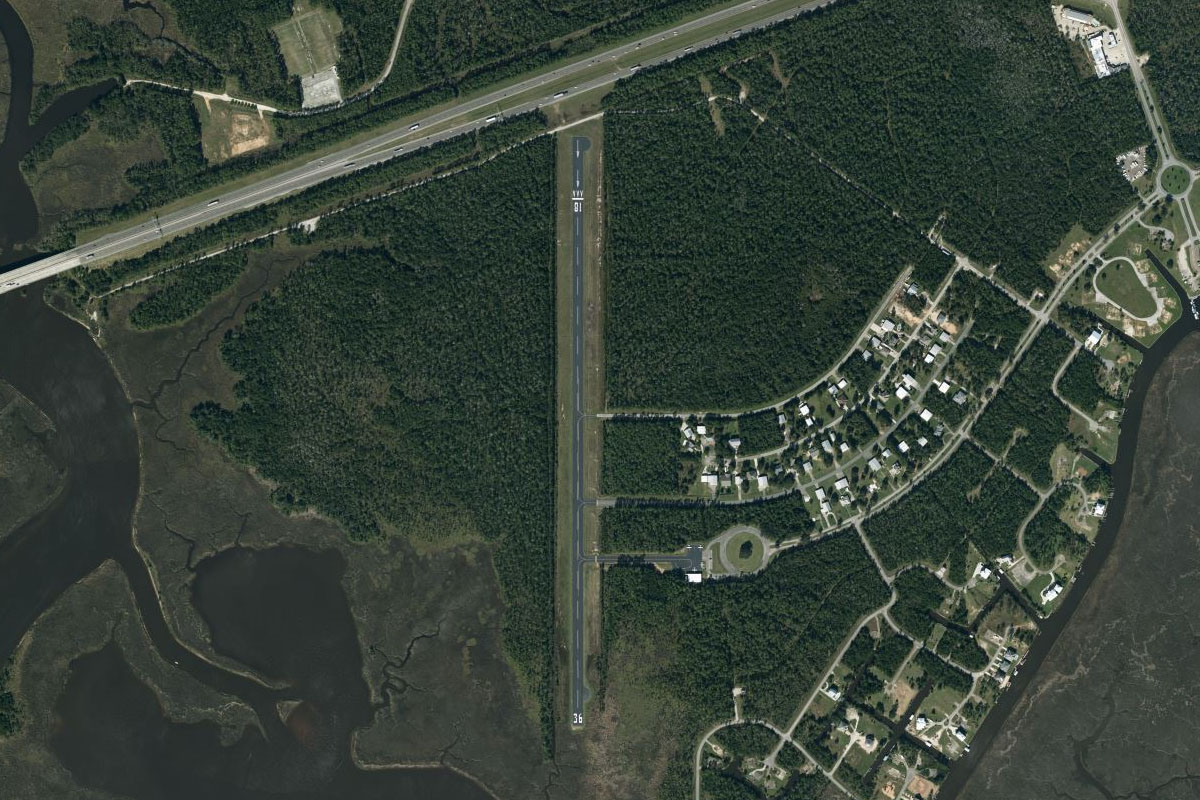
Carrsville(POI5) to KFKN(KFKN)
Distance: 5.03NM Bearing: 267° 2 minutes
When the railway turns slightly to the south, you should see the airport ahead, which sits just to the north of the tracks
Leg 2
Flying from KFKN
Leg Distance: 63.36 Approximate time at 125kts: 30 minutes.
KFKN(KFKN) to Boykins(POI6)
Distance: 15.67NM Bearing: 256° 8 minutes
After takeoff, head south to the town and then to the large retail park at its western edge. From here continue along the railway, which is running parallel to the road, and follow it to the southwest to the town of Boykins
Boykins(POI6) to Roanoke Rapids(POI7)
Distance: 21.68NM Bearing: 260° 10 minutes
Just after the town of Boykins you will see another rail line branch off to the south. Continue west for a few more miles and you should see the transmission line clearing just to the right side of the train line, cutting its way in a straight line forward towards the city of Roanoke Rapids. Follow the power lines
Roanoke Rapids(POI7) to Roanoke Rapids Lake(POI8)
Distance: 18.55NM Bearing: 290° 9 minutes
Head west from Roanoke Rapids along the lake, which will soon reduce in width as it continues west
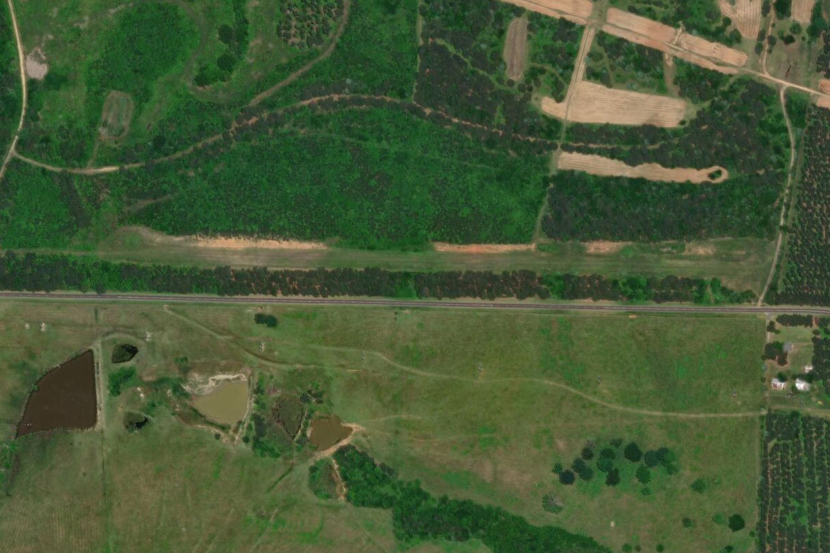
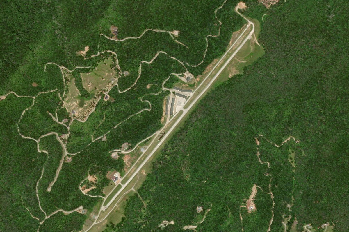
Roanoke Rapids Lake(POI8) to 70NC(70NC)
Distance: 7.46NM Bearing: 291° 4 minutes
A few miles after the river does a series of hairpin bends, you will see the power line clearing running along the south side of the river and past a large, square shaped open field. Just at the northern edge of this field is the grass airstrip
Leg 3
Flying from 70NC
Leg Distance: 43.69 Approximate time at 125kts: 21 minutes.
70NC(70NC) to Henderson(POI9)
Distance: 16.54NM Bearing: 235° 8 minutes
From the airfield, head southwest and track along Interstate 85, which will lead us all the way to our next airport. The road will fork near the town of Henderson. Take the right fork and continue southwest
Henderson(POI9) to Oxford(POI10)
Distance: 8.55NM Bearing: 263° 4 minutes
As it approaches the town of Oxford, the highway will curve around more to the south
Oxford(POI10) to I-85(POI11)
Distance: 9NM Bearing: 232° 4 minutes
Continue along the highway
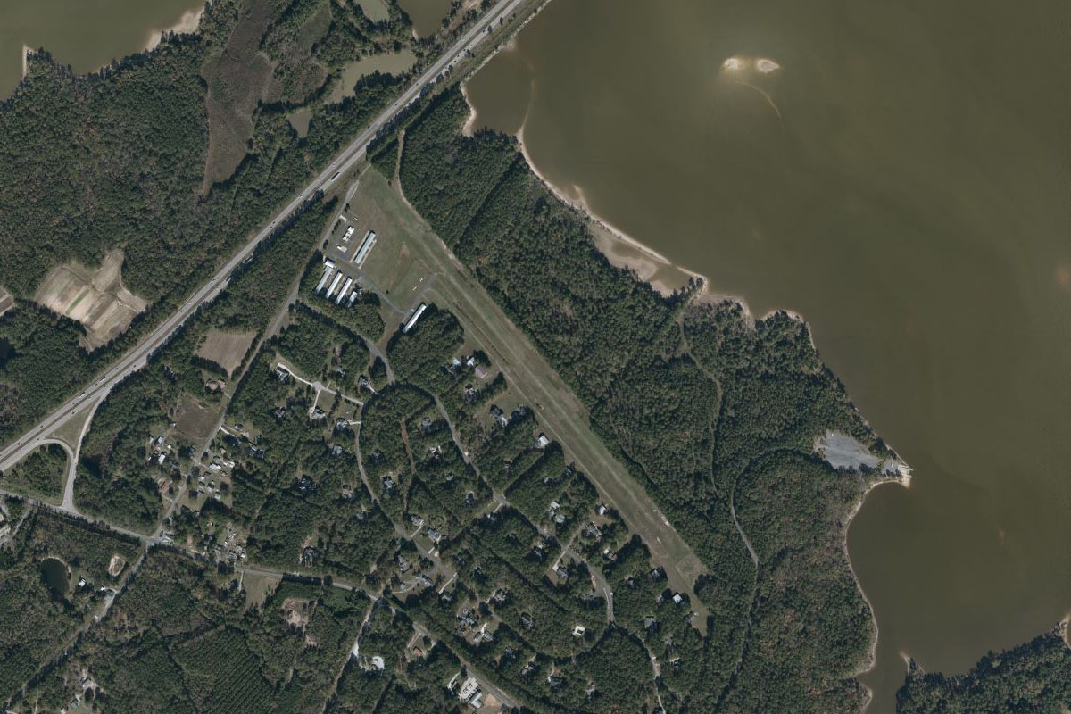
I-85(POI11) to 8NC8(8NC8)
Distance: 9.6NM Bearing: 219° 5 minutes
Follow the highway until it crosses Falls Lake. Just to the south of the bridge is Lake Ridge Aero Park
Leg 4
Flying from 8NC8
Leg Distance: 53.81 Approximate time at 125kts: 26 minutes.
8NC8(8NC8) to Durham(POI12)
Distance: 7.18NM Bearing: 242° 3 minutes
Head southwest to the center of the City of Durham. I-85 will lead the way. From the centre of town, turn to the northwest
Durham(POI12) to Huckleberry Hill(POI13)
Distance: 5.16NM Bearing: 317° 2 minutes
Follow the highway that leads northeast out of town. It will pass Duke University before joining with I-85 and head west
Huckleberry Hill(POI13) to Hillsborough(POI14)
Distance: 6.22NM Bearing: 290° 3 minutes
Keep following the highway. It will soon pass the town of Hillsborough and continue west
Hillsborough(POI14) to Mebane(POI15)
Distance: 6.29NM Bearing: 292° 3 minutes
The highway will pass by the town of Mebane, and an area of large warehouse complexes
Mebane(POI15) to Burlington(POI16)
Distance: 9.48NM Bearing: 273° 5 minutes
The freeway will pass south of the city of Burlington, and north of its airport
Burlington(POI16) to Greensboro(POI17)
Distance: 12.25NM Bearing: 278° 6 minutes
Follow the highway west towards the city of Greensboro. Near a group of warehouses, there will be a large interchange before the city. Turn left and follow the highway south
Greensboro(POI17) to Greensboro Urban Loop(POI18)
Distance: 1.71NM Bearing: 207° 1 minutes
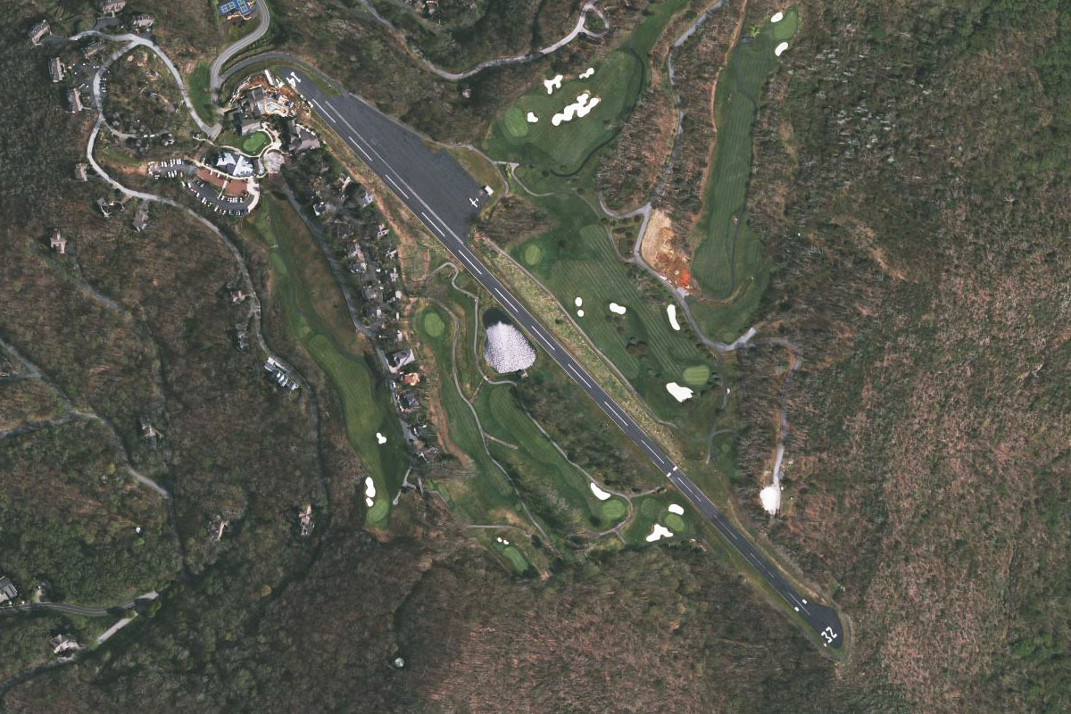
Follow this road for a brief period until it turns off to the west. Leave the road and continue south to a golf course a couple of miles ahead
Greensboro Urban Loop(POI18) to 3A4(3A4)
Distance: 5.52NM Bearing: 185° 3 minutes
Turn directly south from the golf course and you should be lined up with the airstrip, just to the left of the road
Leg 5
Flying from 3A4
Leg Distance: 45.53 Approximate time at 125kts: 22 minutes.
3A4(3A4) to I85 – I74(POI19)
Distance: 11.65NM Bearing: 275° 6 minutes
Fly directly west after takeoff and you will soon pass over I-73, then Randleman Lake before meeting I-85 near its large interchange with I-74. Turn to the left and follow I-85 to the southwest
I85 – I74(POI19) to Thomasville(POI20)
Distance: 8.46NM Bearing: 250° 4 minutes
Continue following the highway past the town of Thomasville
Thomasville(POI20) to I-85(POI21)
Distance: 4.99NM Bearing: 252° 2 minutes
The two carriageways of the highway will split for a few miles then rejoin just to the west of Lexington. Keep tracking southwest
I-85(POI21) to I-85(POI22)
Distance: 8.46NM Bearing: 256° 4 minutes
The highway will merge with another road and continue heading southwest, past a large rail marshalling yard to your left
I-85(POI22) to Salisbury(POI23)
Distance: 9.22NM Bearing: 238° 4 minutes
Just after the rail yard, the highway will curve around the town of Salisbury. Leave the highway and continue forward to the center of town
Salisbury(POI23) to KRUQ(KRUQ)
Distance: 2.75NM Bearing: 247° 1 minutes
Rowan County Airport is just after the town, at its southwestern edge
Leg 6
Flying from KRUQ
Leg Distance: 36.36 Approximate time at 125kts: 17 minutes.
KRUQ(KRUQ) to China Grove(POI24)
Distance: 6.57NM Bearing: 212° 3 minutes
From Rowan Country airport, head south and rejoin Interstate Highway 85, heading southwest. Before the town of China Grove, ignore the two other roads heading southwest and stay with the interstate on the left
China Grove(POI24) to Kannapolis(POI25)
Distance: 5.56NM Bearing: 196° 3 minutes
The highway will curve to the left, then right around a lake at the town of Kannapolis, before turning further to the west
Kannapolis(POI25) to Concord(POI26)
Distance: 6.17NM Bearing: 249° 3 minutes
Continue along the highway southwest, and as it turns south passing Concord Regional Airport
Concord(POI26) to I-485 Junction(POI27)
Distance: 3.76NM Bearing: 214° 2 minutes
Keep following I-85 as it passes a large shopping mall to your right, and Charlotte Motor Speedway to your left, before meeting I-485 at another large interchange
I-485 Junction(POI27) to Hidden Valley(POI28)
Distance: 4.33NM Bearing: 216° 2 minutes
Continue along the highway as it heads southwest towards the city of Charlotte. Once you can see the city, head directly for it
Hidden Valley(POI28) to Charlotte(POI29)
Distance: 6.42NM Bearing: 239° 3 minutes
Pass along to the right side of the city, giving you a great view of downtown from the left window. You should also spot the large stadium at the edge of the city, which is home to the Carolina Panthers football team
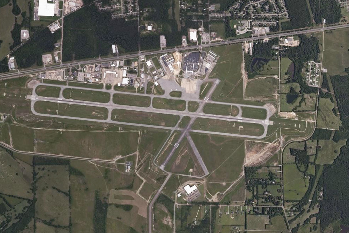
Charlotte(POI29) to KCLT(KCLT)
Distance: 3.55NM Bearing: 276° 2 minutes
Turning west from the downtown area, you'll easily make out the Charlotte/Douglas international airport ahead
Leg 7
Flying from KCLT
Leg Distance: 55.48 Approximate time at 125kts: 27 minutes.
KCLT(KCLT) to McAdenville(POI30)
Distance: 6.7NM Bearing: 305° 3 minutes
After takeoff, pick up I-85 again, which runs east-west along the north of the airport. Turn left and follow it west
McAdenville(POI30) to Gastonia(POI31)
Distance: 8.36NM Bearing: 279° 4 minutes
Follow the highway as it moves west and passes by a long line of large retail outlets, then bypasses the town of Gastonia. You can also fly directly over the town and meet the highway again on the other side
Gastonia(POI31) to Crowders Mountain(POI32)
Distance: 3.24NM Bearing: 259° 2 minutes
The highway will turn to the southwest as it passes Crowders Mountain on your left, then form an interchange with highway 74 heading west. Turn to the right and follow highway 74 west, and through the town of Kings Mountain
Crowders Mountain(POI32) to US-74(POI33)
Distance: 6.63NM Bearing: 279° 3 minutes
Keep following the highway as it turns to the northwest
US-74(POI33) to Shelby(POI34)
Distance: 6.55NM Bearing: 301° 3 minutes
Follow the road as it passes Moss Lake to the north, then on to the town of Shelby
Shelby(POI34) to Mooresboro(POI35)
Distance: 6.86NM Bearing: 282° 3 minutes
Continuing west from Shelby, follow the highway west and it will shortly be rejoined by the Shelby bypass and through the small town of Mooresboro
Mooresboro(POI35) to Forest City(POI36)
Distance: 8.56NM Bearing: 281° 4 minutes
Following US-74 westbound, it will take a left curve around a group of large buildings which is a data center for the social media giant, Facebook. Just after here, you'll see two exits heading to the north. Take the second of the exits
Forest City(POI36) to Rutherfordton(POI37)
Distance: 4.39NM Bearing: 316° 2 minutes
This highway, US-74A, will take you north west past some local businesses and shopping areas, before turning north again towards Rutherfordton
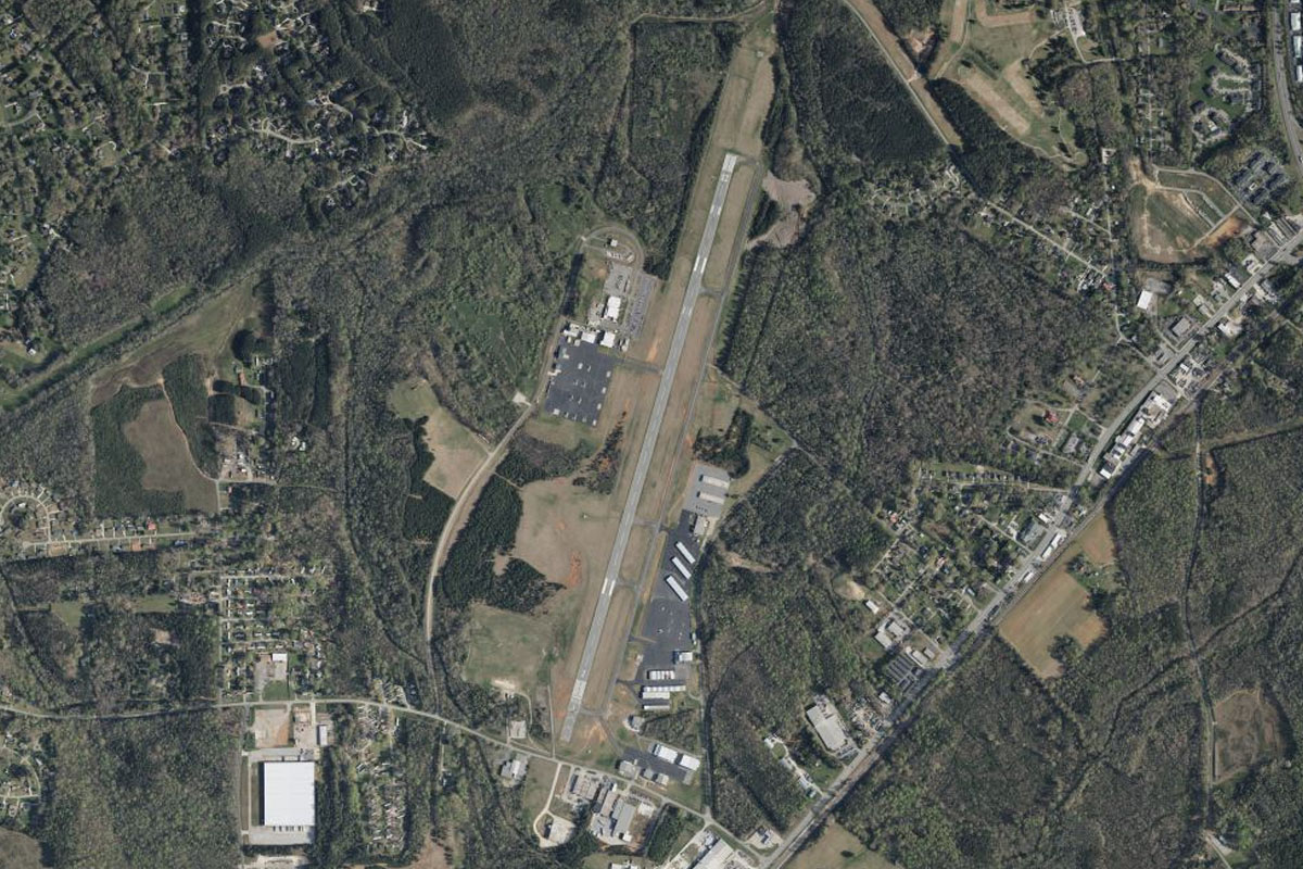
Rutherfordton(POI37) to KFQD(KFQD)
Distance: 4.19NM Bearing: 14° 2 minutes
As you point north along the highway, you should see the airport a few miles ahead to the north
Leg 8
Flying from KFQD
Leg Distance: 37.96 Approximate time at 125kts: 18 minutes.
KFQD(KFQD) to Lake James(POI38)
Distance: 18.08NM Bearing: 359° 9 minutes
Head north from Rutherford Airport. After some hilly terrain, and crossing over I40 as it heads east-west, you will eventually come to the western reaches of Lake James, which at this point will appear more like a river heading west. From here turn northwest
Lake James(POI38) to Celo Knob(POI39)
Distance: 15.36NM Bearing: 311° 7 minutes
Heading northwest you'll see a series of mountain ranges ahead, dominated by a peak at the northern end of the most distant one. Head towards this peak. Gain enough altitude to curve around the peak's north side
Celo Knob(POI39) to 2NC0(2NC0)
Distance: 4.52NM Bearing: 278° 2 minutes
Pass by the peak of Celo Knob, keeping it just to your left, then turn to the west where you will see a golf course on another hill across the valley. The airfield is in the middle of the golf course
Leg 9
Flying from 2NC0
Leg Distance: 43.95 Approximate time at 125kts: 21 minutes.
2NC0(2NC0) to I-26(POI40)
Distance: 10.79NM Bearing: 249° 5 minutes
Departing the airport, head southwest while descending down the western side of the mountain range. Once you meet flatter land, you'll see Interstate Hwy 26 running to the south. Turn and follow it
I-26(POI40) to Asheville(POI41)
Distance: 11.57NM Bearing: 194° 6 minutes
The French Broad River will soon be running south alongside the highway, then to the left you should see the city of Asheville.
Asheville(POI41) to Lake Julian(POI42)
Distance: 7.14NM Bearing: 176° 3 minutes
Keep heading south over the forested area as the highway turns away to the right. Nestled in the forest is the grand Biltmore estate. Just beyond the forest will be Lake Julian
Lake Julian(POI42) to Asheville Regl(POI43)
Distance: 3.21NM Bearing: 182° 2 minutes
Head south past the lake then over Asheville Regional Airport beyond it. Follow the small highway that curves around the south of the airport, and heads southwest
Asheville Regl(POI43) to Boylston(POI44)
Distance: 6.18NM Bearing: 229° 3 minutes
Keep following the road until it starts to run along the left side of a small mountain ridge. Part of the way along the mountain you'll come across a small lake and a power line clearing crossing the road.
Boylston(POI44) to Blantyre(POI45)
Distance: 3.43NM Bearing: 188° 2 minutes
Flying south, just ahead you will see another road and a small river heading between two hills. Follow the road as it curls around the larger hill to the right and the airfield will be just around the corner
Blantyre(POI45) to 3NR3(3NR3)
Distance: 1.63NM Bearing: 230° 1 minutes
The airfield sits as the bottom of Fodderstack Mountain, which has a quarry at its base
Leg 10
Flying from 3NR3
Leg Distance: 46.96 Approximate time at 125kts: 23 minutes.
3NR3(3NR3) to Brevard(POI46)
Distance: 4.21NM Bearing: 256° 2 minutes
Fly along the valley southwest, passing a small lake, then meeting up with a highway as it arrives at the town of Brevard
Brevard(POI46) to Rosman Highway(POI47)
Distance: 8.08NM Bearing: 229° 4 minutes
Follow the highway as it heads southwest between the hills. It will turn to the west as the terrain gets hillier
Rosman Highway(POI47) to Toxaway Lake(POI48)
Distance: 5.23NM Bearing: 270° 3 minutes
Head west across the hills to Toxaway Lake, which sits at the base of Toxaway Mountain.
Toxaway Lake(POI48) to Riley Mountain(POI49)
Distance: 6.69NM Bearing: 273° 3 minutes
Passing to the left side of the mountain, continue west past two neighboring golf courses and over the mountain behind the second course. From here, turn to the southwest
Riley Mountain(POI49) to Highlands(POI50)
Distance: 6.95NM Bearing: 243° 3 minutes
Ahead to the southwest, you will see another mountain. Fly past its right side and over more golf courses. Stay in this direction, over the town of Highlands, and another golf course
Highlands(POI50) to Sky Valley(POI51)
Distance: 8.05NM Bearing: 241° 4 minutes
After the town of Highlands, you'll head over some hilly terrain (and another golf course) before the land descends into a large valley
Sky Valley(POI51) to GE99(GE99)
Distance: 7.75NM Bearing: 242° 4 minutes
Looking southwest across the valley, you should be pointing towards another valley that leads southwest. Fly into this valley and onto Heaven's Landing airstrip at the valley's end
Leg 11
Flying from GE99
Leg Distance: 44.73 Approximate time at 125kts: 21 minutes.
GE99(GE99) to Lake Burton(POI52)
Distance: 6.72NM Bearing: 229° 3 minutes
Head southwest across the mountains and you will shortly be over Lake Burton. When you reach the center of the lake, turn south
Lake Burton(POI52) to Lake Burton(POI53)
Distance: 2.04NM Bearing: 195° 1 minutes
Fly to the south end of the lake, then turn back towards the southwest
Lake Burton(POI53) to Yonah Mountain(POI54)
Distance: 13.11NM Bearing: 230° 6 minutes
Flying southwest, you'll see some hills dotting the landscape ahead. Head for the largest one in the distance, Yonah Mountain
Yonah Mountain(POI54) to Cleveland(POI55)
Distance: 2.94NM Bearing: 209° 1 minutes
Passing to the right of Yonah Mountain, you'll see a road heading south. Follow it to the town of Cleveland
Cleveland(POI55) to Clermont(POI56)
Distance: 5.88NM Bearing: 183° 3 minutes
From Cleveland, head south along the left side of the hills.
Clermont(POI56) to Gainesville(POI57)
Distance: 10.63NM Bearing: 203° 5 minutes
Keep following the highway south (and slightly west) as it makes its way to the city of Gainesville
Gainesville(POI57) to KGVL(KGVL)
Distance: 3.41NM Bearing: 194° 2 minutes
Heading south over the town will take you directly to the airport
Leg 12
Flying from KGVL
Leg Distance: 47.32 Approximate time at 125kts: 23 minutes.
KGVL(KGVL) to I-85(POI58)
Distance: 22.89NM Bearing: 222° 11 minutes
Head southwest from the airport, and we'll soon pick up I-85 also heading southwest
I-85(POI58) to Chamblee(POI59)
Distance: 9.42NM Bearing: 248° 5 minutes
Stay with I-85 as it turns more to the southwest and continues its journey to Atlanta. On the way you might see the large Vulcan Minerals Quarry to the left of the highway
Chamblee(POI59) to Brookhaven(POI60)
Distance: 3.49NM Bearing: 221° 2 minutes
Continue southwest along I-85 as it passes Dekalb Peachtree airport and the suburb of Brookhaven
Brookhaven(POI60) to I-75 Junction(POI61)
Distance: 5.02NM Bearing: 243° 2 minutes
The highway will form a junction with I-75 at the north end of downtown Atlanta. Leave the road here and turn to the west
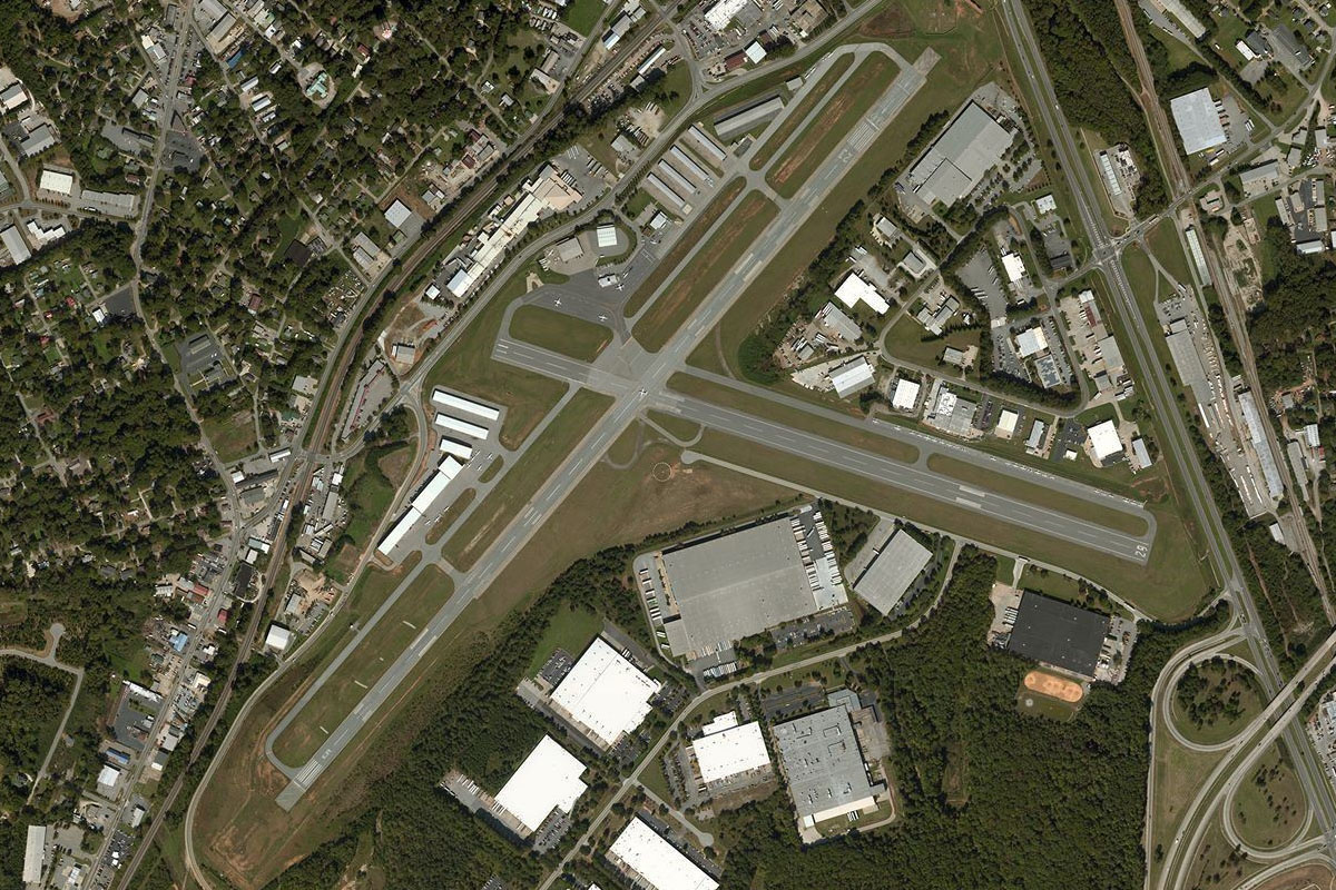
I-75 Junction(POI61) to KFTY(KFTY)
Distance: 6.5NM Bearing: 266° 3 minutes
You'll pass over two rail yards, then a few miles ahead you should see Brown Field
Leg 13
Flying from KFTY
Leg Distance: 37.81 Approximate time at 125kts: 18 minutes.
KFTY(KFTY) to Atlanta(POI62)
Distance: 6.47NM Bearing: 89° 3 minutes
We'll take a tour of Atlanta's best sights by air, starting by heading east back towards the northern end of downtown, where we'll meet the highway and follow it south as it cuts through the city
Atlanta(POI62) to Atlanta(POI63)
Distance: 1.45NM Bearing: 180° 1 minutes
Heading south along the highway, we'll see the sporting fields of Georgia Tech College to the right, with the Coca-Cola world HQ building behind. To the left we'll see Atlanta's tallest building, the Bank of America Plaza
Atlanta(POI63) to Atlanta(POI64)
Distance: 0.72NM Bearing: 136° 0 minutes
Follow the highway as it turns left and cuts the city in half. To the right we'll see Georgia Dome, the home of the Atlanta Football team
Atlanta(POI64) to Stone Mountain(POI65)
Distance: 10.78NM Bearing: 80° 5 minutes
As the highway turns to the south around the city, head east and in the direction of Stone Mountain in the distance, which is a popular tourist attraction and joy flight destination. Keep an eye out to the left for the 'Hawkins National Laboratory' from the TV show 'Stranger Things', which is actually a medical facility in Emory University
Stone Mountain(POI65) to Atlanta(POI66)
Distance: 11.55NM Bearing: 257° 6 minutes
Once you've checked out Stone Mountain, turn around and head back west towards the south end of the city
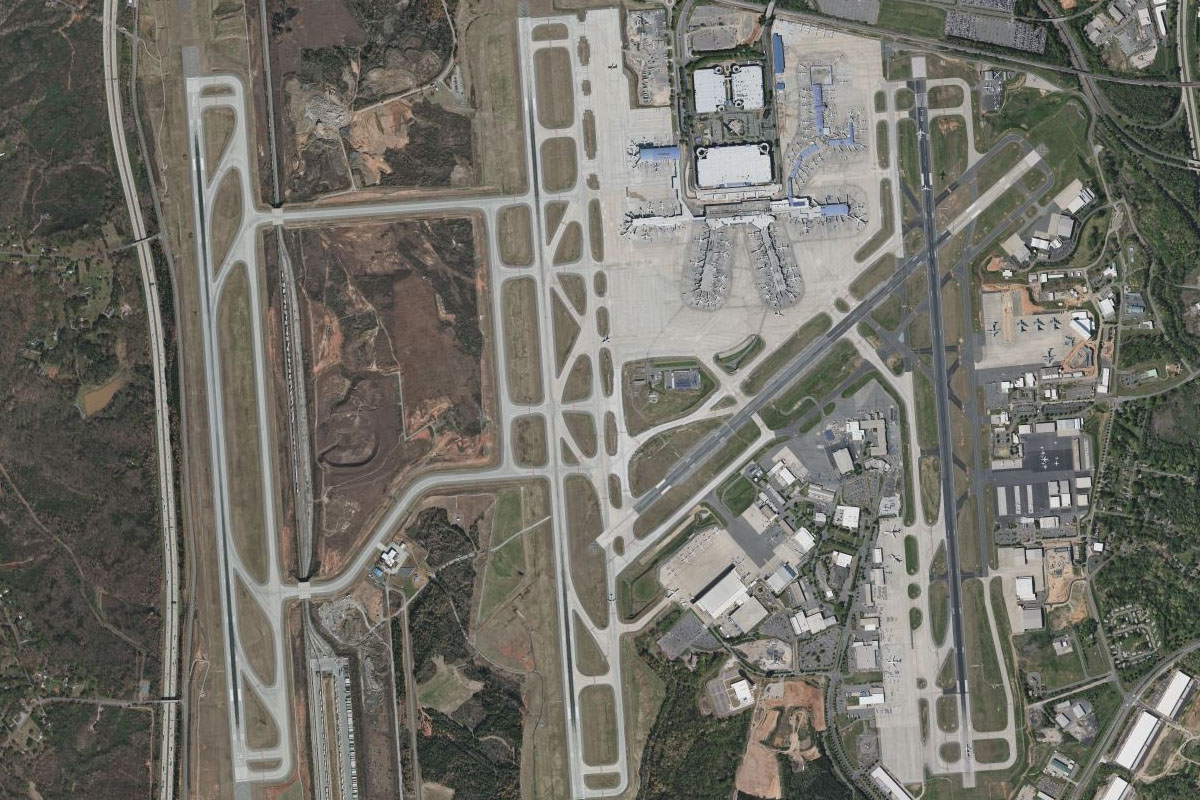
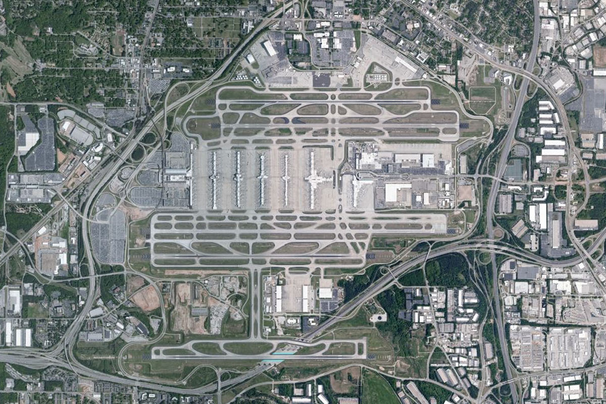
Atlanta(POI66) to KATL(KATL)
Distance: 6.84NM Bearing: 202° 3 minutes
At the south end of the city there is a large freeway interchange. Take the road south from here, which will lead you to Atlanta International Airport, the busiest in the USA
Leg 14
Flying from KATL
Leg Distance: 40.11 Approximate time at 125kts: 19 minutes.
KATL(KATL) to Sandtown(POI67)
Distance: 8.35NM Bearing: 296° 4 minutes
After takeoff, head northwest to follow the power line clearing heading west
Sandtown(POI67) to I-20(POI68)
Distance: 23.2NM Bearing: 279° 11 minutes
Follow the power line clearing west until it is crossed by Interstate Highway 20 heading southwest
I-20(POI68) to Bremen(POI69)
Distance: 5.34NM Bearing: 260° 3 minutes
Follow I-20 west for a few miles until it's junction with state highway 1 heading south, just near a petroleum tank farm
Bremen(POI69) to KCTJ(KCTJ)
Distance: 3.22NM Bearing: 186° 2 minutes
A few miles south of the road junction is the West Georgia Regional Airport
Leg 15
Flying from KCTJ
Leg Distance: 45.36 Approximate time at 125kts: 22 minutes.
KCTJ(KCTJ) to I-20(POI70)
Distance: 16.92NM Bearing: 278° 8 minutes
After takeoff, head west to once again meet Interstate Highway 20 also heading west and crossing into the state of Alabama
I-20(POI70) to Oxford(POI71)
Distance: 17.55NM Bearing: 267° 8 minutes
Keep following the highway west to the town of Oxford, sitting just south of a group of hills
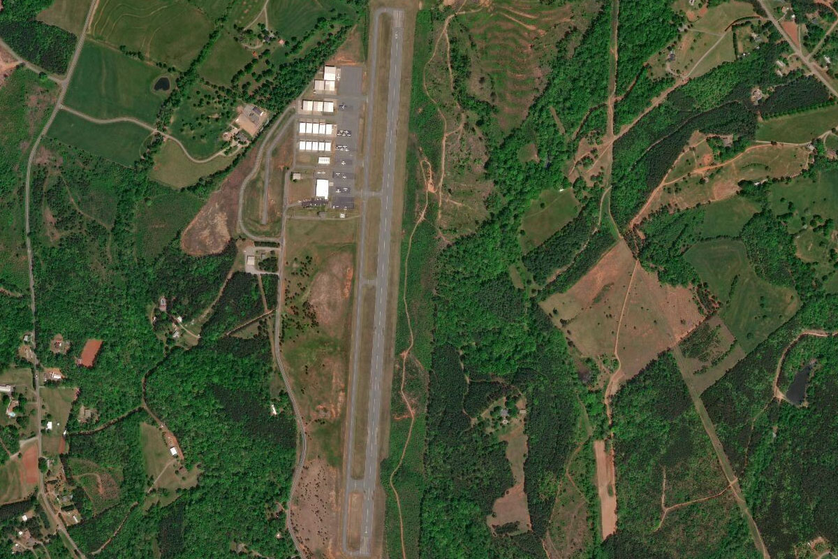
Oxford(POI71) to KASN(KASN)
Distance: 10.89NM Bearing: 263° 5 minutes
Continue west with the highway to Talladega Municipal Airport, which lies next to the major motor racing venue of Talladega Superspeedway
Leg 16
Flying from KASN
Leg Distance: 46.52 Approximate time at 125kts: 22 minutes.
KASN(KASN) to Horn Mountain(POI72)
Distance: 16.31NM Bearing: 190° 8 minutes
Fly south to the tallest point of the long mountain ridge called Horn Mountain
Horn Mountain(POI72) to Horn Mountain(POI73)
Distance: 6.82NM Bearing: 177° 3 minutes
Follow the mountain ridge south
Horn Mountain(POI73) to Goodwater(POI74)
Distance: 7.25NM Bearing: 179° 3 minutes
When the mountain ridge turns away to the west, continue south to the nearby town of Goodwater
Goodwater(POI74) to AL71(AL71)
Distance: 16.14NM Bearing: 172° 8 minutes
Keep flying south to Lake Martin, and Willow Point Airport between the main lake and its western arm
Leg 17
Flying from AL71
Leg Distance: 50.77 Approximate time at 125kts: 24 minutes.
AL71(AL71) to Martin Dam(POI75)
Distance: 8.28NM Bearing: 159° 4 minutes
After takeoff, fly southeast to Martin Dam at the southern tip of the lake
Martin Dam(POI75) to Tallassee(POI76)
Distance: 8.49NM Bearing: 177° 4 minutes
Follow the river like reservoir south to another dam at the town of Tallassee
Tallassee(POI76) to I-85(POI77)
Distance: 6.69NM Bearing: 190° 3 minutes
Follow the road running south to meet Interstate Highway 85
I-85(POI77) to Knollwood(POI78)
Distance: 8.72NM Bearing: 249° 4 minutes
Follow I-85 southwest
Knollwood(POI78) to Montgomery(POI79)
Distance: 12.78NM Bearing: 274° 6 minutes
The highway will lead you west to the city of Montgomery, the state capital of Alabama and known as the birthplace of the civil rights movement
Montgomery(POI79) to KMGM(KMGM)
Distance: 5.81NM Bearing: 233° 3 minutes
Montgomery regional airport lies a few miles southwest of the city center
Leg 18
Flying from KMGM
Leg Distance: 35.83 Approximate time at 125kts: 17 minutes.
KMGM(KMGM) to I-65(POI80)
Distance: 4.44NM Bearing: 181° 2 minutes
Fly south for a few miles to meet Interstate Highway 65
I-65(POI80) to Greenville(POI81)
Distance: 24.8NM Bearing: 213° 12 minutes
Follow the highway southwest to the large town of Greenville
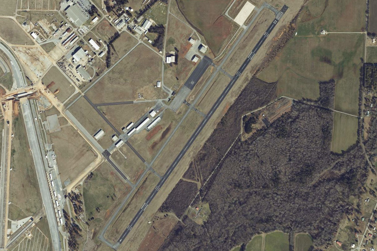
Greenville(POI81) to AL10(POI82)
Distance: 4.76NM Bearing: 141° 2 minutes
Overfly the Maccrenshaw Airport runway on the northern edge of Greenville and it will point you to state road 10 heading southeast away from the town
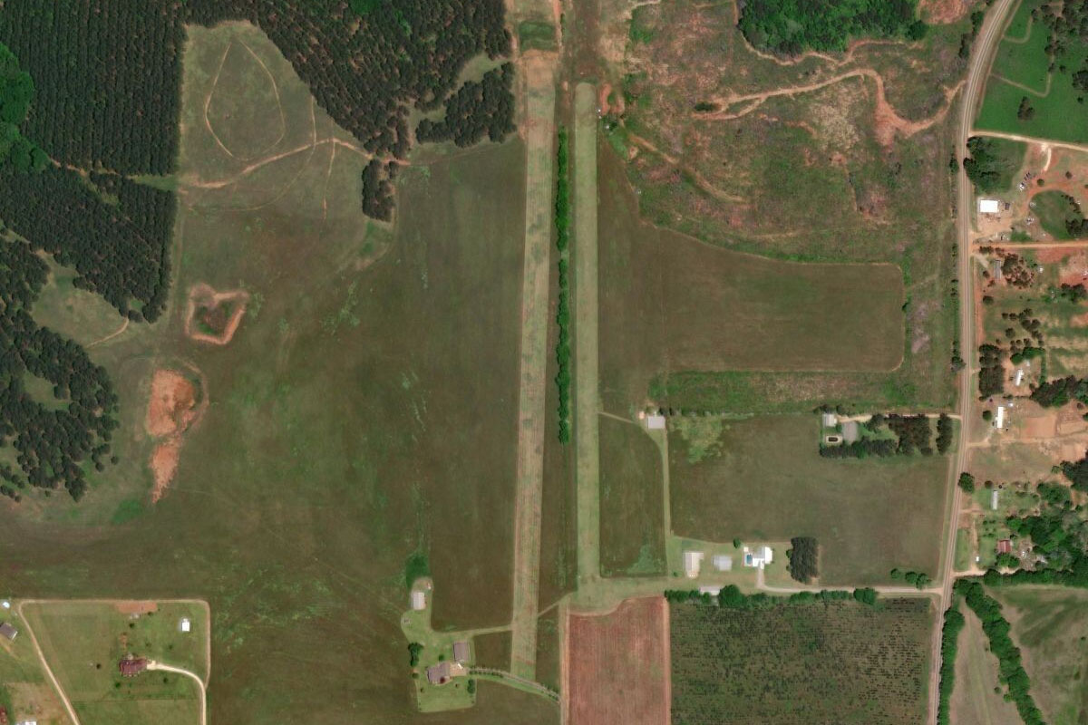
AL10(POI82) to 68AL(68AL)
Distance: 1.83NM Bearing: 92° 1 minutes
Just after the road turns to the east, you will reach 2 grass airfields on the north side of the road. Land on the longer (western) runway of Heart of Dixie Aero Estates
Leg 19
Flying from 68AL
Leg Distance: 34.08 Approximate time at 125kts: 16 minutes.
68AL(68AL) to Point A Lake(POI83)
Distance: 25.87NM Bearing: 181° 12 minutes
After takeoff, head south until you reach the small reservoir of Point A Lake, which runs downstream from the larger Gantt Lake
Point A Lake(POI83) to Andalusia(POI84)
Distance: 4.2NM Bearing: 163° 2 minutes
Continue south to the large town of Andalusia
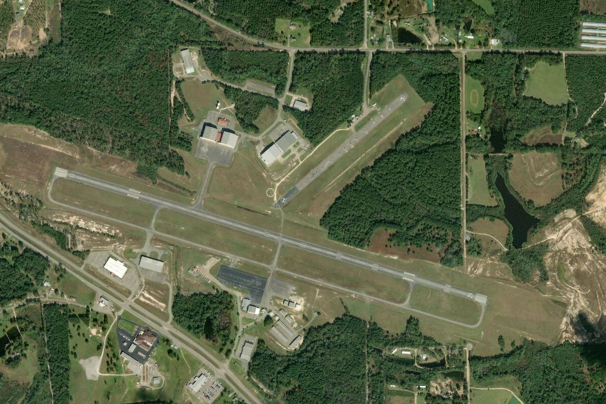
Andalusia(POI84) to 79J(79J)
Distance: 4.01NM Bearing: 98° 2 minutes
South Alabama Regional Airport is a few miles east of Andalusia
Leg 20
Flying from 79J
Leg Distance: 58.24 Approximate time at 125kts: 28 minutes.
79J(79J) to Choctawhatchee Bay(POI85)
Distance: 50.95NM Bearing: 182° 24 minutes
After takeoff, head south into the Florida panhandle, then all the way south to Choctawhatchee Bay near the Florida Coast, passing over the eastern part of Eglin Air Force Base, the largest in the USA
Choctawhatchee Bay(POI85) to KDTS(KDTS)
Distance: 7.29NM Bearing: 244° 3 minutes
Fly southeast across the bay to the beach town of Destin, and the Destin Executive Airport running across the peninsula
Leg 21
Flying from KDTS
Leg Distance: 45.05 Approximate time at 125kts: 22 minutes.
KDTS(KDTS) to Santa Rosa Sound(POI86)
Distance: 17.51NM Bearing: 274° 8 minutes
After takeoff, follow the coast west. The long and narrow waterway named Santa Rosa Sound connects Choctawhatchee Bay and Pensacola Bay
Santa Rosa Sound(POI86) to Pensacola Bay(POI87)
Distance: 26.04NM Bearing: 265° 12 minutes
Continue west to the entrance of Pensacola Bay
Pensacola Bay(POI87) to KNPA(KNPA)
Distance: 1.5NM Bearing: 339° 1 minutes
Just north of the bay entrance is Pensacola Naval Air Station, major training base for the US Marines and Navy, and home to the legendary Blue Angels precision flying team
Leg 22
Flying from KNPA
Leg Distance: 43.35 Approximate time at 125kts: 21 minutes.
KNPA(KNPA) to Bayou Saint John(POI88)
Distance: 12.88NM Bearing: 254° 6 minutes
Keep following the series of coastal waterways west into Alabama, and to the next coastal inlet near Perdido Beach
Bayou Saint John(POI88) to Fort Morgan Peninsula(POI89)
Distance: 14.66NM Bearing: 262° 7 minutes
Continue west along the coast to the Fort Morgan Peninsula, which separates Bon Secour Bay from the Gulf of Mexico
Fort Morgan Peninsula(POI89) to Fort Morgan(POI90)
Distance: 10.21NM Bearing: 271° 5 minutes
Sitting on the end of the peninsula is Fort Morgan. This National Historic Landmark was completed in 1834 and saw action during the US Civil War
Fort Morgan(POI90) to 4R9(4R9)
Distance: 5.6NM Bearing: 293° 3 minutes
Head northwest to Dauphin Island, home to another historic fort – Fort Gaines. On the north side of the island is Jeremiah Denton Airport
Leg 23
Flying from 4R9
Leg Distance: 36.56 Approximate time at 125kts: 18 minutes.
4R9(4R9) to Alabama Point(POI91)
Distance: 5.39NM Bearing: 6° 3 minutes
After takeoff, head north to Alabama Point on the mainland
Alabama Point(POI91) to Mobile(POI92)
Distance: 20.61NM Bearing: 15° 10 minutes
Follow the western shore of Mobile Bay north to the port city of Mobile, the third most populous city in the state
Mobile(POI92) to KMOB(KMOB)
Distance: 10.56NM Bearing: 275° 5 minutes
From downtown Mobile, fly west to Mobile Regional Airport on the city's outskirts
Leg 24
Flying from KMOB
Leg Distance: 39.59 Approximate time at 125kts: 19 minutes.
KMOB(KMOB) to I-10(POI93)
Distance: 8.98NM Bearing: 179° 4 minutes
After takeoff, fly south to meet Interstate Highway 10 running southwest
I-10(POI93) to Mississippi State Line(POI94)
Distance: 9.64NM Bearing: 247° 5 minutes
Follow I-10 southwest
Mississippi State Line(POI94) to Pascagoula(POI95)
Distance: 9.45NM Bearing: 232° 5 minutes
At the Alabama-Mississippi state line, US Highway 90 will fork left and head southwest to the city of Pascagoula
Pascagoula(POI95) to US-90(POI96)
Distance: 10.08NM Bearing: 284° 5 minutes
Follow the highway west over the dual mouths of the Pascagoula River, then continue west
US-90(POI96) to 5R2(5R2)
Distance: 1.44NM Bearing: 235° 1 minutes
As you approach the outer suburbs of Ocean Springs, look for the small airport a mile south of the highway
Leg 25
Flying from 5R2
Leg Distance: 33.44 Approximate time at 125kts: 16 minutes.
5R2(5R2) to Biloxi(POI97)
Distance: 5.37NM Bearing: 286° 3 minutes
After takeoff, head west to the city of Biloxi which suffered widespread damage from Hurricane Katrina in 2005. Continue west to the Bay of Saint Louis
Biloxi(POI97) to Bay of Saint Louis(POI98)
Distance: 23.77NM Bearing: 263° 11 minutes
Follow the coast west, passing the city of Gulfport which was also heavily damaged by Hurricane Katrina in 2005
Bay of Saint Louis(POI98) to 66Y(66Y)
Distance: 4.3NM Bearing: 286° 2 minutes
Fly to the northwestern shore of the bay to Diamondhead Airport, sitting near the edge of the river marsh and bordered by Interstate Highway 10 to the north
Leg 26
Flying from 66Y
Leg Distance: 40.2 Approximate time at 125kts: 19 minutes.
66Y(66Y) to Slidell(POI99)
Distance: 18.8NM Bearing: 259° 9 minutes
Interstate 10 runs past the northern boundary of the airport, follow it west towards the city of Slidell
Slidell(POI99) to Twin Span Bridge(POIA0)
Distance: 11.21NM Bearing: 218° 5 minutes
Follow the I-10 south from the large interchange near Slidell, where it will cross the eastern end of Lake Ponchartrain
Twin Span Bridge(POIA0) to KNEW(KNEW)
Distance: 10.19NM Bearing: 236° 5 minutes
Follow the shore of Lake Pontchartrain southwest to Lakefront Airport, which juts out onto the lake and is the destination for this stage