Welcome to stage 49, and a journey through the rugged beauty of the Atlantic Provinces of eastern Canada. Starting in Nova Scotia (Latin for New Scotland), you’ll explore this beautiful peninsula before heading east to Newfoundland, the world’s 16th largest island and part of the province of Newfoundland and Labrador. A treasure trove of seaside villages, picturesque bays and coves and low lying mountains populate the island, and the beauty continues north along the Atlantic coast of Labrador as you head north to the destination for this stage, the small community of Cartwright
Total Legs: 27 Total Distance: 1468 Total Time(125kts): 11 hours 44 minutes
Leg 1
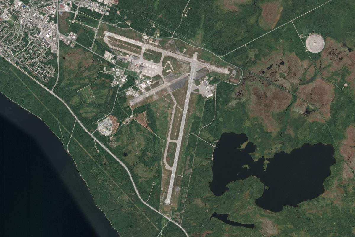
Flying from CYHZ
Leg Distance: 62.64 Approximate time at 125kts: 30 minutes.
CYHZ(CYHZ) to NS-102(POI1)
Distance: 5.17NM Bearing: 10° 2 minutes
After takeoff, head north to meet the main highway
NS-102(POI1) to Shubenacadie River(POI2)
Distance: 10.12NM Bearing: 48° 5 minutes
Follow the highway northeast until it crosses the Shubenacadie River
Shubenacadie River(POI2) to Cobequid Bay(POI3)
Distance: 13.71NM Bearing: 360° 7 minutes
Follow the river north to its mouth at Cobequid Bay
Cobequid Bay(POI3) to Wentworth(POI4)
Distance: 17.84NM Bearing: 6° 9 minutes
Continue north over the bay then follow the minor highway north along a shallow valley to Wentworth Ski area at the northern end of the valley
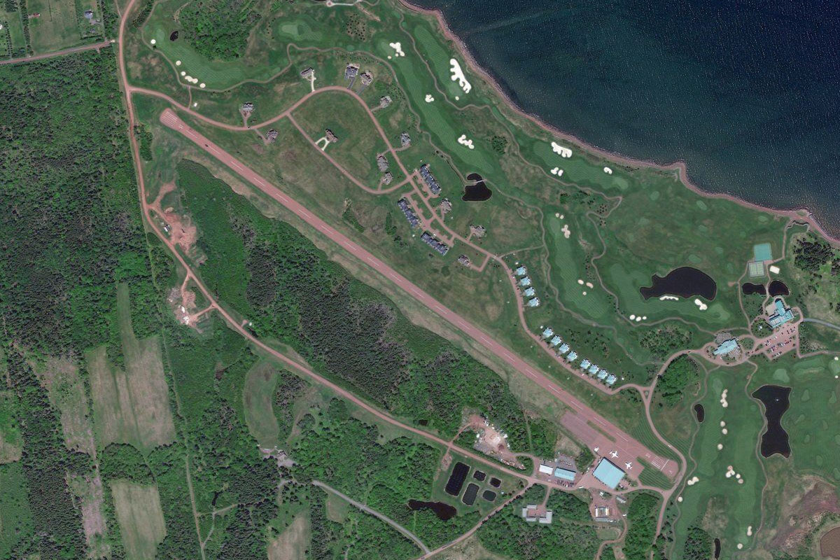
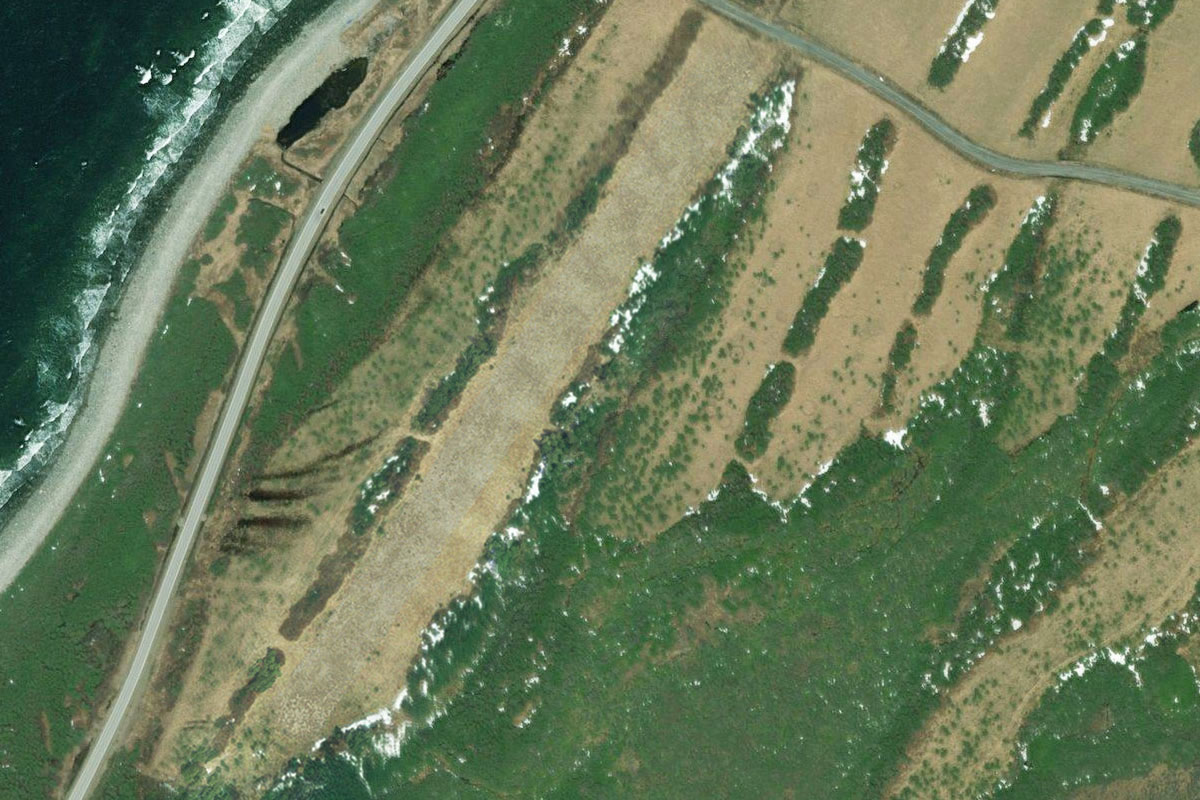
Wentworth(POI4) to Wallace(POI5)
Distance: 12.71NM Bearing: 36° 6 minutes
Once you reach the flat land north of the hills, fly northeast to the first of two harbours, Wallace Harbour
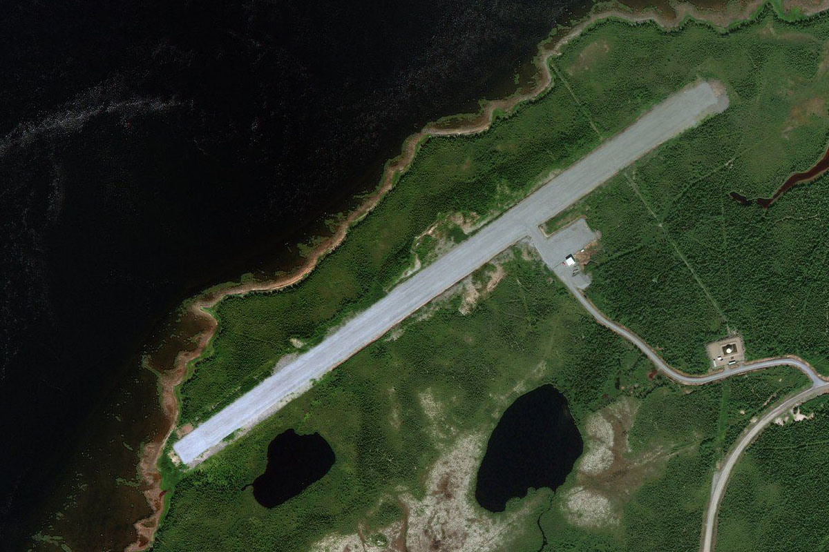
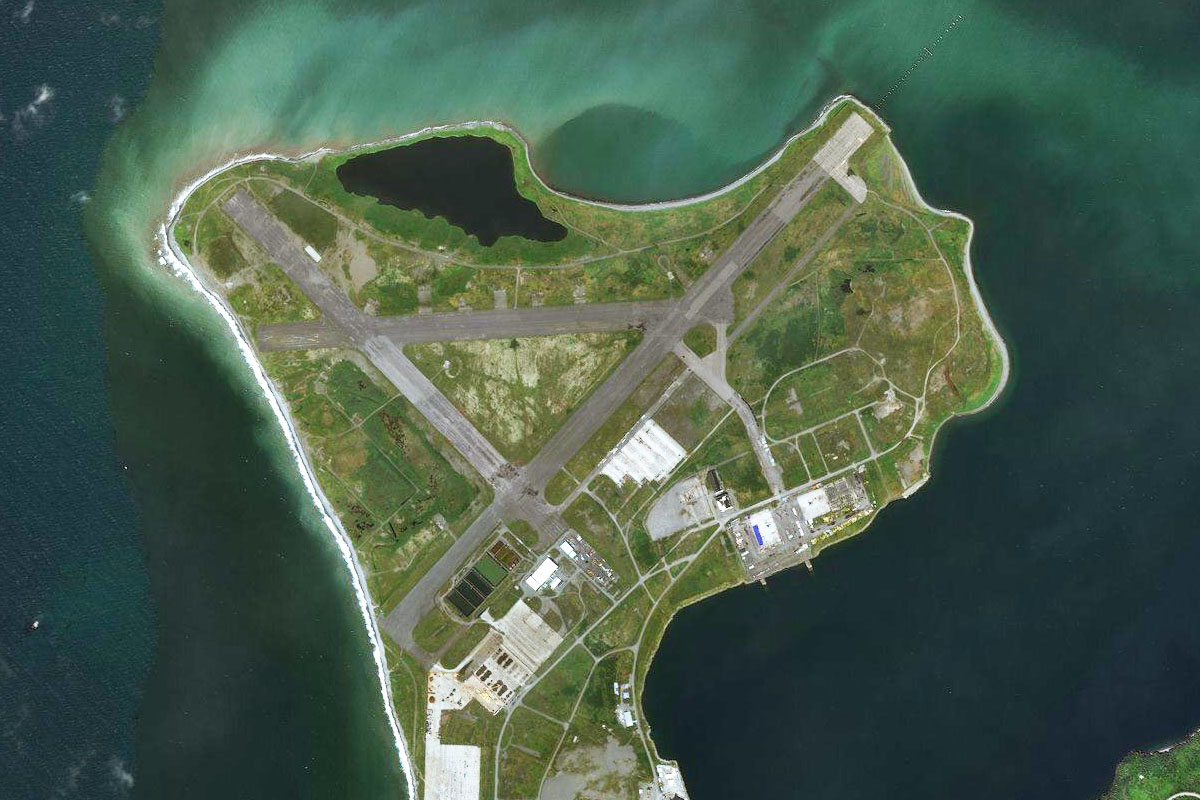
Wallace(POI5) to CFH4(CFH4)
Distance: 3.09NM Bearing: 23° 1 minutes
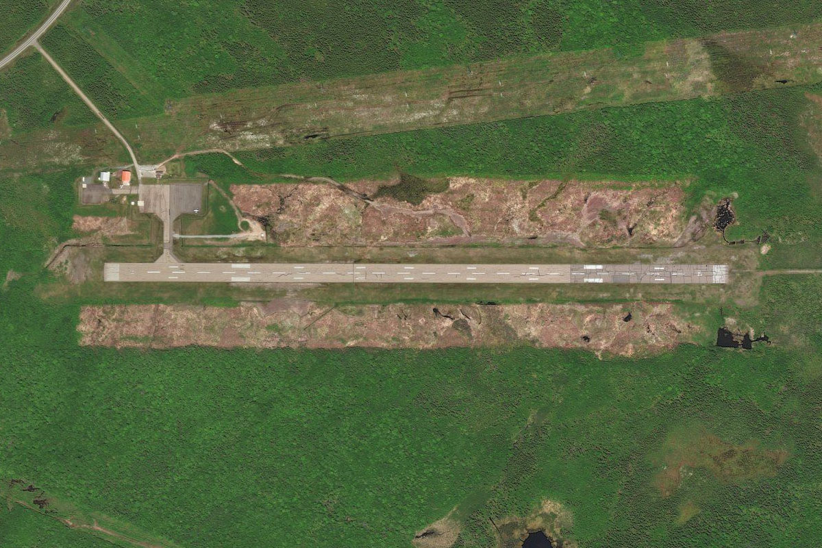
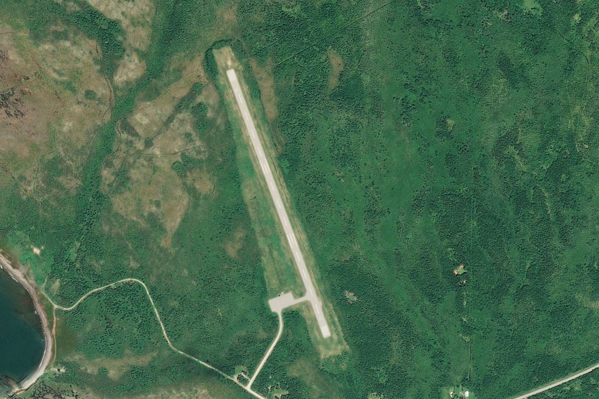
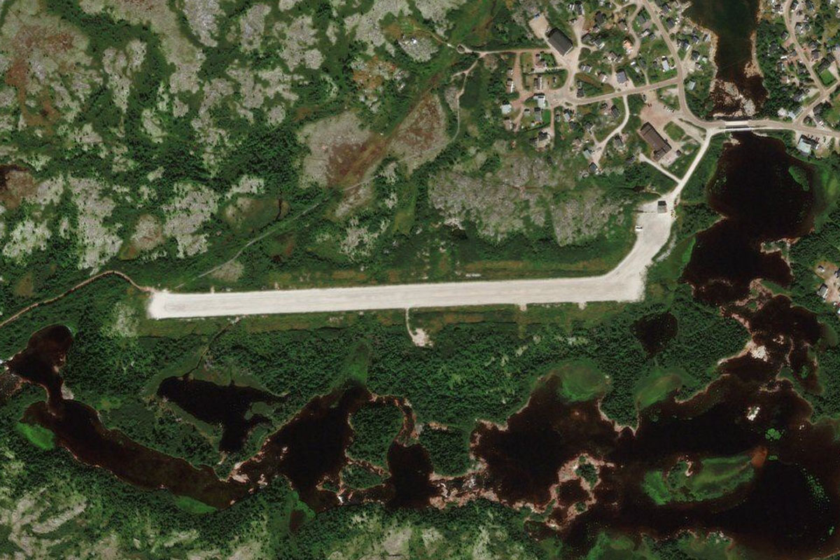
Continue northeast over the next harbour to Fox Harbour Airport next to the shore, adjacent to a golf course
Leg 2
Flying from CFH4
Leg Distance: 35.87 Approximate time at 125kts: 17 minutes.
CFH4(CFH4) to Point Prim(POI6)
Distance: 21NM Bearing: 75° 10 minutes
Fly east over the Northumberland Strait to Point Prim on the island province of Prince Edward Island. A lighthouse adorns the tip of this picturesque peninsula
Point Prim(POI6) to Charlottetown(POI7)
Distance: 11.45NM Bearing: 358° 5 minutes
Fly north over Hillsborough Bay to enter Charlottetown Harbour
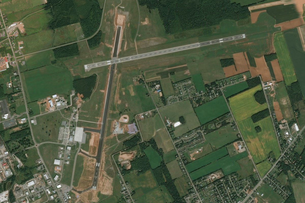
Charlottetown(POI7) to CYYG(CYYG)
Distance: 3.42NM Bearing: 21° 2 minutes
From the harbour, continue north over the province's capital city, Charlottetown, to the airport north of the town
Leg 3
Flying from CYYG
Leg Distance: 54.62 Approximate time at 125kts: 26 minutes.
CYYG(CYYG) to Stanley Bridge(POI8)
Distance: 17.48NM Bearing: 324° 8 minutes
After takeoff, fly northwest over the island's farmland to New London Bay, which is shielded from the north by a large sand spit
Stanley Bridge(POI8) to Cavendish(POI9)
Distance: 3.98NM Bearing: 76° 2 minutes
Make a right hand U-turn at the bay to the north shore of the island, and the town of Cavendish. This is also home to Green Gables House, which was the setting for the popular 1908 novel Anne of Green Gables
Cavendish(POI9) to Dalvay(POI10)
Distance: 13.74NM Bearing: 127° 7 minutes
Follow the coast southeast
Dalvay(POI10) to CCA3(CCA3)
Distance: 19.42NM Bearing: 102° 9 minutes
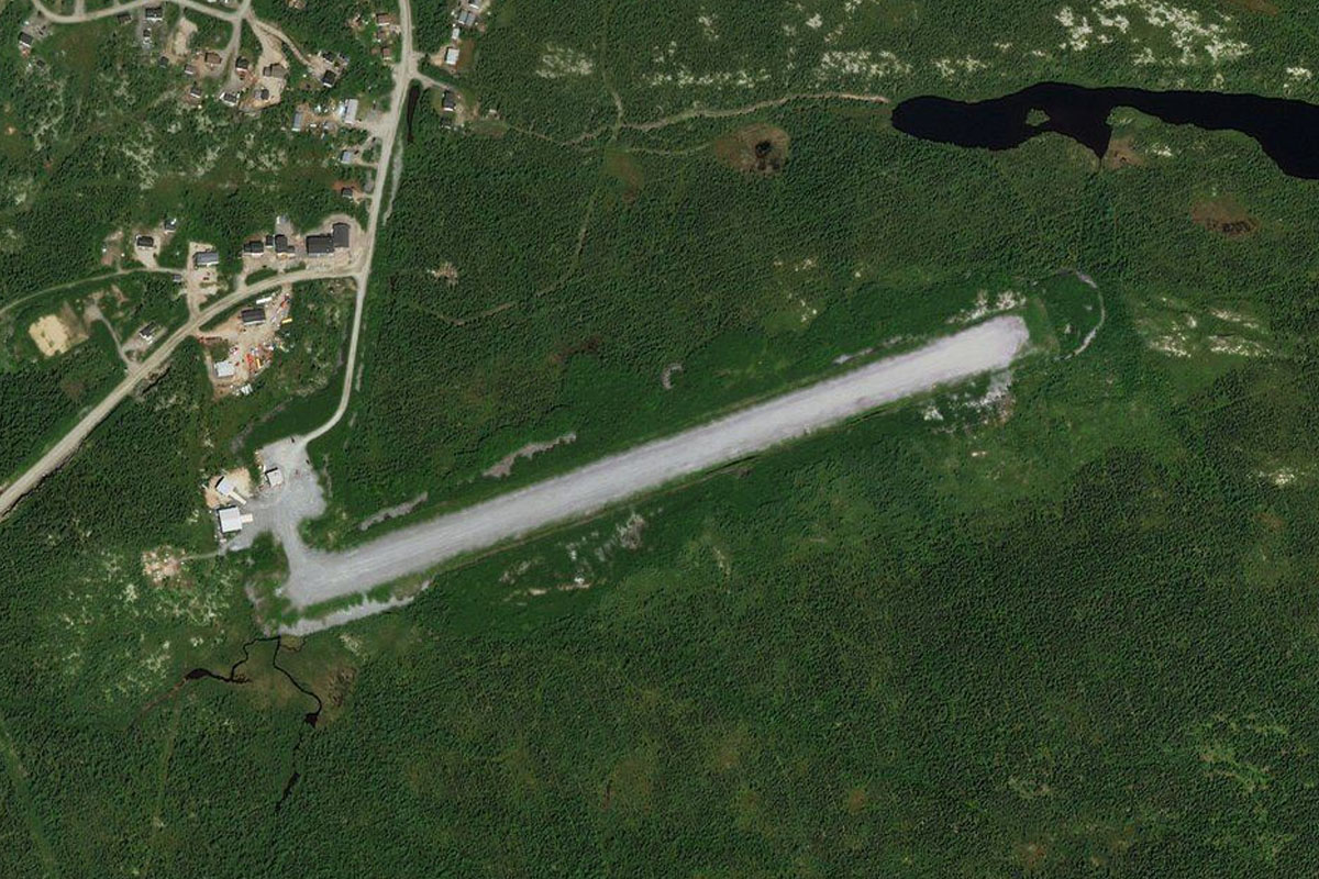
Keep following the coast east to the mouth of St. Peters Bay. Cable Head airpark lies near the eastern end of the bay, between the bay and the coast
Leg 4
Flying from CCA3
Leg Distance: 71.7 Approximate time at 125kts: 34 minutes.
CCA3(CCA3) to Rollo Bay(POI11)
Distance: 12.54NM Bearing: 135° 6 minutes
Fly southeast until you reach the coast
Rollo Bay(POI11) to Cape George Point(POI12)
Distance: 33.23NM Bearing: 165° 16 minutes
Fly south across Cumberland Strait to Cape George Point on the Nova Scotia mainland
Cape George Point(POI12) to Strait of Canso(POI13)
Distance: 21.21NM Bearing: 138° 10 minutes
Fly southeast across St. Georges Bay to the northern end of the Strait of Canso, which connects Northumberland Strait to the Atlantic Ocean
Strait of Canso(POI13) to CYPD(CYPD)
Distance: 4.72NM Bearing: 135° 2 minutes
Fly briefly south along the channel before turning east to Port Hawkesbury Airport, which is east of the causeway crossing of the strait
Leg 5
Flying from CYPD
Leg Distance: 66.76 Approximate time at 125kts: 32 minutes.
CYPD(CYPD) to St. Peters Inlet(POI14)
Distance: 21.84NM Bearing: 104° 10 minutes
After takeoff, follow the large power line clearing east until you reach St. Peters Inlet, which connects Bras d'Or Lake to the Atlantic
St. Peters Inlet(POI14) to Bras d’Or Lake(POI15)
Distance: 8.66NM Bearing: 49° 4 minutes
Fly northeast along the inlet to reach the southern shore of the lake's main body
Bras d’Or Lake(POI15) to East Bay(POI16)
Distance: 20.89NM Bearing: 65° 10 minutes
Continue northeast along the lake shore as it narrows into East Bay
East Bay(POI16) to CYQY(CYQY)
Distance: 15.37NM Bearing: 75° 7 minutes
From the eastern tip of the bay, continue east and pass to the south of the city of Sydney on the way to the airport a few miles further east of the city
Leg 6
Flying from CYQY
Leg Distance: 55.08 Approximate time at 125kts: 26 minutes.
CYQY(CYQY) to St. Andrews Channel(POI17)
Distance: 14.33NM Bearing: 299° 7 minutes
After takeoff, fly northwest over the harbour and the land beyond to reach the northern end of St. Andrews Channel
St. Andrews Channel(POI17) to Kempt Head(POI18)
Distance: 14.13NM Bearing: 250° 7 minutes
Follow the channel southwest alongside the long peninsula-like Boularderie Island
Kempt Head(POI18) to Wagmatcook First Nation(POI19)
Distance: 10.02NM Bearing: 288° 5 minutes
From the southern tip of the peninsula, head west to the waters of St. Patricks Channel, then Nyanza Bay at the mouth of the Middle River, which runs north from the bay
Wagmatcook First Nation(POI19) to Middle River(POI20)
Distance: 9.82NM Bearing: 8° 5 minutes
Follow the river and highway north along a shallow valley
Middle River(POI20) to CCZ4(CCZ4)
Distance: 6.78NM Bearing: 359° 3 minutes
Where the valley splits in two, take the left fork and follow the highway north past some lakes into a wider valley, where the airport lies straight ahead
Leg 7
Flying from CCZ4
Leg Distance: 80.24 Approximate time at 125kts: 39 minutes.
CCZ4(CCZ4) to Cheticamp Island(POI21)
Distance: 15.44NM Bearing: 6° 7 minutes
Fly north over the nearby hills to reach the coast of the Gulf of St. Lawrence
Cheticamp Island(POI21) to Iles de la Madeleine(POI22)
Distance: 51.47NM Bearing: 334° 25 minutes
Fly northwest on the 50 mile crossing to the Magdalen Islands
Iles de la Madeleine(POI22) to CYGR(CYGR)
Distance: 13.33NM Bearing: 40° 6 minutes
Follow the islands northeast to the airport which lies on Havre-aux-Maisons Island, near the center of the group
Leg 8
Flying from CYGR
Leg Distance: 104.14 Approximate time at 125kts: 50 minutes.
CYGR(CYGR) to Plage de la Grande Echouerie(POI23)
Distance: 19.59NM Bearing: 70° 9 minutes
After takeoff, head to the sandy peninsula on the northeastern tip of the islands
Plage de la Grande Echouerie(POI23) to CDA5(CDA5)
Distance: 84.55NM Bearing: 100° 41 minutes
Fly east towards the distant Long Range Mountains on the long overwater leg to the island of Newfoundland. St Andrews Airport lies near the coast in the flat valley north of the mountain range
Leg 9
Flying from CDA5
Leg Distance: 59.01 Approximate time at 125kts: 28 minutes.
CDA5(CDA5) to Codroy River Valley(POI24)
Distance: 8.12NM Bearing: 73° 4 minutes
After takeoff, follow the river valley northeast. A few miles along the valley, look for a small fjord like valley to the southeast
Codroy River Valley(POI24) to Little Codroy Pond(POI25)
Distance: 4.7NM Bearing: 141° 2 minutes
Head southeast over the small lake, then gain altitude as you approach the hills beyond
Little Codroy Pond(POI25) to Rose Blanche(POI26)
Distance: 18.96NM Bearing: 144° 9 minutes
Continue southeast until you reach the coast
Rose Blanche(POI26) to La Poile Bay(POI27)
Distance: 12.09NM Bearing: 97° 6 minutes
Follow the rocky coastline east to the entrance of La Poile Bay
La Poile Bay(POI27) to Couteau Bay(POI28)
Distance: 13.41NM Bearing: 98° 6 minutes
Continue east along the coast past a low lying, rocky mountain range to Couteau Bay at the mouth of Couteau Brook
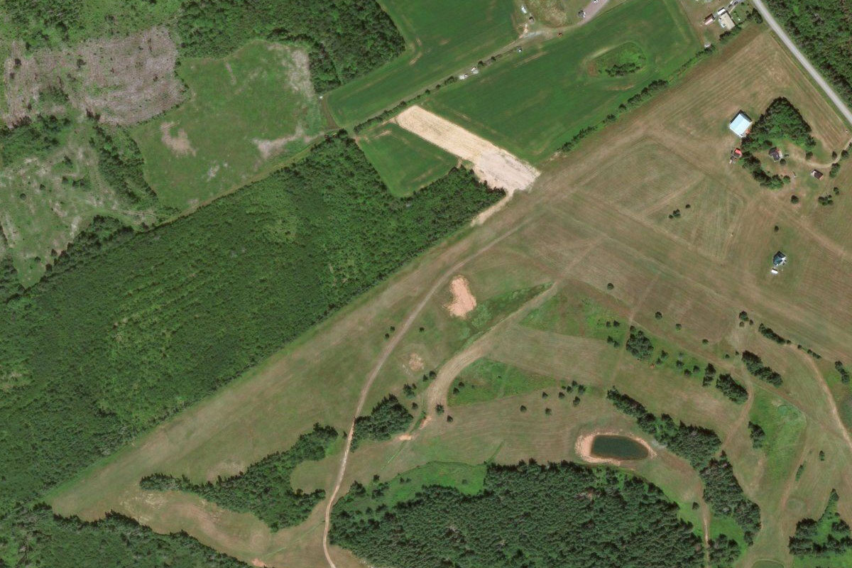
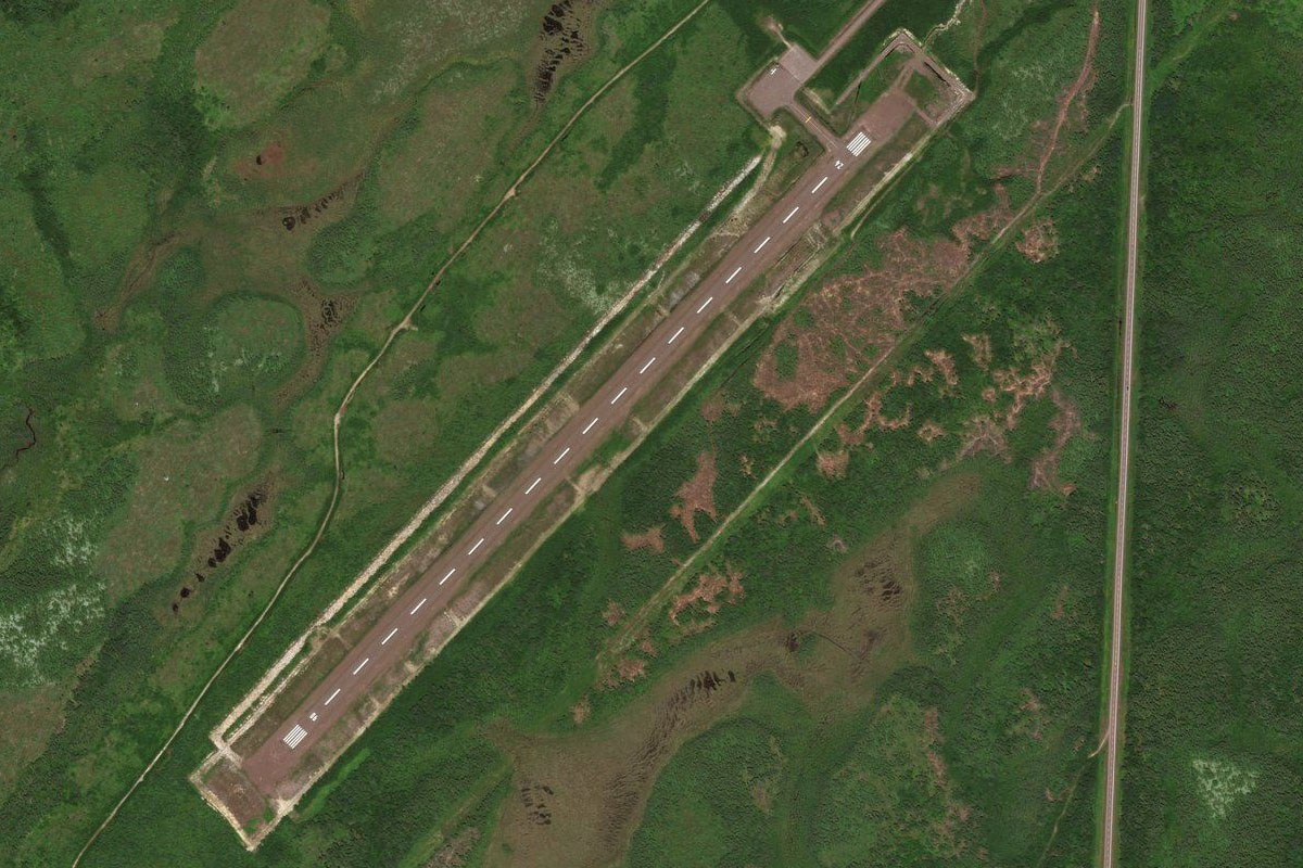
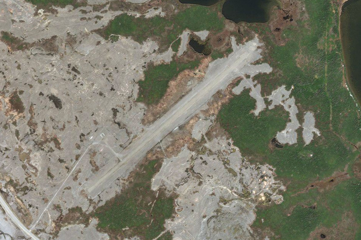
Couteau Bay(POI28) to CDA9(CDA9)
Distance: 1.73NM Bearing: 4° 1 minutes
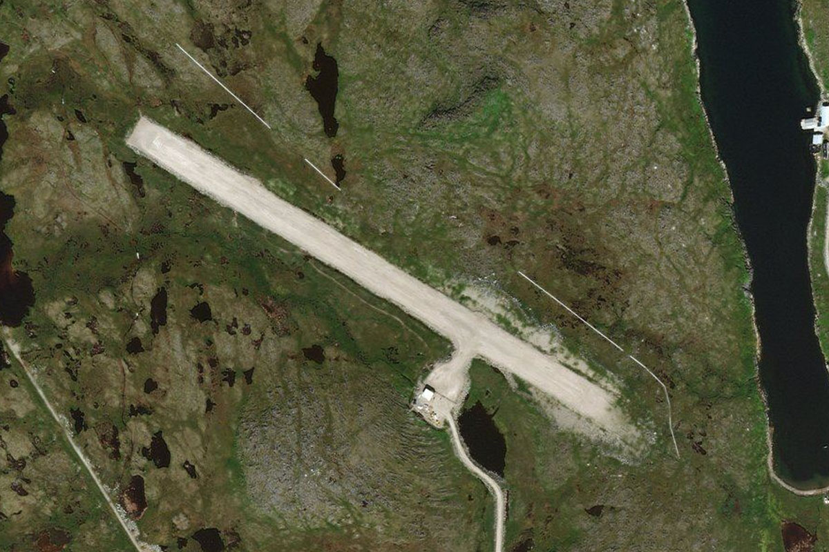
Fly north along the western side of the bay to the large dirt airstrip
Leg 10
Flying from CDA9
Leg Distance: 78.05 Approximate time at 125kts: 37 minutes.
CDA9(CDA9) to Burgeo(POI29)
Distance: 19.41NM Bearing: 127° 9 minutes
After takeoff, head back to the coast and follow it southeast to the small town of Burgeo
Burgeo(POI29) to Ramea(POI30)
Distance: 10.76NM Bearing: 135° 5 minutes
Fly southeast to the nearby group of small islands
Ramea(POI30) to Saint Pierre and Miquelon(POI31)
Distance: 44.58NM Bearing: 139° 21 minutes
Continue southeast until you reach Saint Pierre and Miquelon, a group of islands which form a small French overseas territory
Saint Pierre and Miquelon(POI31) to LFVM(LFVM)
Distance: 3.3NM Bearing: 142° 2 minutes
Miquelon Airport is at the southern end of the northernmost island in the group
Leg 11
Flying from LFVM
Leg Distance: 65.19 Approximate time at 125kts: 31 minutes.
LFVM(LFVM) to Miquelon-Laglande(POI32)
Distance: 14.78NM Bearing: 180° 7 minutes
Fly south over the two largest islands in the group, Miquelon and Laglande, which are connected by a narrow stretch of land
Miquelon-Laglande(POI32) to Saint Pierre(POI33)
Distance: 6.34NM Bearing: 157° 3 minutes
Head southeast to the most populous island in the group, Saint Pierre
Saint Pierre(POI33) to Lamaline(POI34)
Distance: 15.94NM Bearing: 89° 8 minutes
From Saint Pierre, fly east back into Newfoundland and the small harbour near the town of Lamaline
Lamaline(POI34) to Little Lawn Harbour(POI35)
Distance: 13.48NM Bearing: 91° 6 minutes
Follow the coast east until you reach Lawn Bay. Two inlets lead north from the bay; the first to the town of Lawn and the second leads northeast towards a wind farm
Little Lawn Harbour(POI35) to CCC2(CCC2)
Distance: 14.65NM Bearing: 44° 7 minutes
Fly northeast pas the wind farm, over landscape dotted with lakes. As you pass to the west of a large round lake, look out for Winterland airport which lies a few miles northwest of the lake
Leg 12
Flying from CCC2
Leg Distance: 55.77 Approximate time at 125kts: 27 minutes.
CCC2(CCC2) to Marystown(POI36)
Distance: 12.59NM Bearing: 89° 6 minutes
After takeoff, head east past Marystown to the western shore of Placentia Bay
Marystown(POI36) to Jude Island(POI37)
Distance: 9.55NM Bearing: 90° 5 minutes
Continue east to Jude Island
Jude Island(POI37) to CWAR(CWAR)
Distance: 33.63NM Bearing: 100° 16 minutes
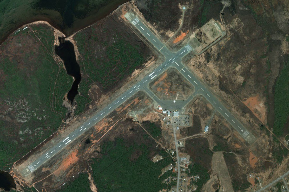
From Jude Island, head east across to the eastern shore of the bay to the disused naval station which is on a small peninsula just north of the town of Placentia
Leg 13
Flying from CWAR
Leg Distance: 60.07 Approximate time at 125kts: 29 minutes.
CWAR(CWAR) to Conception Bay(POI38)
Distance: 35.46NM Bearing: 89° 17 minutes
Fly east across the Avalon Peninsula to the southern end of Conception Bay
Conception Bay(POI38) to St John’s(POI39)
Distance: 20.07NM Bearing: 93° 10 minutes
Continue east across the bay and on to the city of St John's, the capital of the province of Newfoundland and Labrador
St John’s(POI39) to CYYT(CYYT)
Distance: 4.54NM Bearing: 333° 2 minutes
The airport is northwest of the city
Leg 14
Flying from CYYT
Leg Distance: 21.32 Approximate time at 125kts: 10 minutes.
CYYT(CYYT) to Bell Island(POI40)
Distance: 9.3NM Bearing: 285° 4 minutes
After takeoff, fly west to the nearby Bell Island
Bell Island(POI40) to Bryant’s Cove(POI41)
Distance: 9.12NM Bearing: 314° 4 minutes
Fly northwest over Conception Bay
Bryant’s Cove(POI41) to CHG2(CHG2)
Distance: 2.9NM Bearing: 290° 1 minutes
When you reach the western shore of the bay, head to Harbour Grace Airport, with its grass runway west of the small town on the northern side of the inlet
Leg 15
Flying from CHG2
Leg Distance: 49.24 Approximate time at 125kts: 24 minutes.
CHG2(CHG2) to New Pelican(POI42)
Distance: 14.4NM Bearing: 359° 7 minutes
Fly north across the peninsula until you reach the shore of Trinity Bay. This part of the Avalon Peninsula contains The Baccalieu Trail, a popular driving route dotted with seaside villages and beautiful coastal scenery
New Pelican(POI42) to Southwest Arm(POI43)
Distance: 15.53NM Bearing: 314° 7 minutes
Fly northwest over Trinity Bay to Southwest Arm running west from the bay
Southwest Arm(POI43) to Clarenville(POI44)
Distance: 12.19NM Bearing: 325° 6 minutes
Pass over Southwest Arm and continue northwest to the town of Clarenville, which sits on the western shore of Northwest Arm
Clarenville(POI44) to CCZ3(CCZ3)
Distance: 7.12NM Bearing: 24° 3 minutes
From the town, head to the north end of the bay, then to the small airport a few miles north from there
Leg 16
Flying from CCZ3
Leg Distance: 52.44 Approximate time at 125kts: 25 minutes.
CCZ3(CCZ3) to Clode Sound(POI45)
Distance: 11.27NM Bearing: 359° 5 minutes
After takeoff, head north over land, then cross the waters of Clode Sound and continue north to reach Highway 1 heading north
Clode Sound(POI45) to Trans Canada Highway(POI46)
Distance: 11.39NM Bearing: 26° 5 minutes
Follow the highway northeast until it turns northwest just south of Alexander Bay
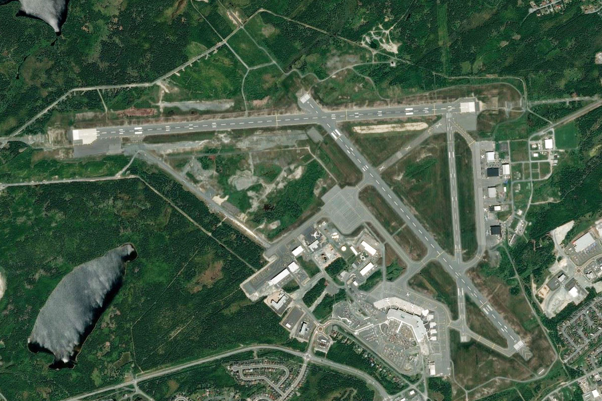
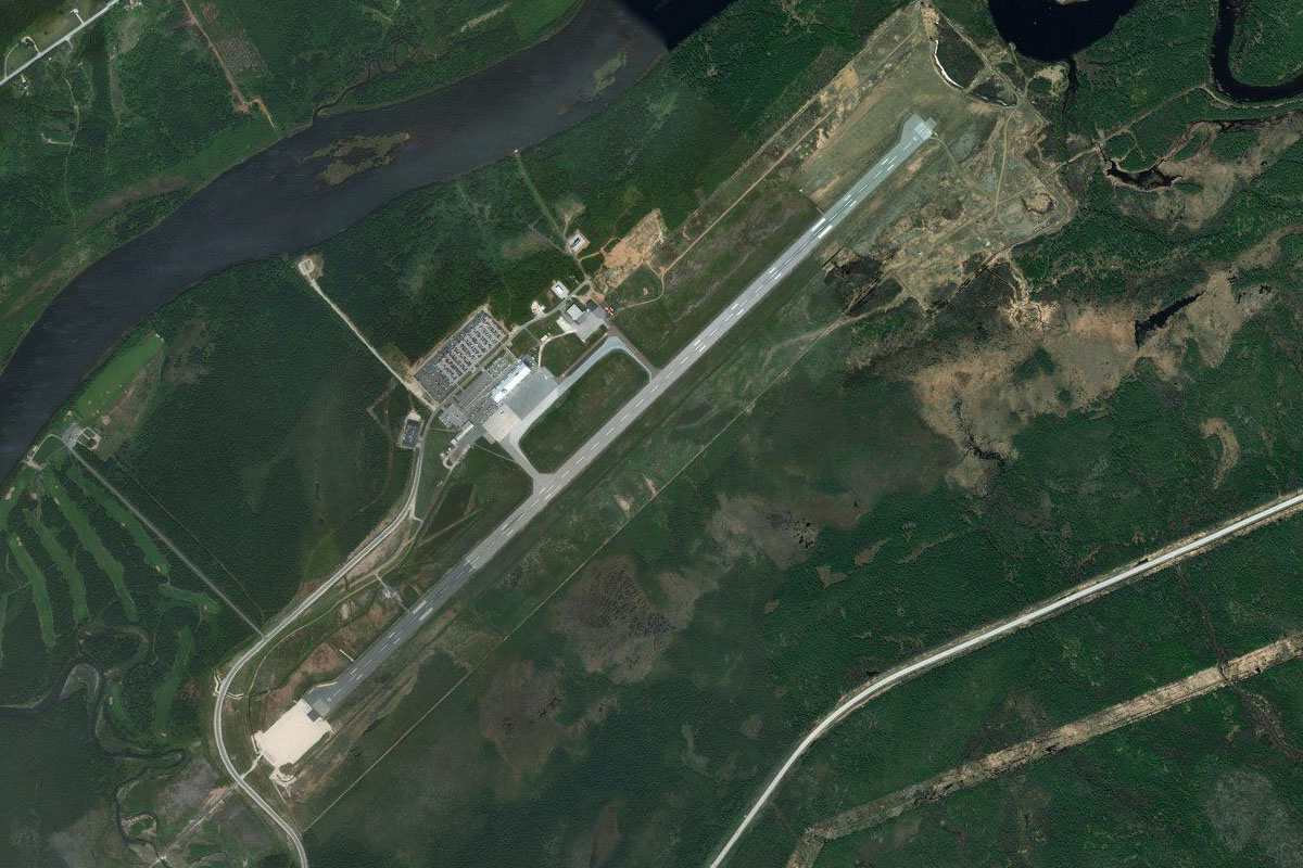
Trans Canada Highway(POI46) to CYQX(CYQX)
Distance: 29.78NM Bearing: 324° 14 minutes
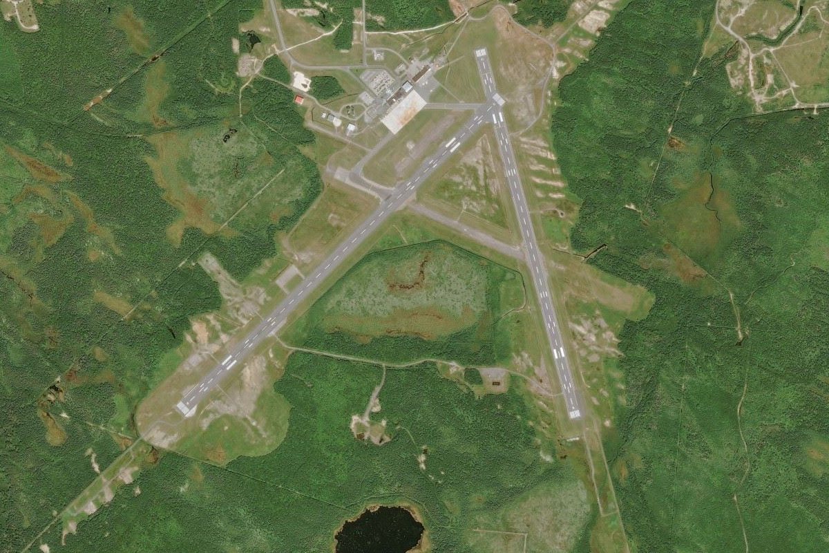
Keep following the highway northwest where it will eventually lead you to Gander Airport, on the north side of Gander Lake. The airport gained prominence as a Trans-Atlantic fuel stop which it is still sometimes used for today, and along with the nearby town gained positive praise for housing thousands of stranded passengers after the September 11 attacks on the USA
Leg 17
Flying from CYQX
Leg Distance: 41.49 Approximate time at 125kts: 20 minutes.
CYQX(CYQX) to Appleton(POI47)
Distance: 11.58NM Bearing: 300° 6 minutes
After takeoff, fly over the town on the western side of the airport, then follow the highway northwest
Appleton(POI47) to Highway 340 Junction(POI48)
Distance: 12.78NM Bearing: 330° 6 minutes
Keep following the highway as it turns further to the northwest after it passes the town of Glenwood. It will soon reach a junction with Highway 340 heading north
Highway 340 Junction(POI48) to Bishops Falls(POI49)
Distance: 15.13NM Bearing: 265° 7 minutes
After the junction, the highway will turn west and run alongside a long lake. At the southern end of the lake it will cross the Exploits River near the town of Bishops Falls
Bishops Falls(POI49) to CCP2(CCP2)
Distance: 2NM Bearing: 20° 1 minutes
The airport is just north of the town and river crossing
Leg 18
Flying from CCP2
Leg Distance: 41.92 Approximate time at 125kts: 20 minutes.
CCP2(CCP2) to Trans Canada Highway(POI50)
Distance: 29.05NM Bearing: 314° 14 minutes
After takeoff, fly northwest over the landscape, crossing the southern tips of four large lakes before once again reaching Highway 1
Trans Canada Highway(POI50) to CCD2(CCD2)
Distance: 12.87NM Bearing: 6° 6 minutes
Follow the highway north to where it will curve around the south end of Halls Bay before continuing north, leading you to Springdale Airport next to the road
Leg 19
Flying from CCD2
Leg Distance: 51.4 Approximate time at 125kts: 25 minutes.
CCD2(CCD2) to Trans Canada Highway(POI51)
Distance: 9.03NM Bearing: 283° 4 minutes
From the airport, follow the highway west along a shallow valley alongside the Indian River
Trans Canada Highway(POI51) to Sandy Lake(POI52)
Distance: 21.1NM Bearing: 255° 10 minutes
Stay with the highway as it runs southwest through another shallow valley before running alongside the long thin Birchy Lake, which will lead to the much larger Sandy Lake
Sandy Lake(POI52) to Sandy Lake(POI53)
Distance: 8.6NM Bearing: 282° 4 minutes
Fly west across the lake to once again meet the highway on the other side
Sandy Lake(POI53) to CYDF(CYDF)
Distance: 12.67NM Bearing: 273° 6 minutes
Stay with the highway as it heads west to Deer Lake, and the airport just north of the town
Leg 20
Flying from CYDF
Leg Distance: 62.52 Approximate time at 125kts: 30 minutes.
CYDF(CYDF) to Bonne Bay(POI54)
Distance: 26.76NM Bearing: 333° 13 minutes
After takeoff head northwest towards the coast, first reaching the East Arm of Bonne Bay which is surrounded by low lying mountains
Bonne Bay(POI54) to Western Brook Pond(POI55)
Distance: 15.03NM Bearing: 19° 7 minutes
Once clear of the mountains to the north, fly northeast between the coast and the mountains of Gros Morne National Park, a UNESCO World Heritage Site with beautiful fjords and abundant wildlife
Western Brook Pond(POI55) to Cow Head(POI56)
Distance: 10.24NM Bearing: 37° 5 minutes
Continue northeast along the coast past the twin round bays near the town of Cow Head
Cow Head(POI56) to CCP1(CCP1)
Distance: 10.49NM Bearing: 41° 5 minutes
Follow the coastal highway northeast past a small lake near the entrance to Parsons Pond River. A few miles further north you will come to a small temporary dirt airstrip on the right hand side of the highway
Leg 21
Flying from CCP1
Leg Distance: 39.62 Approximate time at 125kts: 19 minutes.
CCP1(CCP1) to River of Ponds Lake(POI57)
Distance: 23.94NM Bearing: 36° 11 minutes
After takeoff, keep following the coastal highway northeast
River of Ponds Lake(POI57) to Little Brook Pond(POI58)
Distance: 7.78NM Bearing: 70° 4 minutes
Stay with the road as it turns further northeast with the shore before heading inland passing to the south of a group of lakes
Little Brook Pond(POI58) to CCM4(CCM4)
Distance: 7.9NM Bearing: 13° 4 minutes
When you pass the first of these lakes, turn north across the peninsula and over the small island before crossing Ingornachoix Bay to Port Au Choix Airport on the north shore of the bay
Leg 22
Flying from CCM4
Leg Distance: 47.57 Approximate time at 125kts: 23 minutes.
CCM4(CCM4) to St. John Island(POI59)
Distance: 8.73NM Bearing: 42° 4 minutes
After takeoff, fly northeast to St. John Island, the largest in a group just off the coast
St. John Island(POI59) to Ferolle Point(POI60)
Distance: 13.34NM Bearing: 44° 6 minutes
Continue northeast to the Férolle Peninsula
Ferolle Point(POI60) to Strait of Belle Isle(POI61)
Distance: 22.04NM Bearing: 10° 11 minutes
Fly north over the Strait of Belle Isle to a group of two small islands south of the mainland
Strait of Belle Isle(POI61) to CYBX(CYBX)
Distance: 3.46NM Bearing: 7° 2 minutes
Continue north to the mainland and Lourdes-de-Blanc-Sablon Airport, just north of the small coastal town
Leg 23
Flying from CYBX
Leg Distance: 36.92 Approximate time at 125kts: 18 minutes.
CYBX(CYBX) to Pinware Bay(POI62)
Distance: 19.87NM Bearing: 82° 10 minutes
After takeoff, follow the highway as it loosely follows the Labrador coast east
Pinware Bay(POI62) to Pinware River(POI63)
Distance: 7.89NM Bearing: 30° 4 minutes
When it reaches Pinware Bay, the road will follow the Pinware River northeast through a shallow valley
Pinware River(POI63) to Red Bay(POI64)
Distance: 8.7NM Bearing: 101° 4 minutes
Stay with the road as it turns back to the east and heads for a small round bay
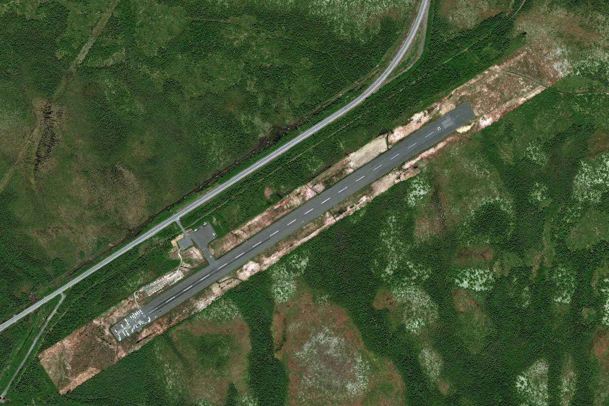
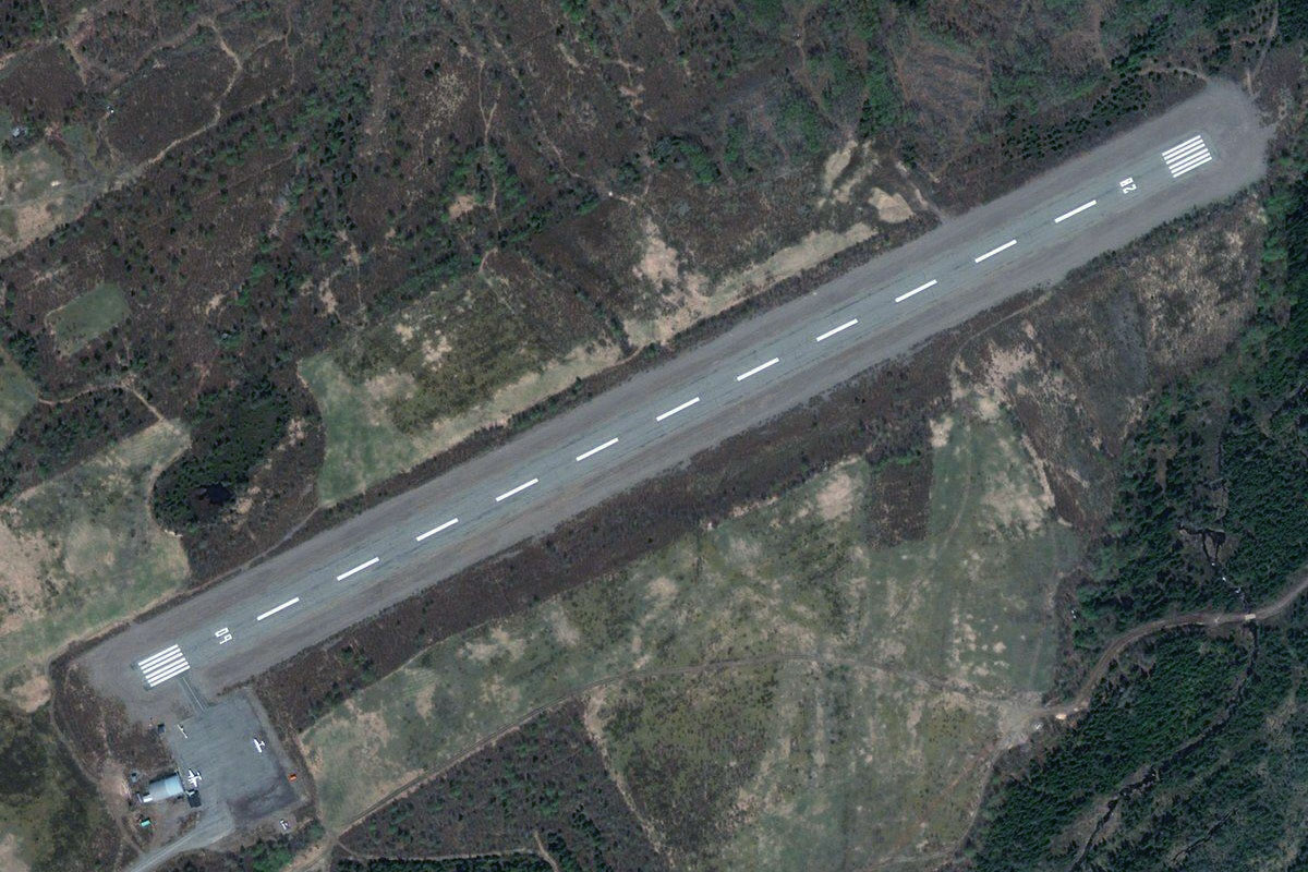
Red Bay(POI64) to CCR1(CCR1)
Distance: 0.46NM Bearing: 130° 0 minutes
There is a small dirt landing strip on the eastern side of the bay, on the north side of the town of Red Bay
Leg 24
Flying from CCR1
Leg Distance: 43.23 Approximate time at 125kts: 21 minutes.
CCR1(CCR1) to Highway 510(POI65)
Distance: 11.4NM Bearing: 22° 5 minutes
After takeoff, stay with the highway as it heads inland to the northeast
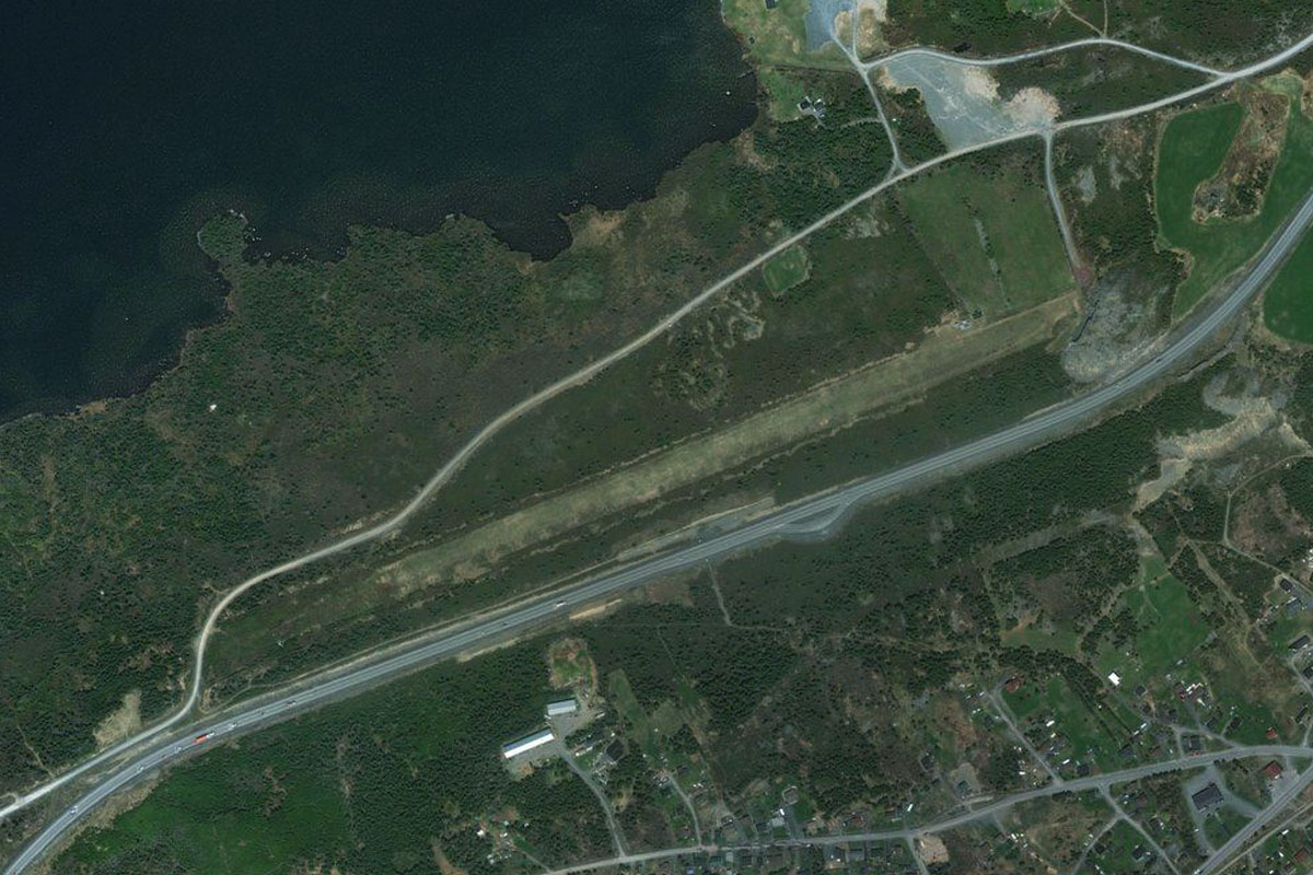
Highway 510(POI65) to Lodge Bay(POI66)
Distance: 27.4NM Bearing: 66° 13 minutes
Keep following the highway as it runs northeast, parallel to the coast
Lodge Bay(POI66) to CYMH(CYMH)
Distance: 4.43NM Bearing: 20° 2 minutes
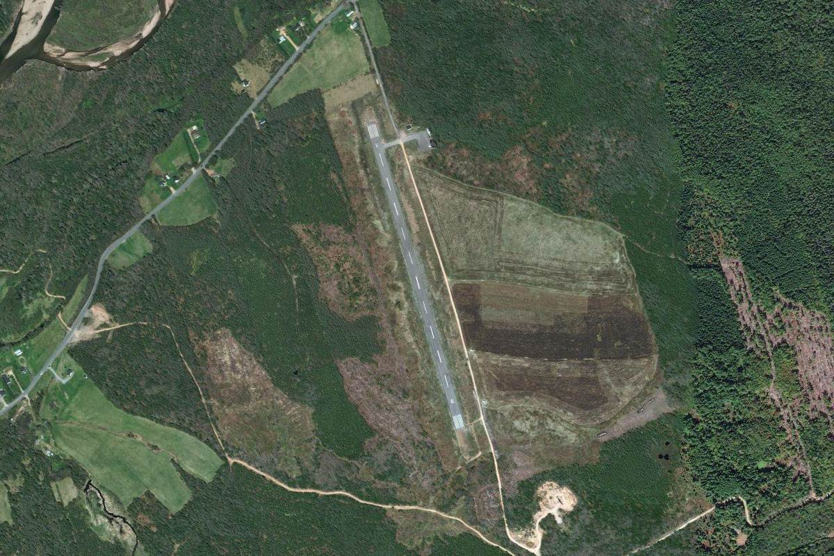
At the small town of Lodge Bay the road will turn north towards the town of Mary's Harbour just south of the St. Lewis Sound. The landing strip is at the southern edge of the town
Leg 25
Flying from CYMH
Leg Distance: 35.91 Approximate time at 125kts: 17 minutes.
CYMH(CYMH) to Labrador Sea(POI67)
Distance: 11.05NM Bearing: 44° 5 minutes
After takeoff, fly northeast over the St. Lewis Sound and the rugged coastal land beyond to reach the coast of the Labrador Sea
Labrador Sea(POI67) to St. Michael Bay(POI68)
Distance: 14.43NM Bearing: 359° 7 minutes
Fly north along the Labrador coast until you reach the mouth of St. Michael Bay
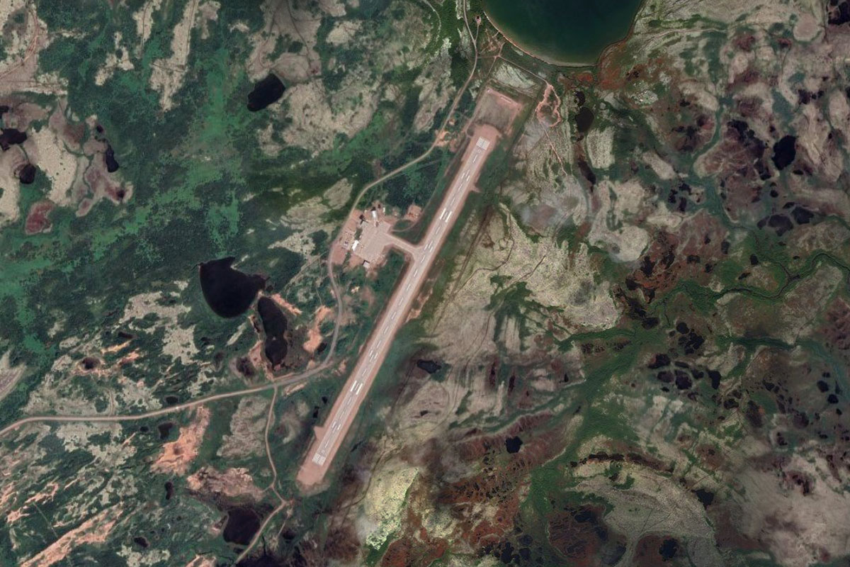
St. Michael Bay(POI68) to CCH4(CCH4)
Distance: 10.43NM Bearing: 313° 5 minutes
Follow the southern shore of the bay west, then northwest to Charlottetown on the southern shore of White Bear Arm, just to the west of a small peninsula. The airport is on the southern edge of the town
Leg 26
Flying from CCH4
Leg Distance: 47.62 Approximate time at 125kts: 23 minutes.
CCH4(CCH4) to Rocky Bay(POI69)
Distance: 25.87NM Bearing: 44° 12 minutes
After takeoff, fly northwest over the rocky, lake filled landscape until you reach the coast
Rocky Bay(POI69) to Island of Ponds(POI70)
Distance: 16.47NM Bearing: 5° 8 minutes
Follow the rugged coastline north, then continue over Porcupine Bay to the aptly named Island of Ponds
Island of Ponds(POI70) to CCE4(CCE4)
Distance: 5.28NM Bearing: 75° 3 minutes
Black Tickle Airport is on the northeastern tip of the island
Leg 27
Flying from CCE4
Leg Distance: 47.76 Approximate time at 125kts: 23 minutes.
CCE4(CCE4) to Stoney Arm(POI71)
Distance: 17.93NM Bearing: 306° 9 minutes
After takeoff, fly along the north shore of the island, then continue northwest along the long Stoney Arm waterway
Stoney Arm(POI71) to Table Bay(POI72)
Distance: 7.22NM Bearing: 321° 3 minutes
Continue northwest over land to the south shore of Table Bay
Table Bay(POI72) to Big Bight(POI73)
Distance: 7.26NM Bearing: 313° 3 minutes
Keep flying northwest between the coast and the islands to the entrance of a long inlet
Big Bight(POI73) to Table Bay Pond(POI74)
Distance: 6.38NM Bearing: 302° 3 minutes
Continue northwest along the inlet and its chain of bays
Table Bay Pond(POI74) to Big Hill(POI75)
Distance: 6.75NM Bearing: 296° 3 minutes
Continue northwest towards a group of hills near the coastal town of Cartwright
Big Hill(POI75) to CYCA(CYCA)
Distance: 2.22NM Bearing: 254° 1 minutes
Cartwright Airport is south of the town, across the small harbour, and is the destination for this stage