The final stage of the North American part of the tour takes you on the arduous crossing of the North Atlantic Ocean to Iceland, our gateway to Europe. The first part is the nearly 200 mile crossing of the Davis Strait to Greenland, before a nearly 300 mile crossing of the vast ice sheet that covers over 80 percent of the world’s largest island. The final part of the stage is the 300 mile crossing from Greenland to Iceland, as you make the first European landing of the tour
Total Legs: 4 Total Distance: 954 Total Time(125kts): 7 hours 37 minutes
Leg 1
Flying from CYVN
Leg Distance: 192.6 Approximate time at 125kts: 92 minutes.
CYVN(CYVN) to Cape Dyer(POI1)
Distance: 7.75NM Bearing: 88° 4 minutes
After takeoff, head east over the impressive coastal cliffs to Davis Strait, a northern arm of the Atlantic Ocean that lies between Baffin Island and Greenland.
Cape Dyer(POI1) to Davis Strait(POI2)
Distance: 172.86NM Bearing: 105° 83 minutes
On the longest leg of the journey so far, make the nearly 180 nautical mile trek across Davis Strait. As you approach Greenland you should be heading for a group of snow capped mountains north of the town of Sissimut
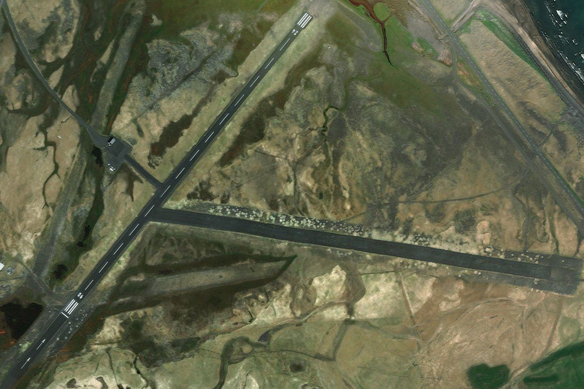
Davis Strait(POI2) to BGSS(BGSS)
Distance: 11.99NM Bearing: 169° 6 minutes
When you near the coast, follow it south to Sissimut Airport, which lies on the south side of a large rocky headland, and across a small bay north of the town
Leg 2
Flying from BGSS
Leg Distance: 77.71 Approximate time at 125kts: 37 minutes.
BGSS(BGSS) to Amerloq(POI3)
Distance: 2.67NM Bearing: 170° 1 minutes
After takeoff, head south past the town to the coastal entrance to Amerloq Fjord
Amerloq(POI3) to Sarfannguit(POI4)
Distance: 19.2NM Bearing: 119° 9 minutes
Fly southeast along the length of the fjord to the small town of Sarfannguit near its eastern end
Sarfannguit(POI4) to Ikertooq(POI5)
Distance: 6.15NM Bearing: 123° 3 minutes
Continue southeast over land to reach another large fjord, Ikerlooq
Ikertooq(POI5) to Avalleq(POI6)
Distance: 6.85NM Bearing: 150° 3 minutes
As the fjord splits into three channels, take the right one heading southeast
Avalleq(POI6) to Kangerlussuaq Fjord(POI7)
Distance: 19.99NM Bearing: 119° 10 minutes
At the end of the fjord, head southeast over the mountains to reach the Kangerlussuaq Fjord, the longest in western Greenland at a length of 120 miles
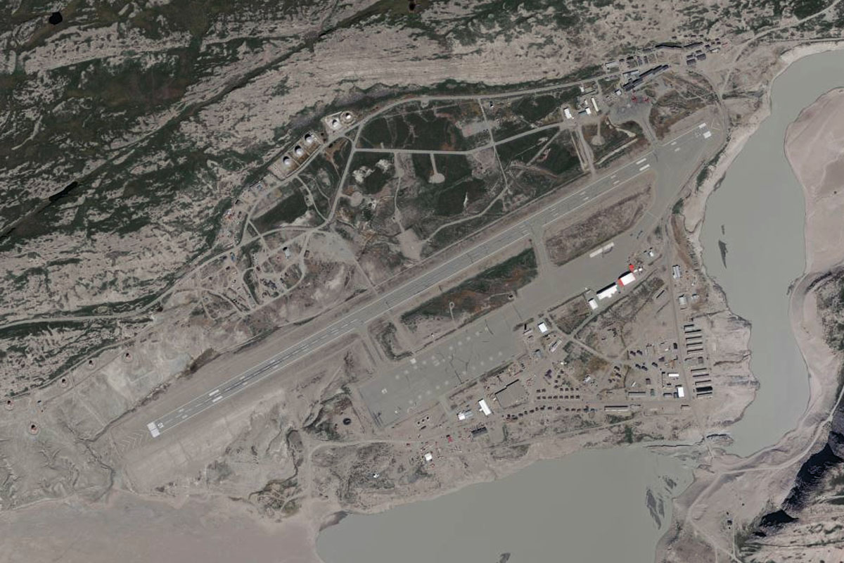
Kangerlussuaq Fjord(POI7) to BGSF(BGSF)
Distance: 22.85NM Bearing: 82° 11 minutes
Fly east along the fjord, where you will reach the town of Kangerlussuaq at its eastern end. The airport is at the base of the mountain on the north side of the town
Leg 3
Flying from BGSF
Leg Distance: 347.27 Approximate time at 125kts: 167 minutes.
BGSF(BGSF) to Qinnguata Kuusua(POI8)
Distance: 23.7NM Bearing: 125° 11 minutes
From Kangerlussuaq, head through the narrow valley and follow the nearby fjord southeast as you gain altitude for the crossing of the Greenland Ice Sheet
Qinnguata Kuusua(POI8) to Greenland Ice Sheet(POI9)
Distance: 288.24NM Bearing: 124° 138 minutes
Cross the vast 300 mile wide Greenland Ice Sheet until you reach the Sermilik Fjord on the eastern side. This ice sheet covers over 80 percent of the island, which is the largest non-continental island in the world
Greenland Ice Sheet(POI9) to Sermilik(POI10)
Distance: 13.45NM Bearing: 197° 6 minutes
Fly south along the fjord until you reach its mouth at the North Atlantic Ocean
Sermilik(POI10) to Ammassalik Fjord(POI11)
Distance: 8.37NM Bearing: 126° 4 minutes
Follow the mountainous coastline around to the southeast and to the mouth of the Ammassalik Fjord
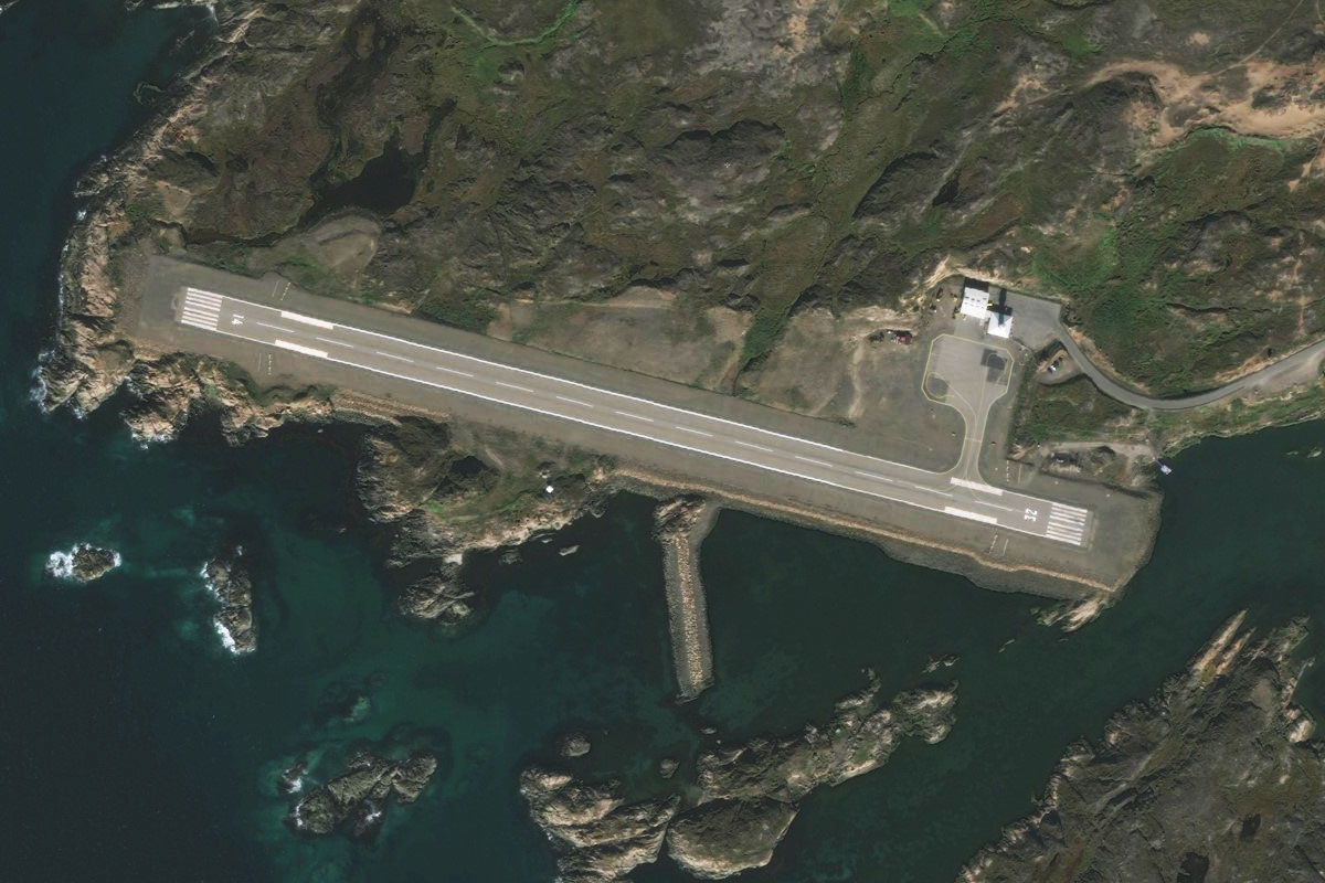
Ammassalik Fjord(POI11) to BGKK(BGKK)
Distance: 13.51NM Bearing: 106° 6 minutes
Cross the mouth of the massive fjord east to Kulusuk Island. The airport and town is on the flat area on the north side of the island
Leg 4
Flying from BGKK
Leg Distance: 336.22 Approximate time at 125kts: 161 minutes.
BGKK(BGKK) to North Atlantic(POI12)
Distance: 10.65NM Bearing: 109° 5 minutes
After takeoff, head east over the nearby mountains and islands to reach the open waters of the North Atlantic Ocean
North Atlantic(POI12) to Iceland(POI13)
Distance: 315.27NM Bearing: 111° 151 minutes
The final leg in the North American part of the tour is the crossing of the North Atlantic Ocean to Iceland, over 300 miles to the east. The first sight of land should be the glacier capped Snæfellsjökull stratovolcano, sitting on the Snæfellsnes Peninsula
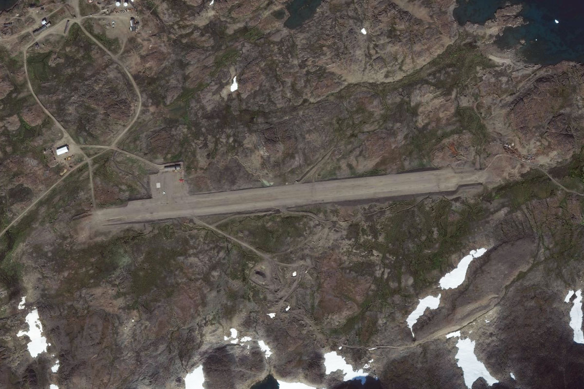
Iceland(POI13) to BIRF(BIRF)
Distance: 10.3NM Bearing: 108° 5 minutes
As you near the peninsula on which the volcano lies, head to the flat land north of the volcano and to Rif Airport east of the town of Hellissandur. This is the destination for the stage and concludes the North American portion of the tour