Welcome to stage 54 of the world tour and the first stage in the United Kingdom. This stage takes place entirely within Scotland. Starting in the Shetland Islands in the far north, you’ll journey south to the mainland via the Orkney Islands on your way to Aberdeen on the east coast. Heading west, you’ll explore the legendary Loch Ness and the Scottish Highlands before making your way south down the western islands of The Hebrides. Heading back to the mainland you’ll further explore the highlands and the tallest mountain in the United Kingdom, Ben Nevis, before finishing the stage in the city of Glasgow on the River Clyde
Total Legs: 26 Total Distance: 1138 Total Time(125kts): 9 hours 6 minutes
Leg 1
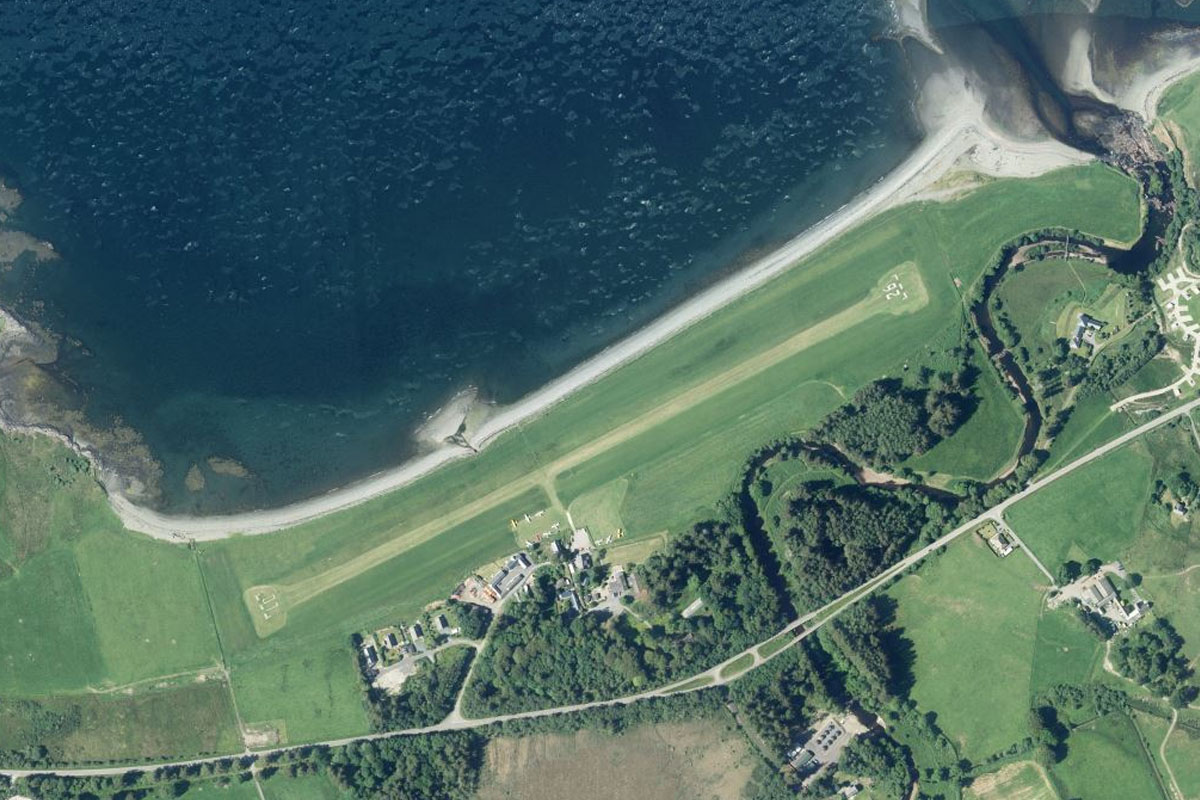
Flying from EGPW
Leg Distance: 19.75 Approximate time at 125kts: 9 minutes.
EGPW(EGPW) to Fetlar(POI1)
Distance: 8.63NM Bearing: 180° 4 minutes
After takeoff, fly south to nearby Fetlar Island
Fetlar(POI1) to EG78(EG78)
Distance: 11.12NM Bearing: 164° 5 minutes
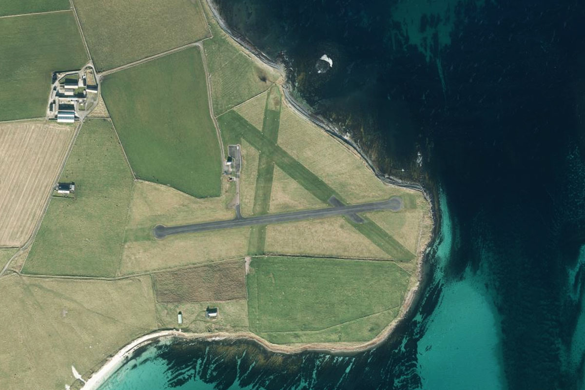
From Fetlar, turn slightly to the east and cross the water to Out Skerries, a group of small islands and the most easterly part of the Shetlands. There is a short 1200ft runway in the eastern half of the islands
Leg 2
Flying from EG78
Leg Distance: 41.25 Approximate time at 125kts: 20 minutes.
EG78(EG78) to Whalsay(POI2)
Distance: 7.87NM Bearing: 239° 4 minutes
Fly southwest to the next island, Whalsay, which lies half way back to the largest island of the Shetlands
Whalsay(POI2) to Mainland(POI3)
Distance: 10.19NM Bearing: 235° 5 minutes
Continue southwest to Mainland, the main island of the Shetlands and the third largest in Scotland
Mainland(POI3) to Mousa(POI4)
Distance: 15.77NM Bearing: 175° 8 minutes
Fly south along the east coast of the island. On the small island of Mousa, a mile east of the Mainland, lies the remains of an Iron Age round tower fort, the Broch of Mousa
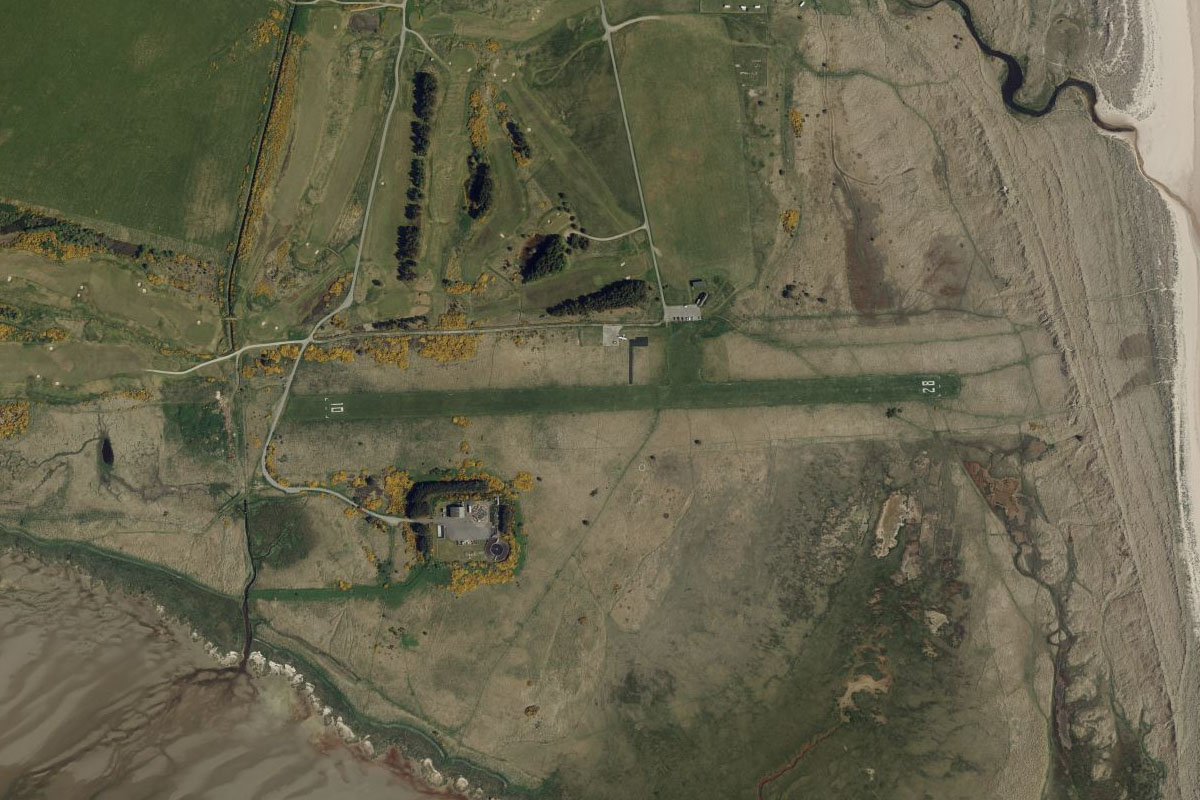
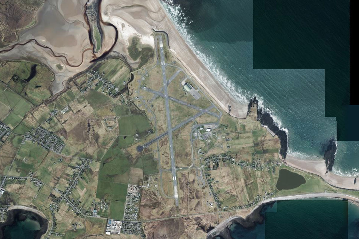
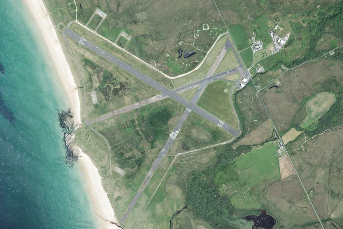
Mousa(POI4) to EGPB(EGPB)
Distance: 7.42NM Bearing: 200° 4 minutes
Continue south to Sumburgh Airport near the southern tip of the island. Just south of the airport is Jarlshof, a remarkable prehistoric archaeological site containing remains dating from 2500BC
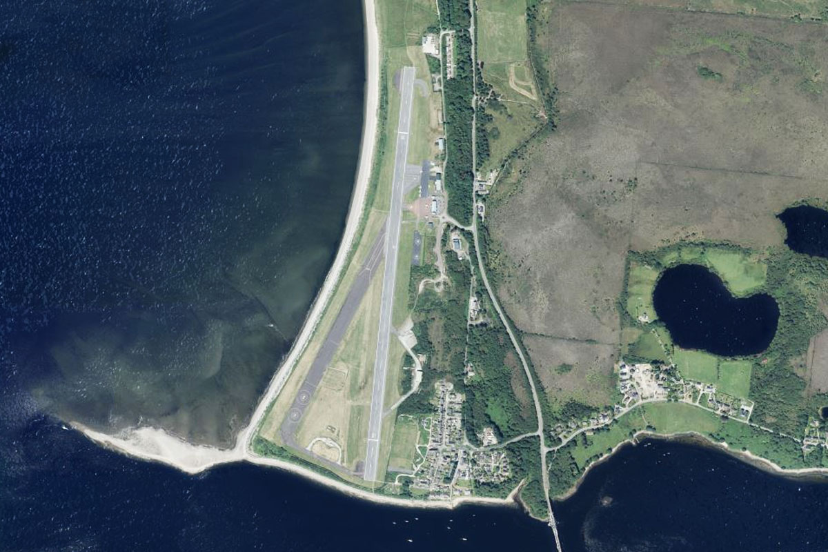
Leg 3
Flying from EGPB
Leg Distance: 23.15 Approximate time at 125kts: 11 minutes.
EGPB(EGPB) to Fair Isle(POI5)
Distance: 21.89NM Bearing: 206° 11 minutes
After takeoff fly southwest to Fair Isle, a small island between the two archipelagos of the Shetland and Orkney islands
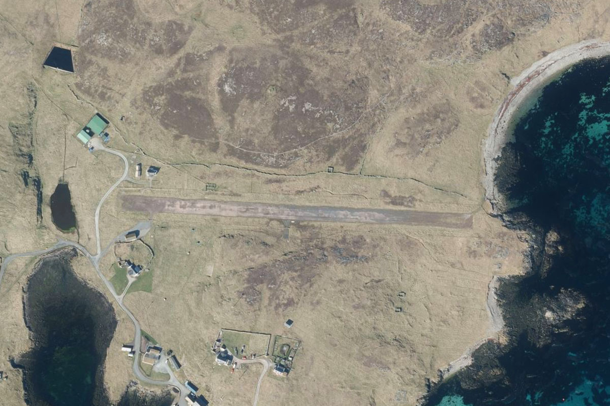
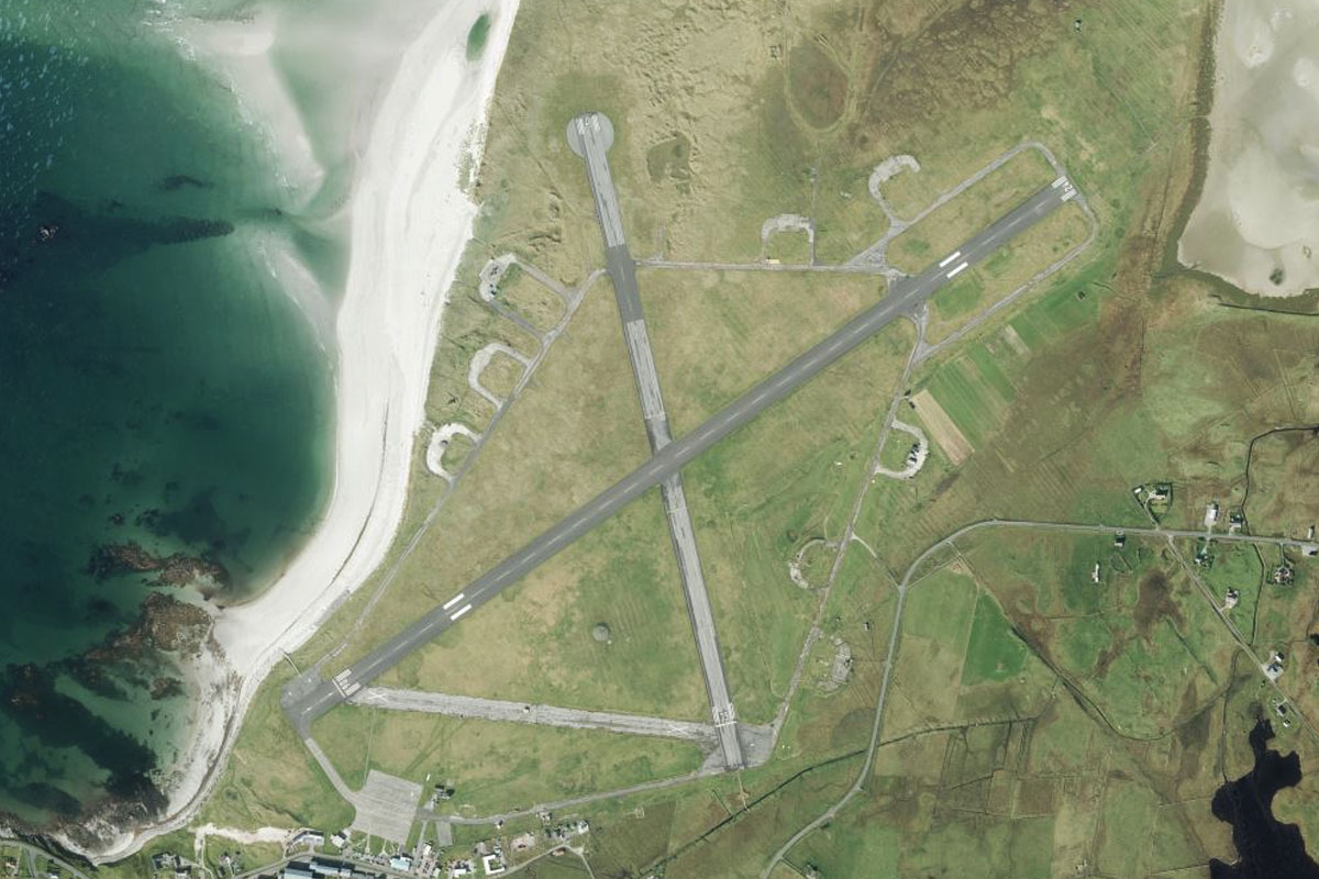
Fair Isle(POI5) to EGEF(EGEF)
Distance: 1.26NM Bearing: 209° 1 minutes
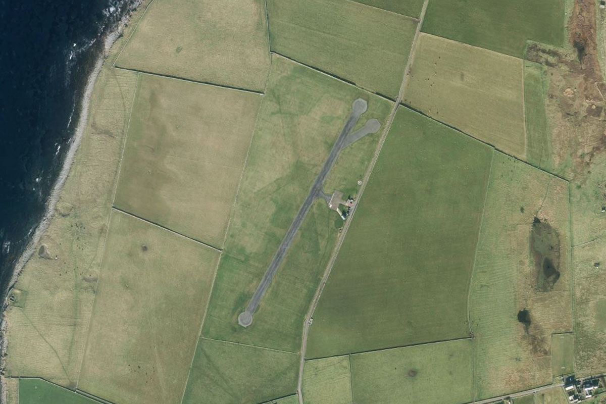
The dirt airstrip is in the center of the island
Leg 4
Flying from EGEF
Leg Distance: 43.17 Approximate time at 125kts: 21 minutes.
EGEF(EGEF) to North Ronaldsay(POI6)
Distance: 25.99NM Bearing: 249° 12 minutes
From Fair Isle, fly southwest to North Ronaldsay, the most northern of the Orkney Islands
North Ronaldsay(POI6) to Papa Westray(POI7)
Distance: 14.18NM Bearing: 274° 7 minutes
Fly west to the northern tip of Papa Westray, which is surrounded by a protected marine area
Papa Westray(POI7) to EGEW(EGEW)
Distance: 3NM Bearing: 225° 1 minutes
Head southwest to the larger island of Westray, and the airport near the northern tip of the island
Leg 5
Flying from EGEW
Leg Distance: 1.53 Approximate time at 125kts: 1 minutes.
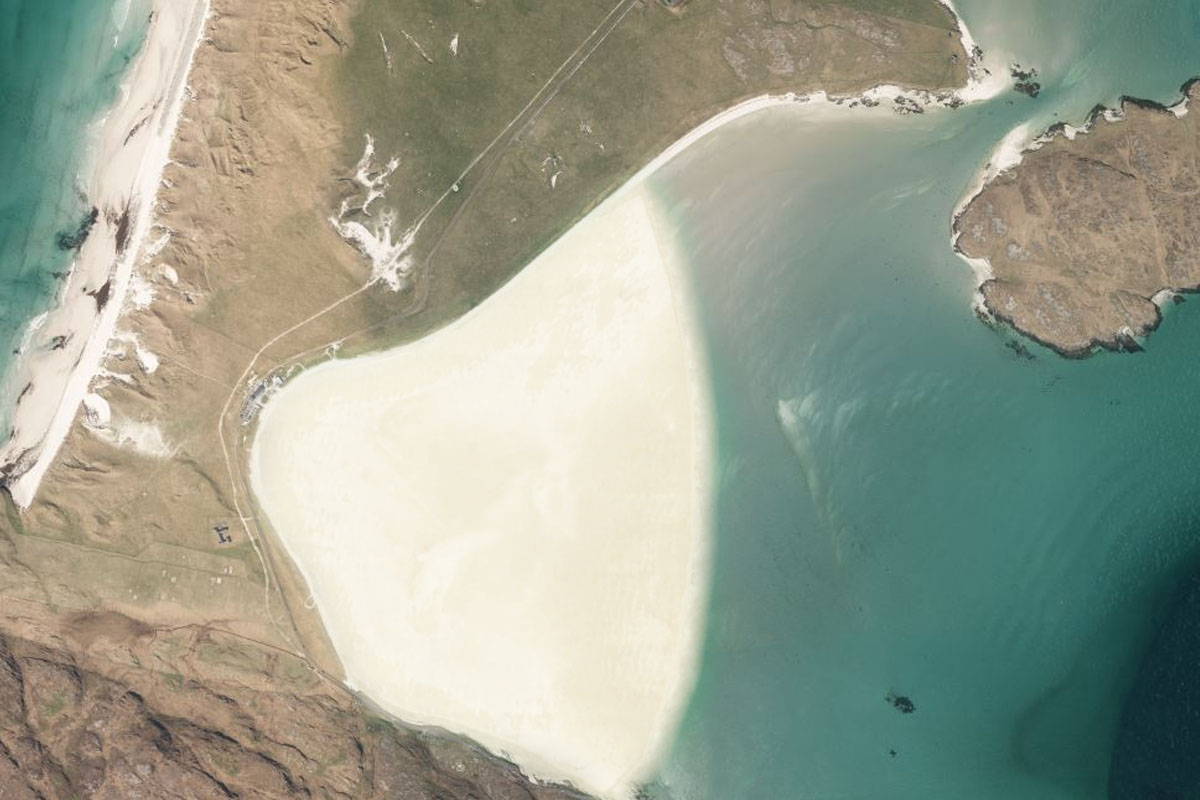
EGEW(EGEW) to Papa Westray(POI8)
Distance: 1.23NM Bearing: 89° 1 minutes
This short leg will trace the world's shortest commercial flight – a 1.5 nautical mile flight east to Papa Westray. This flight is flown by Scottish regional airline Loganair on a Britten Norman BN-2 Islander aircraft
Papa Westray(POI8) to EGEP(EGEP)
Distance: 0.3NM Bearing: 85° 0 minutes
Flying east from Westray will take you directly to Papa Westray airport 1.5 miles away
Leg 6
Flying from EGEP
Leg Distance: 54.48 Approximate time at 125kts: 26 minutes.
EGEP(EGEP) to Fitty Hill(POI9)
Distance: 5.82NM Bearing: 219° 3 minutes
After takeoff, fly southwest over the tallest hill on the island of Westray, Fitty Hill
Fitty Hill(POI9) to Rousay(POI10)
Distance: 6.85NM Bearing: 209° 3 minutes
Continue southwest across Westray Firth to the western tip of the island of Rousay
Rousay(POI10) to Brough of Birsay(POI11)
Distance: 7.17NM Bearing: 253° 3 minutes
Fly west to Orkney's Mainland island, and continue west along its northern coast to the small tidal island, Brough of Birsay. This uninhabited island features the remains of Pictish and Norse settlements
Brough of Birsay(POI11) to Skara Brae(POI12)
Distance: 4.96NM Bearing: 185° 2 minutes
Follow the west coast of the island south until you reach a small circular bay. On the southern shore of the bay is the stone-built Neolithic settlement of Skara Brae, a UNESCO World Heritage Site over 5000 years old
Skara Brae(POI12) to North Gaulton Castle(POI13)
Distance: 5.55NM Bearing: 183° 3 minutes
Continue south along the coast, on the way passing by the 165 foot high sea stack of North Gaulton Castle
North Gaulton Castle(POI13) to Hoy(POI14)
Distance: 6.01NM Bearing: 207° 3 minutes
When the coast turns away to the east, fly southwest across the Hoy Sound to the north west coast of the island of Hoy. Follow the coast southeast, passing by another sea stack, the 450 foot tall Old Man of Hoy
Hoy(POI14) to Rackwick Beach(POI15)
Distance: 1.95NM Bearing: 105° 1 minutes
Follow the hilly coast around the east to Rackwick Beach
Rackwick Beach(POI15) to Scapa Flow(POI16)
Distance: 3.9NM Bearing: 54° 2 minutes
From the beach, follow the valley northeast across to the other side of the island
Scapa Flow(POI16) to Scapa Bay(POI17)
Distance: 9.74NM Bearing: 73° 5 minutes
Cross the water to the Mainland and follow the coast east to Scapa Bay. The large body of water to the south is Scapa Flow, the final resting place of many German ships scuttled at the end of World War I
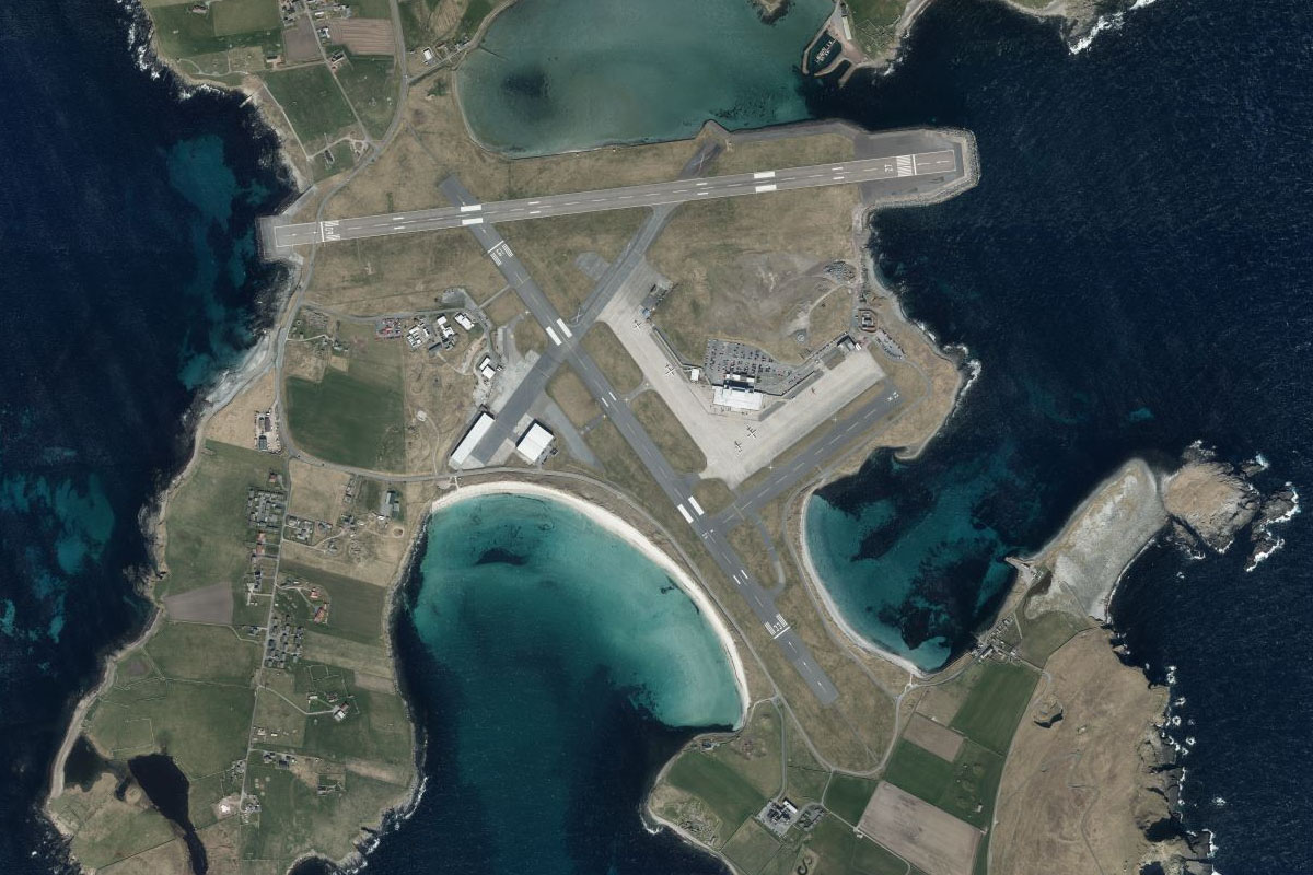
Scapa Bay(POI17) to EGPA(EGPA)
Distance: 2.53NM Bearing: 85° 1 minutes
Continue east to Kirkwall airport, a couple of miles east of Scapa Bay
Leg 7
Flying from EGPA
Leg Distance: 30.92 Approximate time at 125kts: 15 minutes.
EGPA(EGPA) to Lamb Holm(POI18)
Distance: 4.36NM Bearing: 178° 2 minutes
Fly south to the small island of Lamb Holm, which is home to a historic church built by Italian POW's during World War II. The island is connected to the mainland by one of the Churchill Barriers, man-made causeways also built during the war to protect Scapa Flow from the east
Lamb Holm(POI18) to South Ronaldsay(POI19)
Distance: 9.48NM Bearing: 191° 5 minutes
Continue south over the small island of Burray, then along the length of South Ronaldsay. Both islands are connected by the Churchill Barriers
South Ronaldsay(POI19) to Duncansby Head(POI20)
Distance: 5.62NM Bearing: 208° 3 minutes
Fly south across Pentland Firth to Duncansby Head, the most northern part of mainland Scotland and Britain
Duncansby Head(POI20) to EGPC(EGPC)
Distance: 11.46NM Bearing: 191° 6 minutes
Fly south along the coast, then cut across the wide curve of Sinclairs Bay to Wick Airport, just north of the town of the same name
Leg 8
Flying from EGPC
Leg Distance: 50.95 Approximate time at 125kts: 24 minutes.
EGPC(EGPC) to Sarclet(POI21)
Distance: 5.17NM Bearing: 185° 2 minutes
After takeoff, follow the coast south
Sarclet(POI21) to Dunbeath(POI22)
Distance: 12.33NM Bearing: 233° 6 minutes
Keep following the coast around to the southwest, where it will point you towards the town of Dunbeath and the Scaraben Hills
Dunbeath(POI22) to Gordonbush(POI23)
Distance: 18.43NM Bearing: 245° 9 minutes
Fly southwest over the hills until you reach the wind farm at Gordonbush
Gordonbush(POI23) to Golspie(POI24)
Distance: 8.18NM Bearing: 184° 4 minutes
From the wind farm, head south to the coast
Golspie(POI24) to EGZP(EGZP)
Distance: 6.84NM Bearing: 201° 3 minutes
Follow the coast south to the town of Dornoch. The airfield is south of the town next to the golf course
Leg 9
Flying from EGZP
Leg Distance: 43.56 Approximate time at 125kts: 21 minutes.
EGZP(EGZP) to Cromarty Firth(POI25)
Distance: 10.49NM Bearing: 187° 5 minutes
After takeoff, fly south over Dornoch Firth to another coastal inlet, Cromarty Firth
Cromarty Firth(POI25) to Cromarty Firth(POI26)
Distance: 6.93NM Bearing: 262° 3 minutes
Follow the waters of Cromarty Firth west
Cromarty Firth(POI26) to Dingwall(POI27)
Distance: 6.8NM Bearing: 222° 3 minutes
Keep following the inlet as it leads you southwest to the town of Dingwall
Dingwall(POI27) to Beauly Firth(POI28)
Distance: 5.6NM Bearing: 174° 3 minutes
From Dingwall, cut south across land to another inlet, Beauly Firth
Beauly Firth(POI28) to Inverness(POI29)
Distance: 5.99NM Bearing: 97° 3 minutes
Follow the inlet east to the city of Inverness, the northernmost city in the United Kingdom and regarded as the capital of the Highlands
Inverness(POI29) to Culloden(POI30)
Distance: 3.43NM Bearing: 102° 2 minutes
A few miles east of this city is the Culloden Battlefield, the site of the 1746 battle between the British government and the Jacobites
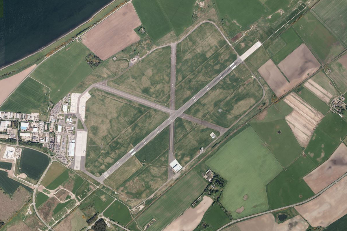
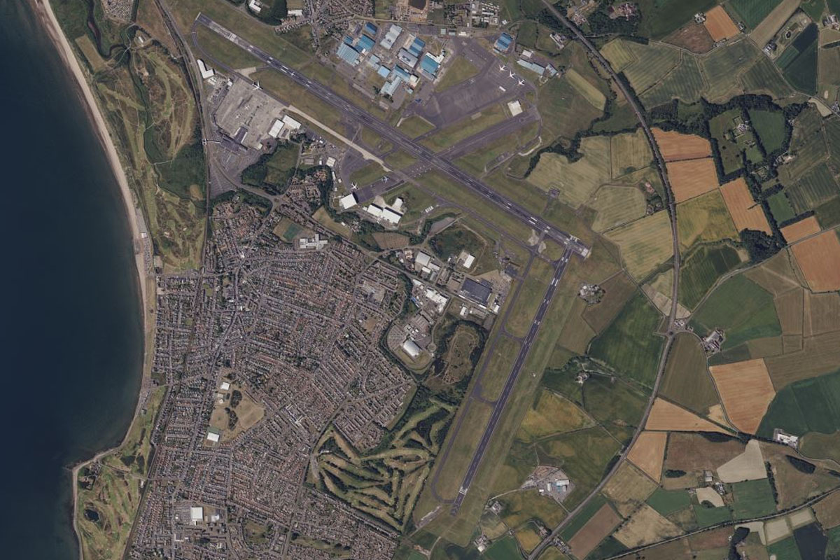
Culloden(POI30) to EGPE(EGPE)
Distance: 4.32NM Bearing: 24° 2 minutes
Northeast from the battlefield, on the shore of the Inner Moray Firth, is Inverness Airport
Leg 10
Flying from EGPE
Leg Distance: 31.66 Approximate time at 125kts: 15 minutes.
EGPE(EGPE) to Nairn(POI31)
Distance: 6.53NM Bearing: 68° 3 minutes
After takeoff, follow the coast east to the town of Nairn
Nairn(POI31) to Lossiemouth(POI32)
Distance: 20.18NM Bearing: 67° 10 minutes
Keep following the coast east to the town of Lossiemouth. West of the town is RAF Lossiemouth, home to Eurofighter Typhoon aircraft
Lossiemouth(POI32) to Quarry(POI33)
Distance: 3.34NM Bearing: 126° 2 minutes
From Lossiemouth, follow the beach southeast for a few miles until you reach a small quarry cut into the forest
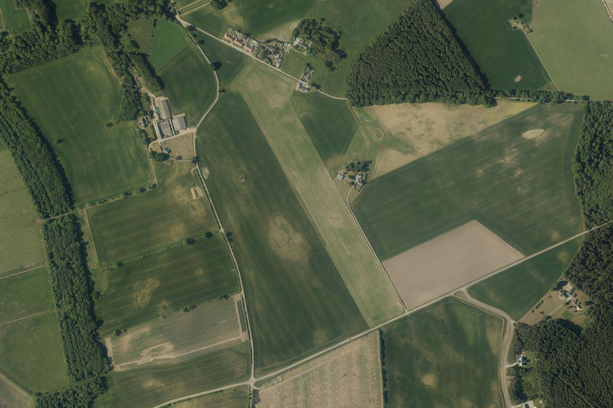
Quarry(POI33) to EGLZ(EGLZ)
Distance: 1.61NM Bearing: 166° 1 minutes
From the quarry, fly south to the small grass airstrip surrounded by farmland
Leg 11
Flying from EGLZ
Leg Distance: 46.93 Approximate time at 125kts: 23 minutes.
EGLZ(EGLZ) to Portknockie(POI34)
Distance: 10.89NM Bearing: 78° 5 minutes
Fly east back to the coast and follow it to the coastal village of Portknockie, which lies on a rocky headland
Portknockie(POI34) to Banff(POI35)
Distance: 11.28NM Bearing: 102° 5 minutes
Follow the coast east past the disused RAF base to the town of Banff, which shares the mouth of the Deveron River with the town of Macduff to its east
Banff(POI35) to Troup Head(POI36)
Distance: 7.16NM Bearing: 78° 3 minutes
Continue east past the coastal cliffs to the small peninsula and nature reserve of Troup Head
Troup Head(POI36) to Pennan(POI37)
Distance: 3.55NM Bearing: 111° 2 minutes
Follow the coast as it turns briefly to the southeast past the small village of Pennan, made famous as the fictional village of Ferness in the 1983 film Local Hero
Pennan(POI37) to Mormond Hill(POI38)
Distance: 6.58NM Bearing: 130° 3 minutes
Leaving the coast, fly southeast to one of the few notable hills in the area, Mormond Hill
Mormond Hill(POI38) to EGQG(EGQG)
Distance: 7.47NM Bearing: 134° 4 minutes
Continue southeast over a dark patch of forest to Longside Airfield, which occupies the eastern part of a former RAF Airfield
Leg 12
Flying from EGQG
Leg Distance: 30.32 Approximate time at 125kts: 15 minutes.
EGQG(EGQG) to Boddam(POI39)
Distance: 4.04NM Bearing: 132° 2 minutes
After takeoff, fly southeast past the large fishing port of Peterhead to reach the coast, which is the easternmost point of mainland Scotland
Boddam(POI39) to Cruden Bay(POI40)
Distance: 4.83NM Bearing: 215° 2 minutes
Follow the rugged coast southwest to Cruden Bay which has a large sandy beach
Cruden Bay(POI40) to Aberdeen(POI41)
Distance: 16.73NM Bearing: 206° 8 minutes
Continue southwest along the coast until you reach the city of Aberdeen, the third largest in Scotland
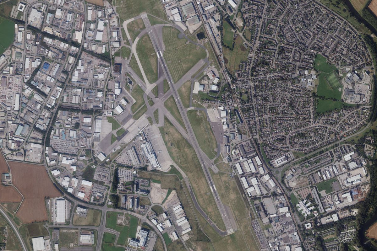
Aberdeen(POI41) to EGPD(EGPD)
Distance: 4.72NM Bearing: 307° 2 minutes
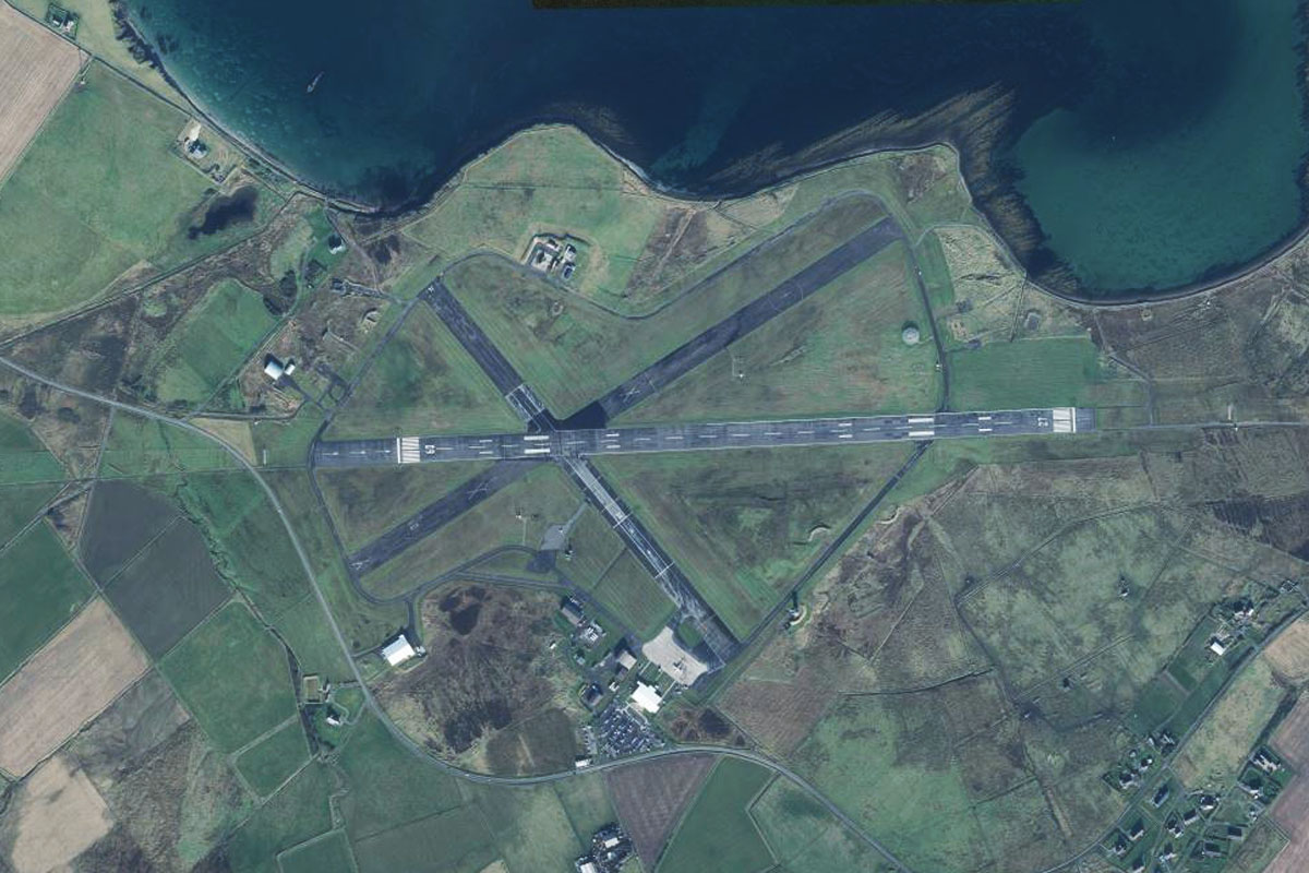
A few miles northeast from the city is Aberdeen Airport, which was originally a RAF station
Leg 13
Flying from EGPD
Leg Distance: 67.67 Approximate time at 125kts: 32 minutes.
EGPD(EGPD) to River Dee(POI42)
Distance: 12.05NM Bearing: 224° 6 minutes
After takeoff, fly southwest until you reach the River Dee near the town of Banchory
River Dee(POI42) to Ballater(POI43)
Distance: 17.07NM Bearing: 273° 8 minutes
Follow the river west where it will eventually enter a shallow valley
Ballater(POI43) to Balmoral(POI44)
Distance: 8.42NM Bearing: 260° 4 minutes
At the town of Ballater, the river will briefly turn north around a golf course before continuing west along the valley. Keep following the river west as it winds its way through the low lying mountains, and keep an eye out for Balmoral Castle on the river's south bank
Balmoral(POI44) to Braemar(POI45)
Distance: 6.11NM Bearing: 250° 3 minutes
Continue west along the river to the town of Braemar, home of the Highland Games Gathering attended by the Royal Family
Braemar(POI45) to River Dee(POI46)
Distance: 7.29NM Bearing: 257° 3 minutes
From Braemar, the river will continue west as it climbs into the highlands. It will then come to a junction with another river and turn northwest
River Dee(POI46) to The Devil’s Point(POI47)
Distance: 3.36NM Bearing: 326° 2 minutes
Follow the river as it climbs northwest towards the Cairngorms mountains
The Devil’s Point(POI47) to Cairn Toul(POI48)
Distance: 4.22NM Bearing: 352° 2 minutes
At a river junction surrounded by mountain peaks, continue north past Cairn Toul, Britain's fourth highest mountain
Cairn Toul(POI48) to Druie(POI49)
Distance: 3.53NM Bearing: 328° 2 minutes
After passing the mountain peaks, descend northwest with the Druie River out of the mountains
Druie(POI49) to Loch an Eilein(POI50)
Distance: 2.23NM Bearing: 278° 1 minutes
Once clear of the mountains, turn west to the nearby lake, Loch an Eilein
Loch an Eilein(POI50) to EGZL(EGZL)
Distance: 3.39NM Bearing: 220° 2 minutes
From the lake follow the base of the mountains southwest to the grass runway at Feshiebridge Airfield, popular for gliders
Leg 14
Flying from EGZL
Leg Distance: 50.56 Approximate time at 125kts: 24 minutes.
EGZL(EGZL) to Aviemore(POI51)
Distance: 6.22NM Bearing: 22° 3 minutes
After takeoff, turn north and follow the River Spey to the nearby town of Aviemore
Aviemore(POI51) to Carrbridge(POI52)
Distance: 4.53NM Bearing: 7° 2 minutes
From Aviemore, follow the A9 motorway north
Carrbridge(POI52) to Daviot(POI53)
Distance: 13.29NM Bearing: 309° 6 minutes
Follow the A9 as it winds its way northwest through the hilly country towards the city of Inverness
Daviot(POI53) to Lochend(POI54)
Distance: 6.31NM Bearing: 271° 3 minutes
Once you reach a large quarry on the left side of the highway, turn and head west to the northern tip of Loch Ness – one of the world's most famous lakes, known locally as a loch
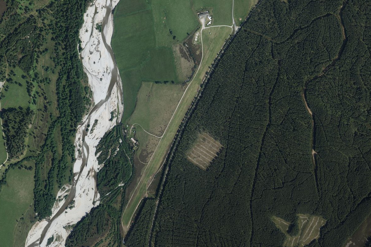
Lochend(POI54) to Fort Augustus(POI55)
Distance: 19.25NM Bearing: 216° 9 minutes
Follow the loch southwest to its southern end. With a depth of up to 230 meters, Loch Ness is the largest loch by volume in the British Isles, and is best known for alleged sightings of the famous Loch Ness Monster
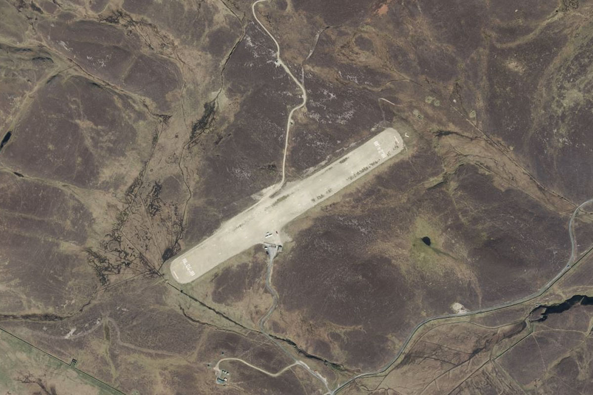
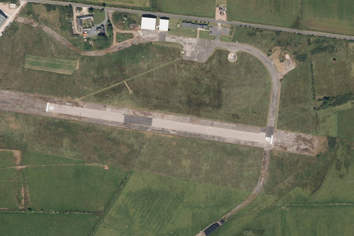
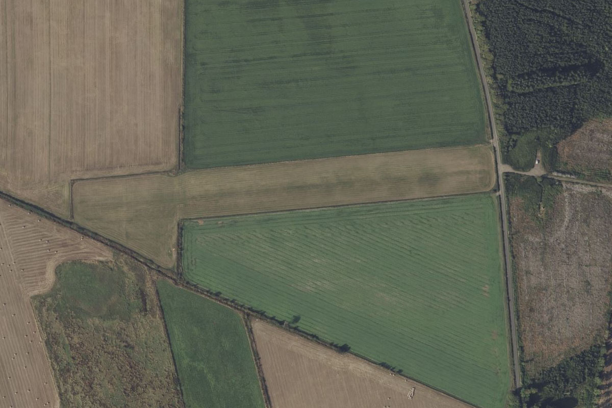
Fort Augustus(POI55) to EGVZ(EGVZ)
Distance: 0.96NM Bearing: 185° 0 minutes
Fort Augustus Airstrip is on a hillside less than a mile south of the loch's southern tip of the loch
Leg 15
Flying from EGVZ
Leg Distance: 41.21 Approximate time at 125kts: 20 minutes.
EGVZ(EGVZ) to Meall Dubh(POI56)
Distance: 7.45NM Bearing: 269° 4 minutes
After takeoff, fly west to the nearby wind farm on top of a mountain peak
Meall Dubh(POI56) to Loch Claunie(POI57)
Distance: 9.48NM Bearing: 282° 5 minutes
Continue west and follow Loch Claunie west along a valley
Loch Claunie(POI57) to Kintail(POI58)
Distance: 5.07NM Bearing: 280° 2 minutes
From the western end of the loch, continue west along the valley with the A87 main road
Kintail(POI58) to Loch Duich(POI59)
Distance: 8.99NM Bearing: 319° 4 minutes
Follow the valley around to the northwest as it leads to another long loch – Duich. Follow it northwest to a junction of three lochs, where the 13th century Eilean Donan castle sits proudly near the eastern shore
Loch Duich(POI59) to Skye Bridge(POI60)
Distance: 7.1NM Bearing: 274° 3 minutes
Turn west and fly along the length of Loch Alsh to where it reaches the open water of Inner Sound. Skye bridge provides a link to the Isle of Skye
Skye Bridge(POI60) to EGEI(EGEI)
Distance: 3.12NM Bearing: 242° 1 minutes
Follow the coast southwest to Broadford Aerodrome next to the shore
Leg 16
Flying from EGEI
Leg Distance: 80.6 Approximate time at 125kts: 39 minutes.
EGEI(EGEI) to Cuillin(POI61)
Distance: 13.67NM Bearing: 251° 7 minutes
After takeoff, fly southwest alongside the mountainous region known as the Cuillin, whose scenic beauty has led it to be designated a national scenic area
Cuillin(POI61) to River Brittle(POI62)
Distance: 4.15NM Bearing: 328° 2 minutes
As you make a clockwise turn around the mountains you will meet the valley of the River Brittle as you head northwest
River Brittle(POI62) to Braes Beach(POI63)
Distance: 8.88NM Bearing: 44° 4 minutes
Continue turning around to the northeast and head for the shore of the island
Braes Beach(POI63) to The Storr(POI64)
Distance: 10.38NM Bearing: 353° 5 minutes
Follow the island's coastline north to the large rocky hill named The Storr. The Old Man of Storr, a famous rock formation, lies on the eastern slope of the hill
The Storr(POI64) to Trotternish Peninsula(POI65)
Distance: 12.78NM Bearing: 340° 6 minutes
Continue to the northern tip of the island
Trotternish Peninsula(POI65) to Garbh Eilean(POI66)
Distance: 11.81NM Bearing: 353° 6 minutes
Cross the Sea of the Hebrides north to a group of small uninhabited islands. This part of the sea is known as The Minch
Garbh Eilean(POI66) to Outer Hebrides(POI67)
Distance: 7.06NM Bearing: 2° 3 minutes
Continue north to reach Lewis and Harris, the largest island in the Outer Hebrides
Outer Hebrides(POI67) to EGPO(EGPO)
Distance: 11.87NM Bearing: 7° 6 minutes
Follow the coastline north to the town of Stornoway, the largest in the Outer Hebrides. The airport is east of the town
Leg 17
Flying from EGPO
Leg Distance: 59.19 Approximate time at 125kts: 28 minutes.
EGPO(EGPO) to Loch Langabhat(POI68)
Distance: 17.22NM Bearing: 242° 8 minutes
After takeoff, fly southwest over the landscape dotted with lakes towards the distant mountains, where you will reach Loch Langabhat also pointing southwest
Loch Langabhat(POI68) to Loch Langabhat(POI69)
Distance: 3.41NM Bearing: 195° 2 minutes
Follow the loch as it turns south between the mountains. The loch is 7 miles long and is the largest freshwater loch on the island
Loch Langabhat(POI69) to Bun Abhainn Eadarra(POI70)
Distance: 5.14NM Bearing: 198° 2 minutes
Follow the valley south until you reach West Loch Tarbert, which separates the two parts of the island
Bun Abhainn Eadarra(POI70) to Luskentyre Beach(POI71)
Distance: 3.97NM Bearing: 233° 2 minutes
Fly southwest across the loch and past the large hill of Beinn Dhubh to the beachy inlet at Luskentyre
Luskentyre Beach(POI71) to Sgarasta Mhor Beach(POI72)
Distance: 5.78NM Bearing: 220° 3 minutes
Continue southwest along the coast to the large beach area between the hills
Sgarasta Mhor Beach(POI72) to Berneray(POI73)
Distance: 6.58NM Bearing: 216° 3 minutes
Keep flying southwest to the island of Berneray
Berneray(POI73) to North Uist(POI74)
Distance: 12.21NM Bearing: 219° 6 minutes
Continue southwest to the larger island of North Uist, and cross the relatively flat landscape to the island's western shore
North Uist(POI74) to EGPL(EGPL)
Distance: 4.88NM Bearing: 165° 2 minutes
Following the coast south will lead you to Benbecula Airport, on the northwestern tip of Benbecula Island
Leg 18
Flying from EGPL
Leg Distance: 28.36 Approximate time at 125kts: 14 minutes.
EGPL(EGPL) to South Uist(POI75)
Distance: 22.59NM Bearing: 184° 11 minutes
Fly south to the next island, South Uist, then follow the main road to the southern end of the island
South Uist(POI75) to Fuday(POI76)
Distance: 3.24NM Bearing: 189° 2 minutes
Fly south to the uninhabited Fuday Island
Fuday(POI76) to EGPR(EGPR)
Distance: 2.53NM Bearing: 234° 1 minutes
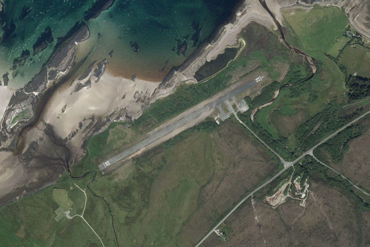
Fly southwest to Barra Airport, which lies at the southern end of the small peninsula on the north of Barra Island. The unique airport is believed to be the only one in the world where scheduled flights use a tidal beach as the runway
Leg 19
Flying from EGPR
Leg Distance: 46.5 Approximate time at 125kts: 22 minutes.
EGPR(EGPR) to Barra Head(POI77)
Distance: 15.7NM Bearing: 206° 8 minutes
After takeoff, follow the chain of islands south to Barra Head, the southernmost island in the Outer Hebrides
Barra Head(POI77) to Isle of Tiree(POI78)
Distance: 27.07NM Bearing: 128° 13 minutes
Fly southeast across the Sea of the Hebrides to the Isle of Tiree
Isle of Tiree(POI78) to EGPU(EGPU)
Distance: 3.73NM Bearing: 110° 2 minutes
Tiree airport sits near the center of the island
Leg 20
Flying from EGPU
Leg Distance: 61.04 Approximate time at 125kts: 29 minutes.
EGPU(EGPU) to Iona(POI79)
Distance: 18.32NM Bearing: 126° 9 minutes
Fly southwest to Iona, a small island of the Inner Hebrides known for its relative tranquility and natural environment, and home to Iona Abbey – one of the oldest Christian religious centers in Western Europe
Iona(POI79) to Colonsay(POI80)
Distance: 14.73NM Bearing: 146° 7 minutes
Head southeast across the Sea of the Hebrides to the northern tip of Colonsay, and island with several sandy beaches
Colonsay(POI80) to Oronsay(POI81)
Distance: 9.31NM Bearing: 210° 4 minutes
Fly southwest to the other end of the island
Oronsay(POI81) to Islay(POI82)
Distance: 6.95NM Bearing: 184° 3 minutes
Fly south across water to the large crescent shaped beach on the north shore of the island of Islay
Islay(POI82) to EGPI(EGPI)
Distance: 11.73NM Bearing: 177° 6 minutes
Continue towards the southern end of the island, where Islay airport sits next to the gently curved shore of Laggan Bay
Leg 21
Flying from EGPI
Leg Distance: 34.36 Approximate time at 125kts: 16 minutes.
EGPI(EGPI) to Kintyre(POI83)
Distance: 19.64NM Bearing: 92° 9 minutes
After takeoff, fly east across the channel and the Isle of Gigha to reach the western shore of the Kintyre Peninsula
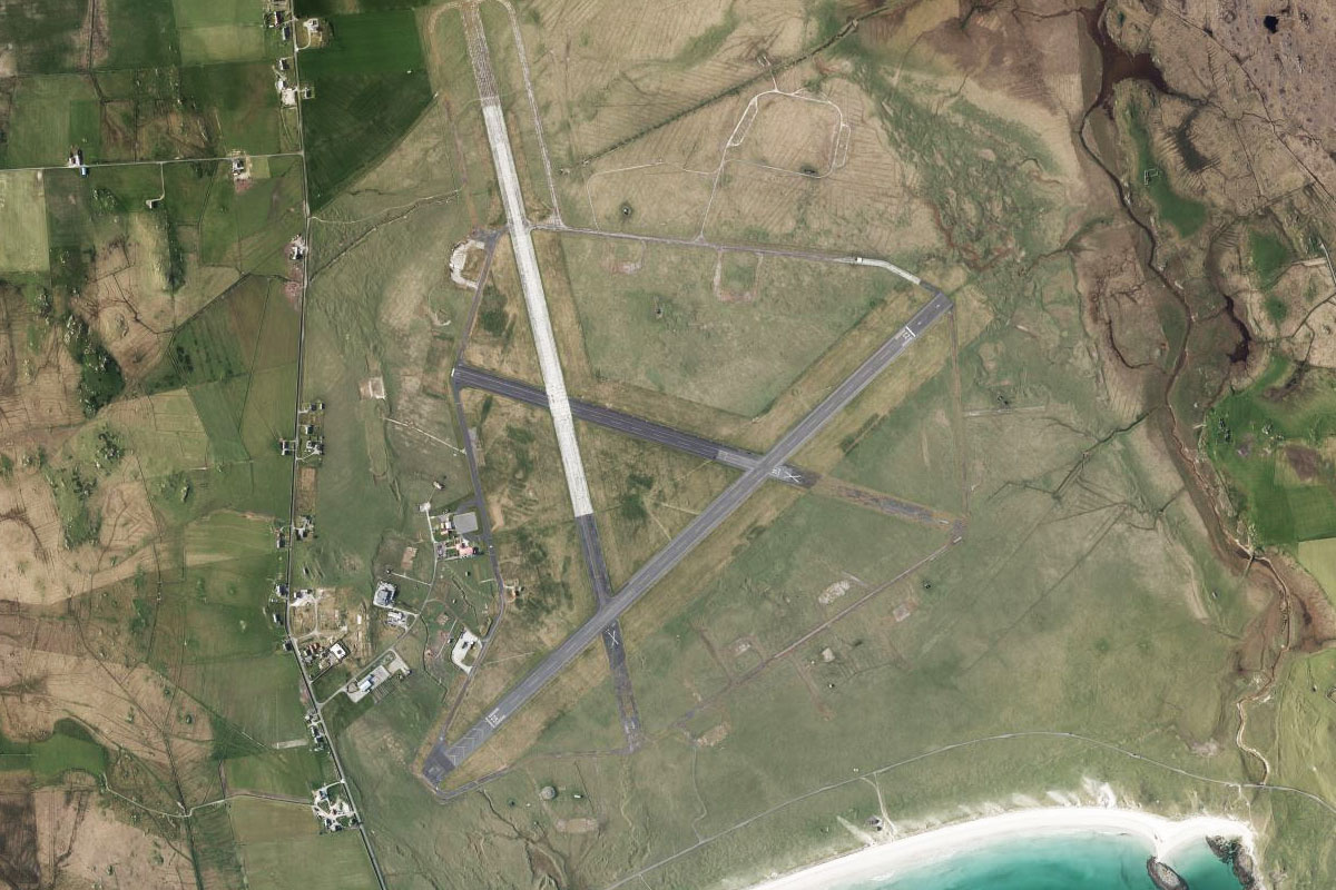
Kintyre(POI83) to EGEC(EGEC)
Distance: 14.72NM Bearing: 183° 7 minutes
Fly south along the west coast of the peninsula. As you near the hilly region in the south you will see Campbeltown Airport running east-west across the peninsula
Leg 22
Flying from EGEC
Leg Distance: 39.83 Approximate time at 125kts: 19 minutes.
EGEC(EGEC) to Davaar(POI84)
Distance: 5.05NM Bearing: 101° 2 minutes
After takeoff, fly to the eastern shore of the peninsula. A couple of miles north of the airport is High Park Farm, once owned by Paul McCartney who wrote the song Mull of Kintyre about the local area
Davaar(POI84) to Arran(POI85)
Distance: 12.21NM Bearing: 89° 6 minutes
Fly east over Kilbranna Sound to cross the southern tip of the Isle of Arran
Arran(POI85) to Ayr(POI86)
Distance: 18.18NM Bearing: 89° 9 minutes
Continue east over the Firth of Clyde to the mainland town of Ayr, home to Burns Cottage – 18th century childhood home of national poet Robert Burns
Ayr(POI86) to EGPK(EGPK)
Distance: 4.39NM Bearing: 27° 2 minutes
Fly to Prestwick Airport, a couple of miles north of Ayr
Leg 23
Flying from EGPK
Leg Distance: 21.66 Approximate time at 125kts: 10 minutes.
EGPK(EGPK) to Troon(POI87)
Distance: 3.19NM Bearing: 312° 2 minutes
After takeoff, head northwest to the coast at the town of Troon, known for the major tournament host – Royal Troon Golf Course
Troon(POI87) to Firth of Clyde(POI88)
Distance: 12.24NM Bearing: 320° 6 minutes
Follow the coastline of the Firth of Clyde northwest until you reach the entrance to the Upper Firth of Clyde, which is populated by two islands, Little Cumbrae and Great Cumbrae
Firth of Clyde(POI88) to Isle of Bute(POI89)
Distance: 4.76NM Bearing: 300° 2 minutes
Continue northwest over Little Cumbrae Island to the hilly headland of the Island of Bute's southern tip
Isle of Bute(POI89) to EGRT(EGRT)
Distance: 1.47NM Bearing: 332° 1 minutes
Bute Airfield lies in the fields north of the headland's hills
Leg 24
Flying from EGRT
Leg Distance: 59.45 Approximate time at 125kts: 29 minutes.
EGRT(EGRT) to Buttock Point(POI90)
Distance: 11.14NM Bearing: 337° 5 minutes
After takeoff, fly to the northern end of the island, passing by Mount Stuart House near the southeastern shore. The house is an extravagant 19th century mansion
Buttock Point(POI90) to Loch Riddon(POI91)
Distance: 6.65NM Bearing: 356° 3 minutes
From the northern tip of the island. continue north along Loch Riddon, then follow the River Ruel as it heads further north along a valley
Loch Riddon(POI91) to Luing(POI92)
Distance: 19.57NM Bearing: 314° 9 minutes
When the river turns northeast towards the wind farm, fly northwest out of the valley towards the tall mountain peak in the distance, until you reach a group of islands in the Firth of Lorn
Luing(POI92) to Mull(POI93)
Distance: 12.04NM Bearing: 359° 6 minutes
From the islands, fly north across the Firth of Lorn to the flat eastern tip of the Isle of Mull
Mull(POI93) to Sound of Mull(POI94)
Distance: 7.22NM Bearing: 308° 3 minutes
Follow the Sound of Mull northwest. The sound separates the Isle of Mull from the Scottish mainland
Sound of Mull(POI94) to EG13(EG13)
Distance: 2.83NM Bearing: 260° 1 minutes
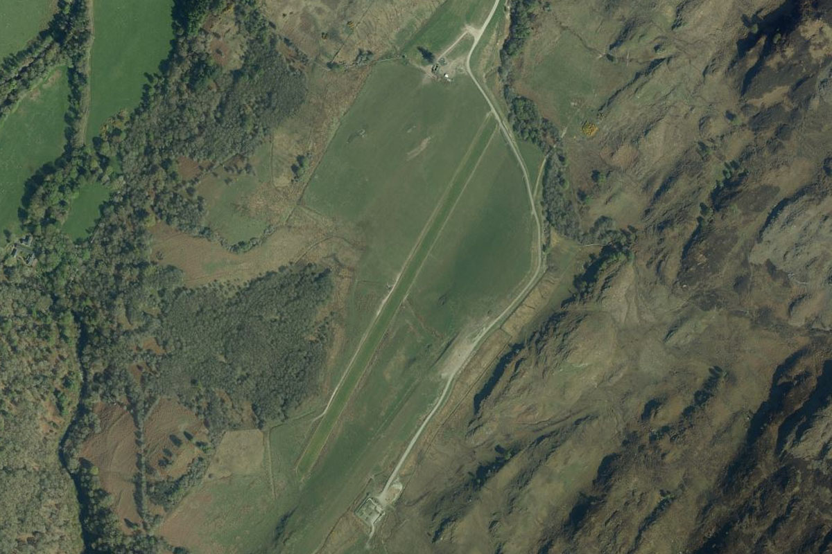
As the sound turns further to the north, look for Glenforsa Airfield on the south bank, near the mouth of the River Forsa
Leg 25
Flying from EG13
Leg Distance: 74.63 Approximate time at 125kts: 36 minutes.
EG13(EG13) to Calve Island(POI95)
Distance: 7.35NM Bearing: 327° 4 minutes
Follow the waterway northwest to the small island near the western bank, Calve Island. The small bay west of the island is home to the village of Tobermory, where an iconic row of colorful buildings line the waterfront
Calve Island(POI95) to Loch Sunart(POI96)
Distance: 3.9NM Bearing: 40° 2 minutes
Turn northeast and fly to the entrance of Loch Sunart
Loch Sunart(POI96) to Loch Sunart(POI97)
Distance: 4.59NM Bearing: 89° 2 minutes
Follow the loch east
Loch Sunart(POI97) to Loch Shiel(POI98)
Distance: 7.57NM Bearing: 49° 4 minutes
Follow the loch as it turns northeast, then continue over the land to reach Loch Shiel, also heading northeast
Loch Shiel(POI98) to Glenfinnian(POI99)
Distance: 10.02NM Bearing: 48° 5 minutes
Follow Loch Shiel northeast to its northern end at Glenfinnian. Just north of the loch is the iconic Glenfinnian Railway Viaduct, made even more famous in recent times as the Harry Potter bridge. Near the shore of the loch is Glenfinnian Monument, erected in 1814 and dedicated to the soldiers of Loudon's Highlanders
Glenfinnian(POI99) to Loch Eil(POIA0)
Distance: 10.82NM Bearing: 103° 5 minutes
Turn east and fly along the length of Loch Eil. At the eastern end of the loch is the town of Fort William in the shadow of Ben Nevis, the highest peak in the United Kingdom
Loch Eil(POIA0) to Ben Nevis(POIA1)
Distance: 4.53NM Bearing: 151° 2 minutes
Fly southeast along the valley next to Ben Nevis for a closer look at this 4413 foot tall mountain
Ben Nevis(POIA1) to Loch Leven(POIA2)
Distance: 3.84NM Bearing: 179° 2 minutes
After passing the mountain, fly south over the mountains to the narrow waters of Loch Leven
Loch Leven(POIA2) to Glen Coe(POIA3)
Distance: 6.58NM Bearing: 261° 3 minutes
Follow the Loch Leven west until you reach the larger Loch Linnhe. The area south of Loch Leven is the Glen Coe National Nature Reserve, with the valley leading southeast from the town of Glencoe known for its outstanding beauty
Glen Coe(POIA3) to Shuna Island(POIA4)
Distance: 8NM Bearing: 223° 4 minutes
Follow the shore of Loch Linnhe southwest to Shuna Island
Shuna Island(POIA4) to EGEO(EGEO)
Distance: 7.43NM Bearing: 183° 4 minutes
From the island, fly south to Oban Airport, which lies hidden by the hills to its north, on the shore of Ardmucknish Bay
Leg 26
Flying from EGEO
Leg Distance: 55.14 Approximate time at 125kts: 26 minutes.
EGEO(EGEO) to Ben Cruachan(POIA5)
Distance: 9.29NM Bearing: 114° 4 minutes
After takeoff, fly east to the nearby mountain of Ben Cruachan
Ben Cruachan(POIA5) to Ben Lui(POIA6)
Distance: 10.98NM Bearing: 94° 5 minutes
After passing the south face of the mountain, fly east as you climb to another mountain of similar height, Ben Lui
Ben Lui(POIA6) to Loch Lomond(POIA7)
Distance: 5.86NM Bearing: 150° 3 minutes
When you reach the peak, fly southeast to the northern tip of Loch Lomond
Loch Lomond(POIA7) to Balloch(POIA8)
Distance: 19.05NM Bearing: 168° 9 minutes
Fly south along the length of Loch Lomond to the town of Balloch at its southern tip. The loch is a popular outdoor leisure destination due to its natural beauty and location near Glasgow
Balloch(POIA8) to Dumbarton(POIA9)
Distance: 4.44NM Bearing: 166° 2 minutes
Follow the River Leven on its short journey south to the River Clyde. Dumbarton Castle sits atop the hill at the junction of the two rivers
Dumbarton(POIA9) to EGPF(EGPF)
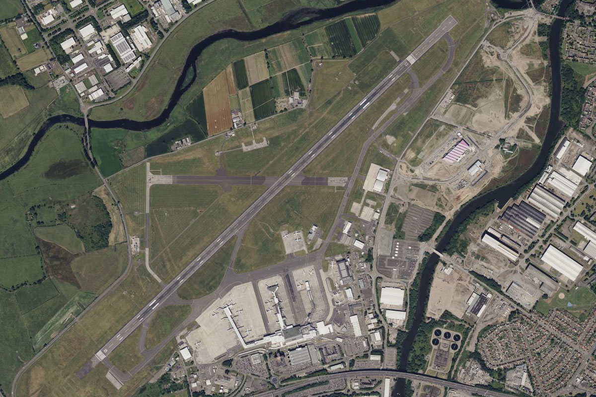
Distance: 5.52NM Bearing: 132° 3 minutes
When you reach the Clyde River, head southeast to Glasgow Airport, the second busiest airport in Scotland and the destination for this stage