Welcome to stage 55, a tour through the Celtic lands of Scotland and Ireland. Starting in Glasgow, the largest city in Scotland, you’ll make your way around the Scottish lowlands to Edinburgh and the east coast, before crossing northern England and the Irish Sea to Northern Ireland via the Isle of Man. The second half of the journey will be an anti-clockwise tour around the Emerald Isle, taking the many sights of this beautiful country. From the Glenariff Valley and the Giant’s Causeway to the Cliffs of Moher and The Burren, beauty surrounds you.
Total Legs: 23 Total Distance: 1261 Total Time(125kts): 10 hours 5 minutes
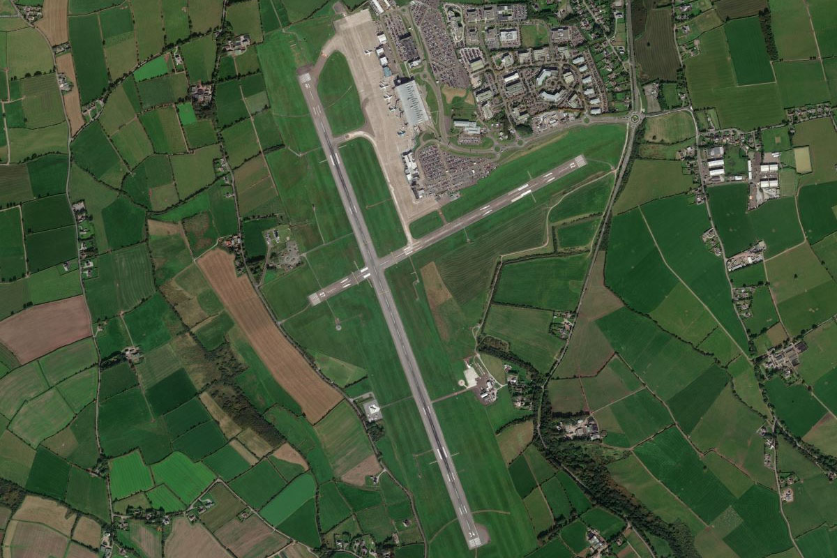
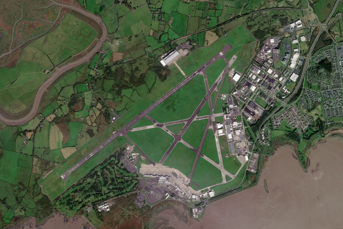
Leg 1
Flying from EGPF
Leg Distance: 44.56 Approximate time at 125kts: 21 minutes.
EGPF(EGPF) to River Clyde(POI1)
Distance: 2.63NM Bearing: 87° 1 minutes
Head east after takeoff to follow the River Clyde towards the city of Glasgow
River Clyde(POI1) to Parkhead(POI2)
Distance: 5.6NM Bearing: 107° 3 minutes
Follow the river southeast for a view of the city's waterfront museums and attractions, as well as Ibrox Stadium to the right and the main centre of Glasgow to the left. Head for Celtic Park stadium, which lies to the east of the city on the north side of the river
Parkhead(POI2) to Forth and Clyde Canal(POI3)
Distance: 4.97NM Bearing: 359° 2 minutes
Head north until you see the Forth and Clyde Canal on the northern outskirts of Glasgow, then follow it northeast.
Forth and Clyde Canal(POI3) to Falkirk Wheel(POI4)
Distance: 13.3NM Bearing: 72° 6 minutes
The canal will be joined by the railway line also heading northeast, and will eventually reach the engineering marvel of the Falkirk Wheel, sitting in a small circular inlet from the canal a few miles east of Cumbernauld airstrip
Falkirk Wheel(POI4) to River Forth(POI5)
Distance: 5.79NM Bearing: 359° 3 minutes
Fly north to reach the River Forth.
River Forth(POI5) to Stirling(POI6)
Distance: 3.77NM Bearing: 292° 2 minutes
Follow the river west to the town of Stirling. South of here is the field and monument to the Battle of Bannockburn. Stirling Castle sits on a hill northwest of the town and the National William Wallace Monument lies north of the river
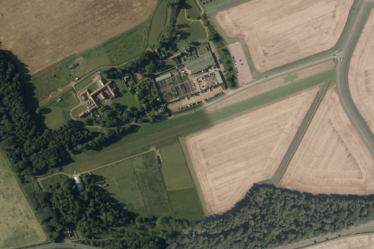
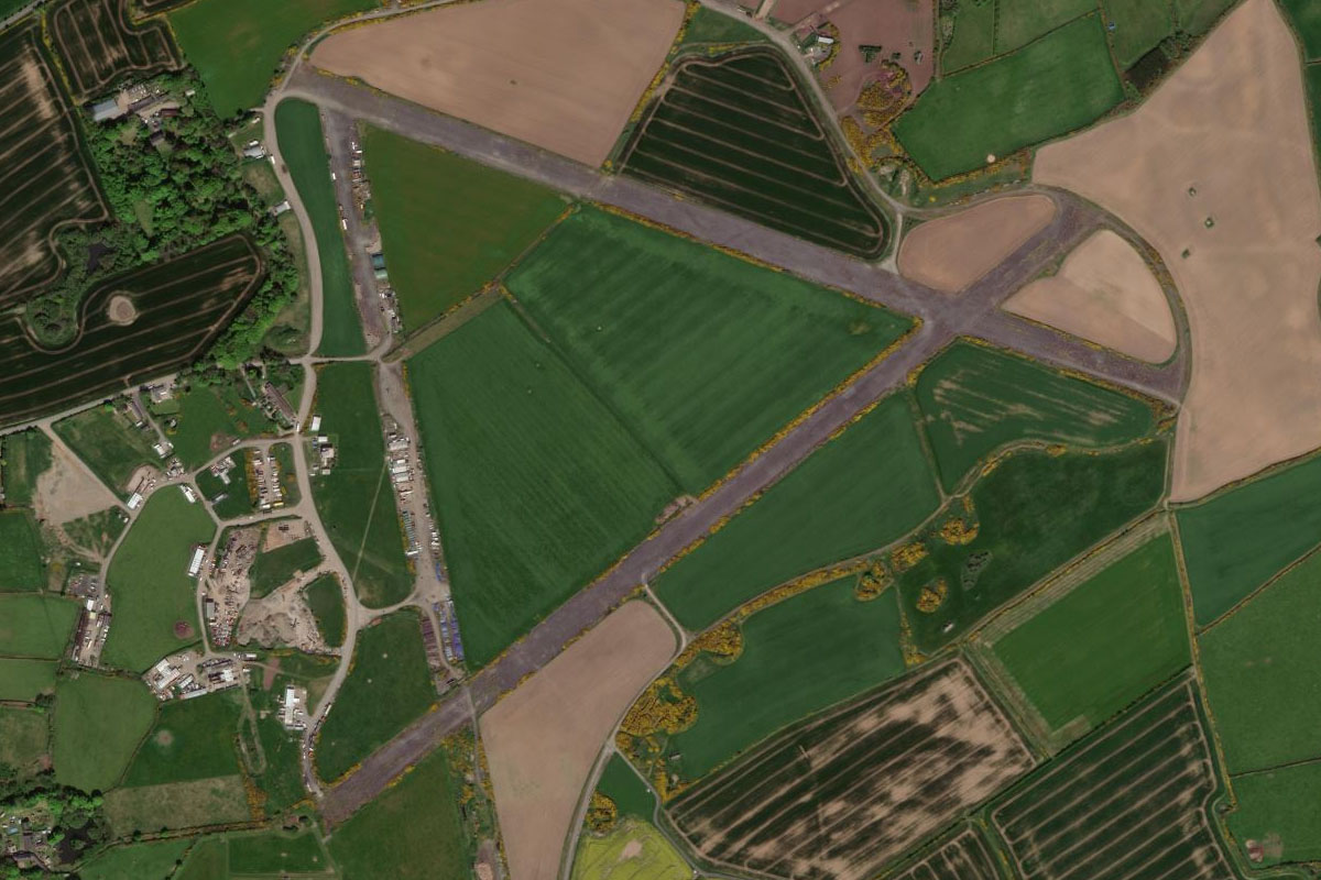
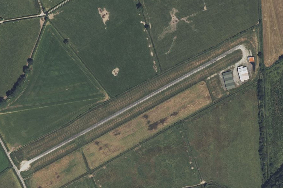
Stirling(POI6) to EGKM(EGKM)
Distance: 8.5NM Bearing: 281° 4 minutes
From Stirling, fly west along the base of the hills to Thornhill Airfield which sits at the edge of a nature reserve a mile north of the highway
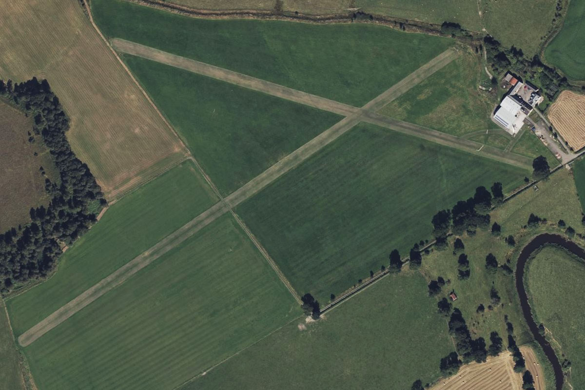
Leg 2
Flying from EGKM
Leg Distance: 43.38 Approximate time at 125kts: 21 minutes.
EGKM(EGKM) to Dunblane(POI7)
Distance: 7.52NM Bearing: 69° 4 minutes
After takeoff, head east and fly to the north side of the Ochil Hills ahead. You should see the A9 motorway heading north past the town of Dunblane
Dunblane(POI7) to Perth(POI8)
Distance: 20.08NM Bearing: 55° 10 minutes
Follow the A9 northeast to the town of Perth, which sits on the River Tay
Perth(POI8) to EGPN(EGPN)
Distance: 15.78NM Bearing: 76° 8 minutes
Head east from Perth then follow the north bank of the River Tay until you reach Dundee Airport, which sits at the river's edge
Leg 3
Flying from EGPN
Leg Distance: 68.53 Approximate time at 125kts: 33 minutes.
EGPN(EGPN) to Tay Road Bridge(POI9)
Distance: 2.36NM Bearing: 86° 1 minutes
Head east along the river's edge until you reach the Tay Road Bridge, then turn north. One the way you might catch a glimpse of RRS Discovery, a historic ship and museum
Tay Road Bridge(POI9) to Glamis Castle(POI10)
Distance: 9.98NM Bearing: 353° 5 minutes
Heading north from Dundee, you'll pass the disused RAF base at Tealing, over some low lying hills, then to the 14th century Glamis Castle in the middle of the large, shallow valley
Glamis Castle(POI10) to Buddon Ness(POI11)
Distance: 12.15NM Bearing: 137° 6 minutes
Turn to the southeast from Glamis Castle and head for the coast, and the triangle shaped headland of Buddon Ness which features two lighthouses and the famous Carnoustie Golf Links
Buddon Ness(POI11) to St Andrews(POI12)
Distance: 6.95NM Bearing: 202° 3 minutes
Head southwest across the water and follow the beach lined coast south across the Eden Estuary to St Andrews, the home of golf
St Andrews(POI12) to Lomond Hills(POI13)
Distance: 16.17NM Bearing: 244° 8 minutes
After passing St Andrews, turn and head southwest to the group of hills in the distance. At the north eastern edge of the hills is the town of Falkland and Falkland Palace and Garden
Lomond Hills(POI13) to Burntisland(POI14)
Distance: 11.23NM Bearing: 177° 5 minutes
Heading south from the hills, you'll come to the northern shore of the Firth of Forth
Burntisland(POI14) to Forth Bridges(POI15)
Distance: 6.44NM Bearing: 238° 3 minutes
Head west along the waterway to the Forth Bridges. The famous Forth Rail Bridge spans the Firth of Forth, followed by the Forth Road Bridge and the newer Queensferry Bridge. Turn south when you reach the bridges
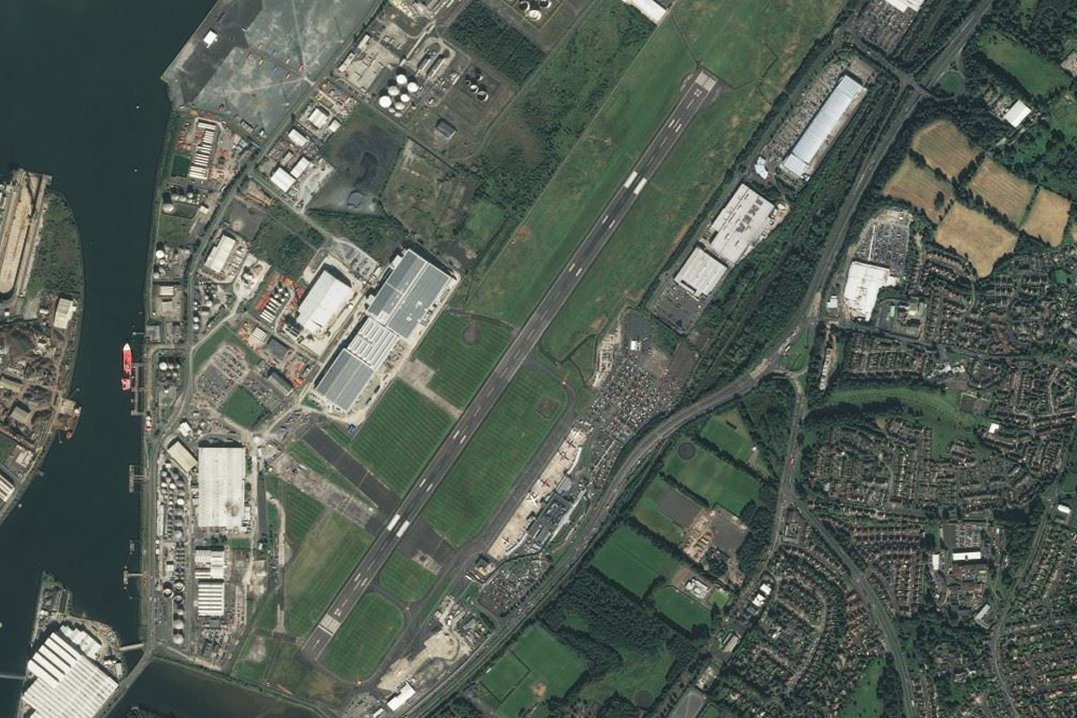
Forth Bridges(POI15) to EGPH(EGPH)
Distance: 3.25NM Bearing: 161° 2 minutes
Head south from the bridges to Edinburgh Airport, the busiest in Scotland
Leg 4
Flying from EGPH
Leg Distance: 21.29 Approximate time at 125kts: 10 minutes.
EGPH(EGPH) to Holyrood(POI16)
Distance: 7.39NM Bearing: 99° 4 minutes
Head east after takeoff and aim for the south side of the hills ahead. Before the group of hills containing Holyrood Park, you will see Edinburgh Castle to the left and also the palace of Holyrood House at the western base of the hills
Holyrood(POI16) to Port Seton(POI17)
Distance: 7.23NM Bearing: 71° 3 minutes
After passing Holyrood Park, turn left towards the coast and follow it to the east
Port Seton(POI17) to Aberlady Bay(POI18)
Distance: 4.37NM Bearing: 35° 2 minutes
Continue along the coast as it turns northeast
Aberlady Bay(POI18) to EGGU(EGGU)
Distance: 2.3NM Bearing: 72° 1 minutes
After crossing Aberlady Bay and reaching the golf course on its north side, turn towards the east and over the town of Gullane. The airfield is just after the town. Another top ranking golf course, Muirfield, is on the north side of the town
Leg 5
Flying from EGGU
Leg Distance: 71.1 Approximate time at 125kts: 34 minutes.
EGGU(EGGU) to Bass Rock(POI19)
Distance: 5.33NM Bearing: 77° 3 minutes
Head east after takeoff to the coastal town of North Berwick. South of the town is the hill of North Berwick Law. A couple of miles further to the east, Bass Rock sits a couple of miles off shore
Bass Rock(POI19) to Dunbar(POI20)
Distance: 5.77NM Bearing: 129° 3 minutes
Turn to the southeast and continue following the coast to the town of Dunbar
Dunbar(POI20) to St Abb’s Head(POI21)
Distance: 14.17NM Bearing: 111° 7 minutes
Keep following the coast southeast where it will turn easterly towards the green hills of St Abb's Head
St Abb’s Head(POI21) to Berwick-Upon-Tweed(POI22)
Distance: 9.44NM Bearing: 153° 5 minutes
Stay with the coast as it turns back to the southeast and past the town of Eyemouth, then on to Berwick on the mouth of the River Tweed
Berwick-Upon-Tweed(POI22) to Holy Island(POI23)
Distance: 9NM Bearing: 138° 4 minutes
Continuing southeast, you'll come to the Holy Island of Lindisfarne, complete with castle and medieval buildings. A Causeway connects the island to the mainland
Holy Island(POI23) to Bamburgh(POI24)
Distance: 5.88NM Bearing: 124° 3 minutes
Still travelling southeast along the coast, you'll soon see Bamburgh Castle near the shore opposite the Farne Islands Nature Preserve just offshore
Bamburgh(POI24) to Embleton Bay(POI25)
Distance: 7.09NM Bearing: 161° 3 minutes
Continue south along the coast over the towns of Seahouses and Beadnell to a series of sandy bays. Once you reach Embleton Bay, which has a small hill to its south, turn southwest and head inland towards the town of Alnwick
Embleton Bay(POI25) to Alnwick(POI26)
Distance: 6.02NM Bearing: 217° 3 minutes
Head for the north side of the town of Alnwick for a view of Alnwick Castle and its garden
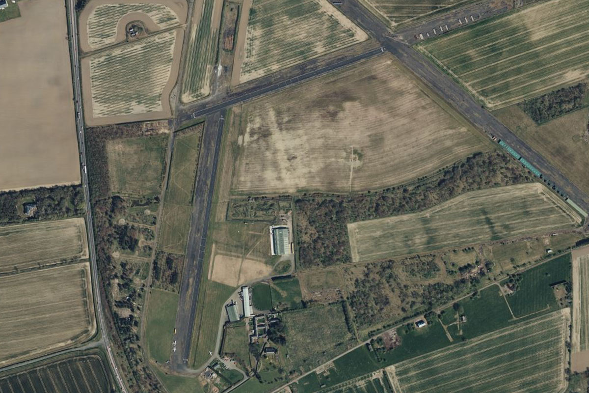
Alnwick(POI26) to EGFL(EGFL)
Distance: 8.4NM Bearing: 182° 4 minutes
Head south from Alnwick to Eshott Airfield, which sits next to the A1 highway
Leg 6
Flying from EGFL
Leg Distance: 47.87 Approximate time at 125kts: 23 minutes.
EGFL(EGFL) to Rothbury(POI27)
Distance: 6.56NM Bearing: 286° 3 minutes
Head west after takeoff, and the River Coquet will lead you to the town of Rothbury, with the Victorian mansion of Cragside sitting on the hill to your right just before the town
Rothbury(POI27) to Kielder Water(POI28)
Distance: 20.72NM Bearing: 248° 10 minutes
Head west (slightly south) over the rolling hills until you reach Kielder Water reservoir
Kielder Water(POI28) to Gilsland(POI29)
Distance: 11.84NM Bearing: 199° 6 minutes
Head south from the reservoir until you reach the Irthing River running southwest along a wide open valley
Gilsland(POI29) to EGNC(EGNC)
Distance: 8.75NM Bearing: 248° 4 minutes
Keep following the river southwest and it will take you past the ancient Roman Hadrian's Wall, then past the town of Brampton before reaching Carlisle Airport
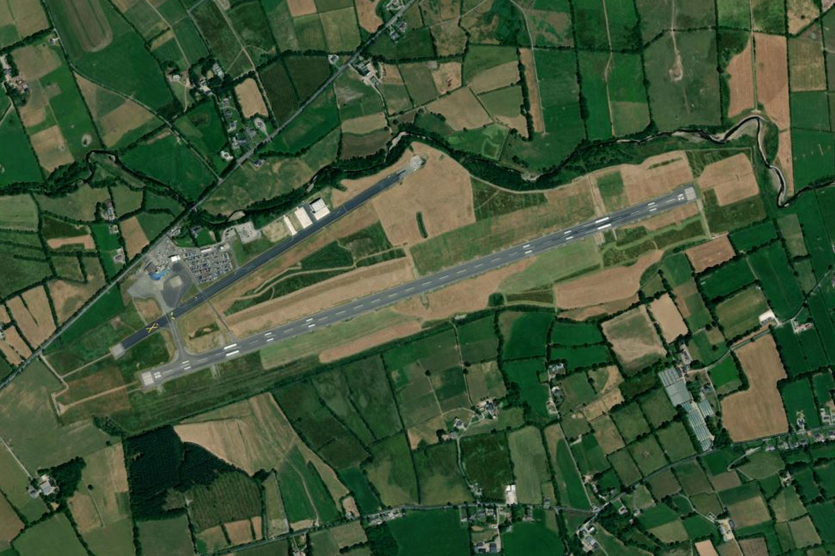
Leg 7
Flying from EGNC
Leg Distance: 32.77 Approximate time at 125kts: 16 minutes.
EGNC(EGNC) to Carlisle(POI30)
Distance: 4.93NM Bearing: 251° 2 minutes
Head southwest to the town of Carlisle, where Carlisle Castle sits near the town center, next to the River Eden's south bank
Carlisle(POI30) to Solway Firth(POI31)
Distance: 9.32NM Bearing: 288° 4 minutes
Head west from Carlisle to the waters of Solway Firth.
Solway Firth(POI31) to Ingleston(POI32)
Distance: 13.06NM Bearing: 270° 6 minutes
Continue west along the northern shore of Solway Firth, heading towards the hills on the far coast
Ingleston(POI32) to EGGY(EGGY)
Distance: 5.46NM Bearing: 266° 3 minutes
Fly west over the hills to the dirt airstrip on the western side overlooking the valley
Leg 8
Flying from EGGY
Leg Distance: 42.72 Approximate time at 125kts: 21 minutes.
EGGY(EGGY) to Hestan Island(POI33)
Distance: 8.13NM Bearing: 203° 4 minutes
Head south after takeoff. When you reach the coast, follow it southwest
Hestan Island(POI33) to Wall Hill(POI34)
Distance: 6.51NM Bearing: 240° 3 minutes
Continue following the coast. When you reach the southern point near Wall Hill, turn southwest across the sea to the Isle of Man
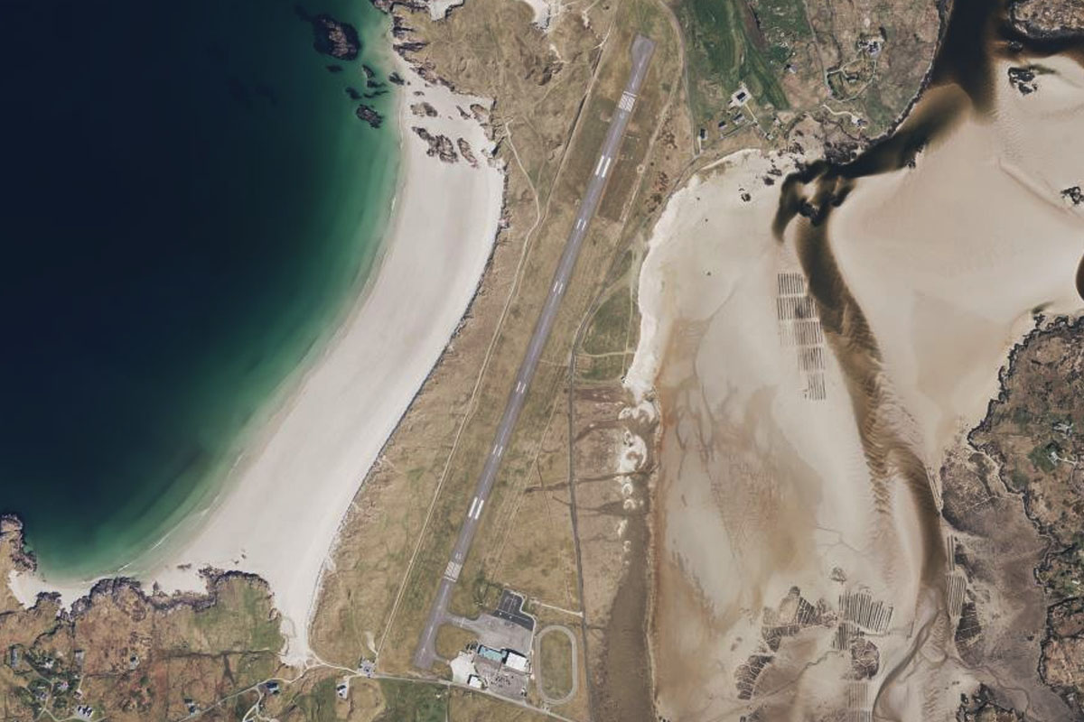
Wall Hill(POI34) to EGZU(EGZU)
Distance: 28.08NM Bearing: 213° 13 minutes
The northern tip of the Isle of man is 24 miles away. Andreas Airfield sits a few miles inland in the center of the flat peninsula
Leg 9
Flying from EGZU
Leg Distance: 60.43 Approximate time at 125kts: 29 minutes.
EGZU(EGZU) to Ballyquinton Point(POI35)
Distance: 37.83NM Bearing: 268° 18 minutes
After takeoff, head west across the Irish sea towards the Dromara Hills of Northern Ireland
Ballyquinton Point(POI35) to Strangford Lough(POI36)
Distance: 15.39NM Bearing: 336° 7 minutes
When you reach land, turn northwest and make your way along the large waterway of Strangford Lough
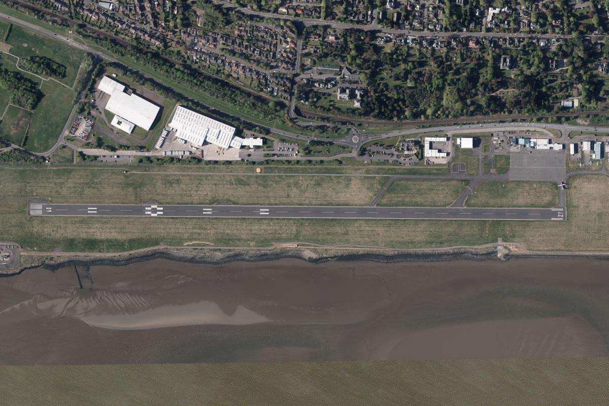
Strangford Lough(POI36) to EGAC(EGAC)
Distance: 7.21NM Bearing: 298° 3 minutes
When you reach the northern end of the lough, turn northwest and head towards the dock area of Belfast, which lies next to Belfast City Airport
Leg 10
Flying from EGAC
Leg Distance: 57.52 Approximate time at 125kts: 28 minutes.
EGAC(EGAC) to Belfast(POI37)
Distance: 3.57NM Bearing: 234° 2 minutes
Head southwest after takeoff for a closer look at Belfast. Dominating the skyline are the twin shipbuilding gantry cranes of Samson and Goliath. Also at the dock area is the Titanic maritime attraction
Belfast(POI37) to Carrickfergus(POI38)
Distance: 9.26NM Bearing: 33° 4 minutes
Turn northeast after visiting the city and follow the north shore of Belfast Lough to Carrickfergus Marina
Carrickfergus(POI38) to Carnfunnock(POI39)
Distance: 10.59NM Bearing: 357° 5 minutes
Head north across land until you reach the coast, then follow it northwest
Carnfunnock(POI39) to Knockore(POI40)
Distance: 11.68NM Bearing: 338° 6 minutes
Continue northwest along the Antrim Coast – a designated area of natural beauty. When you reach the headland of Garron Point, enter the bay to the west
Knockore(POI40) to Glenariff(POI41)
Distance: 2.62NM Bearing: 257° 1 minutes
Heading west into the bay you will see Lurigethan Mountain, which sits between two valleys. Head to the valley and town of Glenariff south of the mountain
Glenariff(POI41) to Glenariff Valley(POI42)
Distance: 3.14NM Bearing: 217° 2 minutes
Head southwest along the beautiful Glenariff valley. At the end of the valley the Glenariff River will branch off to the west and point the way towards the town of Ballymoney
Glenariff Valley(POI42) to EGBA(EGBA)
Distance: 16.66NM Bearing: 281° 8 minutes
Fly over the nearby hills to reach the flat land to the west. Causeway Airfield lies 2 miles to the west of Ballymoney on the bank of the Lower Bann River
Leg 11
Flying from EGBA
Leg Distance: 45.74 Approximate time at 125kts: 22 minutes.
EGBA(EGBA) to Ballintoy(POI43)
Distance: 13.63NM Bearing: 37° 7 minutes
After takeoff, head northeast back to the coast to the small harbor town of Ballintoy, recently used as a location in the Game of Thrones TV series
Ballintoy(POI43) to Giant’s Causeway(POI44)
Distance: 4.45NM Bearing: 282° 2 minutes
Follow the coast west, where beaches will give way to the beautiful Causeway Coast and the main attraction, the basalt columns of Giant's Causeway
Giant’s Causeway(POI44) to Magilligan Point(POI45)
Distance: 16.6NM Bearing: 256° 8 minutes
Continue west along the coast to the large flat peninsula of Magilligan Pont
Magilligan Point(POI45) to EGAE(EGAE)
Distance: 11.06NM Bearing: 224° 5 minutes
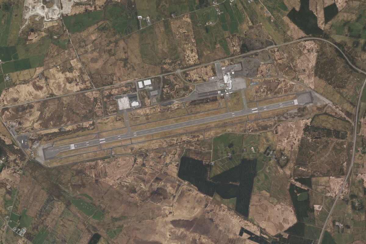
Head southwest along the bay (Lough Foyle) and you'll find the City of Derry Airport on the southern shore
Leg 12
Flying from EGAE
Leg Distance: 64.67 Approximate time at 125kts: 31 minutes.
EGAE(EGAE) to Londonderry(POI46)
Distance: 6.49NM Bearing: 242° 3 minutes
After takeoff, head southwest for a closer look at Derry, a historic town famous for its 17th century walls – complete with 7 gates and 22 cannons
Londonderry(POI46) to Quigley’s Point(POI47)
Distance: 9.16NM Bearing: 30° 4 minutes
From the town, turn to the northeast and fly along the northern shoreline of the bay to the small town and peninsula of Quigley's Point
Quigley’s Point(POI47) to Inishowen(POI48)
Distance: 13.74NM Bearing: 359° 7 minutes
Now flying in the Irish Republic, turn north at Quigley's Point and head across land to the north coast
Inishowen(POI48) to Malin Head(POI49)
Distance: 5.52NM Bearing: 294° 3 minutes
Fly northwest along the coast to the northern most point of mainland Ireland, Dúnalderagh
Malin Head(POI49) to Lough Swilly(POI50)
Distance: 12.51NM Bearing: 215° 6 minutes
Turning southwest, head across the bay, over the headland of Dunaff Hill, and to the mouth of the waterway of Lough Swilly
Lough Swilly(POI50) to Inch(POI51)
Distance: 10.42NM Bearing: 177° 5 minutes
Head south along the waters of Lough Swilly, passing the island of Inch
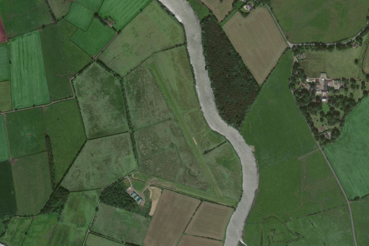
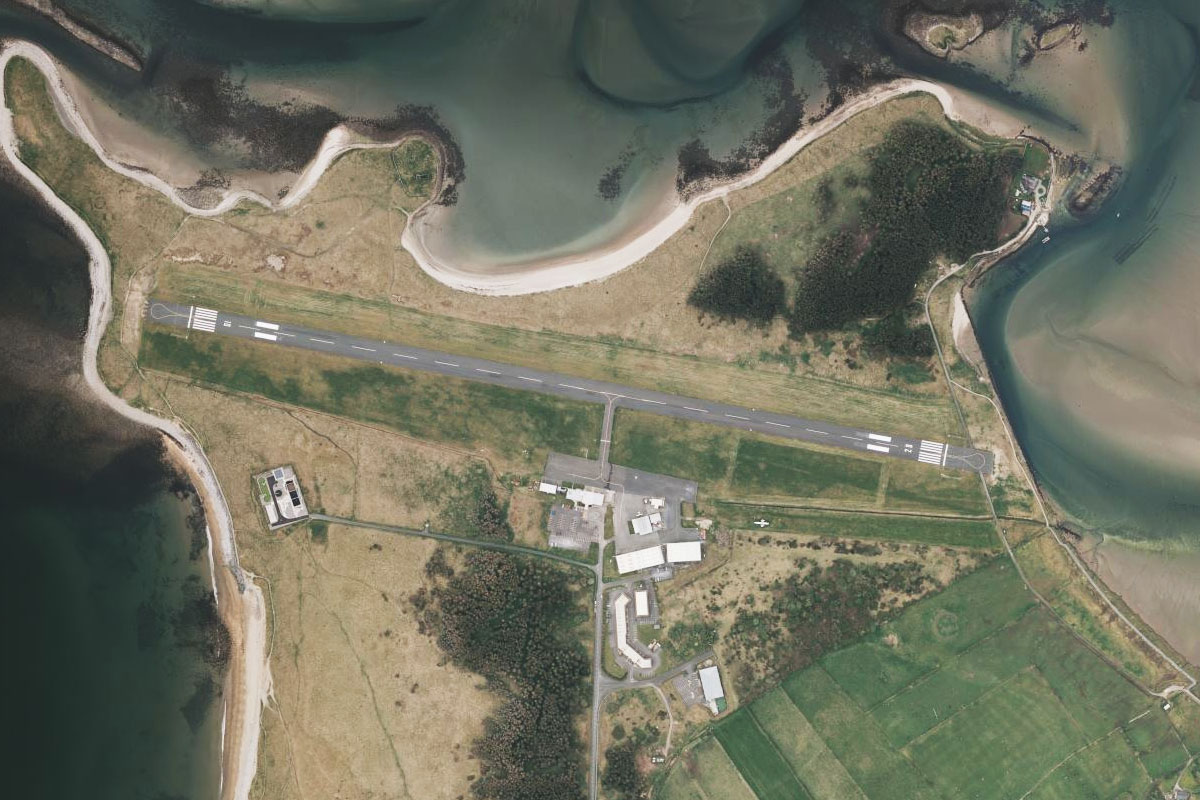
Inch(POI51) to EILT(EILT)
Distance: 6.83NM Bearing: 223° 3 minutes
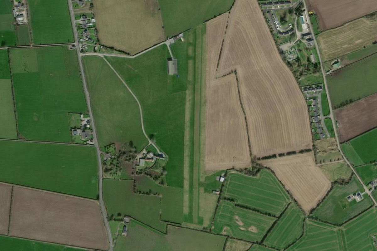
Turn southwest to the southern end of the lough. Letterkenny Airfield is just to the south of the river mouth
Leg 13
Flying from EILT
Leg Distance: 42.59 Approximate time at 125kts: 20 minutes.
EILT(EILT) to River Swilly(POI52)
Distance: 8.13NM Bearing: 263° 4 minutes
After takeoff, follow the River Swilly west along the valley. After about 8 miles the river and green valley will reduce in size
River Swilly(POI52) to Glenveagh National Park(POI53)
Distance: 6.11NM Bearing: 310° 3 minutes
Turn northwest and head towards the prominent peak of Errigal. As you approach the mountain, look for a deep valley to your right
Glenveagh National Park(POI53) to Lough Veagh(POI54)
Distance: 6.49NM Bearing: 45° 3 minutes
Follow the valley northeast over Lough Veagh, part of the beautiful scenery of Glenveagh National Park
Lough Veagh(POI54) to Muckish(POI55)
Distance: 7.66NM Bearing: 320° 4 minutes
Once you pass the lough, turn northwest and head to the coast, passing the peak of Muckish along the way
Muckish(POI55) to Cnoc Fola(POI56)
Distance: 6.74NM Bearing: 271° 3 minutes
Turn west when you reach the coast and head towards the hill named Cnoc Fola (The Peak of Blood)
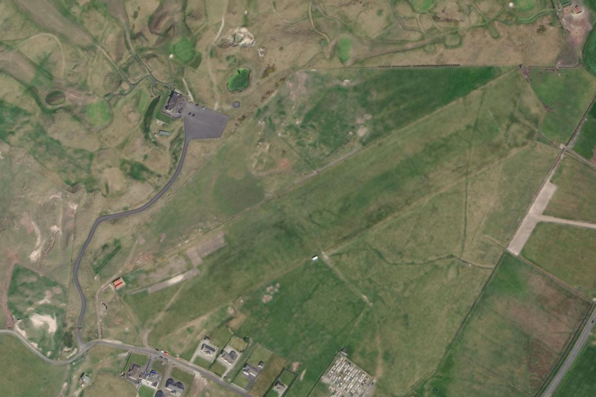
Cnoc Fola(POI56) to EIDL(EIDL)
Distance: 7.46NM Bearing: 203° 4 minutes
Making a left circuit around the hill will line you up for a southerly approach along the coast to Donegal airport
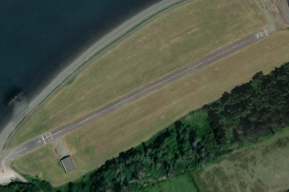
Leg 14
Flying from EIDL
Leg Distance: 50.8 Approximate time at 125kts: 24 minutes.
EIDL(EIDL) to Aran Island(POI57)
Distance: 6.86NM Bearing: 245° 3 minutes
After takeoff, head southwest along the coast to Aran Island
Aran Island(POI57) to Inishkeel(POI58)
Distance: 8.86NM Bearing: 169° 4 minutes
From Aran Island, fly south across the bay to Inishkeel Island, home of ancient monastic ruins
Inishkeel(POI58) to Saint John’s Point(POI59)
Distance: 16.63NM Bearing: 182° 8 minutes
Continue towards a wind farm that lies on top of the mountains to the south, the enter Donegal Bay at Saint John's Point at the end of a narrow peninsula
Saint John’s Point(POI59) to Benbulbin(POI60)
Distance: 12.44NM Bearing: 192° 6 minutes
Heading south across the bay, head for the right side of the hills ahead. The western peak of the hills is Benbulbin
Benbulbin(POI60) to EISG(EISG)
Distance: 6.01NM Bearing: 213° 3 minutes
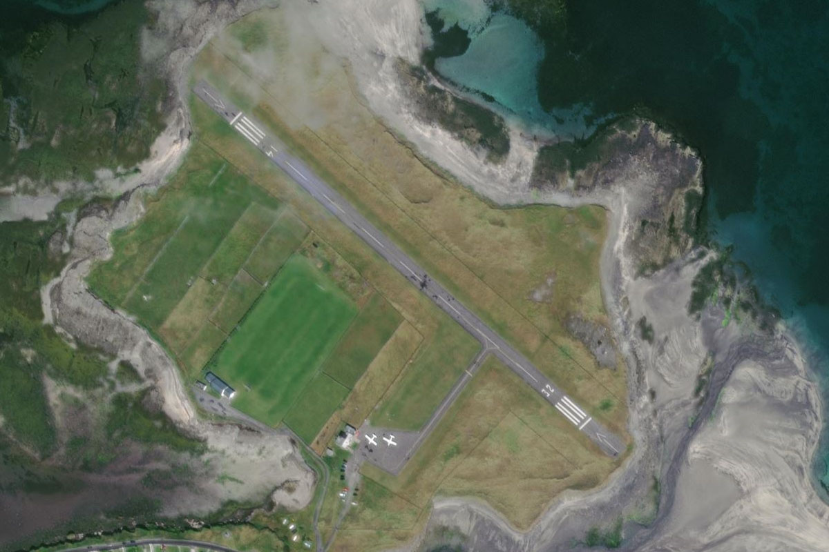
As you pass Benbulbin, the town of Sligo will come into view to the south. Head southwest to Sligo Airport, which sits on a small peninsula northwest of Knocknarea Mountain, which is home to a Megalithic tomb
Leg 15
Flying from EISG
Leg Distance: 50.69 Approximate time at 125kts: 24 minutes.
EISG(EISG) to Killala Bay(POI61)
Distance: 19.37NM Bearing: 266° 9 minutes
Head west after takeoff and cross two flat farmland peninsulas to Killala Bay
Killala Bay(POI61) to Carrowmore Lough(POI62)
Distance: 22.77NM Bearing: 267° 11 minutes
Continue west over the rolling landscape of County Mayo to Carrowmore Lough
Carrowmore Lough(POI62) to Belmullet(POI63)
Distance: 7.08NM Bearing: 286° 3 minutes
Heading west from the lake, follow the road along the narrow peninsula of land to the town of Belmullet
Belmullet(POI63) to EIBT(EIBT)
Distance: 1.47NM Bearing: 270° 1 minutes
The airfield is just across the water to the west of town, on higher ground next to a golf course
Leg 16
Flying from EIBT
Leg Distance: 70.36 Approximate time at 125kts: 34 minutes.
EIBT(EIBT) to The Mullet(POI64)
Distance: 8.34NM Bearing: 204° 4 minutes
Head south along the peninsula known as The Mullet
The Mullet(POI64) to Croaghaun(POI65)
Distance: 8.72NM Bearing: 219° 4 minutes
Turn southwest and head to the rocky outcrop of land dominated by the peaks of Croaghaun
Croaghaun(POI65) to Achillbeg(POI66)
Distance: 12.89NM Bearing: 124° 6 minutes
Turn to the southeast cut across the bay to Achillbeg Island
Achillbeg(POI66) to Clew Bay(POI67)
Distance: 13.03NM Bearing: 98° 6 minutes
Fly east along Clew Bay towards the far shore. There are over 140 islands in the bay known as 'sunken drumlins'
Clew Bay(POI67) to Castlebar(POI68)
Distance: 10.31NM Bearing: 88° 5 minutes
Continue east to the large town of Castlebar
Castlebar(POI68) to EIKN(EIKN)
Distance: 17.07NM Bearing: 82° 8 minutes
Fly east over the low hills to Knock Airport 8 miles east of the hills
Leg 17
Flying from EIKN
Leg Distance: 68.86 Approximate time at 125kts: 33 minutes.
EIKN(EIKN) to Lough Ree(POI69)
Distance: 35.17NM Bearing: 128° 17 minutes
Head southeast after takeoff to the large lake of Lough Ree
Lough Ree(POI69) to River Shannon(POI70)
Distance: 12.77NM Bearing: 167° 6 minutes
Head to the southern end of the lough, then follow the River Shannon south
River Shannon(POI70) to Shannonbridge(POI71)
Distance: 6.94NM Bearing: 224° 3 minutes
The river will turn southwest towards the town of Shannonbridge, past the ancient monastery of Clonmacnoise
Shannonbridge(POI71) to River Shannon(POI72)
Distance: 4.49NM Bearing: 134° 2 minutes
The river will join with another at the town and head southeast
River Shannon(POI72) to EIBR(EIBR)
Distance: 9.49NM Bearing: 168° 5 minutes
When the river turns away to the southwest, leave the river and head south to the town of Birr. The airfield is just to the south of town
Leg 18
Flying from EIBR
Leg Distance: 63.24 Approximate time at 125kts: 30 minutes.
EIBR(EIBR) to Lough Derg(POI73)
Distance: 12.75NM Bearing: 271° 6 minutes
Head west from Birr to the northern end of Lough Derg
Lough Derg(POI73) to Lough Cutra(POI74)
Distance: 19.18NM Bearing: 266° 9 minutes
Continue west to the smaller Lough Cutra
Lough Cutra(POI74) to The Burren(POI75)
Distance: 11.99NM Bearing: 269° 6 minutes
Continue west from the lough, to the bare, rocky landscape of the Burren National Park
The Burren(POI75) to Ballyvaughan(POI76)
Distance: 6.8NM Bearing: 357° 3 minutes
After passing the first group of hills, head north across the Burren to the shore of Galway Bay
Ballyvaughan(POI76) to Galway(POI77)
Distance: 8.58NM Bearing: 25° 4 minutes
Turn northeast and cross the bay to the city of Galway
Galway(POI77) to EICM(EICM)
Distance: 3.94NM Bearing: 62° 2 minutes
Galway Airport lies a couple of miles east of the city
Leg 19
Flying from EICM
Leg Distance: 76.56 Approximate time at 125kts: 37 minutes.
EICM(EICM) to Lough Corrib(POI78)
Distance: 9.58NM Bearing: 318° 5 minutes
Head northwest from Galway to Lough Corrib, the largest lake in the Irish Republic
Lough Corrib(POI78) to Lough Corrib(POI79)
Distance: 9.61NM Bearing: 297° 5 minutes
Fly northwest along the lake
Lough Corrib(POI79) to Lough Corrib(POI80)
Distance: 4.81NM Bearing: 275° 2 minutes
Head west along the western arm of the lake
Lough Corrib(POI80) to Leenaun(POI81)
Distance: 9.97NM Bearing: 317° 5 minutes
The lake will turn northwest where you will meet a road heading northwest through a valley, leading you to the small town of Leenaun on the shore of Killary Harbor
Leenaun(POI81) to Killary Harbour(POI82)
Distance: 2.07NM Bearing: 269° 1 minutes
Fly briefly west along the waters of Killary Harbor. The road will run along the southern shore
Killary Harbour(POI82) to Kylemore Lough(POI83)
Distance: 3.5NM Bearing: 231° 2 minutes
Turn southwest, following the road to Kylemore Lough
Kylemore Lough(POI83) to Letterfrack(POI84)
Distance: 4.23NM Bearing: 270° 2 minutes
Fly west along the length of the lake and continue following the road past Kylemore Abbey, a former castle now a Benedictine Monastery
Letterfrack(POI84) to Errisbeg(POI85)
Distance: 11.33NM Bearing: 183° 5 minutes
When the road reaches the town of Letterfrack, turn south and head towards the distant mountain of Errisbeg. On the southern side of the mountain lies a small peninsula and the two crescent beaches of Dog's Bay and Gurteen Bay
Errisbeg(POI85) to Aran Islands(POI86)
Distance: 13.49NM Bearing: 168° 6 minutes
Head south across the sea, turning slightly left to aim for the western point of the Aran Islands
Aran Islands(POI86) to EIIM(EIIM)
Distance: 7.97NM Bearing: 112° 4 minutes
Fly southeast along the largest of the Aran Islands, Inishmore, to the airport at the eastern end of the island
Leg 20
Flying from EIIM
Leg Distance: 48.74 Approximate time at 125kts: 23 minutes.
EIIM(EIIM) to Doolin Point(POI87)
Distance: 10.21NM Bearing: 123° 5 minutes
Fly southeast over the two smaller islands and continue to the mainland
Doolin Point(POI87) to Cliffs of Moher(POI88)
Distance: 6.07NM Bearing: 212° 3 minutes
Turn right and follow the coast to the southeast, the spectacular Cliffs of Moher
Cliffs of Moher(POI88) to Quilty(POI89)
Distance: 7.38NM Bearing: 178° 4 minutes
After the sea cliffs, turn south across Liscannor Bay
Quilty(POI89) to Shannon Estuary(POI90)
Distance: 16.94NM Bearing: 131° 8 minutes
When you reach land, turn southeast and head for the Shannon River estuary
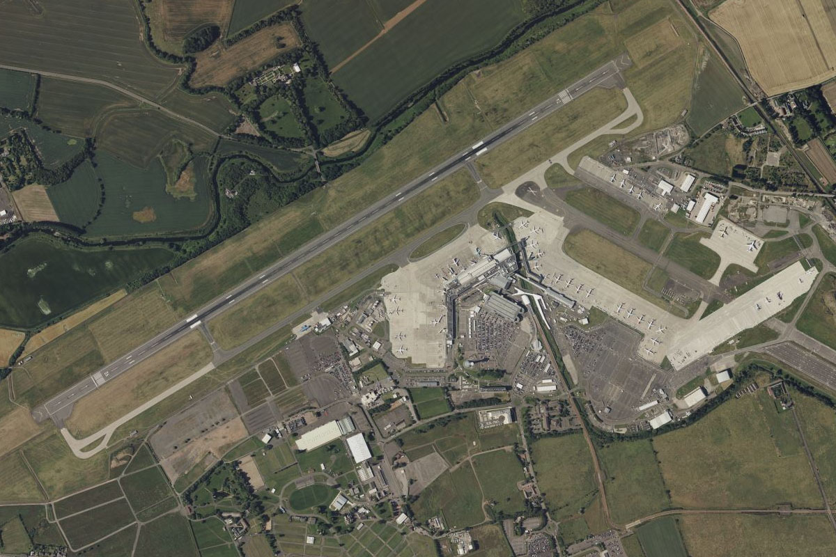
Shannon Estuary(POI90) to EINN(EINN)
Distance: 8.14NM Bearing: 63° 4 minutes
Fly northeast along the estuary to Shannon Airport, which sits in the middle of the two arms of the estuary
Leg 21
Flying from EINN
Leg Distance: 45.07 Approximate time at 125kts: 22 minutes.
EINN(EINN) to Adare(POI91)
Distance: 8.93NM Bearing: 154° 4 minutes
Head southeast from Shannon Airport to the nearby town of Adare, home of Adare Manor, now a luxury hotel. The manor is at the eastern edge of the town
Adare(POI91) to Abbeyfeale(POI92)
Distance: 21.43NM Bearing: 241° 10 minutes
Head southwest, following the tree lined N21 highway through the towns of Rathkeale and Newcastle West before passing some wind farm populated hills on the way to the town of Abbeyfeale
Abbeyfeale(POI92) to Castleisland(POI93)
Distance: 11.14NM Bearing: 216° 5 minutes
The highway will make a left turn in the town of Abbeyfeale and continue southwest across some more hills to the town of Castleisland
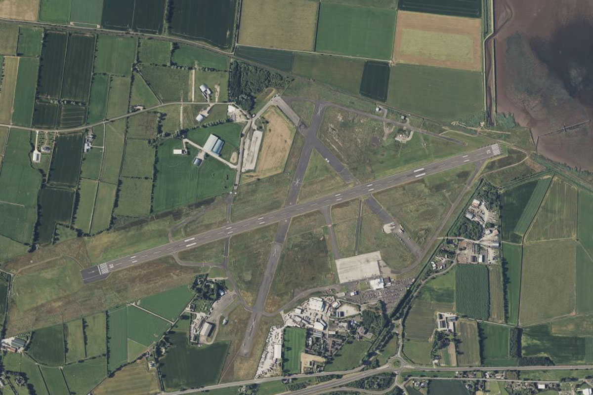
Castleisland(POI93) to EIKY(EIKY)
Distance: 3.57NM Bearing: 219° 2 minutes
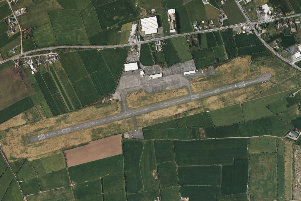
Kerry Airport sits just a few miles southwest of Castleisland
Leg 22
Flying from EIKY
Leg Distance: 90.81 Approximate time at 125kts: 44 minutes.
EIKY(EIKY) to Dingle Bay(POI94)
Distance: 18.66NM Bearing: 251° 9 minutes
From Kerry Airport, head west over Castlemaine Harbor and the large sandy peninsulas of Inch Beach and Rossbeigh Strand to Dingle Bay
Dingle Bay(POI94) to Valentia Island(POI95)
Distance: 19.44NM Bearing: 238° 9 minutes
Follow the southern coast of Dingle Bay southwest until you reach its western tip at Bray Head on Valentia Island
Valentia Island(POI95) to The Skelligs(POI96)
Distance: 8.12NM Bearing: 218° 4 minutes
Turn southwest and head to the two small islands a few miles offshore, The Skelligs. The outer island, Skellig Michael, is the home of a Gaelic monastery over 1000 years old. Also popular in modern times as a shooting location for the Star Wars sequel movies
The Skelligs(POI96) to Dursey Island(POI97)
Distance: 16.33NM Bearing: 135° 8 minutes
Turn southeast and head for the western tip of Dursey Island
Dursey Island(POI97) to Whiddy Island(POI98)
Distance: 26.55NM Bearing: 80° 13 minutes
After passing the island, turn east and fly along the length of Bantry Bay to Whiddy Island at its eastern end, which is the home of a large oil terminal
Whiddy Island(POI98) to EIBN(EIBN)
Distance: 1.71NM Bearing: 106° 1 minutes
Just south of the island on a small outcrop of land is Bantry Aerodrome
Leg 23
Flying from EIBN
Leg Distance: 52.91 Approximate time at 125kts: 25 minutes.
EIBN(EIBN) to Blind Harbour(POI99)
Distance: 15.43NM Bearing: 127° 7 minutes
From Bantry, fly southeast across the rolling landscape to reach the south coast
Blind Harbour(POI99) to Dundeady Island(POIA0)
Distance: 7.24NM Bearing: 91° 3 minutes
Follow the coastline east to Dundeady Island, which is actually a small peninsula protruding south into the Celtic Sea
Dundeady Island(POIA0) to Old Head(POIA1)
Distance: 16.18NM Bearing: 75° 8 minutes
Continue east along the coast to another narrow peninsula, Old Head of Kinsale
Old Head(POIA1) to Kinsale(POIA2)
Distance: 5.69NM Bearing: 12° 3 minutes
Follow the coastline north to Kinsale Harbor, and the town of Kinsale to its north
Kinsale(POIA2) to EICK(EICK)
Distance: 8.37NM Bearing: 8° 4 minutes
Heading north from Kinsale you will shortly reach Cork Airport, the second busiest airport in Ireland after Dublin and the destination for this stage