Stage 57 explores the south of England. From Bristol you’ll explore the Wiltshire countryside full of mysterious wonders such as the iconic Stonehenge and the various white chalk mountainside carvings of the region, before turning west and heading for mainland England’s famous western point at Land’s End. Heading east along the beautiful coastal counties of Devon, Cornwall and Dorset, you’ll make your way to the port cities of Southampton and Portsmouth via the Isle of Wight before a view of the picturesque South Downs with their white chalk sea cliffs. The final stretch will take you north to London to tour the sights of this iconic world city before finishing the stage at the equally iconic Heathrow Airport
Total Legs: 19 Total Distance: 882 Total Time(125kts): 7 hours 3 minutes
Leg 1
Flying from EGGD
Leg Distance: 36.18 Approximate time at 125kts: 17 minutes.
EGGD(EGGD) to Bristol(POI1)
Distance: 6.62NM Bearing: 50° 3 minutes
After takeoff, fly northwest to the city of Bristol. This city on the Avon River is over 1000 years old and is the most populous city in south west England. A local landmark, the Clifton Suspension Bridge, spans the river west of the city
Bristol(POI1) to Bath(POI2)
Distance: 9.47NM Bearing: 118° 5 minutes
From Bristol, follow the Avon River southeast to the nearby city of Bath, named for its Roman baths dating from the year 60AD. The city is also a UNESCO World Heritage Site
Bath(POI2) to Westbury(POI3)
Distance: 8.6NM Bearing: 137° 4 minutes
Continue southeast to a large industrial estate near the town of Westbury
Westbury(POI3) to Westbury White Horse(POI4)
Distance: 2.2NM Bearing: 103° 1 minutes
Fly east along the northern side of the town towards a small escarpment running to the east. On the side of the hill is the Westbury White Horse, one of several figures cut into the hills in the Wiltshire area
Westbury White Horse(POI4) to Cheverell(POI5)
Distance: 5.59NM Bearing: 72° 3 minutes
Follow the escarpment east with the railway line which runs past the small towns along the base of the hill
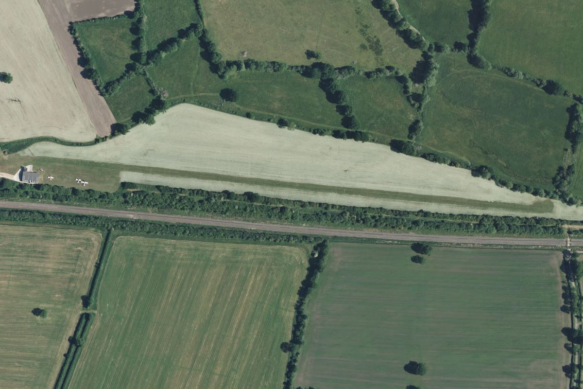
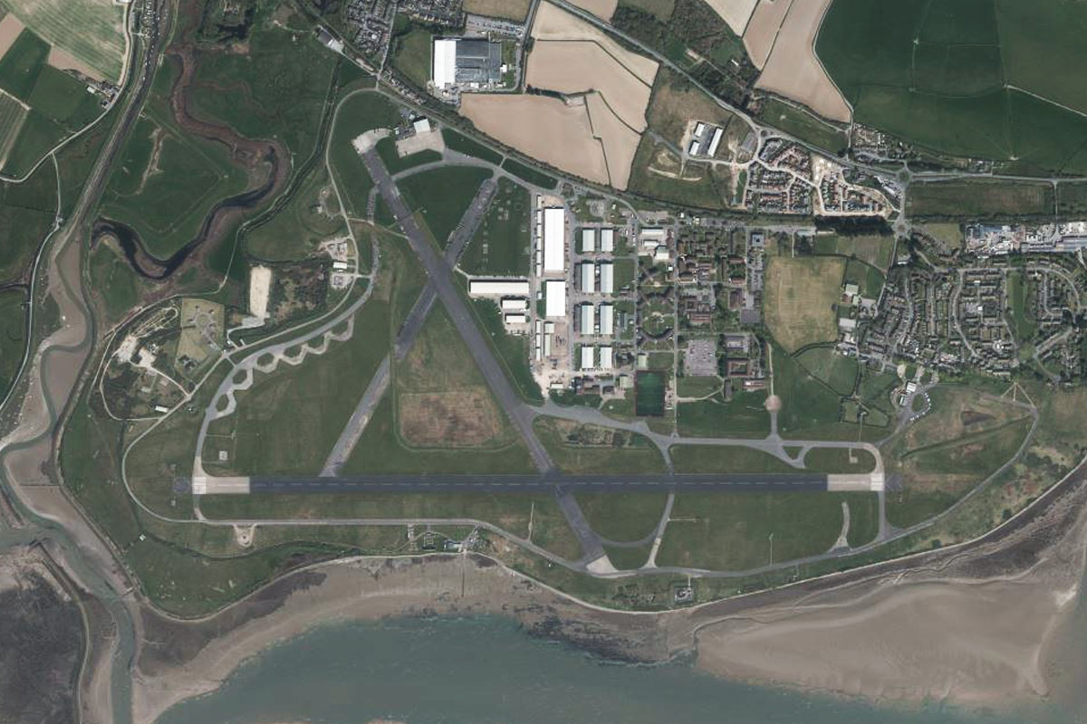
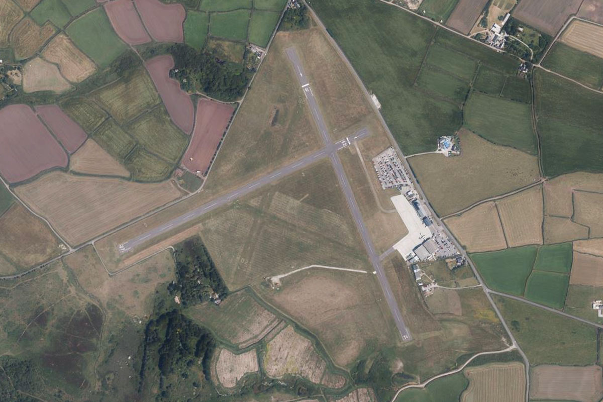
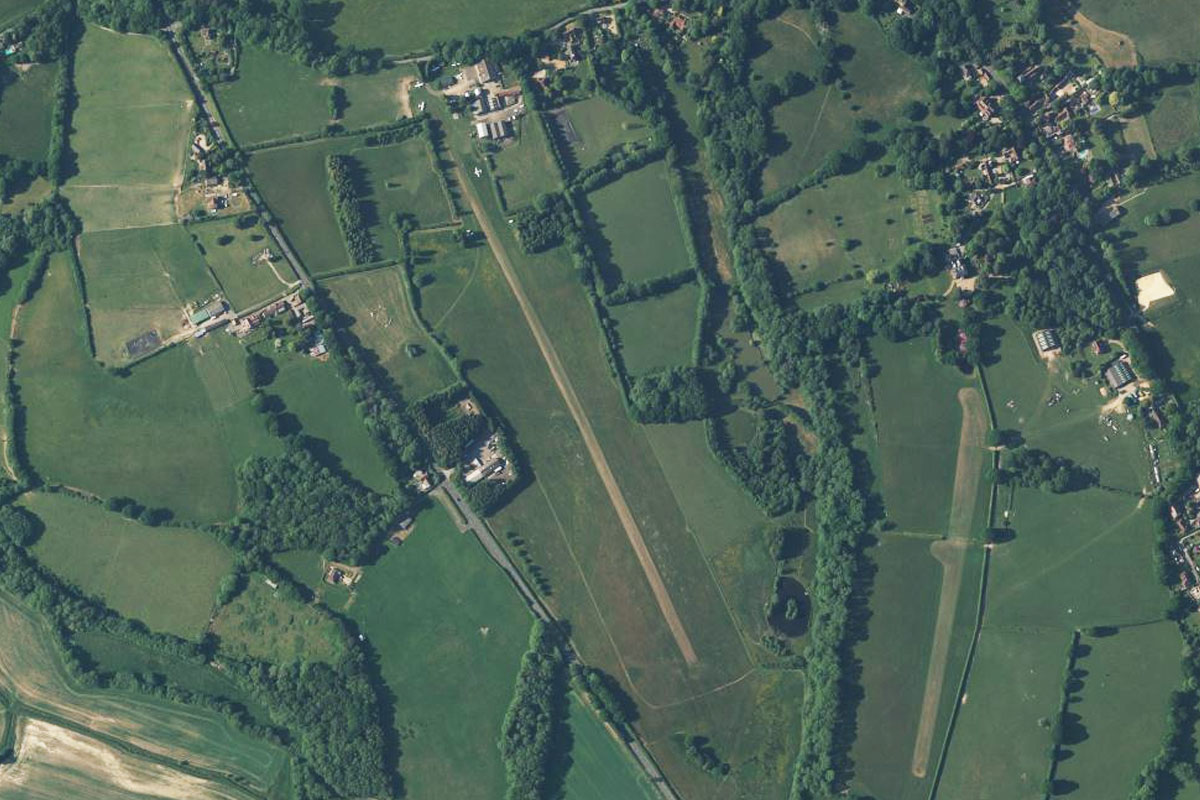
Cheverell(POI5) to EGMV(EGMV)
Distance: 3.7NM Bearing: 53° 2 minutes
Keep following the railway as it runs briefly northeast, then turns back to the east where you will see a grass airstrip running along its north side
Leg 2
Flying from EGMV
Leg Distance: 35.26 Approximate time at 125kts: 17 minutes.
EGMV(EGMV) to Amesbury(POI6)
Distance: 11.35NM Bearing: 147° 5 minutes
After takeoff, fly southeast to Amesbury, the largest in a local group of towns. As you approach the town, look for Stonehenge next to the highway leading west from the town, about 2 miles from the town centre. This famous prehistoric monument is believed to be around 5000 years old
Amesbury(POI6) to Salisbury(POI7)
Distance: 6.26NM Bearing: 189° 3 minutes
Head south to the large town of Salisbury nearby. The famous 800 year old Salisbury Cathedral dominates the town's skyline
Salisbury(POI7) to Grovley Wood(POI8)
Distance: 5.67NM Bearing: 292° 3 minutes
From Salisbury, head to the large wooded area covering the low lying hills to the west
Grovley Wood(POI8) to Chicklade(POI9)
Distance: 6.68NM Bearing: 281° 3 minutes
Continue west to another area of wooded hills
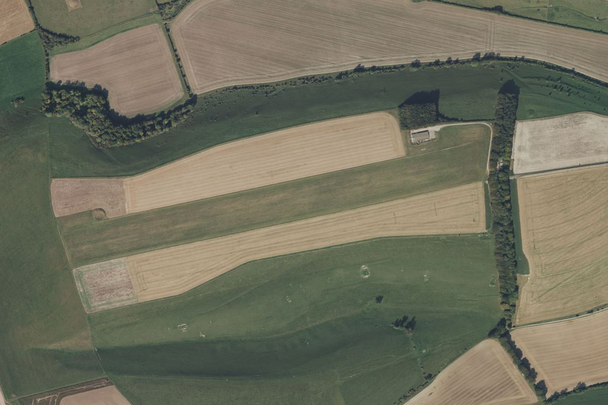
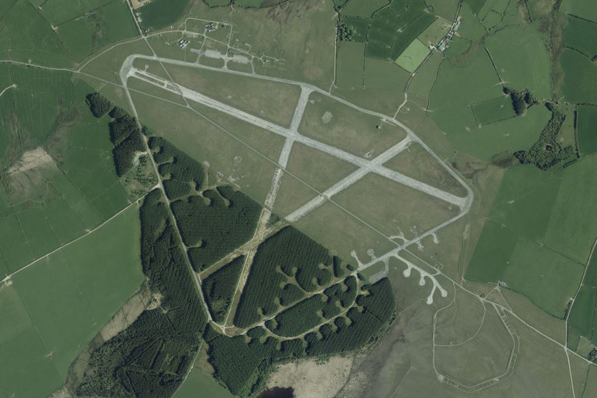
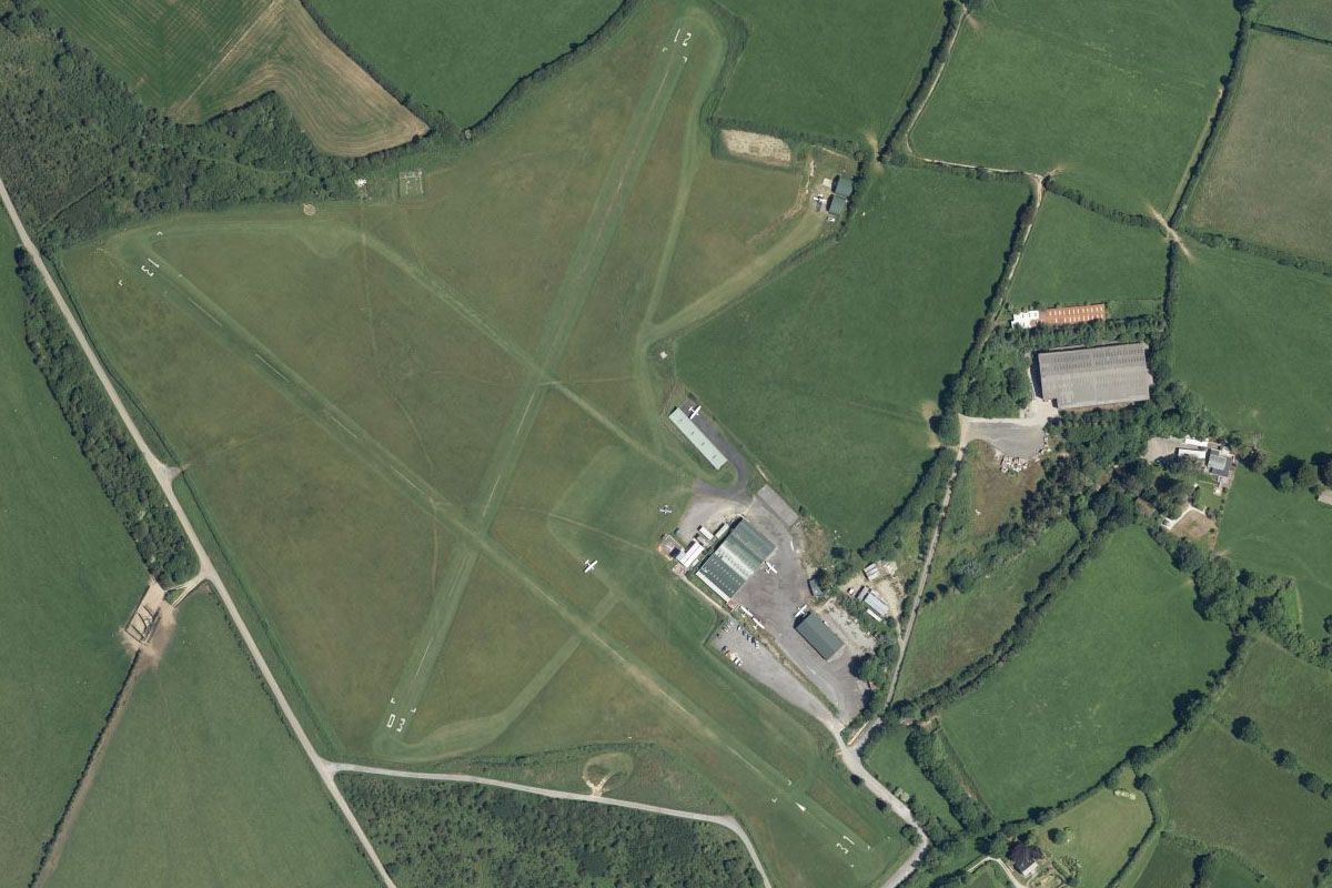
Chicklade(POI9) to EGME(EGME)
Distance: 5.3NM Bearing: 272° 3 minutes
Keep flying west to the large gilder field which sits on top of a low ridge
Leg 3
Flying from EGME
Leg Distance: 41.87 Approximate time at 125kts: 20 minutes.
EGME(EGME) to Shepton Mallet(POI10)
Distance: 11.49NM Bearing: 287° 6 minutes
Fly west over the rolling Somerset landscape to the town of Shepton Mallet. The fields a couple of miles southwest from the town are home to the famous Glastonbury Music Festival
Shepton Mallet(POI10) to Wells(POI11)
Distance: 4.34NM Bearing: 290° 2 minutes
Continue west to the next town, Wells
Wells(POI11) to Mendip Hills(POI12)
Distance: 5.58NM Bearing: 329° 3 minutes
From Wells, fly northwest along the flat top of the nearby Mendip Hills, a designated area of natural beauty. A popular local attraction, Wookey Hole Caves, is in the hills north of Wells
Mendip Hills(POI12) to Cheddar Gorge(POI13)
Distance: 3.11NM Bearing: 258° 1 minutes
As you fly along the ridge, look for Cheddar Gorge carved into the landscape leading west towards the town of Cheddar and its circular reservoir
Cheddar Gorge(POI13) to Glastonbury(POI14)
Distance: 8.45NM Bearing: 158° 4 minutes
From the reservoir, head south to the town of Glastonbury. On the eastern edge of the town is the hill of Glastonbury Tor, topped by St Michael's Tower.
Glastonbury(POI14) to EGDY(EGDY)
Distance: 8.9NM Bearing: 162° 4 minutes
Continue south to the large Royal Naval Air Station Yeovilton, home to various helicopter squadrons of the Royal Navy and British Army
Leg 4
Flying from EGDY
Leg Distance: 70.5 Approximate time at 125kts: 34 minutes.
EGDY(EGDY) to Taunton(POI15)
Distance: 16.86NM Bearing: 272° 8 minutes
After takeoff, fly west to the large town of Taunton, passing by some smaller towns along the way
Taunton(POI15) to Watchet(POI16)
Distance: 13.18NM Bearing: 318° 6 minutes
Fly northwest along the wide shallow valley to reach the coast of the Bristol Channel. On the way you will pass along the western side of the Quantock Hills Area of Natural Beauty
Watchet(POI16) to Foreland Point(POI17)
Distance: 17.71NM Bearing: 283° 9 minutes
Follow the hilly coastline west to Foreland Point, the northernmost point of this section of the coast
Foreland Point(POI17) to Bull Point(POI18)
Distance: 15.85NM Bearing: 260° 8 minutes
Continue west along the coast to Bull Point, where the coast will turn south
Bull Point(POI18) to EGDC(EGDC)
Distance: 6.9NM Bearing: 164° 3 minutes
Follow the North Devon coast briefly south towards the mouth of the River Taw. This is also a designated Area of Natural Beauty. On the north side of the river is Royal Marine Base Chivenor, with its airfield used by the Royal Marines, Royal Navy and RAF Search and Rescue
Leg 5
Flying from EGDC
Leg Distance: 38.68 Approximate time at 125kts: 19 minutes.
EGDC(EGDC) to Westward Ho(POI19)
Distance: 4.3NM Bearing: 230° 2 minutes
Fly southwest across the River Taw to the town and beach of Westward Ho!, named after a best selling 1855 novel set in the local area
Westward Ho(POI19) to Hartland Point(POI20)
Distance: 10.94NM Bearing: 263° 5 minutes
Turn west and cut across Bideford Bay to Hartland Point, where the coast will turn to the south
Hartland Point(POI20) to Widemouth Bay(POI21)
Distance: 13.94NM Bearing: 186° 7 minutes
Follow the coast south to Widemouth Bay, where the coast will turn away to the southwest
Widemouth Bay(POI21) to EGJV(EGJV)
Distance: 9.5NM Bearing: 195° 5 minutes
Continue south, moving away from the coast, to Davidstow Moor Airfield. No longer used by the military, this airfield is now used by small private aircraft
Leg 6
Flying from EGJV
Leg Distance: 32.85 Approximate time at 125kts: 16 minutes.
EGJV(EGJV) to Tintagel(POI22)
Distance: 5.77NM Bearing: 292° 3 minutes
Fly northwest (runway heading) to the coastal town of Tintagel. Next to the peninsula of Tintagel Island are the ruins of Tintagel Castle, said to be the birthplace of the legendary King Arthur
Tintagel(POI22) to Trevose Head(POI23)
Distance: 12.62NM Bearing: 233° 6 minutes
Follow the coastline southwest over the Pentire headland and past the mouth of the River Camel to another peninsula – Trevose Head
Trevose Head(POI23) to Newquay(POI24)
Distance: 8.07NM Bearing: 195° 4 minutes
Continue south along the coast to the large regional town of Newquay
Newquay(POI24) to EGTP(EGTP)
Distance: 6.39NM Bearing: 220° 3 minutes
Fly southwest past the town of Perranporth to Perranporth Airfield, which lies next to the coastal bluffs of Hanover Cove
Leg 7
Flying from EGTP
Leg Distance: 51.02 Approximate time at 125kts: 24 minutes.
EGTP(EGTP) to Hayle(POI25)
Distance: 12.62NM Bearing: 233° 6 minutes
After takeoff, continue southwest along the rugged coastline to the sandy mouth of the River Hayle
Hayle(POI25) to Pendour Cove(POI26)
Distance: 5.53NM Bearing: 269° 3 minutes
Cut west across land to the coastline at Pendour Cove, one of many small bays along this stretch of coast
Pendour Cove(POI26) to Pendeen(POI27)
Distance: 3.96NM Bearing: 241° 2 minutes
Follow the coast southwest to the small peninsula of Pendeen, home to a small lighthouse
Pendeen(POI27) to Isles of Scilly(POI28)
Distance: 25.7NM Bearing: 243° 12 minutes
Fly southwest across the water to the Isles of Scilly, a small group of islands and a designated Area of Natural Beauty
Isles of Scilly(POI28) to EGHE(EGHE)
Distance: 3.21NM Bearing: 204° 2 minutes
Head to St. Mary's Airport in the south of the large central island of the same name
Leg 8
Flying from EGHE
Leg Distance: 43.82 Approximate time at 125kts: 21 minutes.
EGHE(EGHE) to Tresco(POI29)
Distance: 3.84NM Bearing: 327° 2 minutes
From St. Mary's, fly northwest to Tresco Island, the second largest in the group. Near the northern tip of the island are two castles – Cromwell Castle and the ruined King Charles' Castle
Tresco(POI29) to Bishop Rock(POI30)
Distance: 6.73NM Bearing: 215° 3 minutes
From Tresco, fly southwest to the westernmost point of the islands, Bishop Rock. The large 50 meter lighthouse also contains a helipad constructed on top of the light
Bishop Rock(POI30) to St. Agnes(POI31)
Distance: 4.09NM Bearing: 77° 2 minutes
Head east to St. Agnes, the southernmost of the populated islands in the group
St. Agnes(POI31) to Land’s End(POI32)
Distance: 26.37NM Bearing: 67° 13 minutes
Head northeast back across the water to Land's End, the westernmost point of mainland England and popular tourist attraction
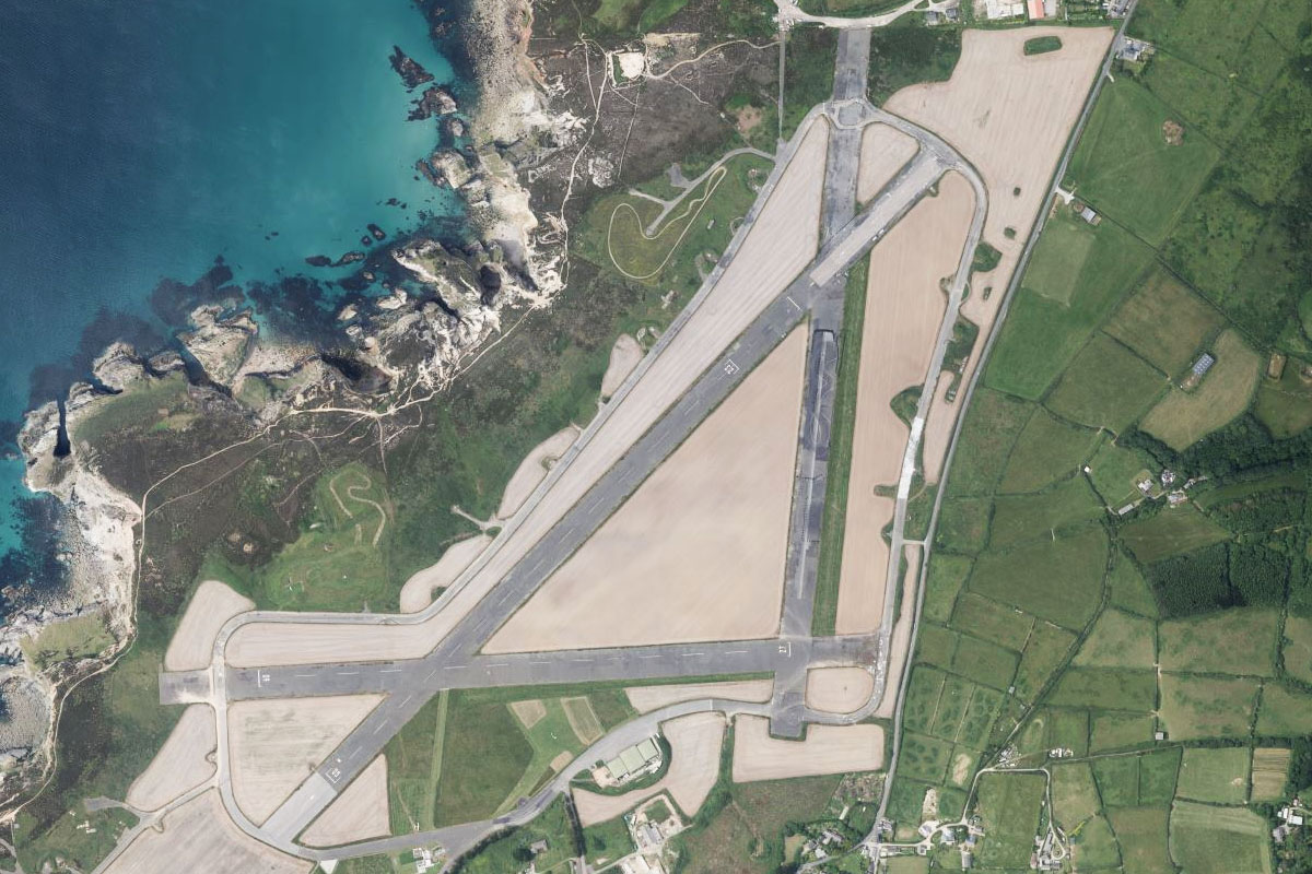
Land’s End(POI32) to EGHC(EGHC)
Distance: 2.79NM Bearing: 38° 1 minutes
Fly northeast across Whitesand Bay to Land's End Airport, a mile from the coast
Leg 9
Flying from EGHC
Leg Distance: 53.93 Approximate time at 125kts: 26 minutes.
EGHC(EGHC) to Penzance(POI33)
Distance: 5.36NM Bearing: 84° 3 minutes
Fly east to the town of Penzance, which lies on the shore of Mount's Bay
Penzance(POI33) to St. Michael’s Mount(POI34)
Distance: 2.2NM Bearing: 87° 1 minutes
Continue east across the bay to St. Michael's Mount, a small tidal island complete with village and hilltop castle
St. Michael’s Mount(POI34) to Falmouth(POI35)
Distance: 14.99NM Bearing: 88° 7 minutes
Fly east across Cornwall's southern peninsula to reach the English Channel south of the town of Falmouth
Falmouth(POI35) to River Fal(POI36)
Distance: 5.21NM Bearing: 23° 3 minutes
When you reach the coast, fly northeast over Falmouth and it's port, and continue along the estuary to where it narrows into the River Fal
River Fal(POI36) to Truro(POI37)
Distance: 4.3NM Bearing: 19° 2 minutes
Follow the river north as it passes to the east of the large town of Truro
Truro(POI37) to Clay Country(POI38)
Distance: 9.63NM Bearing: 47° 5 minutes
Turn northeast and head for the large quarry lined hills. This area contains the largest deposits of China Clay in the world, which has been mined here for over 250 years
Clay Country(POI38) to Eden Project(POI39)
Distance: 3.17NM Bearing: 115° 2 minutes
Turn southeast and head past the clay refinery pools towards the small coastal town of Par. On the way you will see the clear domed structures of the Eden Project, a multiple greenhouse complex containing the world's largest indoor rainforest
Eden Project(POI39) to Bodmin(POI40)
Distance: 6.61NM Bearing: 13° 3 minutes
After passing the Eden Project, head north to the nearby town of Bodmin
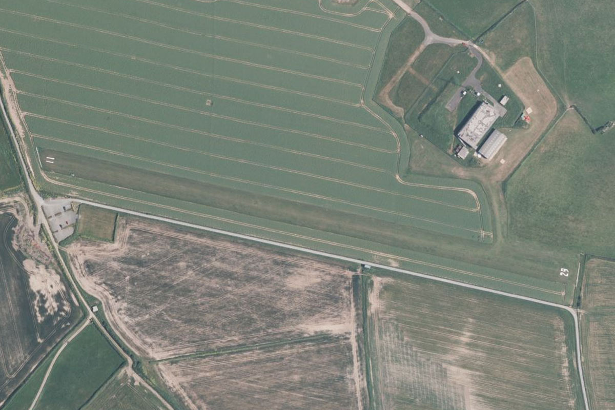
Bodmin(POI40) to EGLA(EGLA)
Distance: 2.46NM Bearing: 39° 1 minutes
From Bodmin, follow the A30 motorway briefly northeast to the airfield sitting half a mile from the south side of the road
Leg 10
Flying from EGLA
Leg Distance: 39.46 Approximate time at 125kts: 19 minutes.
EGLA(EGLA) to Looe(POI41)
Distance: 12.12NM Bearing: 136° 6 minutes
After takeoff, fly southeast to the town of Looe on the English Channel coast
Looe(POI41) to Plymouth(POI42)
Distance: 11.73NM Bearing: 89° 6 minutes
Head east along the coast to the city of Plymouth. This port city is home to the largest operational naval base in Western Europe, HMNB Devonport, which lines the River Tamar west of the city
Plymouth(POI42) to Burgh Island(POI43)
Distance: 10.25NM Bearing: 118° 5 minutes
From Plymouth, cut southeast across the land before continuing along the coastline southeast to Burgh Island, which is a small tidal island near the mouth of the River Avon
Burgh Island(POI43) to Bolt Tail(POI44)
Distance: 2.58NM Bearing: 151° 1 minutes
Fly southeast across the bay to the small peninsula named Bolt Tail, part of the beautiful coastal scenery in the area
Bolt Tail(POI44) to EGZY(EGZY)
Distance: 2.78NM Bearing: 113° 1 minutes
Fly southeast along the top of the coastal bluffs to Bolt Head Airfield, which lies a mile west of the mouth of the Kingsbridge Estuary
Leg 11
Flying from EGZY
Leg Distance: 43.87 Approximate time at 125kts: 21 minutes.
EGZY(EGZY) to Start Point(POI45)
Distance: 5.82NM Bearing: 91° 3 minutes
Follow the coast as it makes its way east to the small peninsula of Start Point
Start Point(POI45) to Start Bay(POI46)
Distance: 5.3NM Bearing: 11° 3 minutes
Fly north across Start Bay, which is lined by long sandy beaches
Start Bay(POI46) to River Dart(POI47)
Distance: 2.65NM Bearing: 62° 1 minutes
Follow the coast northeast to the mouth of the River Dart
River Dart(POI47) to Dartmouth(POI48)
Distance: 3.74NM Bearing: 344° 2 minutes
Fly north along the picturesque valley of the River Dart, passing the town Dartmouth on the western bank of the river
Dartmouth(POI48) to Torquay(POI49)
Distance: 5.5NM Bearing: 32° 3 minutes
When the river turns away to the west, fly northeast across Tor Bay to the seaside town of Torquay. This popular tourist town is the birthplace of famed mystery writer Agatha Christie, and fictional setting for the Fawlty Towers television series
Torquay(POI49) to Exmouth(POI50)
Distance: 9.3NM Bearing: 21° 4 minutes
Keep following the coast northeast to Exmouth – the mouth of the River Exe
Exmouth(POI50) to Exeter(POI51)
Distance: 7.31NM Bearing: 330° 4 minutes
Follow the estuary and river northwest to the city of Exeter, believed to have been established in Roman times around 2000 years ago
Exeter(POI51) to EGTE(EGTE)
Distance: 4.25NM Bearing: 76° 2 minutes
Exeter's airport is a few miles east of the city
Leg 12
Flying from EGTE
Leg Distance: 70.82 Approximate time at 125kts: 34 minutes.
EGTE(EGTE) to Lyme Regis(POI52)
Distance: 19.15NM Bearing: 90° 9 minutes
Fly east until you reach the English Channel coast at Lyme Bay. The beaches and cliffs in the area, known as the Jurassic Coast, are known for their fossils and the area is a world heritage site
Lyme Regis(POI52) to Chesil Beach(POI53)
Distance: 19.08NM Bearing: 119° 9 minutes
Follow the coastline as it curves around to the southeast. Chesil Beach, an 18 mile long shingle beach will guide you towards the Isle of Portland, which it connects with the mainland
Chesil Beach(POI53) to Osmington(POI54)
Distance: 4.27NM Bearing: 35° 2 minutes
As you near the island, turn northeast and fly across the Portland Breakwater to the north side of the bay. Half a mile inland is the Osmington White Horse, one of many chalk figures carved into the hillsides of southern England
Osmington(POI54) to Lulworth(POI55)
Distance: 6.34NM Bearing: 101° 3 minutes
Continue east along the coast, where the picturesque see cliffs provide popular attractions such as the arch of Durdle Dor and the horseshoe shaped Lulworth Cove
Lulworth(POI55) to Isle of Purbeck(POI56)
Distance: 11.11NM Bearing: 90° 5 minutes
Once you pass the small circular Lulworth Cove, fly east across the peninsula of the Isle of Purbeck to the town of Swanage on the bay at its eastern end
Isle of Purbeck(POI56) to Bournemouth(POI57)
Distance: 7.07NM Bearing: 28° 3 minutes
Head northeast across the curved bay to the resort town of Bournemouth, the largest in Dorset
Bournemouth(POI57) to EGHH(EGHH)
Distance: 3.8NM Bearing: 13° 2 minutes
Bournemouth Airport is a couple of miles north of the city
Leg 13
Flying from EGHH
Leg Distance: 56.75 Approximate time at 125kts: 27 minutes.
EGHH(EGHH) to Ringwood(POI58)
Distance: 5.89NM Bearing: 43° 3 minutes
After takeoff, fly northeast, crossing over the A338 highway and River Avon on the way to meet the A31 highway heading northeast
Ringwood(POI58) to Cadnam(POI59)
Distance: 7.08NM Bearing: 52° 3 minutes
Follow the highway northeast until it cuts a path through the wooded area of New Forest
Cadnam(POI59) to River Test(POI60)
Distance: 4.05NM Bearing: 89° 2 minutes
Once you pass the forest, head east to the River Test, which runs southeast into Southampton Water
River Test(POI60) to Southampton(POI61)
Distance: 10.08NM Bearing: 132° 5 minutes
Follow Southampton Water southeast, passing by the city of Southampton. A major port city and the busiest cruise ship terminal in the UK, the city's port was also the departure point for the RMS Titanic in 1912
Southampton(POI61) to The Needles(POI62)
Distance: 14.29NM Bearing: 232° 7 minutes
At the southern end of Southampton Water you will reach The Solent, the channel separating the Isle of Wight from the mainland, and a major shipping channel. Fly southwest along the channel to the western tip of the Isle of Wight, a small formation of chalk stacks known as The Needles
The Needles(POI62) to Tennyson Down(POI63)
Distance: 3.83NM Bearing: 88° 2 minutes
Make a left circuit around the needles and follow the coastal cliffs east. A monument to poet Alfred Lord Tennyson overlooks the area
Tennyson Down(POI63) to Brighstone Down(POI64)
Distance: 4.9NM Bearing: 92° 2 minutes
Follow the ridge that continues east towards the center of the island. Just north from here is the site of the 1970 Isle of Wight music festival
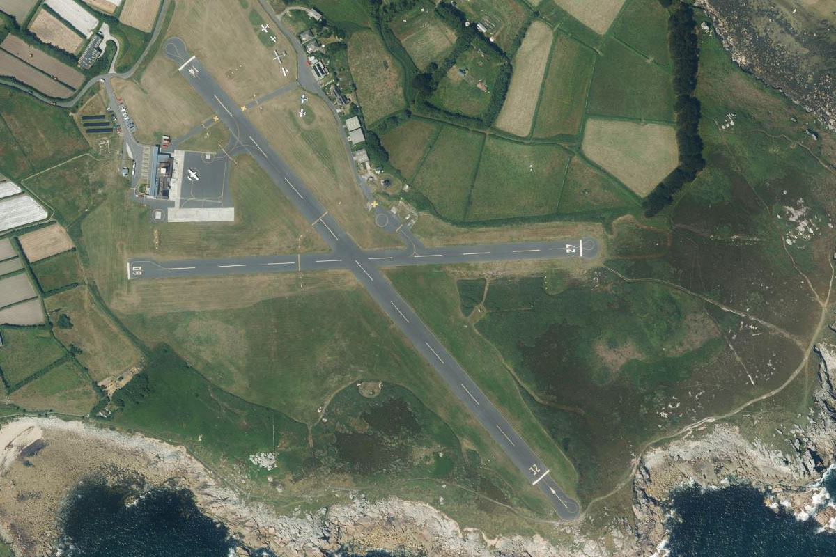
Brighstone Down(POI64) to EGHN(EGHN)
Distance: 6.63NM Bearing: 94° 3 minutes
From the wooded area at the eastern end of the ridge, continue east to the town of Sandown on the island's east coast. The airport sits on the town western side
Leg 14
Flying from EGHN
Leg Distance: 53.35 Approximate time at 125kts: 26 minutes.
EGHN(EGHN) to Ryde(POI65)
Distance: 4.87NM Bearing: 10° 2 minutes
Fly north to the town of Ryde on the north coast of the island
Ryde(POI65) to Portsmouth(POI66)
Distance: 3.93NM Bearing: 27° 2 minutes
Fly northeast across the channel to the city of Portsmouth, home of one of the world's most famous ports. This historic city is home to Lord Nelson's HMS Victory flagship, the Mary Rose shipwreck and a major base for the Royal Navy. The city's maritime history is reflected in the 560ft Spinnaker Tower
Portsmouth(POI66) to Portsmouth Harbour(POI67)
Distance: 3.35NM Bearing: 359° 2 minutes
Fly north along the harbour
Portsmouth Harbour(POI67) to Bishop’s Waltham(POI68)
Distance: 7.61NM Bearing: 328° 4 minutes
From the harbour's northern end, fly northwest across the flat countryside
Bishop’s Waltham(POI68) to Winchester(POI69)
Distance: 7.49NM Bearing: 329° 4 minutes
After passing a few small towns you will arrive at the large town of Winchester, home to many historic buildings such as Winchester Cathedral, Winchester College and Wolvesey Castle
Winchester(POI69) to Basingstoke(POI70)
Distance: 14.84NM Bearing: 37° 7 minutes
From Winchester, follow the M3 motorway northeast to another large town, Basingstoke
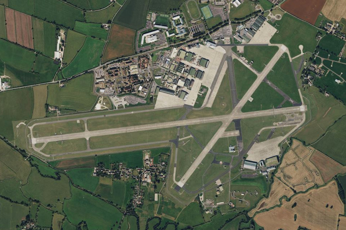
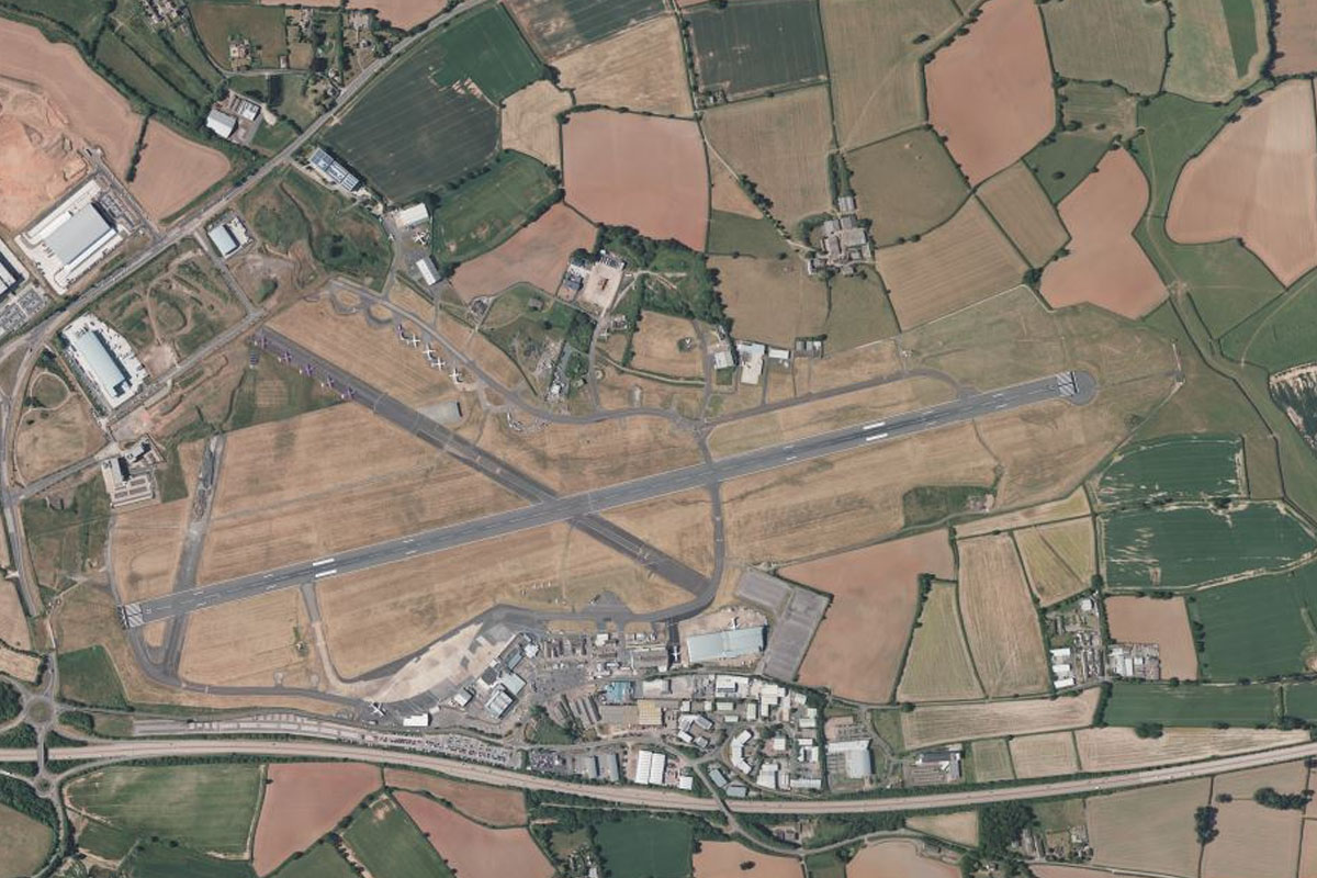
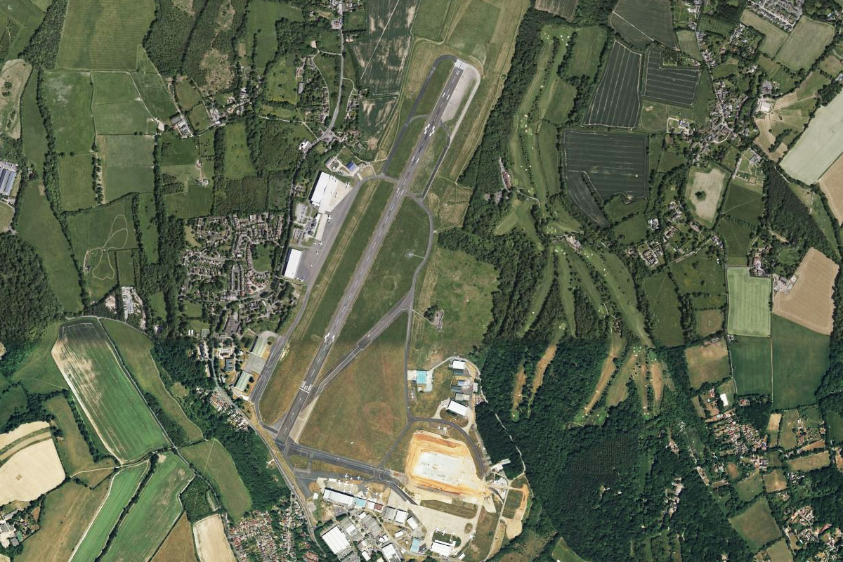
Basingstoke(POI70) to EGLF(EGLF)
Distance: 11.26NM Bearing: 84° 5 minutes
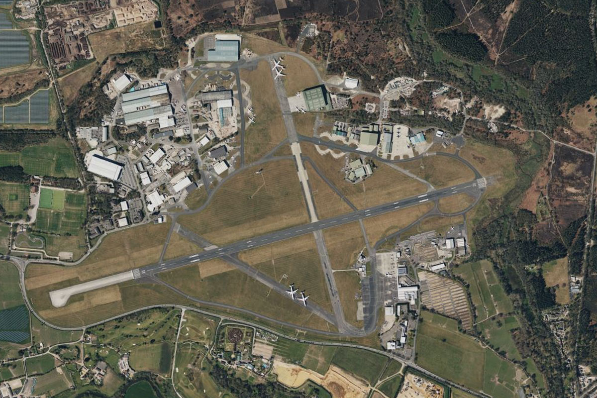
The motorway will turn east where it will soon run parallel with the railway towards the Farnborough/Aldershot built-up area. Farnborough Airport lies 2 miles south of the motorway, on the edge of the suburban area, and is home to the famous air show of the same name
Leg 15
Flying from EGLF
Leg Distance: 41.03 Approximate time at 125kts: 20 minutes.
EGLF(EGLF) to Woking(POI71)
Distance: 9.76NM Bearing: 63° 5 minutes
Fly northeast after takeoff (runway heading) where you will pass over the shooting ranges of the Army Training Centre and the National Rifle Association. Continuing on the same heading you will find the headquarters of the McLaren Racing Team. This large circular building sits next to Fairoaks Airstrip
Woking(POI71) to Dunsfold(POI72)
Distance: 13.81NM Bearing: 179° 7 minutes
Head south past the built up areas of Woking and Guildford to fly over Dunsfold Aerodrome, better known by TV viewers as the Top Gear Test Track
Dunsfold(POI72) to EGHR(EGHR)
Distance: 17.46NM Bearing: 207° 8 minutes
From Dunsfold, fly southwest towards the town of Chichester near the English Channel coast. On the northerly approach to the town you will cross over the escarpment of the South Downs, the group of chalk hills that extend along this part of the coast. Just north of the town is Goodwood Aerodrome, home of the Goodwood Motor Circuit which hosts the annual Festival of Speed
Leg 16
Flying from EGHR
Leg Distance: 59.44 Approximate time at 125kts: 29 minutes.
EGHR(EGHR) to Bognor Regis(POI73)
Distance: 6.27NM Bearing: 134° 3 minutes
From Goodwood, fly southeast to the coastal town of Bognor Regis
Bognor Regis(POI73) to Shoreham(POI74)
Distance: 15.15NM Bearing: 80° 7 minutes
Fly east along the heavily populated section of coast to the inlet at Shoreham Harbour, which is also the mouth of the River Adur
Shoreham(POI74) to Brighton(POI75)
Distance: 4.47NM Bearing: 95° 2 minutes
Continue east to the city of Brighton, a major seaside resort and population centre on England's south coast. Iconic attractions include the Royal Pavilion, the Palace Pier and the i360 observation tower
Brighton(POI75) to Seven Sisters(POI76)
Distance: 11.16NM Bearing: 109° 5 minutes
At Brighton the coast will turn slightly southeast and lead you to the iconic Seven Sisters, a group of chalk cliffs synonymous with the area
Seven Sisters(POI76) to Beachy Head(POI77)
Distance: 4.02NM Bearing: 108° 2 minutes
Continue to where the coast turns to the northeast at Beachy Head, the highest chalk sea cliff in Britain
Beachy Head(POI77) to Eastbourne(POI78)
Distance: 6.84NM Bearing: 42° 3 minutes
Follow the coastline northeast past the town of Eastbourne
Eastbourne(POI78) to Bexhill(POI79)
Distance: 6NM Bearing: 71° 3 minutes
Follow the coast as it runs east to the town of Bexhill
Bexhill(POI79) to EGJT(EGJT)
Distance: 5.53NM Bearing: 359° 3 minutes
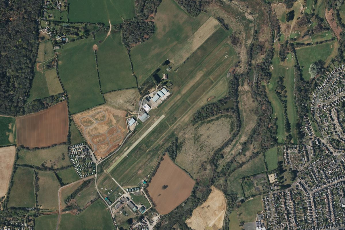
When you reach the small gap between Bexhill and the next town of Hastings, head directly north to Spilstead Farm airfield alongside the A21 highway, passing by the site of the 1066 Battle of Hastings on the way
Leg 17
Flying from EGJT
Leg Distance: 40.78 Approximate time at 125kts: 20 minutes.
EGJT(EGJT) to Bewl Water(POI80)
Distance: 9.33NM Bearing: 329° 4 minutes
After takeoff, fly northwest to the Bewl Water reservoir
Bewl Water(POI80) to Royal Tunbridge Wells(POI81)
Distance: 6.32NM Bearing: 304° 3 minutes
Continue northwest to Royal Tunbridge Wells, a popular tourist town southeast from London
Royal Tunbridge Wells(POI81) to Bough Beech Reservoir(POI82)
Distance: 6.54NM Bearing: 313° 3 minutes
Keep flying northwest to reach Bough Beech Reservoir. Just south of here is Hever Castle, once home to the second wife of King Henry VIII, Anne Boleyn
Bough Beech Reservoir(POI82) to Sevenoaks(POI83)
Distance: 4.41NM Bearing: 31° 2 minutes
From the reservoir, head northeast to the nearby town of Sevenoaks. On the eastern edge of the town is Knole, one of England's largest houses now owned by the National Trust
Sevenoaks(POI83) to Brands Hatch(POI84)
Distance: 5.56NM Bearing: 24° 3 minutes
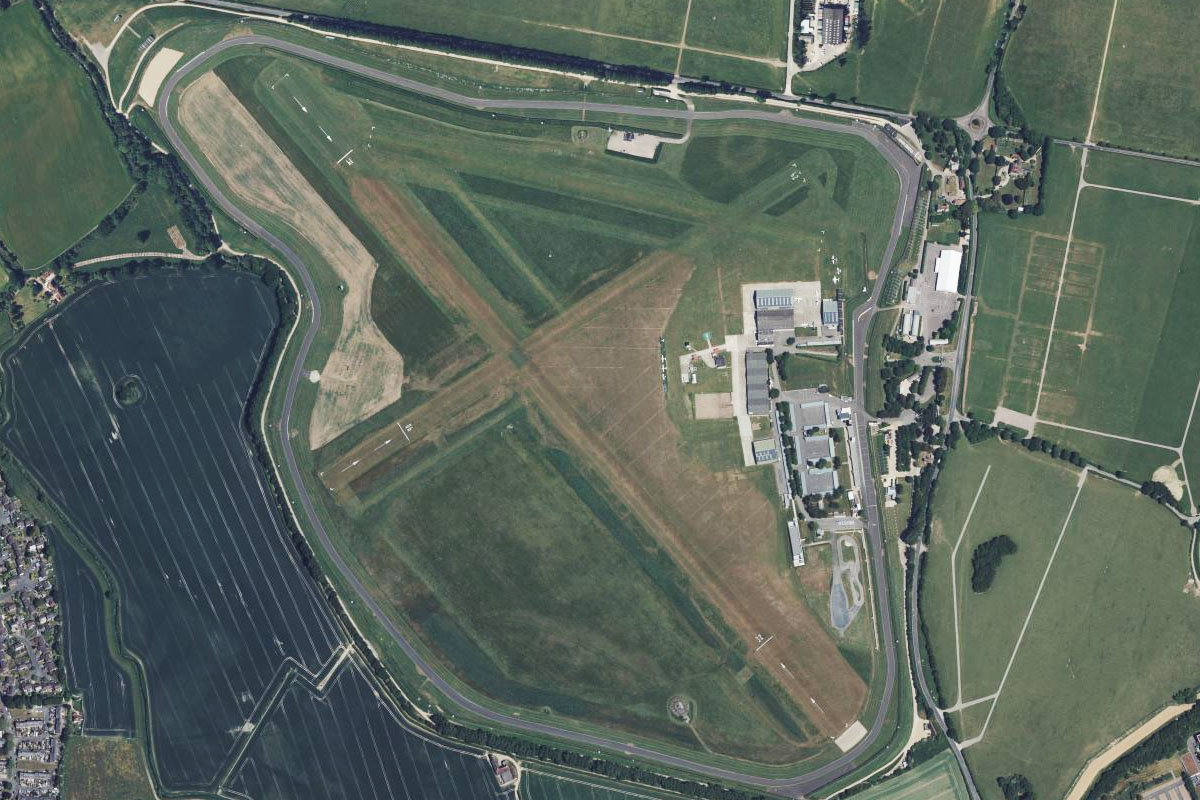
Continuing northeast over the nearby hills you will soon reach Brands Hatch. One of the world's most historic motor racing circuits, it has been in use since the 1950's and sits at the northern edge of the town of West Kingsdown
Brands Hatch(POI84) to EGKB(EGKB)
Distance: 8.62NM Bearing: 259° 4 minutes
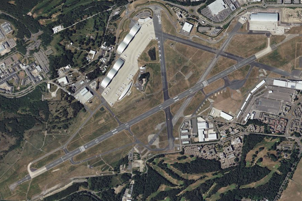
Turn and head west to Biggin Hill Airport. Once a RAF station, Biggin Hill is best known for its role during the Battle of Britain in the Second World War
Leg 18
Flying from EGKB
Leg Distance: 32 Approximate time at 125kts: 15 minutes.
EGKB(EGKB) to Croydon(POI85)
Distance: 5.61NM Bearing: 295° 3 minutes
After takeoff, fly northwest to Croydon, one of the largest commercial districts in greater London
Croydon(POI85) to Wimbledon(POI86)
Distance: 5.17NM Bearing: 311° 2 minutes
Continue northwest to Wimbledon, home of the All England Lawn Tennis and Croquet Club, and the annual Grand Slam tennis event. The site is on the eastern edge of the large park and forest area of Putney Heath
Wimbledon(POI86) to Battersea(POI87)
Distance: 3.4NM Bearing: 32° 2 minutes
Fly northeast towards the River Thames and the iconic quad chimneys of Battersea Power Station, now redeveloped as a residential and commercial centre
Battersea(POI87) to River Thames(POI88)
Distance: 12.76NM Bearing: 87° 6 minutes
Head east along the south side of the River Thames for a tour of London's south side. Flying to the south of the high rise area of Canary Wharf you will pass Greenwich Observatory which gave its name to Greenwich Mean Time, the precursor to today's Coordinated Universal Time (UTC). You will also see the white dome of the O2 Arena on the Greenwich Peninsula before passing London City Airport
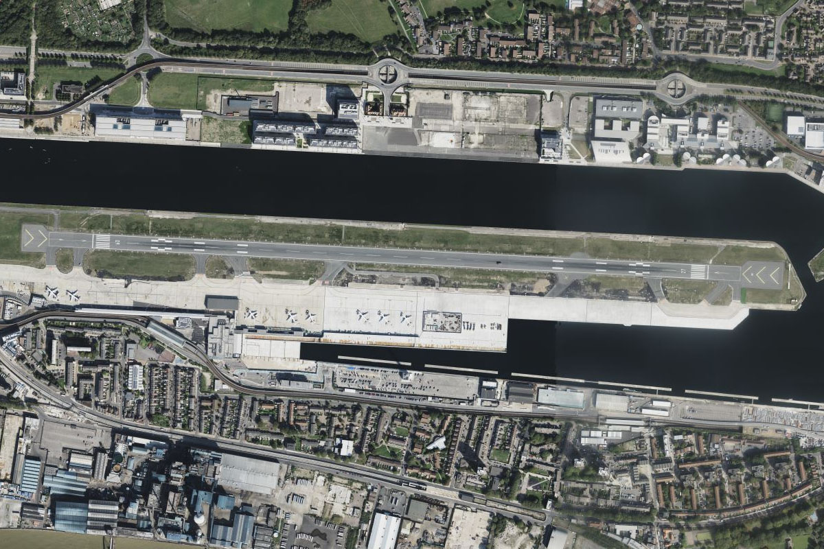
River Thames(POI88) to EGLC(EGLC)
Distance: 5.06NM Bearing: 284° 2 minutes
After passing the airport, turn left for a landing at this challenging airport, built on the site of a former dock area
Leg 19
Flying from EGLC
Leg Distance: 40.75 Approximate time at 125kts: 20 minutes.
EGLC(EGLC) to Hyde Park(POI89)
Distance: 8.45NM Bearing: 269° 4 minutes
After takeoff from London City, fly west following the River Thames through London – the capital and largest city of England and the United Kingdom, with a population of just under 9 million, has been a major settlement for two millennia. The green space of Hyde Park is west of the city centre and north of the river
Hyde Park(POI89) to Olympic Stadium(POI90)
Distance: 5.97NM Bearing: 72° 3 minutes
From Hyde Park, make a right hand 180 degree turn and fly east to the Olympic Stadium a few miles northeast of the city centre, now the home of the West Ham football club
Olympic Stadium(POI90) to Holloway(POI91)
Distance: 3.57NM Bearing: 288° 2 minutes
At the Olympic Stadium, turn 180 degrees to the left and head west to another major sporting arena – the Emirates Stadium. Home to Arsenal football club, this stadium replaced the nearby Highbury stadium in 2005, with the former ground now a residential estate
Holloway(POI91) to Elstree Studios(POI92)
Distance: 8.48NM Bearing: 314° 4 minutes
Fly northwest from the stadium past the outer suburbs of northern London to the town of Borehamwood, the home of Elstree Studios. These historic film studios were production locations of such films The Dam Busters (1955), 2001 A Space Odyssey (1968), Star Wars (1977), The Shining (1980) and the Indiana Jones films, and is still used today for film and TV productions
Elstree Studios(POI92) to Wembley Stadium(POI93)
Distance: 6NM Bearing: 183° 3 minutes
Flying south from the studio complex, you will soon reach what is considered the world's most famous football ground – Wembley Stadium. With 100 years of sporting history, the original 1923 stadium was demolished and replaced in 2007
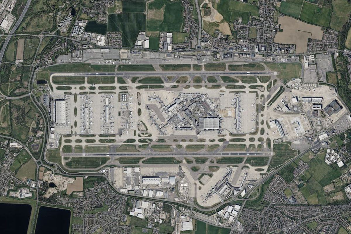
Wembley Stadium(POI93) to EGLL(EGLL)
Distance: 8.28NM Bearing: 234° 4 minutes
From a world famous stadium to a world famous airport, head southwest to Heathrow Airport, the world's second busiest airport by international passenger traffic before the 2020 pandemic