Stage 59 takes you to the first part of the trip through mainland Europe. Working your way along the coast to The Netherlands via Belgium, you’ll visit the major cities of Rotterdam and Amsterdam with a stop at one of the world’s major airports – Schiphol, after a look at some of the iconic Dutch windmill scenery. After a look at another of the country’s icons, the Dykes, you’ll continue along the coast via the Frisian Islands into Germany, before embarking on a tour of Denmark. Starting with a lap around the Jutland peninsula which makes up a large portion of the country’s land area, you’ll visit the famous home of LEGO, Billund, before making your way east via Denmark’s chain of large islands to the capital city, Copenhagen, and Scandinavia’s second busiest airport.
Total Legs: 26 Total Distance: 1138 Total Time(125kts): 9 hours 6 minutes
Leg 1
Flying from LFAC
Leg Distance: 37.35 Approximate time at 125kts: 18 minutes.
LFAC(LFAC) to Grand-Fort-Philippe(POI1)
Distance: 6.56NM Bearing: 60° 3 minutes
After takeoff, fly northeast to meet the coast near the town of Grand-Fort-Philippe
Grand-Fort-Philippe(POI1) to Dunkerque(POI2)
Distance: 9.97NM Bearing: 73° 5 minutes
Follow the coastline east past the harbor and dock areas to the city of Dunkirk, known for Operation Dynamo, the WWII evacuation of Allied soldiers from the city's beaches
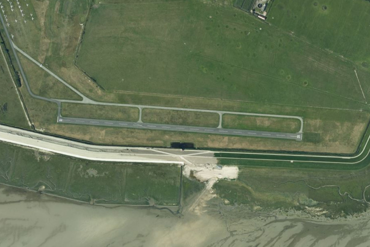
Dunkerque(POI2) to EBOS(EBOS)
Distance: 20.82NM Bearing: 63° 10 minutes
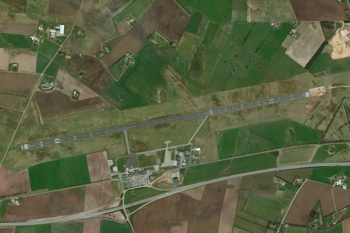
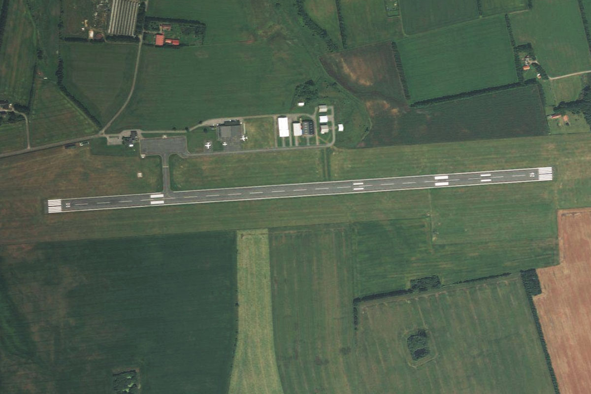
Keep following the coastline, where you will soon cross into Belgium and follow a string of beach resort towns on the way to Ostend Airport next to the coast
Leg 2
Flying from EBOS
Leg Distance: 41.12 Approximate time at 125kts: 20 minutes.
EBOS(EBOS) to Brugge(POI3)
Distance: 13.42NM Bearing: 86° 6 minutes
After takeoff, fly east along with the Ostend-Bruges Canal to the city of Bruges. The canal is over 400 years old. The city is one of the best-preserved medieval towns in Europe, with the popular landmarks of the Belfry Tower and Church of Our Lady dominating the skyline
Brugge(POI3) to Sluis(POI4)
Distance: 8.92NM Bearing: 43° 4 minutes
From Bruges, fly northeast to the town of Sluis on the border of Belgium and The Netherlands. The town still bears the shape of its once fortified existence
Sluis(POI4) to Breskens(POI5)
Distance: 8.26NM Bearing: 45° 4 minutes
Continue across the Dutch countryside to the town of Breskens, at the mouth of the Scheldt River
Breskens(POI5) to Vlissingen(POI6)
Distance: 2.52NM Bearing: 25° 1 minutes
Head northeast across the water to the city of Vlissingen, home of the country's longest beachside promenade and important shipyard facilities
Vlissingen(POI6) to Middleburg(POI7)
Distance: 3.38NM Bearing: 18° 2 minutes
Follow the canal north to the nearby town of Middleburg
Middleburg(POI7) to EHMZ(EHMZ)
Distance: 4.62NM Bearing: 74° 2 minutes
As the canal turns northeast, fly east to Midden-Zeeland Airport, which sits next to the riverside marina community of Oranjeplaat
Leg 3
Flying from EHMZ
Leg Distance: 65.55 Approximate time at 125kts: 31 minutes.
EHMZ(EHMZ) to Oosterscheldekering(POI8)
Distance: 5.92NM Bearing: 343° 3 minutes
After takeoff, fly north over the former island of Noord-Beveland to the large Oosterschelde estuary. The Eastern Scheldt storm surge barrier is the largest of the Delta Works, a series of dams and storm surge barriers designed to protect the Netherlands from North Sea flooding
Oosterscheldekering(POI8) to Keeten-Mastgat(POI9)
Distance: 12.09NM Bearing: 89° 6 minutes
Fly east along the wide estuary, crossing over the 5 kilometer long Zeeland Bridge before the water narrows into the Keeten-Mastgat channel
Keeten-Mastgat(POI9) to Fort Henricus(POI10)
Distance: 10.91NM Bearing: 88° 5 minutes
Continue ease over land, passing the towns of Sint Annaland and Nieuw-Vossemeer before reaching the larger town of Steenburgen. The historic star shaped Fort Henricus is a mile north from the town centre
Fort Henricus(POI10) to Volkerak(POI11)
Distance: 6.55NM Bearing: 28° 3 minutes
From the fort, fly northeast to meet the Volkerak River and follow it to reach the Volkerak Locks at its northern end where it meets the Hollands Diep river
Volkerak(POI11) to Hollands Diep(POI12)
Distance: 9.05NM Bearing: 79° 4 minutes
Follow the river east to where it is crossed by the Moerdijk bridge. Here, the Dordtse Kil river branches off to the north
Hollands Diep(POI12) to Oude Maas(POI13)
Distance: 5.08NM Bearing: 351° 2 minutes
Follow the Dordtse Kil north to where it intersects with the Oude Maas river
Oude Maas(POI13) to Noord(POI14)
Distance: 2.25NM Bearing: 54° 1 minutes
Follow the river northeast for a short distance to where it meets the Beneden Merwede and Noord Rivers
Noord(POI14) to Nieuwe Waterschap canal(POI15)
Distance: 3.22NM Bearing: 357° 2 minutes
At the junction fly north briefly along the river, then across land for a couple of miles to reach the Nieuwe Waterschap canal
Nieuwe Waterschap canal(POI15) to Kinderdijk(POI16)
Distance: 1.72NM Bearing: 301° 1 minutes
Follow the canal northwest to the town of Kinderdijk. The windmill lined canal is a major tourist site and a UNESCO World Heritage Site, and the windmills are listed as national monuments
Kinderdijk(POI16) to Rotterdam(POI17)
Distance: 6.12NM Bearing: 283° 3 minutes
Follow the Nieuwe Maas river west to Rotterdam, The Netherlands' second largest city which is also home to Europe's largest seaport. The Erasmus Bridge is the city's most important landmark
Rotterdam(POI17) to EHRD(EHRD)
Distance: 2.64NM Bearing: 327° 1 minutes
The airport is on the northwestern edge of the city, and serves Rotterdam along with The Hague, which is the country's administrative centre and hosts both the International Court of Justice and the International Criminal Court
Leg 4
Flying from EHRD
Leg Distance: 57.57 Approximate time at 125kts: 28 minutes.
EHRD(EHRD) to A20(POI18)
Distance: 4.18NM Bearing: 89° 2 minutes
After takeoff, fly east to meet the A20 motorway which runs to the northeast
A20(POI18) to Gouda(POI19)
Distance: 9.92NM Bearing: 44° 5 minutes
Follow the motorway northeast past the town of Gouda (famous for its cheese) and the Reeuwijkse Lakes, after which it will turn east just north of the lakes
Gouda(POI19) to Utrecht(POI20)
Distance: 13.52NM Bearing: 83° 6 minutes
The motorway will lead you east to Utrecht, the fourth largest city in the Netherlands. It was the most important city in the Northern Netherlands until the Dutch Golden Age
Utrecht(POI20) to Hilversum(POI21)
Distance: 10.32NM Bearing: 24° 5 minutes
From Utrecht, follow the A27 motorway northeast until you reach the interchange with the A1 motorway east of the town of Hilversum
Hilversum(POI21) to Naardem(POI22)
Distance: 4.63NM Bearing: 326° 2 minutes
Follow the A1 northwest towards Gooi Lake, where you will see the distinct star fort of Naarden, complete with twin moats
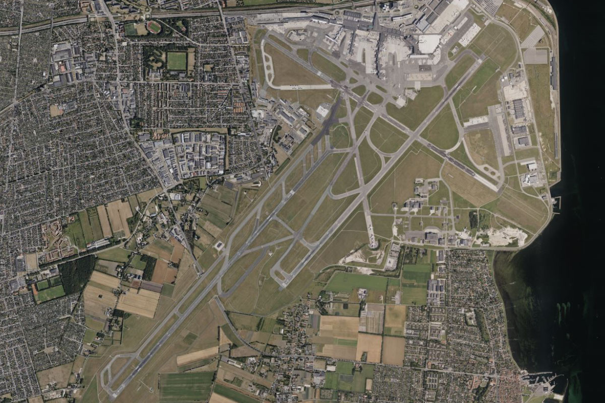
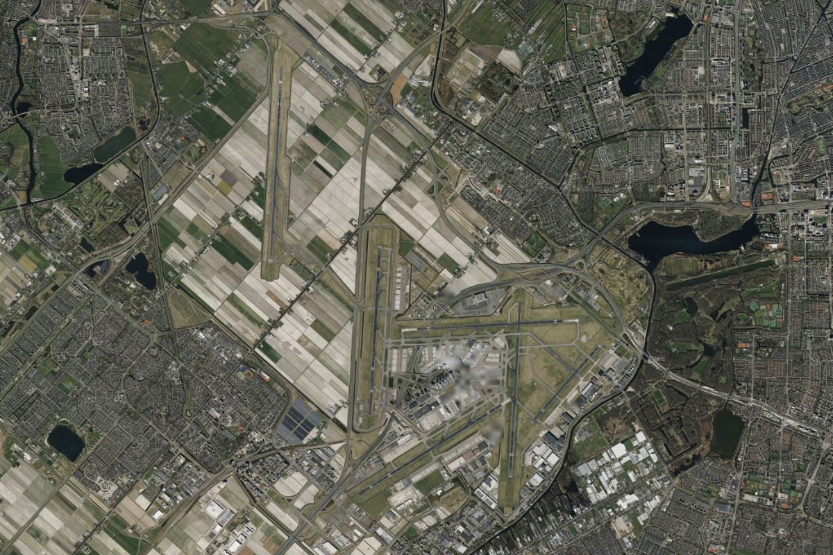
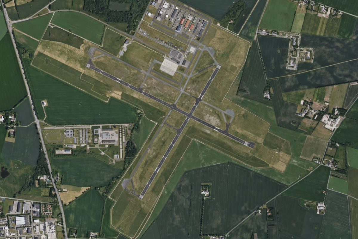
Naardem(POI22) to EHAM(EHAM)
Distance: 15NM Bearing: 269° 7 minutes
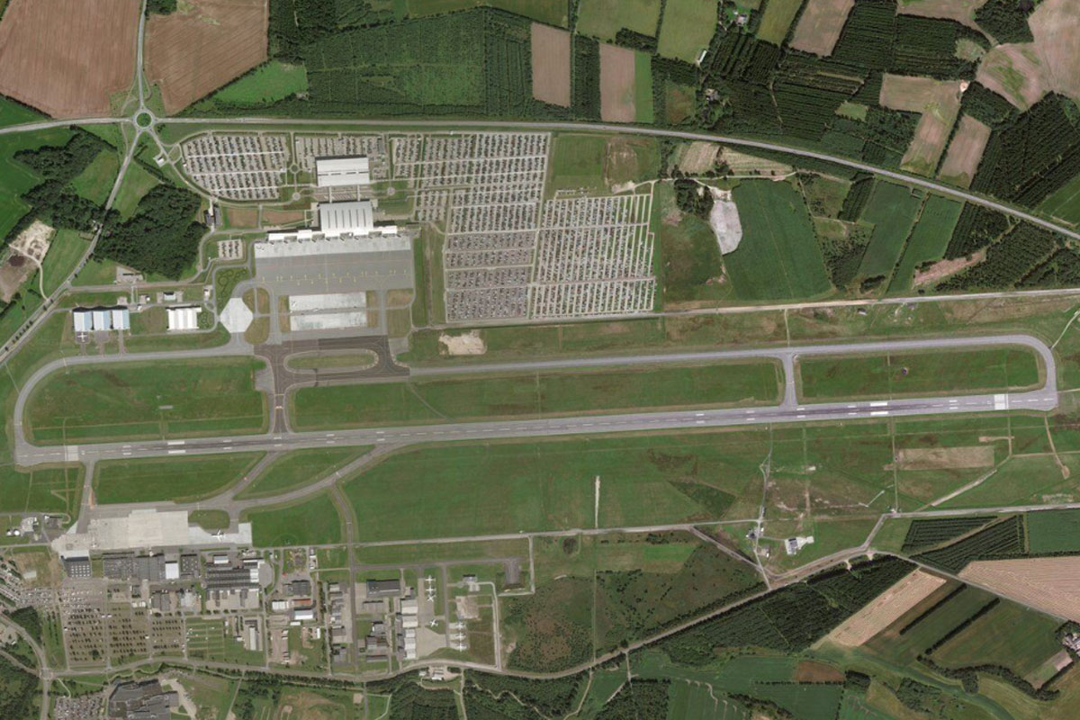
From Naarden, fly directly west to Amsterdam's Schiphol Airport, the world's third busiest airport in 2019
Leg 5
Flying from EHAM
Leg Distance: 48 Approximate time at 125kts: 23 minutes.
EHAM(EHAM) to Amsterdam(POI23)
Distance: 6.71NM Bearing: 47° 3 minutes
Fly northeast to the city of Amsterdam. Originally a small fishing village in the late 12th century, Amsterdam is now one of the world's great cities featuring sights such as the Rijksmuseum, the Oude Church and the Royal Palace, as well as its many canals giving it the title of Venice of the North
Amsterdam(POI23) to Noordzeecanal(POI24)
Distance: 12.58NM Bearing: 293° 6 minutes
From the city, follow the North Sea Canal northwest to meet the coast
Noordzeecanal(POI24) to Julianadorp(POI25)
Distance: 25.31NM Bearing: 7° 12 minutes
Follow the coast north along the 30 mile stretch of beaches, many of them popular with both tourists and locals
Julianadorp(POI25) to EHKD(EHKD)
Distance: 3.4NM Bearing: 46° 2 minutes
As you approach the northern end of the peninsula, look for De Kooy airfield on the eastern shore, just south of the town of Den Helder
Leg 6
Flying from EHKD
Leg Distance: 54.38 Approximate time at 125kts: 26 minutes.
EHKD(EHKD) to Balgzand(POI26)
Distance: 9.37NM Bearing: 83° 4 minutes
After takeoff, fly east across the Balgzand tidal flat,
Balgzand(POI26) to Afsluitdijk(POI27)
Distance: 15.66NM Bearing: 48° 8 minutes
From the northern tip of the peninsula, follow the Afsluitdijk northeast across the bay. This major dam and causeway divides the Waddenzee from the closed off bay Ijsselmeer to the south
Afsluitdijk(POI27) to Terschelling(POI28)
Distance: 19.21NM Bearing: 0° 9 minutes
When you reach the northern end of the causeway, fly north across the Waddensee to the island of Terschelling, one of the West Frisian Islands
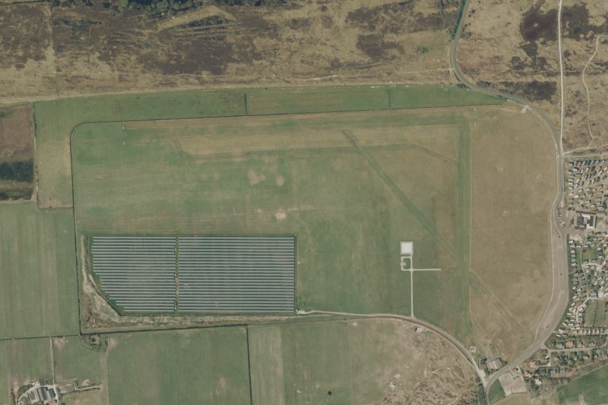
Terschelling(POI28) to EHAL(EHAL)
Distance: 10.14NM Bearing: 76° 5 minutes
Fly to the eastern end of the island, then across the inlet to the island of Ameland. The small airport lies a few miles from the western coast of the island, next to a solar farm
Leg 7
Flying from EHAL
Leg Distance: 38.33 Approximate time at 125kts: 18 minutes.
EHAL(EHAL) to Ameland(POI29)
Distance: 10.09NM Bearing: 83° 5 minutes
After takeoff fly to the eastern end of the island, which is mostly sand dunes and is home to over 3000 people
Ameland(POI29) to Schiermonnikoog(POI30)
Distance: 5.83NM Bearing: 81° 3 minutes
Continue east over the sand bank named Rif, then to the next island in the chain, Schiermonnikoog
Schiermonnikoog(POI30) to Schiermonnikoog(POI31)
Distance: 10.07NM Bearing: 73° 5 minutes
Continue to the eastern end of the island, which is mostly national park – the first in the Netherlands
Schiermonnikoog(POI31) to Borkum(POI32)
Distance: 10.35NM Bearing: 62° 5 minutes
Fly northeast past a group of uninhabited smaller islands, then over the border to the island of Borkum in Germany
Borkum(POI32) to EDWR(EDWR)
Distance: 1.99NM Bearing: 69° 1 minutes
Borkum airfield is near the center of the island
Leg 8
Flying from EDWR
Leg Distance: 44.86 Approximate time at 125kts: 22 minutes.
EDWR(EDWR) to Juist(POI33)
Distance: 6.58NM Bearing: 51° 3 minutes
After takeoff, fly northeast to the next inhabited island, Juist
Juist(POI33) to Norderney(POI34)
Distance: 10.75NM Bearing: 74° 5 minutes
Head east along the long, narrow island, then across to the town of Norderney on the next island, also called Norderney. It is the largest town on the East Frisian Islands
Norderney(POI34) to Baltrum(POI35)
Distance: 9.01NM Bearing: 77° 4 minutes
Continue east to the next island, Baltrum, which is the smallest of the inhabited islands
Baltrum(POI35) to Spiekeroog(POI36)
Distance: 12NM Bearing: 75° 6 minutes
Continue to the next island of Langeoog, then the similarly shaped island of Spiekeroog
Spiekeroog(POI36) to EDWG(EDWG)
Distance: 6.52NM Bearing: 76° 3 minutes
Keep flying east to the next island, Wangerooge. The airport is about half way along the island
Leg 9
Flying from EDWG
Leg Distance: 24.24 Approximate time at 125kts: 12 minutes.
EDWG(EDWG) to Helgoland(POI37)
Distance: 22.89NM Bearing: 354° 11 minutes
After takeoff, fly north to the twin islands of Helgoland. Red cliffs line the west coast of the main island
Helgoland(POI37) to EDXH(EDXH)
Distance: 1.35NM Bearing: 37° 1 minutes
The airport is on the eastern edge of the smaller island
Leg 10
Flying from EDXH
Leg Distance: 47.71 Approximate time at 125kts: 23 minutes.
EDXH(EDXH) to Sankt Peter-Ording(POI38)
Distance: 24.64NM Bearing: 69° 12 minutes
After takeoff, fly east to mainland Germany, and the large beach near the town of Sankt Peter-Ording
Sankt Peter-Ording(POI38) to Osterhever(POI39)
Distance: 9.02NM Bearing: 44° 4 minutes
Fly northeast to the northern coast of the flat peninsula
Osterhever(POI39) to Husum(POI40)
Distance: 10.16NM Bearing: 62° 5 minutes
Follow the shore east, then northeast to the large town of Husum
Husum(POI40) to EDXJ(EDXJ)
Distance: 3.89NM Bearing: 53° 2 minutes
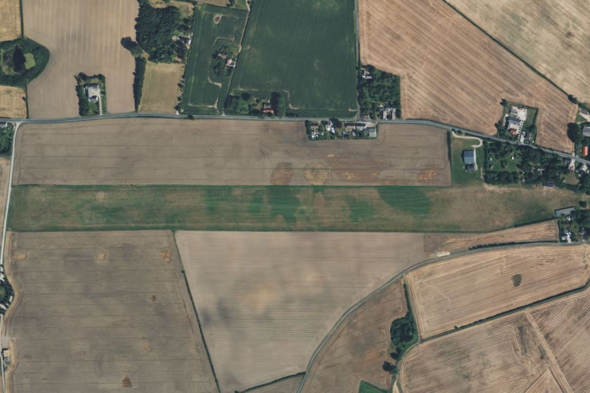
The airport is a couple of miles northeast from the town, and was built during World War II initially as a decoy airfield
Leg 11
Flying from EDXJ
Leg Distance: 42.1 Approximate time at 125kts: 20 minutes.
EDXJ(EDXJ) to Nordfriesische Inseln(POI41)
Distance: 5.27NM Bearing: 275° 3 minutes
After takeoff, fly west to meet the coast of the Schleswig-Holstein Wadden Sea National Park
Nordfriesische Inseln(POI41) to Pellworm(POI42)
Distance: 11.48NM Bearing: 269° 6 minutes
Continue west to the island of Pellworm, which is protected by a dyke around its perimeter
Pellworm(POI42) to Fohr(POI43)
Distance: 12.36NM Bearing: 325° 6 minutes
Fly northwest to the second largest island in the group, Föhr. Extensive mudflats surround the island at low tide, allowing hiking between islands
Fohr(POI43) to EDXW(EDXW)
Distance: 12.99NM Bearing: 336° 6 minutes
Continue northwest to Germany's northernmost island, Sylt. The airport lies near the center of the three-pronged island
Leg 12
Flying from EDXW
Leg Distance: 51.81 Approximate time at 125kts: 25 minutes.
EDXW(EDXW) to Sylt(POI44)
Distance: 9.21NM Bearing: 13° 4 minutes
Fly to the northern tip of the island
Sylt(POI44) to Romo(POI45)
Distance: 9.56NM Bearing: 17° 5 minutes
Continue north into Denmark, and along the sandy western shore of the island of Rømø to its northern tip
Romo(POI45) to Ribe(POI46)
Distance: 10.86NM Bearing: 44° 5 minutes
Turn northeast and fly back to the mainland town of Ribe, a few miles from the coast. Ribe Cathedral is the town's most important landmark
Ribe(POI46) to Gredstedbro(POI47)
Distance: 4.29NM Bearing: 349° 2 minutes
Fly north for a few miles to meet Motorway 24 heading northwest
Gredstedbro(POI47) to Esbjerg(POI48)
Distance: 10.29NM Bearing: 289° 5 minutes
Follow the motorway as it turns west and follows the coast to the port town of Esbjerg
Esbjerg(POI48) to Mennesket ved havet(POI49)
Distance: 2.16NM Bearing: 301° 1 minutes
Northwest from the town on the beach at the end of the dock area, is a popular local sculpture of 4 men looking out to sea
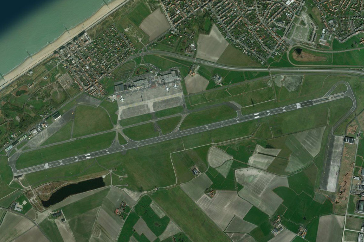
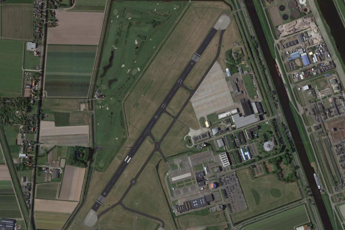
Mennesket ved havet(POI49) to EKEB(EKEB)
Distance: 5.44NM Bearing: 61° 3 minutes
Turn back towards the northeast and head to Esbjerg Airport a few miles from the town
Leg 13
Flying from EKEB
Leg Distance: 61.93 Approximate time at 125kts: 30 minutes.
EKEB(EKEB) to Varde(POI50)
Distance: 6.31NM Bearing: 331° 3 minutes
After takeoff, fly northwest to the nearby town of Varde
Varde(POI50) to Ringkobing Fjord(POI51)
Distance: 15.07NM Bearing: 329° 7 minutes
Continue northwest to Ringkøbing Fjord, which is actually a large shallow lagoon
Ringkobing Fjord(POI51) to Ringkobing Fjord(POI52)
Distance: 16.07NM Bearing: 343° 8 minutes
Fly to the northern end of the lagoon, which is shielded from the North Sea by a long isthmus named Holmsland Dunes
Ringkobing Fjord(POI52) to Nissum Fjord(POI53)
Distance: 15.03NM Bearing: 357° 7 minutes
Follow the coast north to reach another lagoon, Nissum Fjord
Nissum Fjord(POI53) to EK23(EK23)
Distance: 9.45NM Bearing: 71° 5 minutes
From the lagoon, head east to Lindtorp airfield which sits 2 miles northwest from a large solar and wind farm
Leg 14
Flying from EK23
Leg Distance: 42.05 Approximate time at 125kts: 20 minutes.
EK23(EK23) to Nissum Bredning(POI54)
Distance: 9.89NM Bearing: 359° 5 minutes
Fly north to meet the large bay of Nissum Bredning, which is part of the much larger Limfjord
Nissum Bredning(POI54) to Thyholm Peninsula(POI55)
Distance: 4.68NM Bearing: 359° 2 minutes
Continue north across to the peninsula on the other side of the bay
Thyholm Peninsula(POI55) to Visby Bredning(POI56)
Distance: 4.75NM Bearing: 0° 2 minutes
Cross the peninsula and another smaller peninsula to reach a waterway heading northeast
Visby Bredning(POI56) to Thisted(POI57)
Distance: 15.77NM Bearing: 23° 8 minutes
Fly northeast along the waterway until you reach the town of Thisted on its north shore
Thisted(POI57) to EKTS(EKTS)
Distance: 6.96NM Bearing: 0° 3 minutes
Thisted airport is seven miles north from the town
Leg 15
Flying from EKTS
Leg Distance: 39.09 Approximate time at 125kts: 19 minutes.
EKTS(EKTS) to Limfjord(POI58)
Distance: 19.92NM Bearing: 96° 10 minutes
After takeoff, fly east (runway heading) to reach a narrow section of the Limfjord
Limfjord(POI58) to Egholm(POI59)
Distance: 17.03NM Bearing: 75° 8 minutes
Follow the fjord east until you reach the island of Egholm west of the city of Aalborg
Egholm(POI59) to EKYT(EKYT)
Distance: 2.14NM Bearing: 24° 1 minutes
Aalborg airport is north of the island
Leg 16
Flying from EKYT
Leg Distance: 36.95 Approximate time at 125kts: 18 minutes.
EKYT(EKYT) to Aalborg(POI60)
Distance: 3.64NM Bearing: 130° 2 minutes
Fly southeast from the airport to the city of Aalborg, the fourth largest in the country. It was settled as far back as the Iron Age and has been an important harbor town since the Middle Ages
Aalborg(POI60) to Aalborg(POI61)
Distance: 3.16NM Bearing: 43° 2 minutes
Follow the waterway around to the northeast. The light blue lake east of the city is part of a local chalk quarry
Aalborg(POI61) to Bronderslev(POI62)
Distance: 10.57NM Bearing: 347° 5 minutes
Where the river turns southeast, fly north to the large town of Bronderslev, 10 miles away
Bronderslev(POI62) to Hjorring(POI63)
Distance: 12.06NM Bearing: 8° 6 minutes
From Bronderslev, follow the main highway north to another large town, Hjørring
Hjorring(POI63) to Sindal(POI64)
Distance: 5.37NM Bearing: 76° 3 minutes
From the junction east of the town, follow the smaller highway east to the town of Sindal
Sindal(POI64) to EKSN(EKSN)
Distance: 2.15NM Bearing: 21° 1 minutes
Sindal Airport is a couple of miles northeast from the town
Leg 17
Flying from EKSN
Leg Distance: 53.38 Approximate time at 125kts: 26 minutes.
EKSN(EKSN) to Skagen Odde(POI65)
Distance: 9.21NM Bearing: 30° 4 minutes
After takeoff, head northeast towards the long, narrow peninsula of Skagen Odde
Skagen Odde(POI65) to Grenen(POI66)
Distance: 10.97NM Bearing: 45° 5 minutes
Continue northeast to the tip of the peninsula, the Grenen sandbar, which is the northern point of Denmark. It is also one of the most popular tourist attractions in the country and regarded as one of the best bird watching areas in Europe
Grenen(POI66) to Hirsholmene(POI67)
Distance: 15.49NM Bearing: 179° 7 minutes
Fly south to a group of small islands which make up the Hirsholmene Nature Reserve
Hirsholmene(POI67) to EKLS(EKLS)
Distance: 17.71NM Bearing: 131° 9 minutes
Fly southeast across the waters of Kattegat Bay (also referred to as a sea) to its largest island, Læsø. The airport is near the center of the island which is home to around 1800 residents
Leg 18
Flying from EKLS
Leg Distance: 39.7 Approximate time at 125kts: 19 minutes.
EKLS(EKLS) to Hornfiskron(POI68)
Distance: 4.27NM Bearing: 170° 2 minutes
Head to the small island near the south coast of Læsø
Hornfiskron(POI68) to Anholt(POI69)
Distance: 33.6NM Bearing: 146° 16 minutes
Head southeast across the bay to the small island of Anholt. Only the western part of the island is inhabited
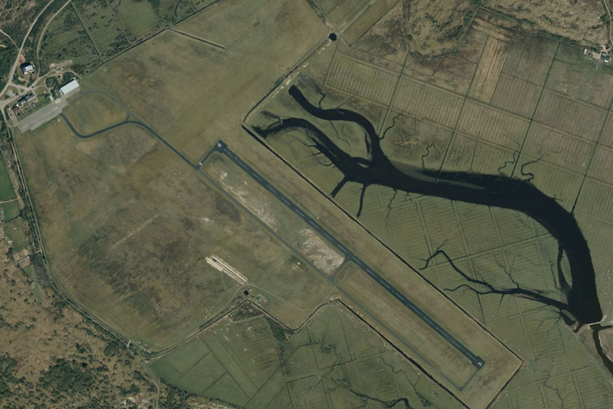
Anholt(POI69) to EKAT(EKAT)
Distance: 1.83NM Bearing: 120° 1 minutes
Head to the small airfield in the south of the island
Leg 19
Flying from EKAT
Leg Distance: 39.23 Approximate time at 125kts: 19 minutes.
EKAT(EKAT) to Grenaa(POI70)
Distance: 24.98NM Bearing: 228° 12 minutes
After takeoff, fly southwest to the eastern point of the Jutland peninsula, near the town of Grenaa
Grenaa(POI70) to EKAH(EKAH)
Distance: 14.25NM Bearing: 228° 7 minutes
Continue southwest to Aarhus Airport, which serves Denmark's second largest city, Aarhus, 40 kilometers away
Leg 20
Flying from EKAH
Leg Distance: 40.1 Approximate time at 125kts: 19 minutes.
EKAH(EKAH) to Aarhus(POI71)
Distance: 15.3NM Bearing: 235° 7 minutes
After takeoff, fly southwest along Kalø Cove to Aarhus, Denmark's second largest city. The city, which dates back to the Viking age, is the primary port of Denmark with a mix of old and new architecture – the modern City Hall and Isbjerget apartment building contrasting the nearly 1000 year old Church of Our Lady
Aarhus(POI71) to Hou(POI72)
Distance: 15.5NM Bearing: 171° 7 minutes
Follow the western shore of the Bay of Aarhus as it leads you south
Hou(POI72) to EKEL(EKEL)
Distance: 9.3NM Bearing: 178° 4 minutes
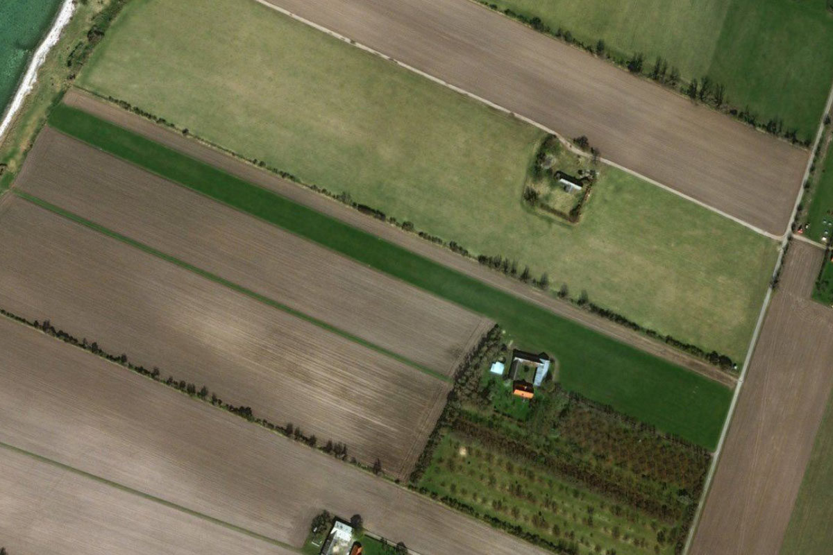
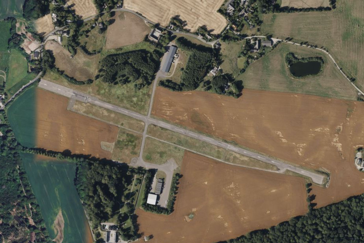
From the marina at the town of Hou, where the coast turns away to the southwest, fly south to the island of Endelave. The grass airstrip is near the western tip of the island
Leg 21
Flying from EKEL
Leg Distance: 38.16 Approximate time at 125kts: 18 minutes.
EKEL(EKEL) to Bjornsknude(POI73)
Distance: 8.2NM Bearing: 241° 4 minutes
From Endelave, head southwest across the water to the small peninsula of Bjornsknude
Bjornsknude(POI73) to Vejle(POI74)
Distance: 16.21NM Bearing: 267° 8 minutes
Fly west along Vejle Fjord to the harbor town of Vejle at its far end
Vejle(POI74) to Farup So(POI75)
Distance: 5.56NM Bearing: 284° 3 minutes
Head west to the nearby lake of Farup So. Just north from here is the town of Jelling, which is home to the Jelling Stones, massive carved rune stones from the 10th century. The site is a UNESCO World Heritage Site
Farup So(POI75) to EKBI(EKBI)
Distance: 8.19NM Bearing: 270° 4 minutes
Continue west to Billund Airport, the second busiest in the country
Leg 22
Flying from EKBI
Leg Distance: 50.34 Approximate time at 125kts: 24 minutes.
EKBI(EKBI) to Billund(POI76)
Distance: 1.44NM Bearing: 226° 1 minutes
The town of Billund on the south side of the airport is home to the Lego company's headquarters as well as it's first theme park which opened in 1968
Billund(POI76) to Kolding(POI77)
Distance: 18.88NM Bearing: 134° 9 minutes
From Billund, fly southeast to the town of Kolding, which sits at the western tip of Kolding Fjord
Kolding(POI77) to Brandso(POI78)
Distance: 10.74NM Bearing: 134° 5 minutes
Continue southeast across the Little Belt Strait to the island of Brandsø
Brandso(POI78) to Bago(POI79)
Distance: 4.64NM Bearing: 123° 2 minutes
Further southeast is the nearby island of Bågø
Bago(POI79) to Assens(POI80)
Distance: 3.78NM Bearing: 128° 2 minutes
Continue southeast to the town of Assens, which lies on the west coast of Fyn, Denmark's third largest island
Assens(POI80) to Glamsbjerg(POI81)
Distance: 7.28NM Bearing: 84° 3 minutes
From Assens, fly east to the town of Glamsbjerg
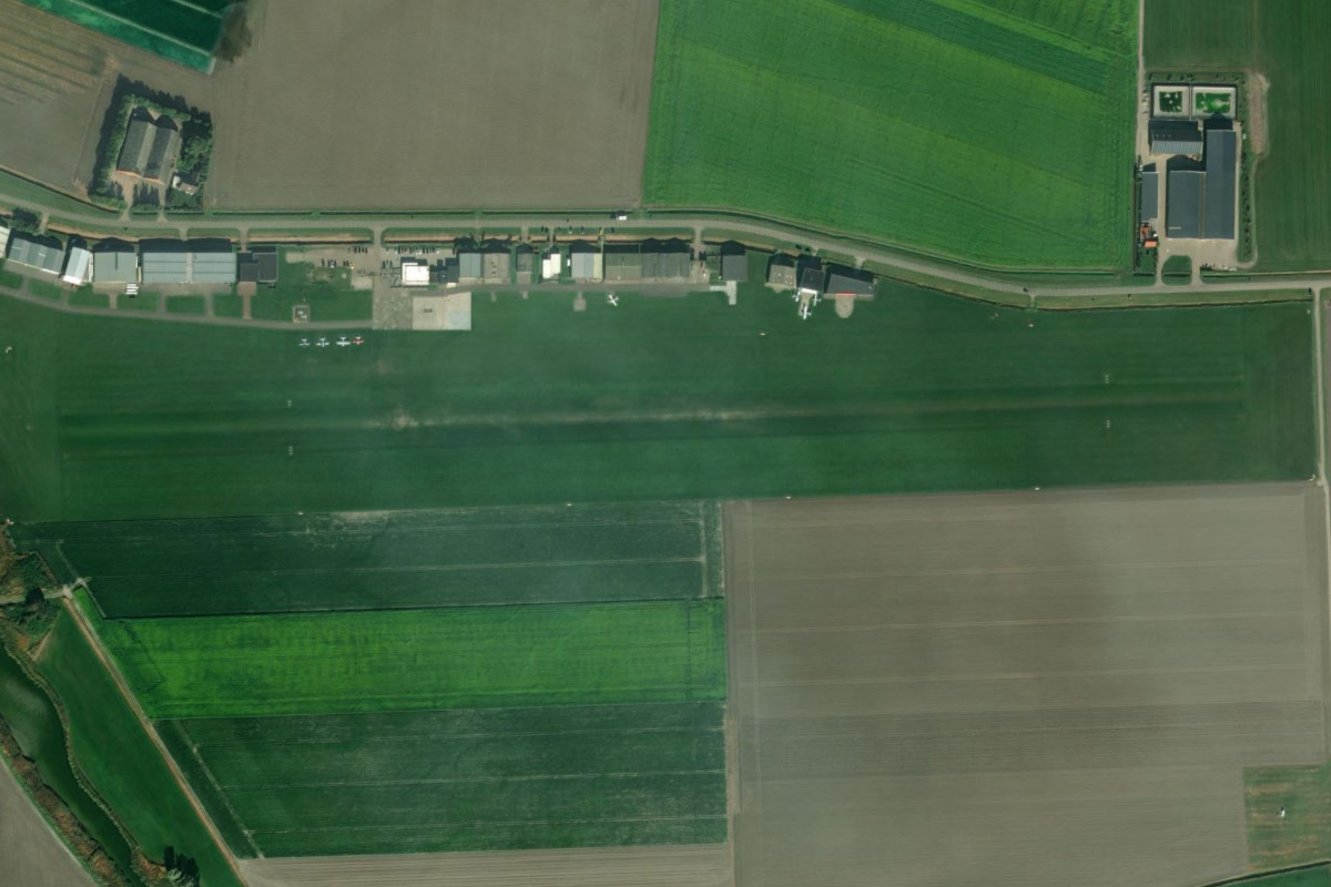
Glamsbjerg(POI81) to EKFS(EKFS)
Distance: 3.58NM Bearing: 110° 2 minutes
A few miles southeast from Glamsbjerg is the large grass strip of the local glider field which lies at the western edge of the town of Broby
Leg 23
Flying from EKFS
Leg Distance: 43.97 Approximate time at 125kts: 21 minutes.
EKFS(EKFS) to Odense(POI82)
Distance: 10.95NM Bearing: 30° 5 minutes
Fly northeast to the city of Odense, the third largest city in Denmark and the commercial hub of the island of Funen. It is also the birthplace of author Hans Christian Andersen
Odense(POI82) to Langeskov(POI83)
Distance: 7.15NM Bearing: 108° 3 minutes
From the city, fly southeast to the town of Langeskov, where you will meet highway E20 also heading southeast
Langeskov(POI83) to Nyborg(POI84)
Distance: 8.26NM Bearing: 105° 4 minutes
Follow the highway southeast to the town of Nyborg on the shore of the Great Belt Strait
Nyborg(POI84) to Zealand(POI85)
Distance: 10.88NM Bearing: 72° 5 minutes
Follow the Great Belt Bridge east across the strait to Zealand, Denmark's largest island. The bridge is in two sections, divided by the island of Sprogø in the middle
Zealand(POI85) to EKFO(EKFO)
Distance: 6.73NM Bearing: 79° 3 minutes
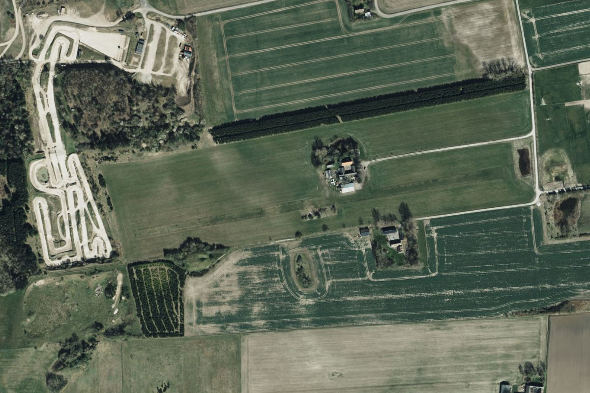
After the bridge crossing, continue east with the highway and look for a small private airstrip a mile south of the road after the wedge shaped town of Vemmelev. At the western edge of the airstrip is Slegelse Motocross track
Leg 24
Flying from EKFO
Leg Distance: 33.32 Approximate time at 125kts: 16 minutes.
EKFO(EKFO) to Slagelse(POI86)
Distance: 3.08NM Bearing: 23° 1 minutes
After takeoff, fly northeast to the nearby large town of Slagelse
Slagelse(POI86) to Tuelso(POI87)
Distance: 8.03NM Bearing: 61° 4 minutes
From Slagelse, follow highway E20 northeast where it will pass to the north of Tuelsø lake
Tuelso(POI87) to Ringsted(POI88)
Distance: 7.99NM Bearing: 90° 4 minutes
Keep following the highway east to the town of Ringsted
Ringsted(POI88) to Borup(POI89)
Distance: 6.89NM Bearing: 60° 3 minutes
Leaving the highway at Ringsted, fly northeast to the town of Borup
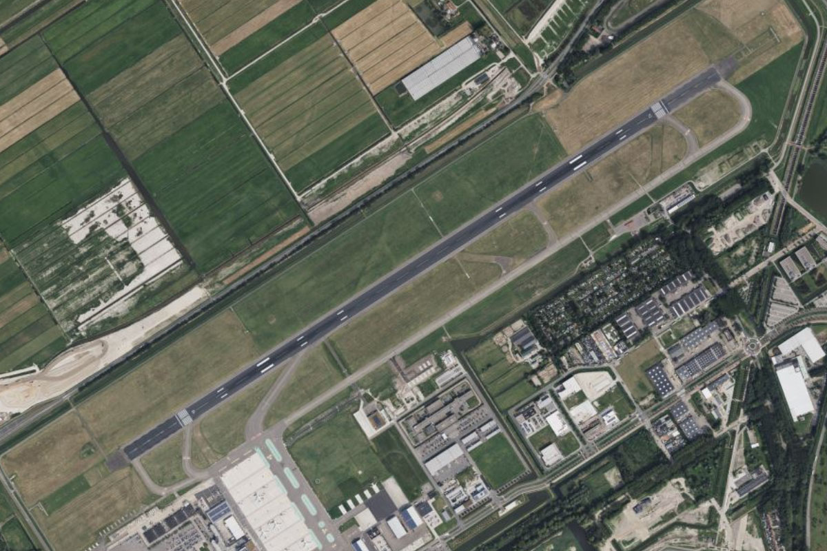
Borup(POI89) to EKRK(EKRK)
Distance: 7.33NM Bearing: 38° 4 minutes
Continuing northeast from Borup, you will soon reach Roskilde Airport
Leg 25
Flying from EKRK
Leg Distance: 29.98 Approximate time at 125kts: 14 minutes.
EKRK(EKRK) to Roskilde(POI90)
Distance: 3.76NM Bearing: 330° 2 minutes
After takeoff, head northwest to the city of Roskilde. The 12th century Roskilde Cathedral is near the city center and the Viking Ship Museum lies to the north, on the shore of Roskilde Fjord. The annual music festival is one of the biggest in Scandinavia
Roskilde(POI90) to Elleore(POI91)
Distance: 2.69NM Bearing: 339° 1 minutes
From the city, head northwest into Roskilde Fjord
Elleore(POI91) to Eskilso(POI92)
Distance: 2.97NM Bearing: 7° 1 minutes
Continue north along the fjord to where it narrows around the island of Eskilsø
Eskilso(POI92) to Frederikssund(POI93)
Distance: 6.72NM Bearing: 343° 3 minutes
Continue north along the narrow section of the fjord until you reach the Crown Prince Frederick bridge near the town of Frederickssund
Frederikssund(POI93) to Slangerup(POI94)
Distance: 4.33NM Bearing: 83° 2 minutes
From the bridge, follow the highway east over Frederickssund to the nearby town of Slangerup
Slangerup(POI94) to Hillerod(POI95)
Distance: 6.74NM Bearing: 37° 3 minutes
Fly northeast to the city of Hillerod, home to the 17th-century Frederiksborg Castle and the large forest and hunting grounds of Store Dyrehave east of the city
Hillerod(POI95) to EKGH(EKGH)
Distance: 2.77NM Bearing: 70° 1 minutes
A couple of miles east of the city is Gronholt Airport
Leg 26
Flying from EKGH
Leg Distance: 36.78 Approximate time at 125kts: 18 minutes.
EKGH(EKGH) to Helsingor(POI96)
Distance: 9.72NM Bearing: 48° 5 minutes
After takeoff, fly northeast to the town of Helsingør, on the shore of Øresund strait. On the water's edge is Kronborg Castle, immortalized in William Shakespeare's play Hamlet
Helsingor(POI96) to Niva(POI97)
Distance: 7.09NM Bearing: 201° 3 minutes
Turn and follow the coast southwest
Niva(POI97) to Nordhavnen(POI98)
Distance: 12.92NM Bearing: 163° 6 minutes
Keep following the coast south as it leads you to the harbor north of the country's capital, Copenhagen
Nordhavnen(POI98) to Copenhagen(POI99)
Distance: 2.73NM Bearing: 186° 1 minutes
Continue south for a look around the city. Rosenborg Castle and Amalienborg Palace are north of the river, while the rectangular Opera House is on the south bank
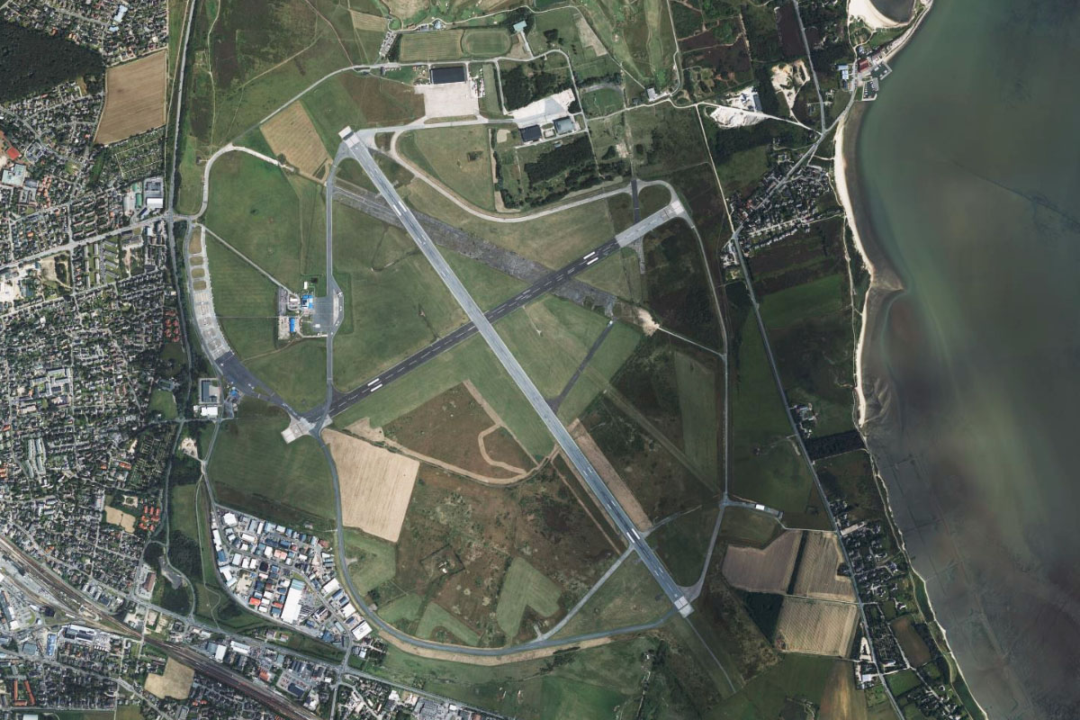
Copenhagen(POI99) to EKCH(EKCH)
Distance: 4.32NM Bearing: 139° 2 minutes
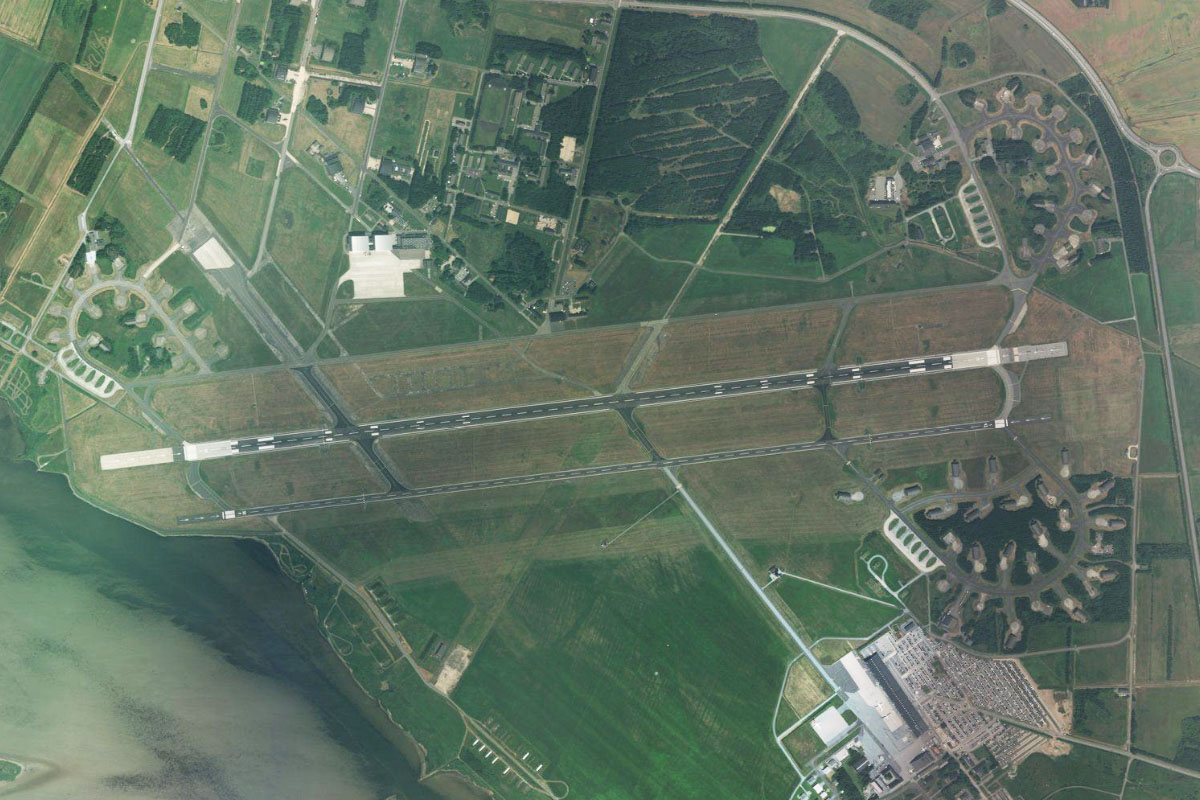
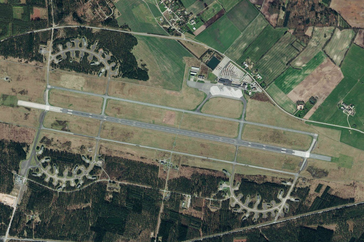
Kastrup Airport is a few miles southeast from the city. It is the second largest airport in the Nordic countries, and the destination for this stage