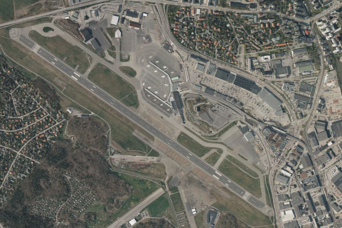
Welcome to stage 60, and a journey through the south of Sweden. Although mostly flat terrain, there’s plenty of beautiful scenery to see, with thousands of islands dotting the Baltic Sea coastline and thousands of lakes inland, including the country’s largest lake, Vänern. Starting in Copenhagen, you’ll cross east to the Swedish city of Malmö before making your way along the Baltic Sea coast to Gotland, Sweden’s largest island. After a visit to the capital, Stockholm, you’ll visit another island, Åland, which is an autonomous region of Finland. Crossing the mainland west, you’ll head to the capital city of Norway, Oslo, before finishing the stage in the second largest airport in the Nordic countries
Total Legs: 25 Total Distance: 1227 Total Time(125kts): 9 hours 48 minutes
Leg 1
Flying from EKCH
Leg Distance: 36.22 Approximate time at 125kts: 17 minutes.
EKCH(EKCH) to Peberholm(POI1)
Distance: 3.54NM Bearing: 104° 2 minutes
After takeoff, fly east to the artificial island of Peberholm, created as part of the Øresund Bridge connecting Denmark with Sweden
Peberholm(POI1) to Sweden(POI2)
Distance: 5.14NM Bearing: 107° 2 minutes
Follow the bridge east to Sweden. It is the longest in Europe with both roadway and railway combined in a single structure
Sweden(POI2) to Malmo(POI3)
Distance: 4.23NM Bearing: 51° 2 minutes
From the eastern end of the bridge, head northeast to Malmö, Sweden's third largest city. The city's most famous landmark is the twisting skyscraper near the waterfront, known as the Turning Torso
Malmo(POI3) to Lund(POI4)
Distance: 9.06NM Bearing: 41° 4 minutes
Continue northeast past the outskirts of Malmö to the large town of Lund, whose 11th century cathedral is one of the oldest stone buildings still in use in Sweden
Lund(POI4) to Dalby(POI5)
Distance: 5.85NM Bearing: 109° 3 minutes
From Lund, follow the main road southeast to the nearby town of Dalby
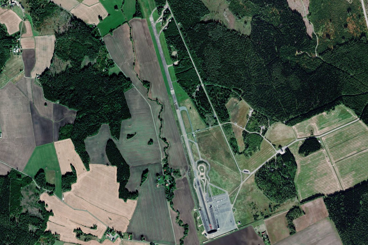
Dalby(POI5) to ESMS(ESMS)
Distance: 8.4NM Bearing: 169° 4 minutes
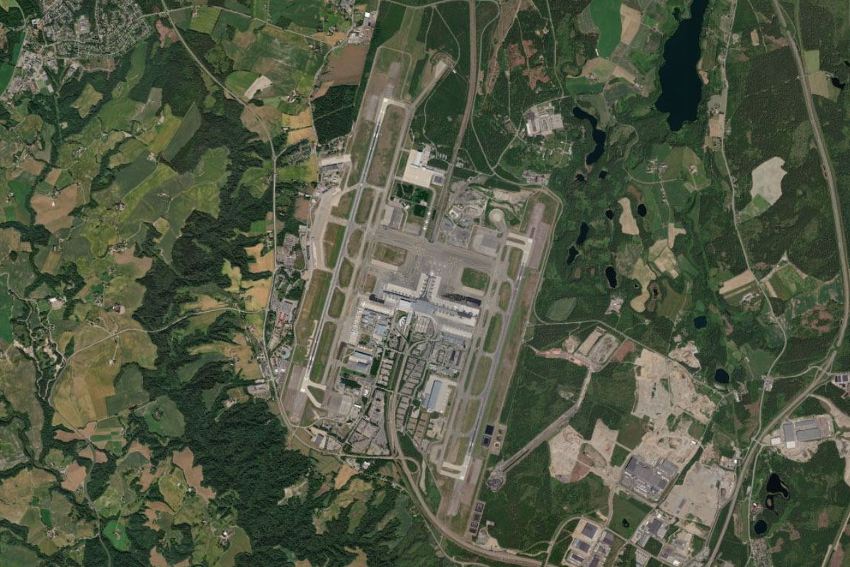
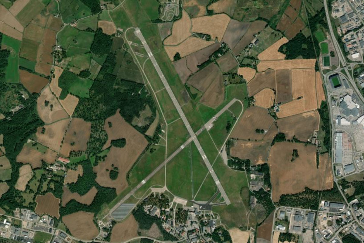
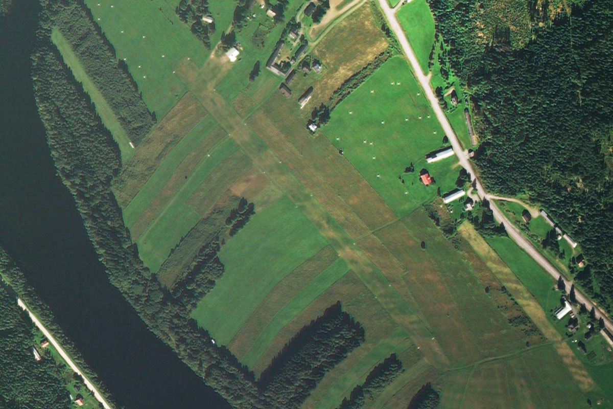
Turn south and head to Malmö Airport, which is the fourth busiest in Sweden
Leg 2
Flying from ESMS
Leg Distance: 38.25 Approximate time at 125kts: 18 minutes.
ESMS(ESMS) to Vombsjon(POI6)
Distance: 11.91NM Bearing: 33° 6 minutes
After takeoff, fly northeast to lake Vombsjön, which provides drinking water for Malmö
Vombsjon(POI6) to Horby(POI7)
Distance: 10.52NM Bearing: 8° 5 minutes
From the lake, fly north to the town of Hörby, which lies to the east of another lake, Ringsjön
Horby(POI7) to Huarod(POI8)
Distance: 11.06NM Bearing: 82° 5 minutes
From Hörby, follow the power lines east through the forested farmland
Huarod(POI8) to ESMK(ESMK)
Distance: 4.76NM Bearing: 37° 2 minutes
At the eastern end of the forest where the power lines turn northeast, fly northeast to Kristianstad Airport
Leg 3
Flying from ESMK
Leg Distance: 50.66 Approximate time at 125kts: 24 minutes.
ESMK(ESMK) to Ahus(POI9)
Distance: 7.9NM Bearing: 80° 4 minutes
Fly east to meet the shoreline of Hanö Bay at the town of Åhus
Ahus(POI9) to Solvesborg(POI10)
Distance: 11.12NM Bearing: 44° 5 minutes
Follow the coast northeast to the large town of Sölvesborg. A unique pedestrian bridge crosses the bay east of the city and is a local landmark
Solvesborg(POI10) to Pukavik Bay(POI11)
Distance: 7.38NM Bearing: 44° 4 minutes
Continue northeast over the peninsula to Pukavik Bay
Pukavik Bay(POI11) to Starno(POI12)
Distance: 3.38NM Bearing: 74° 2 minutes
As you cross the bay, head east to the small Stärnö Peninsula, which is also a nature reserve
Starno(POI12) to Blekinge(POI13)
Distance: 14.29NM Bearing: 79° 7 minutes
Fly east along the Blekinge archipelago, a scenic coastal area of islands and nature reserves
Blekinge(POI13) to Ronneby(POI14)
Distance: 3.21NM Bearing: 359° 2 minutes
As you near the large farmland peninsula of Gö, head north to the large town of Ronneby
Ronneby(POI14) to ESDF(ESDF)
Distance: 3.38NM Bearing: 348° 2 minutes
Ronneby Airport is a few miles north from the town
Leg 4
Flying from ESDF
Leg Distance: 53.66 Approximate time at 125kts: 26 minutes.
ESDF(ESDF) to Karlskrona(POI15)
Distance: 12.45NM Bearing: 115° 6 minutes
After takeoff, fly southeast to the city of Karlskrona, which occupies the island of Trossö. Parts of the city are a UNESCO World Heritage site, including its Naval Base
Karlskrona(POI15) to Djursvik(POI16)
Distance: 21.69NM Bearing: 44° 10 minutes
After passing Karlskrona, turn northeast and head across land until you reach the coast of the Kalmar Strait, which separates the mainland from the island of Öland
Djursvik(POI16) to Kalmar(POI17)
Distance: 17.44NM Bearing: 19° 8 minutes
Follow the coastline north towards the city of Kalmar, the home of Kalmar Castle where, in 1397, the Kalmar Union was formed – a union of Denmark, Norway and Sweden (including Finland)
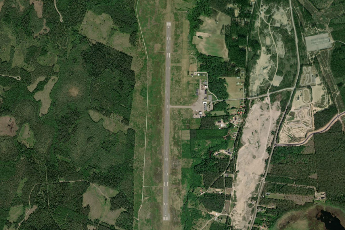
Kalmar(POI17) to ESMQ(ESMQ)
Distance: 2.08NM Bearing: 332° 1 minutes
Kalmar Airport is on the western edge of the city
Leg 5
Flying from ESMQ
Leg Distance: 50.44 Approximate time at 125kts: 24 minutes.
ESMQ(ESMQ) to Farjestaden(POI18)
Distance: 6.62NM Bearing: 93° 3 minutes
Fly east and follow the 6km long Öland Bridge across to the island of the same name
Farjestaden(POI18) to Borgholm(POI19)
Distance: 14.11NM Bearing: 18° 7 minutes
Head north along the western side of the island. The bayside towns of Borgholm and Kopingsvik are popular with tourists and campers
Borgholm(POI19) to ESMZ(ESMZ)
Distance: 29.71NM Bearing: 18° 14 minutes
Continue north along the narrow island to Oland Airport near the northern point
Leg 6
Flying from ESMZ
Leg Distance: 57.39 Approximate time at 125kts: 28 minutes.
ESMZ(ESMZ) to Stora Karlso(POI20)
Distance: 29.96NM Bearing: 88° 14 minutes
After takeoff, fly east across the to Stora Karlsö, the more southern of 2 small islands near the coast of Sweden's largest island, Gotland
Stora Karlso(POI20) to Klintehamn(POI21)
Distance: 9.5NM Bearing: 43° 5 minutes
Fly northeast over the smaller island on the way to the town of Klintehamn on the island of Gotland
Klintehamn(POI21) to Visby(POI22)
Distance: 15.53NM Bearing: 4° 7 minutes
Fly north to the city of Visby, on the west coast. The medieval city is a popular tourist site and hosts an annual medieval festival
Visby(POI22) to ESSV(ESSV)
Distance: 2.4NM Bearing: 40° 1 minutes
Visby airport is north of the city
Leg 7
Flying from ESSV
Leg Distance: 30.17 Approximate time at 125kts: 14 minutes.
ESSV(ESSV) to Aminne(POI23)
Distance: 13.76NM Bearing: 89° 7 minutes
From Visby, fly to the eastern coast of the island
Aminne(POI23) to Slite(POI24)
Distance: 4.49NM Bearing: 9° 2 minutes
Follow the coast north to the industrial town of Slite
Slite(POI24) to Skenholmen(POI25)
Distance: 9.02NM Bearing: 44° 4 minutes
Follow the coast until you reach the barren island of Skenholmen
Skenholmen(POI25) to ESVB(ESVB)
Distance: 2.9NM Bearing: 357° 1 minutes
Fly north from the island towards the village of Fårösund on the main island, next to which lies a small airport
Leg 8
Flying from ESVB
Leg Distance: 87.39 Approximate time at 125kts: 42 minutes.
ESVB(ESVB) to Bastetrask(POI26)
Distance: 4.55NM Bearing: 302° 2 minutes
After takeoff, head northwest to Bästeträsk, the largest lake on the island
Bastetrask(POI26) to Hallshuk(POI27)
Distance: 6.53NM Bearing: 279° 3 minutes
Fly west across the mouth of the bay to the northern tip of the peninsula
Hallshuk(POI27) to Ostergotland archipelago(POI28)
Distance: 56.33NM Bearing: 284° 27 minutes
Fly west across the Baltic Sea until you reach the outer islands of the Östergötland archipelago, a group of more than 8000 islands
Ostergotland archipelago(POI28) to Ytterby(POI29)
Distance: 14.73NM Bearing: 283° 7 minutes
As you reach the archipelago, look for an island filled channel continuing west into the mainland
Ytterby(POI29) to ESGB(ESGB)
Distance: 5.25NM Bearing: 343° 3 minutes
When you reach the western end of the channel, fly north across land to another channel, where you will see a small grass airstrip just south of a marina
Leg 9
Flying from ESGB
Leg Distance: 34.89 Approximate time at 125kts: 17 minutes.
ESGB(ESGB) to Mem(POI30)
Distance: 6.58NM Bearing: 288° 3 minutes
After takeoff, fly northwest to the Slätbaken fjord, then follow it to its western end at the village of Mem
Mem(POI30) to Norsholm(POI31)
Distance: 13.98NM Bearing: 270° 7 minutes
Fly west across land to reach the eastern point of Roxen Lake
Norsholm(POI31) to Linkoping(POI32)
Distance: 11.21NM Bearing: 246° 5 minutes
Follow the southern shore of the lake west, then south towards the city of Linköping
Linkoping(POI32) to ESSL(ESSL)
Distance: 3.12NM Bearing: 145° 1 minutes
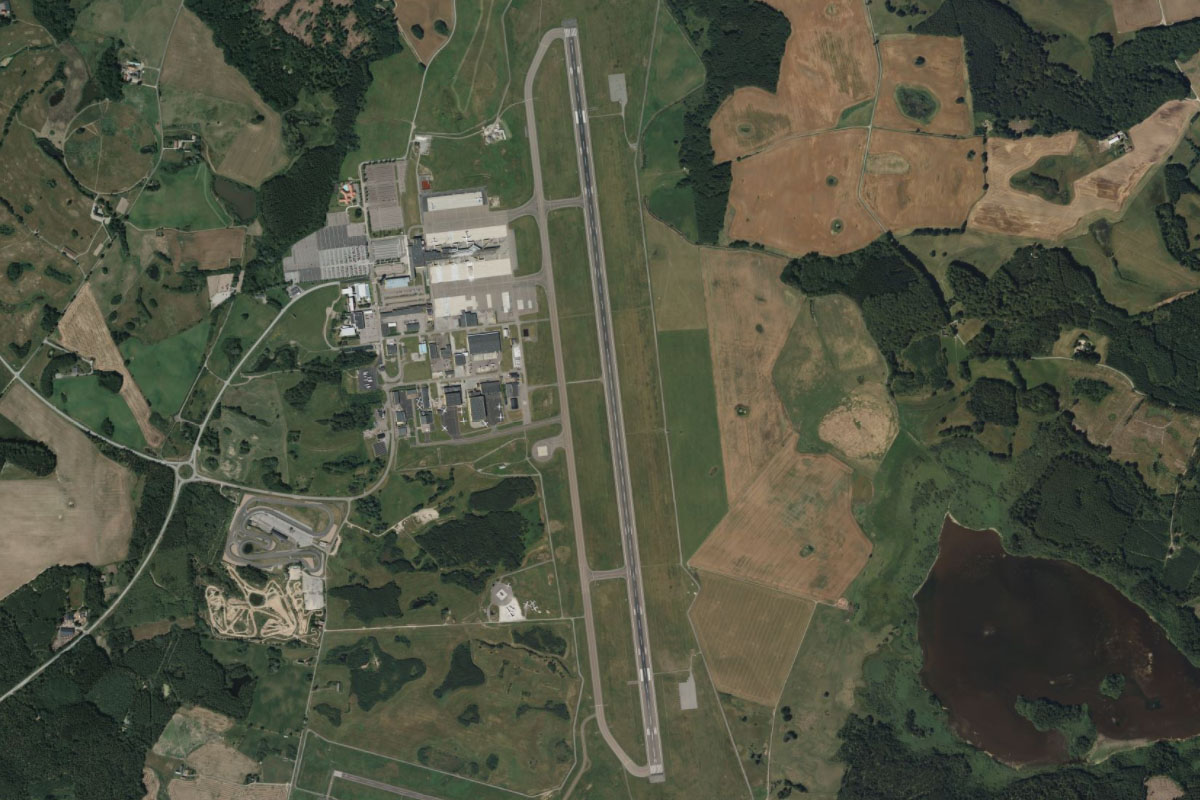
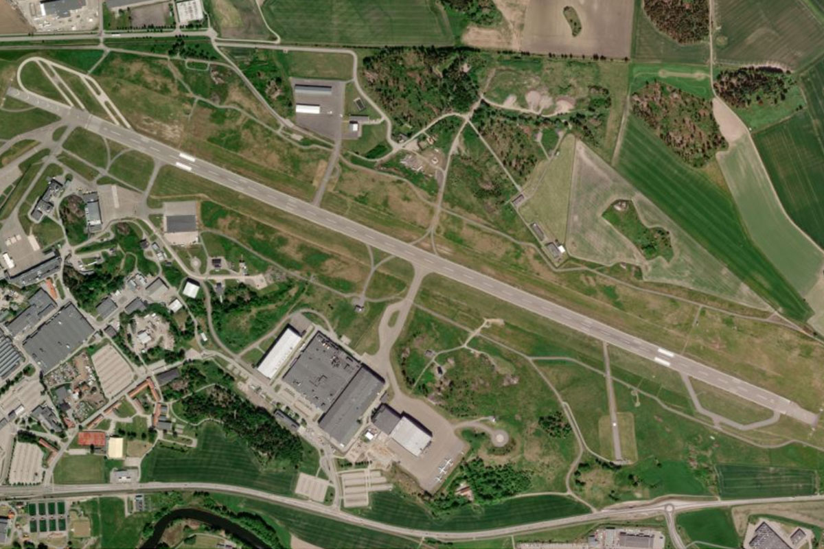
Head to Linköping City Airport near the eastern edge of the city. This is also the manufacturing facility of Swedish aircraft maker SAAB
Leg 10
Flying from ESSL
Leg Distance: 45.37 Approximate time at 125kts: 22 minutes.
ESSL(ESSL) to Mantorp(POI33)
Distance: 12.66NM Bearing: 254° 6 minutes
Fly west past Linköping, then follow the E4 highway to the town of Mantorp, where the Mantorp Park motor racing circuit sits on the north side of the road
Mantorp(POI33) to Vattern(POI34)
Distance: 17.98NM Bearing: 270° 9 minutes
Head west until you reach Vättern, Sweden's second largest lake
Vattern(POI34) to Karlsborg(POI35)
Distance: 9.97NM Bearing: 314° 5 minutes
Cross the lake northwest to the town of Karlsborg. The lake hosts the annual cycling race Vätternrundan, attracting 20,000 riders on the 300 km trip around its shore
Karlsborg(POI35) to ESKL(ESKL)
Distance: 4.76NM Bearing: 333° 2 minutes
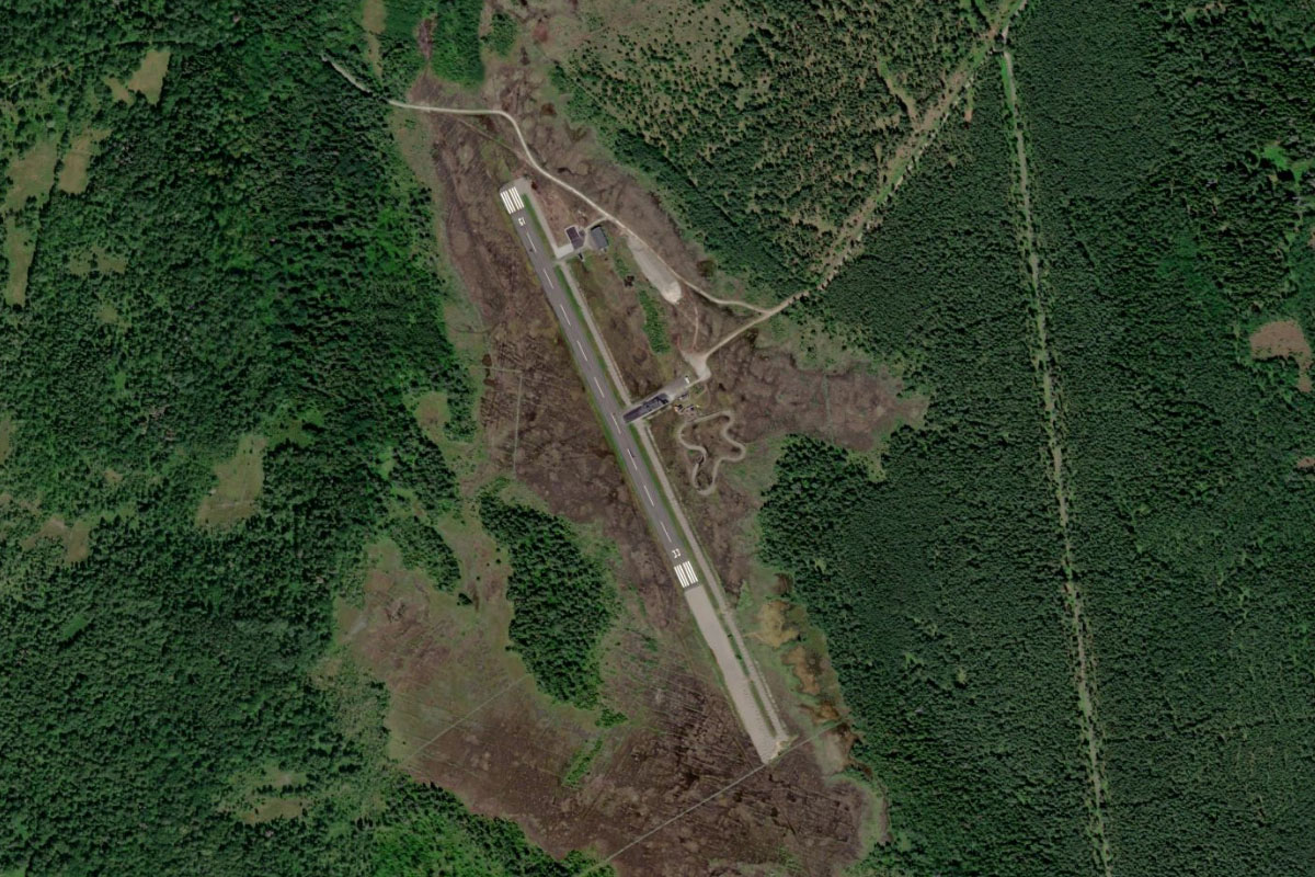
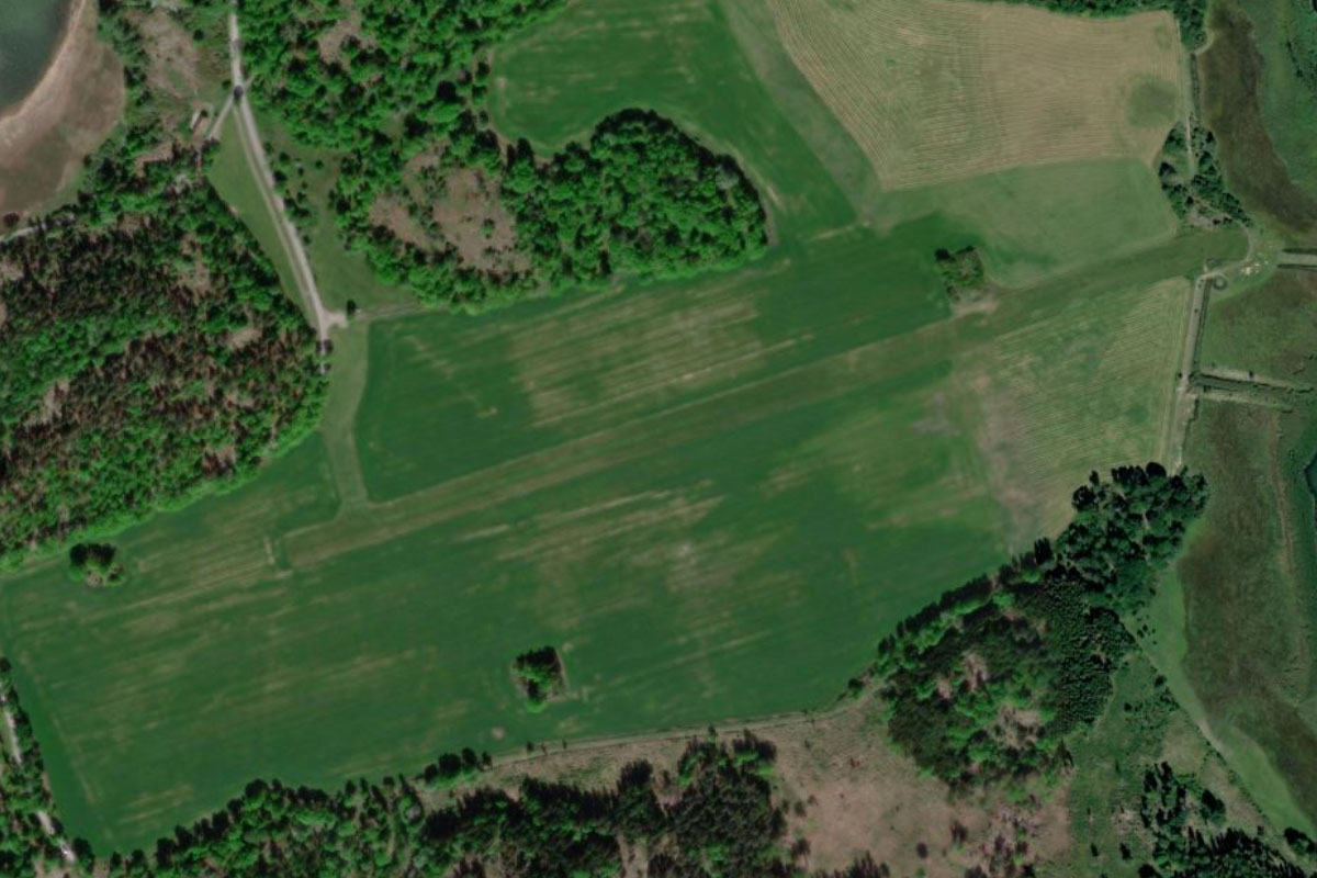
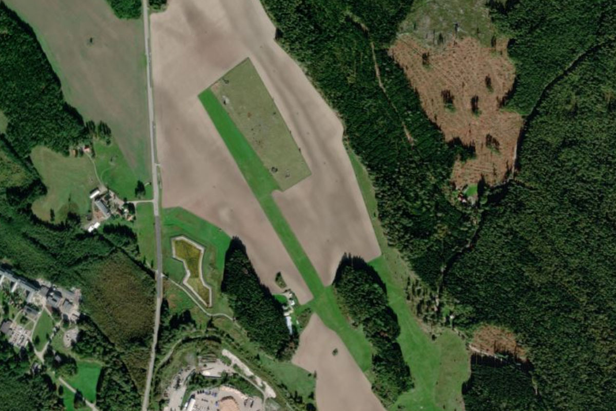
The garrison town of Karlsborg occupies a small peninsula, which will point you northwest to the small grass airfield in a clearing a few miles away
Leg 11
Flying from ESKL
Leg Distance: 67.02 Approximate time at 125kts: 32 minutes.
ESKL(ESKL) to Vattern(POI36)
Distance: 4.51NM Bearing: 59° 2 minutes
After takeoff, fly northeast back to the shore of the lake
Vattern(POI36) to Olshammar(POI37)
Distance: 9.85NM Bearing: 35° 5 minutes
Fly northeast along the shore along with highway 49 to the town of Olshammar
Olshammar(POI37) to Askersund(POI38)
Distance: 8.46NM Bearing: 18° 4 minutes
Follow the highway as it turns north to the town of Askersund
Askersund(POI38) to Tisaren(POI39)
Distance: 10.21NM Bearing: 39° 5 minutes
From Askersund, fly northeast to Tisaren lake
Tisaren(POI39) to Sottern(POI40)
Distance: 10.43NM Bearing: 79° 5 minutes
Fly east to another lake, Sottern. The lake and its many islands are a popular recreational area
Sottern(POI40) to Katrineholm(POI41)
Distance: 20.95NM Bearing: 87° 10 minutes
From the lake, fly east to the town of Katrineholm
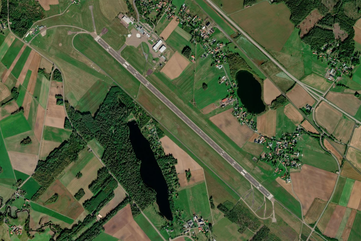
Katrineholm(POI41) to ESVK(ESVK)
Distance: 2.61NM Bearing: 37° 1 minutes
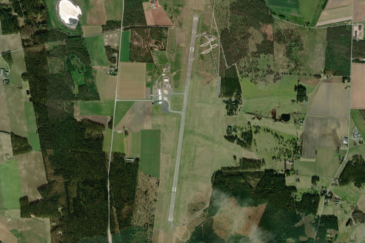
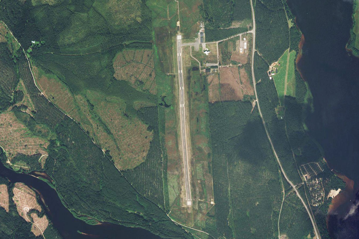
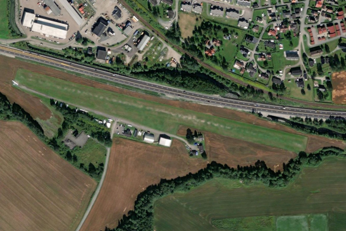
From the center of town, fly north to the small grass airfield which is next to the main road heading north away from the town
Leg 12
Flying from ESVK
Leg Distance: 63.96 Approximate time at 125kts: 31 minutes.
ESVK(ESVK) to Flen(POI42)
Distance: 11.72NM Bearing: 73° 6 minutes
After takeoff, head east along with the highway to the small town of Flen, which is surrounded by lakes and small hills
Flen(POI42) to Malmkoping(POI43)
Distance: 6.2NM Bearing: 32° 3 minutes
Head northeast to the nearby town of Malmköping
Malmkoping(POI43) to Dunkern(POI44)
Distance: 4.84NM Bearing: 69° 2 minutes
Fly east to nearby Dunkern lake
Dunkern(POI44) to Akers styckebruk(POI45)
Distance: 9.34NM Bearing: 43° 4 minutes
Head northwest to the town of Åkers styckebruk
Akers styckebruk(POI45) to Sodertalje(POI46)
Distance: 16.68NM Bearing: 98° 8 minutes
Follow the E20 highway east to the city of Södertälje. Settlements in the area date back as far as 3000 BC, and north of here on the island of Björkö, is what was once the ancient Viking city of Birka
Sodertalje(POI46) to Masmo(POI47)
Distance: 8.56NM Bearing: 52° 4 minutes
From Södertälje, follow the highway northeast until you reach the marinas near the town of Masmo
Masmo(POI47) to Drottningholm(POI48)
Distance: 3.89NM Bearing: 359° 2 minutes
From the small bridge crossing near the marina, fly north to the eastern edge of Lovön island, where you will find Drottningholm Palace, the private residence of the Swedish Royal Family
Drottningholm(POI48) to ESSB(ESSB)
Distance: 2.73NM Bearing: 31° 1 minutes
From the palace, head a few miles northeast to Bromma Airport, which is the second largest of Stockholm's airports after Arlanda
Leg 13
Flying from ESSB
Leg Distance: 47.55 Approximate time at 125kts: 23 minutes.
ESSB(ESSB) to Riddarfjarden(POI49)
Distance: 3.2NM Bearing: 118° 2 minutes
After takeoff, fly southeast (runway heading) over Kungsholmen Island to reach Riddarfjärden, the river-like eastern section of Lake Malar. The large globe like building in the distance is the Avicii Arena, which hosts music and sporting events
Riddarfjarden(POI49) to Stockholm(POI50)
Distance: 4.11NM Bearing: 85° 2 minutes
Follow the waterway east past the center of Stockholm. The island of Gamla Stan is the Old Town of Stockholm and features the Royal Palace and Stockholm Cathedral
Stockholm(POI50) to Askrikefjarden(POI51)
Distance: 4.99NM Bearing: 45° 2 minutes
When the waterway turns northeast follow it to where it meets the larger waterway, Askrikefjärden
Askrikefjarden(POI51) to Stora Timraro(POI52)
Distance: 9.43NM Bearing: 30° 5 minutes
Continue northeast over an area of many islands until you reach a shipping channel which narrows and continues northeast
Stora Timraro(POI52) to Yxlan(POI53)
Distance: 17.33NM Bearing: 45° 8 minutes
Follow the shipping channel northeast towards the Baltic Sea, passing by the island of Ljusterö and the long narrow island of Yxlan
Yxlan(POI53) to Spillersboda(POI54)
Distance: 3.31NM Bearing: 303° 2 minutes
When you reach the northern tip of the island of Yxlan, turn northwest and head to the small town of Spillersboda on the mainland
Spillersboda(POI54) to ESSN(ESSN)
Distance: 5.18NM Bearing: 283° 2 minutes
Fly west from Spillersboda over Limmaren lake to Norrtälje Airport, which is south of the large town of the same name
Leg 14
Flying from ESSN
Leg Distance: 45.38 Approximate time at 125kts: 22 minutes.
ESSN(ESSN) to Norrtalje(POI55)
Distance: 1.47NM Bearing: 4° 1 minutes
Fly north to the nearby town of Norrtälje
Norrtalje(POI55) to Lidon(POI56)
Distance: 11.27NM Bearing: 75° 5 minutes
From the town, follow the narrow waterway east until it opens out near a group of islands. Continue east to the island of Lidön
Lidon(POI56) to Aland(POI57)
Distance: 29.76NM Bearing: 45° 14 minutes
Fly northeast across the Åland Sea to the island of Åland, an autonomous part of Finland and the largest of an archipelago of thousands of islands leading east to the Finnish mainland
Aland(POI57) to EFMA(EFMA)
Distance: 2.88NM Bearing: 10° 1 minutes
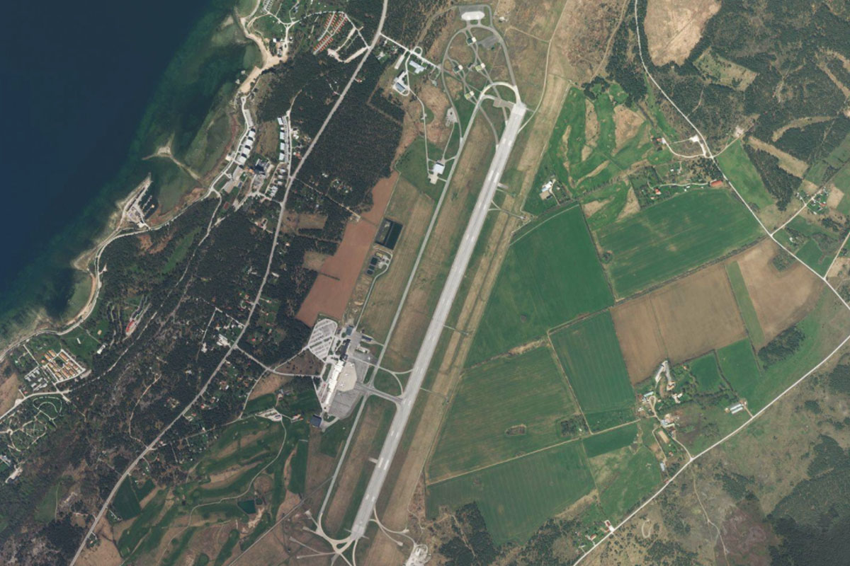
As you near the city of Mariehamn turn north to the airport which lies to the west of the city
Leg 15
Flying from EFMA
Leg Distance: 61.99 Approximate time at 125kts: 30 minutes.
EFMA(EFMA) to Ivarskarsfjarden(POI58)
Distance: 7.9NM Bearing: 329° 4 minutes
After takeoff, head northwest over a small, narrow lake to reach Ivarskarsfjarden sound, one of many interconnected waterways in this region
Ivarskarsfjarden(POI58) to Hostgrund(POI59)
Distance: 10.82NM Bearing: 269° 5 minutes
Fly west to reach the smaller islands near the coast
Hostgrund(POI59) to Aland Sea(POI60)
Distance: 17.49NM Bearing: 269° 8 minutes
Continue west across the Åland Sea until you reach a group of small islets a few miles from the coast of Sweden
Aland Sea(POI60) to Osthammar(POI61)
Distance: 14.55NM Bearing: 251° 7 minutes
Turning slightly left, continue west over a large peninsula to the town of Östhammar, which sits on the western shore of a long narrow coastal inlet
Osthammar(POI61) to ES05(ES05)
Distance: 11.23NM Bearing: 219° 5 minutes
From Östhammar, fly southwest over the smaller town of Gimo to Lunda Airfield, which is also used for motorsport events
Leg 16
Flying from ES05
Leg Distance: 24.66 Approximate time at 125kts: 12 minutes.
ES05(ES05) to Orbyhus(POI62)
Distance: 12.94NM Bearing: 288° 6 minutes
After takeoff, fly west, following the highway to the town of Örbyhus. On the way you will cross the large power line clearing which runs back to Forsmark Nuclear Power Plant, the largest in Sweden, 15 miles to the north
Orbyhus(POI62) to Tierp(POI63)
Distance: 9.46NM Bearing: 311° 5 minutes
At Örbyhus, the road and railway will head northwest to the nearby town of Tierp
Tierp(POI63) to ESKT(ESKT)
Distance: 2.26NM Bearing: 266° 1 minutes
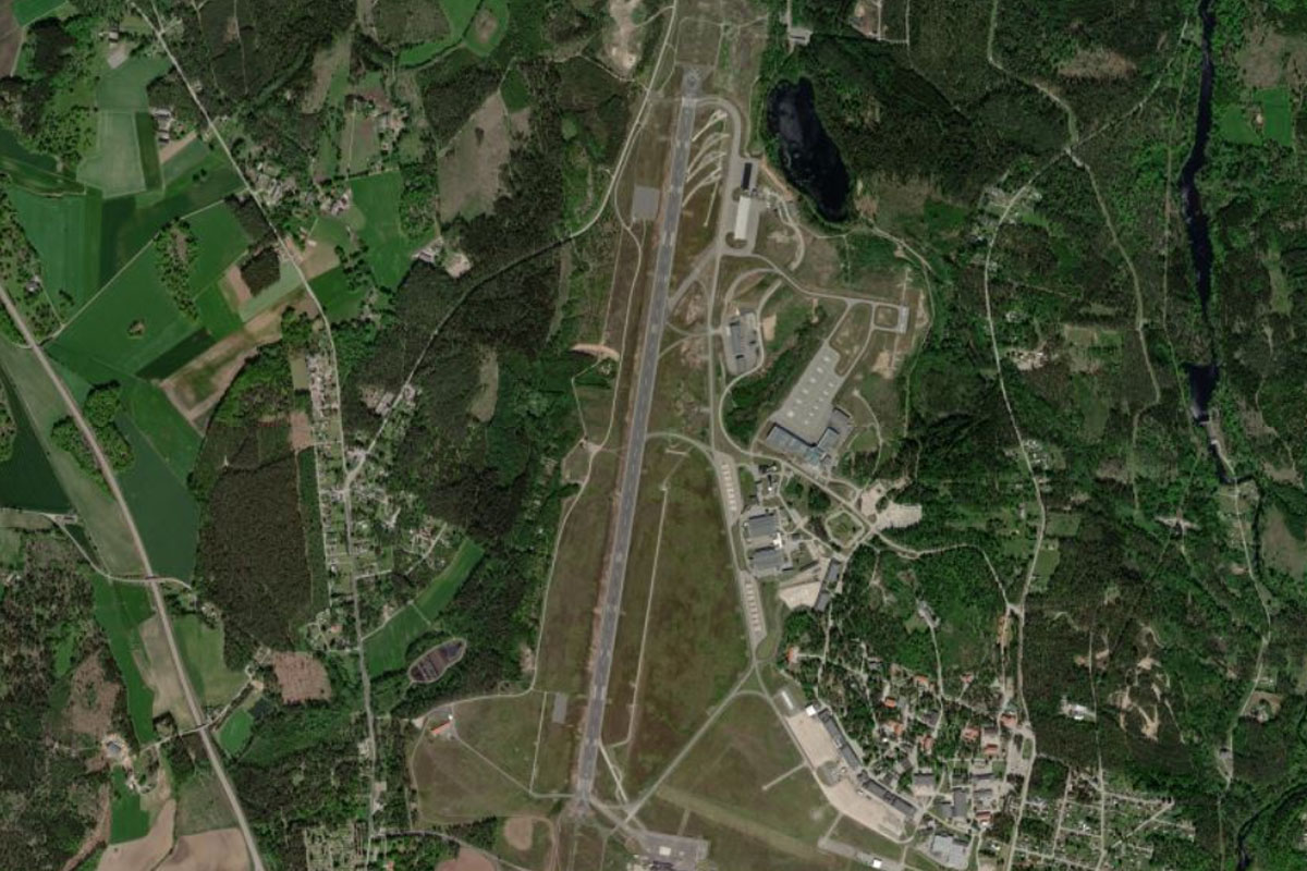
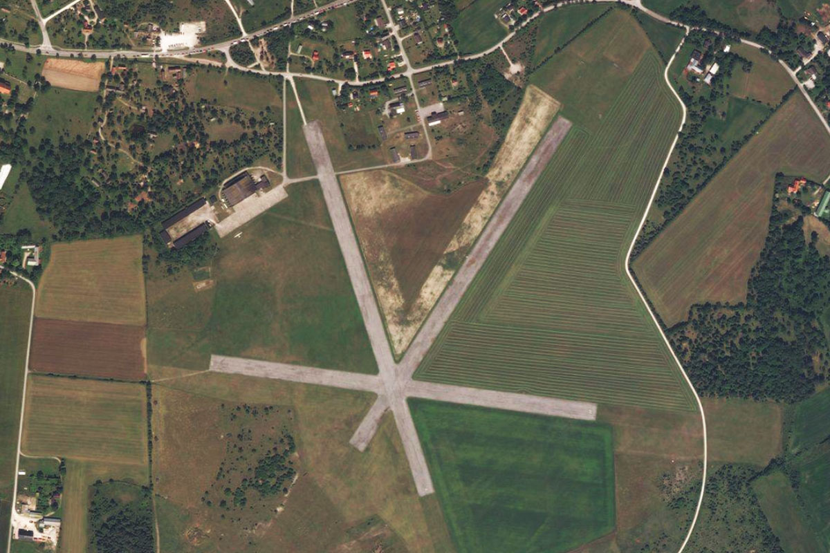
West of the town is Tierp Airport. This mixed use facility is home to Tierp Arena, a world class drag racing track
Leg 17
Flying from ESKT
Leg Distance: 34.61 Approximate time at 125kts: 17 minutes.
ESKT(ESKT) to Dragon Gate(POI64)
Distance: 7.14NM Bearing: 351° 3 minutes
Head north after takeoff to reach the Dal River. Just before reaching the river you will see Dragon Gate, an unfinished Chinese culture center, hotel and museum next to the highway
Dragon Gate(POI64) to Skutskar(POI65)
Distance: 10.87NM Bearing: 357° 5 minutes
Continue north along the Dal River to its mouth near the town of Skutskär
Skutskar(POI65) to Gavle(POI66)
Distance: 8.2NM Bearing: 278° 4 minutes
Follow the coast around to the west and past the port area to the city of Gävle
Gavle(POI66) to ESSK(ESSK)
Distance: 8.4NM Bearing: 224° 4 minutes
Follow the highway leading southwest from the city to reach the airport which lies 2 miles east of a large lake, Storsjön
Leg 18
Flying from ESSK
Leg Distance: 50.74 Approximate time at 125kts: 24 minutes.
ESSK(ESSK) to Storsjon(POI67)
Distance: 13.12NM Bearing: 256° 6 minutes
After takeoff, fly to the western end of the lake, where you will meet a highway also heading west
Storsjon(POI67) to Hofors(POI68)
Distance: 6.76NM Bearing: 250° 3 minutes
Follow the highway west to the town of Hofors. The large Ovako steel plant is on the eastern edge of the town
Hofors(POI68) to Falun(POI69)
Distance: 19.36NM Bearing: 274° 9 minutes
Keep following the highway west until you reach the town of Falun on the northern edge of Runn Lake. Falun Copper Mine is near the western edge of the town, and operated for a thousand years before closing in 1992. The mine is now a museum and UNESCO World Heritage Site
Falun(POI69) to ESSD(ESSD)
Distance: 11.5NM Bearing: 192° 6 minutes
Fly south along the western edge of the lake, then across the Dal River to reach Dala Airport
Leg 19
Flying from ESSD
Leg Distance: 31.1 Approximate time at 125kts: 15 minutes.
ESSD(ESSD) to Djuras(POI70)
Distance: 13.94NM Bearing: 298° 7 minutes
After takeoff, fly northwest to the nearby town of Borlänge, then continue northwest with the highway along a narrow river valley to the town of Djuras
Djuras(POI70) to Leksand(POI71)
Distance: 11.22NM Bearing: 333° 5 minutes
From the river junction at Djuras, follow the Österdal river as it winds its way north to the town of Leksand, near the southern tip of Siljan Lake
Leksand(POI71) to ESVS(ESVS)
Distance: 5.94NM Bearing: 297° 3 minutes
From Leksand, fly northwest across the lake and a smaller inlet to the airstrip at Siljansnäs
Leg 20
Flying from ESVS
Leg Distance: 54.22 Approximate time at 125kts: 26 minutes.
ESVS(ESVS) to Vadsjon(POI72)
Distance: 8.74NM Bearing: 254° 4 minutes
Fly west to Vadsjön lake sitting in the nearby hills
Vadsjon(POI72) to Van(POI73)
Distance: 13.49NM Bearing: 235° 6 minutes
Head southwest to the long narrow lake, which is a wider section of the Van River
Van(POI73) to Malung(POI74)
Distance: 11.99NM Bearing: 270° 6 minutes
From the river, fly west over some low lying hills to the town of Malung, on the Västerdal River
Malung(POI74) to Bredsjon(POI75)
Distance: 12.96NM Bearing: 250° 6 minutes
Fly west from Malung over the nearby hills to Bredsjön, one of the larger lakes in the local area
Bredsjon(POI75) to ESTS(ESTS)
Distance: 7.04NM Bearing: 229° 3 minutes
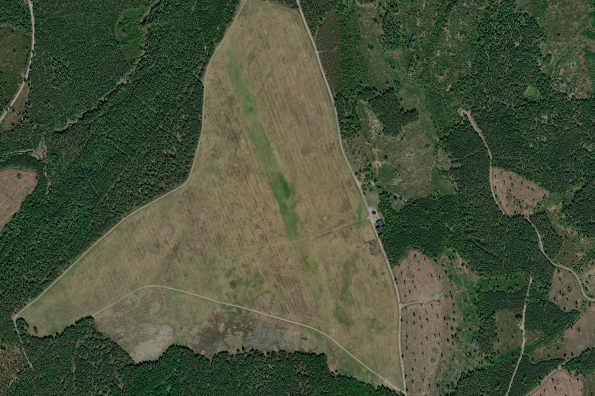
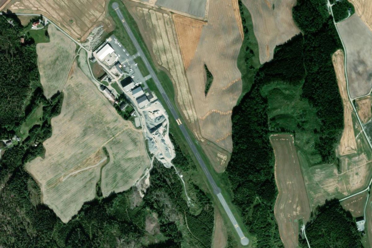
From the lake, fly southwest to reach Klarälven, Sweden's longest river. You will find the small grass airstrip inside one of the river's turns on the eastern bank
Leg 21
Flying from ESTS
Leg Distance: 35.22 Approximate time at 125kts: 17 minutes.
ESTS(ESTS) to Klaralven(POI76)
Distance: 19.02NM Bearing: 144° 9 minutes
After takeoff, follow the picturesque river valley southeast
Klaralven(POI76) to Klaralven(POI77)
Distance: 13.52NM Bearing: 156° 6 minutes
After a few sharp turns, the river will turn towards the south as the valley widens out
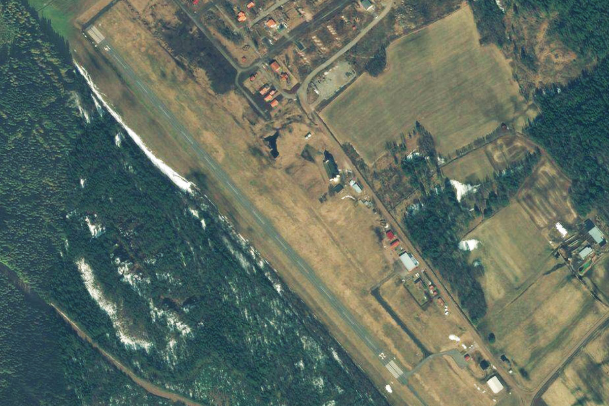
Klaralven(POI77) to ESOH(ESOH)
Distance: 2.68NM Bearing: 163° 1 minutes
When the river sharply turns away to the west, continue south to Hagfors Airport
Leg 22
Flying from ESOH
Leg Distance: 45.01 Approximate time at 125kts: 22 minutes.
ESOH(ESOH) to Munkfors(POI78)
Distance: 11.16NM Bearing: 179° 5 minutes
After takeoff, follow the river as it twists it way past the town of Munkfors. A large steel factory is in the town's north
Munkfors(POI78) to Deje(POI79)
Distance: 13.96NM Bearing: 185° 7 minutes
The river will turn southwest before continuing south to the town of Deje
Deje(POI79) to Karlstad(POI80)
Distance: 13.61NM Bearing: 169° 7 minutes
Keep following the river south to the city of Karlstad, which lies near the north shore of Sweden's largest lake, Vänern. The city's history dates back to the medieval age
Karlstad(POI80) to ESOK(ESOK)
Distance: 6.28NM Bearing: 301° 3 minutes
Karlstad airport is a few miles northwest from the city
Leg 23
Flying from ESOK
Leg Distance: 62.23 Approximate time at 125kts: 30 minutes.
ESOK(ESOK) to Stora Gla(POI81)
Distance: 25.93NM Bearing: 270° 12 minutes
Fly west after takeoff, crossing over the lakes of Varmeln and Glafsfjorden before reaching Stora Gla lake, which lies in the Glaskogen Nature Reserve
Stora Gla(POI81) to Arjang(POI82)
Distance: 12.24NM Bearing: 237° 6 minutes
Fly southwest from the lake to the town of Årjäng, 12 miles away
Arjang(POI82) to ENRK(ENRK)
Distance: 24.06NM Bearing: 266° 12 minutes
Continue west over more lakes, and across the border to the Norwegian town of Rakkestad. The airport is a mile south from the town
Leg 24
Flying from ENRK
Leg Distance: 58.06 Approximate time at 125kts: 28 minutes.
ENRK(ENRK) to Glomma(POI83)
Distance: 4.93NM Bearing: 269° 2 minutes
After takeoff, fly west to meet Norway's longest river, Glomma
Glomma(POI83) to Vestvannet(POI84)
Distance: 5.31NM Bearing: 228° 3 minutes
Turn southwest and follow the right fork of the river into Vestvannet Lake
Vestvannet(POI84) to Missingmyr(POI85)
Distance: 3.78NM Bearing: 262° 2 minutes
Just after the road bridge crosses a narrow section of the lake, turn west and cross the nearby hills to meet highway E6
Missingmyr(POI85) to Moss(POI86)
Distance: 9.6NM Bearing: 298° 5 minutes
Follow the highway northwest past Rygge Air Base towards the city of Moss
Moss(POI86) to Oslofjord(POI87)
Distance: 9.78NM Bearing: 302° 5 minutes
Continue northwest over the city and the Oslofjord beyond to reach a small inlet leading north after passing a small island
Oslofjord(POI87) to Drammensfjord(POI88)
Distance: 9.54NM Bearing: 352° 5 minutes
Follow the fjord north
Drammensfjord(POI88) to Drammen(POI89)
Distance: 6.59NM Bearing: 295° 3 minutes
The fjord will turn northwest and lead you to the port town of Drammen
Drammen(POI89) to ENHS(ENHS)
Distance: 8.53NM Bearing: 272° 4 minutes
From Drammen, follow the river valley west to where it turns north at the town of Hokksund. The grass airfield is on the town's southern edge
Leg 25
Flying from ENHS
Leg Distance: 61.28 Approximate time at 125kts: 29 minutes.
ENHS(ENHS) to Tyrifjorden(POI90)
Distance: 16.04NM Bearing: 9° 8 minutes
After takeoff, follow the river north as it curves around the mountains to Tyrifjorden, Norway's fifth largest lake
Tyrifjorden(POI90) to Tyrifjorden(POI91)
Distance: 7.1NM Bearing: 94° 3 minutes
Follow the lake around to the east and look for the highway running along its eastern edge
Tyrifjorden(POI91) to Sandvika(POI92)
Distance: 10.08NM Bearing: 129° 5 minutes
Follow the highway as it heads over a mountain pass and cuts across land southeast to the town of Sandvika
Sandvika(POI92) to Oslo(POI93)
Distance: 6.67NM Bearing: 73° 3 minutes
As you reach the built up area, follow the highway east to Norway's capital city, Oslo. This 1000 year old city is home to over 1 million people and its waterfront is home to the iconic opera house and the Munch Museum, home to the famous painting – The Scream. The Royal Palace lies in the west of the city
Oslo(POI93) to Alnabru(POI94)
Distance: 5.55NM Bearing: 55° 3 minutes
From the city, fly northeast past the large rail yard
Alnabru(POI94) to ENGM(ENGM)
Distance: 15.84NM Bearing: 16° 8 minutes
After passing the rail yard, turn north and head for Oslo Gardermoen Airport, the second busiest Nordic airport and the destination for this stage