Welcome to a grand expedition through the pristine wonders of Western and Northern Norway, a land of extraordinary fjords, rugged coastlines, and ethereal landscapes. This stage commences in the historic city of Trondheim, where medieval charm meets modern vitality. From here, you’ll embark on a easterly course into Sweden, before heading back to the dramatic coastline and untamed beauty of Norway. A highlight of the stage is the iconic Lofoten peninsula. This archipelago, with its soaring peaks, quaint fishing villages, and vivid seascapes, is a painter’s dream and a hiker’s paradise. Continuing your voyage northward, you’ll arrive in Tromso, the northernmost city in Norway. Known as the Paris of the North, Tromso effortlessly combines urban elegance with Arctic allure. The final part of this stage will lead you eastward, through the Lapp Gate, where you cross into the rugged beauty of Lapland. Here, the landscape transforms, revealing vast stretches of tundra, punctuated by sparkling lakes and ancient forests on the way to the stage destination in Sweden’s most northerly city, Kiruna.
Total Legs: 21 Total Distance: 1002 Total Time(125kts): 8 hours 0 minutes
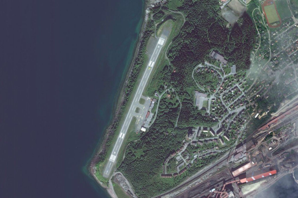
Leg 1
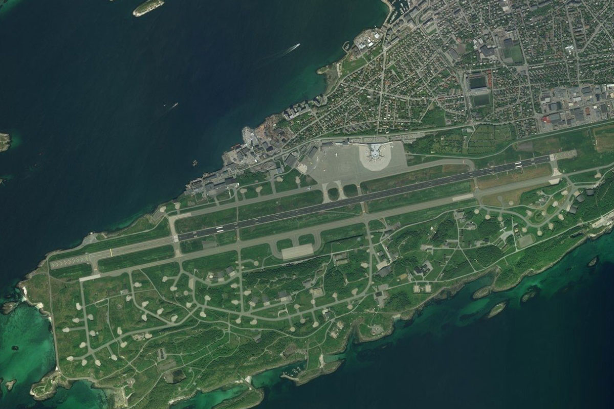
Flying from ENVA
Leg Distance: 26.83 Approximate time at 125kts: 13 minutes.
ENVA(ENVA) to Stjordalselva(POI1)
Distance: 6.92NM Bearing: 83° 3 minutes
After takeoff fly east, following the Stjørdal River along a wide valley
Stjordalselva(POI1) to Stjordalselva(POI2)
Distance: 2NM Bearing: 124° 1 minutes
Where the river meets the smaller Forra River, it will turn southeast through a narrow valley
Stjordalselva(POI2) to Stjordalselva(POI3)
Distance: 1.84NM Bearing: 43° 1 minutes
The river will turn northeast briefly before continuing east along the narrow valley
Stjordalselva(POI3) to Stjordalselva(POI4)
Distance: 5.31NM Bearing: 80° 3 minutes
Stay with the river as it heads east before making a sharp left – right kink
Stjordalselva(POI4) to Meraker(POI5)
Distance: 7.44NM Bearing: 108° 4 minutes
The river will turn slightly to the southeast before the valley widens out, passing the town of Krokstad on the way to the town of Meråker
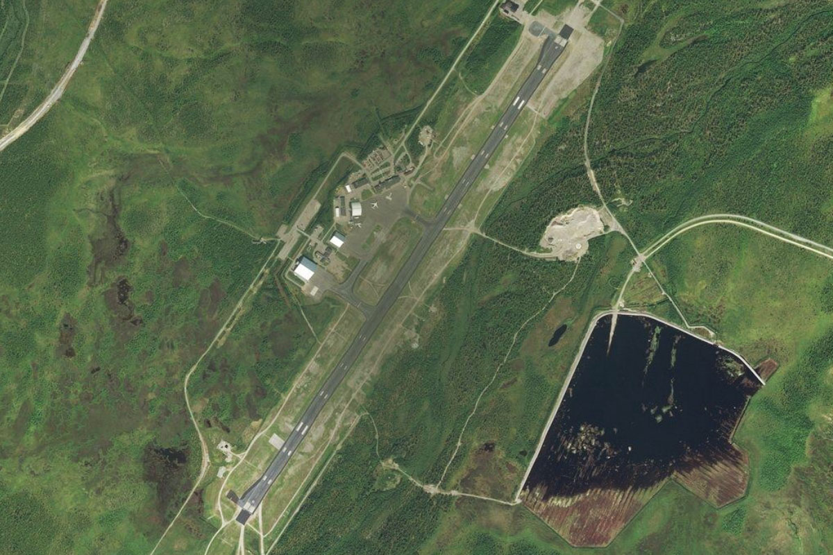
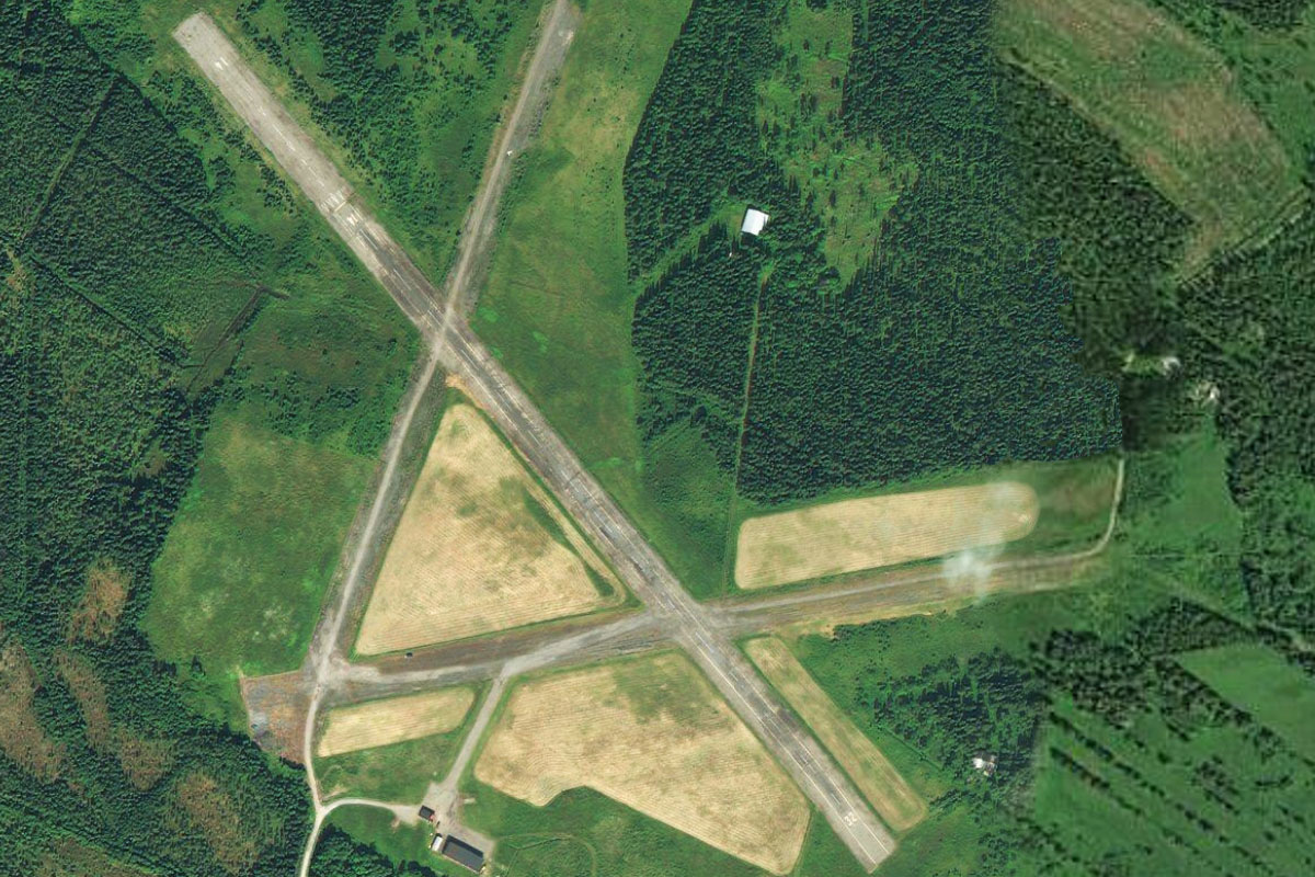
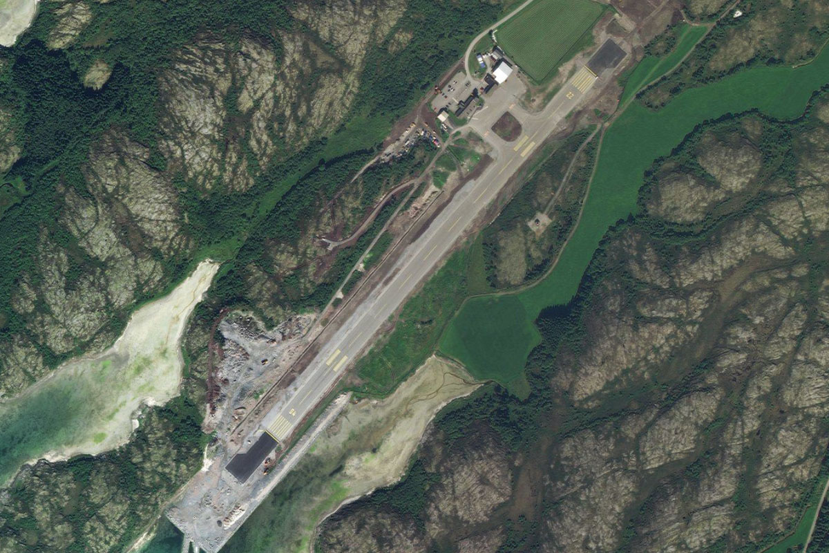
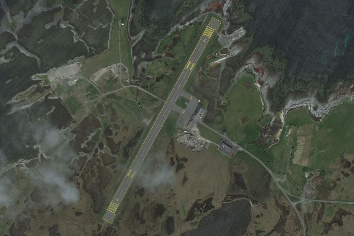
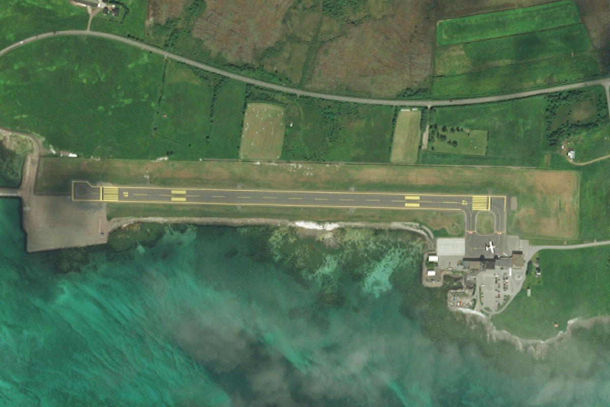
Meraker(POI5) to ENME(ENME)
Distance: 3.32NM Bearing: 140° 2 minutes
As the river continues east from Meraker, follow the smaller valley branching off to the southeast to the small grass airfield
Leg 2
Flying from ENME
Leg Distance: 50.5 Approximate time at 125kts: 24 minutes.
ENME(ENME) to Gronbergdammen(POI6)
Distance: 2.78NM Bearing: 75° 1 minutes
After takeoff, fly east to nearby Grønberg Dam
Gronbergdammen(POI6) to Storlien(POI7)
Distance: 6.13NM Bearing: 121° 3 minutes
Follow the E14 highway southeast along the valley, which will soon open out to a large area of flat land as you head towards the border with Sweden, where the road will cross a small mountain pass
Storlien(POI7) to Rensjon(POI8)
Distance: 5.88NM Bearing: 54° 3 minutes
As you reach the ski resort town of Storlien, turn northeast and fly across the flat land to Rensjön lake, a pair of long lakes divided by a narrow middle section
Rensjon(POI8) to Bodsjon(POI9)
Distance: 9.95NM Bearing: 54° 5 minutes
Continue northeast to Bodsjon lake which has a small island at its center, and is at the western end of a chain of lakes
Bodsjon(POI9) to Tannforsen(POI10)
Distance: 4.89NM Bearing: 85° 2 minutes
Turn east and head along the lakes towards the nearby mountains. Separating two of these lakes is Tannforsen, Sweden's largest waterfall and popular tourist attraction
Tannforsen(POI10) to Areskutan(POI11)
Distance: 6.13NM Bearing: 90° 3 minutes
Continue east as you climb towards the mountain peak of Areskutan
Areskutan(POI11) to Are(POI12)
Distance: 3.12NM Bearing: 139° 1 minutes
As you near the peak, turn southeast and descend to the popular ski resort town of Åre, which lies between the mountain and the river. Enjoy the spectacular view on the way
Are(POI12) to Undersaker(POI13)
Distance: 6.94NM Bearing: 130° 3 minutes
Follow the river southeast
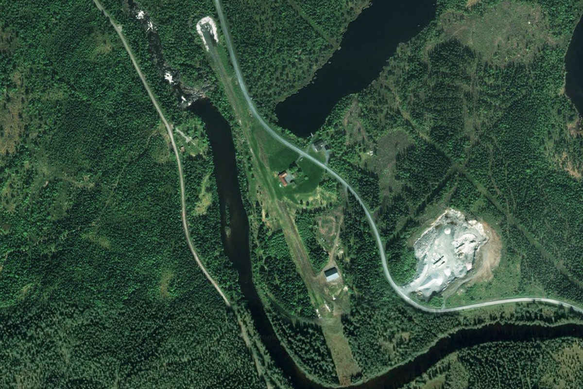
Undersaker(POI13) to ESJA(ESJA)
Distance: 4.68NM Bearing: 69° 2 minutes
The river will curve around to the northeast towards Liten lake. Just before the lake you will see Moland Airfield next to the river
Leg 3
Flying from ESJA
Leg Distance: 30.47 Approximate time at 125kts: 15 minutes.
ESJA(ESJA) to Morsil(POI14)
Distance: 6.19NM Bearing: 96° 3 minutes
Fly along the lake to its eastern end, where it will narrow and lead you to the town of Morsil
Morsil(POI14) to Ockesjon(POI15)
Distance: 4.41NM Bearing: 108° 2 minutes
Follow the waterway southeast, where it will soon widen out into another lake, Ockesjon
Ockesjon(POI15) to Storsjon(POI16)
Distance: 11.65NM Bearing: 89° 6 minutes
Continue east to Storsjon, Sweden's fifth largest lake
Storsjon(POI16) to ESNZ(ESNZ)
Distance: 8.22NM Bearing: 109° 4 minutes
A large island near the eastern edge of the lake is home to Ostersund Airport, which serves the nearby city on the lake's eastern shore
Leg 4
Flying from ESNZ
Leg Distance: 47.2 Approximate time at 125kts: 23 minutes.
ESNZ(ESNZ) to Ostersund(POI17)
Distance: 3.89NM Bearing: 96° 2 minutes
After takeoff, fly east to the nearby city of Östersund, the largest inland city in northern Sweden with over 50,000 people
Ostersund(POI17) to E45(POI18)
Distance: 7.79NM Bearing: 40° 4 minutes
From the city, turn northeast and meet up with highway 45 heading in the same direction to the northern tip of a nearby lake, Mosjon. E45 is the longest road in Sweden
E45(POI18) to E45(POI19)
Distance: 5.76NM Bearing: 353° 3 minutes
Stay with the highway as it heads north and crosses the Indalsälven at the town of Lit. It is one of Sweden's longest rivers
E45(POI19) to E45(POI20)
Distance: 17.59NM Bearing: 44° 8 minutes
Just north of the town, the highway will turn back to the northeast and across the flat countryside, passing between two small lakes on the way to a group of larger ones
E45(POI20) to Hammerdalssjon(POI21)
Distance: 5.45NM Bearing: 349° 3 minutes
As it nears the lakes, the road will once again turn north and cross a large lake, Hammerdalssjön
Hammerdalssjon(POI21) to ESNA(ESNA)
Distance: 6.72NM Bearing: 16° 3 minutes
Keep following the highway as it turns back towards the northeast and heads towards another group of lakes. Just before you reach the lakes, Hallviken Airport will be on the left side of the highway. One runway of this airport is still open but mostly unused
Leg 5
Flying from ESNA
Leg Distance: 65.19 Approximate time at 125kts: 31 minutes.
ESNA(ESNA) to Stromsund(POI22)
Distance: 7.17NM Bearing: 12° 3 minutes
From Hallviken, head north to the nearby town of Strömsund, where the E45 highway crosses Ströms vattudal, a long narrow lake system
Stromsund(POI22) to Stroms vattudal(POI23)
Distance: 21.63NM Bearing: 330° 10 minutes
Follow the narrow lake northwest, where it will eventually branch into two narrow channels
Stroms vattudal(POI23) to Stroms vattudal(POI24)
Distance: 6.92NM Bearing: 321° 3 minutes
Follow the left channel which will continue briefly north before turning northwest around a large hill
Stroms vattudal(POI24) to Stroms vattudal(POI25)
Distance: 5.16NM Bearing: 300° 2 minutes
Keep following the waterway northwest
Stroms vattudal(POI25) to Stroms vattudal(POI26)
Distance: 6.19NM Bearing: 266° 3 minutes
The waterway will turn west and wind its way between some more hills
Stroms vattudal(POI26) to Kalberget(POI27)
Distance: 7.21NM Bearing: 291° 3 minutes
Continue northwest towards the prominent peak, Kalberget
Kalberget(POI27) to Gaddede(POI28)
Distance: 9.78NM Bearing: 298° 5 minutes
From the mountain peak, continue northwest along the waterway to where it narrows at the lakeside town of Gäddede
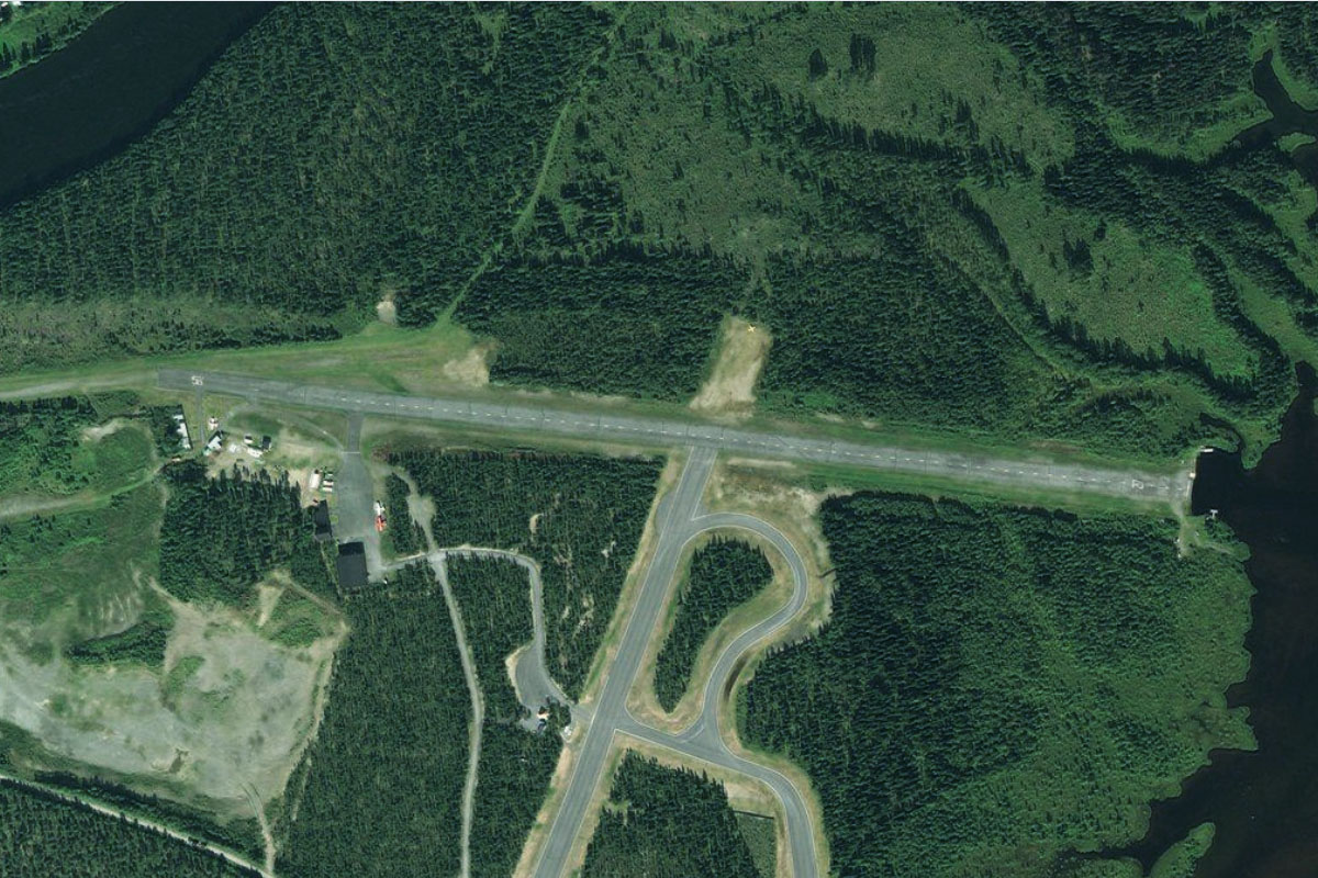
Gaddede(POI28) to SE017(SE017)
Distance: 1.13NM Bearing: 245° 1 minutes
As you approach the town, look to the left for Frostlanda Airfield, a small airstrip cut into the forest on the side of a nearby hill
Leg 6
Flying from SE017
Leg Distance: 48.3 Approximate time at 125kts: 23 minutes.
SE017(SE017) to Kvesjoen(POI29)
Distance: 9.79NM Bearing: 270° 5 minutes
After takeoff, fly west along the length of two adjoining lakes, Murusjøen and Kvesjøen, which will take you back into Norway
Kvesjoen(POI29) to Laksjoen(POI30)
Distance: 4.59NM Bearing: 229° 2 minutes
When you reach the western tip of the lake, fly southwest over the hills to another large lake, Laksjøen
Laksjoen(POI30) to Otersjoen(POI31)
Distance: 8.27NM Bearing: 277° 4 minutes
From Laksjøen, follow a chain of smaller lakes west
Otersjoen(POI31) to Sanddola(POI32)
Distance: 3.6NM Bearing: 269° 2 minutes
From the western end of the lake, follow the Sanddøla river west into a narrow valley and follow it west
Sanddola(POI32) to Sanddola(POI33)
Distance: 5.02NM Bearing: 241° 2 minutes
Keep following the river valley as it curves around to the southwest. The area here is part of the Sanddøldalen Nature Reserve
Sanddola(POI33) to Sanddola(POI34)
Distance: 10.83NM Bearing: 258° 5 minutes
Stay with the river as it continues west
Sanddola(POI34) to Sanddola(POI35)
Distance: 5.37NM Bearing: 225° 3 minutes
The river will turn back to the southwest towards its junction with the Luru River
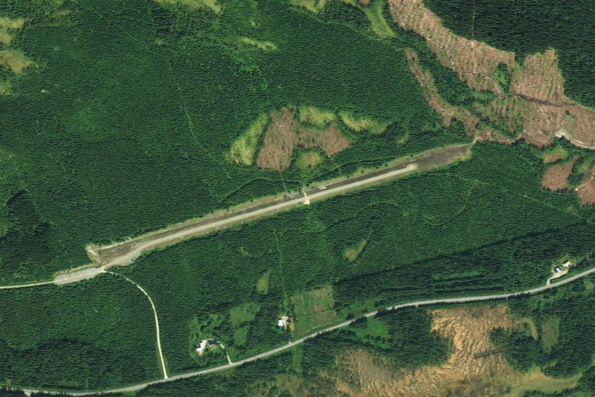
Sanddola(POI35) to ENGR(ENGR)
Distance: 0.83NM Bearing: 268° 0 minutes
Just to the west of the river junction and road bridge is the small grass strip of Grong Airfield
Leg 7
Flying from ENGR
Leg Distance: 23.55 Approximate time at 125kts: 11 minutes.
ENGR(ENGR) to Grong(POI36)
Distance: 3.98NM Bearing: 344° 2 minutes
After takeoff, fly north with the river as it meanders along the valley towards to town of Grong, where it will meet the Namsen River
Grong(POI36) to Namsen(POI37)
Distance: 7.33NM Bearing: 267° 4 minutes
Turn west with the river and follow it across the landscape as it passes to the south of a mountain
Namsen(POI37) to Namsen(POI38)
Distance: 3.73NM Bearing: 244° 2 minutes
As the river turns north around another large hill, continue southwest to meet it on the other side
Namsen(POI38) to Namsen(POI39)
Distance: 6.95NM Bearing: 280° 3 minutes
Stay with the river as it continues west before turning northwest along the beautiful Namdalen Valley
Namsen(POI39) to ENNM(ENNM)
Distance: 1.56NM Bearing: 254° 1 minutes
As the river turns west the valley will open out to the town of Namsos, where you will see the airport near the eastern end of the town
Leg 8
Flying from ENNM
Leg Distance: 31.92 Approximate time at 125kts: 15 minutes.
ENNM(ENNM) to Namsenfjorden(POI40)
Distance: 3.88NM Bearing: 243° 2 minutes
Fly west along the waterway past the town of Namsen
Namsenfjorden(POI40) to Lokkaren(POI41)
Distance: 4.72NM Bearing: 359° 2 minutes
As you pass the mountain to your right, follow the shore around to the north and fly along the narrow channel
Lokkaren(POI41) to Surviksundet(POI42)
Distance: 3.58NM Bearing: 297° 2 minutes
When you reach the open body of water at the northern end of the channel, turn northwest and fly along another narrow channel
Surviksundet(POI42) to Foldafjorden(POI43)
Distance: 7.35NM Bearing: 1° 4 minutes
As the channel opens out to another larger waterway, turn north and follow another channel, which will eventually pass between two mountainous headlands
Foldafjorden(POI43) to Hundhammerfjellet(POI44)
Distance: 4.55NM Bearing: 359° 2 minutes
Continue north across the Folda fjord to the long, narrow peninsula. A wind farm sits atop the hills running along the peninsula
Hundhammerfjellet(POI44) to Stor-Arnoya(POI45)
Distance: 3.75NM Bearing: 302° 2 minutes
From the wind farm, fly northwest over a group of many small islands
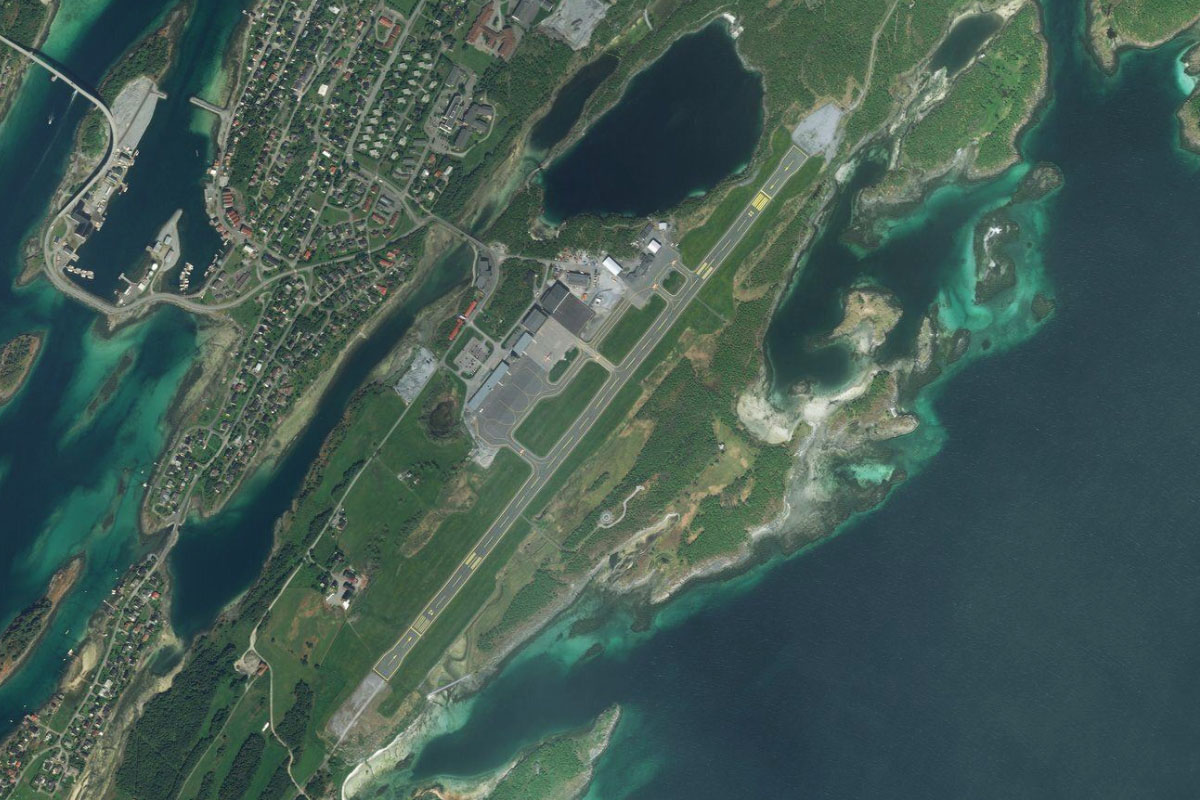
Stor-Arnoya(POI45) to ENRM(ENRM)
Distance: 4.09NM Bearing: 304° 2 minutes
Continue northwest over a larger hilly island to Rorvik Airport on the large island of Inner Vikna
Leg 9
Flying from ENRM
Leg Distance: 48.39 Approximate time at 125kts: 23 minutes.
ENRM(ENRM) to Rorvik(POI46)
Distance: 2.76NM Bearing: 53° 1 minutes
Fly northeast to the nearby port town of Rørvik. Two bridges, the Nærøysund Bridge and Marøysund Bridge, connect the town with the mainland
Rorvik(POI46) to Kvingla(POI47)
Distance: 7.34NM Bearing: 45° 4 minutes
Continue northeast across the channel and follow the coastline of the Kvingla peninsula northeast. This mountainous peninsula is technically an island after a canal was built in the southeast
Kvingla(POI47) to Leka(POI48)
Distance: 9.1NM Bearing: 19° 4 minutes
When you pass the northwestern tip of the peninsula, head north towards the island of Leka. The mountain peak of Vattind dominates the center of the island
Leka(POI48) to Skeisneset(POI49)
Distance: 5.16NM Bearing: 54° 2 minutes
Fly to the northeastern tip of the island. This flat area is part of the Skeisneset nature reserve
Skeisneset(POI49) to Kvaloya(POI50)
Distance: 7.93NM Bearing: 34° 4 minutes
Head northeast across the mouth of Røingen fjord to the island of Kvaløya, one of many islands of the same name in Norway. The peak of Kvaløyfjellet is near the center of the island
Kvaloya(POI50) to Hellbergsoya(POI51)
Distance: 7.34NM Bearing: 358° 4 minutes
Fly north over the open water to a group of uninhabited long narrow islands
Hellbergsoya(POI51) to Torghatten(POI52)
Distance: 3.84NM Bearing: 23° 2 minutes
Turn and head northeast towards the prominent peak of Torghatten on the island of Torget. The mountain is well known for its hole through the center, which is a naturally formed tunnel
Torghatten(POI52) to ENBN(ENBN)
Distance: 4.92NM Bearing: 34° 2 minutes
From Torghatten, you should see Brønnøy airport to the northeast, which serves the town of Brønnøysund
Leg 10
Flying from ENBN
Leg Distance: 32.18 Approximate time at 125kts: 15 minutes.
ENBN(ENBN) to Sjovollen(POI53)
Distance: 7.85NM Bearing: 7° 4 minutes
Fly north over the town of Brønnøysund, then past the mountain peak of Mosaksla on the way to the northern tip of the peninsula
Sjovollen(POI53) to Vevelstadsundet(POI54)
Distance: 9.5NM Bearing: 21° 5 minutes
Turning slightly northeast, fly along the narrow channel between the island of Hamnøya and the mainland
Vevelstadsundet(POI54) to Rodoya(POI55)
Distance: 5.78NM Bearing: 14° 3 minutes
Fly north to the nearby island of Rødøya. A mountain runs along the north of the island
Rodoya(POI55) to Alsten(POI56)
Distance: 5.84NM Bearing: 329° 3 minutes
Turn and fly northwest over a group of flat islands to the island of Alsten, and the southern end of a mountain range called the Seven Sisters – a line of mountain peaks roughly 1000 meters in height
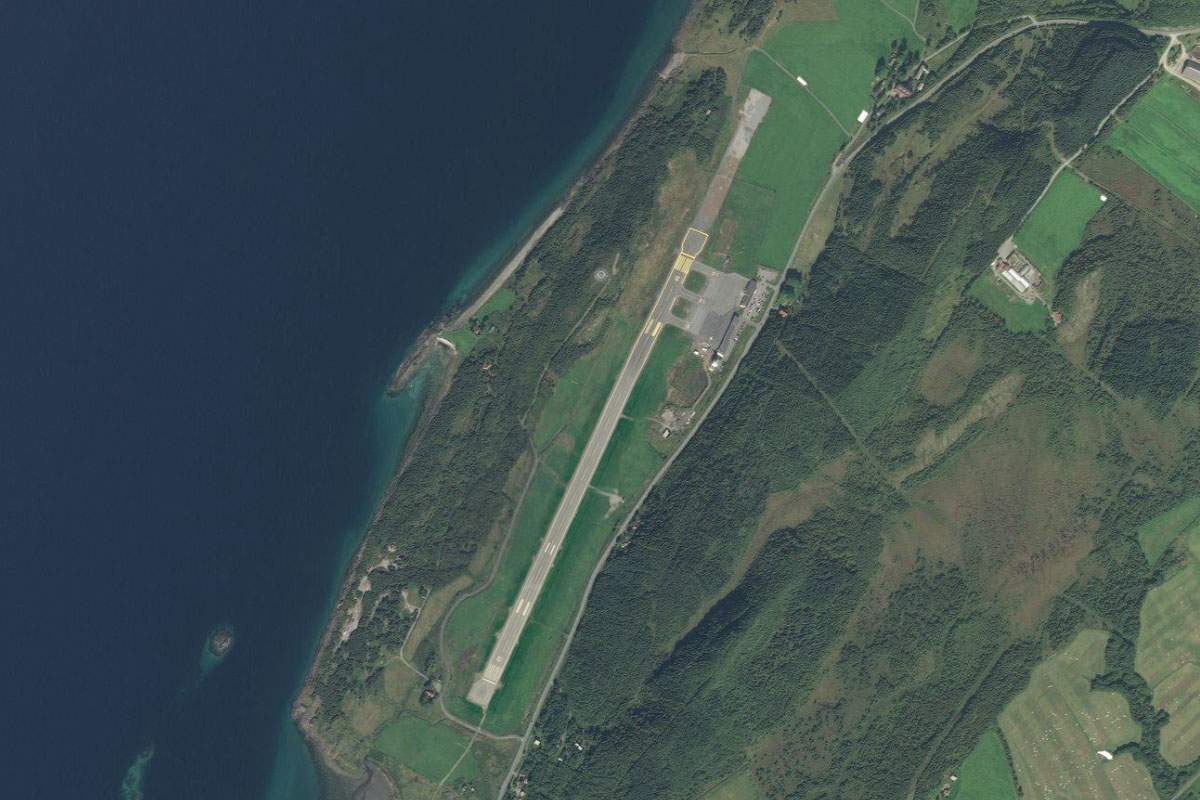
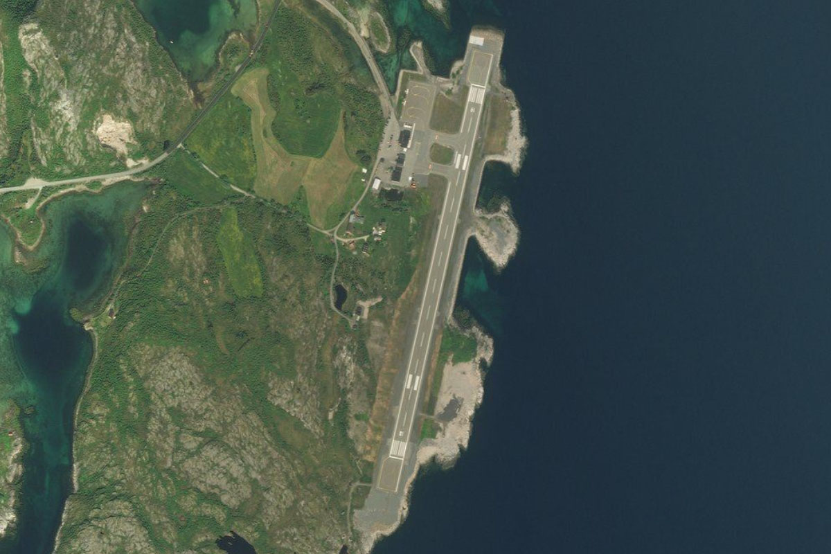
Alsten(POI56) to ENST(ENST)
Distance: 3.21NM Bearing: 2° 2 minutes
Head north to Stokka Airport on the west coast of the island
Leg 11
Flying from ENST
Leg Distance: 53.85 Approximate time at 125kts: 26 minutes.
ENST(ENST) to Sandnessjoen(POI57)
Distance: 6.19NM Bearing: 44° 3 minutes
Fly northeast along the length of the island to the town of Sandnessjøen. Just to the east of the town is the Helgeland Bridge, which links the island to the mainland
Sandnessjoen(POI57) to Reinesfjellet(POI58)
Distance: 2.42NM Bearing: 4° 1 minutes
After passing the town, fly north across the water to the western tip of a mainland peninsula which features the mountain ridge and peak of Reinesfjellet
Reinesfjellet(POI58) to Ytre Lavong(POI59)
Distance: 10.16NM Bearing: 51° 5 minutes
Follow the mountain range northeast along the peninsula's northern coast
Ytre Lavong(POI59) to Ranfjorden(POI60)
Distance: 8.68NM Bearing: 51° 4 minutes
After passing the mountain range, continue northeast along Ranfjord
Ranfjorden(POI60) to Hemnesberget(POI61)
Distance: 7.24NM Bearing: 82° 3 minutes
From a small island in the center of the fjord, continue east towards a narrow section of the fjord
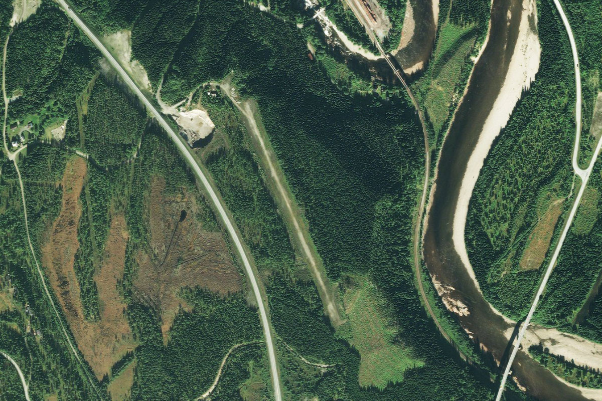
Hemnesberget(POI61) to Mo i Rana(POI62)
Distance: 13.33NM Bearing: 62° 6 minutes
Turning northeast, the fjord will widen as it leads you to the city of Mo i Rana at its eastern end. The city has one of Norway's largest industrial parks
Mo i Rana(POI62) to Ranelva(POI63)
Distance: 4.26NM Bearing: 62° 2 minutes
Continue northeast past over the town along the river Ranelva
Ranelva(POI63) to ENRA(ENRA)
Distance: 1.57NM Bearing: 336° 1 minutes
The river will curve around the mountain that overlooks the city and lead you north to Rossvoll Airport
Leg 12
Flying from ENRA
Leg Distance: 67.48 Approximate time at 125kts: 32 minutes.
ENRA(ENRA) to Rovassaga(POI64)
Distance: 3.61NM Bearing: 325° 2 minutes
After takeoff, fly northwest past the eastern end of Langvatnet lake, then follow the Rovassaga river north into a valley
Rovassaga(POI64) to Rovassaga river(POI65)
Distance: 1.88NM Bearing: 22° 1 minutes
Follow the river briefly northeast, where it will meet another river. The many rivers in this area are used for hydroelectric power
Rovassaga river(POI65) to Svartisvatnet(POI66)
Distance: 5.06NM Bearing: 306° 2 minutes
At the river junction, turn north as you gain altitude and follow the river as it curves and climbs northwest to a narrow lake
Svartisvatnet(POI66) to Storglomvatnet(POI67)
Distance: 11.92NM Bearing: 359° 6 minutes
From the western tip of the lake, fly north over the eastern half of the Svartisen glacier which, combined with the western half, is Norway's second largest glacier. North of the glacier is the horseshoe shaped Storglom lake. The glacier also marks the crossing point of the Arctic Circle
Storglomvatnet(POI67) to Storglomvatnet(POI68)
Distance: 4.68NM Bearing: 353° 2 minutes
Continue to the northern tip of the lake
Storglomvatnet(POI68) to Arstadvatnet(POI69)
Distance: 5.98NM Bearing: 40° 3 minutes
Follow a chain of smaller lakes northeast to the picturesque Arstad lake, at the foot of Simlebreen glacier
Arstadvatnet(POI69) to Arstaddalsdammen(POI70)
Distance: 5.72NM Bearing: 359° 3 minutes
Fly north along a narrow valley, past another long narrow lake
Arstaddalsdammen(POI70) to Sintind(POI71)
Distance: 4.42NM Bearing: 13° 2 minutes
After passing the dam at the northern end of the lake, follow the river valley northeast towards the prominent mountain peak, Sintind
Sintind(POI71) to Beiarelva(POI72)
Distance: 2.44NM Bearing: 70° 1 minutes
At the base of the peak, the river will head east to meet the Beiar river
Beiarelva(POI72) to Beiarfjorden(POI73)
Distance: 2.54NM Bearing: 7° 1 minutes
Follow the river north to the Beiar fjord
Beiarfjorden(POI73) to Nordfjorden(POI74)
Distance: 7.63NM Bearing: 273° 4 minutes
Follow the fjord as it curves around to the west and along some narrow sections before meeting the larger Nordfjorden
Nordfjorden(POI74) to Saltfjorden(POI75)
Distance: 7.61NM Bearing: 2° 4 minutes
Follow Nordfjorden north until you reach the wide open waters of Saltfjorden
Saltfjorden(POI75) to ENBO(ENBO)
Distance: 3.99NM Bearing: 9° 2 minutes
Fly north across the fjord to Bodø Airport, which runs along the southern end of the city
Leg 13
Flying from ENBO
Leg Distance: 61.53 Approximate time at 125kts: 30 minutes.
ENBO(ENBO) to Landegode(POI76)
Distance: 8.28NM Bearing: 344° 4 minutes
Fly north to the mountainous island of Landegode. The tallest point on the island is Rypdalstinden. Head for the valley between the island's tallest peaks for some extra sightseeing
Landegode(POI76) to Helligvaer(POI77)
Distance: 9.24NM Bearing: 266° 4 minutes
Fly west to the Helligvær island group. There are over 300 flat, treeless islands in the group, with 5 of them inhabited
Helligvaer(POI77) to Vedoya(POI78)
Distance: 40.69NM Bearing: 268° 20 minutes
Turn west and head across Vestfjorden, where you will eventually see two small mountainous islands in the far distance. These islands and many smaller ones nearby are home to over a million seabirds
Vedoya(POI78) to ENRS(ENRS)
Distance: 3.32NM Bearing: 334° 2 minutes
As you approach the islands you will see the flat island of Røst to their north, where most of the local population live and is home to a thriving fishing community. Much of the island is covered with fish drying racks. The airport is in the north of the island
Leg 14
Flying from ENRS
Leg Distance: 55.47 Approximate time at 125kts: 27 minutes.
ENRS(ENRS) to Vaeroy(POI79)
Distance: 12.9NM Bearing: 51° 6 minutes
After takeoff, fly northeast to the island of Værøy, which will be the start of your journey along the Lofoten islands – one of Norway's most popular tourist destinations
Vaeroy(POI79) to Vaeroy(POI80)
Distance: 4.52NM Bearing: 39° 2 minutes
Crossing over the saddle between the two mountain peaks at the southern end of the island will give a great view of the island's main bay, part of Måstadfjellet Nature Reserve. Continue northeast to the northern end of the island.
Vaeroy(POI80) to Mosken(POI81)
Distance: 3.22NM Bearing: 6° 2 minutes
Head north to the small mountainous island of Mosken
Mosken(POI81) to Moskenesoya(POI82)
Distance: 5.14NM Bearing: 10° 2 minutes
Continue north to the southern tip of Moskenesøya, the first of the major islands that make up the archipelago. This stretch of water is home to Moskstraumen, a system of tidal eddies and whirlpools, one of the strongest in the world. It is also known as the Lofoten Maelstrom
Moskenesoya(POI82) to A(POI83)
Distance: 5.28NM Bearing: 43° 3 minutes
Fly northeast along the eastern side of the island to the town of Å, which marks the southern end of Highway E10
A(POI83) to Forsfjorden(POI84)
Distance: 3.77NM Bearing: 347° 2 minutes
After you pass the town, turn north and follow a chain of lakes as you climb along a valley to reach Forsfjorden
Forsfjorden(POI84) to Kjerkfjorden(POI85)
Distance: 1.36NM Bearing: 55° 1 minutes
Follow the fjord around to the northeast, where it will meet Kjerkfjorden
Kjerkfjorden(POI85) to Kirkefjord(POI86)
Distance: 2.13NM Bearing: 338° 1 minutes
Turn left and fly north along the fjord to its end at the town of Kirkefjord
Kirkefjord(POI86) to Selfjorden(POI87)
Distance: 2.45NM Bearing: 36° 1 minutes
Before you reach the town, fly northeast through the gap in the mountains, then continue northeast through another gap to reach Selfjorden
Selfjorden(POI87) to Ramberg(POI88)
Distance: 5.69NM Bearing: 28° 3 minutes
Fly northeast along the fjord to its northern end near the large sandy beach at the town of Ramberg
Ramberg(POI88) to Napp(POI89)
Distance: 5.09NM Bearing: 59° 2 minutes
As you follow the headland around to the northeast, you will see another gap through the mountains ahead which will take you to Nappstraumen, the channel between Moskenesøya and the next island, Vestvågøya
Napp(POI89) to ENLK(ENLK)
Distance: 3.92NM Bearing: 65° 2 minutes
Continue northeast to the town of Leknes, one of the main towns on Lofoten. The airport is on the western edge of the town
Leg 15
Flying from ENLK
Leg Distance: 36.27 Approximate time at 125kts: 17 minutes.
ENLK(ENLK) to Middagstinden(POI90)
Distance: 13.5NM Bearing: 23° 6 minutes
After takeoff, fly northeast (runway heading) along the wide valley until you reach the coastline. The peak of Middagstinden sits at the northern point of the island. Climbing to the height of the peak will give you a great overview of the surrounding scenery
Middagstinden(POI90) to Hoven(POI91)
Distance: 4.47NM Bearing: 96° 2 minutes
Turn east around the mountain and head for the smaller peak of Hoven, sitting alone on the northern part of the island of Gimsøya
Hoven(POI91) to Sundklakkbrua(POI92)
Distance: 3.81NM Bearing: 156° 2 minutes
From the peak, turn southeast and head for the narrow channel between the islands of Gimsøya and Vestvågøya. The small bridge crossing here is one of many along the highway that joins the islands
Sundklakkbrua(POI92) to Lyngvaer(POI93)
Distance: 2.89NM Bearing: 157° 1 minutes
Continue south across the water to a group of flat islands next to the western shore of the largest of the Lofoten islands, Austvågøya
Lyngvaer(POI93) to Rorvikstranda(POI94)
Distance: 1.41NM Bearing: 132° 1 minutes
Just past the islands, enter the small bay to the east. A small beach and camping area is at the end of the bay
Rorvikstranda(POI94) to Kabelvag(POI95)
Distance: 5.66NM Bearing: 79° 3 minutes
Fly east along the valley and follow the highway all the way to the town of Kabelvåg on the south coast of the island
Kabelvag(POI95) to ENSH(ENSH)
Distance: 4.53NM Bearing: 55° 2 minutes
Follow the coast northeast past the main town on the island, Svolvær, to the town's airport a few miles further northeast
Leg 16
Flying from ENSH
Leg Distance: 23.98 Approximate time at 125kts: 12 minutes.
ENSH(ENSH) to Austnesfjorden(POI96)
Distance: 6.71NM Bearing: 4° 3 minutes
After takeoff, fly north along Austnes fjord. Highway E10 runs along the fjord's western shore
Austnesfjorden(POI96) to Higravfjorden(POI97)
Distance: 3.79NM Bearing: 38° 2 minutes
When you reach the northern end of the fjord, turn northeast and fly along a valley and another fjord, Higrav
Higravfjorden(POI97) to Hadselfjorden(POI98)
Distance: 3NM Bearing: 354° 1 minutes
The fjord will meet Slover fjord and run north to meet the more open waters of Hadsel fjord
Hadselfjorden(POI98) to Melbu(POI99)
Distance: 3.48NM Bearing: 334° 2 minutes
Fly north across the fjord to the town of Melbu on the island of Hadseløya
Melbu(POI99) to Stokmarknes(POIA0)
Distance: 4.57NM Bearing: 24° 2 minutes
Fly northeast over the hills to the town of Stokmarknes on the north shore of the island
Stokmarknes(POIA0) to ENSK(ENSK)
Distance: 2.43NM Bearing: 61° 1 minutes
Just across the water, northeast from Stokmarknes, is Skagen airport
Leg 17
Flying from ENSK
Leg Distance: 51.69 Approximate time at 125kts: 25 minutes.
ENSK(ENSK) to Sortland(POIA1)
Distance: 10.9NM Bearing: 42° 5 minutes
Fly northeast along the shore of the island until you reach the large town of Sortland
Sortland(POIA1) to Gavlfjorden(POIA2)
Distance: 8.94NM Bearing: 346° 4 minutes
Continue north along the shore, then across the bay to a small hilly headland further north
Gavlfjorden(POIA2) to Skjoldehamn(POIA3)
Distance: 2.99NM Bearing: 43° 1 minutes
Fly northeast across the fjord to reach the southern tip of the island of Andøya, the 10th largest island in Norway
Skjoldehamn(POIA3) to Tranesvagen(POIA4)
Distance: 6.98NM Bearing: 14° 3 minutes
Fly north along the east coast of the island until you reach the entrance to Tranesvågen cove
Tranesvagen(POIA4) to Andoya(POIA5)
Distance: 10.33NM Bearing: 23° 5 minutes
Gain enough altitude to cross the mountains as you fly northeast along the center of the island
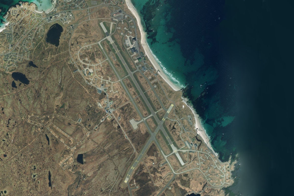
Andoya(POIA5) to ENAN(ENAN)
Distance: 11.55NM Bearing: 22° 6 minutes
As the mountains give way to the flat bog land that makes up much of the island, continue northeast to Andoya airport at the northern tip of the island
Leg 18
Flying from ENAN
Leg Distance: 72.42 Approximate time at 125kts: 35 minutes.
ENAN(ENAN) to Orja(POIA6)
Distance: 13.82NM Bearing: 87° 7 minutes
After takeoff, fly east across Andfjorden to the small island of Orja on the way to Norway's second largest island, Senja
Orja(POIA6) to Manestind(POIA7)
Distance: 6.6NM Bearing: 9° 3 minutes
When you reach the island, fly north to the pyramid like mountain of Månestind, sitting at the western tip of one of Senja island's many mountainous peninsulas
Manestind(POIA7) to Bergsoyan(POIA8)
Distance: 6.93NM Bearing: 41° 3 minutes
Head northeast over another peninsula to a group of small, low lying Bergsøyan islands, whose crystal clear waters make for a popular paddleboard destination
Bergsoyan(POIA8) to Edoya(POIA9)
Distance: 19.19NM Bearing: 47° 9 minutes
Continue northeast over another 4 mountainous peninsulas to the relatively flat island of Edoya at the mouth of Malangen fjord
Edoya(POIA9) to Haja(POIAA)
Distance: 8.01NM Bearing: 15° 4 minutes
Turn north and head to the lone mountain island of Haja
Haja(POIAA) to Ersfjord(POIAB)
Distance: 11.75NM Bearing: 92° 6 minutes
Turn east and fly along the length of Ersfjord
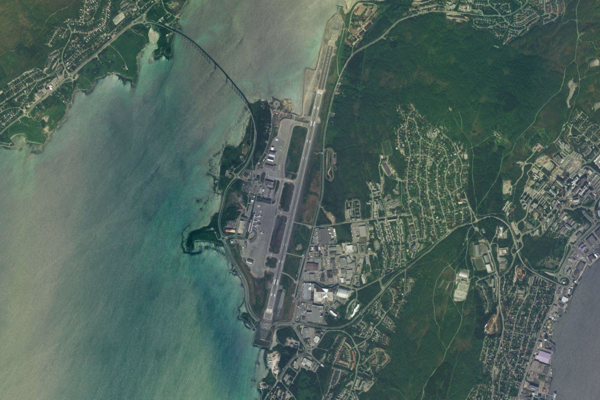
Ersfjord(POIAB) to ENTC(ENTC)
Distance: 6.12NM Bearing: 87° 3 minutes
Continue east to Tromsø airport, which is on the island of Tromsøya also housing the city of Tromsø
Leg 19
Flying from ENTC
Leg Distance: 42.2 Approximate time at 125kts: 20 minutes.
ENTC(ENTC) to Tromso(POIAC)
Distance: 2.07NM Bearing: 138° 1 minutes
Head to the city of Tromsø, southeast from the airport. It is the third largest city in the world north of the Arctic Circle and has a relatively warm climate considering its high latitude. The Tromsø bridge connects the city to the mainland, pointing you towards the Arctic Cathedral, one of the city's main landmarks
Tromso(POIAC) to Balsfjorden(POIAD)
Distance: 10.63NM Bearing: 174° 5 minutes
From the city, follow Balsfjorden south
Balsfjorden(POIAD) to Balsfjorden(POIAE)
Distance: 4.57NM Bearing: 143° 2 minutes
Keep following the fjord southeast through a couple of narrower points
Balsfjorden(POIAE) to Malangen(POIAF)
Distance: 6.3NM Bearing: 212° 3 minutes
Look for a low valley to the southwest and follow the highway heading through it, leading you to one of the southern arms of the Malangen fjord
Malangen(POIAF) to Malselva(POIAG)
Distance: 10.54NM Bearing: 207° 5 minutes
Continue southwest past the mountain peak of Marfjellet until you reach the river Målselva
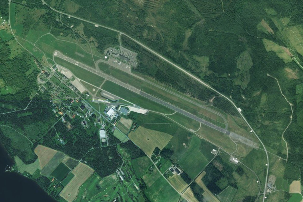
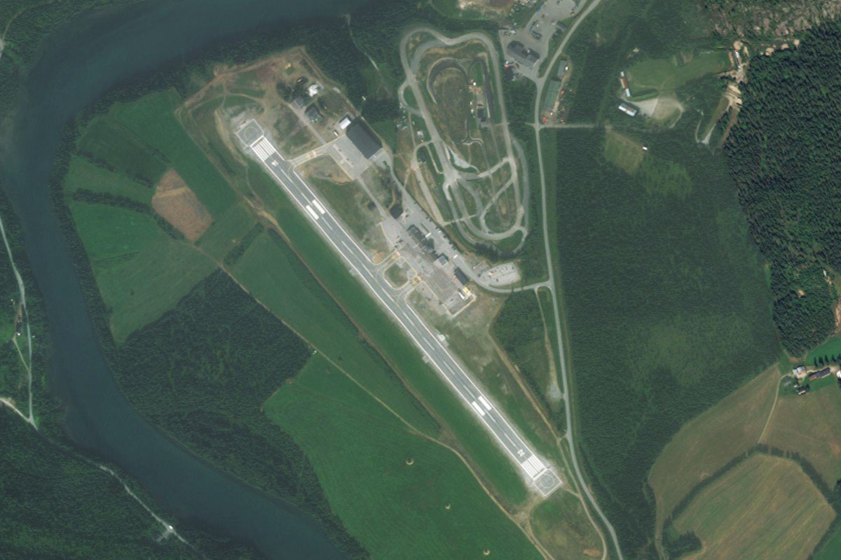
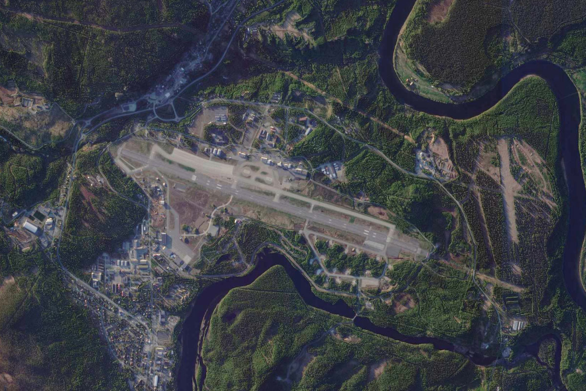
Malselva(POIAG) to ENDU(ENDU)
Distance: 8.09NM Bearing: 166° 4 minutes
The river will lead you south to Bardufoss Airport, which is also home to the Royal Norwegian Air Force's Bardufoss Air Station
Leg 20
Flying from ENDU
Leg Distance: 48.71 Approximate time at 125kts: 23 minutes.
ENDU(ENDU) to Barduelva(POIAH)
Distance: 4.41NM Bearing: 175° 2 minutes
After takeoff, fly south to enter a nearby river valley
Barduelva(POIAH) to Setermoen(POIAI)
Distance: 7.93NM Bearing: 196° 4 minutes
Follow the valley south to the town of Sertermoen at its southern end
Setermoen(POIAI) to Salangselva(POIAJ)
Distance: 4.71NM Bearing: 224° 2 minutes
From Setermoen, fly southwest to another river valley
Salangselva(POIAJ) to Salangselva(POIAK)
Distance: 7.57NM Bearing: 184° 4 minutes
Follow the river and E6 highway south along the valley
Salangselva(POIAK) to Gratangsbotn(POIAL)
Distance: 8.76NM Bearing: 247° 4 minutes
At a valley junction, the river will head southeast and the highway southwest. Follow the highway southwest between the mountain peaks of Spanstinden and Hogtinden on the way to the small town of Gratangsbotn at the end of Gratangen fjord
Gratangsbotn(POIAL) to Bjerkvik(POIAM)
Distance: 7.51NM Bearing: 195° 4 minutes
As you near the town, head south along another valley, where highway E6 will descend to the town of Bjerkvik, at the end of Herjangsfjorden
Bjerkvik(POIAM) to ENNK(ENNK)
Distance: 7.82NM Bearing: 200° 4 minutes
Continue south to the town of Narvik, on the shore of Ofotfjorden. The airport is at the western end of the peninsula on which the town sits
Leg 21
Flying from ENNK
Leg Distance: 84.23 Approximate time at 125kts: 40 minutes.
ENNK(ENNK) to Rombaken(POIAN)
Distance: 2.66NM Bearing: 49° 1 minutes
Fly northeast from Narvik to enter the Rombaken fjord
Rombaken(POIAN) to Rombaken(POIAO)
Distance: 9.6NM Bearing: 96° 5 minutes
Fly to the eastern end of the fjord, which will narrow towards its eastern end
Rombaken(POIAO) to Gatterjavri(POIAP)
Distance: 4.63NM Bearing: 99° 2 minutes
Continue east, climbing out of the valley towards the lake of Gátterjávri, on the Norway-Sweden border
Gatterjavri(POIAP) to Vassejavri(POIAQ)
Distance: 2.93NM Bearing: 23° 1 minutes
Fly northeast to the nearby lake, Vássejávri. This is also the home to the Riksgränsen ski resort
Vassejavri(POIAQ) to Tornetrask(POIAR)
Distance: 10.52NM Bearing: 78° 5 minutes
Follow the E10 highway east to Torneträsk, the sixth largest lake in Sweden
Tornetrask(POIAR) to Abisko(POIAS)
Distance: 6.42NM Bearing: 133° 3 minutes
Follow the highway briefly southeast along the edge of the lake to the town of Abisko
Abisko(POIAS) to Lapporten(POIAT)
Distance: 6.51NM Bearing: 134° 3 minutes
From Abisko, continue southeast to the U-shaped valley known as Lapporten, or the Lapp Gate. The valley is known for its spectacular view of the countryside beyond
Lapporten(POIAT) to Rautasjaure(POIAU)
Distance: 10.18NM Bearing: 137° 5 minutes
Continue southeast over the rolling countryside until you reach Rautasjaure, a long narrow lake heading southeast
Rautasjaure(POIAU) to Rautasalven(POIAV)
Distance: 11.88NM Bearing: 113° 6 minutes
Follow the lake and its subsequent river southeast until you exit the last valley to the flat land beyond
Rautasalven(POIAV) to E10(POIAW)
Distance: 6.94NM Bearing: 101° 3 minutes
Continue heading southeast until you meet highway E10, also running southeast
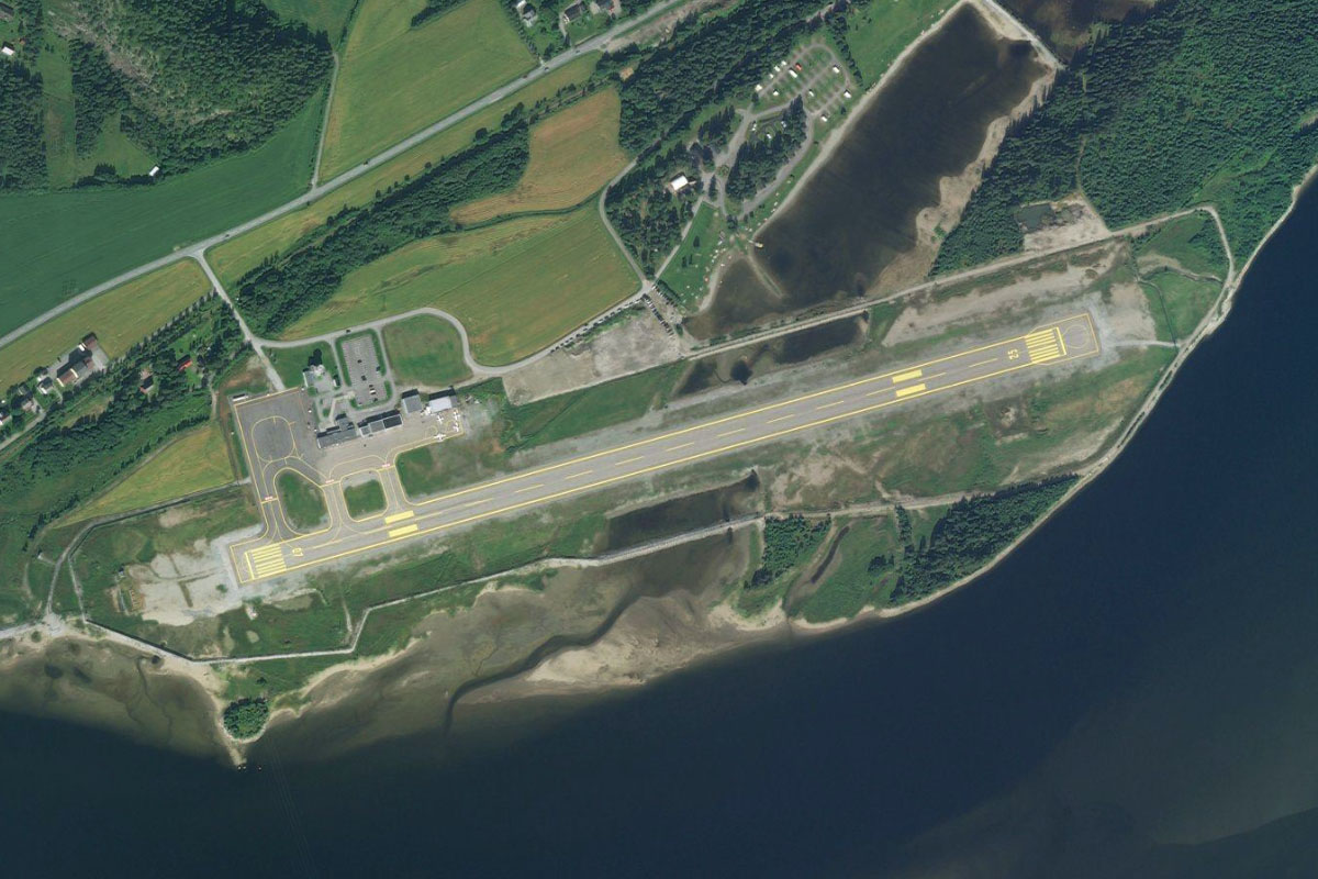
E10(POIAW) to ESNQ(ESNQ)
Distance: 11.96NM Bearing: 125° 6 minutes
Follow the highway to Kiruna, the northernmost city in Sweden. This iron-ore mining town is home to over 20,000 people, and its most famous landmark is the Kiruna Church – one of Sweden's largest wooden buildings. The airport southeast from the town is the destination for this stage of the journey