Welcome to a captivating journey through the historic landscapes of Western Russia and the enchanting allure of Finland. The stage begins in the northern jewel of Arkhangelsk, a city steeped in centuries of maritime history and cultural richness. From here, the first leg takes you southwest, traversing the vast landscapes that cradle Lake Onega. This immense body of water, framed by forests and scattered islets, sets the stage for a tranquil voyage as you make your way to Saint Petersburg. Known as the ‘Venice of the North,’ Saint Petersburg beckons with its imperial splendor, a city adorned with palaces, canals, and a cultural legacy that resonates across time. Continuing south, skirting the shores of Lake Ladoga – Europe’s largest freshwater lake, the vistas here are expansive, and the cultural history runs deep. Crossing into Finland, the second part of the stage unfolds amidst the vibrant cities and serene lakes of this Nordic gem. Jyväskylä, surrounded by a labyrinth of lakes, is a blend of modernity and tradition. Tampere, a city of innovation, straddles the Tammerkoski Rapids, offering a glimpse into Finland’s industrial heritage.Turku, a city with a maritime spirit, invites you to explore its archipelago and historic castle before you conclude your journey in the Finnish capital, Helsinki. The ‘Daughter of the Baltic,’ Helsinki is a harmonious blend of neoclassical architecture, modern design, and a thriving cultural scene
Total Legs: 22 Total Distance: 1205 Total Time(125kts): 9 hours 38 minutes
Leg 1
Flying from ULAA
Leg Distance: 73.69 Approximate time at 125kts: 35 minutes.
ULAA(ULAA) to Northern Dvina River(POI1)
Distance: 7.78NM Bearing: 169° 4 minutes
After takeoff, fly south to the Northern Dvina River
Northern Dvina River(POI1) to Northern Railway(POI2)
Distance: 8.5NM Bearing: 169° 4 minutes
Continuing south, you will see Novodvinsk Airport on the north side of a small lake as you reach a railway line also heading south
Northern Railway(POI2) to Lomovoe(POI3)
Distance: 19.29NM Bearing: 160° 9 minutes
Follow the railway south. It will soon be joined by a power line clearing also heading south. After passing the small town of Tundra, you will soon reach the larger town of Lomovoe
Lomovoe(POI3) to Kholmogorskaya(POI4)
Distance: 11.91NM Bearing: 164° 6 minutes
Continuing south along the railway, the next town you will reach is Kholmogorskaya, with the power line clearing running past the eastern side of the town
Kholmogorskaya(POI4) to Samoded(POI5)
Distance: 12.34NM Bearing: 181° 6 minutes
Keep following the railway south to the next town, Samoded
Samoded(POI5) to USAO(USAO)
Distance: 13.87NM Bearing: 173° 7 minutes
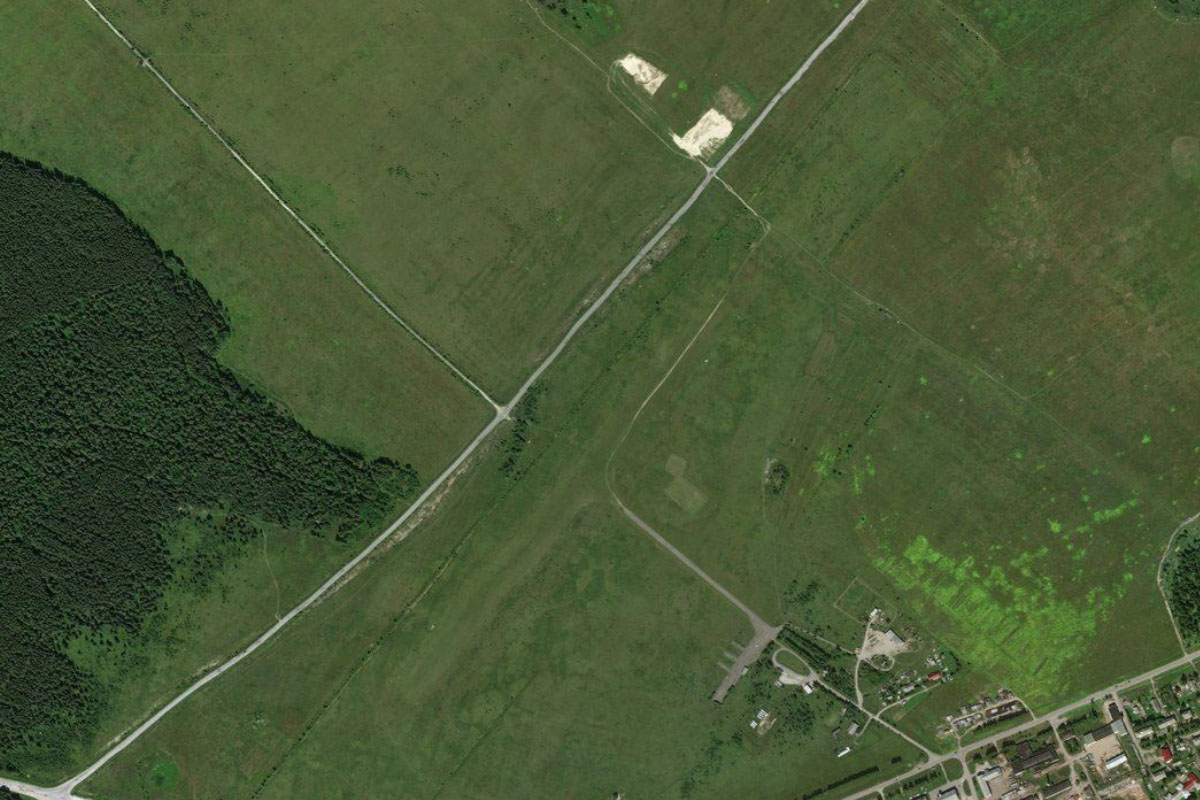
The railway, power line clearing and another highway will all lead south to the next town, Obozersky, on the shore of a narrow lake. A couple of miles southeast from the town is the disused air base at Letneozerskiy, once home to the famous MIG-25 interceptor
Leg 2
Flying from USAO
Leg Distance: 43.34 Approximate time at 125kts: 21 minutes.
USAO(USAO) to Emtsa(POI6)
Distance: 19.13NM Bearing: 168° 9 minutes
After takeoff, the railway, highway and power lines will all lead south to the town of Emtsa
Emtsa(POI6) to Sheleksa(POI7)
Distance: 10.64NM Bearing: 167° 5 minutes
Continue south across the flat landscape across the Emtsa River, then on to the next town, Sheleksa
Sheleksa(POI7) to Mirny(POI8)
Distance: 7.37NM Bearing: 165° 4 minutes
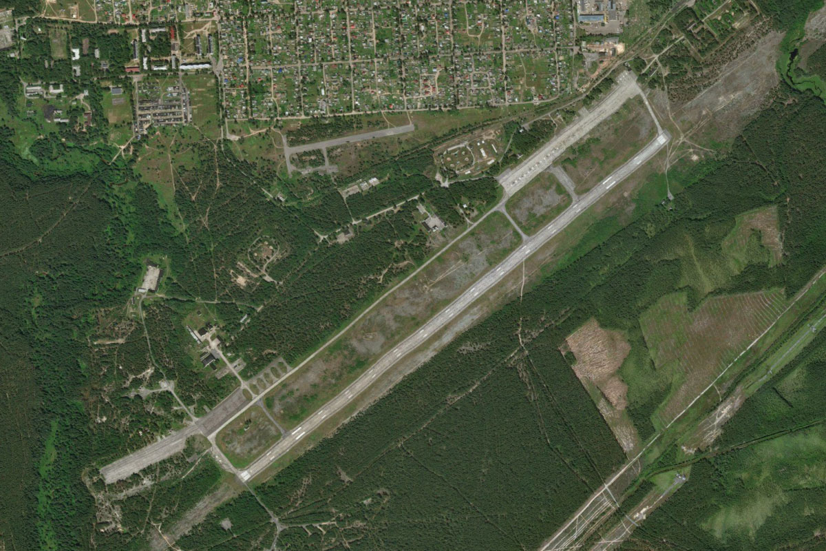
After Sheleksa, you will reach the twin towns of Mirny, to the left of the railway, and Plesetsk, further south. Mirny is a closed town due to its proximity to the nearby Plesetsk Cosmodrome
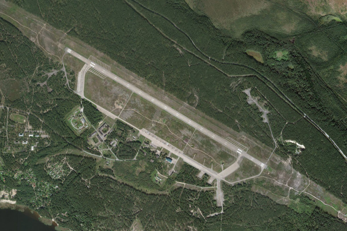
Mirny(POI8) to UMIR(UMIR)
Distance: 6.2NM Bearing: 106° 3 minutes
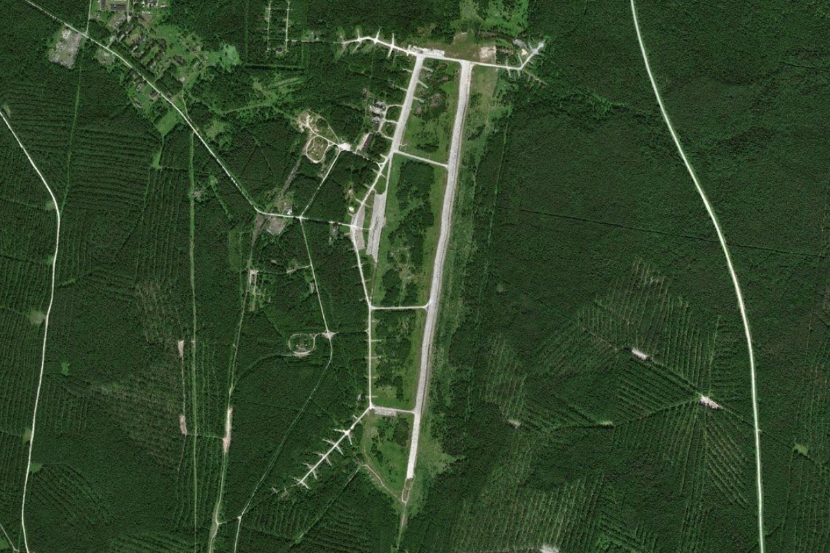
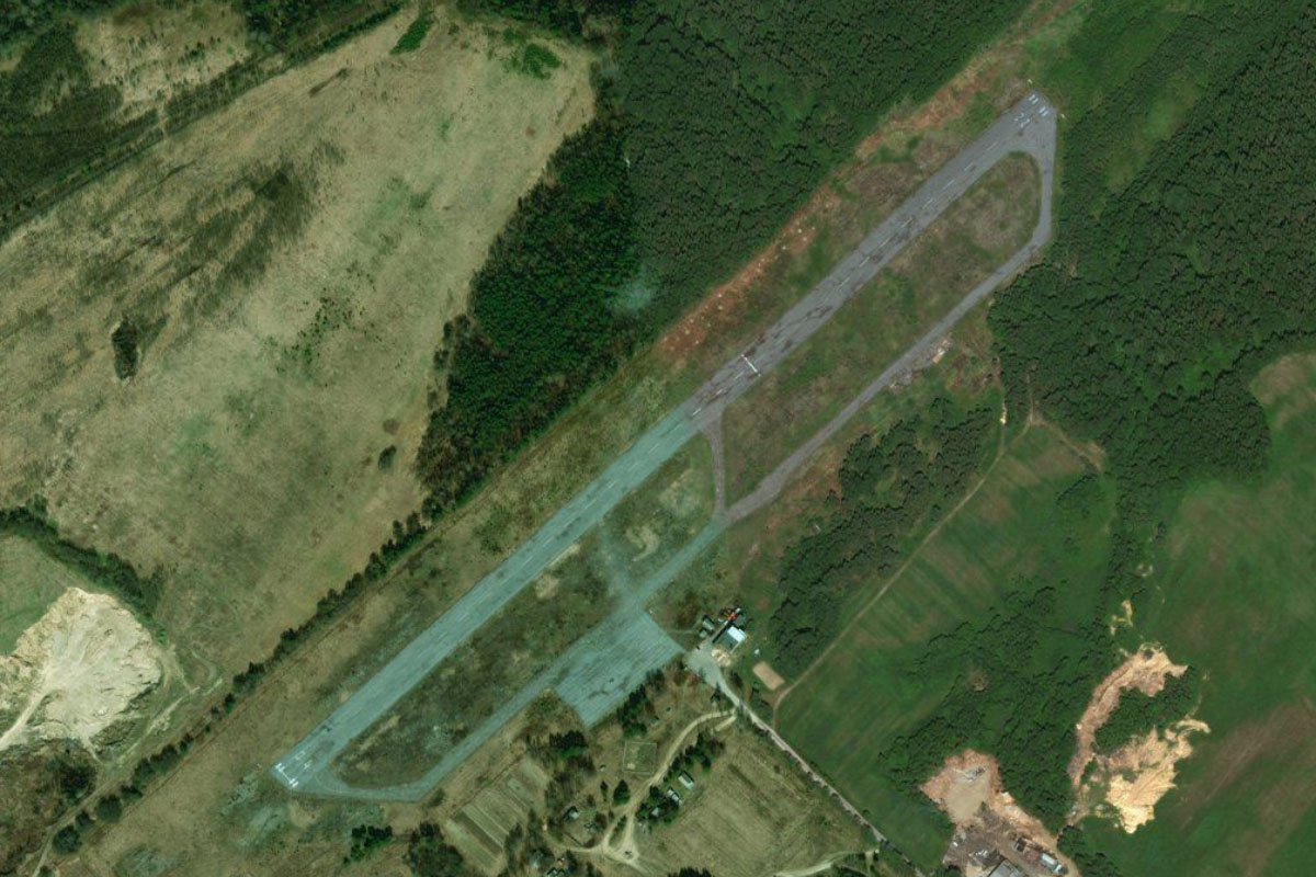
Plestsy Airport is a few miles east from Mirny
Leg 3
Flying from UMIR
Leg Distance: 29.63 Approximate time at 125kts: 14 minutes.
UMIR(UMIR) to Oksovskii(POI9)
Distance: 19.97NM Bearing: 228° 10 minutes
Fly southwest until you reach the town of Oksovskii on the Onega River, then follow the river southwest
Oksovskii(POI9) to Onega River(POI10)
Distance: 8.78NM Bearing: 164° 4 minutes
Keep following the river as it heads south
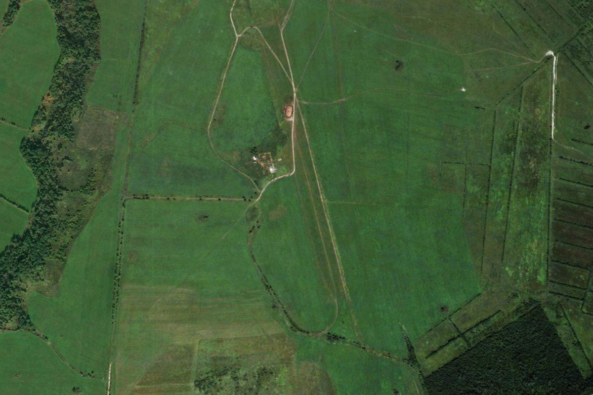
Onega River(POI10) to XLP1(XLP1)
Distance: 0.88NM Bearing: 211° 0 minutes
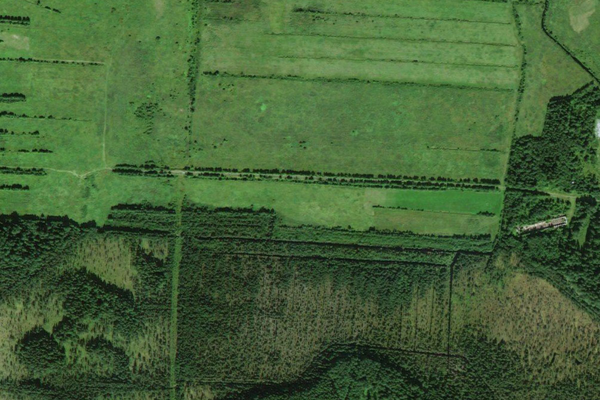
As the river turns west, look for a small grass airstrip on the southern side near a fork in the river
Leg 4
Flying from XLP1
Leg Distance: 64.91 Approximate time at 125kts: 31 minutes.
XLP1(XLP1) to Kuvakino(POI11)
Distance: 10.84NM Bearing: 212° 5 minutes
After takeoff, continue southwest along the river
Kuvakino(POI11) to Konevo(POI12)
Distance: 12NM Bearing: 191° 6 minutes
Follow the river south to one of the larger towns in the area, Konevo
Konevo(POI12) to Shelokhovskaya(POI13)
Distance: 13.81NM Bearing: 189° 7 minutes
As the river makes a detour west, continue south with the main road to meet the river once again near the town of Shelokhovskaya
Shelokhovskaya(POI13) to Usachevskaya(POI14)
Distance: 13.45NM Bearing: 148° 6 minutes
The road will run alongside to river as it heads southeast to the town of Usachevskaya, where the river meets the Voloshka River
Usachevskaya(POI14) to ULAR(ULAR)
Distance: 14.81NM Bearing: 204° 7 minutes
The river will once again turn to the southwest, leading you to the large regional town of Kargopol. There is a large grass airstrip in the fields west of the town
Leg 5
Flying from ULAR
Leg Distance: 70.1 Approximate time at 125kts: 34 minutes.
ULAR(ULAR) to Vatamanovskaya(POI15)
Distance: 9.41NM Bearing: 271° 5 minutes
After takeoff, fly west to the nearby small town of Vatamanovskaya
Vatamanovskaya(POI15) to Lake Lyokshmazero(POI16)
Distance: 16.79NM Bearing: 290° 8 minutes
Making a slight turn to the northwest, fly to the nearby lake, Lyokshmazero
Lake Lyokshmazero(POI16) to Krivtsy(POI17)
Distance: 32.97NM Bearing: 264° 16 minutes
From the lake, fly west across the flat terrain to eventually find a local highway crossing the Vodla River at the town of Krivtsy
Krivtsy(POI17) to ULPA(ULPA)
Distance: 10.93NM Bearing: 260° 5 minutes
Follow the river west as it passes a few smaller towns on the way to the larger town of Pudozh, with a population of 10,000. The airport is to the north as you approach the town
Leg 6
Flying from ULPA
Leg Distance: 78.13 Approximate time at 125kts: 38 minutes.
ULPA(ULPA) to Lake Onega(POI18)
Distance: 17.69NM Bearing: 251° 8 minutes
After takeoff, follow the river west to where it empties into Lake Onega, the second largest lake in Europe
Lake Onega(POI18) to Lake Onega(POI19)
Distance: 4.41NM Bearing: 293° 2 minutes
Fly northwest to the western point of a nearby peninsula, which is also home to a large quarry
Lake Onega(POI19) to Klimenetsky Island(POI20)
Distance: 14.57NM Bearing: 270° 7 minutes
Fly west across the lake to Klimenetsky Island, the largest on the lake
Klimenetsky Island(POI20) to Klimenetsky Island(POI21)
Distance: 4.84NM Bearing: 336° 2 minutes
Follow the eastern side of the island north into a narrow bay
Klimenetsky Island(POI21) to Sennaya Guba(POI22)
Distance: 2.36NM Bearing: 270° 1 minutes
Fly a short hop west across the island to the town of Sennaya Guba on its western side
Sennaya Guba(POI22) to Kerk Island(POI23)
Distance: 2.57NM Bearing: 346° 1 minutes
Fly north along the waterway to the mostly treeless Kerk Island
Kerk Island(POI23) to Kizhi(POI24)
Distance: 1.54NM Bearing: 341° 1 minutes
Continue north to the World Heritage listed island of Kizhi. This long, narrow island is known for its historic wooden churches, with The Church of the Transfiguration being the most spectacular
Kizhi(POI24) to Lake Onega(POI25)
Distance: 4.55NM Bearing: 234° 2 minutes
From Kizhi, turn southwest and cross the nearby peninsula
Lake Onega(POI25) to Suysari(POI26)
Distance: 13.13NM Bearing: 235° 6 minutes
Continue southwest, crossing the western part of Lake Onega to the island of Suysari
Suysari(POI26) to ULPP(ULPP)
Distance: 12.47NM Bearing: 216° 6 minutes
From the island, cross southwest over another large peninsula on the way towards the city of Petrozavodsk. On the northern outskirts of the city next to a small bay is Peski Airport
Leg 7
Flying from ULPP
Leg Distance: 42.8 Approximate time at 125kts: 21 minutes.
ULPP(ULPP) to Lososinkoye(POI27)
Distance: 10.51NM Bearing: 183° 5 minutes
After takeoff, head south past the city to Lososinkoye lake 10 miles away
Lososinkoye(POI27) to Mashezero(POI28)
Distance: 3.95NM Bearing: 129° 2 minutes
Fly southeast to the nearby lake, Mashezero
Mashezero(POI28) to Pyazhieva Sel’ga(POI29)
Distance: 11.92NM Bearing: 132° 6 minutes
From the lake, look to the south for a power line clearing, then follow it southeast to its junction with more power lines near the town of Pyazhieva Sel'ga, where they will both lead south
Pyazhieva Sel’ga(POI29) to Paysky(POI30)
Distance: 14.36NM Bearing: 168° 7 minutes
Follow the power lines south past the town of Ladva-Vetka until they turn further to the west near the town of Paysky, which lies a mile west from the clearing
Paysky(POI30) to XLP2(XLP2)
Distance: 2.06NM Bearing: 268° 1 minutes
As you approach the town, fly west over it to the small grass airfield in the large clearing a mile west from the town
Leg 8
Flying from XLP2
Leg Distance: 43.1 Approximate time at 125kts: 21 minutes.
XLP2(XLP2) to Svir(POI31)
Distance: 15.11NM Bearing: 172° 7 minutes
After takeoff, continue south until you reach the Svir River
Svir(POI31) to Podporozhye(POI32)
Distance: 5.61NM Bearing: 226° 3 minutes
Follow the river southwest to the large town of Podporozhye, where a hydroelectric station spans the river
Podporozhye(POI32) to Svirstroy(POI33)
Distance: 15.82NM Bearing: 229° 8 minutes
Continue southwest, where a highway and power line clearing will cut across land to once again meet the Svir river at the town of Svirstroy
Svirstroy(POI33) to ULOD(ULOD)
Distance: 6.56NM Bearing: 203° 3 minutes
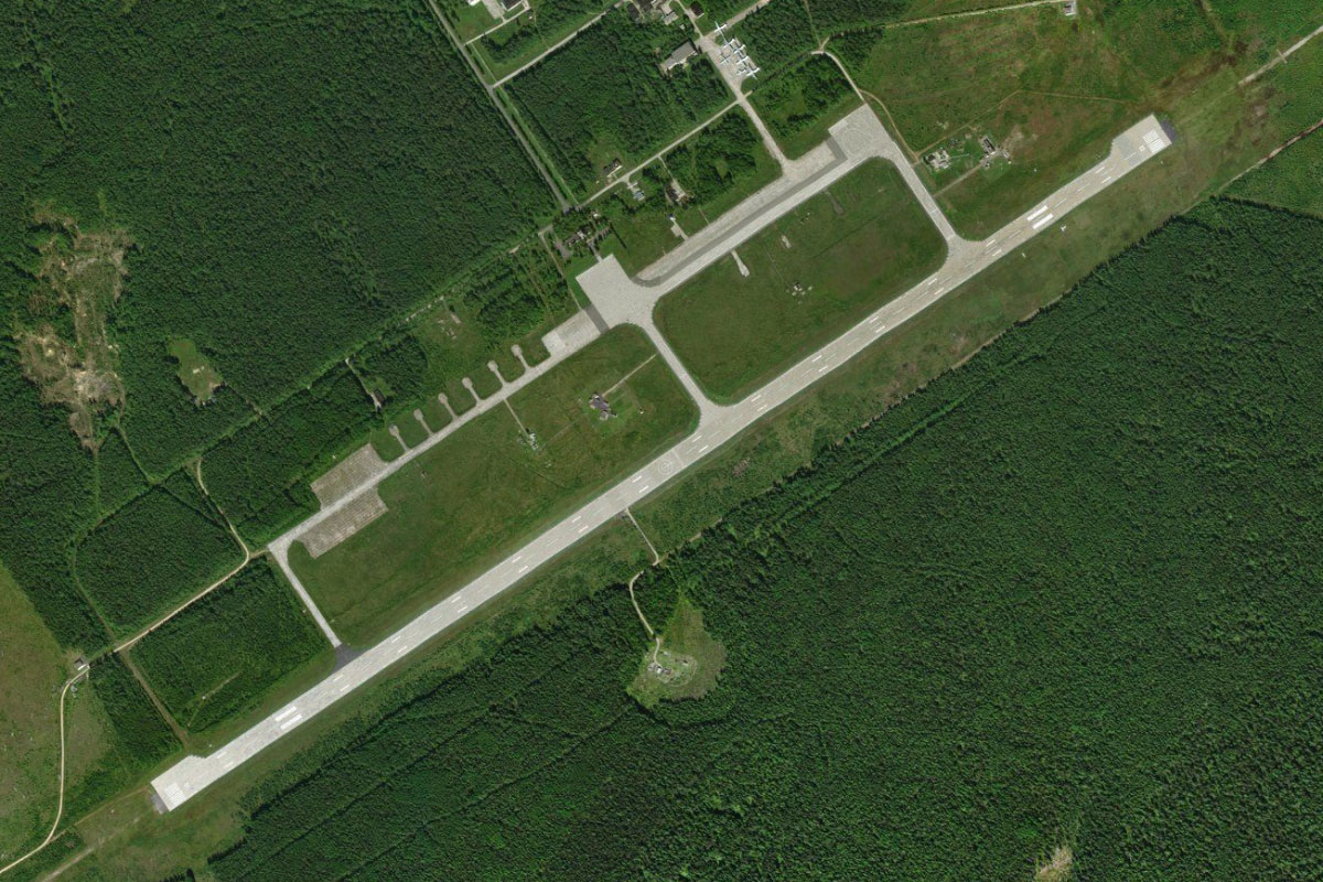
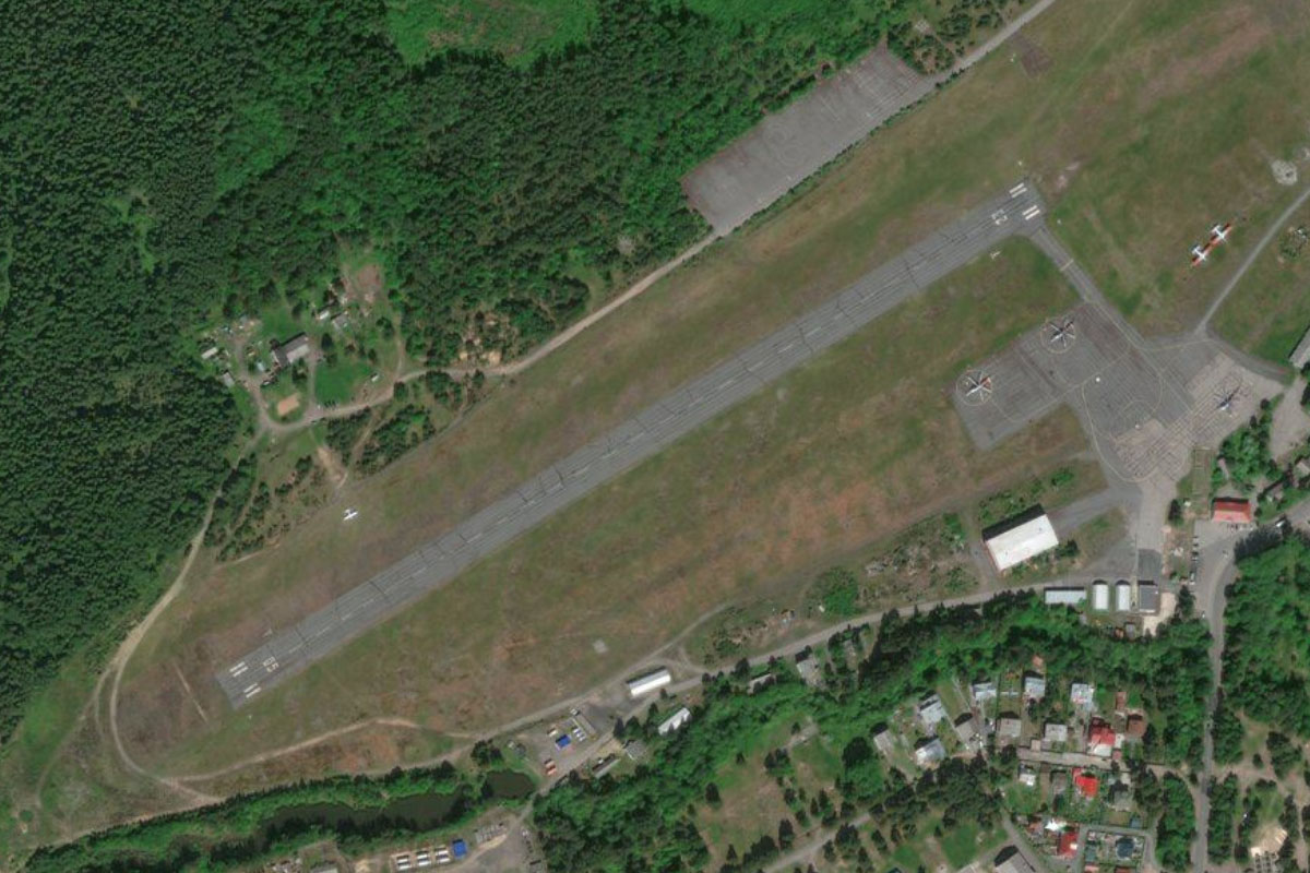
Follow the narrow section of the river southwest to the nearby large regional town of Lodeynoye Pole, and the air base near the town's southern edge
Leg 9
Flying from ULOD
Leg Distance: 87.68 Approximate time at 125kts: 42 minutes.
ULOD(ULOD) to Svir Bay(POI34)
Distance: 20.39NM Bearing: 235° 10 minutes
After takeoff, fly southwest to Svir Bay on the eastern edge of Lake Ladoga, the largest lake in Europe
Svir Bay(POI34) to Volkhov Bay(POI35)
Distance: 28.24NM Bearing: 195° 14 minutes
Follow the shoreline to another large bay, Volkhov Bay
Volkhov Bay(POI35) to Petrokrepost Bay(POI36)
Distance: 34.06NM Bearing: 231° 16 minutes
Fly southwest, cutting across a wide peninsula to reach the large bay at the southern end of the lake, Petrokrepost Bay
Petrokrepost Bay(POI36) to ULSW(ULSW)
Distance: 4.99NM Bearing: 160° 2 minutes
From the halfway point around the bay, fly south over a small town to Putilovo Airfield, in a large clearing next to the forest edge
Leg 10
Flying from ULSW
Leg Distance: 43.72 Approximate time at 125kts: 21 minutes.
ULSW(ULSW) to Naziya(POI37)
Distance: 3.63NM Bearing: 224° 2 minutes
After takeoff, fly southwest to meet the nearby railway line
Naziya(POI37) to Mra(POI38)
Distance: 9.29NM Bearing: 240° 4 minutes
Follow the railway southwest to the large town of Mga, where it will turn to the west
Mra(POI38) to Otradnoye(POI39)
Distance: 6.72NM Bearing: 268° 3 minutes
Keep following the railway as it leads you west
Otradnoye(POI39) to Reka Tosna(POI40)
Distance: 3.81NM Bearing: 240° 2 minutes
Near the town of Otradnoye, the railway will turn southwest to pass by the Neva River and across one of its smaller tributaries, the Tosna River
Reka Tosna(POI40) to M-11(POI41)
Distance: 7.32NM Bearing: 243° 4 minutes
Continue southwest over another railway line at the large residential and industrial district of Kolpino, and onto the nearby motorway interchange and toll plaza
M-11(POI41) to Pushkin Airport(POI42)
Distance: 5.63NM Bearing: 234° 3 minutes
Continue southwest towards Pushkin Airport. To your left you will pass Pavlovskiy Park, a large parkland which is home to Pavlovsk Museum and palace. On the right you will pass Catherine Palace, a grand palace once the summer residence of the Russian tsars. The palace is part of the World Heritage Site Saint Petersburg and Related Groups of Monuments
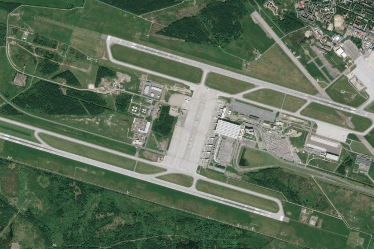
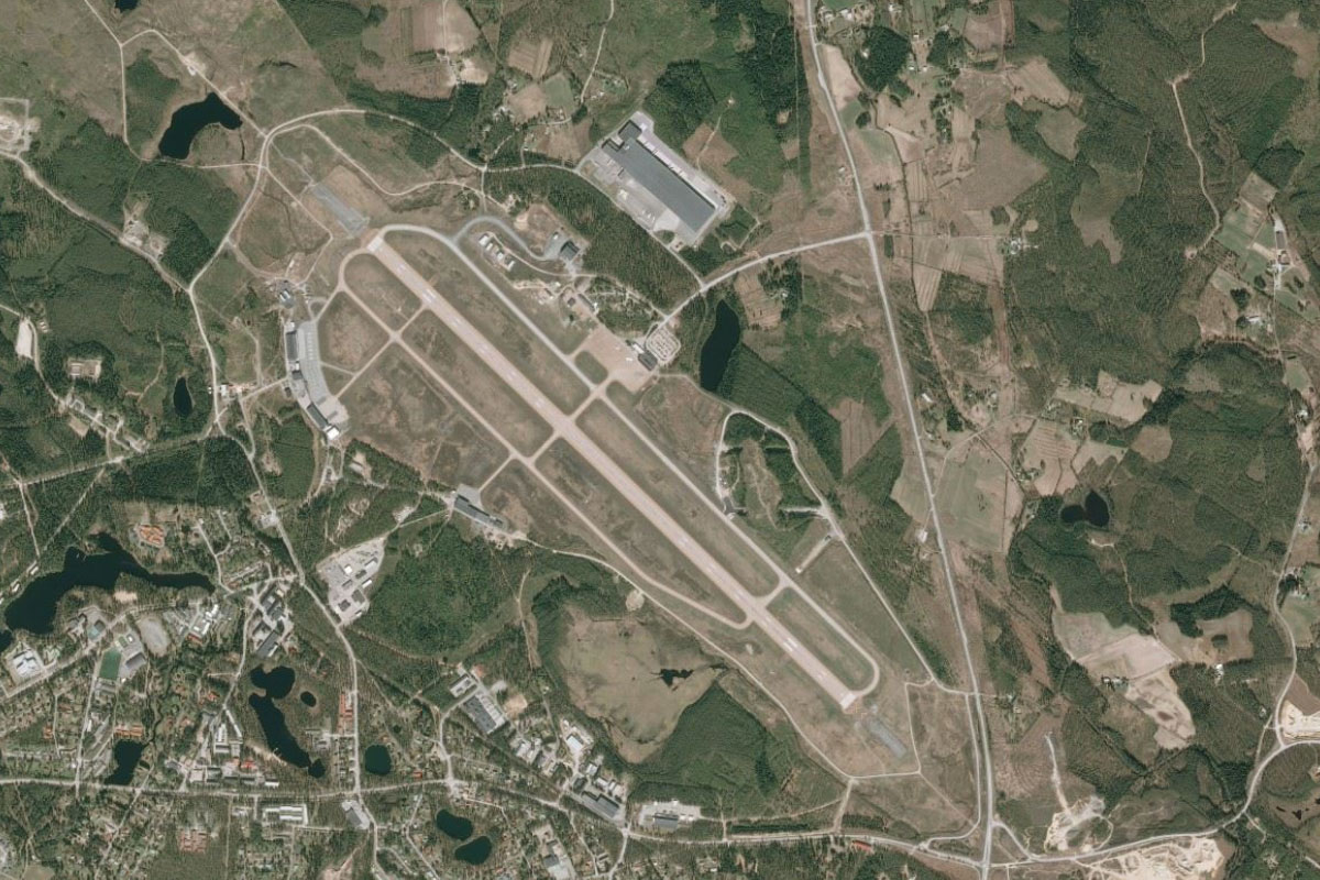
Pushkin Airport(POI42) to ULLI(ULLI)
Distance: 7.32NM Bearing: 328° 4 minutes
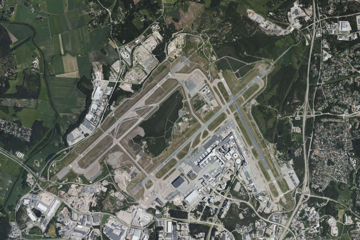
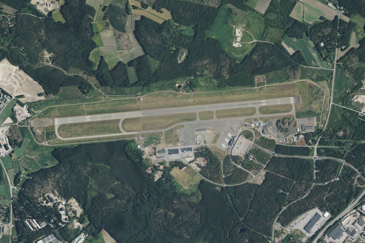
From Pushkin Airport, turn and head northwest to the larger Pulkovo Airport, the main airport serving Saint Petersburg
Leg 11
Flying from ULLI
Leg Distance: 59.31 Approximate time at 125kts: 28 minutes.
ULLI(ULLI) to Saint Petersburg(POI43)
Distance: 8.66NM Bearing: 2° 4 minutes
From Pulkovo airport, fly north to the city of Saint Petersburg, the cultural center and second largest city in Russia. Despite its richness of cultural and heritage sites and monuments, the city is only around 300 years old, and the historic Peter and Paul Fortress, Mariinsky Theater, Winter Palace and Smolny Convent contrast modern wonders such as Europe's tallest building – the Lakhta Center
Saint Petersburg(POI43) to Neva Bay(POI44)
Distance: 7.75NM Bearing: 221° 4 minutes
After exploring the city, fly southwest to the shore of Neva Bay, which is the easternmost part of the Gulf of Finland
Neva Bay(POI44) to Saint Petersburg Dam(POI45)
Distance: 14.51NM Bearing: 276° 7 minutes
Fly west along the southern shore of the bay until you reach the large road causeway which forms part of the 25km long Saint Petersburg dam. Along the way you will pass by the grand Peterhof Palace, Russia's answer to Versailles
Saint Petersburg Dam(POI45) to Kotlin Island(POI46)
Distance: 4.52NM Bearing: 5° 2 minutes
Follow the dam north to Kotlin Island
Kotlin Island(POI46) to Gorskaya(POI47)
Distance: 8.02NM Bearing: 66° 4 minutes
Keep following the dam as it turns east across the bay
Gorskaya(POI47) to A-118(POI48)
Distance: 5.3NM Bearing: 64° 3 minutes
Upon reaching land, follow the A-118 motorway northeast
A-118(POI48) to A-118(POI49)
Distance: 4.04NM Bearing: 43° 2 minutes
At a large interchange, the motorway will turn further northeast and head past Levashovo Air Base, now undergoing redevelopment as a mixed use airport
A-118(POI49) to XLLN(XLLN)
Distance: 6.51NM Bearing: 8° 3 minutes
From the highway interchange east of Levashovo Air Base, fly north to Kasimovo Airfield, 6 miles away
Leg 12
Flying from XLLN
Leg Distance: 36.4 Approximate time at 125kts: 17 minutes.
XLLN(XLLN) to A-121(POI50)
Distance: 13.04NM Bearing: 340° 6 minutes
After takeoff, fly north to meet highway A-121, then follow it north past a group of lakes
A-121(POI50) to Lake Sukhodolskoye(POI51)
Distance: 10.68NM Bearing: 13° 5 minutes
When the highway curves around to the west, fly north until you reach the southern end of Lake Sukhodolskoye. This long narrow lake west of Lake Ladoga is part of the Vuoski River system
Lake Sukhodolskoye(POI51) to USAP(USAP)
Distance: 12.68NM Bearing: 299° 6 minutes
Follow the lake northwest to Gromovo Air Base, which is on the north shore of the lake
Leg 13
Flying from USAP
Leg Distance: 60.33 Approximate time at 125kts: 29 minutes.
USAP(USAP) to Vuoski River(POI52)
Distance: 3.77NM Bearing: 223° 2 minutes
Fly southwest to the rail and bridge crossing of the Vuoski River
Vuoski River(POI52) to Vuoski River(POI53)
Distance: 9.52NM Bearing: 252° 5 minutes
Follow the wide section of the river west
Vuoski River(POI53) to Vuoski River(POI54)
Distance: 9.48NM Bearing: 297° 5 minutes
Keep following the river as it turns northwest and narrows along a channel
Vuoski River(POI54) to Vuoski River(POI55)
Distance: 8.91NM Bearing: 300° 4 minutes
After the narrow section, the river will continue northwest as a large island filled lake
Vuoski River(POI55) to Vuoski River(POI56)
Distance: 16.15NM Bearing: 308° 8 minutes
The river will narrow once again as it continues northwest
Vuoski River(POI56) to Imatra(POI57)
Distance: 7.68NM Bearing: 332° 4 minutes
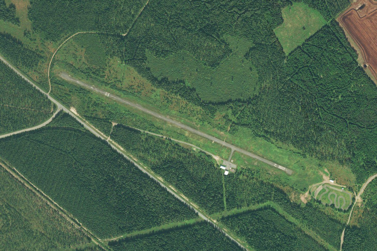
Stay with the river as it winds past the industrial town of Svetogorsk before crossing the border into Finland, and the town of Imatra
Imatra(POI57) to EFIM(EFIM)
Distance: 4.82NM Bearing: 33° 2 minutes
Follow the highway leading north from Imatra to Immola Airfield, 4 miles north from the town
Leg 14
Flying from EFIM
Leg Distance: 60.3 Approximate time at 125kts: 29 minutes.
EFIM(EFIM) to Simpele(POI58)
Distance: 17.11NM Bearing: 39° 8 minutes
After takeoff, follow highway 6 northeast across the flat landscape to the town of Simpele
Simpele(POI58) to Parikkala(POI59)
Distance: 8.98NM Bearing: 14° 4 minutes
Keep following the highway as it curves north around the lake to the town of Parikkala
Parikkala(POI59) to Sarkisalmi(POI60)
Distance: 2.8NM Bearing: 328° 1 minutes
The highway will turn northwest along a narrow section of land between the lakes to the town of Särkisalmi, where it will meet highway 14
Sarkisalmi(POI60) to Punkaharju(POI61)
Distance: 9.53NM Bearing: 332° 5 minutes
Follow highway 14 northwest towards the town of Punkaharju. The town lies on a peninsula at Lake Saimaa, the largest lake in Finland
Punkaharju(POI61) to Anttola(POI62)
Distance: 11.21NM Bearing: 300° 5 minutes
Follow the highway northwest as it hops across a series of islands to the other side of the lake, before continuing northwest
Anttola(POI62) to Savonlinna(POI63)
Distance: 5.81NM Bearing: 246° 3 minutes
At the highway junction you will see Savonlinna Airport ahead. You can either continue to the airport to finish the stage or follow the highway west to the town to explore Olavinlinna, a 15th-century medieval castle
Savonlinna(POI63) to EFSA(EFSA)
Distance: 4.86NM Bearing: 2° 2 minutes
A few miles north from the town is Savanlinna Airport
Leg 15
Flying from EFSA
Leg Distance: 34.46 Approximate time at 125kts: 17 minutes.
EFSA(EFSA) to Haukivesi(POI64)
Distance: 9.54NM Bearing: 293° 5 minutes
Fly northwest (runway heading) until you reach Haukivesi, part of the Saimaa lake system
Haukivesi(POI64) to Laivo(POI65)
Distance: 4.25NM Bearing: 269° 2 minutes
When you reach the lake, fly west to a long narrow island, Laivo
Laivo(POI65) to Rantasalmi(POI66)
Distance: 6.33NM Bearing: 269° 3 minutes
Continue west to the town of Rantasalmi on of the lake's narrow channels, passing over the town's airport along the way
Rantasalmi(POI66) to Haukivesi(POI67)
Distance: 6.21NM Bearing: 265° 3 minutes
Continue west to the southern tip of one of the lake's many coves
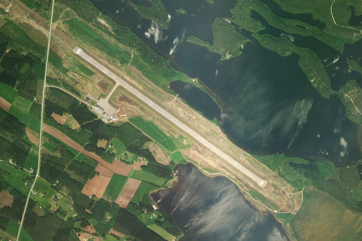
Haukivesi(POI67) to EFVR(EFVR)
Distance: 8.13NM Bearing: 299° 4 minutes
Turning northwest, the lake's narrow channel will point you to the town of Joroinen, with Varkaus Airport east of the town, next to the lake
Leg 16
Flying from EFVR
Leg Distance: 69.72 Approximate time at 125kts: 33 minutes.
EFVR(EFVR) to Sysma(POI68)
Distance: 8.8NM Bearing: 284° 4 minutes
After takeoff, fly west to the northern tip of a nearby lake, Sysma
Sysma(POI68) to Pieksamaki(POI69)
Distance: 11.52NM Bearing: 276° 6 minutes
Continue west to the tip of the next lake, Maavesi, then onto the large town of Pieksamaki
Pieksamaki(POI69) to Hankasalmen asema(POI70)
Distance: 19.87NM Bearing: 259° 10 minutes
Fly west from the town, where you will soon see a railway also heading west to the town of Hankasalmen asema, where it will meet a highway heading southwest
Hankasalmen asema(POI70) to Neimisjarvi(POI71)
Distance: 5.16NM Bearing: 229° 2 minutes
Follow the railway and highway southwest
Neimisjarvi(POI71) to Jyvaskyla(POI72)
Distance: 13.77NM Bearing: 253° 7 minutes
Keep following the highway west as it leads you past the town of Lievestuore to the city of Jyväskylä, the seventh largest city in Finland
Jyvaskyla(POI72) to EFJY(EFJY)
Distance: 10.6NM Bearing: 324° 5 minutes
As you pass the city center, a highway will lead north to Jyväskylä Airport
Leg 17
Flying from EFJY
Leg Distance: 43.1 Approximate time at 125kts: 21 minutes.
EFJY(EFJY) to Kintausjarvi(POI73)
Distance: 10.38NM Bearing: 227° 5 minutes
After takeoff, fly southwest towards two large, irregular shaped lakes
Kintausjarvi(POI73) to Petajavesi(POI74)
Distance: 5.66NM Bearing: 224° 3 minutes
Continue southwest to the nearby town of Petäjävesi. On the south side of the town is Petäjävesi Old Church, listed on the UNESCO World Heritage List for its testimony to the wooden church architecture of the Nordic countries
Petajavesi(POI74) to Keuruu(POI75)
Distance: 13.34NM Bearing: 259° 6 minutes
From Petäjävesi, follow the highway and railway west to the town of Keuruu, at the northern end of a large lake, Keurusselkä
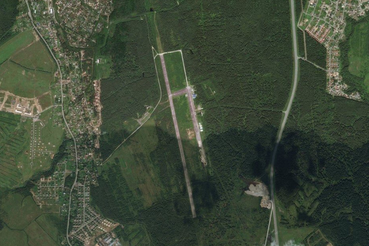
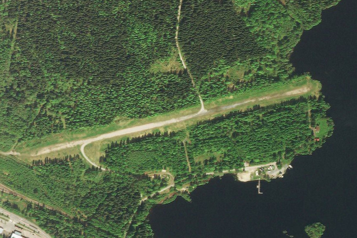
Keuruu(POI75) to EFMT(EFMT)
Distance: 13.72NM Bearing: 174° 7 minutes
Turn south and fly the length of the lake to the town of Mänttä at its southern end. Near the eastern edge of the town is a small grass airfield
Leg 18
Flying from EFMT
Leg Distance: 55.88 Approximate time at 125kts: 27 minutes.
EFMT(EFMT) to Vilppula(POI76)
Distance: 4.78NM Bearing: 252° 2 minutes
After takeoff, fly west to the nearby town of Vilppula
Vilppula(POI76) to Ruovesi(POI77)
Distance: 11.99NM Bearing: 249° 6 minutes
Continue west to the town of Ruovesi, which lies on the western shore of the lake of the same name
Ruovesi(POI77) to Vankavesi(POI78)
Distance: 10.58NM Bearing: 208° 5 minutes
From Ruovesi, follow a group of connected lakes southwest to reach a larger lake, Vankavesi
Vankavesi(POI78) to Nasijarvi(POI79)
Distance: 10.2NM Bearing: 187° 5 minutes
Follow the lake south where it will widen into the main section of the lake, named Näsijärvi
Nasijarvi(POI79) to Tampere(POI80)
Distance: 11.19NM Bearing: 165° 5 minutes
Follow Näsijärvi south to the city of Tampere, the third largest city in Finland, with history dating back as far as the 7th century
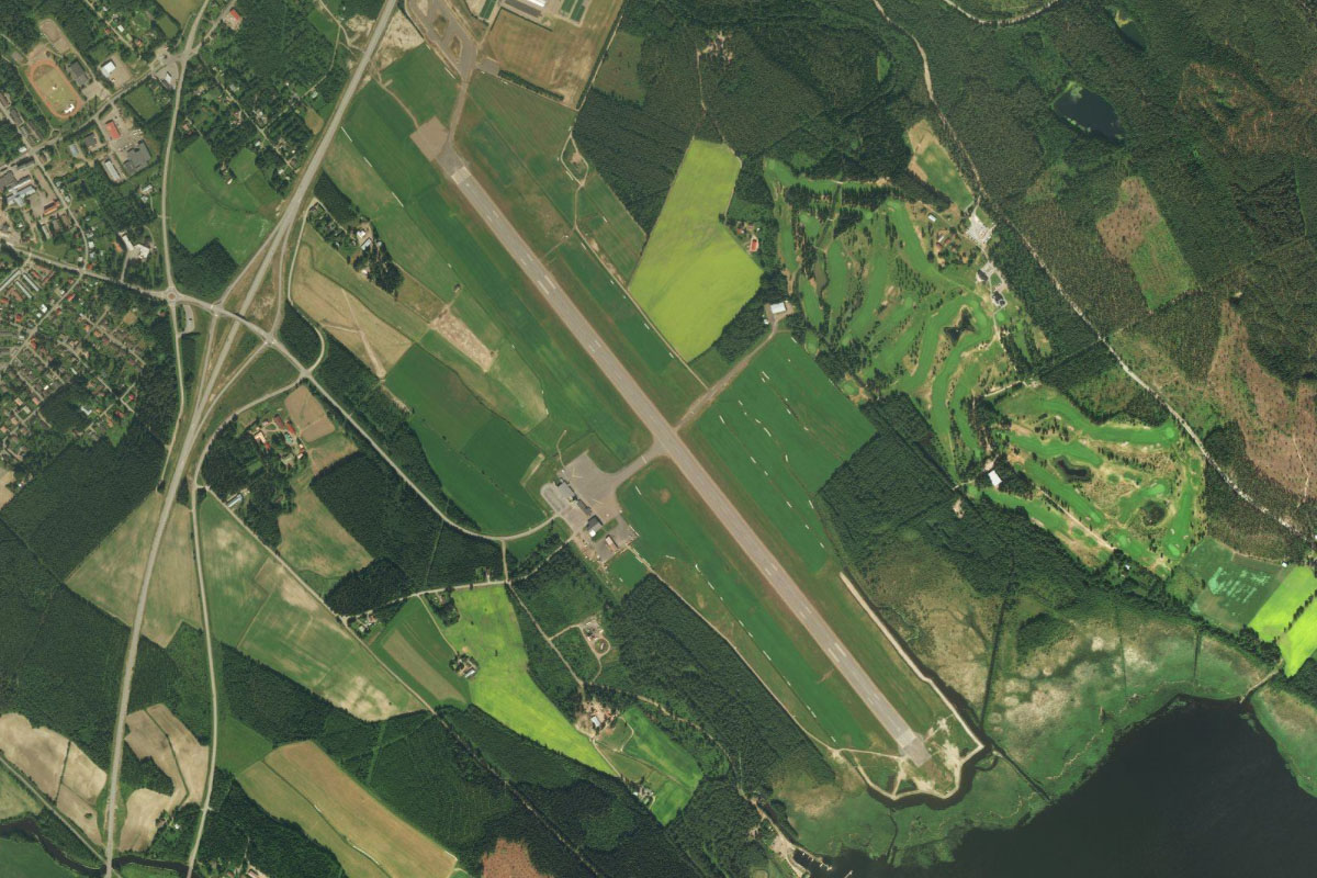
Tampere(POI80) to EFTP(EFTP)
Distance: 7.14NM Bearing: 215° 3 minutes
Tampere's Pirkkala Airport is southwest from the city
Leg 19
Flying from EFTP
Leg Distance: 46.75 Approximate time at 125kts: 22 minutes.
EFTP(EFTP) to Kulovesi(POI81)
Distance: 11.54NM Bearing: 269° 6 minutes
After takeoff, fly west over a nearby waterway to reach another lake, Kulovesi
Kulovesi(POI81) to Vammala(POI82)
Distance: 10.26NM Bearing: 222° 5 minutes
The lake will lead you southwest to the narrow section at the town of Vammala, where there is a bridge crossing
Vammala(POI82) to Kokemaenjoki(POI83)
Distance: 10.89NM Bearing: 215° 5 minutes
Follow the lake southwest as it narrows into the Kokemäki River
Kokemaenjoki(POI83) to EFEU(EFEU)
Distance: 14.06NM Bearing: 236° 7 minutes
When the river makes a sharp U-turn to the northwest, continue southwest, where a local highway will soon lead you to the town of Eura. The airport is near the eastern edge of the town
Leg 20
Flying from EFEU
Leg Distance: 37.37 Approximate time at 125kts: 18 minutes.
EFEU(EFEU) to Pyhajarvi(POI84)
Distance: 13.97NM Bearing: 149° 7 minutes
After takeoff, fly southeast to the southern tip of the nearby lake, Pyhäjärvi
Pyhajarvi(POI84) to Mynajarvi(POI85)
Distance: 8.45NM Bearing: 174° 4 minutes
Fly south to a group of four small lakes
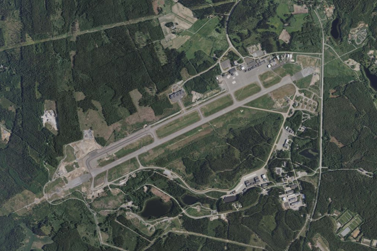
Mynajarvi(POI85) to EFTU(EFTU)
Distance: 14.95NM Bearing: 181° 7 minutes
Continue south towards the city of Turku, the sixth largest city (third largest urban area) in Finland. Before you reach the city, you will arrive at the airport a few miles to its north
Leg 21
Flying from EFTU
Leg Distance: 57.46 Approximate time at 125kts: 28 minutes.
EFTU(EFTU) to Turku(POI86)
Distance: 4.08NM Bearing: 172° 2 minutes
After takeoff, fly south to explore the city. Turku was founded around the thirteenth century, making it Finland's oldest city. Among its many historic buildings, Turku Cathedral lies in the north of the city, while Turku Castle is in the south, near the port area
Turku(POI86) to Pargas(POI87)
Distance: 9.25NM Bearing: 166° 4 minutes
Continue south over the islands of the Turku Archipelago to the large limestone quarry near the town of Pargas.
Pargas(POI87) to Trollo(POI88)
Distance: 9.88NM Bearing: 180° 5 minutes
Continue south until the larger islands give way to open water, dotted with much smaller islands
Trollo(POI88) to Hiittinen(POI89)
Distance: 18.03NM Bearing: 134° 9 minutes
Fly southeast across the water to another archipelago, then cross it southeast to once again reach open water
Hiittinen(POI89) to Hanko(POI90)
Distance: 10.72NM Bearing: 104° 5 minutes
Cross the open water of the Tryhål channel to reach Hanko Port. This large port facility used mainly for car imports lies at the tip of the Hanko peninsula, west from the town of Hanko
Hanko(POI90) to EFHN(EFHN)
Distance: 5.5NM Bearing: 62° 3 minutes
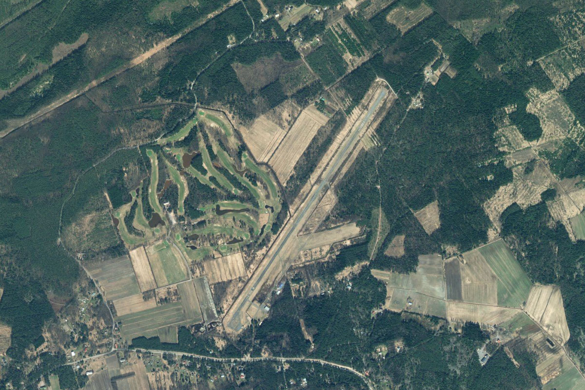
Fly east over the town to the airport, a few miles to the east of the town next to a golf course
Leg 22
Flying from EFHN
Leg Distance: 66.94 Approximate time at 125kts: 32 minutes.
EFHN(EFHN) to Ekenas Archipelago(POI91)
Distance: 12.14NM Bearing: 70° 6 minutes
After takeoff, fly east to reach a large group of coastal islands – the Ekenäs Archipelago
Ekenas Archipelago(POI91) to Obbnas(POI92)
Distance: 28.09NM Bearing: 60° 13 minutes
Follow the archipelago northeast along the coast. You will eventually reach the Obbnäs peninsula, home to one of Finland's largest Naval Bases
Obbnas(POI92) to Kirkkonummi(POI93)
Distance: 5.04NM Bearing: 22° 2 minutes
When you reach the peninsula, fly north to the town of Kirkkonummi. Here you will meet a major road, National Route 51, which runs east
Kirkkonummi(POI93) to Laajalahti(POI94)
Distance: 11.95NM Bearing: 64° 6 minutes
Follow the highway northeast until you reach the bay to the west of Helsinki, shielded at its south by the island of Lauttasaari and several bridge crossings
Laajalahti(POI94) to EFHK(EFHK)
Distance: 9.72NM Bearing: 14° 5 minutes
From the bay, fly north to Vantaa – Helsinki's main airport, which is the busiest in the country and the fourth busiest in the Nordic countries. This is the destination for the stage