The Amazon
The planet’s largest river
South America’s Amazon is the planet’s largest river and one of its most renowned and storied natural features. Originating high in the Peruvian Andes, the Amazon flows 4,000 miles in a generally eastward course to its delta on the Atlantic Ocean at the equator. The Amazon basin – the region that is drained by the Amazon River – is 2,700,000 square miles in area, the largest drainage basin in the world. Comprising 1,100 tributaries, the total volume of water that flows through the Amazon River system is immense, approximately 1,700 cubic miles per year, the greatest of any river on the planet.
The Amazon Rainforest, the largest rainforest in the world, covers most of the Amazon Basin. The rainforest and the Amazon River system support a massive wealth of life. This includes over 1,500 bird species, 1,500 species of amphibians, 3,000 fish species, 1,400 mammals, 80,000 plant species, and 2.5 million insect species. The Amazon is the most biodiverse region on the planet.
The Amazon has been the focus of exploration to outsiders for centuries, but much of it remains shrouded in mystery. The area is sparsely populated, with most of the cities located along the Amazon or its major tributaries. The Amazon’s human history dates back thousands of years, with some cultures having developed advanced agriculture techniques and other technologies. Europeans arrived in the early 1500s and exploration began in the mid-1500s incentivized by the prospects of discovering gold.
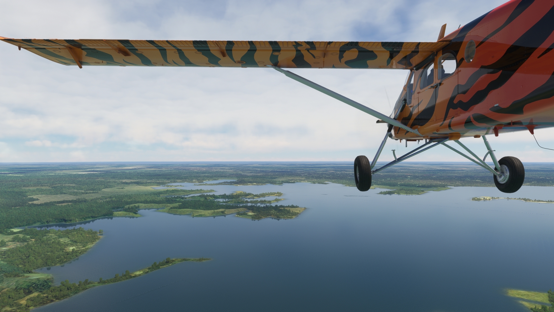
This bush trip explores the Amazon River from the depths of the Amazon Rainforest to its delta. Pilots will bask in some of the greatest sights this renowned river system has to offer, from lush stands of endless forest to coastal islands.
Flight tips:
Weather, date and time are customizable. Live weather is preset.
Set your aircraft to "cold and dark" after each landing to end the flight, preferably in one of the parking lots.
Use ATC if you like.
This mission is created as a VFR flight. All necessary information is contained in the Navlog. If necessary, a GPS course is available.
Total Legs: 10 Total Distance: 906 Total Time(125kts): 7 hours 14 minutes
Leg 1
Ponta Pelada to Presidente Figueiredo Airport
Leg Distance: 81.03 Approximate time at 125kts: 39 minutes.
Ponta Pelada(SBMN) to Amazon Theatre(POI1)
Distance: 2.49NM Bearing: 309° 1 minutes
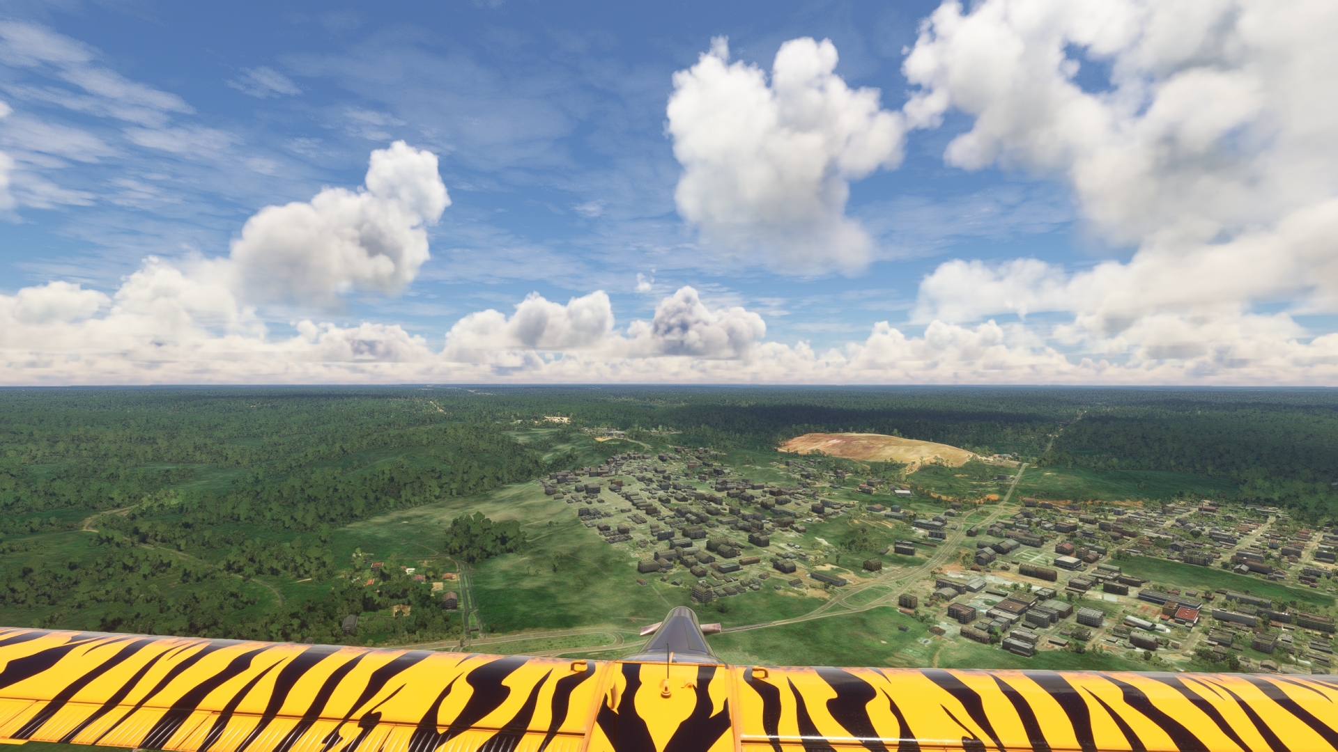
After taking-off from Ponta Pelada Airport, set a course to the northwest and fly over the southern reaches of Manaus. The city is the capital of Amazonas, the largest state in Brazil and the largest national subregion in South America. With more than 2.2 million inhabitants, Manaus is the largest city within the Amazon region and one of only two that has a population greater than 1 million, the other being Belém, also of Brazil. The city is located on the northern bank of the Rio Negro (Black River) just to the west of its confluence with Rio Solimões (Solimões River).
The Solimões River is the name often used within Brazil for the Amazon River upstream of its confluence with the Rio Negro. The Rio Negro, named such due to its dark color, is the Amazon River system’s second largest tributary and joins the Solimões / Amazon from the north. The Rio Negro and the Solimões / Amazon meet less than a mile to the east of Ponta Pelada Airport. The water of each, the Rio Negro being dark colored and the Rio Solimões / Amazon being light colored, run side-by-side for nearly four miles downstream. This confluence is called “Meeting of Waters” and downstream of this point the river is known exclusively as the Amazon River. The color of each river is due primarily to the type of sediment carried and also to water speed and temperature.
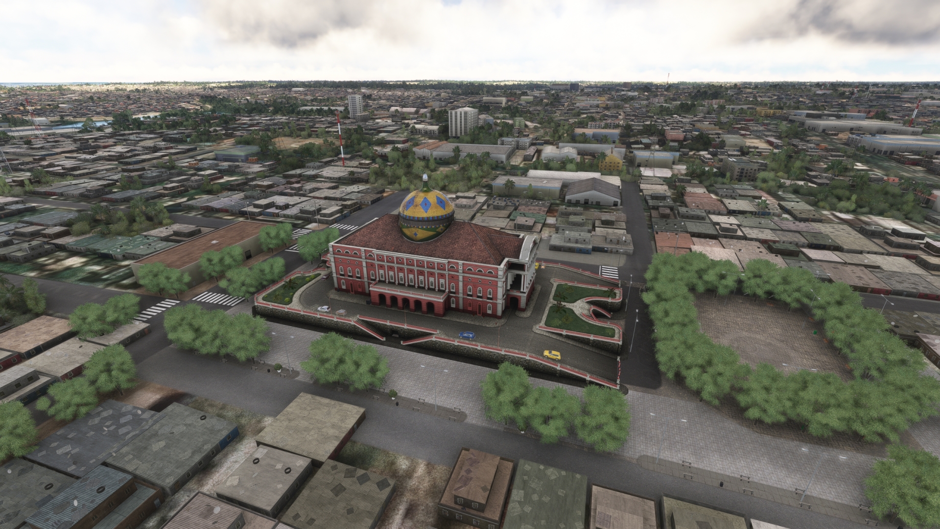
In addition to incredible vistas of the surrounding natural environment, this first leg of the journey brings wonderful architectural sights of Manaus into view. One of the most splendid is the Amazon Theater (Teatro Amazonas). Located just a few blocks north of the north bank of the Rio Negro, the Amazon Theater was constructed in 1884 during the rubber boom of the Amazon. The rubber boom spanned from 1879 to 1912 and marked a dramatic period in the entire Amazon Basin. Based on the extraction of natural rubber in the area, industrialists made massive fortunes which provided the basis for construction of beautiful works of architecture. The most notable of these is the Amazon Theater. The theater, built in the style of Renaissance Revival, is today the home of the Amazonas Philharmonic Orchestra and hosts the annual Amazonas Opera Festival.
Amazon Theatre(POI1) to Journalist Phelippe Dahsou Bridge(POI2)
Distance: 3.3NM Bearing: 302° 2 minutes
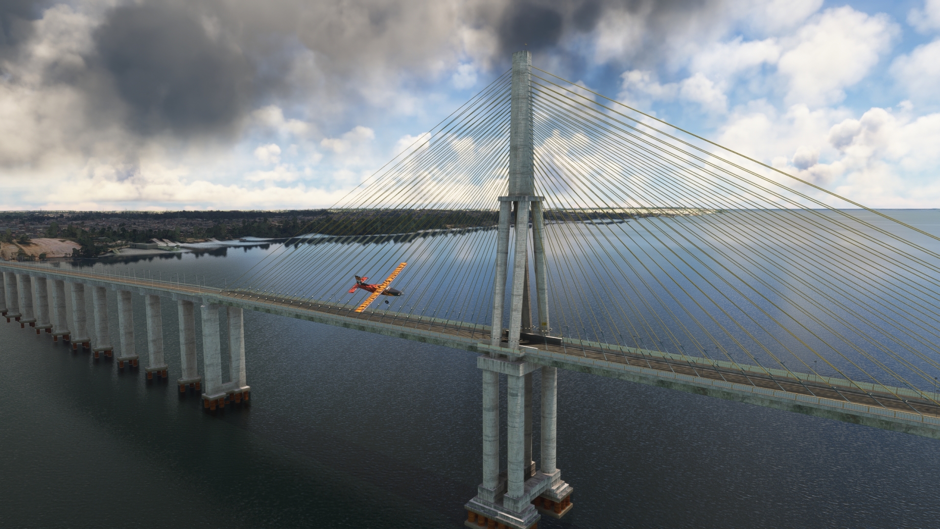
Maintain heading to fly out over the northern side of the Rio Negro and pass over the Journalist Phelippe Dahsou Bridge. Also called the Rio Negro Bridge, the span is the fourth longest in Brazil at just over 2 miles in length.
Journalist Phelippe Dahsou Bridge(POI2) to Arena da Amazonia(POI3)
Distance: 3.53NM Bearing: 72° 2 minutes
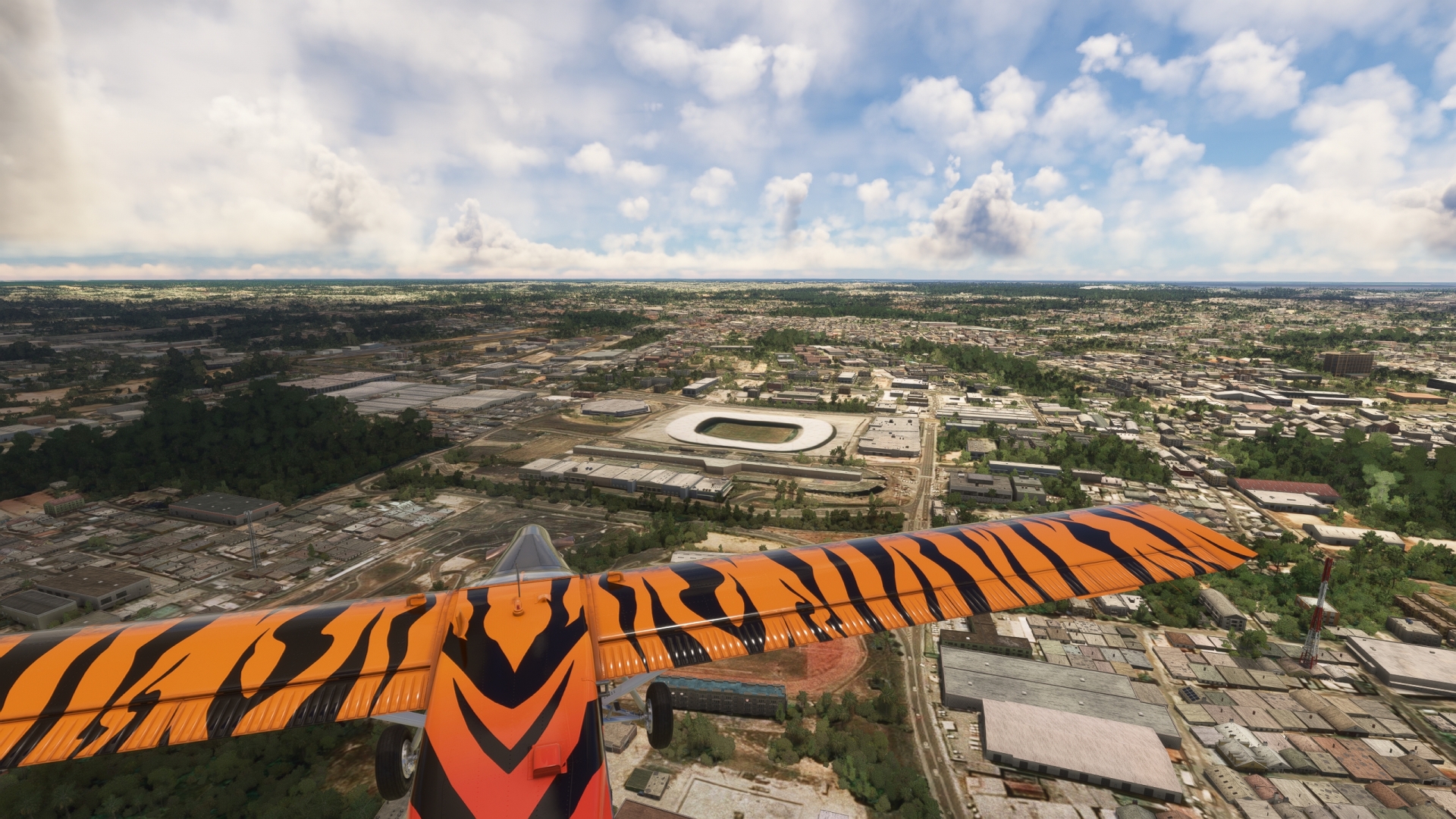
Over the Journalist Phelippe Dahsou Bridge, turn sharply to the northeast. Pass over the southwestern aspect of Manaus and gain a visual on and then pass over Arena da Amazônia, the Amazon Arena. The arena, which seats over 40,000, hosted matches of the 2014 FIFA World Cup and the 2016 Summer Olympics.
Arena da Amazonia(POI3) to Urubu River Bridge(POI4)
Distance: 57.94NM Bearing: 19° 28 minutes
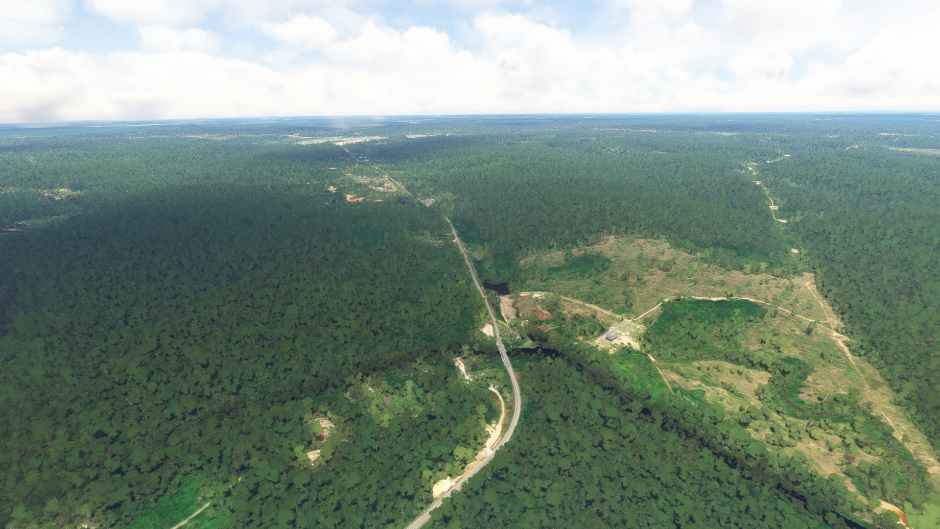
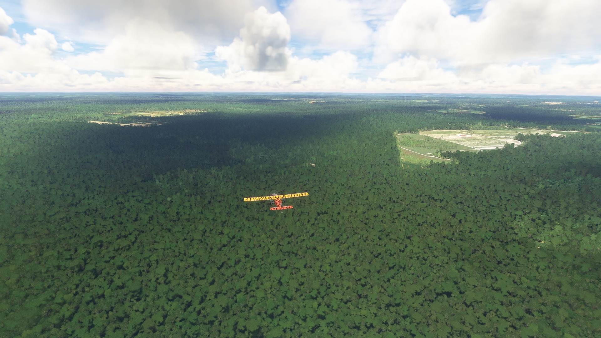
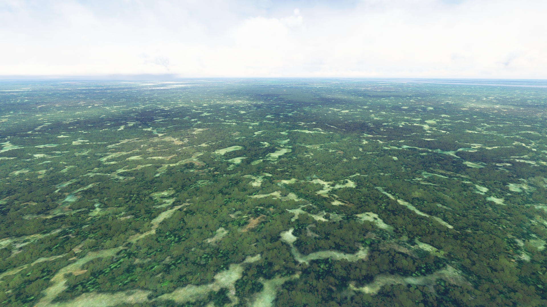
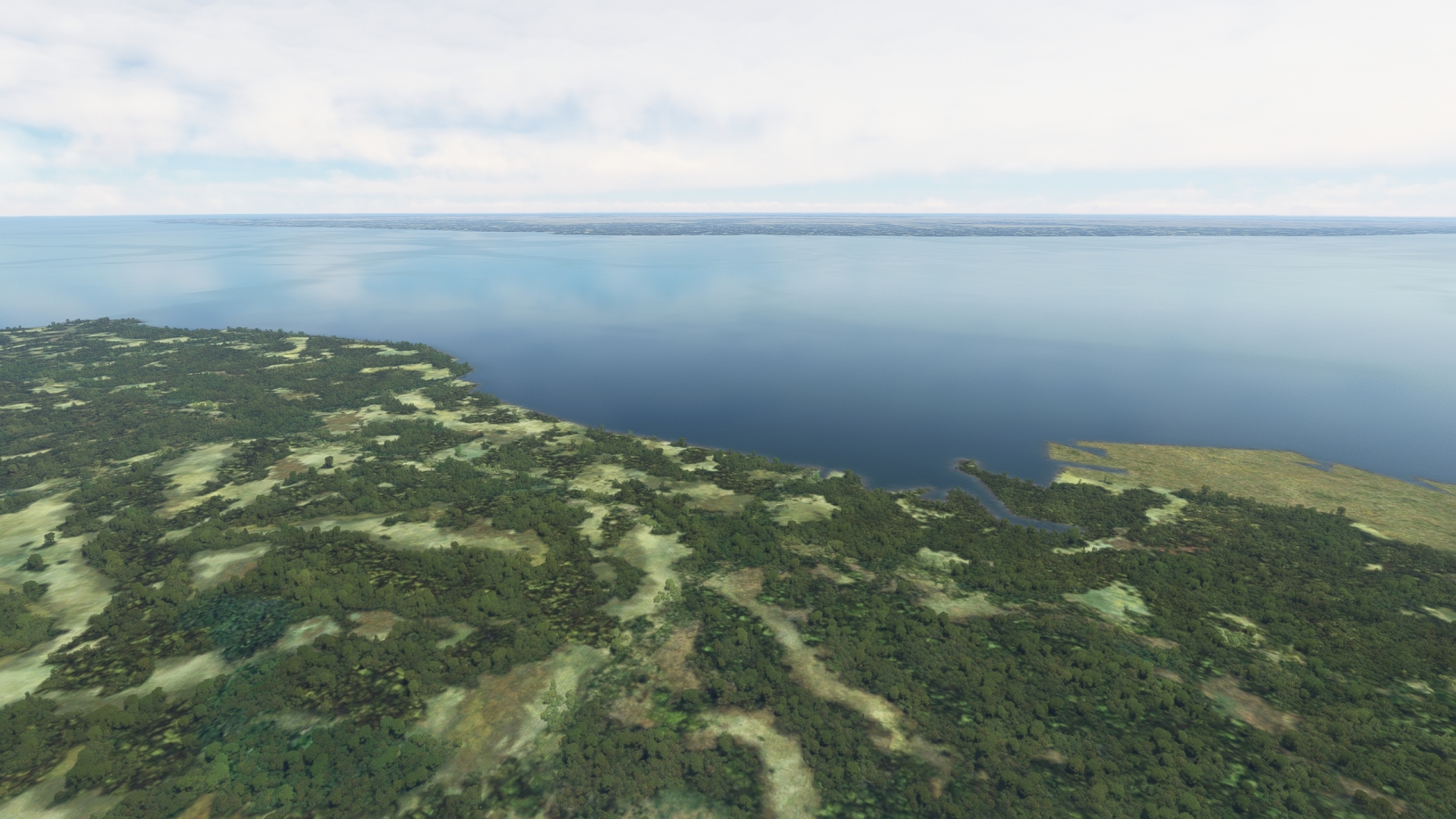
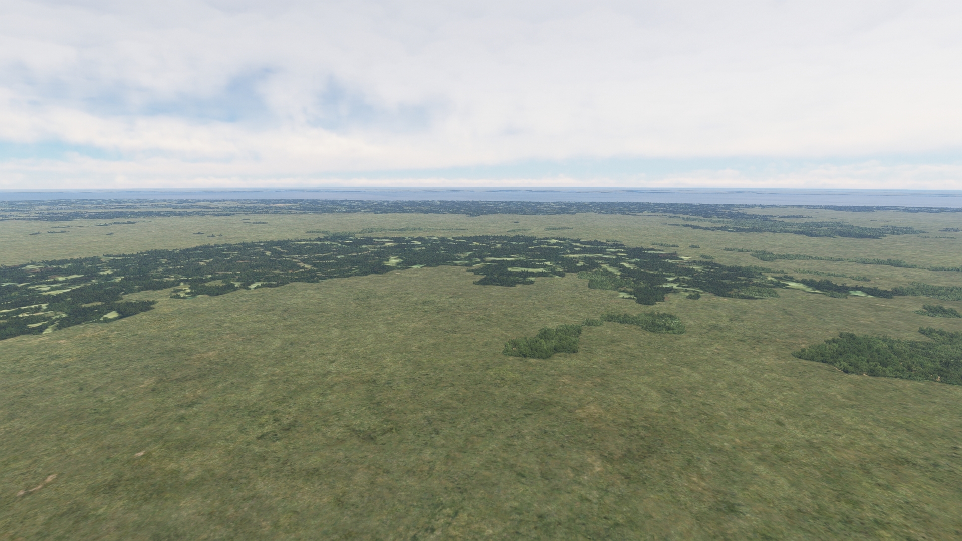
Turn north over Arena da Amazônia and follow the course of highway BR-174. Views of urban expanse are quickly replaced by broad vistas of the massive Amazon Rainforest. This section of the journey grants an intimate appreciation for both the sheer scale of the Amazon Basin and the intricate details of growth that compose the rainforest. The vegetation canopy is so thick that little sunlight reaches the floor of the rainforest.
Gain a visual on the Urubu River (Rio Urubu) and the small village of Rio Urubu on its southern bank. Pass over the Rio Urubu Bridge (Ponte Rio Urubu).
Urubu River Bridge(POI4) to Urubu River(POI5)
Distance: 11.3NM Bearing: 315° 5 minutes
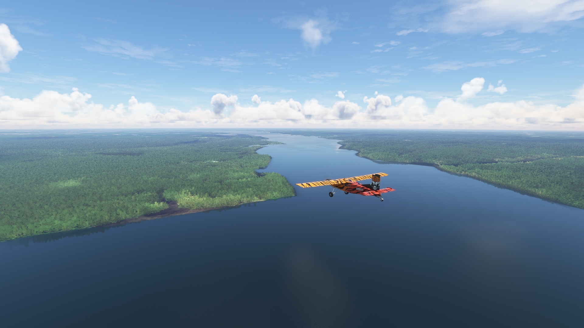
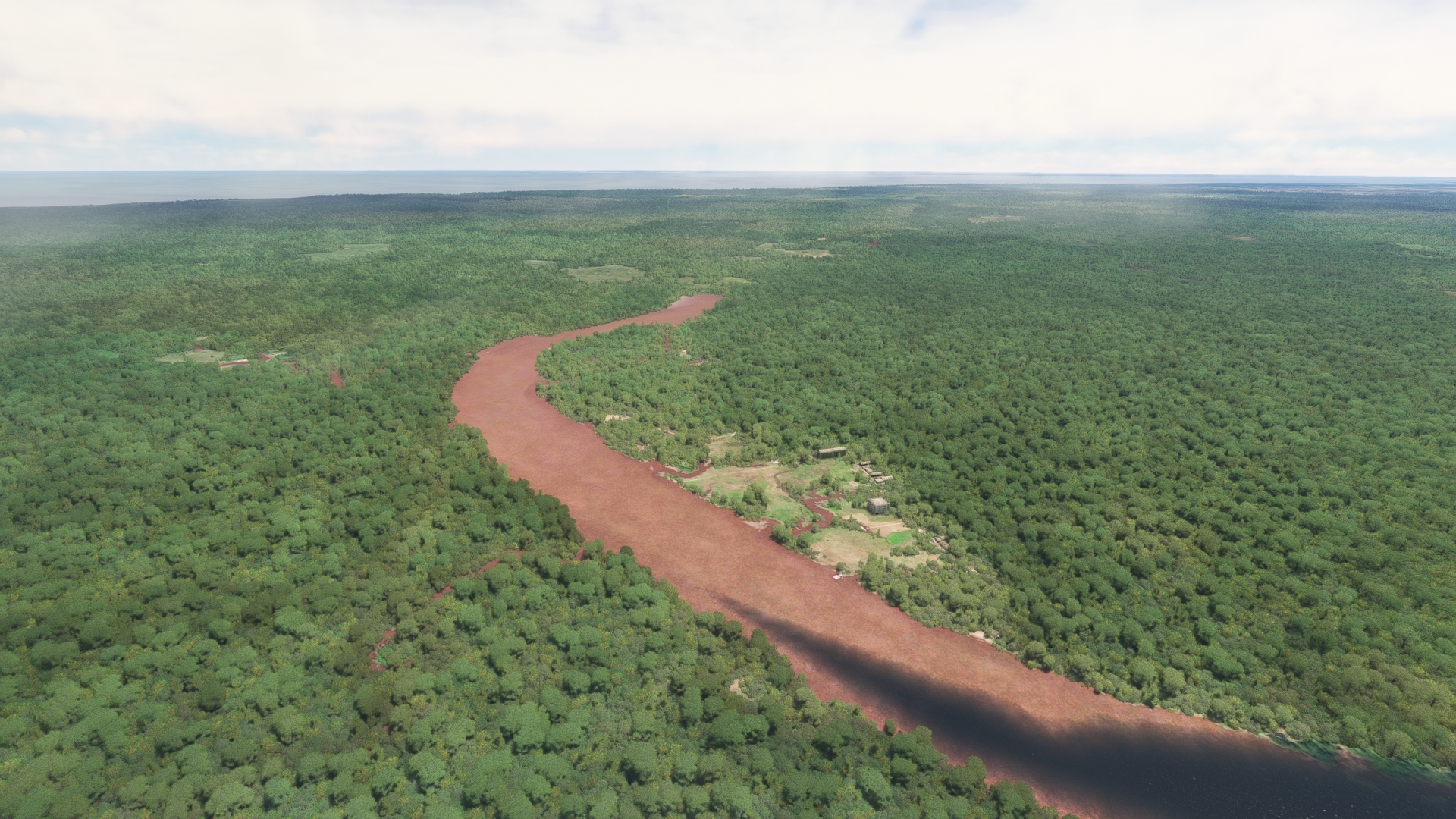
At the Rio Urubu Bridge, turn onto a northwest course and follow the Urubu River upstream. The Rio Urubu, like the Rio Negro, is a blackwater river. The color is due to decaying particulates of organic matter, primarily trees and plants of the rainforest. The Urubu River is a tributary to the Amazon River downstream from Manaus.
Urubu River(POI5) to Presidente Figueiredo Airport(SBRI)
Distance: 2.47NM Bearing: 32° 1 minutes
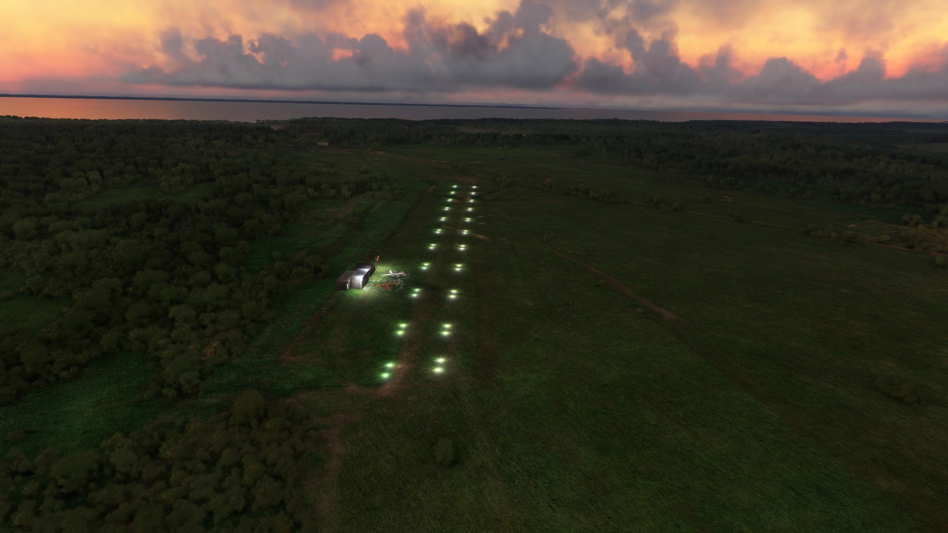
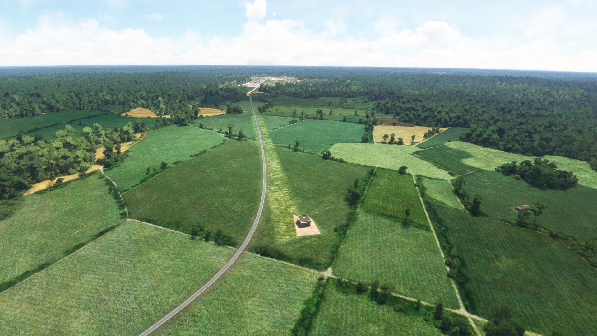
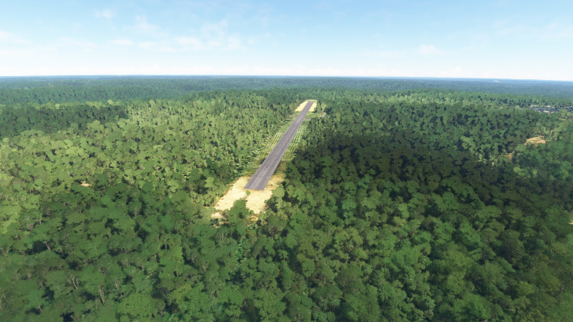
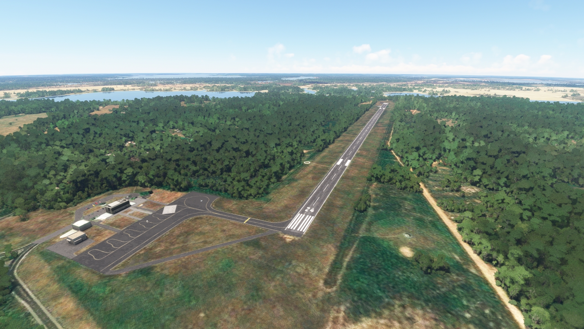
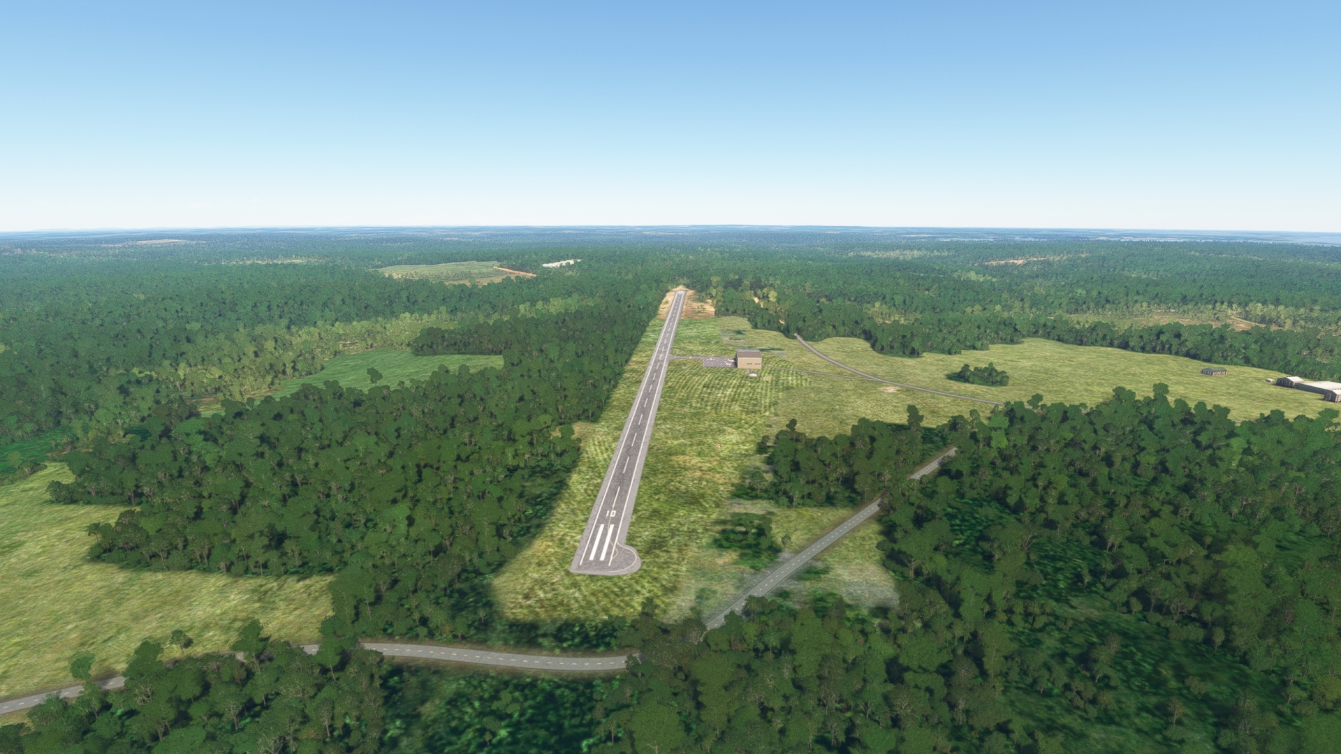
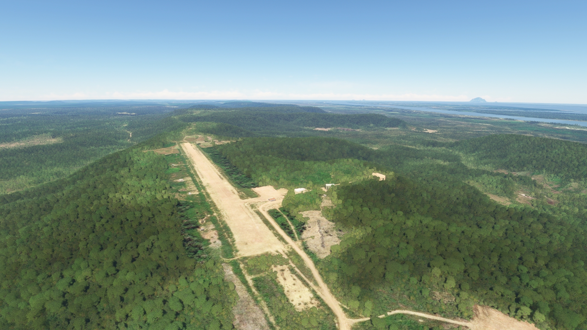
Gain a visual on Presidente Figueiredo Airport (SBRI), which lies to the north of the Urubu River amid agriculture fields, and land. The airport is located just to the southwest of an agricultural complex.
Leg 2
Presidente Figueiredo Airport to Balbina
Leg Distance: 45.87 Approximate time at 125kts: 22 minutes.
Presidente Figueiredo Airport(SBRI) to Presidente Figueiredo(POI6)
Distance: 8.21NM Bearing: 132° 4 minutes
Take-off from Presidente Figueiredo Airport and set a course to the southeast. Fly over the town of Presidente Figueiredo, named after João Batista de Figueiredo Tenreiro Aranha, the first president of Amazonas (when it was a province). The town is known as the “Land of Waterfalls” due to more than 100 waterfalls in the area.
Presidente Figueiredo(POI6) to Balbina Dam(POI7)
Distance: 33.54NM Bearing: 94° 16 minutes
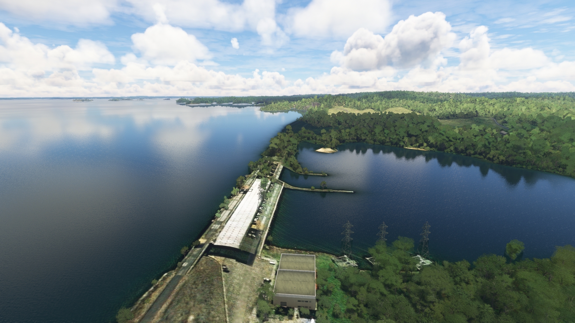
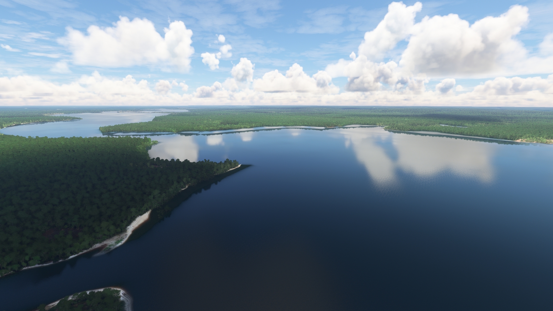
Turn onto a northeast heading and gain a visual on Lake Balbina (Lago de Balbina), a large reservoir. Follow the Amazonas state highway AM-240 from Presidente Figueiredo to the southeastern extremity of Lake Balbina and the Balbina Dam. The lake was formed by the construction of the Balbina Dam on the Uatumã River (Rio Uatumã), a northern tributary of the Amazon River. Lake Balbina covers approximately 900 square miles of Amazon rainforest.
Balbina Dam(POI7) to Balbina(SWBL)
Distance: 4.12NM Bearing: 108° 2 minutes
Turn to the east over Balbina Dam and gain a visual on the town of Balbina. Land at Balbina Airport (SWBL), which is located just to the northeast of town.
Leg 3
Balbina to Urucara
Leg Distance: 123.03 Approximate time at 125kts: 59 minutes.
Balbina(SWBL) to Uatuma River(POI8)
Distance: 5.3NM Bearing: 228° 3 minutes
Lift off from Balbina Airport and turn onto a southwest heading and gain a visual on the Uatumã River (Rio Uatumã). Like other rivers in this part of the Amazon Basin, the Uatumã River is a blackwater river. The area is home to numerous archaeological sites, including ancient petroglyphs. Due to the incredible growth in the Amazon, many archaeological ruins remain undiscovered, deeply buried beneath soil and vegetation.
Uatuma River(POI8) to Uatuma River Meanders and Oxbows(POI9)
Distance: 27.99NM Bearing: 143° 13 minutes
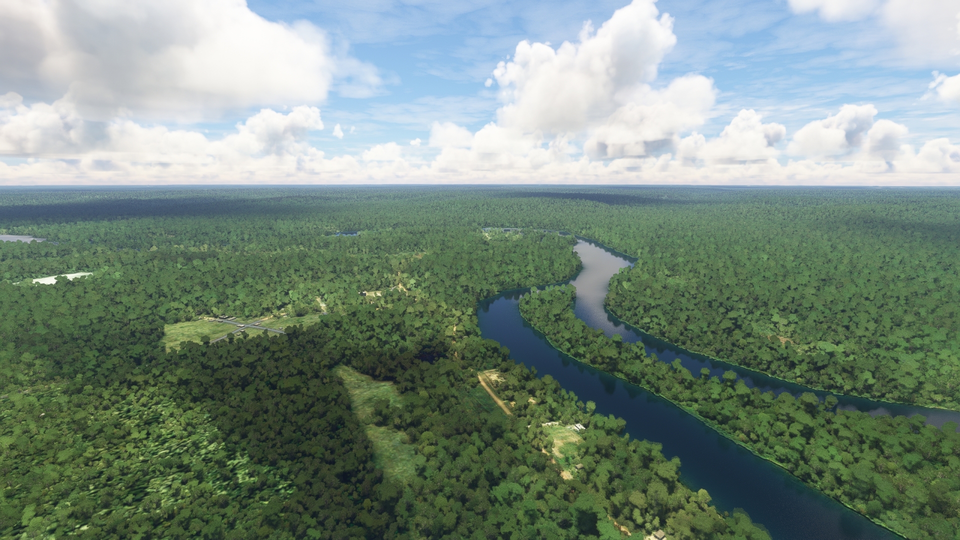
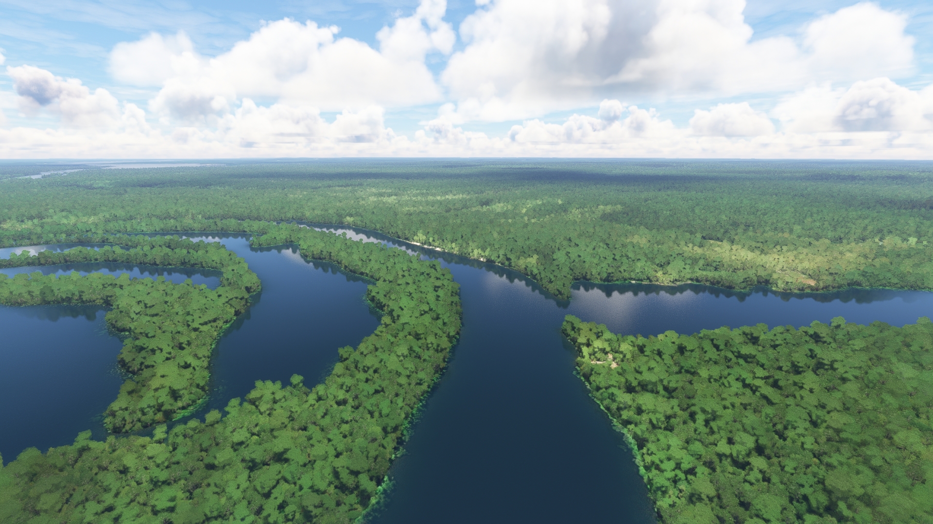
Follow the Uatumã River along its course to the southeast and gain a visual on a series of distinct meanders of the river. Meanders form due to the complex action of a river’s incising action and deposition of weathered and eroded sediment. Pass over the meander of the Uatumã River where a southern tributary of the river joins the main branch. Several oxbows, small bow-shaped lakes formed by the migrating action of a meander, are located just north of the main branch of the river.
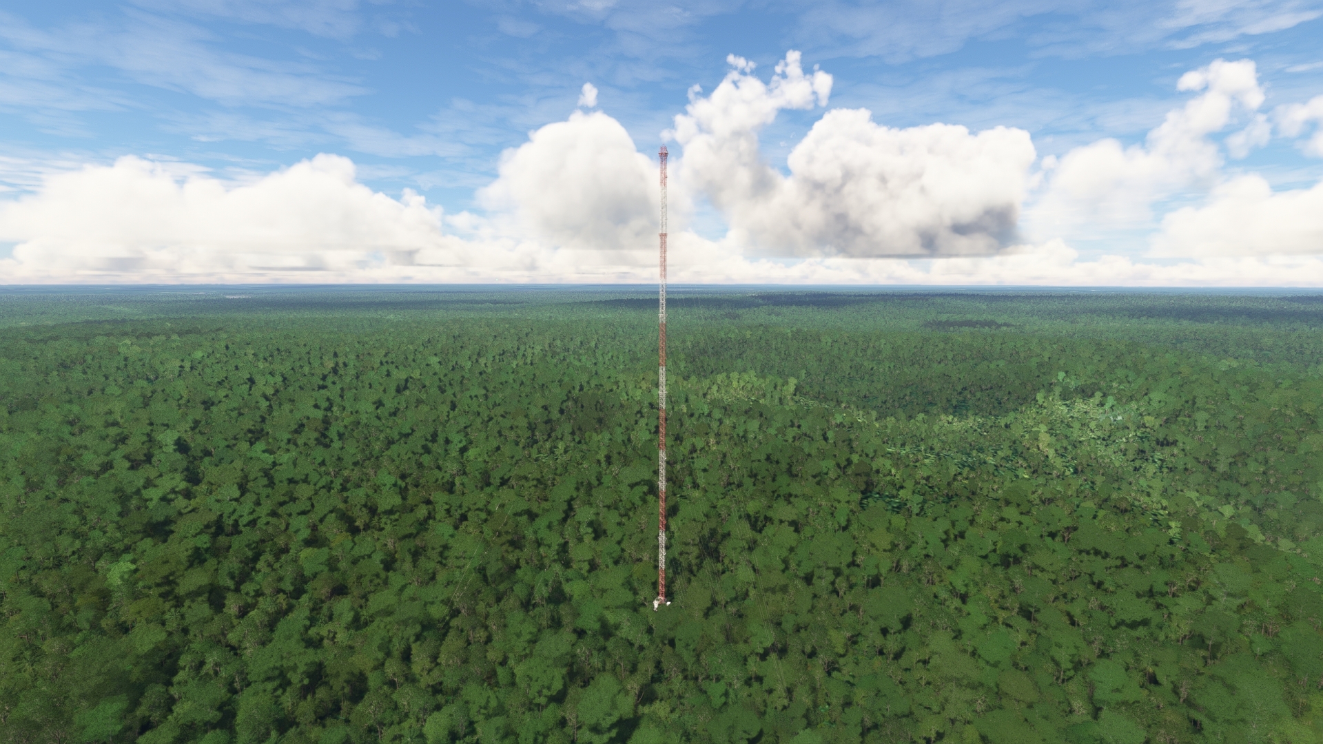
Uatuma River Meanders and Oxbows(POI9) to Amazon Tall Tower Observatory(POI10)
Distance: 9.15NM Bearing: 48° 4 minutes
Once over the meanders and oxbows of the Uatumã River, gain a visual on the river Igarapé Tucumanduba to the south. The river joins the Amazon at the southernmost point of the prominent meander of the area. Fly over the confluence and turn onto a course of 47° M and pass over the dense rainforest of the area. Continue on course to reach the Amazon Tall Tower Observatory (ATTO), a 1,066-foot (325 meter)-tall steel tower. The structure is a joint German-Brazilian scientific initiative to learn more about the interaction of the atmosphere, the rainforest, and the ground of the Amazon Basin. The ATTO, which is the tallest structure in South America, houses numerous instruments that work in concert with sensors on two other towers in the area and on the ground level of the rainforest.
Amazon Tall Tower Observatory(POI10) to Lake Cumateuba(POI11)
Distance: 7.64NM Bearing: 163° 4 minutes
Turn sharply at the ATTO onto a southeast heading and gain a visual on the Uatumã River and Lake Cumateúba (Lago Cumateúba). The lake was formed by the migration of the large meander of the Uatumã River directly to its south.
Lake Cumateuba(POI11) to Jatapu River(POI12)
Distance: 44.44NM Bearing: 125° 21 minutes
After passing over Lake Cumateúba, follow the path of the Uatumã River to the east-southeast to the confluence of the Uatumã and Jatapu Rivers. The Jatapu River (Rio Jatapu) is a major tributary to the Uatumã River, flowing into it from the north. The numerous tributaries of the Amazon that come into view from the air dramatically show the intricacies and interrelatedness of the hydrologic structure of the greater Amazon Basin. The region experiences tremendous levels of rainfall; Manaus receives an average of 93 inches of rainfall per year, nearly eight feet! The precipitation throughout the entire 2.7-million-square-mile Amazon Basin ultimately flows into the main Amazon River (along with meltwater from its source high in the Peruvian Andes) through over 1,100 tributaries like the Jatapu.
Jatapu River(POI12) to Urucara(SWWK)
Distance: 28.51NM Bearing: 114° 14 minutes
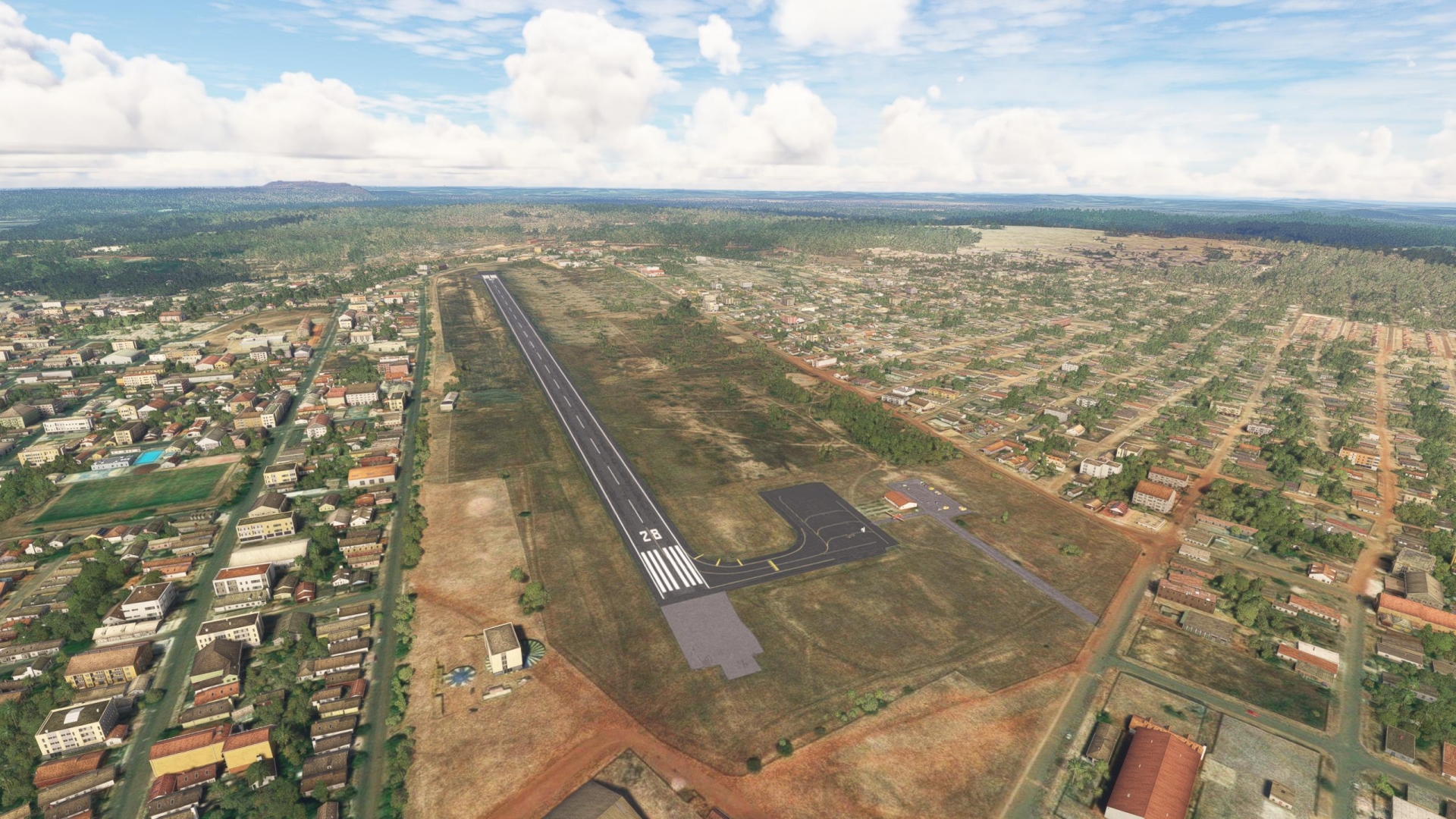
Continue following the course of the Uatumã River. Pass the confluence of the Maripá River (Rio Maripá), which flows into the Uatumã River from the north. Pass the town of São Sebastião do Uatumã, which lies just to the east of the confluence of the Maripá and Uatumã rivers. The town is a center of cassava and livestock production and is renowned by anglers for its sports fishing. Continue following the river to the town of Urucará, which lies on the north bank of the Uatumã River. Land at Urucará Airport (SWWK), located on the north side of the town.

Leg 4
Urucara to Parintins
Leg Distance: 63.84 Approximate time at 125kts: 31 minutes.
Urucara(SWWK) to Amazon Confluence(POI13)
Distance: 12.94NM Bearing: 74° 6 minutes
After taking-off from Urucará Airport, continue to the northeast, following the Uatumã River. Continue tracking the Uatumã River until it ends at its confluence with the Amazon River at a large meander in the Amazon’s course.
The wealth of life engendered by the Amazon River and the Amazon Basin’s tropical climate supported multiple societies in the area long before the first European explorers arrived. Archaeologists estimate that up to 3 million indigenous people lived throughout the Amazon basin in advanced societies, practicing farming, hunting, gathering, and fishing.
In 1500, Spanish explorer Vicente Yáñez Pinzón was the first European to document a journey into the Amazon. During his expedition, which penetrated just fifty miles upstream from the delta, he named the river “Río Santa María del Mar Dulce,” Saint Mary’s River of the Sweet Sea – “Sweet Sea” a reference to the fresh water of the delta region. In 1541 to 1542, Spaniard Francisco de Orellana and his expedition descended the river, beginning in the Andes, during a quest for gold and other riches. After passing present day Manaus, his expedition encountered native female warriors he named “Amazons” after legendary women fighters described in Greek mythologies. His use of the term Amazon was repeated in literature and it eventually was used as the basis for the name of the River.
Amazon Confluence(POI13) to The Saracura Event – Amazon Tsunami(POI14)
Distance: 33.01NM Bearing: 124° 16 minutes
Continue following the Amazon downstream and pass the small village of Mocambo on its northern bank. The river widens at this point, flowing around three large islands and several smaller islets. Fly over the islands and islets to reach the southern bank of the river, a part of the Amazon called by some the “Eagle Coast,” which is near the village of Saracura. A seismic shift in a fault under the Amazon in this area caused a series of waves, some as tall as 20 feet, to roar down the river and impact the village of Saracura. Called the Saracura Event, this “Amazon Tsunami” displaced over 100 residents, killed a farmer, and cut a cove into the southern bank of the river.
The Saracura Event – Amazon Tsunami(POI14) to Parintins(SWPI)
Distance: 17.89NM Bearing: 130° 9 minutes
Continue following the southern bank of the Amazon and gain a visual on the city of Parintins. Parintins Airport (SWPI), also called Júlio Belém Airport, is located southwest of the city adjacent several small river channels.
Leg 5
Parintins to Obidos
Leg Distance: 89.84 Approximate time at 125kts: 43 minutes.
Parintins(SWPI) to Bumbodromo(POI15)
Distance: 3NM Bearing: 62° 1 minutes
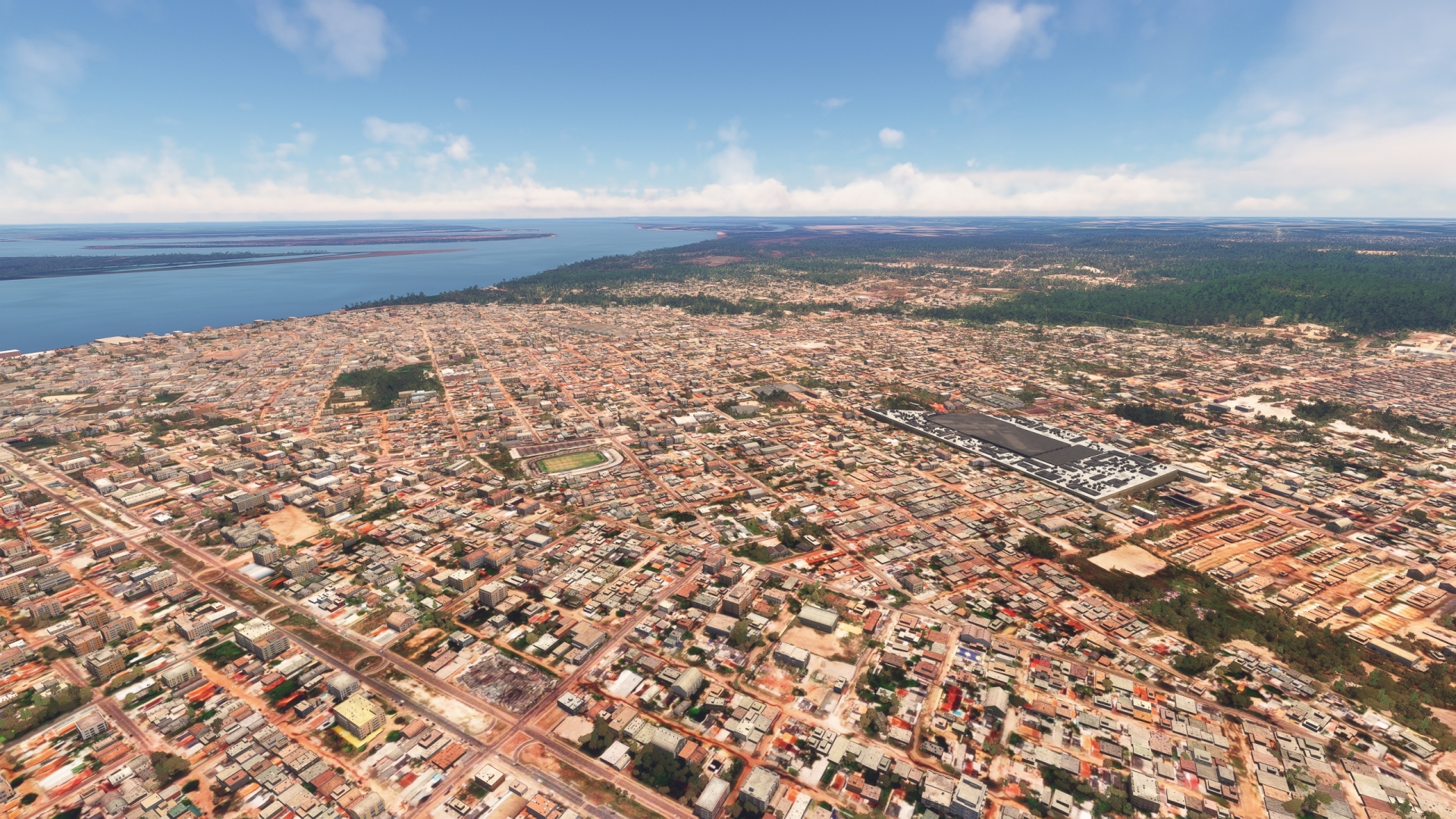
Lift off from Parintins Airport and fly to the northeast to Parintins. With just over 100,000 inhabitants, Parintins is the second largest city in the state of Amazonas after Manaus. Pass over the Parintins Cultural Center and its Bumbódromo, an amphitheater with seating for up to 35,000 spectators. The Parintins Folklore Festival, one of Brazil’s most renowned cultural events, is hosted at the Bumbódromo every year.
Bumbodromo(POI15) to Santa Julia(POI16)
Distance: 21.53NM Bearing: 72° 10 minutes
Continue following the Amazon’s course to the northeast. Gain a visual on the small village of Santa Júlia, which is located on a clearing on the river’s southern bank. Stay on course and leave Amazonas and enter Pará, Brazil’s second largest state by area, then pass over Santa Júlia.
Santa Julia(POI16) to Juruti(POI17)
Distance: 26NM Bearing: 71° 12 minutes
Track the southern bank of the Amazon and pass Macaianim Island (Ilha do Macaianim) and then gain a visual on the city of Juruti, located on the southern bank of the Amazon. The city supports a large bauxite mine that is located to its southwest. Bauxite, the world’s primary source of aluminum, is a key export of Brazil. The majority of Brazil’s bauxite is mined in the state of Pará.
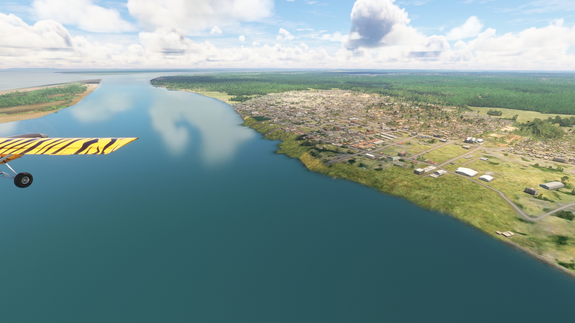
Juruti(POI17) to Obidos(SNTI)
Distance: 39.31NM Bearing: 82° 19 minutes
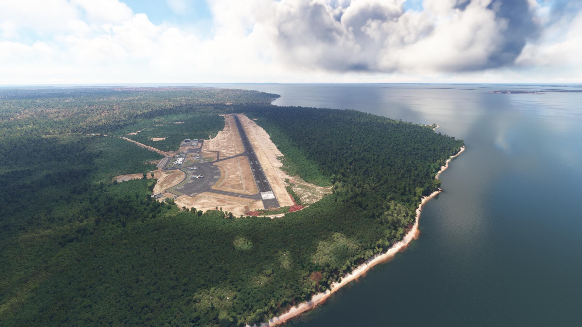
Continue on course to the northeast, tracking the southern bank of the Amazon. Gain a visual on the Trombetas River (Rio Trombetas), a 470-mile-long northern tributary to the Amazon that is known for its numerous rapids. The city of Óbidos is located just to the east of the confluence of the Trombetas and Amazon Rivers on the Amazon’s northern bank. Land at Óbidos Airport (SNTI), located on the north end of the city.
Leg 6
Obidos to Santarem
Leg Distance: 55.67 Approximate time at 125kts: 27 minutes.
Obidos(SNTI) to Vila Menino Desus(POI18)
Distance: 22.45NM Bearing: 157° 11 minutes
The Amazon turns onto a southeast course downstream of Óbidos. Take-off from Óbidos Airport, follow the river, and gain a visual on Great Curuai Lake (Lago Grande do Curuai), located to the southwest of the Amazon. Pass over the village of Vila Menino Desus, located on a low spit of land between the Amazon and the lake.
Vila Menino Desus(POI18) to Santarem(SBSN)
Distance: 33.22NM Bearing: 139° 16 minutes
Continue on course and pass over the confluence of the Tapajós River (Rio Tapajós) and the Amazon. The 1,300-mile-long Tapajós is a major tributary of the Amazon and joins the river from its south. Gain a visual on the city of Santarém on the eastern side of the confluence. Land at Santarém-Maestro Wilson Fonseca Airport (SBSN), located on the western side of Santarém.
Leg 7
Santarem to Monte Alegre
Leg Distance: 57.99 Approximate time at 125kts: 28 minutes.
Santarem(SBSN) to Santarem(POI19)
Distance: 4.22NM Bearing: 129° 2 minutes
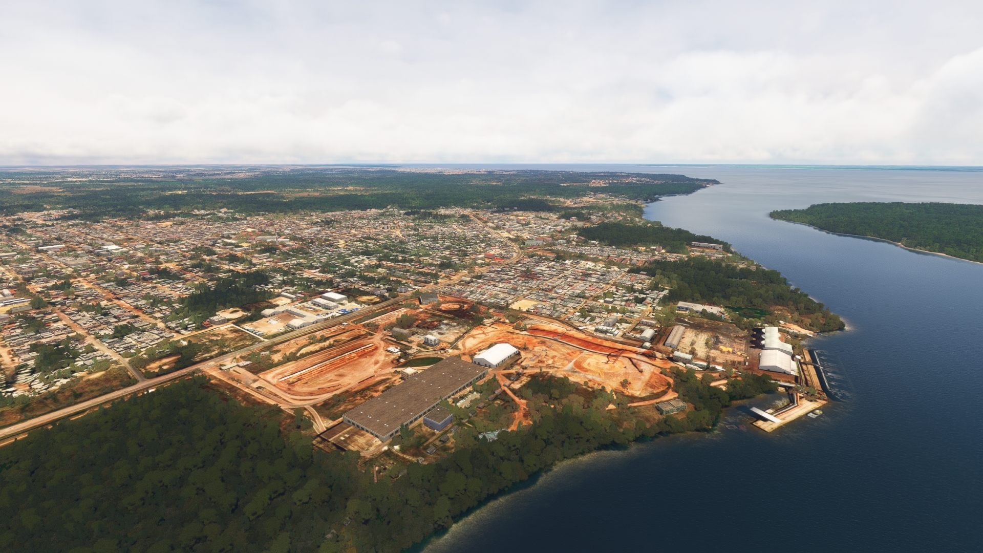
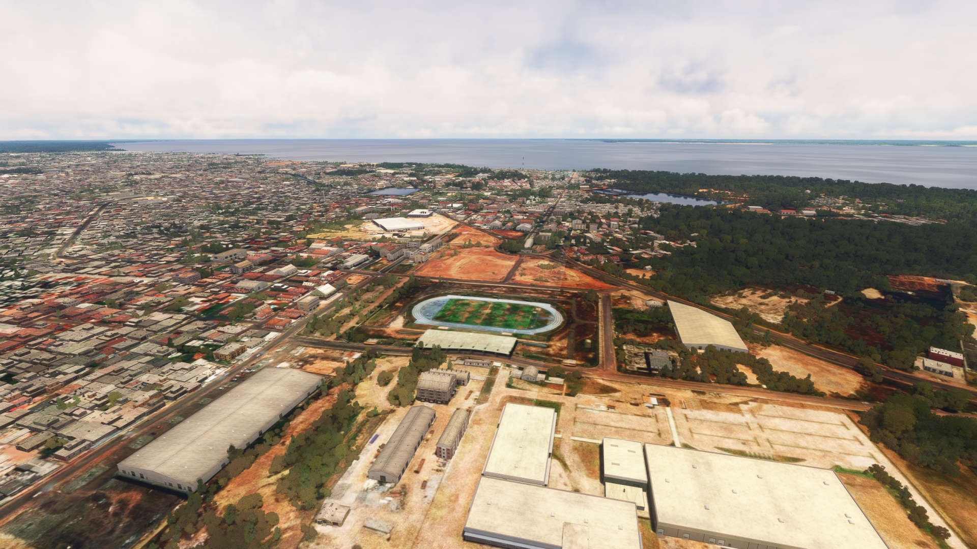
After lifting off from Santarém-Maestro Wilson Fonseca Airport, head to the southeast and pass over the city of Santarém. The city is today one of the most important business, financial, cultural, and tourism centers in the entire Amazon Basin. Its port, Port of Santarém, is a critical hub as it is located midway between Manaus and the Atlantic coast. The port is a vital logistical center for the numerous villages in the region and for transport of the many agricultural and other products of the area. The beaches and clear water of the area has made Santarém renowned as a vacation destination.
Santarem(POI19) to Great Lake of Monte Alegre(POI20)
Distance: 34.89NM Bearing: 94° 17 minutes
Turn to the east-northeast over Santarém and pass over a small group of low islands and then reach the Great Lake of Monte Alegre (Lago Grande de Monte Alegre) on the north side of the Amazon River. The large lake is an important source of fish for locals in the area.
Great Lake of Monte Alegre(POI20) to Monte Alegre(SNMA)
Distance: 18.88NM Bearing: 35° 9 minutes
Turn to the northeast over the Great Lake of Monte Alegre and sight the city of Monte Alegre. The area is an important archaeological region that has revealed troves of information about pre-colonial societies in the Amazon. Land at Monte Alegre Airport (SNMA), located in the middle of the city.
Leg 8
Monte Alegre to Almeirim
Leg Distance: 94.85 Approximate time at 125kts: 46 minutes.
Monte Alegre(SNMA) to Prainha(POI21)
Distance: 37.16NM Bearing: 91° 18 minutes
Lift off from Monte Alegre Airport and fly along the northern shoreline of the Amazon to the city of Prainha. The city was established as a port and trading center to leverage the commercial activity on the Amazon.
Prainha(POI21) to Almeirim(SNYA)
Distance: 57.69NM Bearing: 90° 28 minutes
Continue on course along the northern bank of the Amazon. Pass the river islands of Jurupari and Almeirim and then gain a visual on the town of Almeirim. Land at Almeirim Airport, located just north of town. Almeirim was established in the early 1600s by Portuguese and Dutch colonists. Decades later, in 1685, the Portuguese built a fort to control navigation on its section of the Amazon.
Leg 9
Almeirim to Macapa Intl
Leg Distance: 145.75 Approximate time at 125kts: 70 minutes.
Almeirim(SNYA) to Grand Gurupa Island(POI22)
Distance: 36.47NM Bearing: 105° 18 minutes
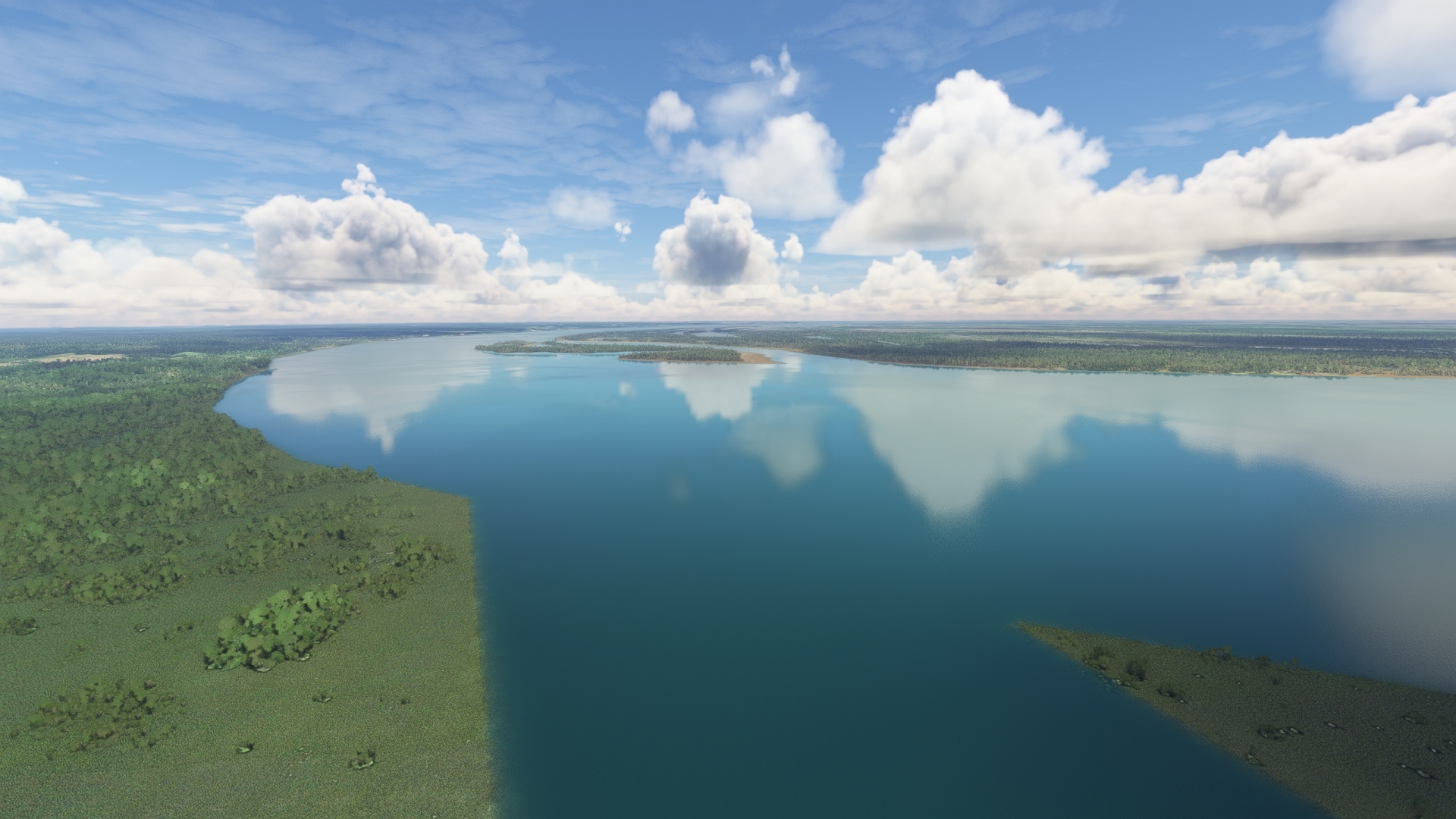
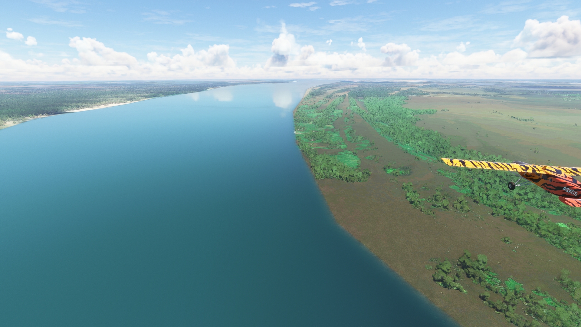
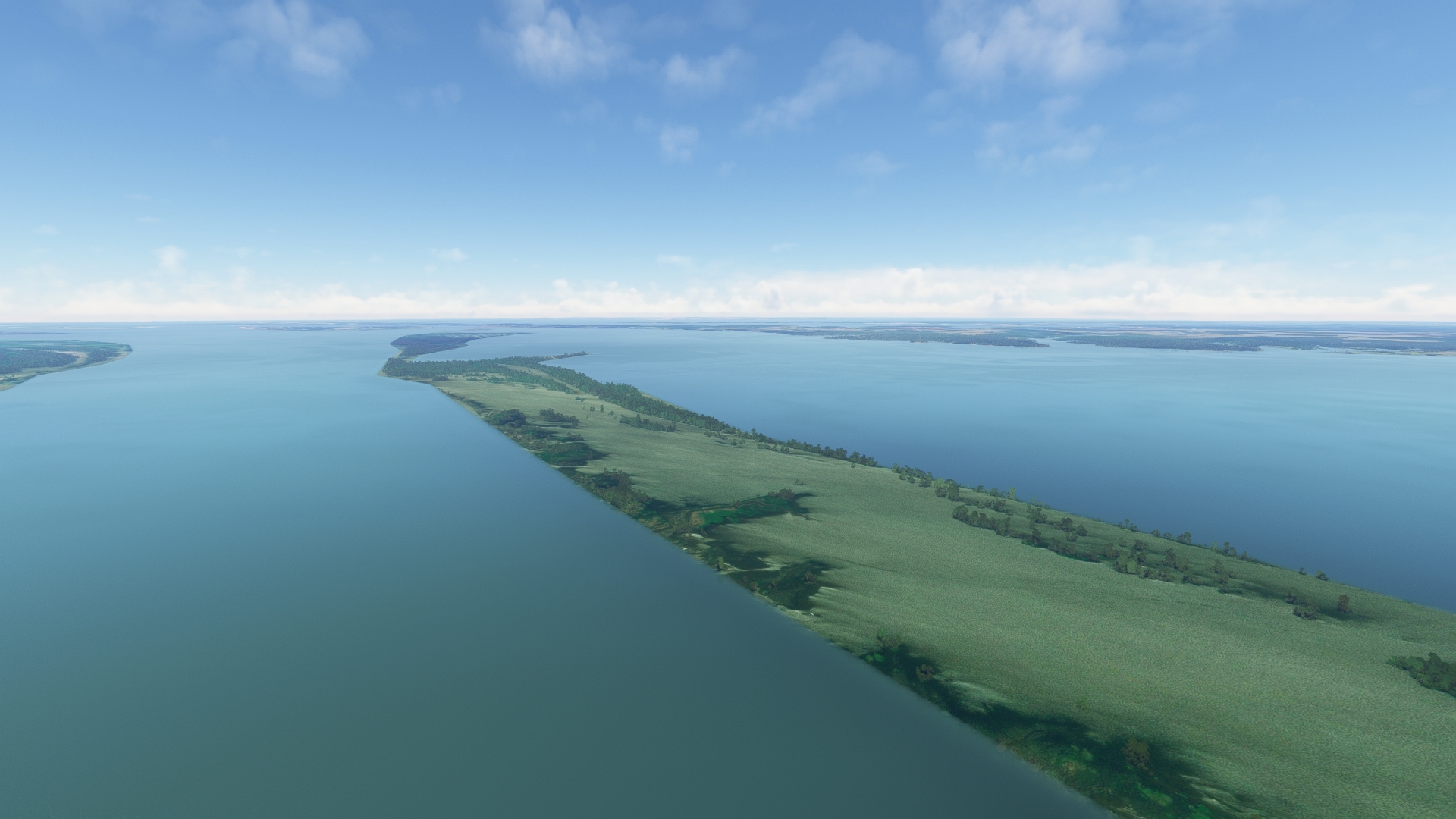
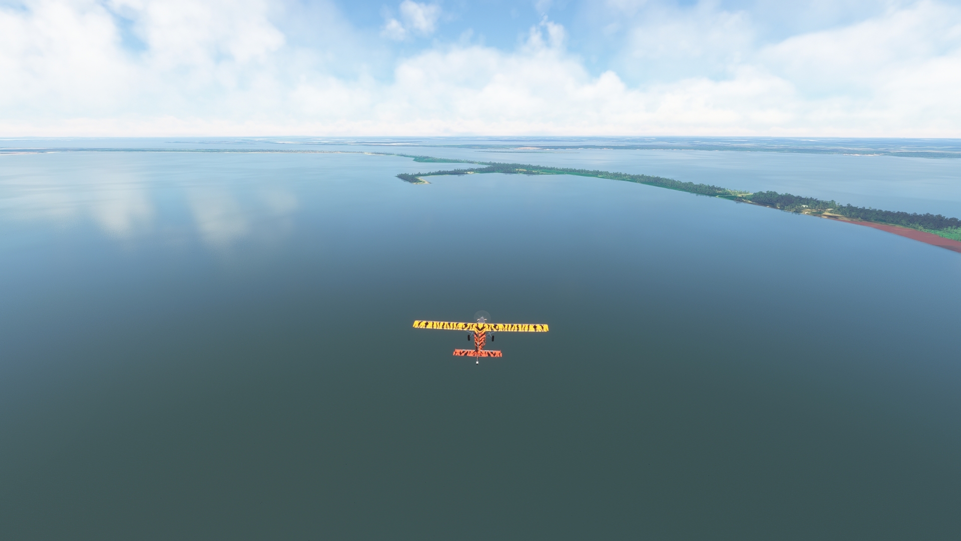
After taking-off from Almeirim Airport, fly out over the midline of the Amazon and pass over Commandi Island (Ilha do Comandaí). As the Amazon nears its outlet to the Atlantic Ocean (at this point just under 250 miles distant), its rate of downstream flow slows very gradually. The amount of sediment it can carry is related to water speed. The faster the flow, the more sediment it can carry; and as it slows, the river deposits sediment. This deposition creates complex networks of low islands like Commandi Island. Pass another low island, Urucuricaia Island (Ilha Urucuricaia) and reach Grand Gurupá Island (Ilha Grande de Gurupá). This large island (80 miles long by 28 miles wide) comprises several small rivulets, islets, and is covered in vast swaths of rainforest. The island is the westernmost aspect of the Amazon River Delta, which has formed over millennia as the last of the river’s sediment is deposited at its juncture with the Atlantic Ocean.
The entire group of islands in the Amazon River Delta is called the Marajó Archipelago. There are more than 2,500 low islands built of fine silt in this island group, the westernmost being Grand Gurupá Island.

Grand Gurupa Island(POI22) to Itatupa-Baquia Sustainable Development Reserve(POI23)
Distance: 55.28NM Bearing: 62° 27 minutes
Fly on a northeasterly course along the midline of Grand Gurupá Island and climb to 3,000 feet to gain a view of the western portion of Amazon River Delta. Fly over the Itatupã-Baquiá Sustainable Development Reserve, located at the northeastern end of Grand Gurupá Island. The Brazilian government established the reserve to protect the unique ecosystem of this part of the Amazon Delta region.
Itatupa-Baquia Sustainable Development Reserve(POI23) to Santana(POI24)
Distance: 43.38NM Bearing: 34° 21 minutes
Maintain altitude and heading and pass over a series of islands and channels to the northeast of Grand Gurupá Island, many of which are protected reserves. The view from this altitude provides a great perspective to understand how the delta region and the Marajó Archipelago was formed and continues to evolve.
Sight the city of Santana in the distance and continue onto the northern bank of the Amazon, passing into the Brazilian state of Amapá. Pass the confluence of the northern tributary of the Vila Nova River (Rio Vila Nova) and then fly over Santana Island (Ilha de Santana). Pass the confluence of the northern tributary of the Matapi River (Rio Matapi) and then pass over the city of Santana.
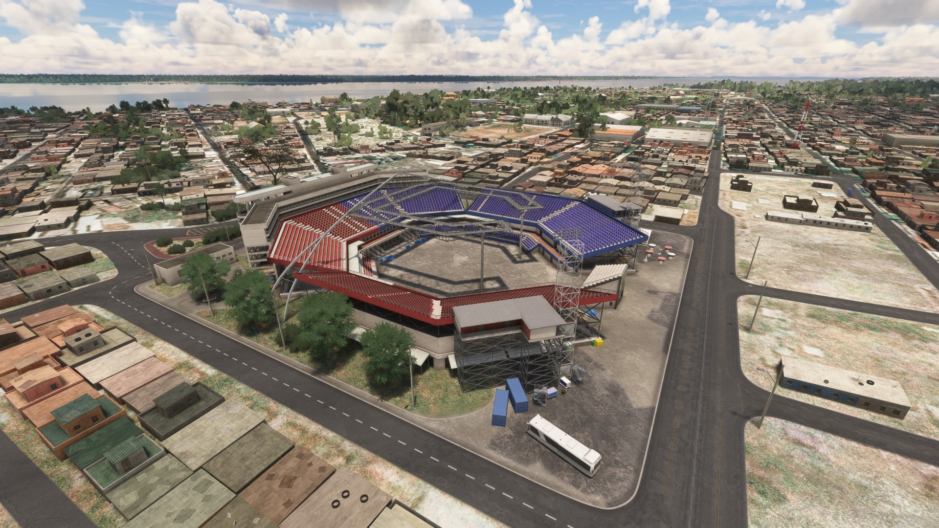
Santana(POI24) to Milton de Souza Correa Stadium(POI25)
Distance: 6.25NM Bearing: 78° 3 minutes
At Santana, gain a visual on Amapá state highway AP-010, the course of which parallels the northern bank of the Amazon. Follow the highway to Milton de Souza Corrêa Stadium. Commonly referred to as Zerão, the stadium is located just a few hundred feet north of the equator, hence the nickname Zerão (Big Zero), as in 0 latitude.
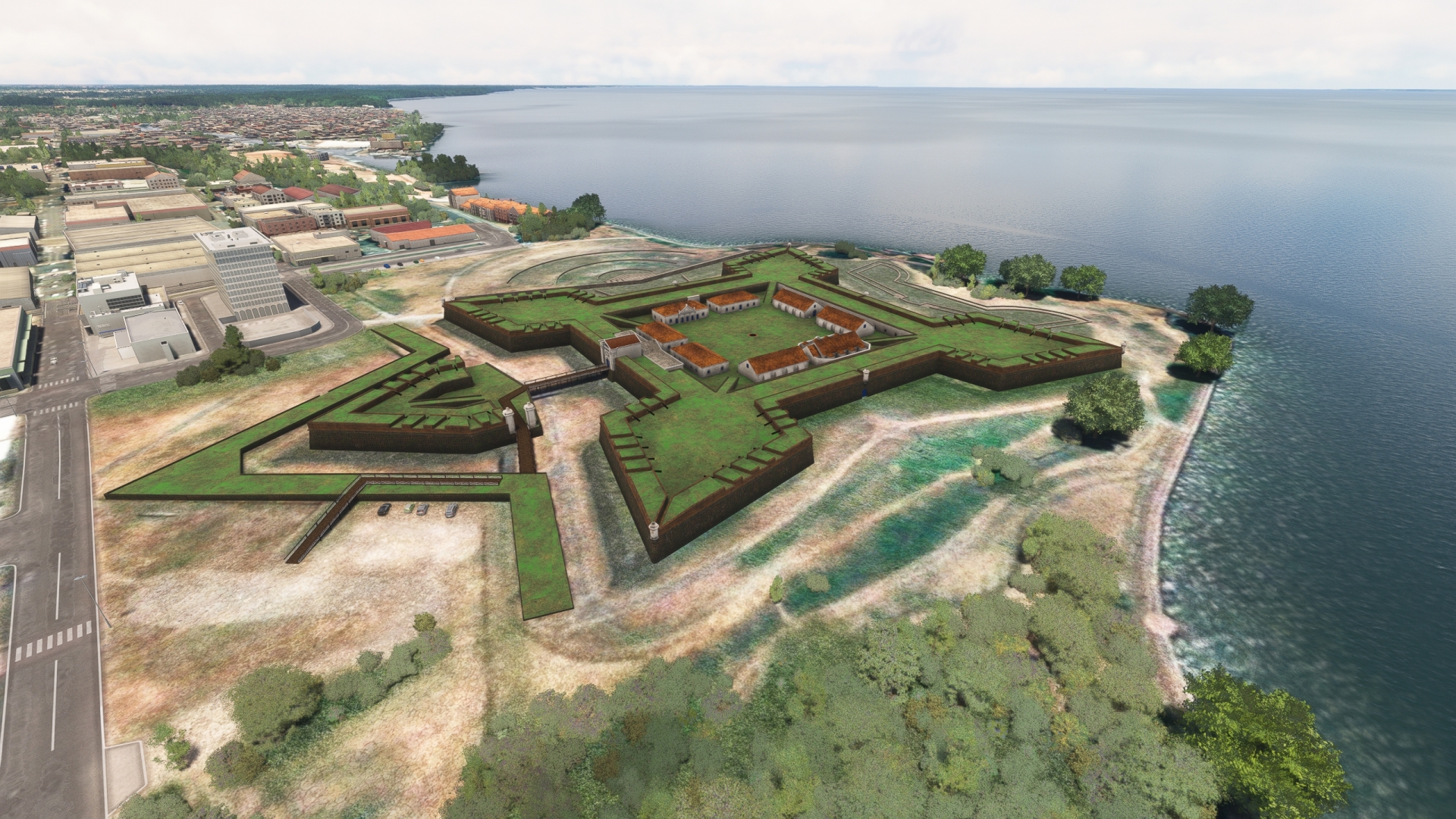
Milton de Souza Correa Stadium(POI25) to Sao Jose de Macapa Fortress(POI26)
Distance: 2.64NM Bearing: 66° 1 minutes
Continue on course to the northern shore of the Amazon and São José de Macapá Fortress (Fortaleza de São José de Macapá). Built in the late 1700s, this fort was built to establish a stronghold on the northern bank of the Amazon. The city of Macapá grew in the presence of the fort in the decades after its construction. Today, apart from being the capital of Amapá, the city of more than a half million is a vital center of commerce.
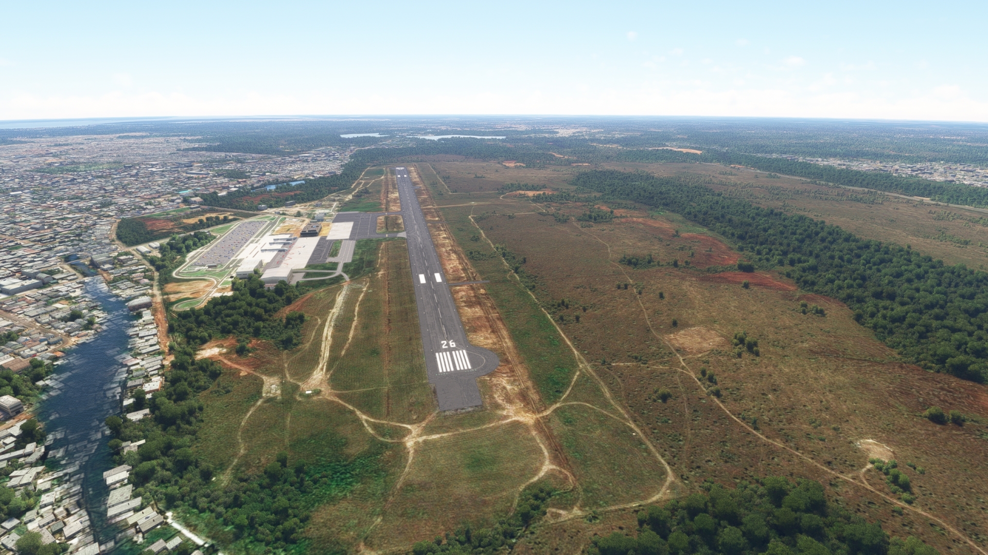
Sao Jose de Macapa Fortress(POI26) to Macapa Intl(SBMQ)
Distance: 1.73NM Bearing: 333° 1 minutes
Turn to the northwest and fly over the central portion of the city of Macapá, the capital of the Brazilian state of Amapá. Gain a visual on and land at Macapá International Airport (SBMQ).
Leg 10
Macapa Intl to Fazenda Montenegro Airport
Leg Distance: 148 Approximate time at 125kts: 71 minutes.
Macapa Intl(SBMQ) to Ponta Do Ceu(EH)
Distance: 71.49NM Bearing: 73° 34 minutes
Prior to take-off at Macapá International Airport, configure the ADF receiver to 290.0 kHz for NDB Ponta do Céu (EH). Take-off and fly to the northeast and pass over the northern bank of the Amazon River. Once in range of the NDB, use it as the primary navigation guide.
After leaving Macapá International Airport, the route passes to the north of Cará Island (Ilha do Cará), Jurupari Island (Ilha Jurupari), and then passes over the northwestern extremity of Viçosa Island (Ilha Viçosa). Continue back over the Amazon after passing over Viçosa Island to reach the NDB at Ponta do Céu, located at the southern end of Curuá Island (Ilha Curuá).
Ponta Do Ceu(EH) to Sao Sebastiao de Vicosa(POI27)
Distance: 11.22NM Bearing: 202° 5 minutes
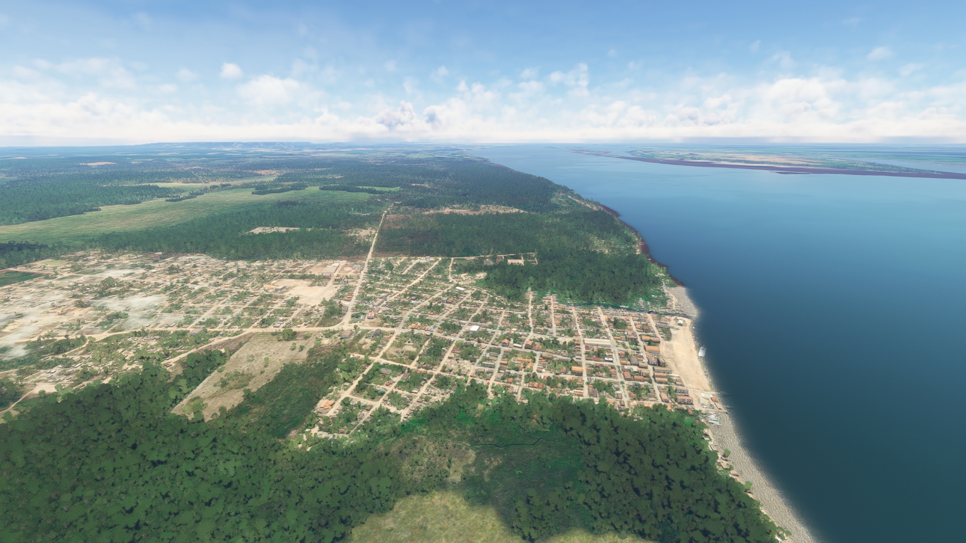
Once at Ponta do Céu, turn to the south and pass over the Amazon River where it meets the Atlantic Ocean. Gain a visual on the eastern extremity of Viçosa Island and pass over the fishing village of São Sebastião de Viçosa, located on the north side of the island at the head of a small rivulet extending to the Amazon.
Sao Sebastiao de Vicosa(POI27) to Caviana Island(POI28)
Distance: 21.82NM Bearing: 163° 10 minutes
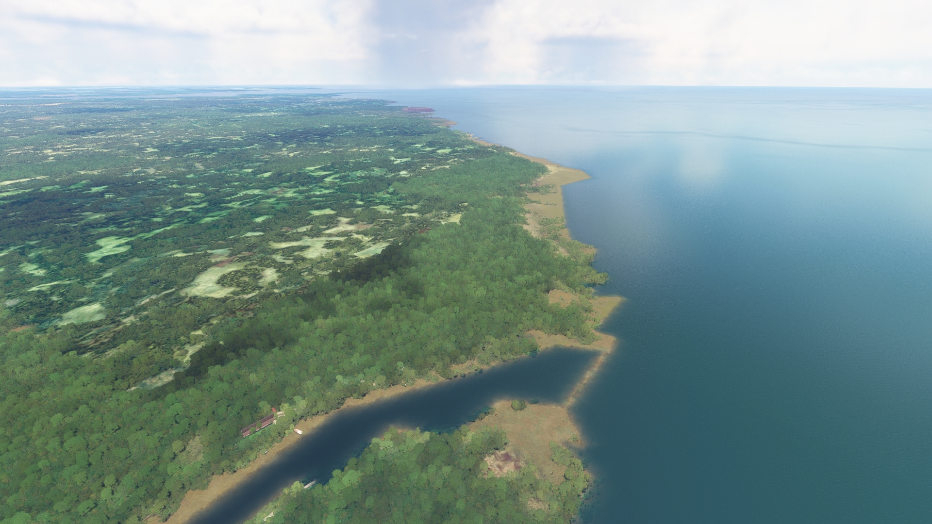
After passing over São Sebastião de Viçosa, turn onto a heading of 163° M and pass over Santa Rosa Bay (Baía de Santa Rosa). The route traverses the outer edge of the Amazon River Delta. While the open Atlantic Ocean lies beyond to the east, under the water the delta extends in a massive cone of sediment for hundreds of miles, built over millennia by the inexorable flow of the Amazon River.
Maintaining course, sight a small unnamed island at the southern end of Santa Rosa Bay and pass over it to reach a small bay on the northern end of Caviana Island (Ilha Caviana).
Caviana Island(POI28) to Pacas Island(POI29)
Distance: 17.22NM Bearing: 134° 8 minutes
Once at Caviana Island, turn onto a heading of 134° M and pass over the eastern end of the island. Gain a visual on two islands in the distance. Pass over the larger, western island, Pacas Island (Ilha das Pacas).
Pacas Island(POI29) to Mexiana Island(POI30)
Distance: 12.63NM Bearing: 183° 6 minutes
Once over Pacas Island, turn onto a heading of 183° M and fly over the midpoint of Mexiana Island (Ilha Mexiana), a low, swampy island. The equator passes directly through the midline of Mexiana Island.
Mexiana Island(POI30) to Fazenda Montenegro Airport(SBTM)
Distance: 13.62NM Bearing: 183° 7 minutes
Now back in the Southern Hemisphere, pass over the channel to the south of Mexiana Island and gain a visual on three small bays on the northern end of Marajó Island (Ilha Marajó). Locate the small airfield, SBTM, behind the middle bay. Marajó Island is the second largest island in South America and the largest in the Marajó Archipelago. It is known for its water buffalo population and a tidal bore wave that occurs when incoming high tides collide with strongly flowing river water. Land at SBTM to complete this incredible journey along the Amazon River. Congratulations!