Travelling from east to west, you’ll visit Austria’s renowned cities and towns, its great mountains, and its gorgeous lakes and rivers.
Points of interest include the capital Vienna, the nation’s highest mountain, Grossglockner, and a number of sights off-the-beaten-path, notably in the famed Tyrol.
You’ll embark on this tour in a Cessna 208 Grand Caravan, stopping off at airports large and small throughout the country on this unforgettable and inspirational aerial voyage.
Assistance on the trip will be available in the form of a ‘Back on Track’ button on the VFR Map — however, be advised that using this will disable achievements tied to the activity.
Total Legs: 8 Total Distance: 392 Total Time(125kts): 3 hours 8 minutes
Leg 1
Schwechat to Linz
Leg Distance: 104.41 Approximate time at 125kts: 50 minutes.
Schwechat(LOWW) to Vienna(POI1)
Distance: 9.75NM Bearing: 301° 5 minutes
After lifting your Cessna 208 Grand Caravan into the Austrian skies from Vienna International Airport, head northwest into the heart of the Austrian capital, Vienna, one of the most storied and historically significant cities in history, not to mention one with exquisite architecture and beautiful vistas, especially when viewed from the air.
Vienna(POI1) to Tulln(TULLN)
Distance: 14.56NM Bearing: 295° 7 minutes
Continue on you northwestern heading to Tulln, a magnificent historic city built on the Danube River and known as the “City of Flowers” due to its multitude of beautiful parks and large manicured gardens.
Tulln(TULLN) to Krems an der Donau(POI2)
Distance: 18.87NM Bearing: 280° 9 minutes
From Tulln, bear slightly to the left and follow the Danube for just under 19 nautical miles to Krems an der Donau, a city built at the confluence of the Krems and Danube rivers.
Krems an der Donau(POI2) to Melk(MELK)
Distance: 15.28NM Bearing: 219° 7 minutes
Turn to the southwest and continue to follow the general path of the Danube to Melk, home of Melk Abbey, a large Benedictine abbey that stands above the town itself on a large buttress of rock that overlooks the Danube.
Melk(MELK) to Ostronger Wald(POI3)
Distance: 10.33NM Bearing: 265° 5 minutes
From Melk, head due west to Ostronger Wald, a beautiful forest overlooking the Danube.
Ostronger Wald(POI3) to Perg(PERG)
Distance: 17.69NM Bearing: 268° 8 minutes
17.7 nautical miles farther west from Ostronger Wald you’ll reach Perg, a city with many beautiful buildings.
Perg(PERG) to SolarCity Linz(POI4)
Distance: 11.01NM Bearing: 270° 5 minutes
A few more minutes of westward flight brings you to SolarCity Linz, an energy efficient district in the city of Linz with housing for approximately 4,000 people.
SolarCity Linz(POI4) to Linz(LOWL)
Distance: 6.92NM Bearing: 256° 3 minutes
Bring your Grand Caravan down at Linz Airport.

Leg 2
Linz to Salzburg
Leg Distance: 66.17 Approximate time at 125kts: 32 minutes.
Linz(LOWL) to Wels(WELS)
Distance: 8.01NM Bearing: 230° 4 minutes
Back in the air, set a course for the southwest, and you’ll arrive at Wels, a city built on the Traun River.
Wels(WELS) to Planasee(POI5)
Distance: 5.05NM Bearing: 217° 2 minutes
Continuing on a southwest heading, you’ll shortly pass over the small lake Planasee, which lies next to the Traun River.
Planasee(POI5) to Traunsee(POI6)
Distance: 15.03NM Bearing: 199° 7 minutes
Bear slightly left and in 15 nautical miles you’ll fly over Traunsee, a beautiful lake surrounded by mountains that some claim is home to a legendary lake monster.
Traunsee(POI6) to Attersee(POI7)
Distance: 9.74NM Bearing: 264° 5 minutes
Turn to the west and you’ll soon arrive at Attersee, a gorgeous alpine lake that is the third largest, by surface area, in Austria, and the largest completely within the nation’s borders.
Attersee(POI7) to Mondsee(POI8)
Distance: 7.35NM Bearing: 247° 4 minutes
Turn on a west-southwest heading and you’ll reach Mondsee, an S-shaped lake surrounded by magnificent peaks, notably the Drachenwand, a sheer cliff at its southern end.
Mondsee(POI8) to Fuschl am See(POI9)
Distance: 3.4NM Bearing: 236° 2 minutes
Continue on your course to Fuschl am See, a town at the southeastern shore of Fuschlsee, an Austrian alpine lake.
Fuschl am See(POI9) to Seekirchen am Wallersee(POI10)
Distance: 9.15NM Bearing: 310° 4 minutes
Turn to the northwest, flying past Fuschlsee, and you’ll shortly arrive at Seekirchen am Wallersee, a town that is the oldest Austrian population center in the country’s history.
Seekirchen am Wallersee(POI10) to Salzburg(LOWS)
Distance: 8.44NM Bearing: 216° 4 minutes
Head to the southwest from Seekirchen am Wallersee for 8.4 nautical miles and land at Salzburg Airport.

Leg 3
Salzburg to Zell Am See
Leg Distance: 43.49 Approximate time at 125kts: 21 minutes.
Salzburg(LOWS) to Hallein(POI11)
Distance: 7.67NM Bearing: 146° 4 minutes
Return to the beautiful Austrian heights and head south-southeast to Hallein, a city on the bank of the Salzach River with rich history, notably, a salt mine that was used for thousands of years.
Hallein(POI11) to Hohenwerfen Castle(POI12)
Distance: 12.58NM Bearing: 158° 6 minutes
Remain on your course for another 12.6 nautical miles and you’ll reach the extraordinary Hohenwerfen Castle, a stone fortress overlooking the Salzach Valley.
Hohenwerfen Castle(POI12) to Hochkonig(POI13)
Distance: 6.31NM Bearing: 229° 3 minutes
From Hohenwerfen Castle, turn southwest and you’ll soon be over Hochkönig, the highest mountain in the Berchtesgaden Alps.
Hochkonig(POI13) to Saalfelden am Steinernen Meer(POI14)
Distance: 8.66NM Bearing: 267° 4 minutes
Head west from Hochkönig for just under 9 nautical miles to arrive at Saalfelden am Steinernen Meer, a town in the midst of gorgeous alpine scenery.
Saalfelden am Steinernen Meer(POI14) to Zell Am See(LOWZ)
Distance: 8.27NM Bearing: 192° 4 minutes
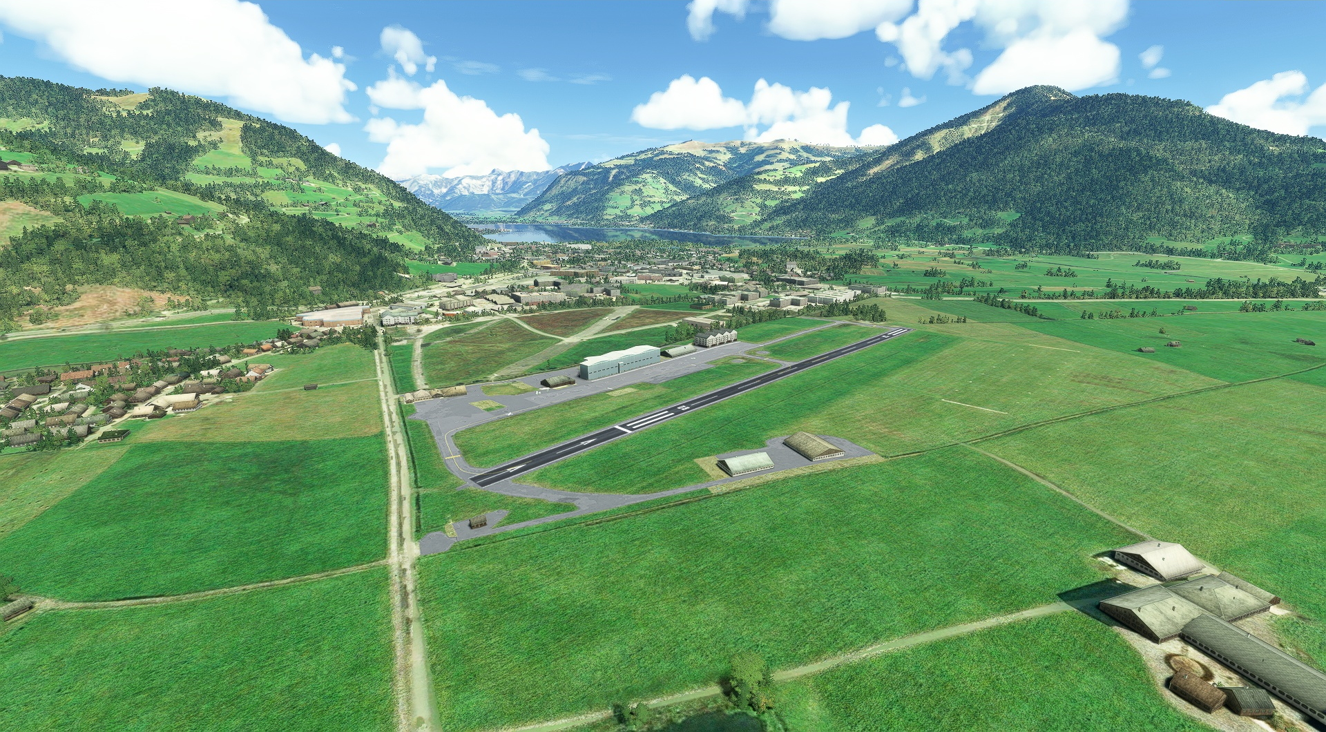
Turn to the south-southwest, descend, and land at Zell am See airport.

Leg 4
Zell Am See to St Johann
Leg Distance: 45.64 Approximate time at 125kts: 22 minutes.
Zell Am See(LOWZ) to Grossglockner(POI15)
Distance: 13.63NM Bearing: 193° 7 minutes
Lift off from Zell am See, gain altitude, and set a south-southwesterly heading to get to Grossglockner, the highest mountain in Austria at 12,461 feet above sea level.
Grossglockner(POI15) to Enzingerboden(POI16)
Distance: 6.39NM Bearing: 330° 3 minutes
Over the summit of Grossglockner, make a sharp turn to the northwest, and you’ll soon be over the wonderful mountain village of Enzingerboden.
Enzingerboden(POI16) to Hochfilzen(POI17)
Distance: 17.96NM Bearing: 355° 9 minutes
Head due north for 18 nautical miles from Enzingerboden to arrive at the popular Tyrolean winter sports town of Hochfilzen.
Hochfilzen(POI17) to St Johann(LOIJ)
Distance: 7.66NM Bearing: 289° 4 minutes
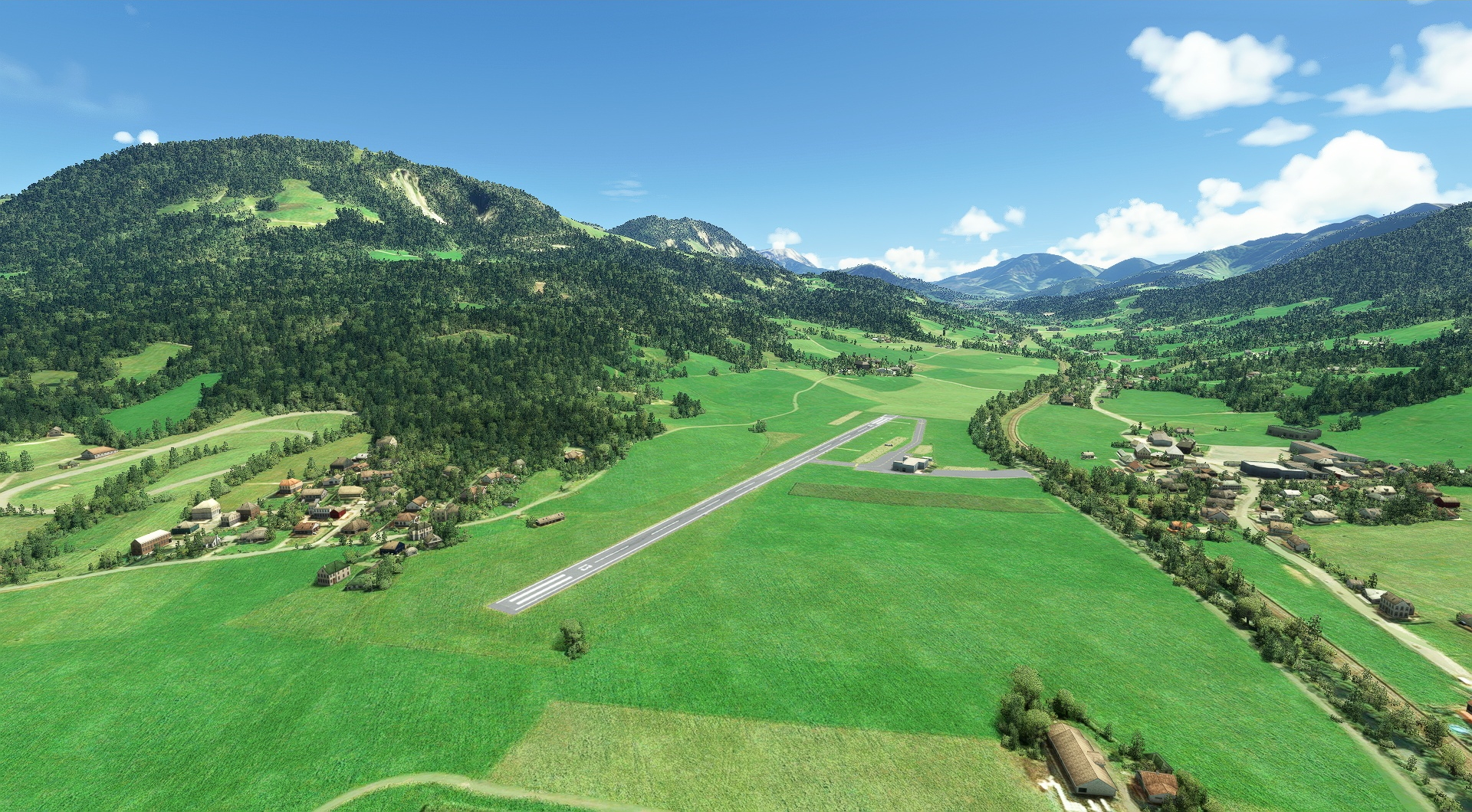
Turn northwest and land at Sankt Johann Airport.

Leg 5
St Johann to Langkampfen Airport
Leg Distance: 14.06 Approximate time at 125kts: 7 minutes.
St Johann(LOIJ) to Kaiser Mountains(POI18)
Distance: 6.47NM Bearing: 288° 3 minutes
Lift your Grand Caravan into the air from Sankt Johann Airport and set a course to the northwest for the Kaiser Mountains, a beautiful limestone ridge of peaks considered to be some of the most stunning mountain scenery in Austria’s Tyrol.
Kaiser Mountains(POI18) to Festung Kufstein(POI19)
Distance: 5.63NM Bearing: 279° 3 minutes
Bear slightly to the left and you’ll soon be over Festung Kufstein, a massive fortress built atop a promontory that overlooks the Tyrolean town of Kufstein.
Festung Kufstein(POI19) to Langkampfen Airport(LOIK)
Distance: 1.96NM Bearing: 230° 1 minutes
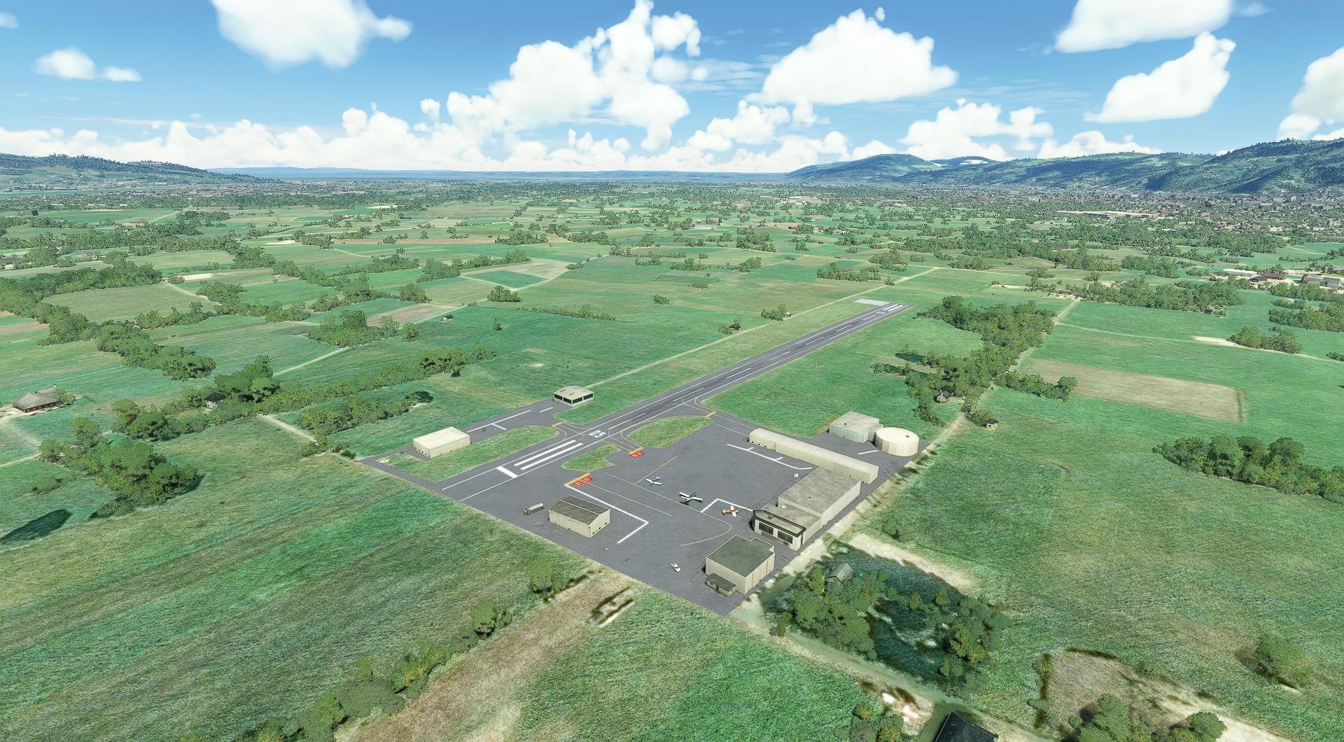
Turn to the southwest and land at Kufstein-Langkampfen Airport.

Leg 6
Langkampfen Airport to Innsbruck
Leg Distance: 42.26 Approximate time at 125kts: 20 minutes.
Langkampfen Airport(LOIK) to Brandenberg(POI20)
Distance: 10.38NM Bearing: 241° 5 minutes
Once in the air again, get on a southwesterly heading and after 10.4 nautical miles you’ll reach Brandenberg, one of the Tyrol’s most picturesque mountain villages.
Brandenberg(POI20) to Achen Lake(POI21)
Distance: 7.67NM Bearing: 254° 4 minutes
Continue on your course to Achen Lake, the largest lake in Tyrol.
Achen Lake(POI21) to Jenbach(POI22)
Distance: 5.03NM Bearing: 146° 2 minutes
Turn sharply to a south-southeasterly heading to fly past Jenbach, a settlement with dwellings that date back to the Bronze Age.
Jenbach(POI22) to Nordkette(POI23)
Distance: 17.42NM Bearing: 241° 8 minutes
Turn into a southwest heading and fly along the Inn Valley to Nordkette, a small range of mountains just north of the city of Innsbruck called by some the Jewel of the Alps.
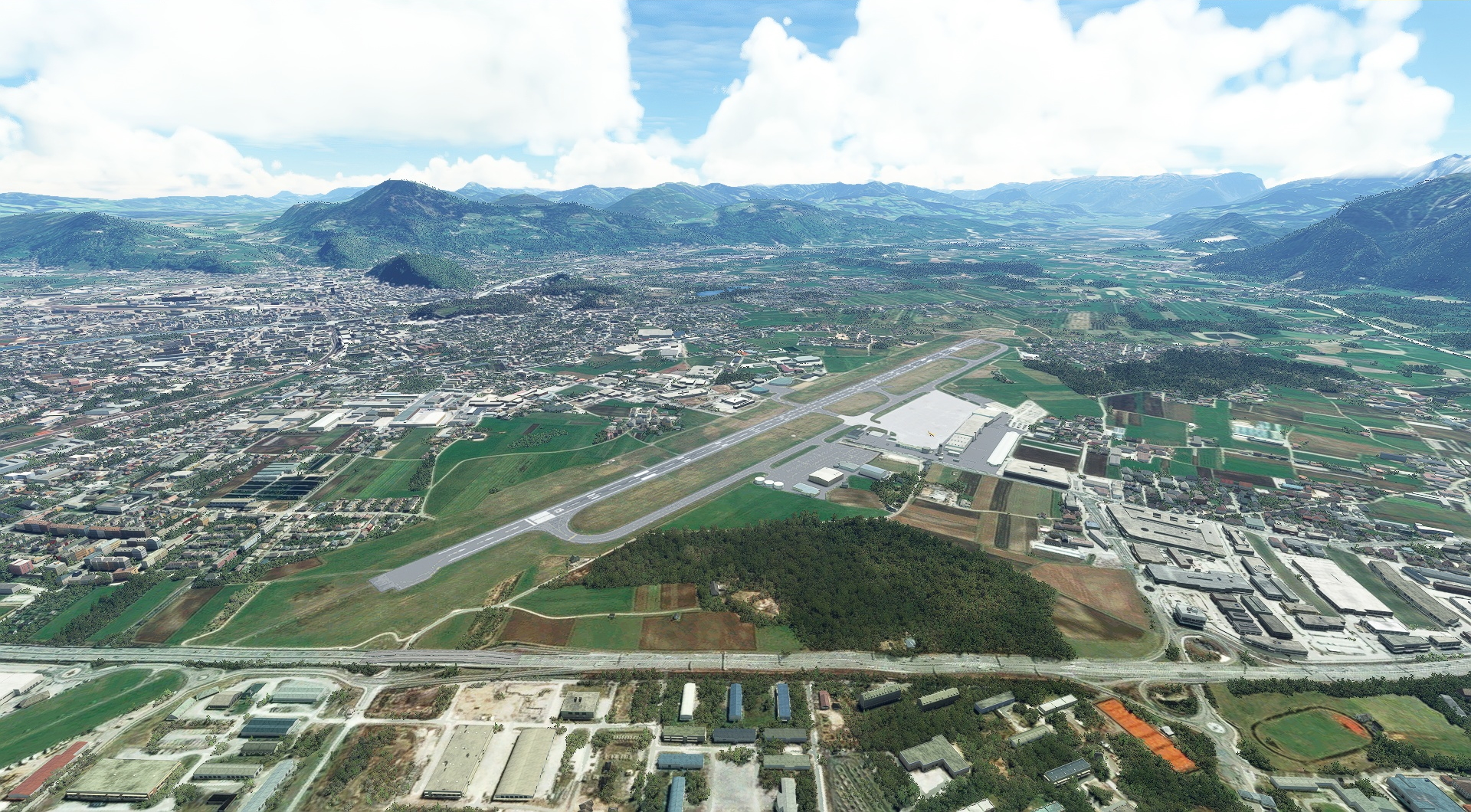
Nordkette(POI23) to Innsbruck(LOWI)
Distance: 1.76NM Bearing: 242° 1 minutes
Descend and land at Innsbruck Airport.

Leg 7
Innsbruck to Hoefen
Leg Distance: 31.28 Approximate time at 125kts: 15 minutes.
Innsbruck(LOWI) to Zirl(ZIRL)
Distance: 4.31NM Bearing: 274° 2 minutes
Once in the air, aim the nose of the Grand Caravan to the west-northwest, gain altitude, and you’ll soon pass over Zirl, a small Tyrolean town.
Zirl(ZIRL) to Telfs(TELFS)
Distance: 7.15NM Bearing: 284° 3 minutes
Continue on your course, up the Inn Valley, to Telfs, the third largest town in the Tyrol.
Telfs(TELFS) to Zugspitze(POI24)
Distance: 7.52NM Bearing: 327° 4 minutes
From Telfs, continue gaining altitude and set a course to the northwest and in 7.5 nautical miles you’ll pass over the summit of Zugspitze, the highest peak in the Wetterstein Mountains and the highest point in Germany.
Zugspitze(POI24) to Plansee(POI25)
Distance: 8.67NM Bearing: 282° 4 minutes
Head to the west-northwest and you’ll soon fly above Plansee, one of the most spectacular of Tyrol’s alpine lakes.
Plansee(POI25) to Hoefen(LOIR)
Distance: 3.63NM Bearing: 281° 2 minutes
Continue on your course and land at Reutte-Höfen Airfield.

Leg 8
Hoefen to Dornbirn
Leg Distance: 44.73 Approximate time at 125kts: 21 minutes.
Hoefen(LOIR) to Vilsalpsee(POI26)
Distance: 7.75NM Bearing: 262° 4 minutes
From Reutte-Höfen Airfield, head west to Vilsalpsee, an incredibly gorgeous deep blue lake surrounded by stunning mountain vistas.
Vilsalpsee(POI26) to Oberstdorf(POI27)
Distance: 9.31NM Bearing: 246° 4 minutes
Turn to the west-southwest, cross into Germany, and pass over Oberstdorf, the southernmost population center in Germany.
Oberstdorf(POI27) to Mittelberg(POI28)
Distance: 7.29NM Bearing: 223° 3 minutes
Head slightly more to the south, pass back into Austria, and you’ll fly past Mittelberg, a town that while located in Austria, can only be accessed by road from Germany and which has both Austrian and German postal codes.
Mittelberg(POI28) to Schonenbach(POI29)
Distance: 5.89NM Bearing: 297° 3 minutes
From Mittelberg, turn to the northwest and you’ll soon reach Schönenbach, a beautiful small enclave known for mountain scenery in Vorarlberg, Austria’s westernmost state.
Schonenbach(POI29) to Schoren(POI30)
Distance: 12.42NM Bearing: 276° 6 minutes
Bear slightly to the left and fly for 12.4 nautical miles to Schoren, a small town on the banks of the Dornbirner Ach, a stream in Vorarlberg.
Schoren(POI30) to Dornbirn(LOIH)
Distance: 2.07NM Bearing: 214° 1 minutes
Bank to the southwest and bring your Grand Caravan to the end of this wonderful Austrian Journey at Hohenems-Dornbirn Airfield.

