The Carpathians are a 900-mile-long chain of mountains that sweep across Central Europe in a broad, elegant arc from the Czech Republic at their northwestern extremity to Serbia at their southern anchor. They are the third longest range of peaks in Europe after the Urals and the Scandes (Scandinavian Mountains), and they are the second most extensive mountain region in area after the Alps. Although not as high or as well-known as the Alps, they rank alongside them among the world’s most beautiful peaks.
The chain, generally divided into the Western Carpathians, the Eastern Carpathians, and the Southern Carpathians, comprises a number of smaller ranges throughout its expanse. The peaks are geologically and topographically diverse, ranging from gentle hills to sheer cliff faces. The Carpathians reach their highest altitudes in the Tatra Mountains of Slovakia, which are renowned as some of the most dramatic peaks found throughout the globe. Apart from natural features, the Carpathians are home to a large number of cities and towns throughout their extent.
This bush trip brings aviators into the most dramatic of the Carpathians. Beginning near their northwestern end, the journey winds through the peaks and valleys of the Western Carpathians and then visits the highest peaks of the chain in the High Tatras. The journey then continues into its final legs in the Eastern Carpathians.
Total Legs: 4 Total Distance: 259 Total Time(125kts): 2 hours 4 minutes
Leg 1
Holič Airport to Zilina
Leg Distance: 70.32 Approximate time at 125kts: 34 minutes.
Holic Airport(LZHL) to Vrbovce(POI1)
Distance: 13.17NM Bearing: 88° 6 minutes
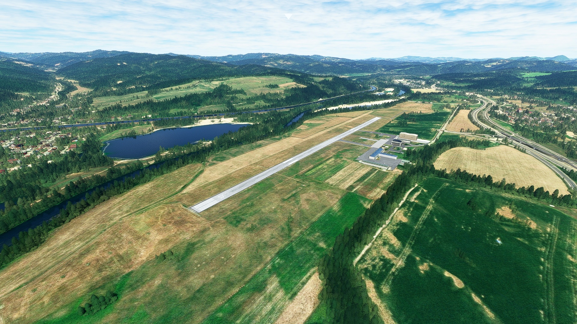
After lifting off from Holič Airport, set a course to the east and fly into the foothills of the White Carpathians. Located on the western end of the greater Carpathian chain, the White Carpathians are located along the border of Slovakia and the Czech Republic. Much of the White Carpathians are protected by the White Carpathians Protected Landscape Area, and include forests of beech and ash trees and animals such as the Eurasian eagle-owl, the Eurasian lynx, and the European wildcat. Pass by peaks that rise to altitudes of nearly 2,000 feet above sea level and gain a visual on the town of Vrbovce, which lies along highway 500 at its intersection with a number of smaller roads. The town is a center for mountain tourism in the area.
Vrbovce(POI1) to Myjava River(POI2)
Distance: 4.65NM Bearing: 93° 2 minutes
Continue to the east, gaining a visual on the town of Myjava. Fly over the Myjava River just north of the town of Myjava. The river flows through varying small ranges of the Western Carpathians, including the White Carpathians and the Myjava Hills, south of the town of Myjava.
Myjava River(POI2) to Nove Mesto nad Vahom(POI3)
Distance: 9.89NM Bearing: 95° 5 minutes
Adjust course slightly to the south and gain a visual on the town of Stará Turá. Fly just to the north of Stará Turá and sight the town of Nové Mesto nad Váhom. The town lies along the Váh River at the northern periphery of the Danubian Hills, which are the northeastern extremity of the Danubian Lowland. The Váh River is a tributary of the Danube that begins its course in the High Tatra Mountains, the highest section of the Carpathians. The area of Nové Mesto nad Váhom has a long, rich history that stretches to prehistoric times; archaeologists have discovered numerous artifacts dating to the Stone and Bronze Ages in the area.
Nove Mesto nad Vahom(POI3) to Trencin(POI4)
Distance: 11.62NM Bearing: 39° 6 minutes
Turn onto a northeast heading over Nové Mesto nad Váhom and follow the course of the Váh River up the Váh Valley. This section of the flight provides spectacular vistas of a number of small ranges of the Carpathians, including the Little Carpathians, the White Carpathians, the Strážov Mountains, and the Maple Mountains. Trenčín is one of Slovakia’s largest cities and is a popular destination for mountain tourists. It is known for the Trenčín Castle, which stands above the city on the top of a mountain. It was built during the age of the Roman Empire and was the residence of Matthew III Csák, a Hungarian oligarch who was known as the “Lord of the Váh River and the Tatra Mountains.”
Trencin(POI4) to Dubnica nad Vahom(POI5)
Distance: 7NM Bearing: 48° 3 minutes
Continue following the Váh River to the town of Dubnica nad Váhom.
Dubnica nad Vahom(POI5) to Nosice Reservoir(POI6)
Distance: 13.6NM Bearing: 30° 7 minutes
Keep following the course of the Váh River to the Nosice Reservoir, formed by the Nosice Dam along the river’s path. The dam was completed in 1957 and was built for flood control and hydroelectric generation.
Nosice Reservoir(POI6) to Zilina(LZZI)
Distance: 10.39NM Bearing: 55° 5 minutes
Continue following the Váh River from Nosice Reservoir and gain a visual on the village of Dolný Hričov, located just to the southeast of the river. Land at Žilina Airport, an international airport just to the west of Dolný Hričov.

Leg 2
Zilina to Tatry
Leg Distance: 94.24 Approximate time at 125kts: 45 minutes.
Zilina(LZZI) to Hricov Reservoir(POI7)
Distance: 3.28NM Bearing: 69° 2 minutes
Take to the sky and follow the course of the Váh River to Hričov Reservoir, an important reservoir that formed after the completion of the Hričov Dam in 1962.
Hricov Reservoir(POI7) to Vrutky(POI8)
Distance: 11.7NM Bearing: 126° 6 minutes
Turn onto a southeast heading over the Hričov Reservoir and continue following the Váh River. The River flows through the Malá Fatra range of the Carpathians here. Pass the village of Strečno, where the Varinka Stream meets the Váh. Strečno is renowned for World War II battles where members of the Slovak Resistance waged intense mountain warfare tactics against the German Army. Pass the Domašínsky Meander, a 180-degree turn in the Váh River and then continue to the town of Vrútky, which gained prominence upon the completion of Košice–Bohumín Railway in 1870. The railway was a major engineering feat due to the difficulties imposed by the mountainous terrain of the Carpathians.
Vrutky(POI8) to Ruzomberok(POI9)
Distance: 15.36NM Bearing: 92° 7 minutes
Adjust heading to the north, into an east-southeast heading at Vrútky. The path of the Váh enters the Loptov Basin along this stretch, which is surrounded by the Carpathian ranges of the Low Tatras, the Greater Fatra, and the Choč Mountains. Gain a visual on the town of Ružomberok, where the Revúca River meets the Váh.
Ruzomberok(POI9) to Liptovska Mara(POI10)
Distance: 8NM Bearing: 75° 4 minutes
Continue along the Váh to Liptovská Mara, Slovakia’s second largest reservoir. It was formed in 1975 with the construction of the reservoir’s dam for flood control and hydroelectricity generation.
Liptovska Mara(POI10) to Orava River(POI11)
Distance: 11.2NM Bearing: 351° 5 minutes
Break away from the course of the Váh River at Liptovská Mara and set a due north heading. This part of the Carpathians is known as the Beskids and comprises a number of sub-ranges. Pass over the Orava River, a major tributary to the Váh, at the village of Krivá, which lies along motorway 59.
Orava River(POI11) to Orava Reservoir(POI12)
Distance: 7.05NM Bearing: 18° 3 minutes
Continue following the Orava River to Orava Reservoir, the largest lake in Slovakia. The reservoir is surrounded by lands of the Horná Orava Protected Landscape Area, which comprises large sweeps of fir, beech, and spruce forest. Sub-ranges of the Carpathians in this area include Orava Magura, Podbeskydská vrchovina, and Oravské Beskydy.
Orava Reservoir(POI12) to Osobita(POI13)
Distance: 10.14NM Bearing: 137° 5 minutes
Turn onto a southeast heading over Orava Reservoir, begin gaining altitude, and pass directly over the town of Trstená. Continue on course into the Tatra Mountains, commonly called the Tatras. Sight the mountain called Osobitá in the distance. The name translates to “the lonely one,” and is very distinctive as it stands above the surrounding terrain.
Osobita(POI13) to Banikov(POI14)
Distance: 3.79NM Bearing: 181° 2 minutes
Turn onto a course just west of due south and gain a visual on a large ridge of peaks. The ridge is called Roháče and is part of the Western Tatra Mountains. The mountains are rugged with prominent ridgelines and peaks, and many mountaineers consider this to be the most beautiful portion of the Carpathians. The highest of the Roháče peaks is Baníkov, which stands 7,146 feet above sea level.
Banikov(POI14) to Bystra(POI15)
Distance: 5.22NM Bearing: 90° 3 minutes
Over the summit of Baníkov, turn onto a nearly due-east course and fly along the highest peaks of the Western Tatra Mountains. Gain a visual on Bystrá, the highest mountain in the Western Tatras. Located just south of Slovakia’s border with Poland, Bystrá stands 7,375 feet above sea level.
Bystra(POI15) to Krivan(POI16)
Distance: 6.37NM Bearing: 98° 3 minutes
Adjust heading slightly to the south over the summit of Bystrá and pass into the High Tatra Mountains. The High Tatra Mountains, also called the High Tatras, are the highest portion of the Carpathians and the highest mountains in Slovakia. This section of the Carpathians is also the only one that comprises an alpine bioregion. With 29 peaks that rise above 2,500 meters (8,202 feet), the High Tatras was the first region in all of Europe to be recognized with a transnational park, the Tatra National Park, which straddles Slovakia and Poland. Kriváň is one of the area’s standout peaks. Pyramidal in form, the 8,186-foot-high mountain is renowned as one of the most beautiful peaks in Slovakia.
Krivan(POI16) to Gerlachovsky stit(POI17)
Distance: 5.26NM Bearing: 83° 3 minutes
Turn into a due-east heading over the summit of Kriváň and sight Gerlachovský štít, the highest mountain in the High Tatras, the Carpathians, and in Slovakia at 8,709 feet above sea level. Flying over the summit of Gerlachovský štít grants one of the greatest mountain vistas in the world, with dramatic peaks extending in all directions.
Gerlachovsky stit(POI17) to Tatry(LZTT)
Distance: 6.87NM Bearing: 136° 3 minutes
Turn onto a southeast heading and gain a visual on Poprad–Tatry Airport, descend in altitude, and land at the airport.

Leg 3
Tatry to Presov
Leg Distance: 51.75 Approximate time at 125kts: 25 minutes.
Tatry(LZTT) to Podolinec(POI18)
Distance: 16.37NM Bearing: 40° 8 minutes
After taking to the sky at Poprad–Tatry Airport, set a heading to the northeast and follow the Poprad River along the base of the High Tatras. Pass a number of small towns and gain a visual on the town of Podolínec, which is Slovak for “place between the hills.”
Podolinec(POI18) to Bajerovce(POI19)
Distance: 10.29NM Bearing: 101° 5 minutes
Turn onto an east-southeast course at Podolínec and parallel the corridor of the Poprad River, remaining to its south. This is a transitional region between the Western Carpathians and the Eastern Carpathians. Sight and fly over the town of Bajerovce, which is surrounded by peaks of the Outer Eastern Carpathians.
Bajerovce(POI19) to Lipany(POI20)
Distance: 7.5NM Bearing: 111° 4 minutes
Adjust course slightly to the south and gain a visual on the Torysa River. Fly over the town of Lipany, which lies on the Torysa River at its intersection with motorway 68.
Lipany(POI20) to Presov(POI21)
Distance: 14.33NM Bearing: 124° 7 minutes
Follow the Torysa River to the city of Prešov. The city lies where the Sekčov River, which flows through the Eastern Carpathians, meets the Torysa River.
Presov(POI21) to Presov(LZPW)
Distance: 3.26NM Bearing: 50° 2 minutes
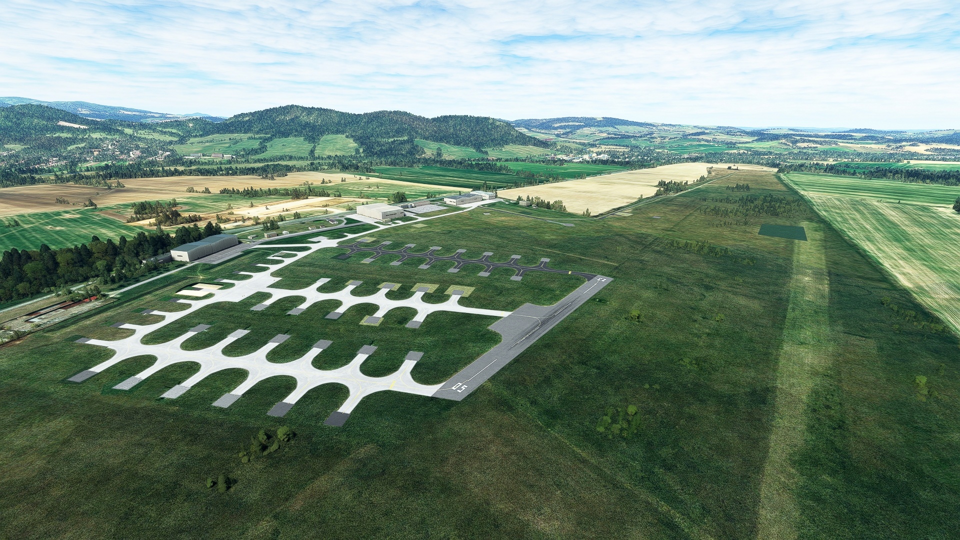
Turn onto a northeast course and land at Prešov Air Base.

Leg 4
Presov to Kolonica Airstrip
Leg Distance: 42.93 Approximate time at 125kts: 21 minutes.
Presov(LZPW) to Domasa Reservoir(POI22)
Distance: 15.15NM Bearing: 86° 7 minutes
Take off from Prešov Air Base and set a heading to the east and gain a visual on the southern end of Domaša Reservoir. The region along this corridor is typical of this part of the Eastern Carpathians with low, rolling terrain.
Domasa Reservoir(POI22) to Humenne(POI23)
Distance: 10.06NM Bearing: 113° 5 minutes
Turn onto a southeast heading at the Domaša Reservoir. Fly along the low, rolling terrain and sight the town of Humenné, which lies at the confluence of the Laborec River and the Cirocha River. The Laborec River drains the Laborec Highlands of the Outer Eastern Carpathians and the Cirocha River drains the Bukovec Range, also of the Outer Eastern Carpathians.
Humenne(POI23) to Snina(SNINA)
Distance: 9.76NM Bearing: 64° 5 minutes
Turn onto an east-northeast course and follow the Cirocha River to the town of Snina. Snina lies at the confluence of the Cirocha River and the Pčolinka River between the Bukovec Mountains and the volcanic Vihorlat Mountains, both of the Outer Eastern Carpathians.
Snina(SNINA) to Stakcin(POI24)
Distance: 3.5NM Bearing: 69° 2 minutes
Continue on course, following the Cirocha River to the town of Stakčín. Stakčín is an administrative center for Poloniny National Park, which protects the Bukovec Mountains of the Outer Eastern Carpathian Mountains. Portions of the park are recognized by the United Nations as a World Heritage Site in the section called the Primeval Beech Forests of the Carpathians.
Stakcin(POI24) to Kolonica Airstrip(LZSN)
Distance: 4.46NM Bearing: 151° 2 minutes
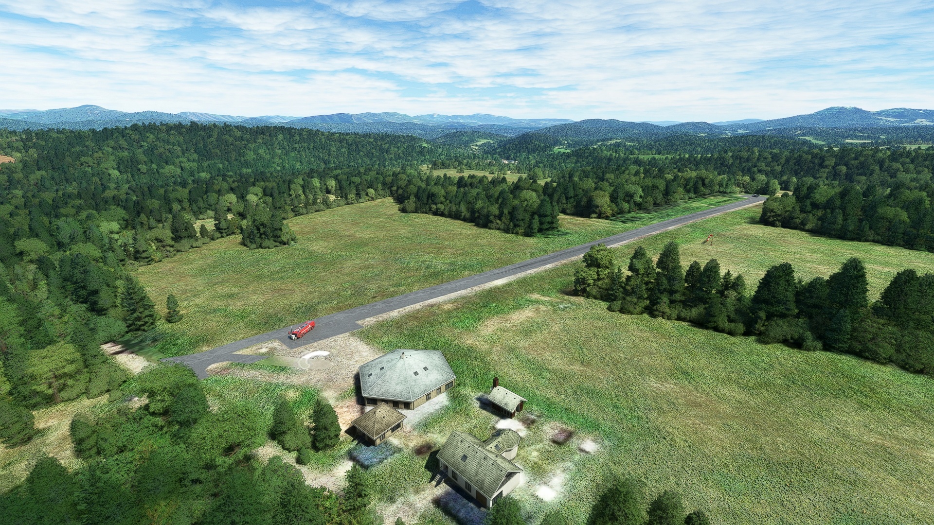
Turn south at Stakčín and follow the Kolonica River to Kolonica Airstrip and land, bringing this exploration of the Carpathians to a close.

