Take a private pilot's dream vacation! Rent a Cessna 172SP in Honolulu and take off on a four-day exploration of the Hawaiian Islands. There's nothing quite like viewing the unspoiled beauty of Hawaii's beaches, volcanos, and canyons from the air. Navigating between the islands (sometimes out of sight of land) adds to both the challenge and the thrill.
On your first leg, take off from Honolulu International Airport (PHNL), fly around Oahu, and return and land to pick up a friend at MCAS Kaneohe Bay (PHNG).
On your second leg, fly from MCAS Kaneohe Bay (PHNG) along the north side of Moloka'i and land at Kahului airport (PHOG) on Maui.
On the third leg of the flight, depart from Kahului airport (PHOG), fly along the north side of Maui then down to the big island of Hawai'i. Fly around the island and land at Ellison Onizuka Kona Intl airport (PHKO).
On your fourth leg, you will depart from Ellison Onizuka Kona Intl airport (PHKO) and have a large water leg. Flying past Kaho'olawe Island reserve, the southern side of Lana'i Island, then Oahu you will arrive at Lihue airport (PHLI) on the island of Kaua'i.
Your final leg will start at Lihue airport (PHLI) on the island of Kaua'i. You will fly around the island of Kaua'i, then you will fly over the water to return to Kalaeloa (John Rodgers Field) airport (PHJR) on the island of Oahu.
Total Legs: 6 Total Distance: 821 Total Time(125kts): 6 hours 34 minutes
Leg 1
Flying from PHNL
Leg Distance: 71.26 Approximate time at 125kts: 34 minutes.
Honolulu International Airport.(PHNL) to POI 1(POI1)
Distance: 11.16NM Bearing: 258° 5 minutes
Leaving PNHL, you will head towards the west coast of Oahu. Before you turn north, you will pass over PHJR your eventual destination. To the west of that is an industrial area and the first waypoint, just off the beach. 1000-foot AGL is a good altitude to fly, just stay close to the shore should you have an emergency.
POI 1(POI1) to POI 2(POI2)
Distance: 18.84NM Bearing: 321° 9 minutes
As you cross over the beach, you will track Northwest to Ka’ena point. The west coast has amazing surf spots as well as numerous sea caves. See if you can spot any from the air, so you can visit them next week.
POI 2(POI2) to POI 3(POI3)
Distance: 8.93NM Bearing: 75° 4 minutes
As you reach Ka’ena point, you will turn east following the shore. On your right, you will pass Dillingham airfield. As you come abeam Kaiaka point you will turn northeast along the shore.
POI 3(POI3) to POI 4(POI4)
Distance: 9.73NM Bearing: 31° 5 minutes
As you fly Northeast, along the shore, you will be passing many famous beaches. This includes Laiankea beach and Sunset beach. As you come to Kahuku Point you will have reached the northern most point on Oahu.
POI 4(POI4) to POI 5(POI5)
Distance: 3.56NM Bearing: 80° 2 minutes
Flying west from the last waypoint, you have a short leg before turning southeast along the eastern shore.
POI 5(POI5) to POI 6(POI6)
Distance: 17.59NM Bearing: 139° 8 minutes
As the shore turns southeast, follow it. This heading should take you to your destination airport. Today a friend has invited you to land at MCAS Kaneohe Bay. They will join you for the remainder of the flight.
POI 6(POI6) to MCAS Kaneohe Bay(PHNG)
Distance: 1.45NM Bearing: 133° 1 minutes
As you fly south along the east coast you will see a bay ahead. Fly into the bay and plan on landing at PHNG, making left traffic for Runway 04.

Leg 2
Flying from PHNG
Leg Distance: 84.85 Approximate time at 125kts: 41 minutes.
MCAS Kaneohe Bay(PHNG) to POI 7(POI7)
Distance: 34.91NM Bearing: 102° 17 minutes
Take off from MCAS Kaneohe Bay (PHNG) and fly to Kahului Airport (PHOG) on Maui for lunch and fuel. Along the way, explore the north shore of Molokai, and the old pineapple fields of Lanai. This first leg will take you over 32NM of open water. Climb to 7500 feet AGL and as you see the coast of Moloka’i you can begin your decent back to 1000 feet AGL.
POI 7(POI7) to POI 8(POI8)
Distance: 24.54NM Bearing: 86° 12 minutes
Fly along the north shore of Moloka’i. About midway you will fly over a small airport called Kalaupapa airport. Continue until you come to the eastern most part of the island.
POI 8(POI8) to Kahului Airport(PHOG)
Distance: 25.4NM Bearing: 125° 12 minutes
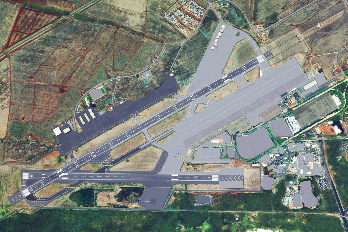
From Moloka’i continue southeast and fly along the northeast shore of Maui. Following the shore will bring you into Kahului Airport (PHOG). Expect leftffic into runway 05.

Leg 3
Flying from PHOG
Leg Distance: 28.32 Approximate time at 125kts: 14 minutes.
Kahului Airport(PHOG) to POI 9(POI9)
Distance: 8.51NM Bearing: 45° 4 minutes
After refueling and eating lunch at Kahului Airport (PHOG), make the short trip to Hana Airport (PHHN), exploring Haleakala Volcano along the way.
POI 9(POI9) to Hana Airport(PHHN)
Distance: 19.81NM Bearing: 115° 10 minutes
When ready, proceed to Hana Airport (PHHN) on the northwest side of the island. Expect a straight in approach to runway 08.

Leg 4
Flying from PHHN
Leg Distance: 244.48 Approximate time at 125kts: 117 minutes.
Hana Airport(PHHN) to POI 10(POI10)
Distance: 33.43NM Bearing: 146° 16 minutes
Fly from Hana Airport (PHHN) to Hawaii (the Big Island), spend a few hours exploring the volcanos, then land at Kona International Airport (PHKO). From the airport, fly southeast, crossing 25 NM of open water. It is recommended that you climb to 7500 feet AGL until you see the coast, then you can begin to descend to 1000 FT AGL.
POI 10(POI10) to POI 11(POI11)
Distance: 52.42NM Bearing: 109° 25 minutes
Once you are flying along the shore, proceed southeast until you have Hilo international airport off your right wing.
POI 11(POI11) to POI 12(POI12)
Distance: 29.31NM Bearing: 145° 14 minutes
Fly towards the eastern most part of Hawai’i and as you pass that point you see the Kapoho lava flow (1960) and just south of that the 2018 lava flow.
POI 12(POI12) to POI 13(POI13)
Distance: 36.89NM Bearing: 234° 18 minutes
Once past the eastern most point, follow the shore southwest. As you progress along the shore, you will have a fantastic view of previous lava flows.
POI 13(POI13) to POI 14(POI14)
Distance: 30.69NM Bearing: 219° 15 minutes
As you proceed southeast, you will come to the most southern point of the Hawai’ian islands. It is here that you will turn northwest.
POI 14(POI14) to POI 15(POI15)
Distance: 22.5NM Bearing: 307° 11 minutes
Following the shore northwest, you will come to the Manuka Natural Area Reserve off your right wing, about 10 NM into this leg.
POI 15(POI15) to Ellison Onizuka Kona International Airport(PHKO)
Distance: 39.24NM Bearing: 345° 19 minutes
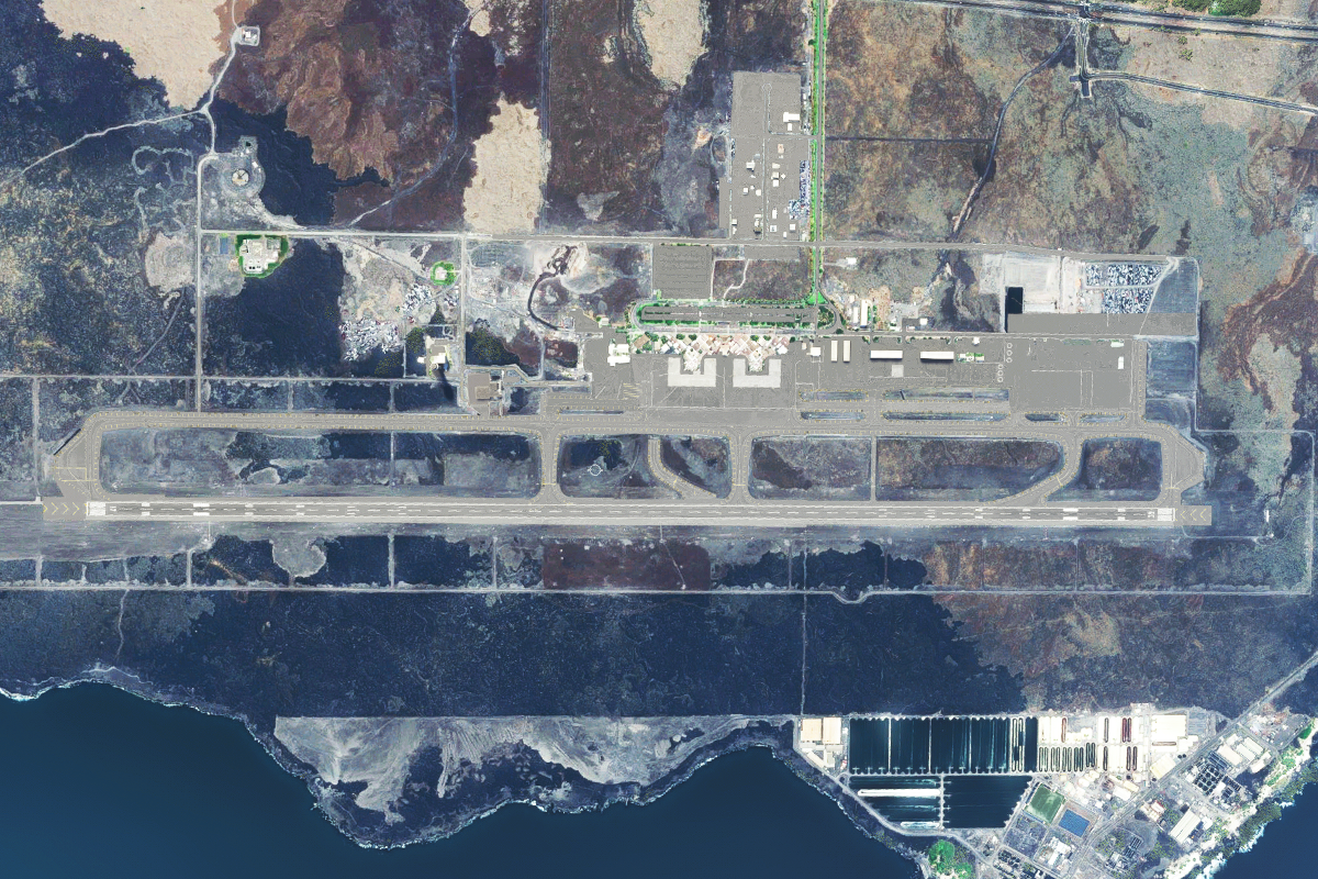
You should now be flying almost due north along the shore. You are approaching Ellison Onizuka Kona International airport. Expect left traffic for runway 17.

Leg 5
Flying from PHKO
Leg Distance: 235.18 Approximate time at 125kts: 113 minutes.
Ellison Onizuka Kona International Airport(PHKO) to POI 16(POI16)
Distance: 51.76NM Bearing: 313° 25 minutes
Fly northwest from Hawaii’s Kona International Airport (PHKO) past Maui, Molokai, Oahu, and then across more than 60 miles of open water to Lihue Airport (PHLI) on Kauai. As this is a long overwater flight, it is recommended that you climb and maintain 8500 Feet AGL.
POI 16(POI16) to POI 17(POI17)
Distance: 28.14NM Bearing: 300° 14 minutes
You will initially pass Kaho’olawe island reserve off your right wing. Lana’i Island should be in front of you. As you pass the reserve, see if you can see Molokini island between the reserve and the island of Maui. It is one of the best dive spots in Hawai’i.
POI 17(POI17) to POI 18(POI18)
Distance: 49.7NM Bearing: 302° 24 minutes
As you pass Lanai off your right wing, you should see Oahu in the distance. If you would like to get a closer look at the southern side of Oahu, you can begin to descend to 1000 feet AGL
POI 18(POI18) to POI 19(POI19)
Distance: 23.94NM Bearing: 262° 11 minutes
Follow the shore west and you will have Diamond head off your right wing. A popular hiking spot, it is also one of the most iconic movie and TV backgrounds in the world. If you would like to fly over Pearl Harbor, now would be the time to do it. Follow the shore to the airport and continue Northwest. You cannot miss it. If you are interested in getting to your destination, continue to follow the shore west.
POI 19(POI19) to Lihue Airport(PHLI)
Distance: 81.64NM Bearing: 292° 39 minutes
We are now going to fly over a large amount of open water. Heading Northwest from the southwest point of the island, climb to 8500 feet. As the shore comes into view, you can begin to descend to traffic pattern altitude for PHLI. Expect left traffic for runway 21.

Leg 6
Flying from PHLI
Leg Distance: 157.13 Approximate time at 125kts: 75 minutes.
Lihue Airport(PHLI) to POI 20(POI20)
Distance: 5.64NM Bearing: 13° 3 minutes
After a week of adventuring, it is time to head home. Take off from Lihue Airport (PHLI), explore the stunning scenery of Kauai, “The Garden Island”, and fly your final leg home to Kalaeloa (John Rodgers Field) (PHJR). The aircraft is going to have an annual inspection done at that field and they will ferry it back to Honolulu for you. Your friend is spending a few days at the Naval Command Center and will hitch a ride back to the air station (likely in an F-18). Start your return trip by flying the north shore of the island. The first waypoint is just outside Kapa’a.
POI 20(POI20) to POI 21(POI21)
Distance: 9.64NM Bearing: 349° 5 minutes
Turn north and follow the shoreline. You will pass over the small town of Anahola. Continue north until the shore turns west.
POI 21(POI21) to POI 22(POI22)
Distance: 15.09NM Bearing: 267° 7 minutes
Fly west until the shore begins to run southwest. When you are abeam turtle bay (it is off your left wing), you will want to turn southwest.
POI 22(POI22) to POI 23(POI23)
Distance: 7NM Bearing: 228° 3 minutes
Continue to follow the shore southwest. Off your left wind are fantastic beaches.
POI 23(POI23) to POI 24(POI24)
Distance: 7.21NM Bearing: 224° 3 minutes
Continue to follow the shore southwest. The Ku’ia Natural Area Reserve is just off your left wing. It is actually two separate locations, the Hono O Na Pali and Kuia reserves. Both protect rare plants / animals and comprise many ecosystems.
POI 24(POI24) to POI 25(POI25)
Distance: 8.9NM Bearing: 171° 4 minutes
As the shore turns due south, you will want to continue to follow it. You should pass right over the Barking Sands airport. As the shore turns east, you should be close to the next waypoint.
POI 25(POI25) to Kalaeloa (John Rodgers Field) Airport(PHJR)
Distance: 103.65NM Bearing: 103° 50 minutes
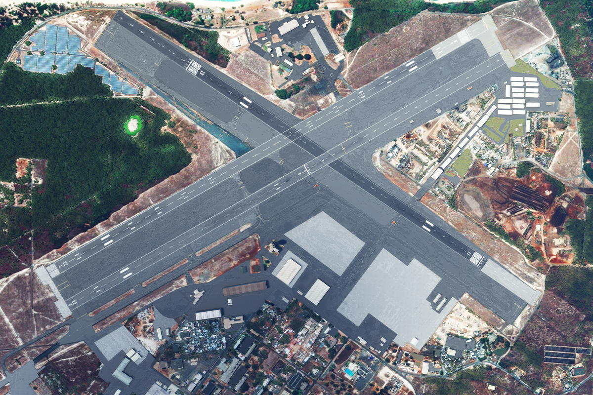
Follow the shore to the eastern part of the island. When the shore begins to run northeast you want to continue on your southeast heading. You are flying direct to your destination airport, over open water. Climb to 9500 feet AGL. Once you have the shoreline in sight you can descend to traffic pattern altitude. Expect straight in for runway 11.

