Stage 11 of our world tour kicks off in Reno, Nevada, with a lap around the famous air race circuit before heading to Lake Tahoe and into California. You’ll see the best of what the Golden State has to offer, from the major cities of San Francisco and Los Angeles to the unparalleled beauty of Yosemite Valley. A trip to the state capitol of Sacramento, the wine growing region of the Napa Valley, the dramatic coast of Big Sur, the San Andreas Fault and the Mohave Desert all combine to make this bush trip a truly memorable one.
Total Legs: 24 Total Distance: 1153 Total Time(125kts): 9 hours 13 minutes
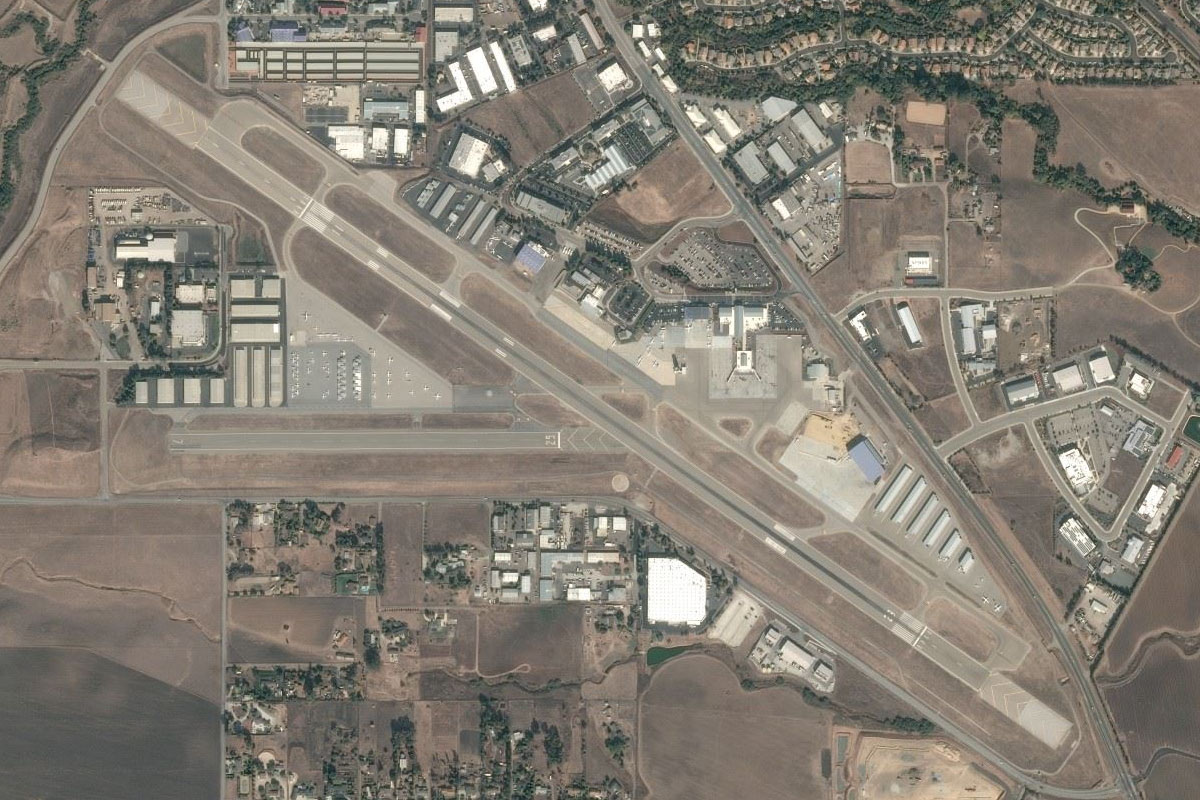
Leg 1
Flying from KRTS
Leg Distance: 55.49 Approximate time at 125kts: 27 minutes.
KRTS(KRTS) to Pylon 3(POI1)
Distance: 1.05NM Bearing: 32° 1 minutes
We'll start this tour with a lap around the "Reno Air Race Circuit". After takeoff, head anticlockwise in a large oval around the northern side of the airfield. Stay low to see the pylon markers – 50ft poles with barrels on top
Pylon 3(POI1) to Pylon 5(POI2)
Distance: 1.73NM Bearing: 301° 1 minutes
Continue anti-clockwise around the circuit to its northern point at pylon 5
Pylon 5(POI2) to Pylon 7(POI3)
Distance: 1.62NM Bearing: 184° 1 minutes
Continue the left hand turn around the circuit to pylon 7 on the western side
Pylon 7(POI3) to Home Pylon(POI4)
Distance: 1.14NM Bearing: 107° 1 minutes
Finish the circuit by heading to the home pylon to the north of the main parking area, then head southeast
Home Pylon(POI4) to Reno(POI5)
Distance: 8.63NM Bearing: 150° 4 minutes
Head for the main downtown area of Reno
Reno(POI5) to Washoe Lake(POI6)
Distance: 11.74NM Bearing: 161° 6 minutes
Head south from downtown to the northern tip of Washoe Lake
Washoe Lake(POI6) to Incline Village(POI7)
Distance: 8.99NM Bearing: 214° 4 minutes
As soon as you reach the lake, turn southwest and fly over the mountain ridge
Incline Village(POI7) to Lake Tahoe(POI8)
Distance: 16.57NM Bearing: 171° 8 minutes
Once you are over the ridge, turn south and follow the eastern shore of Lake Tahoe, the largest alpine lake in the USA and the largest by volume after the Great Lakes
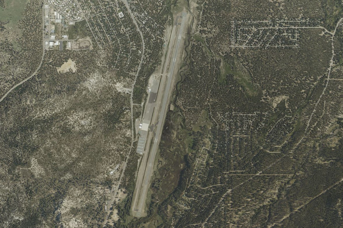
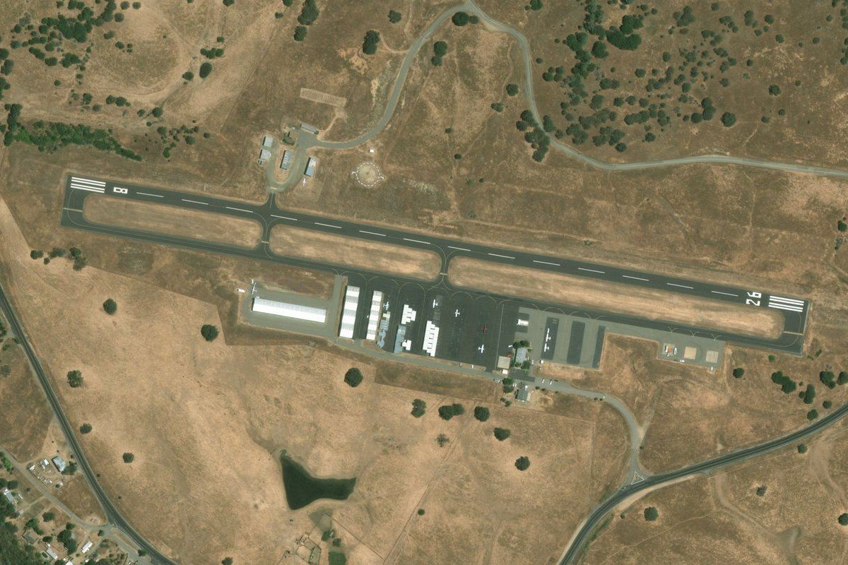
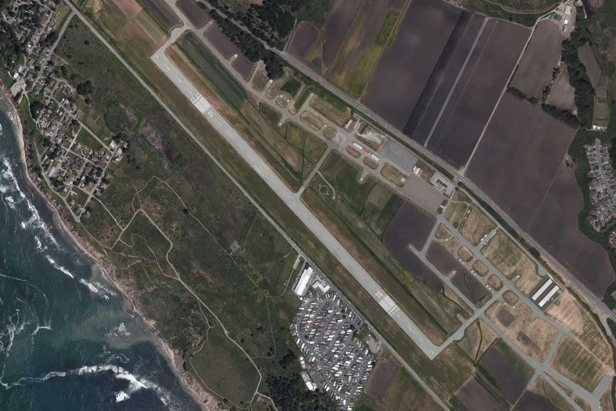
Lake Tahoe(POI8) to KTVL(KTVL)
Distance: 4.02NM Bearing: 189° 2 minutes
When you reach the town of South Lake Tahoe at the end of the lake, the airport will be just south of the main part of town
Leg 2
Flying from KTVL
Leg Distance: 62.9 Approximate time at 125kts: 30 minutes.
KTVL(KTVL) to Christmas Valley(POI9)
Distance: 6.26NM Bearing: 174° 3 minutes
After takeoff, follow hwy 89 south into the valley
Christmas Valley(POI9) to Grass Lake(POI10)
Distance: 1.88NM Bearing: 70° 1 minutes
Turn east with the highway. Keep an eye out for bears in the grass meadow
Grass Lake(POI10) to Topaz Lake(POI11)
Distance: 20.98NM Bearing: 93° 10 minutes
Keep following the highway east past the road junction and through another small valley, then over the mountains to Topaz Lake
Topaz Lake(POI11) to Walker(POI12)
Distance: 11.76NM Bearing: 151° 6 minutes
At the lake, turn right and fly to the town of Walker at the southern end of the valley
Walker(POI12) to US-395(POI13)
Distance: 10.28NM Bearing: 162° 5 minutes
Follow US hwy 395 south as it climbs through a smaller valley
US-395(POI13) to O57(O57)
Distance: 11.74NM Bearing: 101° 6 minutes
Follow the highway as it turns and heads southeast to the small town of Bridgeport, with its airfield at the south end of the reservoir
Leg 3
Flying from O57
Leg Distance: 45.3 Approximate time at 125kts: 22 minutes.
O57(O57) to Mono Lake(POI14)
Distance: 18.19NM Bearing: 138° 9 minutes
After takeoff, head southeast to Mono Lake, a large saline soda lake featuring Tufa Limestone formations
Mono Lake(POI14) to US-395(POI15)
Distance: 9.27NM Bearing: 182° 4 minutes
Turn south from the lake and meet up with hwy 395
US-395(POI15) to KMMH(KMMH)
Distance: 17.84NM Bearing: 127° 9 minutes
Follow hwy 395 as it tracks southeast along the base of the Sierra Nevada mountains, and leads you right to Mammoth Yosemite Airport
Leg 4
Flying from KMMH
Leg Distance: 73.45 Approximate time at 125kts: 35 minutes.
KMMH(KMMH) to Mammoth Mountain(POI16)
Distance: 11.17NM Bearing: 271° 5 minutes
Fly west over the ski resort town of Mammoth Lakes, and to the right side of the Mammoth Mountain Ski Area
Mammoth Mountain(POI16) to Waugh Lake(POI17)
Distance: 7.57NM Bearing: 300° 4 minutes
After passing the ski area, turn northwest and past a group of lakes
Waugh Lake(POI17) to Lembert Dome(POI18)
Distance: 10.06NM Bearing: 308° 5 minutes
Continue northwest over the rocky terrain until you see a small river valley below, then follow it northwest to where it opens out and meets highway 120 heading east past the large rocky Lembert Dome
Lembert Dome(POI18) to Tioga Pass Road(POI19)
Distance: 4.96NM Bearing: 253° 2 minutes
Stay with the highway as it passes Tuolumne Meadows before turning south
Tioga Pass Road(POI19) to Half Dome(POI20)
Distance: 8.24NM Bearing: 202° 4 minutes
Follow the road until it reaches Tenaya lake, then continue south to Yosemite Valley
Half Dome(POI20) to Yosemite Valley(POI21)
Distance: 9.2NM Bearing: 242° 4 minutes
Take in the sights as you head southwest along Yosemite Valley. Half Dome to your left, then the imposing cliff face of El Capitan to your right. Follow the river valley out of the western end of Yosemite Valley
Yosemite Valley(POI21) to Merced River(POI22)
Distance: 2.81NM Bearing: 193° 1 minutes
Follow the Merced River as it turns south
Merced River(POI22) to Merced River(POI23)
Distance: 8.19NM Bearing: 249° 4 minutes
Stay with the Merced River and highway 140 as they wind their way southwest
Merced River(POI23) to Merced River(POI24)
Distance: 5.45NM Bearing: 214° 3 minutes
Stay with the river as it turns more to the south
Merced River(POI24) to Bullion Knob(POI25)
Distance: 4.3NM Bearing: 181° 2 minutes
When highway 140 turns away to the east, fly south past the left side of the peak of Bullion Knob ahead
Bullion Knob(POI25) to KMPI(KMPI)
Distance: 1.5NM Bearing: 227° 1 minutes
The airport sits at the southern base of the peak, a few miles west of the town of Mariposa
Leg 5
Flying from KMPI
Leg Distance: 58.95 Approximate time at 125kts: 28 minutes.
KMPI(KMPI) to Merced River(POI26)
Distance: 14.25NM Bearing: 258° 7 minutes
After takeoff, head west out of the mountains and meet up with the Merced River
Merced River(POI26) to Livingston(POI27)
Distance: 20.2NM Bearing: 238° 10 minutes
Follow the Merced River southwest to the town of Livingston
Livingston(POI27) to Patterson(POI28)
Distance: 19.77NM Bearing: 269° 9 minutes
From Livingston, head west across the flat farmland to the town of Patterson at the base of the hills
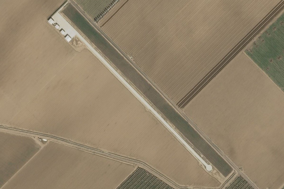
Patterson(POI28) to CN99(CN99)
Distance: 4.73NM Bearing: 339° 2 minutes
A few miles north of the town is the concrete strip of Del Mar Farms airstrip
Leg 6
Flying from CN99
Leg Distance: 33.26 Approximate time at 125kts: 16 minutes.
CN99(CN99) to I-5(POI29)
Distance: 7.77NM Bearing: 271° 4 minutes
After takeoff, head west to Interstate Hwy 5 running along the base of the hills
I-5(POI29) to Tracy Golf Club(POI30)
Distance: 4.51NM Bearing: 300° 2 minutes
Follow I-5 for a short distance until you reach Tracy Golf club, which straddles both sides of the highway, then turn west over the mountains
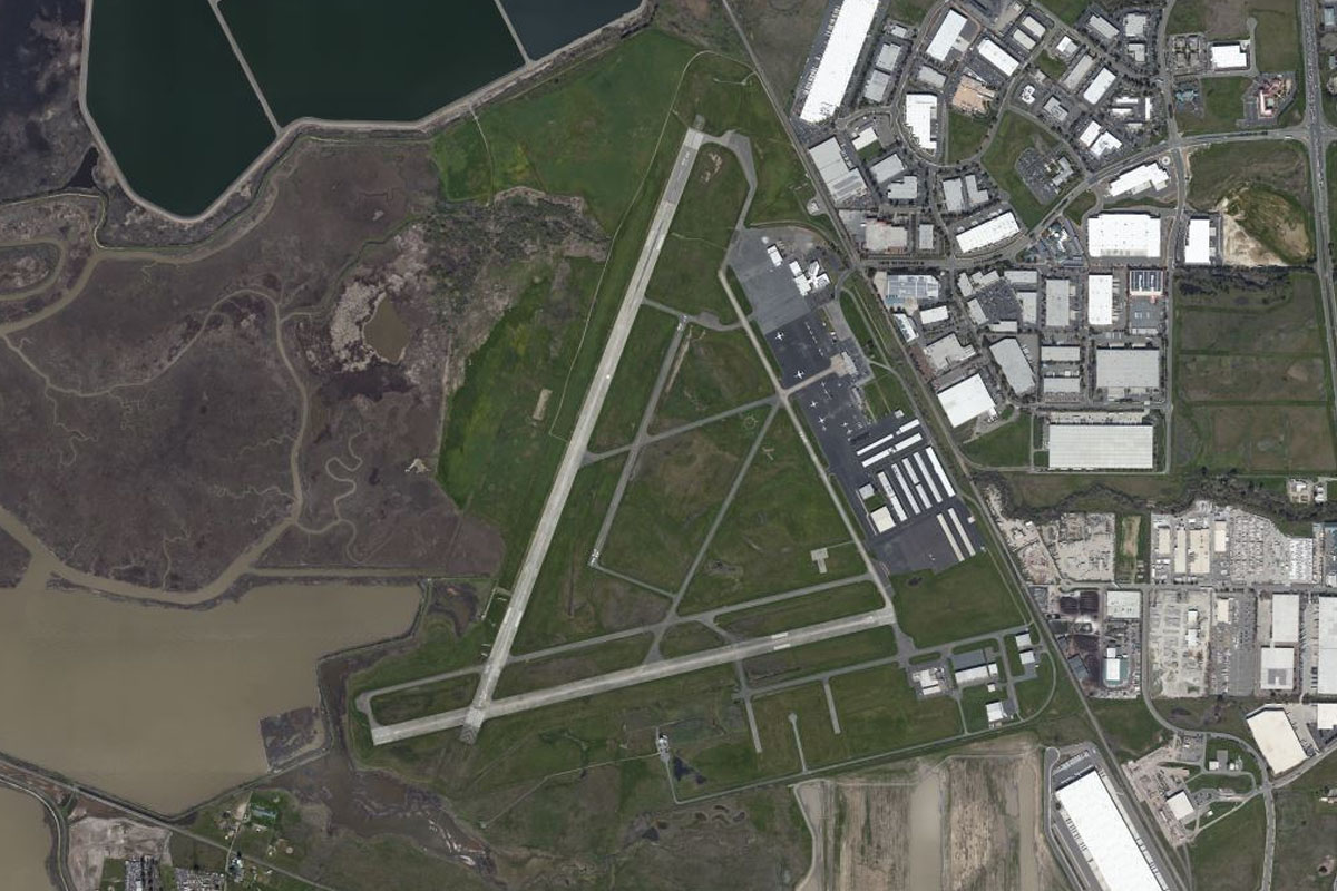
Tracy Golf Club(POI30) to KLVK(KLVK)
Distance: 20.98NM Bearing: 268° 10 minutes
The hilly terrain will flatten out to the city of Livermore. The airport is along side the highway at the northern edge of the water treatment ponds
Leg 7
Flying from KLVK
Leg Distance: 47.64 Approximate time at 125kts: 23 minutes.
KLVK(KLVK) to Walnut Creek(POI31)
Distance: 16.55NM Bearing: 304° 8 minutes
After takeoff, head northwest and meet up with Interstate 680
Walnut Creek(POI31) to Suisun Bay(POI32)
Distance: 10.55NM Bearing: 2° 5 minutes
The highway will interchange with state highway 24 at the town of Walnut Creek, and head north. Fly north all the way to the bay
Suisun Bay(POI32) to Lower Sherman Island(POI33)
Distance: 9.06NM Bearing: 85° 4 minutes
Head east along the bay to where it split in two, then follow the Sacramento River northeast
Lower Sherman Island(POI33) to Sacramento River(POI34)
Distance: 8.86NM Bearing: 30° 4 minutes
As the river turns north it will pass the town of Rio Vista
Sacramento River(POI34) to O88(O88)
Distance: 2.62NM Bearing: 328° 1 minutes
Turn northwest over the town of Rio Vista and the airport is a couple of miles past the town
Leg 8
Flying from O88
Leg Distance: 34.7 Approximate time at 125kts: 17 minutes.
O88(O88) to Shipping Channel(POI35)
Distance: 2.77NM Bearing: 17° 1 minutes
After takeoff, head northeast back to the river, then follow the shipping channel north
Shipping Channel(POI35) to Shipping Channel(POI36)
Distance: 19.63NM Bearing: 0° 9 minutes
Continue along the Sacramento Deep Water Shipping Channel as it heads north
Shipping Channel(POI36) to Sacramento River(POI37)
Distance: 2.97NM Bearing: 65° 1 minutes
Follow the channel as it turns east towards the Sacramento River and the city
Sacramento River(POI37) to Sacramento(POI38)
Distance: 1.79NM Bearing: 10° 1 minutes
Follow the river north as it passes the downtown area of the California State capital, Sacramento
Sacramento(POI38) to KSMF(KSMF)
Distance: 7.54NM Bearing: 315° 4 minutes
After passing the city, turn northwest and head to Sacramento International Airport
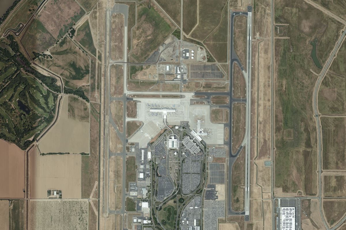
Leg 9
Flying from KSMF
Leg Distance: 38.34 Approximate time at 125kts: 18 minutes.
KSMF(KSMF) to Woodland(POI39)
Distance: 8.19NM Bearing: 245° 4 minutes
After takeoff, head west to the town of Woodland
Woodland(POI39) to Lake Berryessa(POI40)
Distance: 23.71NM Bearing: 259° 11 minutes
From Woodland, head towards the mountains in the distance, following the "grid" heading, and across the mountains to the northern tip of Lake Berryessa
Lake Berryessa(POI40) to 20CL(20CL)
Distance: 6.44NM Bearing: 300° 3 minutes
Head a few miles northwest from the lake to Mysterious Valley airstrip, which sits in a small crop-filled depression in the hills ahead
Leg 10
Flying from 20CL
Leg Distance: 43.45 Approximate time at 125kts: 21 minutes.
20CL(20CL) to Calistoga(POI41)
Distance: 14.27NM Bearing: 219° 7 minutes
After takeoff, head southwest over two mountain ridges before reaching the northern end of the Napa Valley, then turn southeast
Calistoga(POI41) to Napa Valley(POI42)
Distance: 20.07NM Bearing: 123° 10 minutes
Head southeast along the beautiful Napa Valley, the USA's most famous wine making region
Napa Valley(POI42) to KAPC(KAPC)
Distance: 9.11NM Bearing: 158° 4 minutes
Follow the highway to the south end of the valley at the town of Napa, then the airport a few miles south of the town
Leg 11
Flying from KAPC
Leg Distance: 61.86 Approximate time at 125kts: 30 minutes.
KAPC(KAPC) to Sears Point(POI43)
Distance: 8.25NM Bearing: 228° 4 minutes
After takeoff, head southeast across the marshes and past the Sears Point motor racing circuit
Sears Point(POI43) to Point San Pedro(POI44)
Distance: 9.46NM Bearing: 180° 5 minutes
Turn south and follow the western shore of San Pablo Bay over the hilly Point San Pedro
Point San Pedro(POI44) to San Quentin(POI45)
Distance: 3.08NM Bearing: 177° 1 minutes
Continue south to San Quentin at the western end of the Richmond-San Rafael Bridge, which is the home of San Quentin State Prison
San Quentin(POI45) to Mount Tamalpais(POI46)
Distance: 10.7NM Bearing: 261° 5 minutes
From San Quentin, turn west and cross the mountains, passing on the north side of the peaks of Mount Tamalpais, then continuing towards the coast
Mount Tamalpais(POI46) to Stinson Beach(POI47)
Distance: 4.42NM Bearing: 126° 2 minutes
Turn southeast and follow highway 1 past Bolinas Lagoon and along the coast
Stinson Beach(POI47) to Point Bonita(POI48)
Distance: 7.46NM Bearing: 117° 4 minutes
Follow the coast southeast to Point Bonita, which sits 2 miles west of the Golden Gate Bridge
Point Bonita(POI48) to Golden Gate(POI49)
Distance: 6.11NM Bearing: 77° 3 minutes
Head east over the world's most famous bridge, the Golden Gate Bridge, then past Alcatraz Island – the notorious prison now a tourist attraction
Golden Gate(POI49) to Hunters Point(POI50)
Distance: 6.23NM Bearing: 147° 3 minutes
Follow the shore around to the right, passing San Francisco's famous wharves and the downtown area before crossing over the Bay Bridge, then continue to the container terminal and shipyards of Hunters Point
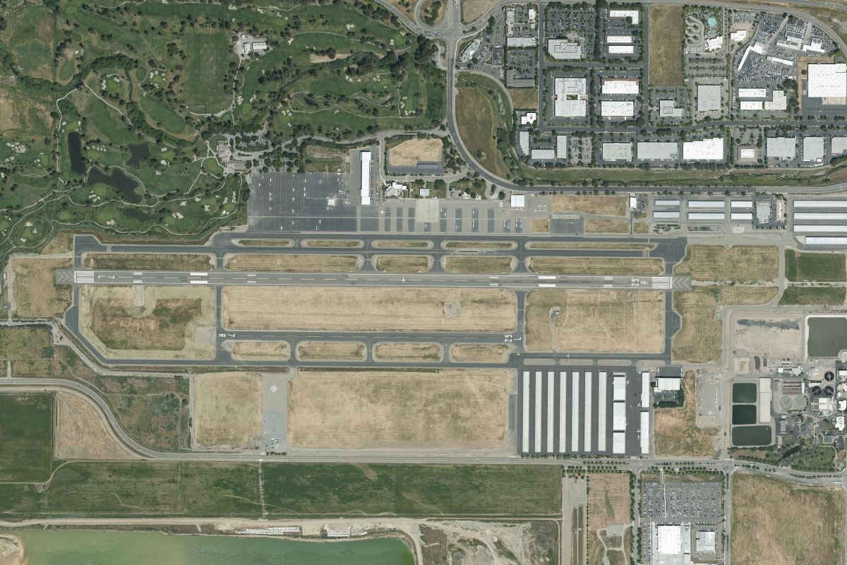
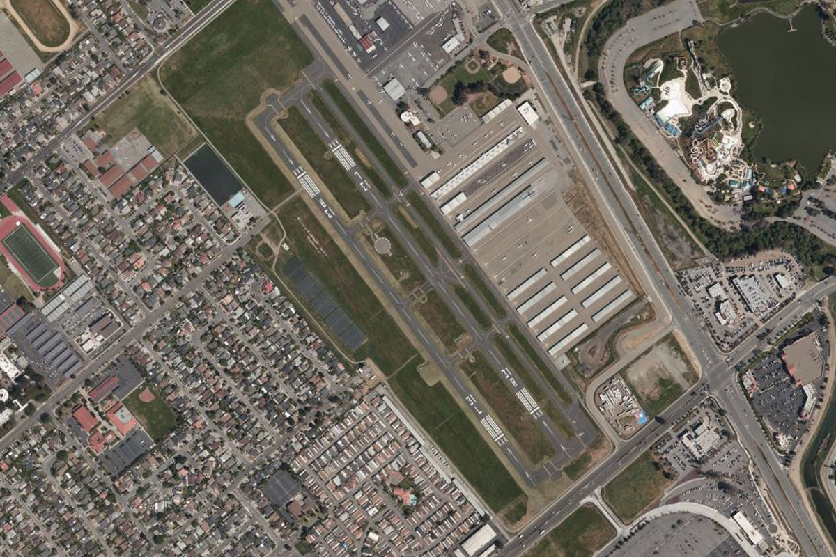
Hunters Point(POI50) to KSFO(KSFO)
Distance: 6.15NM Bearing: 175° 3 minutes
A turn south from Hunters Point will take you to the iconic San Francisco International Airport
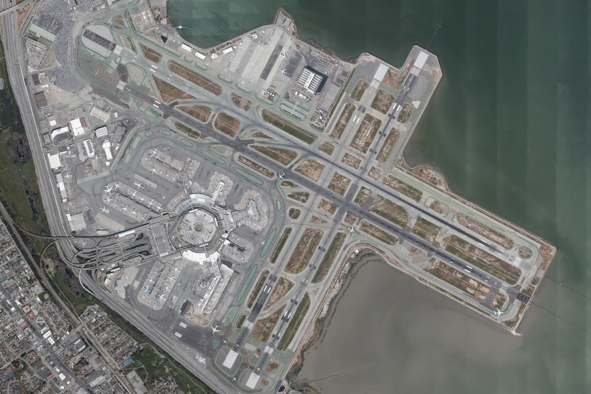
Leg 12
Flying from KSFO
Leg Distance: 30.07 Approximate time at 125kts: 14 minutes.
KSFO(KSFO) to San Francisco(POI51)
Distance: 9.51NM Bearing: 336° 5 minutes
After takeoff, head north for a closer look at downtown San Francisco. Once dominated by the Transamerica Pyramid at the northern end, the Salesforce Tower is now the tallest building in the city
San Francisco(POI51) to Golden Gate Park(POI52)
Distance: 4.93NM Bearing: 252° 2 minutes
From the city, turn west and fly to the coast over another San Francisco icon, Golden Gate Park
Golden Gate Park(POI52) to Pedro Point Headlands(POI53)
Distance: 13.63NM Bearing: 169° 7 minutes
Follow the coast south past the Pedro Point Headlands
Pedro Point Headlands(POI53) to KHAF(KHAF)
Distance: 2NM Bearing: 129° 1 minutes
After the headlands, you'll see the town of Montara and the Half Moon Bay airport a couple of miles south
Leg 13
Flying from KHAF
Leg Distance: 38.3 Approximate time at 125kts: 18 minutes.
KHAF(KHAF) to Bayshore Freeway(POI54)
Distance: 13.85NM Bearing: 84° 7 minutes
After takeoff, head east over the mountains, passing a quarry and the Upper Crystal Springs Reservoir, before meeting the Bayside Freeway running along the western side of the bay
Bayshore Freeway(POI54) to Moffett Field(POI55)
Distance: 9.74NM Bearing: 109° 5 minutes
Follow the freeway southeast past Moffett Federal Airfield, also home to the NASA Ames Research Center and the historic Hangar One – one of the largest freestanding structures in the world
Moffett Field(POI55) to Cupertino(POI56)
Distance: 3.99NM Bearing: 163° 2 minutes
After passing Moffett Field, head south to meet the Junipero Sierra Freeway (I-280) at Cupertino, home of the tech giant Apple headquarters in the large circular building as you turn east along the freeway
Cupertino(POI56) to I-280(POI57)
Distance: 5.89NM Bearing: 89° 3 minutes
Follow the freeway east past the Apple complex. Before the interchange with CA17 you will pass the domes of the Century Cinemas and the Winchester Mystery House
I-280(POI57) to San Jose(POI58)
Distance: 3.26NM Bearing: 50° 2 minutes
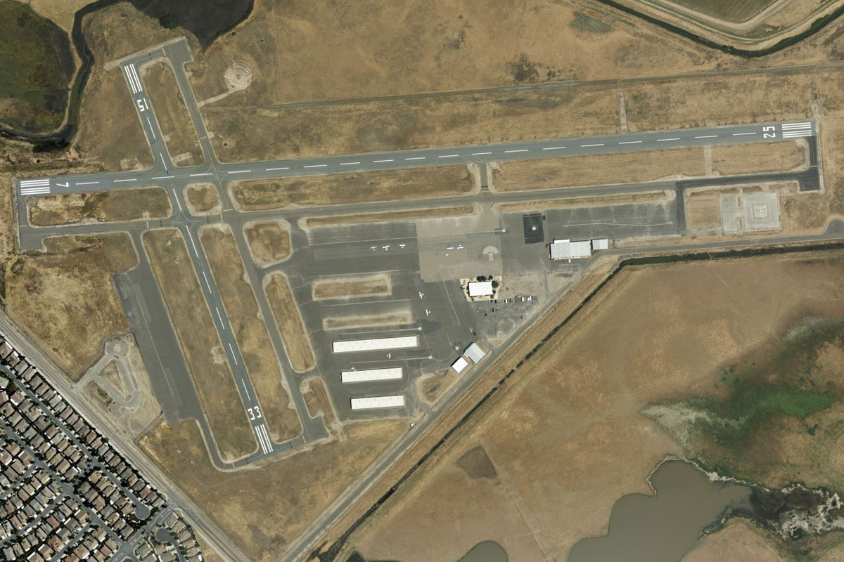
Keep following I-280 as it turns northeast and passes downtown San Jose
San Jose(POI58) to KRHV(KRHV)
Distance: 1.57NM Bearing: 92° 1 minutes
Just past San Jose there will be another large freeway interchange. The airport is just east of here
Leg 14
Flying from KRHV
Leg Distance: 58.28 Approximate time at 125kts: 28 minutes.
KRHV(KRHV) to Los Gatos(POI59)
Distance: 8.75NM Bearing: 221° 4 minutes
After takeoff, head southwest towards the gap in the mountains and you'll see state highway 17 heading into the hills
Los Gatos(POI59) to Santa Cruz(POI60)
Distance: 18.17NM Bearing: 181° 9 minutes
Head south through the hills with the highway, then continue south all the way to the coast, and the town of Santa Cruz
Santa Cruz(POI60) to Seascape(POI61)
Distance: 8.36NM Bearing: 79° 4 minutes
Fly east along the coast of Santa Cruz, with the pier and boardwalk famous with moviegoers as the setting for the 80s movie – The Lost Boys
Seascape(POI61) to Moss Landing(POI62)
Distance: 9.45NM Bearing: 139° 5 minutes
Follow the coast around the southeast
Moss Landing(POI62) to Sand City(POI63)
Distance: 10.31NM Bearing: 179° 5 minutes
Stay along the coast as it turns south
Sand City(POI63) to KMRY(KMRY)
Distance: 3.24NM Bearing: 172° 2 minutes
As the coast curves around to the southwest, you should see Monterey Regional Airport a couple of miles inland, south of the large shopping center at Sand City
Leg 15
Flying from KMRY
Leg Distance: 76.6 Approximate time at 125kts: 37 minutes.
KMRY(KMRY) to Spyglass Hill(POI64)
Distance: 5.88NM Bearing: 263° 3 minutes
After takeoff, head west across Monterey to the coast, which is littered with some of the world's top golf courses, the first one here being Spyglass Hill
Spyglass Hill(POI64) to Cypress Point(POI65)
Distance: 1.48NM Bearing: 207° 1 minutes
Turn to the south and follow the coast to another famous golf course, Cypress Point
Cypress Point(POI65) to Pebble Beach(POI66)
Distance: 2.21NM Bearing: 113° 1 minutes
Turning southeast to follow the coast, this time passing another legendary golf course, Pebble Beach
Pebble Beach(POI66) to Point Sur(POI67)
Distance: 15.24NM Bearing: 160° 7 minutes
Follow the coast south past the seaside town of Carmel, Point Lobos and the rocky coast beyond. Highway 1 leads the way along the coast past the famous stretch of coast known as Big Sur, and the Bixby Creek bridge
Point Sur(POI67) to CA-1(POI68)
Distance: 14.41NM Bearing: 119° 7 minutes
Head around Point Sur and continue following the coast
CA-1(POI68) to Breaker Point(POI69)
Distance: 29.56NM Bearing: 131° 14 minutes
After miles of rugged coastline, the land will flatten out before the town of San Simeon
Breaker Point(POI69) to CN66(CN66)
Distance: 7.82NM Bearing: 120° 4 minutes
Cross the coast and head southeast along the base of the hills. The airport is a few miles south of a small creek valley, at the base of the hill that houses the famous Hearst Castle
Leg 16
Flying from CN66
Leg Distance: 37.53 Approximate time at 125kts: 18 minutes.
CN66(CN66) to Point Estero(POI70)
Distance: 15.91NM Bearing: 128° 8 minutes
After takeoff. follow the cost southeast to Point Estero
Point Estero(POI70) to Morro Rock(POI71)
Distance: 8.92NM Bearing: 120° 4 minutes
From Point Estero, cut across the bay to Morro Rock, the nearly 600ft tall volcanic plug at the mouth of Morro Bay
Morro Rock(POI71) to KSBP(KSBP)
Distance: 12.7NM Bearing: 114° 6 minutes
Continue southeast over Morro Bay and along the shallow valley beyond, before the airport on the southern outskirts of San Luis Obispo
Leg 17
Flying from KSBP
Leg Distance: 75.18 Approximate time at 125kts: 36 minutes.
KSBP(KSBP) to Santa Margarita Lake(POI72)
Distance: 9.68NM Bearing: 43° 5 minutes
After takeoff, head northeast over the hills to Santa Margarita Lake
Santa Margarita Lake(POI72) to Soda Lake(POI73)
Distance: 30.54NM Bearing: 89° 15 minutes
Turn to the east and cross the mountain range to the flat land of the Carrizo Plain, and Soda Lake
Soda Lake(POI73) to San Andreas Fault(POI74)
Distance: 25.63NM Bearing: 111° 12 minutes
From Soda Lake, head southeast along the plain. The rippled line of ground on the eastern side of the plain is the San Andreas Fault
San Andreas Fault(POI74) to Maricopa(POI75)
Distance: 4.06NM Bearing: 11° 2 minutes
When you reach the southern end of the plain, turn northeast and to the town of Maricopa
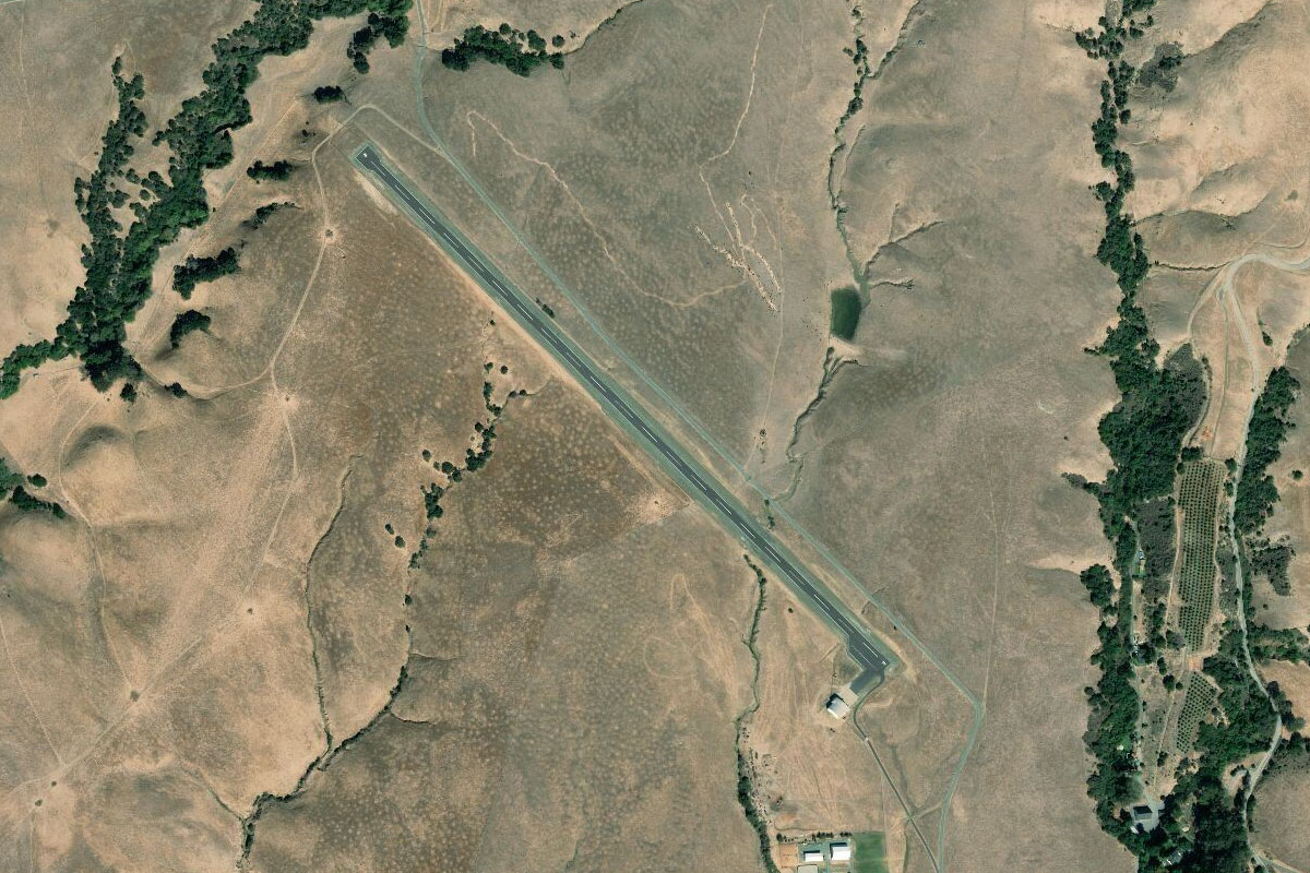
Maricopa(POI75) to L17(L17)
Distance: 5.27NM Bearing: 329° 3 minutes
From Maricopa, follow the highway northwest to the larger town of Taft, with the airport on the eastern side of town
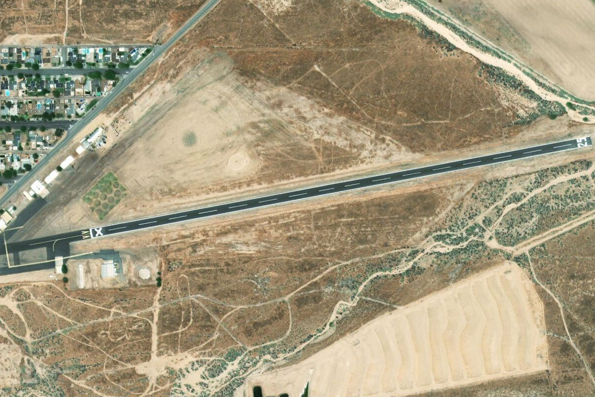
Leg 18
Flying from L17
Leg Distance: 27.93 Approximate time at 125kts: 13 minutes.
L17(L17) to Buena Vista(POI76)
Distance: 10.65NM Bearing: 55° 5 minutes
From Taft, fly northeast to the lake at Buena Vista
Buena Vista(POI76) to I-5(POI77)
Distance: 3.71NM Bearing: 80° 2 minutes
Follow the road from the southern tip of the lake as it heads east towards Interstate 5
I-5(POI77) to CA-99(POI78)
Distance: 7.65NM Bearing: 79° 4 minutes
Continue following the road east as it passes over state highway 99
CA-99(POI78) to CA-223(POI79)
Distance: 3.92NM Bearing: 78° 2 minutes
Continue east for a few more miles before turning to the south
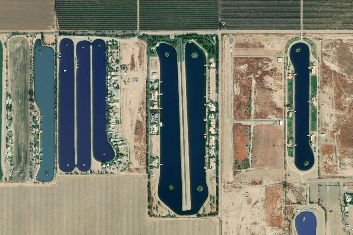
CA-223(POI79) to 7CA2(7CA2)
Distance: 2NM Bearing: 166° 1 minutes
A couple of miles south of the highway is a group of purpose built ski lakes. The largest one of these has an airstrip right down the middle
Leg 19
Flying from 7CA2
Leg Distance: 42.75 Approximate time at 125kts: 21 minutes.
7CA2(7CA2) to CA-223(POI80)
Distance: 8.8NM Bearing: 65° 4 minutes
Head northeast after takeoff, over the town of Arvin and back to highway 223 as it heads to the mountains
CA-223(POI80) to CA-58(POI81)
Distance: 5.68NM Bearing: 43° 3 minutes
Follow the highway as it climbs and meets up with highway 58 heading east
CA-58(POI81) to CA-58(POI82)
Distance: 9.55NM Bearing: 110° 5 minutes
Follow highway 58 eastwards as it climbs further into the hills, on the way passing the Tehachapi Loop of the Union Pacific Railway
CA-58(POI82) to Tehachapi(POI83)
Distance: 3.91NM Bearing: 131° 2 minutes
The road will lead you southeast to the town of Tehachapi
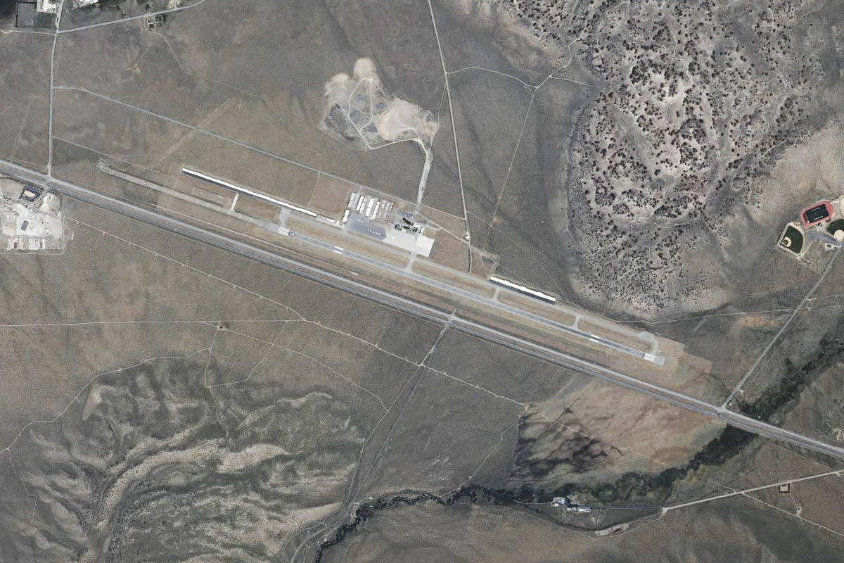
Tehachapi(POI83) to KMHV(KMHV)
Distance: 14.81NM Bearing: 94° 7 minutes
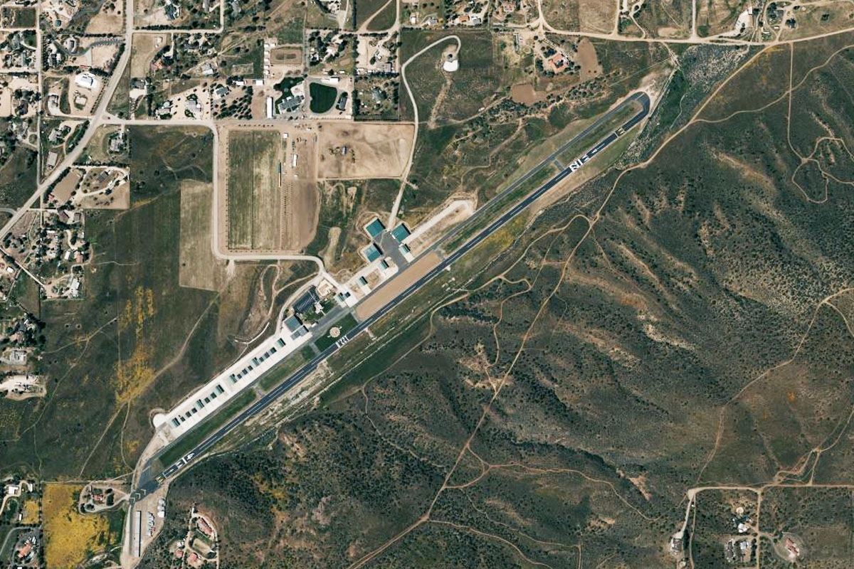
Stay with the highway until it reaches the wind farms at Tehachapi Pass, then head east to the town of Mohave and the "Air and Space Port" on the north side of town
Leg 20
Flying from KMHV
Leg Distance: 47.54 Approximate time at 125kts: 23 minutes.
KMHV(KMHV) to Edwards(POI84)
Distance: 15.58NM Bearing: 104° 7 minutes
After takeoff, head east past the motor vehicle proving grounds, then on to Edwards Air Force Base, and important testing and research facility for the USAF and NASA
Edwards(POI84) to Shadow Mountains(POI85)
Distance: 20.44NM Bearing: 122° 10 minutes
The large oil-lined lake-bed runway 12 points the way to the low lying Shadow Mountains. It is marked with the number 30 at its opposite end
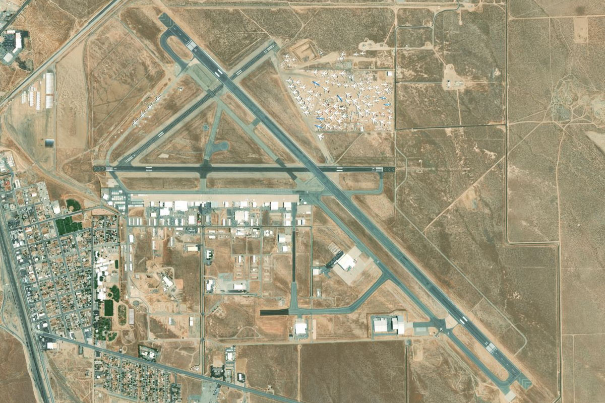
Shadow Mountains(POI85) to KVCV(KVCV)
Distance: 11.52NM Bearing: 116° 6 minutes
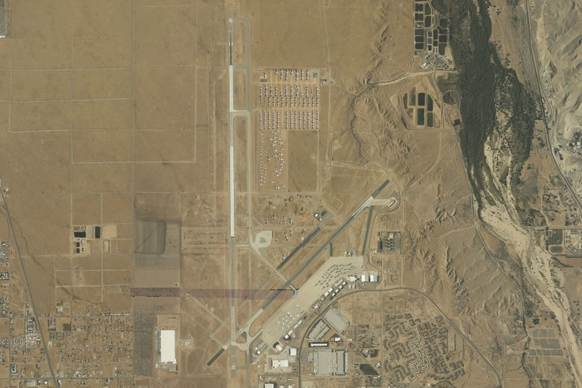
Continue southeast towards Victorville, and the Southern California Logistics Airport, which is a large aircraft storage facility northwest of the town
Leg 21
Flying from KVCV
Leg Distance: 47.39 Approximate time at 125kts: 23 minutes.
KVCV(KVCV) to Palmdale(POI86)
Distance: 34.92NM Bearing: 257° 17 minutes
After takeoff, follow the grid west to the town of Palmdale at the foot of the San Gabriel Mountains
Palmdale(POI86) to Mount McDill(POI87)
Distance: 8.11NM Bearing: 248° 4 minutes
From Palmdale, head over the break in the canal and between the two tallest peaks that lie in the mountains west of the city
Mount McDill(POI87) to L70(L70)
Distance: 4.36NM Bearing: 215° 2 minutes
As you pass the peaks, you should see the airfield at Agua Dulce in the valley slightly to the left
Leg 22
Flying from L70
Leg Distance: 25.97 Approximate time at 125kts: 12 minutes.
L70(L70) to Vasquez Rocks(POI88)
Distance: 3.09NM Bearing: 198° 1 minutes
After takeoff, head south to the freeway, passing over the landmark of Vasquez Rocks. Used in countless movies, TV shows and music videos, they are most famous for being the "Star Trek" rocks
Vasquez Rocks(POI88) to Antelope Valley Freeway(POI89)
Distance: 9.49NM Bearing: 226° 5 minutes
Follow the freeway southwest through the mountains
Antelope Valley Freeway(POI89) to I-5(POI90)
Distance: 2.9NM Bearing: 168° 1 minutes
Stay with the freeway as it turns south and merges with Interstate 5
I-5(POI90) to Burbank(POI91)
Distance: 7.34NM Bearing: 128° 4 minutes
Follow I-5 southeast as it points towards the Hollywood Hills
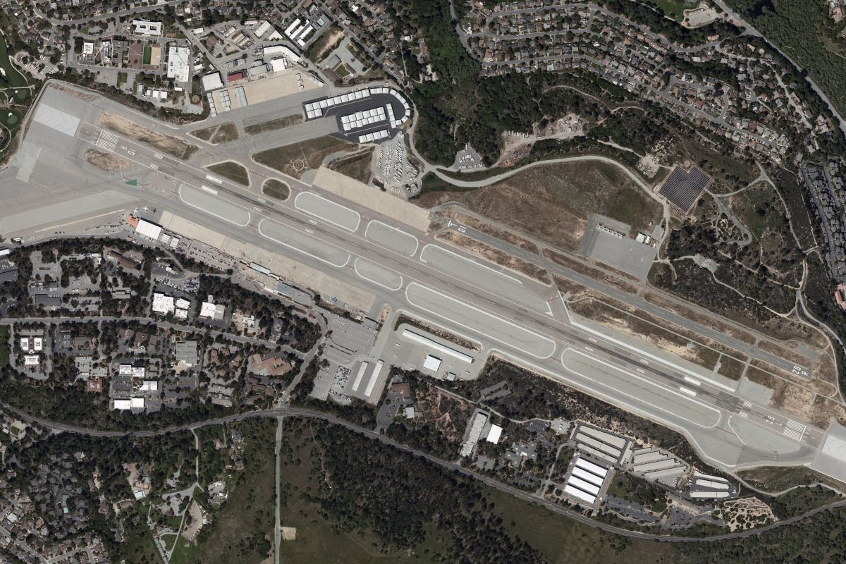
Burbank(POI91) to KBUR(KBUR)
Distance: 3.15NM Bearing: 116° 2 minutes
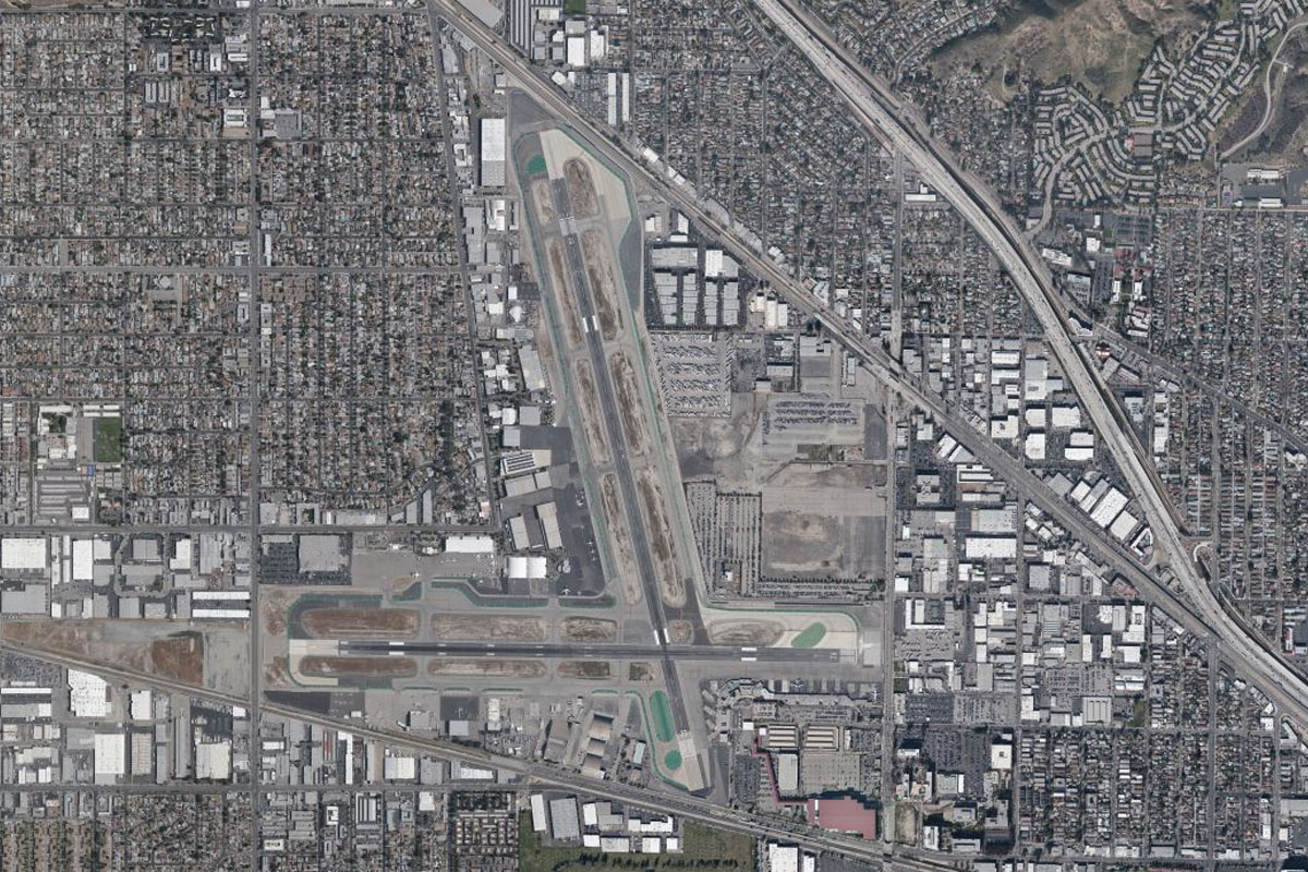
When the freeway split in two, continue southeast to Hollywood Burbank Airport
Leg 23
Flying from KBUR
Leg Distance: 35.74 Approximate time at 125kts: 17 minutes.
KBUR(KBUR) to Universal(POI92)
Distance: 3.66NM Bearing: 174° 2 minutes
Head south after takeoff and over to Universal Studios, on the way passing Burbank and Warner Brothers Studios to your left
Universal(POI92) to Hollywood(POI93)
Distance: 5.14NM Bearing: 123° 2 minutes
From Universal turn southeast and follow the Hollywood Freeway towards Los Angeles. The Hollywood sign will be on the mountain to your left
Hollywood(POI93) to Los Angeles(POI94)
Distance: 3.4NM Bearing: 106° 2 minutes
Keep following the freeway past the north side of downtown LA until you reach the concrete canal on the Los Angeles River
Los Angeles(POI94) to Los Angeles River(POI95)
Distance: 2.8NM Bearing: 156° 1 minutes
Head southeast along the river canal, another popular movie location
Los Angeles River(POI95) to Commerce(POI96)
Distance: 2.84NM Bearing: 86° 1 minutes
When the canal turns, head east over the large rail yard and intermodal terminal
Commerce(POI96) to Pasadena(POI97)
Distance: 9.03NM Bearing: 352° 4 minutes
After passing the rail yard, head north until you reach the city of Pasadena, which sits a few miles south of the mountains
Pasadena(POI97) to Foothill Freeway(POI98)
Distance: 5.25NM Bearing: 83° 3 minutes
Running through Pasadena is the Foothill Freeway, follow it east
Foothill Freeway(POI98) to KEMT(KEMT)
Distance: 3.62NM Bearing: 160° 2 minutes
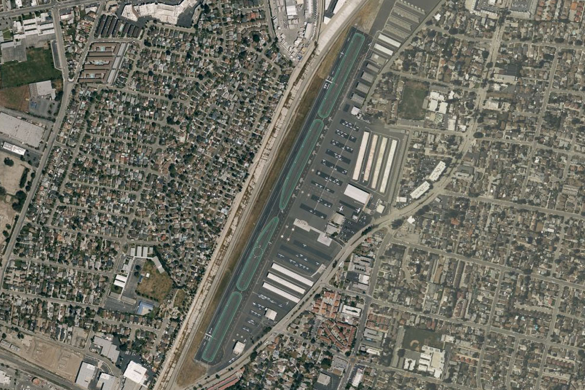
When you reach the horse racing track of Santa Anita Park, turn south and head for the San Gabriel Valley Airport a few miles away
Leg 24
Flying from KEMT
Leg Distance: 54.78 Approximate time at 125kts: 26 minutes.
KEMT(KEMT) to San Gabriel River(POI99)
Distance: 3.16NM Bearing: 162° 2 minutes
After takeoff, head south to the large freeway interchange between the San Gabriel River and the hills
San Gabriel River(POI99) to Pomona Freeway(POIA0)
Distance: 9.56NM Bearing: 92° 5 minutes
Follow the Pomona Freeway east until it interchanges with the Orange Freeway heading south
Pomona Freeway(POIA0) to Brea(POIA1)
Distance: 4.55NM Bearing: 194° 2 minutes
Follow the Orange Freeway south through the hills
Brea(POIA1) to Anaheim(POIA2)
Distance: 8.06NM Bearing: 169° 4 minutes
Stay with the Orange Freeway all the way south to the stadium at Anaheim
Anaheim(POIA2) to Disneyland(POIA3)
Distance: 3.54NM Bearing: 301° 2 minutes
Turn right around the stadium and follow interstate 5 northwest past Disneyland, the world's most famous theme park
Disneyland(POIA3) to Norwalk(POIA4)
Distance: 8.72NM Bearing: 291° 4 minutes
Stay with I-5 as it heads northwest
Norwalk(POIA4) to Los Angeles River(POIA5)
Distance: 5.38NM Bearing: 289° 3 minutes
When the freeway turns north, continue northwest until you reach the Los Angeles River, which will line you up for LAX
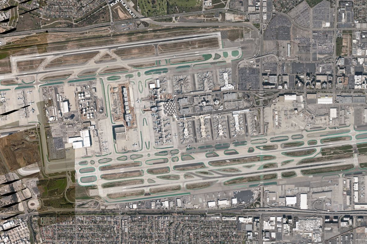
Los Angeles River(POIA5) to KLAX(KLAX)
Distance: 11.81NM Bearing: 254° 6 minutes
Head west to the iconic Los Angeles International Airport – LAX