This stage takes you along the coast of the southeastern United States. Starting in Florida, you’ll get a close up view of the Kennedy Space Center at Cape Canaveral, before heading north to the motor racing hotspot of Daytona. Continuing north through Jacksonville and into Georgia, you will see the beautiful historic city of Savannah, then Charleston in South Carolina before continuing along the coast to the major tourist destination of Myrtle Beach. The last section of the stage will feature the long, thin barrier islands of the Outer Banks and the Cape Hatteras National Seashore, which will lead you north to the Wright Brothers National Memorial in Kill Devil Hills, a bucket list destination for any aviation lover, before finishing the stage in Norfolk, Virginia
Total Legs: 17 Total Distance: 836 Total Time(125kts): 6 hours 41 minutes
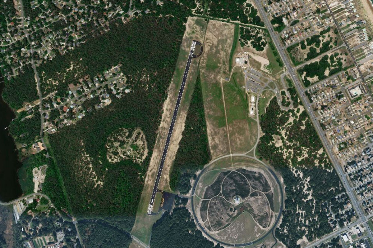
Leg 1
Flying from KMCO
Leg Distance: 61.66 Approximate time at 125kts: 30 minutes.
KMCO(KMCO) to East Lake Tohopekaliga(POI1)
Distance: 8.37NM Bearing: 177° 4 minutes
After takeoff, head south to the circular East Lake Tohopekaliga
East Lake Tohopekaliga(POI1) to Cocoa(POI2)
Distance: 29.77NM Bearing: 90° 14 minutes
Head east towards the coast until you reach the Indian River Lagoon, which runs a third of the length of Florida's coastline
Cocoa(POI2) to Cape Canaveral(POI3)
Distance: 11.65NM Bearing: 61° 6 minutes
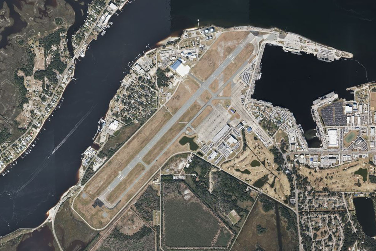
Head northeast to the large triangle shaped peninsula of Cape Canaveral, the famous historic rocket launch facility currently used by NASA, SpaceX and Blue Origin, and part of the larger Kennedy Space Center
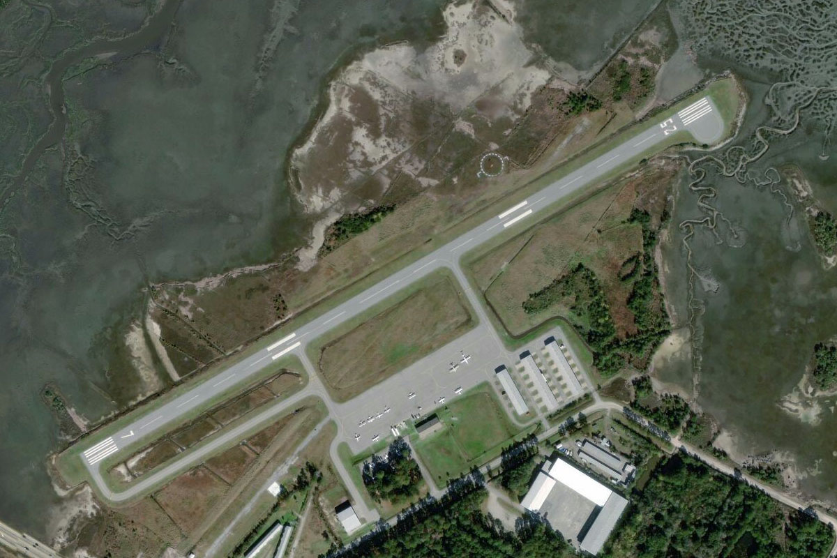
Cape Canaveral(POI3) to KTTS(KTTS)
Distance: 11.87NM Bearing: 325° 6 minutes
After viewing the launch complex, fly northwest to the Shuttle Landing Facility, passing the massive Vehicle Assembly Building on the way. The 15000ft runway should pose no problem for a small aircraft
Leg 2
Flying from KTTS
Leg Distance: 41.87 Approximate time at 125kts: 20 minutes.
KTTS(KTTS) to Canaveral National Seashore(POI4)
Distance: 8.87NM Bearing: 1° 4 minutes
After takeoff, head north to the coast and follow the long sliver of land of the Canaveral National Seashore
Canaveral National Seashore(POI4) to Daytona Beach(POI5)
Distance: 29.44NM Bearing: 338° 14 minutes
Follow the coast north past the populated area of New Smyrna Beach
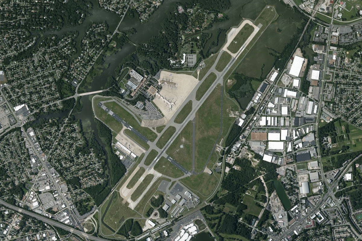
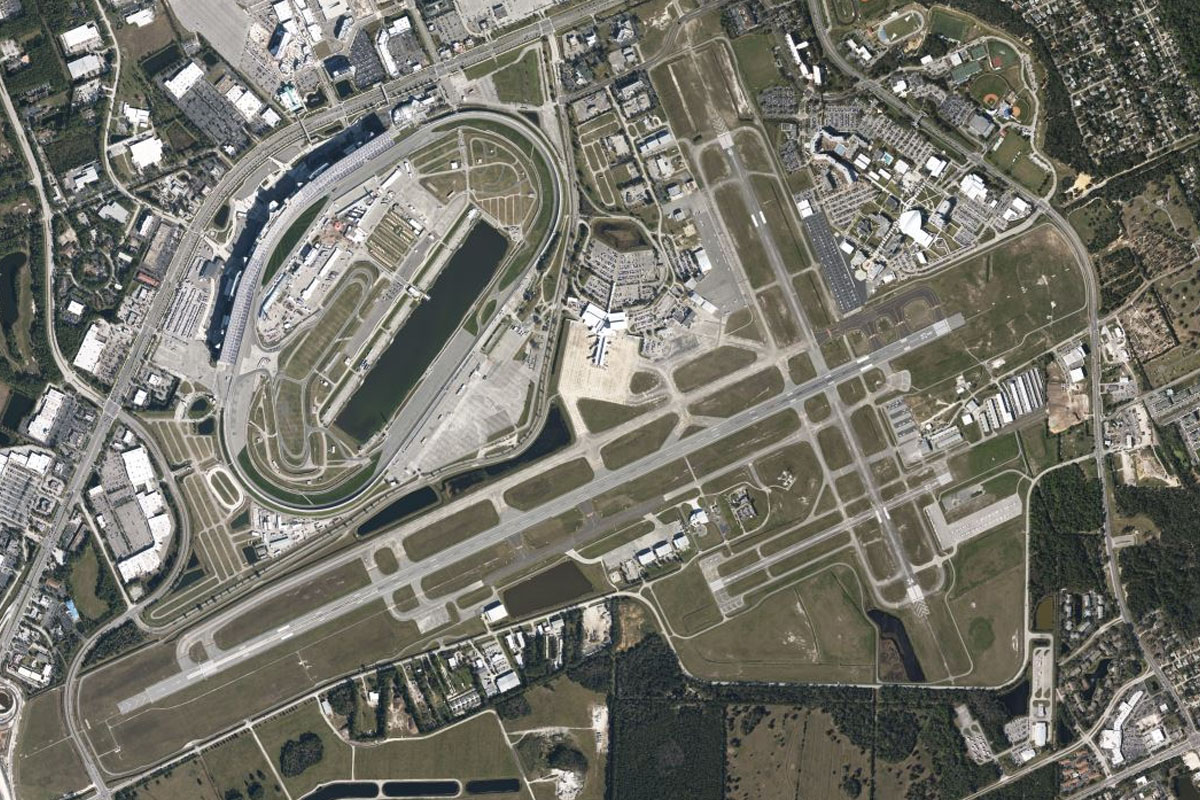
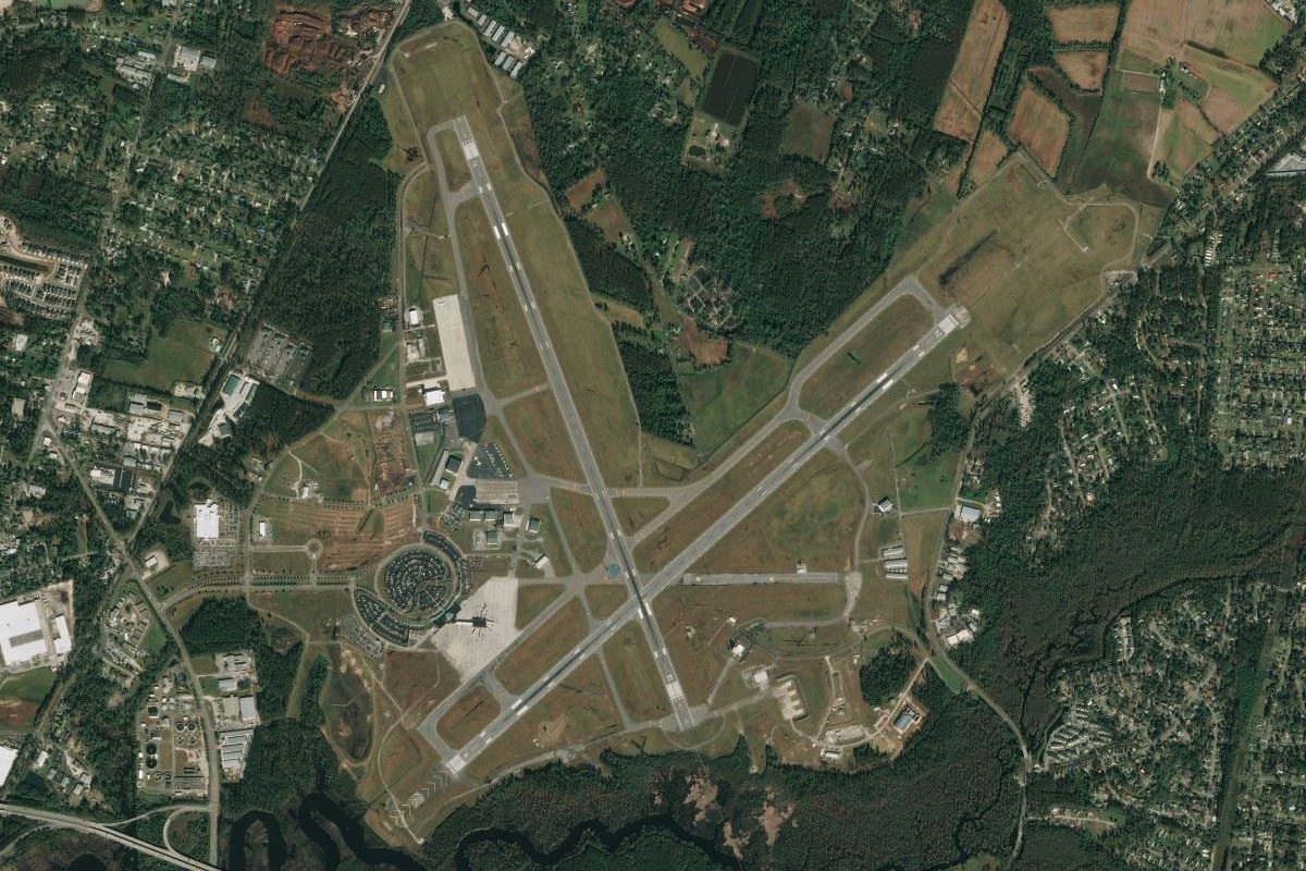
Daytona Beach(POI5) to KDAB(KDAB)
Distance: 3.56NM Bearing: 270° 2 minutes
As you near the marina and bridges of Daytona Beach, head a couple of miles inland to Daytona Beach International Airport, which sits next to the world famous Daytona International Speedway
Leg 3
Flying from KDAB
Leg Distance: 49.86 Approximate time at 125kts: 24 minutes.
KDAB(KDAB) to Ormond Beach(POI6)
Distance: 10.43NM Bearing: 3° 5 minutes
After takeoff, head north to once again meet the coast
Ormond Beach(POI6) to Palm Coast(POI7)
Distance: 13.71NM Bearing: 345° 7 minutes
Follow the coast north past the canal filled residential area of Palm Coast
Palm Coast(POI7) to Saint Augustine(POI8)
Distance: 20.84NM Bearing: 352° 10 minutes
Continue north along the coast to Saint Augustine, built around the mouth of the Matanzas River
Saint Augustine(POI8) to KSGJ(KSGJ)
Distance: 4.88NM Bearing: 324° 2 minutes
The airport sits on the inland side of the river a few miles north of the town
Leg 4
Flying from KSGJ
Leg Distance: 42.14 Approximate time at 125kts: 20 minutes.
KSGJ(KSGJ) to Jacksonville(POI9)
Distance: 27.35NM Bearing: 330° 13 minutes
Fly northwest with Highway 1 as it leads you to the city of Jacksonville, the most populous city in the state
Jacksonville(POI9) to St. Johns River(POI10)
Distance: 4.66NM Bearing: 33° 2 minutes
Follow the river as it turns east then north around the city which will give you a view of the downtown and stadium areas
St. Johns River(POI10) to KNRB(KNRB)
Distance: 10.13NM Bearing: 97° 5 minutes
Follow the river east to Naval Station Mayport near the river mouth, and home to the US Navy's Fourth Fleet
Leg 5
Flying from KNRB
Leg Distance: 41.22 Approximate time at 125kts: 20 minutes.
KNRB(KNRB) to Fort Clinch(POI11)
Distance: 19.14NM Bearing: 3° 9 minutes
Fly north along the coast after takeoff. The entrance to Saint Marys River is also the border between Florida and Georgia, and has a 19th century fort on the south bank of the river mouth
Fort Clinch(POI11) to Cumberland Island(POI12)
Distance: 16.29NM Bearing: 14° 8 minutes
Continue north along the coast, following the length of Cumberland Island. An Abandoned lighthouse lies at the northern end
Cumberland Island(POI12) to 09J(09J)
Distance: 5.79NM Bearing: 360° 3 minutes
Fly north over the Saint Andrew Sound to Jekyll Island. The airport is on the western side of the island, near the golf course
Leg 6
Flying from 09J
Leg Distance: 43.42 Approximate time at 125kts: 21 minutes.
09J(09J) to Altamaha River(POI13)
Distance: 15.31NM Bearing: 4° 7 minutes
After takeoff head north along the river delta, passing two airports before reaching the Altamaha River running northwest
Altamaha River(POI13) to Altamaha River(POI14)
Distance: 18.06NM Bearing: 324° 9 minutes
Follow the Altamaha River northwest, where you will soon see a highway running northwest a few miles left of the river, which leads to the town of Jesup
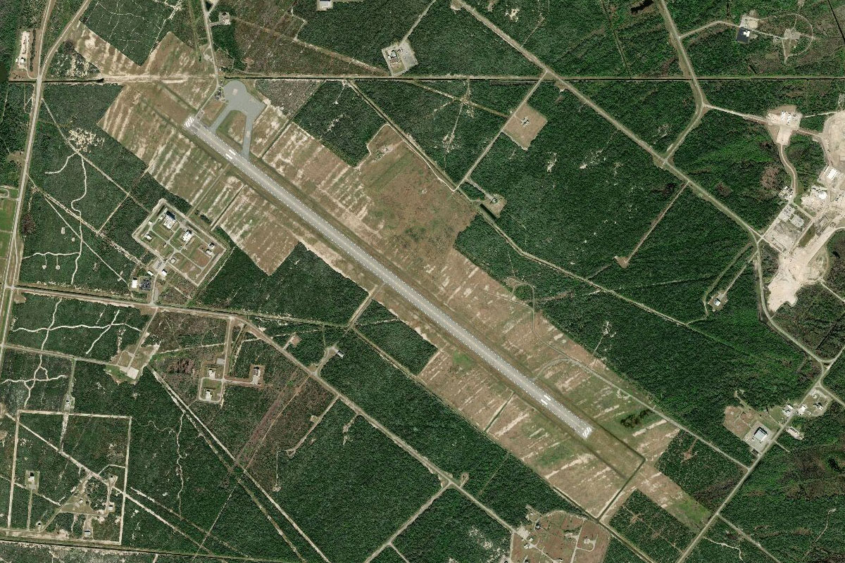
Altamaha River(POI14) to KJES(KJES)
Distance: 10.05NM Bearing: 279° 5 minutes
Head west from the river to follow the highway towards Jesup. The airport sits a few miles south of the town
Leg 7
Flying from KJES
Leg Distance: 42.98 Approximate time at 125kts: 21 minutes.
KJES(KJES) to Jesup(POI15)
Distance: 3.67NM Bearing: 7° 2 minutes
Head north to the nearby town of Jesup
Jesup(POI15) to Walthourville(POI16)
Distance: 17.31NM Bearing: 60° 8 minutes
Follow the highway that leads northeast in a straight line from Jesup. A Railway line also runs alongside the highway
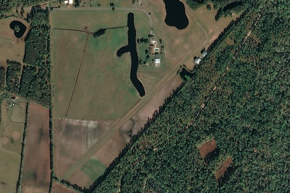
Walthourville(POI16) to GA39(GA39)
Distance: 22NM Bearing: 64° 11 minutes
When the highway turns away north to Hinesville, continue northeast along the straight railway line until you eventually cross the Ogeechee River. A few miles after crossing the river, the railway will fork northeast, where there will be a small airpark hidden in the trees on the north side of the railway, opposite a small lake on the south side
Leg 8
Flying from GA39
Leg Distance: 44.46 Approximate time at 125kts: 21 minutes.
GA39(GA39) to Savannah(POI17)
Distance: 10.12NM Bearing: 65° 5 minutes
Head northeast to Savanna, Georgia's oldest city known for its historic buildings and city park squares. One of these is Chippewa Square, featured in the park bench scene from the movie 'Forrest Gump'
Savannah(POI17) to Harbour Town(POI18)
Distance: 12.98NM Bearing: 88° 6 minutes
Head east from Savannah to the coastal island of Hilton Head, popular vacation destination in the state of South Carolina
Harbour Town(POI18) to Hilton Head Island(POI19)
Distance: 10.74NM Bearing: 51° 5 minutes
Fly northeast along Hilton Head Island, home to 23 championship golf courses including the famous Harbor Town Golf Links
Hilton Head Island(POI19) to Parris Island(POI20)
Distance: 6.41NM Bearing: 21° 3 minutes
From Hilton Head, fly north along the river channel to the east of Parris Island, Marine Corps training facility
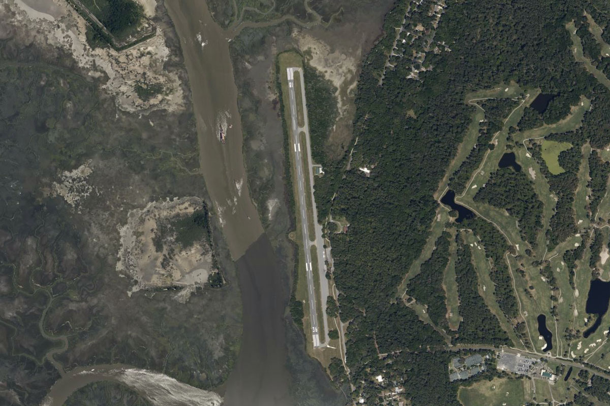
Parris Island(POI20) to KARW(KARW)
Distance: 4.21NM Bearing: 21° 2 minutes
Continue north between the river fork to the golf course south of the town of Red Oak, which will line you up with Beaufort County airport to the east
Leg 9
Flying from KARW
Leg Distance: 54.94 Approximate time at 125kts: 26 minutes.
KARW(KARW) to Morgan River(POI21)
Distance: 5.75NM Bearing: 69° 3 minutes
Head northeast (runway heading) after takeoff until you reach the Morgan River, which will lead you to Saint Helena Sound
Morgan River(POI21) to Saint Helena Sound(POI22)
Distance: 9.93NM Bearing: 90° 5 minutes
Fly east along Saint Helena Sound, part of a large basin of estuaries known as the ACE Basin, and head to Edisto Beach on the north side of the inlet
Saint Helena Sound(POI22) to Folly Beach(POI23)
Distance: 22.71NM Bearing: 70° 11 minutes
Follow the coast northeast until you reach the town of Folly Beach, which stretches along most of the length of Folly Island
Folly Beach(POI23) to Charleston(POI24)
Distance: 6.94NM Bearing: 14° 3 minutes
Fly north for a closer look at the city of Charleston, which sits between the Ashley and Cooper Rivers, and is the third largest city in the state of South Carolina
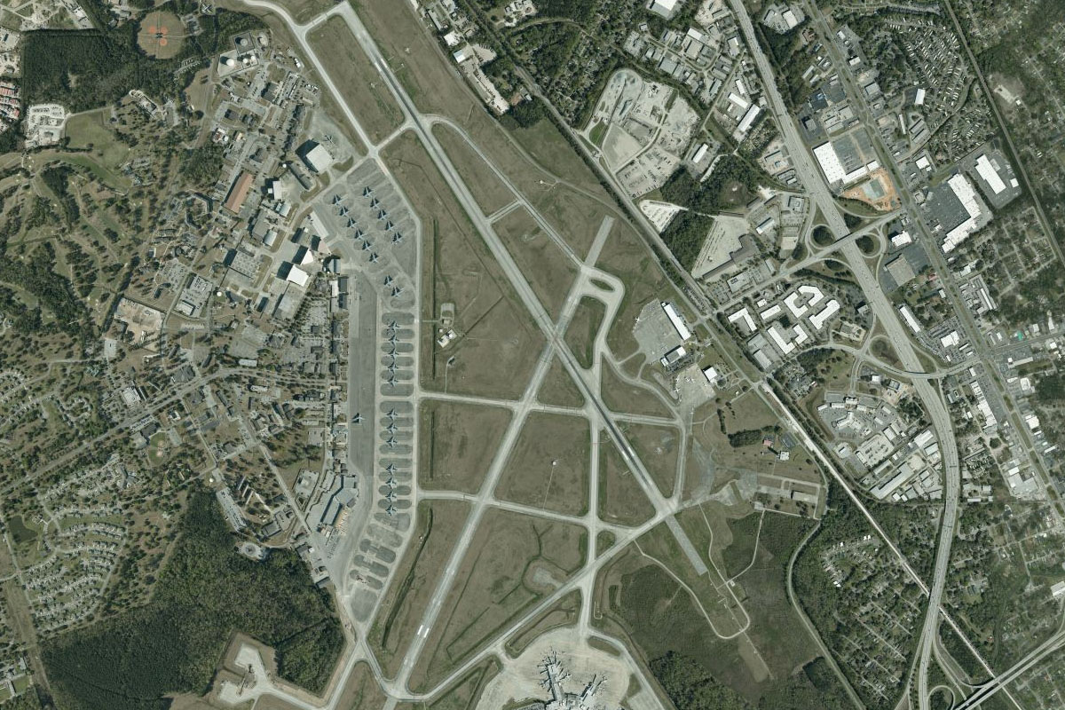
Charleston(POI24) to KCHS(KCHS)
Distance: 9.61NM Bearing: 332° 5 minutes
Head north from the city to Charleston International Airport. This airport also houses the 787 manufacturing facility for Boeing, and the C-17 aircraft of the USAF
Leg 10
Flying from KCHS
Leg Distance: 50.78 Approximate time at 125kts: 24 minutes.
KCHS(KCHS) to Bulls Island(POI25)
Distance: 23.46NM Bearing: 93° 11 minutes
After takeoff, head east to the northern tip of one of the large coastal barrier islands, Bulls Island, which is within the National Wildlife Refuge of Cape Romain
Bulls Island(POI25) to Muddy Bay(POI26)
Distance: 10.59NM Bearing: 53° 5 minutes
Fly northeast across Bulls Bay to the group of islands that from the northern part of Cape Romain National Wildlife Refuge
Muddy Bay(POI26) to US-17(POI27)
Distance: 6.01NM Bearing: 10° 3 minutes
Head north a few miles inland to meet US Highway 17 heading northeast
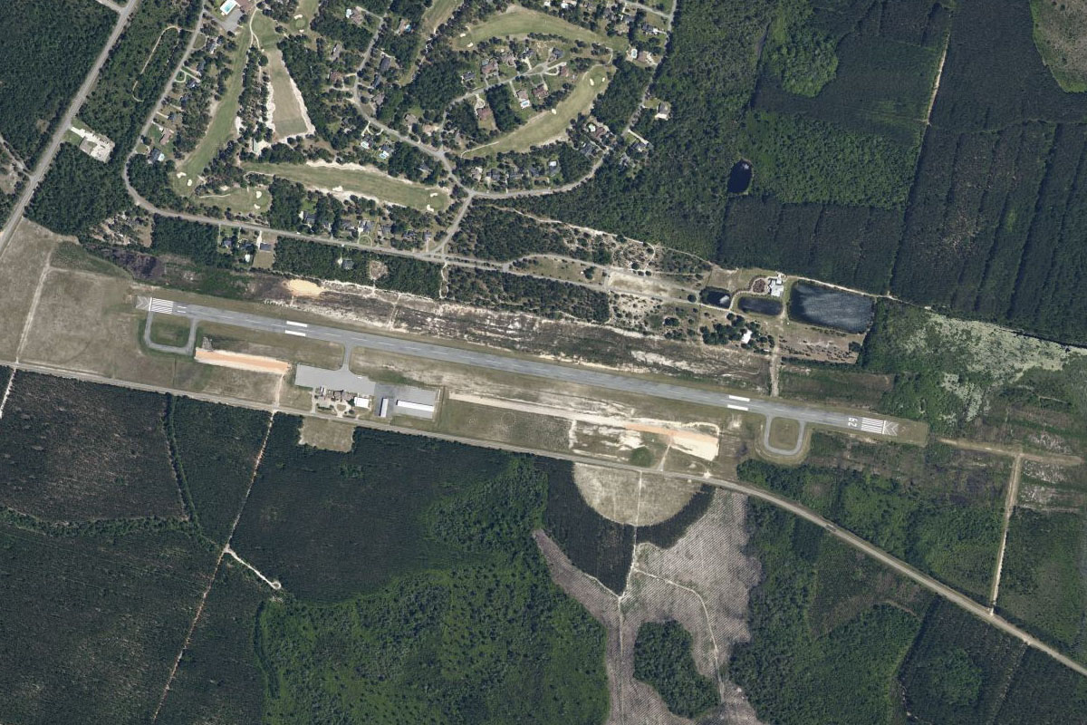
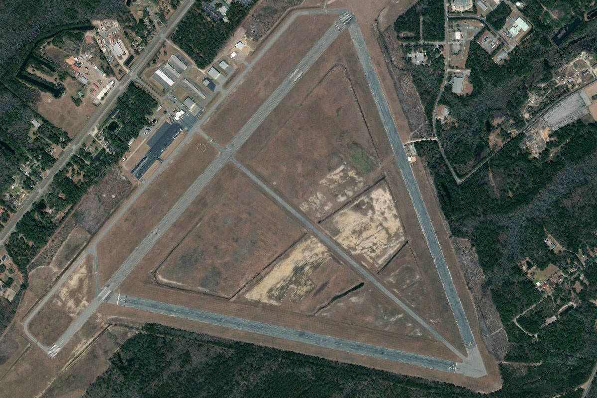
US-17(POI27) to KGGE(KGGE)
Distance: 10.72NM Bearing: 38° 5 minutes
Follow the highway northeast to Georgetown County Airport, which sits in between the highway and the Great Pee Dee River
Leg 11
Flying from KGGE
Leg Distance: 57.63 Approximate time at 125kts: 28 minutes.
KGGE(KGGE) to Myrtle Beach(POI28)
Distance: 32.87NM Bearing: 53° 16 minutes
After takeoff, continue northeast along the coast to Myrtle Beach, one of the USA's most visited tourist destinations, and home to beaches, resorts and nearly 100 golf courses
Myrtle Beach(POI28) to North Myrtle Beach(POI29)
Distance: 12.7NM Bearing: 64° 6 minutes
Keep following the coast northeast past North Myrtle Beach
North Myrtle Beach(POI29) to 60J(60J)
Distance: 12.06NM Bearing: 74° 6 minutes
From North Myrtle Beach, there will be an area of coastal marshland around the Little River Inlet before you reach the towns of Sunset Beach and Ocean Isle Beach. Just north of Ocean Isle Beach, on the other side of the river, is Ocean Isle Airport
Leg 12
Flying from 60J
Leg Distance: 46.44 Approximate time at 125kts: 22 minutes.
60J(60J) to Cape Fear(POI30)
Distance: 21.44NM Bearing: 103° 10 minutes
After takeoff, head east to the mouth of Cape Fear River, which runs to the north and separates the peninsula of Cape Fear from the mainland
Cape Fear(POI30) to Cape Fear River(POI31)
Distance: 7.53NM Bearing: 39° 4 minutes
Follow the river northeast
Cape Fear River(POI31) to Wilmington(POI32)
Distance: 13.39NM Bearing: 4° 6 minutes
Continue north along the river to the city of Wilmington, which is home to a large historic district and also houses the largest TV and Film studios in the USA outside of California
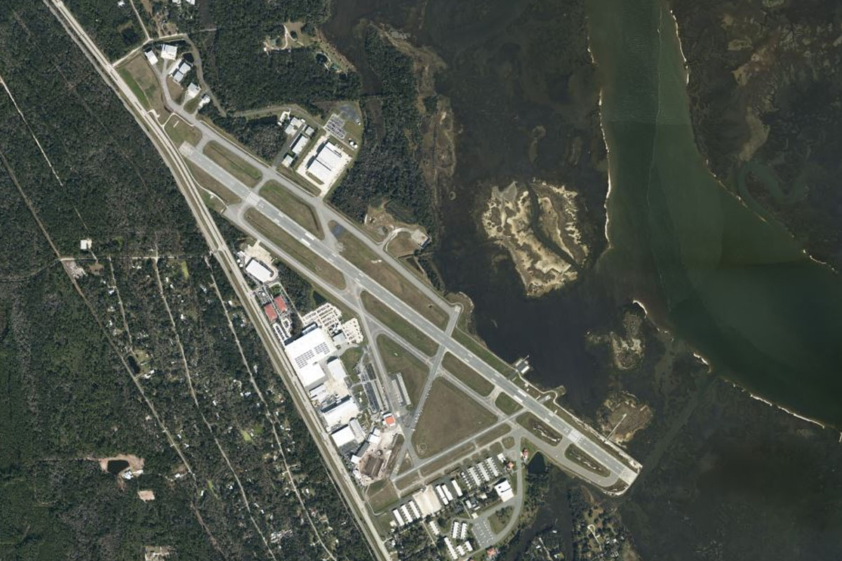
Wilmington(POI32) to KILM(KILM)
Distance: 4.08NM Bearing: 49° 2 minutes
Wilmington Airport lies to the northeast of the city
Leg 13
Flying from KILM
Leg Distance: 52.61 Approximate time at 125kts: 25 minutes.
KILM(KILM) to US-17(POI33)
Distance: 6.17NM Bearing: 80° 3 minutes
Head east after takeoff to meet US Highway 17 heading northeast
US-17(POI33) to Camp Lejeune(POI34)
Distance: 18.77NM Bearing: 56° 9 minutes
Follow the highway northeast until you pass the military air base on the left side of the road, which marks the southern point of Camp Lejeune – a 246 square mile Marine Corps Base
Camp Lejeune(POI34) to New River(POI35)
Distance: 8.39NM Bearing: 96° 4 minutes
Fly east to the coast
New River(POI35) to Bear Island(POI36)
Distance: 12.75NM Bearing: 70° 6 minutes
Follow the coast northeast until you reach the inlet south of the town of Swansboro. Much of the coast here is part of Camp Lejeune
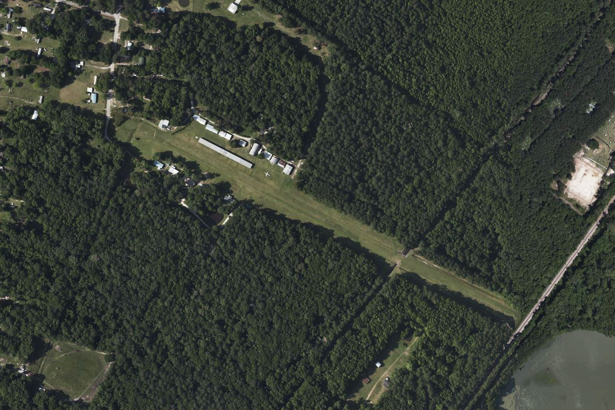
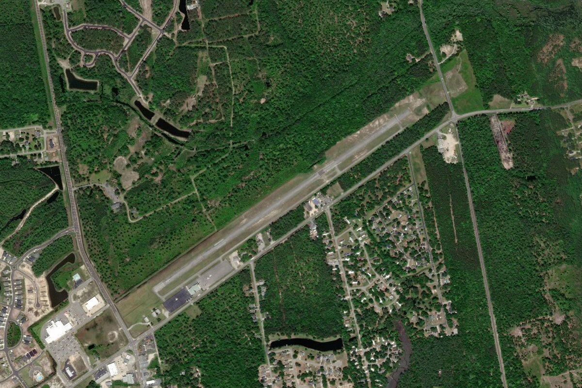
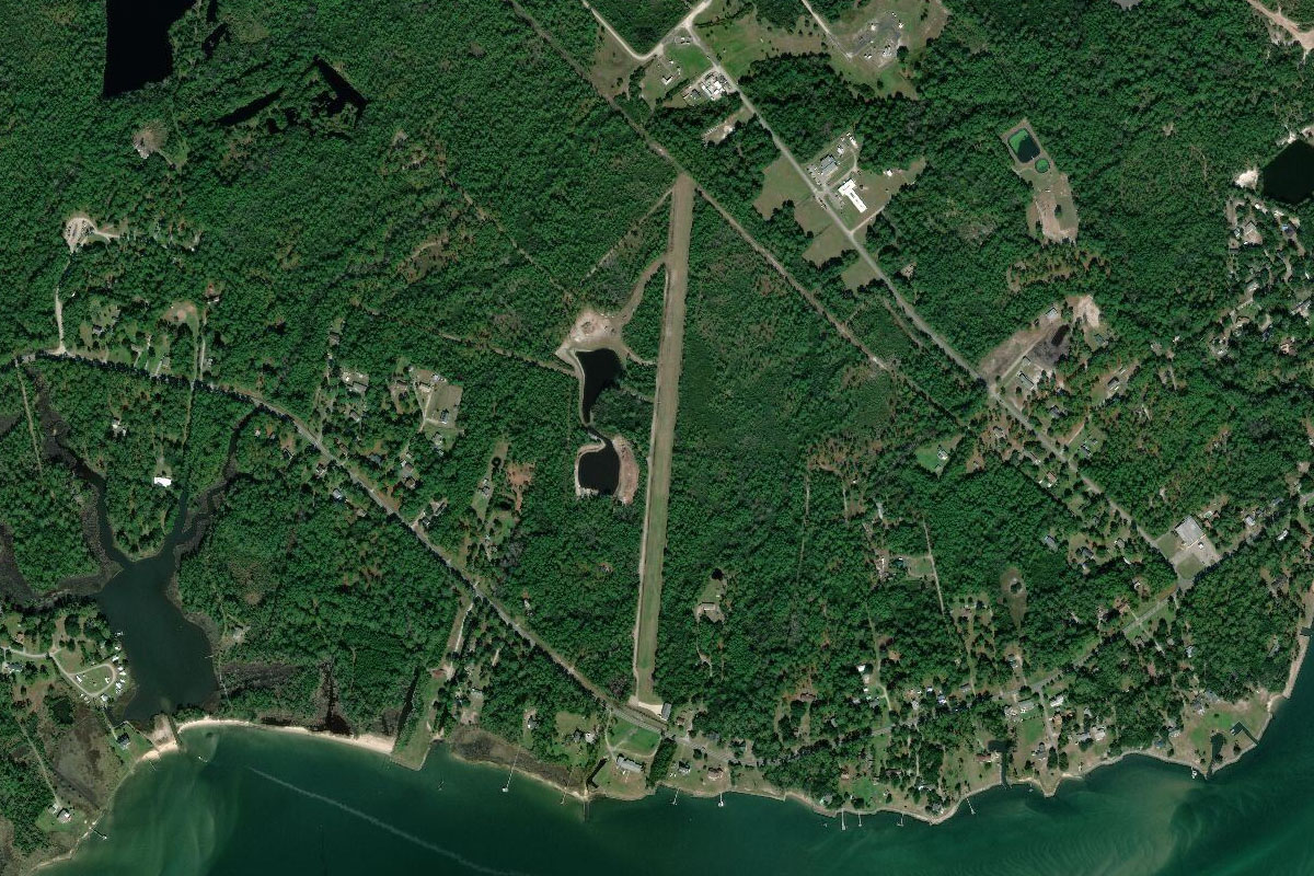
Bear Island(POI36) to 4NC5(4NC5)
Distance: 6.53NM Bearing: 42° 3 minutes
When you reach the inlet fly northeast over the bay, then to the grass airstrip which lies in an area of cleared land bordering the forest, just to the east of a small speedway track
Leg 14
Flying from 4NC5
Leg Distance: 42.39 Approximate time at 125kts: 20 minutes.
4NC5(4NC5) to Morehead City(POI37)
Distance: 16.16NM Bearing: 102° 8 minutes
Fly east along the waters of Bogue Sound to The twin towns of Morehead City and Beaufort which lie on either side of the Newport River entrance running north
Morehead City(POI37) to The Outer Banks(POI38)
Distance: 12.03NM Bearing: 112° 6 minutes
Continue east along the shore until you reach the Outer Banks, a 200 mile stretch of barrier islands and spits along the Atlantic Coast, and home to many historic sites and wildlife refuges
The Outer Banks(POI38) to Cape Lookout National Seashore(POI39)
Distance: 11.25NM Bearing: 47° 5 minutes
Follow the Outer Banks northeast until you reach the first opening of Drum Inlet
Cape Lookout National Seashore(POI39) to NC54(NC54)
Distance: 2.95NM Bearing: 2° 1 minutes
Just north of the inlet, on the 'mainland' of Cedar Island, is a small grass airfield sitting between the waters of Core Sound to its south, and Atlantic Field military base to its north
Leg 15
Flying from NC54
Leg Distance: 42.89 Approximate time at 125kts: 21 minutes.
NC54(NC54) to Core Banks(POI40)
Distance: 4.41NM Bearing: 90° 2 minutes
After takeoff, head east back to the Outer Banks
Core Banks(POI40) to Ocracoke(POI41)
Distance: 19.74NM Bearing: 59° 9 minutes
Continue northeast along the shore. The first notable town you will see is Ocracoke
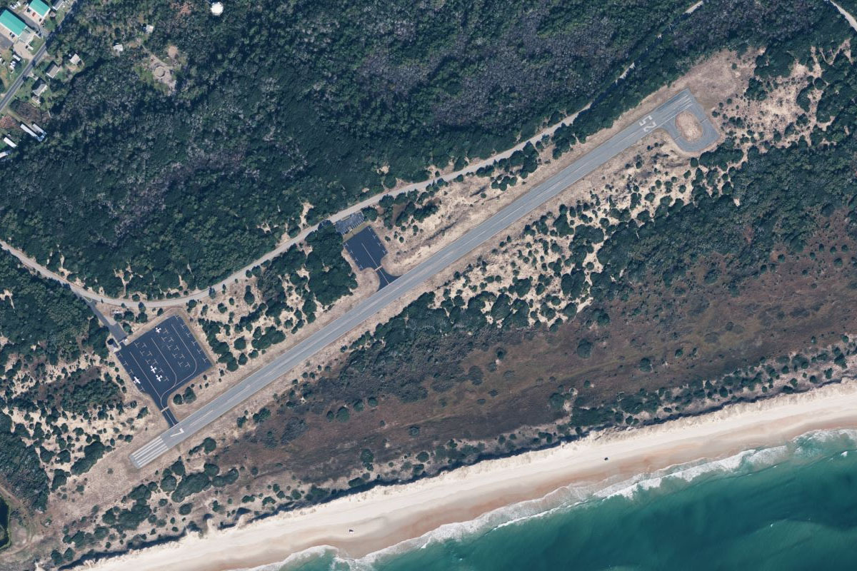
Ocracoke(POI41) to KHSE(KHSE)
Distance: 18.74NM Bearing: 77° 9 minutes
Keep following the coast past the town of Hatteras, after which you will see Mitchell airport running northeast from the shore
Leg 16
Flying from KHSE
Leg Distance: 53.84 Approximate time at 125kts: 26 minutes.
KHSE(KHSE) to Cape Hatteras(POI42)
Distance: 4.48NM Bearing: 102° 2 minutes
Fly east to the southeastern point of the Outer Banks, Cape Hatteras
Cape Hatteras(POI42) to Cape Hatteras National Seashore(POI43)
Distance: 21.49NM Bearing: 20° 10 minutes
Follow the thin stretch of land of the Cape Hatteras National Seashore north
Cape Hatteras National Seashore(POI43) to KFFA(KFFA)
Distance: 27.87NM Bearing: 350° 13 minutes
Continue north along the coast. After passing Bodie Island lighthouse the area will become more populated as it leads to the town of Kill Devil Hills, the home of First Flight Airport and the Wright Brothers National Memorial, which commemorates the first airplane flight in 1903
Leg 17
Flying from KFFA
Leg Distance: 66.46 Approximate time at 125kts: 32 minutes.
KFFA(KFFA) to Three Dunes(POI44)
Distance: 33.33NM Bearing: 355° 16 minutes
After takeoff, continue to the northern end of the Outer Banks, and into Virginia
Three Dunes(POI44) to Virginia Beach(POI45)
Distance: 20.98NM Bearing: 356° 10 minutes
Keep following the shore past the high rise beach resort city of Virginia Beach
Virginia Beach(POI45) to First Landing State Park(POI46)
Distance: 4.26NM Bearing: 310° 2 minutes
After passing Virginia Beach, fly northwest across the large green patch of First Landing State Park, a National Natural Landmark and historic landing site of the Virginia Company colonists in 1607
First Landing State Park(POI46) to Chesapeake Bay Bridge-Tunnel(POI47)
Distance: 5.1NM Bearing: 286° 2 minutes
Head west along the coast, over the southern stretch of the Chesapeake Bay Bridge-Tunnel, part of a 17 mile crossing of the mouth of Chesapeake Bay
Chesapeake Bay Bridge-Tunnel(POI47) to KORF(KORF)
Distance: 2.79NM Bearing: 232° 1 minutes
After crossing the bridge, you will be lining up for Norfolk International Airport a few miles to the southwest, and the destination airport for this stage